On a historic rail sketching adventure, Grasshopper and I headed up into the Santa Cruz Mountains to sketch a portal of one of the longest rail tunnels on the former South Pacific Coast Railroad (later Southern Pacific) route.
This 28 mile route started at Vasona Junction in Los Gatos and climbed over the Santa Cruz Mountains to the beach town of Santa Cruz.
Part of this route still exists as the Big Trees and Pacific Railroad which operates a tourist train from Felton to the Santa Cruz Beach Boardwalk.
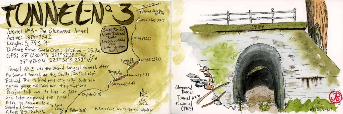
The tunnel we were looking for is the Glenwood Tunnel, also known as Tunnel No. 3. This 5,793 foot tunnel was active from 1879 to 1942. The original tunnel was built for narrow gauge but when Southern Pacific took over the line in 1887, they later converted the line to standard gauge (4 ft 8.5 in).
When the South Pacific Coast Railroad was first planned, then had to figure out how to get the road bed into the San Lorenzo Valley. To do this they had to built two one-mile long tunnels: Tunnel No. 2 (Summit Tunnel) and Tunnel No. 3 (Glenwood Tunnel).
From northbound Highway 17, we took the Laurel exit heading towards the former township of Laurel. We passed a few mountain homes and two bikers laboring up the hill as we headed down towards the former rail-bed.
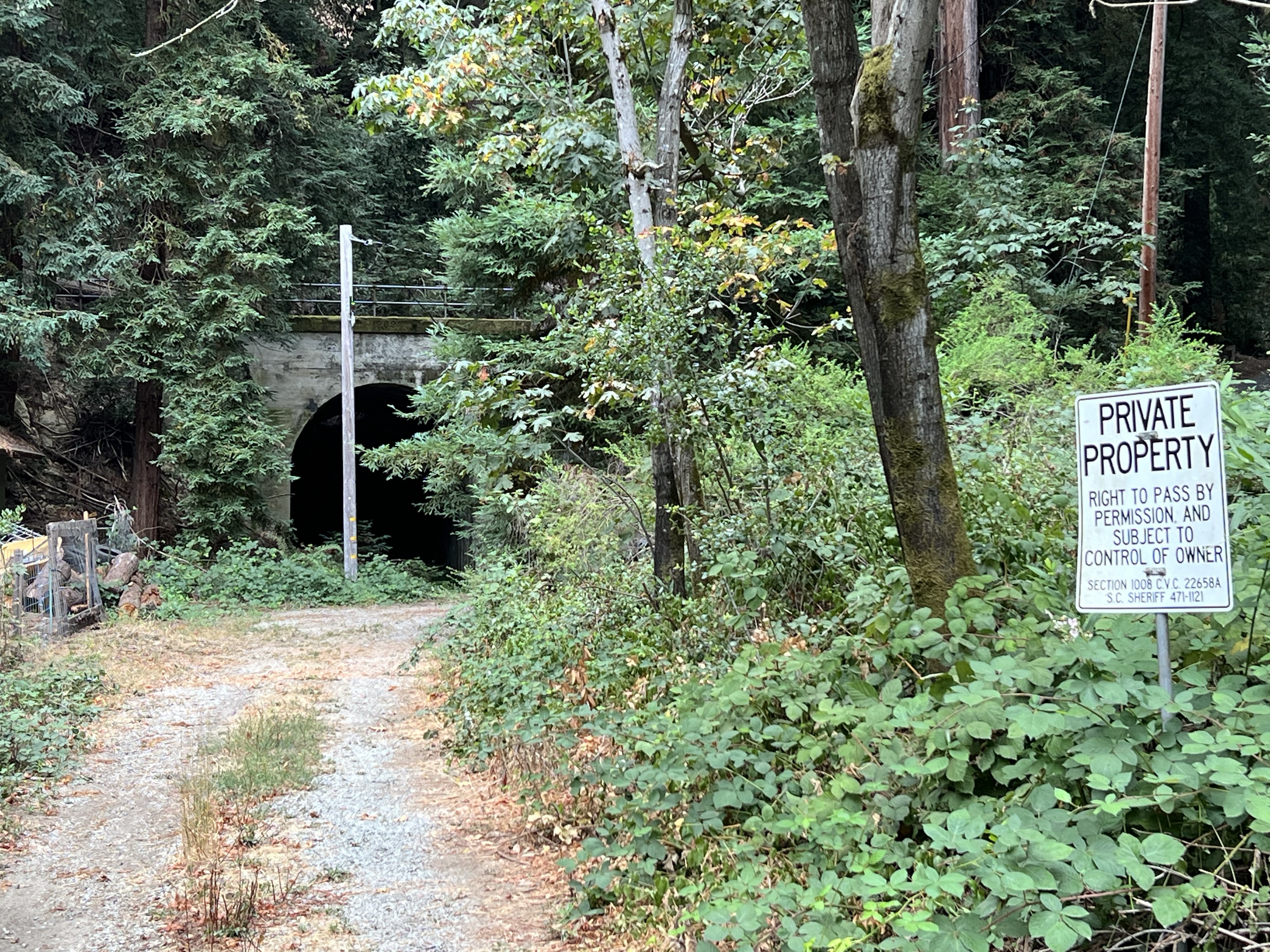
We parked and headed out to a get a better look. The west portal of the Glenwood Tunnel was visible, but parts were obscured by trees and a power pole. The “private property” sign kept us at bay. Was this the best view we would get?
I climbed up a side road, probably also private property, that parallels the rail bed, to get a better sketching vantage point. Even here, the portal was obscured by redwoods but I started a sketch anyway (which, like Tunnel No. 3, I abandoned).
Not being satisfied with the sketch I returned to where Grasshopper was sketching. His only company was a barking dog on the other side of a fence. There was a house just to our left.
A man peeked over the fence with his cup of coffee and said, “You can walk up to the tunnel if you want.”
This was the owner of the house (let’s call him “Bill”) and we had a nice conversation with him about living in the redwoods, winter storms, history, his spring-fed water system, and trains and tunnels.
We thanked Bill and walked around the chain that crossed the rail bed and headed towards the western portal of the Glenwood Tunnel. Now this was the way to sketch the tunnel (featured sketch).


We walked into the 1909 concrete portal. The tunnel ended in about 50 feet.
In 1940, winter storms and landslides closed portions of the route permanently. Southern Pacific made the decision to abandon the line. The major tunnels were dynamited at both ends, closing the tunnels for good. The concrete portals are all that still remain.
Now that we firmly had tunnel fever, we had to find the other side of the tunnel, the eastern portal.
Tunnel No. 3 now passes under Highway 17 so you have to cross over the highway to find the other end.

The eastern portal of the Glenwood Tunnel is much harder to get to than the western portal. To get a comparable view you would have to scrabble down a steep hillside or trespass through a stable to reach the rail bed which now seems to be a creek bed.
So we had to make due and sketch the portal from the side of Glenwood Drive, which the concrete portal now supports.


Great article. The line was closed in 1940 not 1942.
LikeLike