Image

Black-headed Seacrow

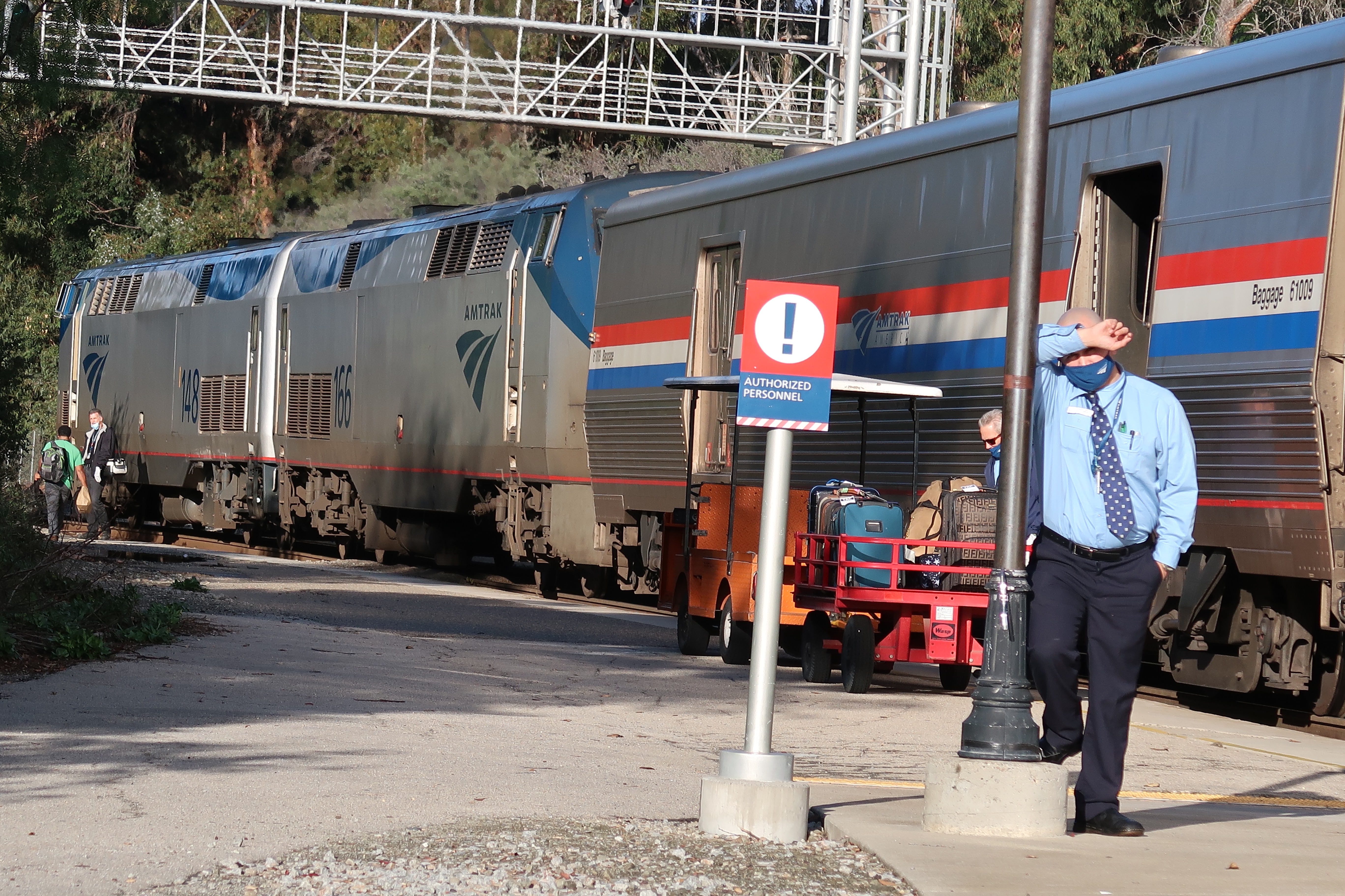
I guess I was destined to love birds from very early on in my life.

My one and only childhood home was(and still remains) a two story trackhouse built on the site of a former apricot orchard in Sunnyvale. I grew up on a court or cul-de-sac of sixteen family homes, built in 1970. We knew everyone on the court and are still friends with a fellow family. I still remember the single apricot tree in the backyard as a reminder of the ground’s agricultural past.

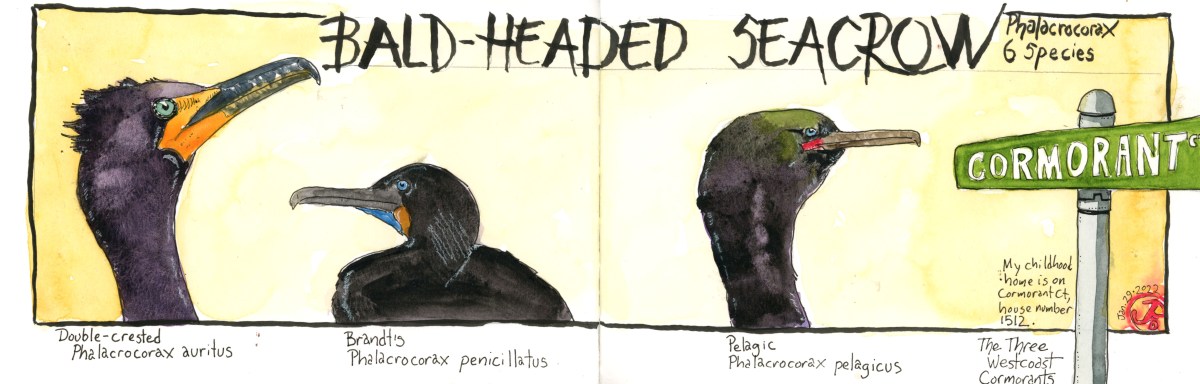
The street name was Cormorant Court. The developers named all the north-south streets after birds: Blackhawk, Albatross, Emperor, Crow, Eagle, Condor, Heron, Grosbeak etc. The west-east streets are mostly British place names: Inverness, Dunholme Jura, Liverpool, Lambeth, Londonderry etc.

There were many times in my youth where I had to spell “cormorant” for people who couldn’t arrange the consonances and vowels in right order and I also had to explain what a cormorant was. The Cambridge dictionary describes cormorant as: a large, black sea bird with a long neck and body. That seems just about right, although I might quibble with the word “sea”. The genus name, Phalacrocorax can be translated as bald-headed crow, referring to the dark plumage of most cormorants. The common name cormorants comes from the French meaning crow of the sea.

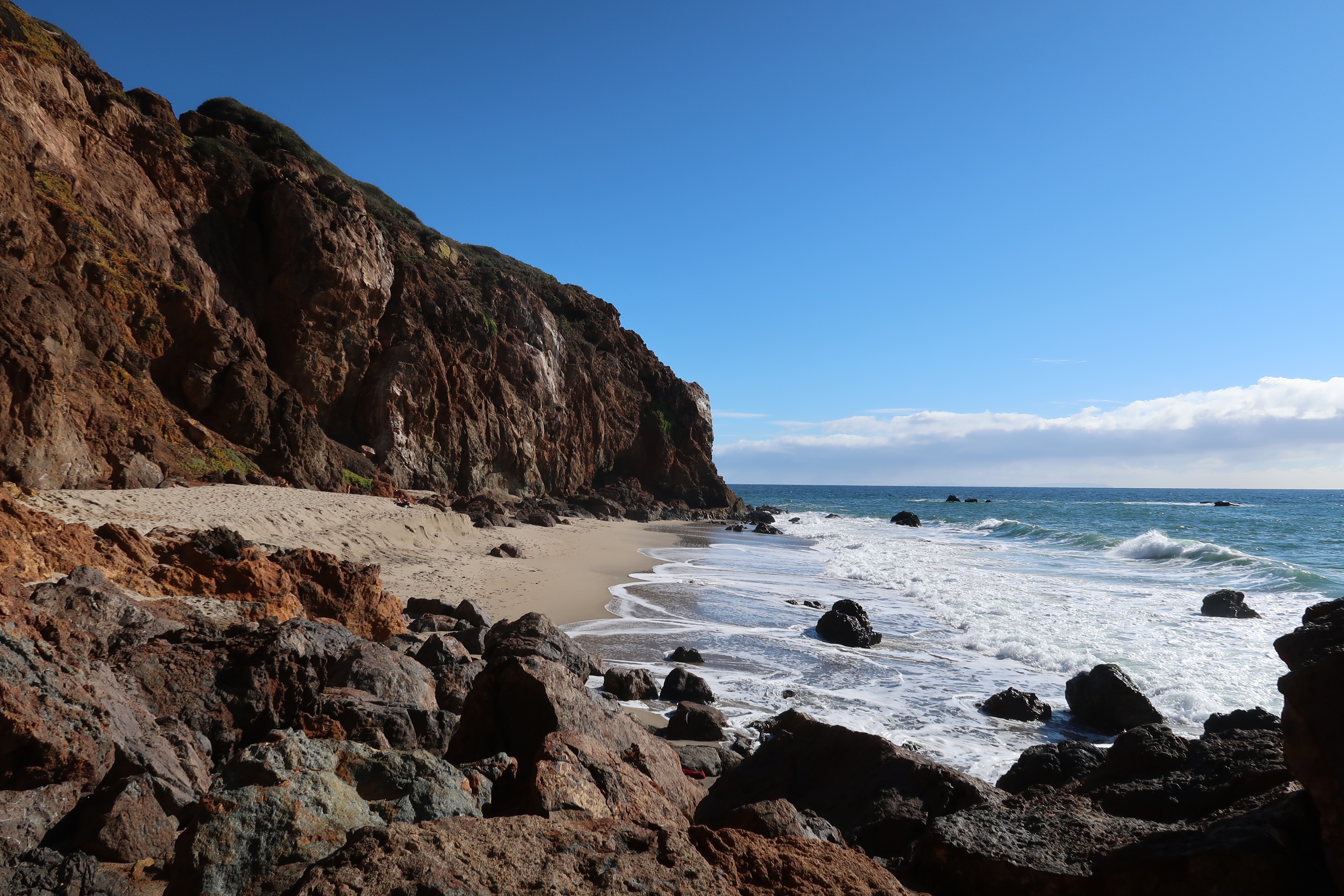
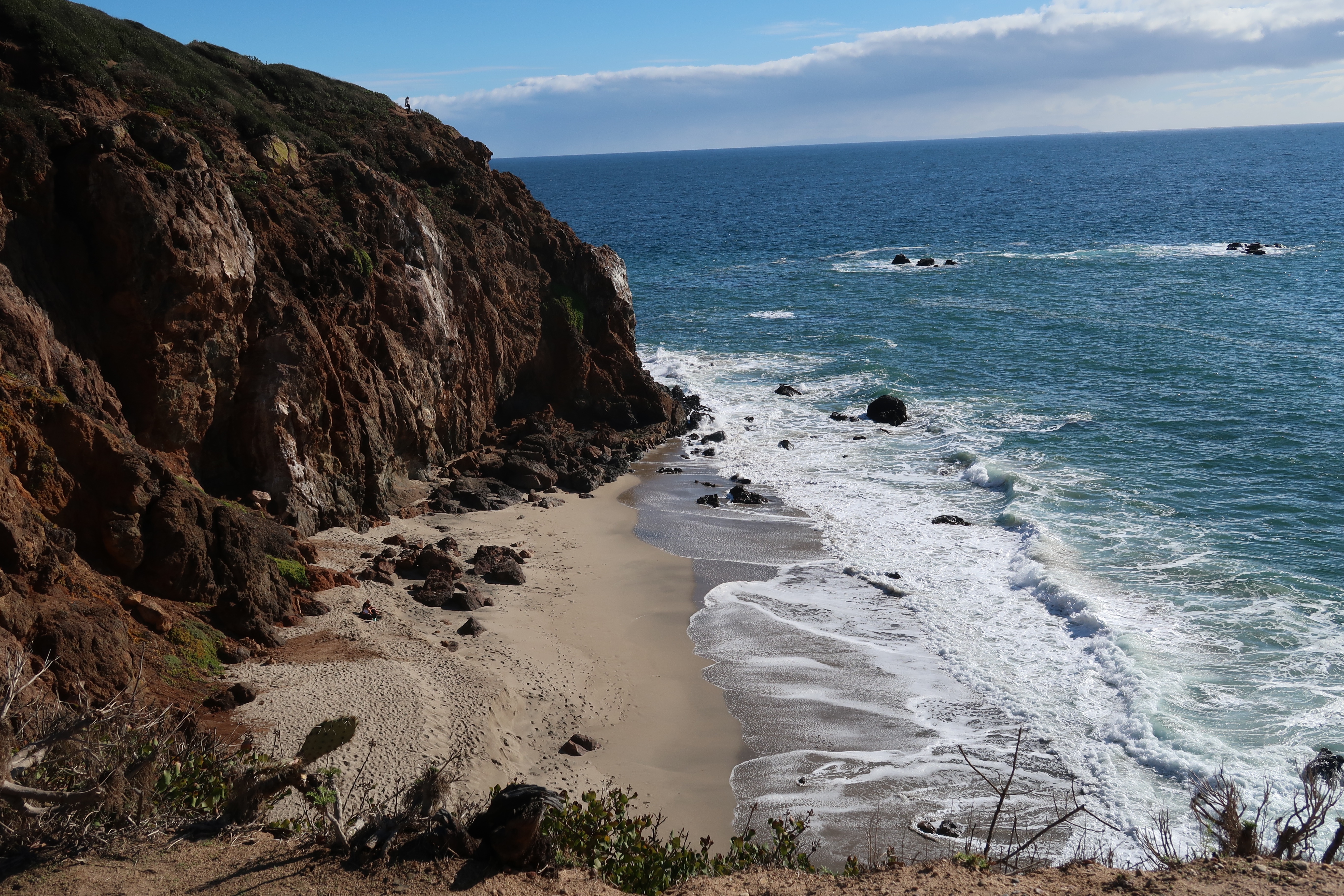
In honor of my home street I decided to do a spread about the cormorant. The cormorant is synonymous with water. Worldwide, there are 40 species of cormorants and shags. All cormorants feed on fish, by diving underwater from the surface where they catch their prey with large hooked beaks.

On the West Coast, there are three common cormorants: the double-crested, Brandt’s, and pelagic. Along with these three, there are three other species found in North America: the great, neotropic, and red-faced cormorant. The red-faced is not found in the Lower 48 but in coastal Alaska.

The double-crested cormorant is the largest cormorant in the west. It is commonly found inland, favoring freshwater. Brandt’s and pelagic are coast huggers and are almost always associated with saltwater. All three are common and easily seen.

I have recently seen a rare cormorant for the state of California. In fact I have seen two different individuals in two months. This is the Neotropic cormorant (Phalacrocorax brasilianus). The first I had added to my California and Santa Cruz County list on December 11 at Pinto Lake.

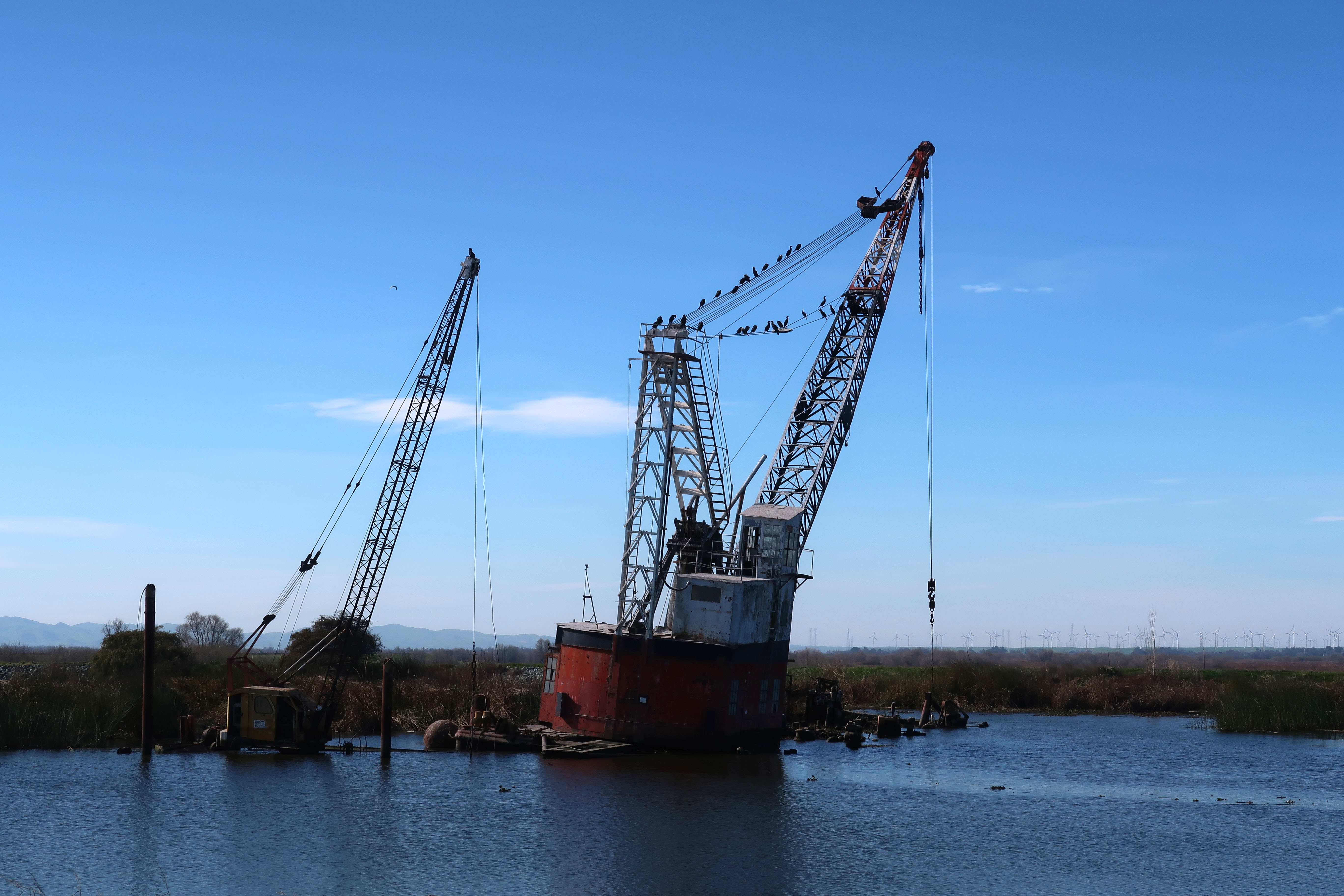
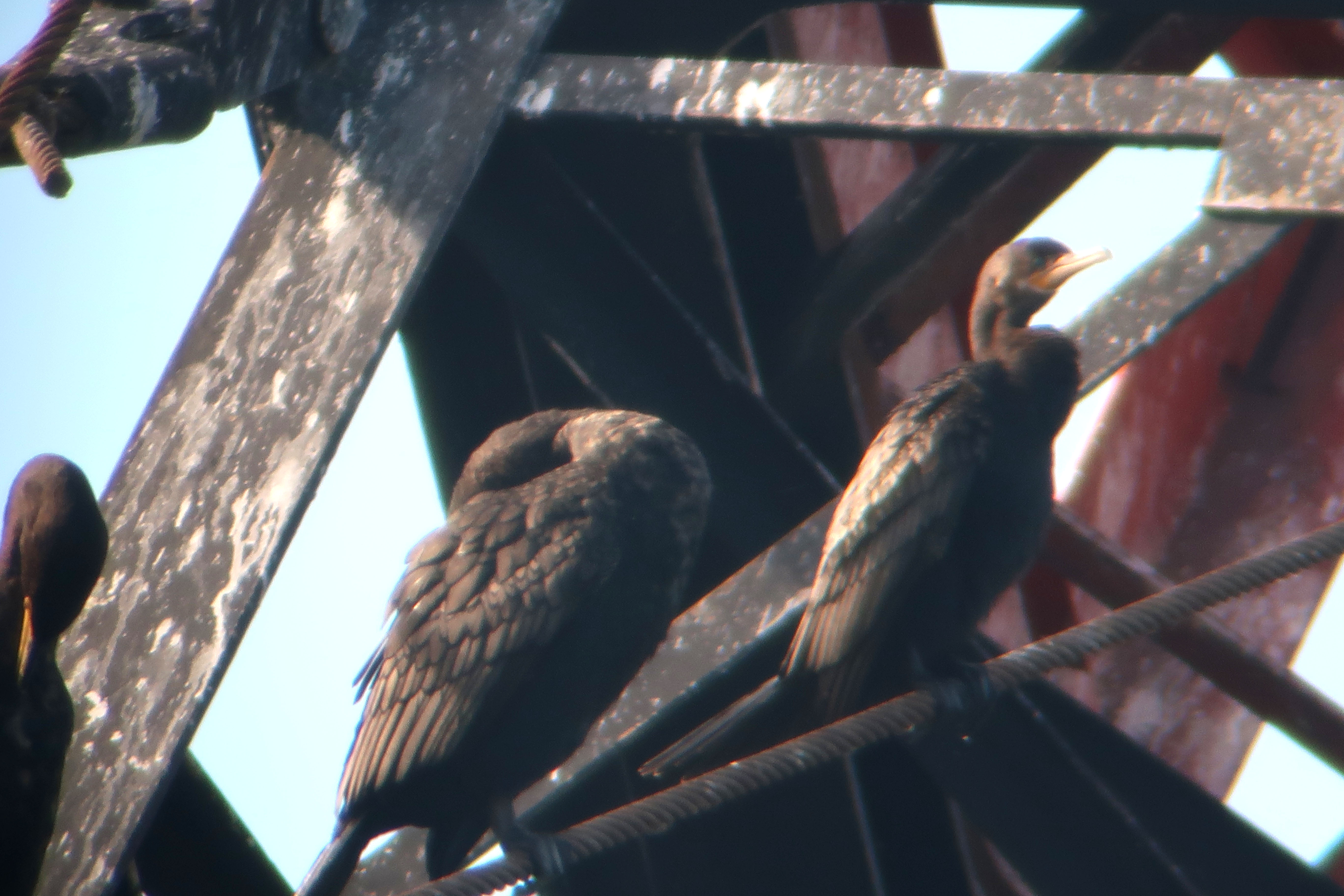
Then on an outing for winter raptors with Grasshopper Sparrow to Robinson Road in Solano County, we went for the Neotropic that was found on the Christmas Bird Count in December. The raptors and mountain plovers were very scarce at Robinson Road so we made the 20 minute journey to Brannan Island Road in Sacramento County, just over the Sacramento River.

The Neotropic had been seen perched on a ruined crane barge. We found the barge and cormorants perched on the cables. With a short search we found the Neotropic perched among the larger double-crested cormorants. Lifer for Grasshopper and a new county bird for me! This was a first record for this species in Sacramento County.

Can you see which one of these cormorants is different from all the others?
The Neotropic cormorant on the right and a double-crested on the left.
Image

The Sea Elephant, the Laughing Gull, and a Tsunami

After work, on my way down to Santa Cruz, I spotted a male elephant seal resting on Waddell State Beach. On the previous Friday I had seen a juvenile bald eagle perched above the beach. Waddell Beach had been good to me.

This weekend, on Saturday morning, I returned to Waddell Beach to see if the elephant seal was still there and if so, I intended to sketch it. But I found so much more!

I pulled into the dirt parking lot at about 7:30 AM. And there was the male elephant seal on the beach looking like a massive piece of driftwood. The seal’s stern was pointing toward the tide and it bulbous snout, facing east. This is only the second elephant seal I have seen on Waddell State Beach.

I planned to search the gull flock that usually rests and bathes in Waddell Creek on the beach near the creek mouth. At the end of the beach I could see the flock of about 100 gulls. I was hoping to find a black-legged kittiwake, a gull that I have been wanted to add to my county list for a while. But before I got to the flock, there were a few gulls foraging around the elephant seal. Indeed, they seemed to be in orbit around the massive mammal.

The dark gulls where juvenile Heermann’s gulls but there was one daintier gull that was actively foraging in the surfline. This gull really stood out. And that’s always a good thing when you’re gulling. The first thing that called out to me was the shape, size, and color of the beak. Now where had I seen that beak before?

This gull was smaller than the nearby Heermann’s gulls. I checked off the fieldmarks: dark bill, darkish smudge behind the eye (clearly one of the hooded gulls), dark eye with a white broken ring, grey back, brownish wing coverts, white undertail coverts (seen when in flight), dark wing tips, and dark legs. This could be only one gull, a gull I had seen on the Texas coast; even taking a dip in a hotel’s swimming pool. This was a first winter laughing gull (Leucophaeus atricilla)! A rare gull on the west coast of California.

Three laughing gulls in the hotel swimming pool in Rockport, Texas. The gull in the center most resembles the gull I found at Waddell Beach. The two other hooded gulls are in adult breeding plumage.
A pinniped piece of driftwood. A battle-scarred male elephant seal, master of Waddell Beach.

After taking some photos of the very active laughing gull, I pulled out my Stillman and Birn Beta hardcover panoramic journal, picked a position, and started sketching the elephant seal. He was very accommodating by just doing his driftwood impression. I looked north towards the parking lot and I noticed that a park ranger’s truck had just pulled in.

My field sketch of the male elephant seal at Waddell Beach.
The first winter laughing gull of Waddell Beach. What a great find! A Santa Cruz County lifer!

The ranger got out of his truck and he began walking towards me. Here I was, about to get a lecture about being too close to the elephant seal, when I was keeping a 25 foot buffer from the pinniped. Or so I though. When the ranger came within hailing distance, (when masked this seems to be about eight feet), he told me there was a tsunami warning and the surge was predicted to hit the coast right about now. I looked at my watch and it was just after 8 AM. He recommended that I leave the beach, which I did. I asked him if there had been and earthquake and he told me that and underwater volcano had erupted!

The undersea volcano Hunga Tonga-Hunga Ha’apai, 40 miles from the island of Tonga in the South Pacific, had erupted. A tsunami warning had been issued along the entire west coast of the United States as well as across the Pacific in Japan. The only evidence of the tsunami I witnessed was a swell running up Waddell Creek which causing the mallards to take to the air. At the time I really thought nothing of it. Winter waves I though. (I later found out that the surge damaged boats in Santa Cruz Harbor).

When I made it back to the parking lot I encountered two local birders who where looking for the recently reported black scoters. It is always great to have fellow witnesses when you find a rare bird. I showed them where the gull was, just to the right of the elephant seal and further down the beach. They got on it and then put word out on Monterey Birds of it’s presence. The more witnesses the better! Birders in Santa Cruz County love to share.

Thank you Lois, for getting the word out. And thank you for the very uncommon cuckoo in Watsonville!

One of the birders was Lois, the finder of the common cuckoo in Watsonville in the fall of 2012. That was an extremely rare bird that brought birders from across the United States to see it. I was glad to partially repay the favor with this humble, wayward, hooded gull. We seemed to be almost even.

Well, almost.

Image

County Birding in the New Year

It was a good omen to see a large raptor perched on a snag just after I crossed into Santa Cruz County on Highway 1.

I was not sure what the raptor was (hard to identify at 70 miles per hour) but it certainly was not a red-tailed hawk, it was much bigger. I was thinking more eagle-like.

I passed Waddell Beach and turned around at the soonest point. I headed back and pulled into the dirt parking lot at Waddell State Beach. Once I got bins on the bird, I had no doubt that I was looking at an eagle. Not a golden but a juvenile bald eagle. Perhaps a second or third year bird. Welcome to Santa Cruz County! What a great afterwork bird!

That large yellow bill screams: bald eagle!! This is a juvenile bird and the first I have seen at Waddell Beach.

The next morning, Saturday, I headed to Tryrrell Park, just behind the Santa Cruz Museum of Natural History to look for a wayward warbler that had recently been spending the winter among the oaks and willows. Within about ten minutes I had the small, grey warbler, foraging in the willows with a Townsend’s warbler. A Lucy’s warbler. What a rarity and what a great county bird!

I then headed across town to the Natural Brides Overlook just off Westcliff Drive, to looked for a reported ruddy turnstone. It was not there but a local fellow Santa Cruz Bird Club member was there looking for the same bird with a scope. Together we found some nice birds: whimbrel, black turnstone, black oystercatcher, back-bellied plover, Heerman’s gull, and a close female white-winged scoter on the water.

We met a man with a large lens from Sacramento, our state capital, and he was photographing some birds on the rock. He was excited at adding Brandt’s cormorant and Heerman’s gull to his life list (these birds are not seen in the Central Valley). A father and son from the east coast walked up, telling use there was a hawk perched on a light post on Westcliff. What follows is the conversation:

Son: I think it’s a rough-legged hawk.

Me: Now that would be a great bird to see here. (I put the raptor in my bins) Peregrine.

Father: It’s too big to be a peregrine.

In the meantime my club member compatriot has put his scope on the bird in question. And he asks me to take a look. I looked.

Me: Peregrine.

Dad: They are smaller on the east coast.

Size is not a great measure for field identification because birds can often seem larger when they fluff up their feathers and in raptors occurs reverse sexual dimorphism, which simply means that females are larger than males.

A rough-legged hawk, no err, a peregrine, no, too big to be a peregrine. . . okay a peregrine! A nickname for this bird on Hawk Hill is “Elvis” because of it’s dark head and “sideburns”.

I got some beta from the club member about a bird in the county that I needed to add to my lifelist. I had lackadaisically searched for the Santa Cruz County resident with no luck. Why? First I was searching in the wrong place and secondly, the bird was an exotic species which had been introduced to California.

Exotic species are an odd one when it comes to listing. They could be escapees and normally you cannot count them but if they have a established and sustained breeding population, such as the European starling or the Himalayan snowcock, then they can be counted. With the ABA’s approval of course.

So I headed down Highway One towards Watsonville. My destination: Pinto Lake City Park. The bird in question, according to my beta, was to be found in the reeds near the picnic area, just to the right of the dock.

At the moment the dock was inundated with the Devil’s Bird: great-tailed grackle. There must have been about 30. I searched the reeds and got a brief view of my quarry before a flock flew to the other side of the dock.

I walked over and followed the sounds of the flock moving through the reeds. I final got great views of lifebird # 1,666 (a global pandemic really spoils a world life list). Here was a flock of 12 scale-breasted munias. This small sparrow-like birds are native to Asia and India. How they got here, no one really knows.

Image

SLO Watertower

On my way back to the Bay Area from my Malibu adventure, I overnighted in San Luis Obispo. There was a water tower, across the line from the passenger depot that I wanted to add to my sketchbook. One of the few Southern Pacific water towers still standing in California.

I timed my visit with the arrival of Train # 14, the northbound Coast Starlight. This is an AMTRAK route that starts in Los Angles and terminates in Seattle, Washington.

I had about 20 minutes to sketch the water tower before the 14 pulled into San Luis Obispo. The train was already running 30 minutes late. I picked my position and started to sketch. A voice over my shoulder ask if was riding coach or had a roomette.

The voice belonged to an AMTRAK conductor who was about to board the train, SLO is a crew changeover point. I told him I wasn’t boarding the train, just sketching the tower. We had a conversation about other Southern Pacific existing water towers. He recommend a very large tower in the desert of Arizona that I should visit.

The Coast Starlight arriving at San Luis Obispo, 30 minutes late.

With the recent heavy precipitation over Donner Pass, I wondered aloud if the rotary plows at Roseville had been put to work to clear the pass. The conductor didn’t know. Before long the Coast Starlight pulled into the station and I looked down at my sketchbook and I hadn’t gotten very far but I had a nice conversation with a railroad working man. Two rail nerds chewing the fat!

SLO is was is called a stretch stop, also known in another time as a smoke stop, where the Starlight pauses for about 20 minutes so passengers can get out and stretch their legs, or poison their lungs with nicotine. This is also where crews, engineers and conductors, change over.

This photos says a lot. The conductor monitors the progress of boarding the train, baggage is being loading into the baggage car, and the engineers are changing over.

I couldn’t continue sketching because a double decker Superliner passenger car was now between myself and the historic water tower. So I watched the interactions on the platform instead. Passengers where doing laps, other where boarding, some hanging back from the train were vapping, and the train crew was in the process of changing over.

“All aboard!” And passengers filtered back into the cars. The locomotive sounded it’s horn. It was time for the Starlight to start its climb up the Horseshoe Curve on the Cuesta Grade and I watched the train slowly disappear around the curve.

I now turned back to the water tower and restarted my sketch.

The SLO 65,000 gallon water tower was built in 1940, at a cost of $2,130. The watertower was built across from the passenger station so steam locomotives could take on water without having to back into the yard further south down the track. At that time, ten passenger trains passed through SLO. The tank was in service until 1956, when steam was replaced with diesel on the coast line. The tower was preserved and restored by 1998.

Image

Planet of the Apes, Malibu Creek State Park, Part 1

What is now Malibu Creek State Park was once Fox Ranch, a backlot used by 20th Century Fox for location work on may television shows and films. The back lot became a Malibu Creek State Park in 1976.

Probably the most well known film shot here was the sci-fi classic Planet of the Apes (1968). The film was shot between May 21,1967 and filming wrapped up on August 10, 1967. I intended to find and sketch some of the locations used at Malibu Creek State Park.

It turns out that it is not too hard to find these locations because there are many “Visiting Planet of the Apes Locations” videos posted on youtube and other blog posts created by fans of the film. Also the State Park has placed some interpretive signs noting the park’s cinematic history.

On my hike out on Crags Road, I passed the Ape City location on my way to the M*A*S*H site. I would come by this site on my way back and do a sketch of the landscape around the set.

But sequentially the first location using Malibu Creek State Park proved to be one the park’s most visited locations: Rock Pool. In the pool, the three astronauts, including the film’s star Charlton Heston, come upon some water for the first time after landing on a bleak desertlike planet (the previous sequence was filmed at Lake Powell in Arizona). They quickly strip off their space suits and have a jubilant and frolicking skinny dip. Meanwhile some mysterious creatures steal their clothes.

Rock Pool, the filming location of the skinny dipping scene. Now why does not one of these signs say “NO SKINNY DIPPING”?

This leads to the next scene which was filmed at Fox Ranch: the hunt in the cornfield. In reality this was an open oak meadow where now, at one end, is the group campsite. For the film, corn (which grew to eight feet high) was planted in the meadow. In the film, the astronauts come upon a mute race of humanoids harvesting fruit from two (oak) trees. Here Taylor notes: “Look on the bright side, if this is the best they got around here, in six months we’ll be running this planet”. Then the humanoids pause and look on in horror as an odd ape horn sounds and they run for their lives. The human hunt has begun. In this field, Taylor and the audience, first sees the apes of the film’s title: a gorilla soldier, mounted on horseback with a rifle. One of the film’s stars Roddy McDowall said of this scene, “The cornfield hunt offered one of the film’s most powerful and disturbing sequences”. That means a lot, considering that Planet of the Apes features quite a few “powerful and disturbing” scenes. The featured sketch is of the ridge lines surrounding the meadow that once was covered in a cornfield.

The former cornfield used for the human hunt scene. The hills seen in the background have changed very little from when the filming too place here in 1967.

The biggest set built for the film was Ape City which was constructed along Crags Road near Century Lake. The set itself stretched for 300 feet and was constructed of a sprayed foam over an iron mesh form. A large part of the location work of the middle of the film was filmed here, at this location, including Taylor’s attempted escape and the utterance of the film’s most famous line: “Take your sticking paws off me, you damned dirty ape!”

This is a production still of what Ape City looked like during the sequel to Planet of the Apes: Beneath the Planet of the Apes.
This is the former site of the Ape City set in 2021. An interpretive sign in the foreground.
These are the “famous” steps that lead up to the human cage. When Taylor attempts to escape, he runs up these steps, barefoot.

Planet of the Apes proved to be so successful that the movies spanned four sequels, a television series, an animated television show, and books and comics. Some of the sequels where partly filmed at Malibu Creek State Park. The meadow near the group campsite was featured in Beneath the Planet of the Apes (1970) and in the epic battle in Battle for the Planet of the Apes (1973).

The next Planet of the Apes location I was heading to and sketching was south of Malibu Creek State Park, along the coast near Zuma Beach. At this location would be filmed one of the most shocking endings ever put to film in any movie made in the 1960’s, or of any movie made, in any decade, for that matter!

Image

Will Geer’s Theatricum Botanicum

For my southlands adventures, I stayed in the artist’s enclave: Topanga Canyon.

The town of Topanga, situated northwest of downtown Los Angles, has been a magnet for artists, musicians, free-thinkers, bohemians, “lefties”, and filmakers for many years. The area still maintains a funky, laid-back vibe. When you are in the canyon, you feel a million miles away from the largest city in California and second largest city in the United States: L.A.

The area has had a long history with musicians. In 1952, folk singer Woody Guthrie moved here. A partial list of musicians that at one time made the canyon their home are: Neil Young, Stephan Stills, Jim Morrison, Randy California, Taj Mahal, Billy Preston, Gram Parsons, Mick Fleetwood, Marin Gaye, Van Morrison, and Joni Mitchell. It was in at his Topanga Canyon house that Neil Young wrote and recorded his masterpiece, After the Gold Rush in 1969-70.

A reminder of the Topanga’s artistic past is alive at Will Geer’s Theatricum Botanicum on Topanga Canyon Boulevard. Will Geer is perhaps best known for his role as Grandpa Zebulon Walton in the successful television series The Waltons (1972-1981).

Before his success in the 1970s, Geer was a successful actor of the stage, screen and radio. Then came the McCarthy Era and Geer refused to testify before the House of Un-American Actives Committee (HUAC). As a result he was blacklisted by the committee and he could no longer find work in Hollywood. Geer was forced to sell his house in Los Angles and bought land in Topanga Canyon where his family relocated.

At this time Geer had a chance to seize upon two of his passions: theatre and botany. He created a band of artists and actors and he was able to employ other of his blacklisted friends and he created the Theatricum Botanicum in 1973. On this property in Topanga, folksinger Woody Guthrie had a small cabin where he lived for many years, it became known as “Woody’s Shack”.

In my sketch of the area, I added Woody’s Shack as an anchor to the left (of course Guthrie was always to the left) of my panoramic spread.

Woody’s Shack. I incorporated the font of the sign into the sketch.

One thing I really wanted to sketch at the Theatricim Botanicaum was the bust of Will Geer, sculpted by local artist Megan Rice. The bust was in the garden created by Geer himself. In the the garden, now called “Will’s Garden”, he planted every plant mentioned in the works of Shakespeare. He clearly loved this place and the flora and fauna in it, that he is buried in the garden itself.

The bust of Will Geer created by local sculptor Megan Rice. This really seems to capture the essence of the man.

The Theatricum Botanicum is still a thriving theater company. Today the company’s artistic director is Will’s daughter, Ellen Geer. The company performs the works of Shakespeare as well as contemporary plays and musical performances ( some have included Pete Seeger, Arlo Guthrie, and Burl Ives). They also have an educational program promoting youth theater and also supports learning through field trips.

The main stage at the Theatricum Botanicum.
Art seems to infuse ever inch of the Theatricum Botanicum. Exhibit D: the culvert of the creek. This place is alive!
Image

Sketching on the Helipad, M*A*S*H Part 2

I climbed up the dirt road to the helipad that is featured in the opening credits of the show.

The very last shot in the opening is two jeeps headed slowly down the road, carried the wounded to the hospital tent and doctors madly attempting to help the wounded. The names of three actors appear: Loretta Swit, Larry Linville, and Gary Burghoff. The opening credits was one of the main reasons I headed to the helipad to sketch.

The road leading down from the helipad in the foreground and the Goat Buttes in the background.

The iconic opening, as seen in the pilot episode, shows some downtime at the M*A*S*H unit: doctors golfing, doctors and nurses drinking champagne, reading, resting, and men playing catch. One solider catches the football, turning away in the process. He is about to turn back to the game of catch when he pauses and listens. He seems to know when something is about to happen before others do. “Here they come!” he announces. An off camera voice says, “I don’t hear noth’in.” And the solider, Radar O’ Reilly, quickly responses, “Wait for it.” We don’t have to wait long. The next shot is of Radar, from behind his right shoulder, as we look on with him, the camera zooms in to two helicopters flying over the mountains when the guitar refrain of “Suicide is Painless” starts off (in B minor).

M*A*S*H’s introduction is a part of my life’s television soundtrack like the opening of the Dukes of Hazzard, Dallas and Dynasty, The Facts of Life, The Electric Company (“HEY YOU GUYS !!!), Villa Alegre, and the Waltons. But somehow the M*A*S*H intro still holds up for it’s audio and visual impact, and I couldn’t wait to sketch the landscape of this groundbreaking series. In the 1970’s and early 80’s when you heard the first three notes of Suicide is Painless, it was time to rush into the living room to watch a new episode (or a repeat) of M*A*S*H.

I wanted to sketch this iconic opening, the choppers flying over the Santa Monica Mountains in the background and Radar in the foreground. To do this, I first sketched Radar (Gary Burghoff) to the left of my panoramic view. I did this a few weeks before heading out on the trail and it was based on a screen shot of the pilot episode opening. This preliminary sketch would be my anchor for the rest of the image. I just had to match the mountains in the background with the right angle. I knew that this scene had to be filmed from the helipad.

I searched all points on the compass and looking to the southeast, I saw the mountains that matched the opening exactly. I traded my pack and poles for my pens and journal and began sketching. The result is the featured sketch.

My aim was not to capture every detail in the landscape and I really just focused on the contours of the hills which have not changed much since they were first filmed for the opening almost 50 years ago. To outline their form I used my expressive brush pen which give vibrancy and economy to the line. This is where sketching holds it’s own over other visual media like photography. When I was tracing the curvaceous lines of the Santa Monica Mountains, I was really getting to know my subject in a deeper way. I was really seeing the landscape.

When I finished sketching this perspective, I then sketched two other perspectives from the opening credits. I then did a quick sketch of the road leading down to the main set featured at the very end of the opening credits. Let’s call it the “Loretta Swit, Larry Linville, and Gary Burghoff Road”.

This is another sketch from intro of M*A*S*H. The sketch to the right is what is seen briefly in the intro and what is on the left extends the landscape of the real location. I wrote in the lyrics of “Suicide is Painless” in the foreground hillside (This song was used in M*A*S*H the movie). Originally, director Robert Altman wanted the lyrics to sound like “the stupidest song ever written”. When the songwriter, Johnny Mandel could not come up with the right lyric, the director asked his 15 tear old son, Michael to write them, and this became one of the most memorable songs in cinematic and television history.
This is the last panoramic sketch I did from the helipad, this time looking west. In this scene from the opening in the foreground, Hawkeye Pierce gestures to others to head in as they move to the right, just after the chopper has landed with casualties. l lined up the background from a screen shot of the opening.

I then headed to the core of the set and I wanted to sketch the burnt out ambulance. This ambulance had been used in the original series but had been damaged during a brush fire during the final season of the show’s production in 1983. I took a seat at a picnic bench and started sketching away.

The contrast between the ambulance that had seen better days with the unchanged landscape of the Goat Butte was an essay in the unchangeable change in the world around us.

What a great morning of sketching at the M*A*S*H site. The skies where clear, having shaken off the showers of the pervious day and I had the entire site to myself!

Image

M*A*S*H, Malibu Creek State Park, Part 1

I headed out early from my Topanga Canyon digs on a 23 minutes drive to Malibu Creek State Park.

I would be hiking just over two miles (2.37 miles to be exact), on a fireroad called Crags Road, to the location set for the popular television series M*A*S*H (1972-1983). This state park was once the filming backlot for 20th Century Fox and many other tv shows and films where also filmed here, including the original Planet of the Apes. More on that film in a later post.

The level trail, which paralleled the rain-swollen Malibu Creek, was muddy from the rain over the past few days. Mist hung below the beautiful mountainous peaks of the Goat Buttes. The buttes are part of the Santa Monica Mountains, the only mountain range in California that runs west to east. I felt I was already in the “Korean” landscape of M*A*S*H. This landscape looked very familiar.

After I passed the side trail to Rock Pool, Crags Road began to climb upward in a muddy assent. The trail briefly leveled out and I headed down towards the former location of Ape City, built in the late 1960s for the sci-fi classic Planet of the Apes. But more about that in another post.

The fireroad now narrowed as it continued to parallel Malibu Creek. At this point I had not encountered a single person on my hike. I hoped that I would have the M*A*S*H site all to myself! The early bird, indeed gets the worm!

The beautiful long shadows of winter sun. On Crags Road less than 0.8 mile from the M*A*S*H site. But first I had to cross the creek.

I followed the sign to the creek crossing only to find a wooden staircase the led into the waters of Malibu Creek! The creek was impassable here, unless I was willing to swim. I looked upstream and I could just make out a makeshift “bridge” constructed of logs and tree limbs. Perhaps “constructed” is too much of word to describe the crossing but I had to chance it to get to the M*A*S*H site, which was on the opposite side of the creek.

I started across the “bridge”, carefully choosing each footfall on wobbly and far too thin sticks and logs. Here having trekking poles helped afford two more points of balance during the crossing. One pole slipped off a log and I attempted to put the pole down on the bottom of the creek, only to find that it was so deep that my pole was suspended in midwater. I made it to the opposite bank without becoming fully or partial immersion. I made sure my journals were safely stowed in a dry bag.

I now bushwacked to find the trail, which at this point did not resemble a fireroad but a single track trail. I was now very close, perhaps 0.5 of a mile and I was waiting, with childlike anticipation, for my first glimpse of the filming site. As I rounded a corner, I saw a Korean War era ambulance by the side of the trail. This marked the edge of the filming set.

This is a restored Dodge WC54 ambulance, which, despite what other have stated online, was not actually used during the filming of M*A*S*H. When you come up this vehicle, you know you about to enter the set.

I briefly scanned the site, which included three interruptive signs, two burnt out vehicles (a jeep and an ambulance) from the series, picnic benches, and a replica of the iconic signpost that was placed just outside of The Swamp. But before I explored the site properly, I headed up to the helipad to do some sketching. And yes, I had the site to myself, in beautiful clear winter weather!

This burnt out ambulance was used in the series. An ambulance similar to this is featured in the opening credits. A brush fire burnt the set during the final episode in 1983 and the fire was written into the script.
The replica signpost with the distinctive outline of the Goat Buttes.

The featured sketch is a map of the M*A*S*H site. I drew this before I head down to Malibu and it helped orient me when I was visiting the location for the first time.

Image

Planet of the Apes, Pt. Dume, Part 2

After my visit to Malibu Creek State Park, I headed south on Malibu Canyon Road and then turned west on the Pacific Coast Highway to the filming location of one of the best and perhaps most shocking endings of any film.

This is Point Dume State Beach and a little cove, named Pirate’s Cove, hidden away from the main beach by rocks that reached out into the Pacific. To get there, you had to time the tides (low tide is best) and then scrabble up and over some rocks to get to the secluded beach.

When I got down to Pirate’s Cove, I almost had the beach to myself, except for an amorous couple at the other end of the beach. I picked a location that was close to the camera position in the final scene of Planet of the Apes and I began to sketch in the forms with my dark sepia brush pen. It was a glorious day after a heavy downpour the day before and is relished the sun and the view before me.

Warning: what follows is a description of the ending of Planet of the Apes (1968) and it will spoil the surprise ending of the film so if you have not seen this film, please stop reading and watch Planet of the Apes (1968) ASAP!

The last scene of Planet of the Apes was filmed at this little cove and the true reveal is shocking, even to this day. Taylor looks up and sees the ruined, half buried Statue of Liberty and realizes that he has been on planet Earth the whole time. Earth has become dominated by apes. The final shot was accomplished by shooting in the real location and adding a matte painting of the ruined Statue of Liberty.

A view of Pirate’s Cove from the cliffs above.

On the other side of the cove, at the southeastern end of Pt. Dume State Beach, the epic scene, just before the final shot, where the camera pans to the left, from a high angle. In the foreground view comes the torch and then the pointed crown of the Statue of Liberty. These where scale mock ups and where filmed from a 70 foot scaffolding built for the film. It was on this stretch of beach where Charlton Heston utters the famous final lines of Planet of the Apes, “They blew it up! God, damn you! Dawn you all to hell!”

This is approximately the angle seen in the film as the camera pans across the mock up of the Statue of Liberty. And this is where Heston spoke the final lines in the film. Maybe right where the lady in a light blue shirt is walking.

This final scene can be viewed on so many levels and this is one reason that this film is seen as a classic of the science fiction genre to this day. What does this ending say about the state of the United States or the world in 1968? What does it say about the plight of freedom, liberty, and democracy today? Like all great films, Planet of the Apes does not simply serve up easy answers but like any great work of art, it is thought provoking and lets the viewer decide for themselves, what the film, and it’s ending, ultimately means.

The final shot of Planet of the Apes.

Point Dume Beach was also used in one other Apes Film: Escape From the Planet of the Apes (1971). The wonderful beginning of the film was filmed here. A spacecraft is just offshore and the military stages at the beach to attempt a rescue of the astronauts. The general order the spacecraft open and he salutes and then falls into silence. The three astronauts have every appearance of being human, until they take off their helmets!