One of the most sketchable locations on the Gettysburg Battlefield is Devil’s Den.
Some of the most intense fighting on the second day of the Battle of Gettysburg occurred in and around this collection of volcanic rocks. Like the odd house at the end of the cul de sac from my childhood that we deemed “haunted”, Devil’s Den, as legend has it, was believed to be the den of a serpent named “Devil”. This was the haunted grounds of urban legend for the youth of Gettysburg, even before the battle enveloped the town.
At this location, on the afternoon of July 2, Major General Daniel Sickle’s left flank was placed here under the command of Captain John Smith’s artillery battery. HIs position was attacked from the west by Confederates from Texas, Alabama, and Georgia. The Confederates overran the Union’s position and took Devil’s Den. They used this location to position sharpshooters to fired at the Union soldiers on Little Round Top.
The landscape now bears the ghastly and ghoulish names of this bloody encounter. The place names seem to be taken from the macabre works of Poe: the Slaughter Pen, Bloody Run, and the Valley of Death.
Devil’s Den was one of my favorite sketching locations at Gettysburg. I have always loved to sketch and paint the contours, layers, and textures of rocks and Devil’s Den supplied these in spades. I was very intentional with my sketching position. The rock in the foreground of the sketch (featured sketch) is a rock that is not featured or named on any interpretive signs at Devil’s Den. This rock is known as the Waud Rock.
The rock is named after battlefield sketcher, Alfred Waud. Waud followed the Army of the Potomic and sketched almost every battle that the army was engaged in. While many focus on the rise of photography during the Civil War, a sketcher amongst the carnage and danger of a live battle is very intriguing to me. When Waud was at Devil’s Den, he was photographed by Alexander Gardner as he sits on the rock that now bears his name.
While I was sketching the rocks, an elderly visitor came up and had a chat. He thought I was reading a book but I told him I was sketching the Waud Rock. He didn’t seem to be very impressed but I could tell that the reason he had approached me was because he wanted me to know that one of his distant relatives had fought at Little Round Top.
I sketched part of the spread seated on Waud Rock, in Waud’s, exact position, somehow summoning the sprit of this amazing sketcher through my backside.
Gardner’s photograph of Waud on his rock at Devil’s Den.One of the most famous photographs from Gettysburg and perhaps the entire Civil War: a dead Confederate sharpshooter at Devil’s Den. It is now believed that this photo was staged. Yes the soldier is indeed dead but he was moved to this location and a rifle was placed against the rock wall.The same location at Devil’s Den, sans sharpshooter, today.
Along with Dunker Church and the Bloody Lane, another symbol of the Battle of Antietam is what is now known as the “Burnside Bridge”. Before the Battle is was known as the “Rohrbach Bridge”. On September 17, 1862, it was known as the “Lower Bridge”. After the battle it was renamed the “Burnside Bridge” after the Union General whose troops took the three arched, stone bridge that spans Antietam Creek as they drove Confederates back.
So I saw no problem in giving the bridge a new name: “Armstrong Bridge”. Sure it sort of sounds like Burnside. Both are two syllable words, both are compound words. It was only after inking the text that I realized the error. Instead of fretting over it or blaming it on a slight case of jet lag or the local pale ale I was sampling, I decided to embrace my mistake as if it didn’t happen. So I chose to embrace the mantra of Miles Davis who said, “Do no fear mistakes. There are none.” Besides, this just adds to the sketch. At least that’s what I keep telling myself.
The bridge was built in 1836, to connect Sharpsburg to the nearby southerly town of Rohrerville. The bridge was in use for foot, hoof, and later auto traffic until 1966, when the bridge was restored to it’s Civil War Era appearance.
The battle over this crossing over Antietam Creek took place in the late morning. About 500 Confederate troops held the high ground on the westside of the bridge. Burnside’s Ninth Corps assaulted the important creek crossing. The rebels held until Union troops where able to ford the creek south of the bridge, forcing the Confederates to retreat and the North took possession of the stone bridge.
Using an old stone wall as my drawing table, I sketch Rohrbach Bridge, or whatever the bridge is called!The Burnside Bridge seen for the Confederate side of the creek. The large tree on the opposite side of the creek is known as the Burnside Sycamore and is one of those “witness trees” which was alive at the time of the battle. I sketched the bridge to the left of the tree, along the stone wall.
At the end of the most bloody and most costly day in the history of American combat the destruction was astounding. The numbers are grime reminders: 23,000 killed. All this in a single day. Of all the soldiers that were wounded, roughly one out of seven died of their wounds. 2/3 of the 622,000 lives that were lost during the Civil War, died of disease.
One solider from the 9th Pennsylvania described the scene at Antietam as, “No tongue can tell, no mind conceive, no pen portray the horrible sights I witnessed this morning.”
James McPherson in this Civil War masterpiece, Battle Cry of Freedom wrote about Antietam, “The causalities of Antietam numbered four times the total suffered by American soldiers at the Normandy beaches on June 6, 1944. More than twice as many Americans lost their lives in one day at Sharpsburg as fell in combat in the War of 1812, the Mexican War, and the Spanish-American war combined.”
And Antietam was just a warm up for a battle that took place less than a year later, around a small town in Southern Pennsylvania. This three day battle would have the highest death toll out of any battle during the Civil War and was the turning point in the war. This battle was the Battle of Gettysburg.
On July 3, 1863, the last day of the Battle of Gettysburg, General Lee put a massive force on a frontal assault, across open ground, towards the Union’s line on Cemetery Ridge. This was to be the decisive battle of the campaign. And it’s outcome would dictate the future direction of the Civil War.
The assault first started at 1:00 PM with a massive artillery bombardment towards the Union line. Some 150 Confederate cannons tenderized the heart of the Union position. With all the cannon fire came a lot of smoke, which made aiming at your intended target problematic. Many rebel shells overshot their target, hence the shells that struck General Meade’s headquarters, which was further east from the heart of the Union line, but apparently not further east enough. The artillery assault did not break or severely weaken the Union center but Lee proceeded with the second part of this plan, the infantry charge.
A stature of Confederate General Robert E. Lee on his horse Traveller, tops the Virginia Monument. This was the first and largest of the Confederate monuments at Gettysburg. It is perhaps one of the few statues of Lee still remaining and one of the very few north of the Mason-Dixon Line. The statue is located close to the location where Pickett’s Charge started and where Lee observed the battle.
At about 3:00 PM, the assault, which came to be known as Pickett’s Charge, began. The 6,000 Union troops positioned on Cemetery Ridge saw a line of Confederate soldiers appear out of the woods a mile away. The line was almost a mile in length. Pickett’s Charge had begun.
Field sketching from the location of the start of Pickett’s Charge looking towards Cemetery Ridge and the “Copse of Trees” which was the destination of the charge. Getting an early start at Gettysburg has it’s advantages, I had the place to myself.
General George Pickett was another interesting figure in the Civil War. His classmates at West Point referred to him as the “goat”. Today that term, when applied to elite athletes, means “Greatest Of All Time” but in Pickett’s time it referred to his academic performance; he was last in his 1846 class at West Point. Pickett cut his teeth during the Mexican War fighting with many of the men he was now fighting against. While the charge now bears his name, Pickett was one of three commanders that led the charge. The charge could have bore any name of those behind it “Longstreet” or “Lee” but for whatever reason, it has gone down in history as “Pickett’s Charge”.
The 12,500 Confederate troops moved over the open ground towards the Emmitsburg Road. They were now open targets for the Union infantry and artillery that waited for them. Union artillery started to blow holes in the rebel line but the charge still moved on as holes in their advancing line was plugged by soldiers marching behind.
One of the Confederate commanders under Pickett was General Lewis Armistead. His story exemplifies the irony of the Civil War as brother fought brother and friend fought friend. Armistead was leading his men to attack one of his dear friends from his US Army days: Major General Winifred Scott Hancock.
Both men became friends while serving in California. In 1861, Armistead resigned from the US Army to join the Confederate Army (Armistead was a native of North Carolina). Hancock’s wife held a going away party for the men who where leaving to fight for the Southern cause and this was the last time that Armistead and Hancock spent together. Before he left, Armistead gave Mrs. Hancock his prayer book. Who know what was going through Armistead’s mind as he advanced toward this good friend with murderous intent. Could he really raise his sword against his friend?
The Confederates continued to move west toward Cemetery Ridge and as they moved closer, their losses grew higher. Still they advanced, filling in the holes caused by death and injury with men at the back. Still they marched towards the Copse of Trees.
A quick field sketch of the part of the Union line on Cemetery Ridge known as the “Bloody Angle”.
The south concentrated there attack on the stone wall the turned in at a 90 degree angle. This location became known as “The Angle” or the “Bloody Angle”. Armistead led his men, his hat on sword point towards The Angle.
The Confederates reached what is know was the High Water Mark, on Cemetery Ridge. The High Water Mark is the farthest the Southern Army ever advanced into the north and it is where they where stopped, dead in their tracks, literally. This was the climax of the Confederate offensive, after this point, the South would be on the defensive for the remainder of the war.
The memorial marker at the spot where General Lewis Armistead fell at the High Water Mark on Cemetery Ridge.
Armistead reached a Union cannon after jumping over the small stone wall that formed The Angle. Armistead and this men were surrounded by Union troops and they were fired upon at point-blank range. The general was mortally wounded and he died without ever seeing his friend Hancock, who was also injured in the battle but he survived his wounds.
Pickett’s Charge had run out of steam and they soon where retreating back to the west. In this failed charge, 6,000 confederate soldiers were killed, wounded, or captured. Half of Pickett’s division was gone. When General Lee saw Pickett, he ordered him to reassemble his division to cover the retreat. General Pickett replied, “General, I have no division.”
One of the most famous speeches in American History was delivered at the dedication ceremony for the new National Cemetery at Gettysburg on November 19, 1863. This was four months after the turning point of the Civil War, the Battle of Gettysburg.
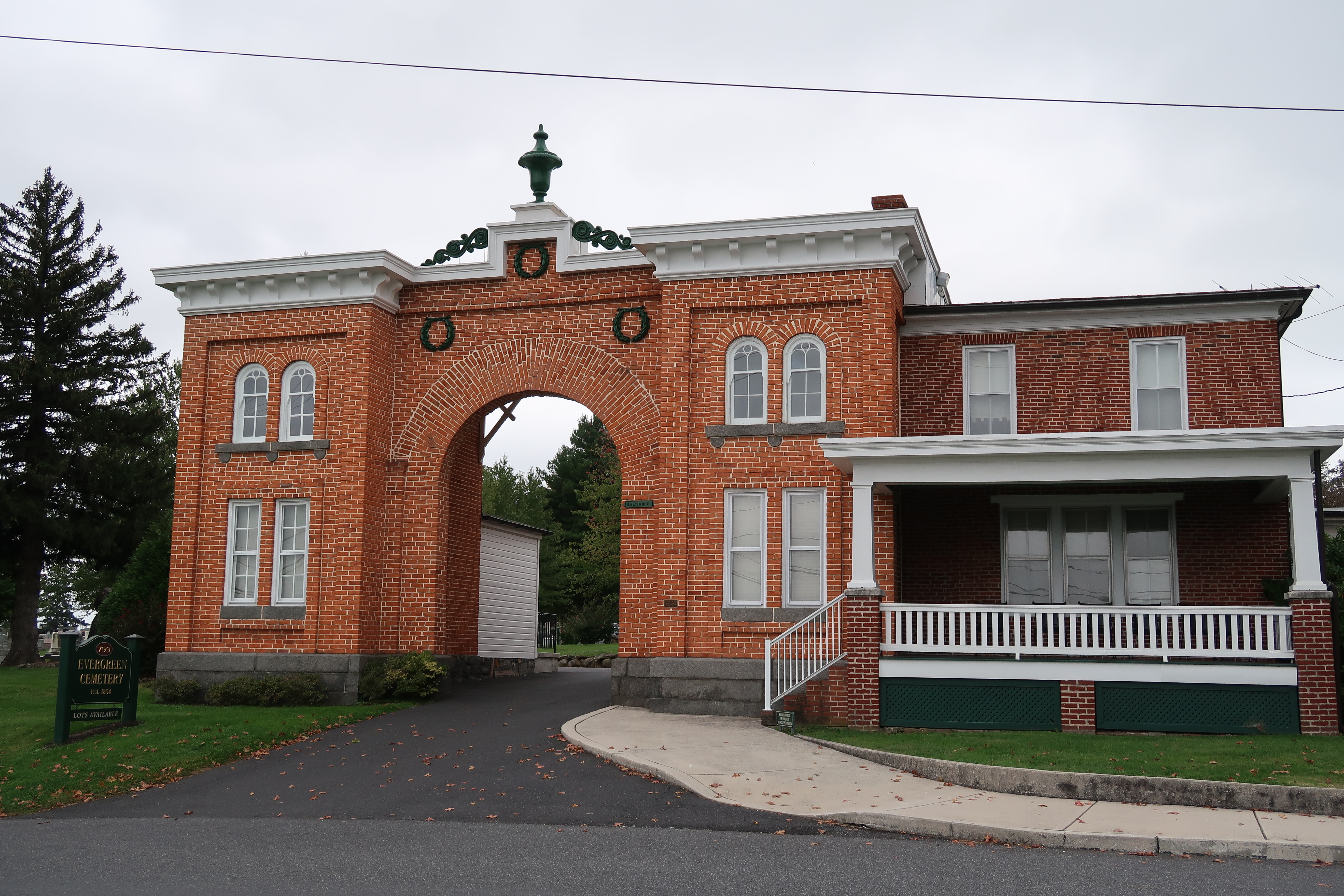
This cemetery was created to be a permanent resting place for the Union soldiers that fell at the Battle of Gettysburg. The new cemetery is bordered by the existing Evergreen Cemetery. This cemetery was founded in 1854 and the only civilian killed during the battle, Jennie Wade, is buried at Evergreen. The front gate was the site of fighting on the first day of the Battle of Gettysburg.
The front gate of the Evergreen Cemetery.
While the there is a monument to the Gettysburg Address on the grounds of the National Cemetery, featuring a bust of Lincoln, the speakers platform where Lincoln delivered the famous words was actually on the grounds of Evergreen Cemetery.
This is an ink sketch I did while seated in the National Cemetery looking towards the location of the speaker’s plateformThe bust of Lincoln at the Gettysburg Address Monument.
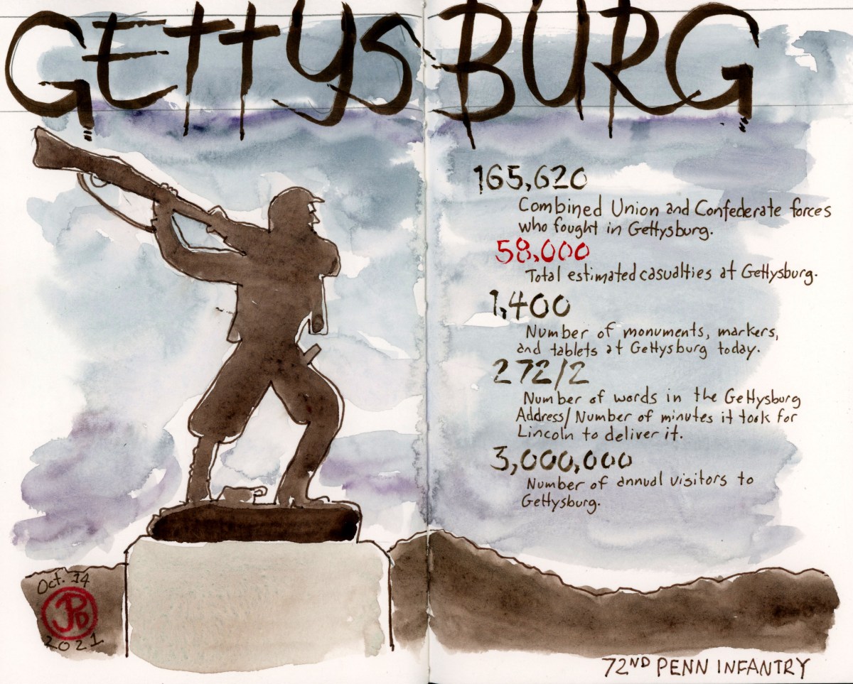
The most famous 272 words in American history, delivered my Abraham Lincoln at Gettysburg, November 19, 1863.
Four score and seven years ago our fathers brought forth on this continent, a new nation, conceived in Liberty, and dedicated to the proposition that all men are created equal.
Now we are engaged in a great civil war, testing whether that nation, or any nation so conceived and so dedicated, can long endure. We are met on a great battle-field of that war. We have come to dedicate a portion of that field, as a final resting place for those who here gave their lives that that nation might live. It is altogether fitting and proper that we should do this.
But, in a larger sense, we can not dedicate — we can not consecrate — we can not hallow — this ground. The brave men, living and dead, who struggled here, have consecrated it, far above our poor power to add or detract. The world will little note, nor long remember what we say here, but it can never forget what they did here. It is for us the living, rather, to be dedicated here to the unfinished work which they who fought here have thus far so nobly advanced. It is rather for us to be here dedicated to the great task remaining before us — that from these honored dead we take increased devotion to that cause for which they gave the last full measure of devotion — that we here highly resolve that these dead shall not have died in vain — that this nation, under God, shall have a new birth of freedom — and that government of the people, by the people, for the people, shall not perish from the earth.
Lincoln arrived by train in Gettysburg they day before. While it is untrue that he wrote the speech on the train ride from Washington, he did put the finishing touches on the speech at David Wills house in the center of Gettysburg. Wills was a prominent lawyer who hosted the president during his stay in Gettysburg.
The Gettysburg Train station where president arrived the day before he gave his Gettysburg Address.
Sketching Note: the featured sketch is made up of the first hand written draft of the Gettysburg Address by President Lincoln. I attempted to imitate Lincoln’s script. The silhouette of Lincoln was sketched in the field, a few blocks from my house in San Francisco. It is a mural on the side of Lincoln High School, where my father was a graduate in 1950.
Three million people visit Gettysburg National Military Park every year, making it one of the most visited battlefields in American History.
People come to this battlefield to look over the landscape, read the carved marble words on monuments, and photograph the bronze statues.
There are 1,400 monuments, statues, markers, and tablets spread across the roughly 25 acres of the former battlefield of Gettysburg. The battle was fought over three days on July 1, 2, and 3 of 1863 in, but mostly around the town of Gettysburg.
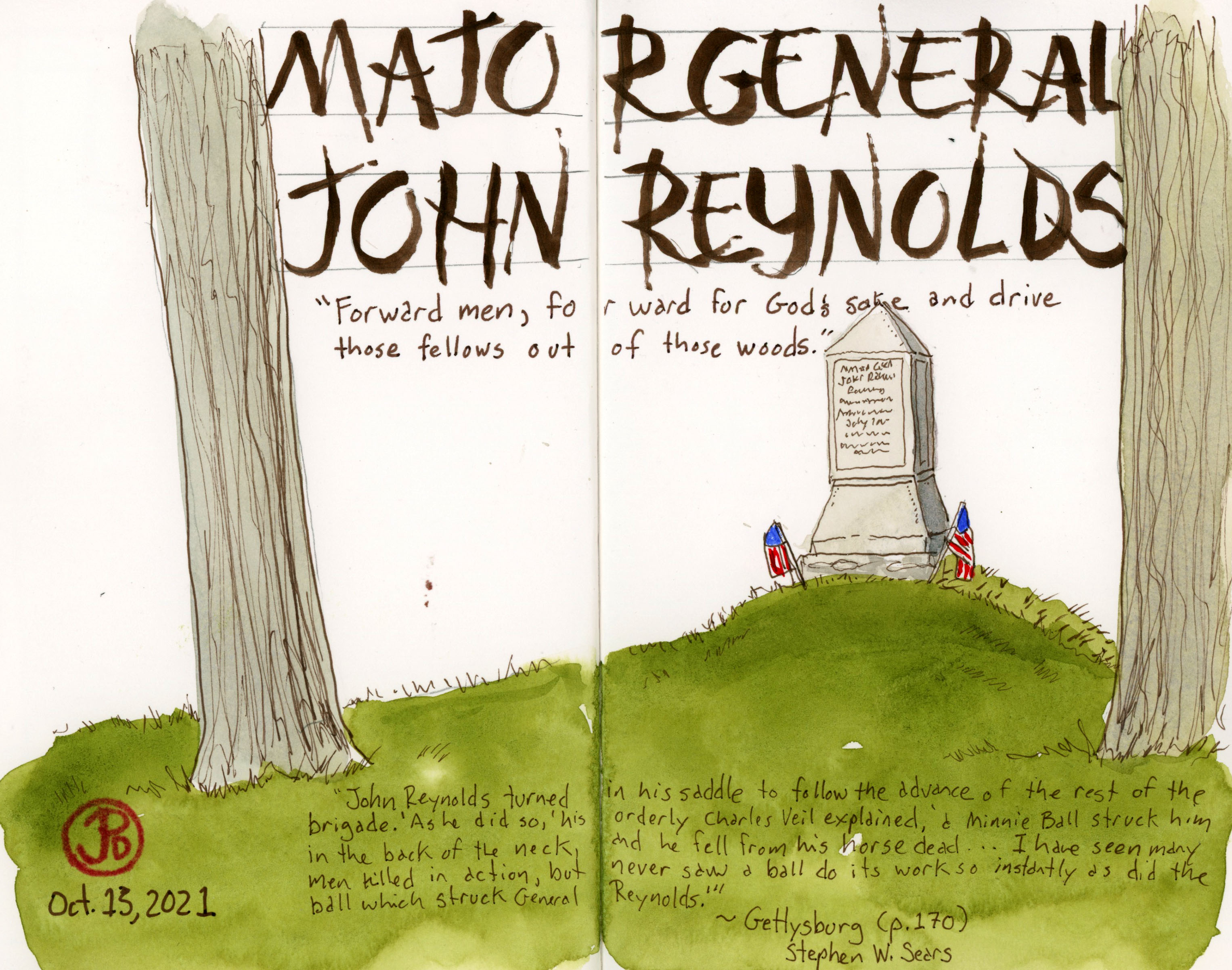
This is one of the many monuments on the Gettysburg Battlefield. This monument marks the spot where General John Reynolds was shot and killed on the morning of July 1, the first day of the battle. Reynolds was they highest ranking officer killed at Gettysburg.
So why did the Battle of Gettysburg happen at Gettysburg? General Lee moved the Army of Northern Virginia through Maryland and up into Pennsylvania in an attempt to cause a battle that would force Lincoln into peace talks. Looking at a map of Gettysburg, we see that all roads lead to this town, from all points on the compass. And there was plenty of coveted high ground to the north and south of Gettysburg.
All roads lead to Gettysburg.
Over the next few posts I will share some of the many sketches I did at Gettysburg (summoning my inner Alfred Waud). I spend three days exploring the rich history of this battlefield and it provided many sketching opportunities.
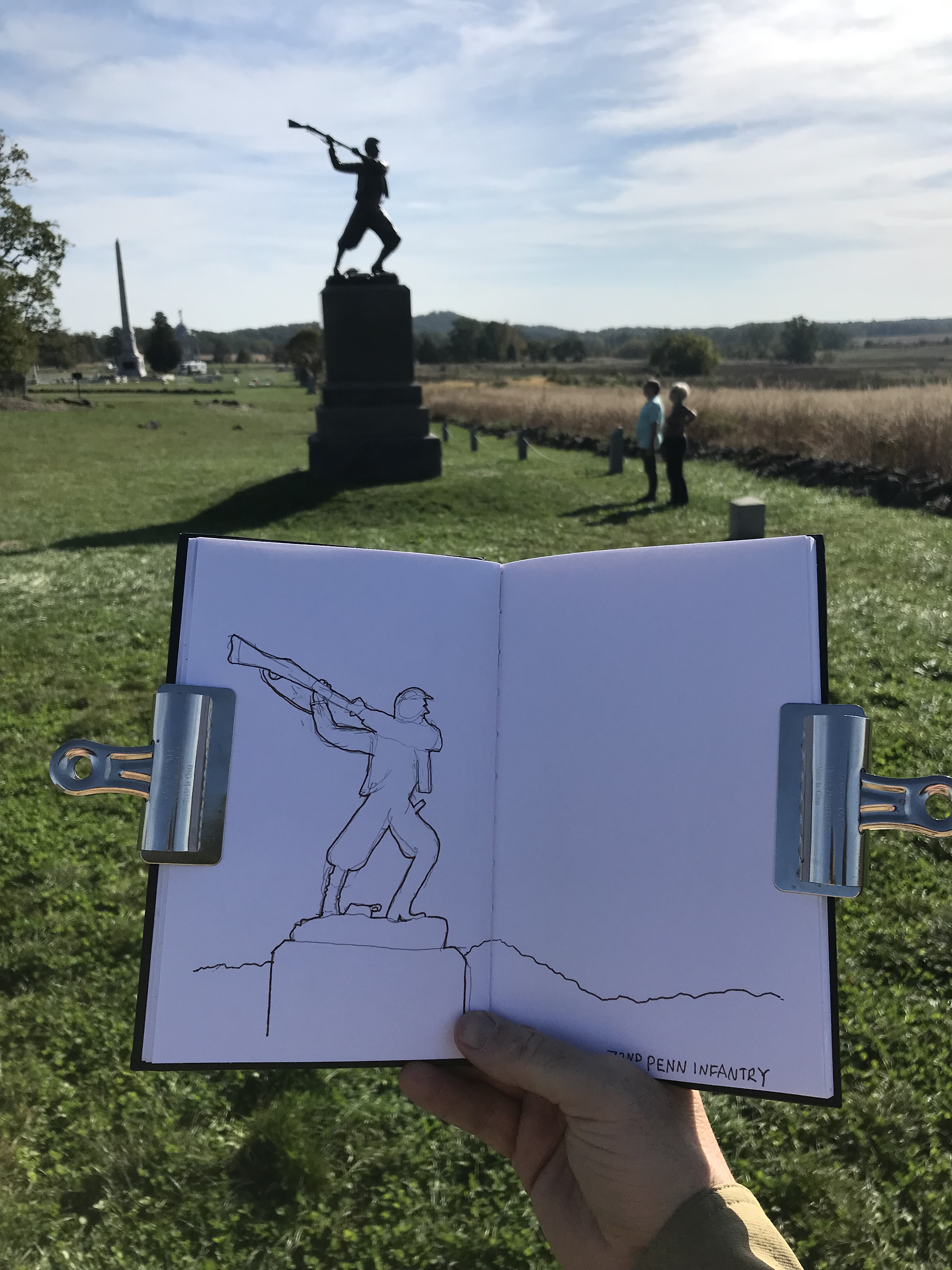
Here I am field sketching the 72nd Pennsylvania Monument at the Highwater Mark, the climax of the Battle of Gettysburg as two people admire what is one of the most iconic statues on the battlefield.This is largest monument at Gettysburg and it’s fitting that it is the Pennsylvania Monument.
The Battle of Antietam, near Sharpsburg, Maryland, is the single bloodiest day in any American War battle. During the Civil War, every causality was an American so the causality rate is understandably higher than in other conflicts. But the brutality of the fight over once day, makes the Battle of Antietam stand out amongst other battles.
About 23,000 where killed in this once day conflict. The Battle of Antietam, named after the creek that flows east of Dunker Church, was a failed campaign, by General Robert E. Lee to invade the north in the border state of Maryland. It was also not the decisive battle that Lincoln wanted and the ever meek General McCellan, let the depleted rebel army escape across the Potomic. McCellan was soon replaced but this victory was enough for Lincoln to introduce the document that had been sitting in a desk drawer: the Emancipation Proclamation.
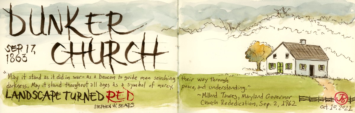
One of the enduring sights from Antietam is the Dunker Church. It has been called, “one of the most famous churches in American military history”. This simple, one room church was surrounded by the horrors of war on September 17, 1862. When soldiers first came upon this small, plain, and unassuming building, some thought it was a schoolhouse.
The church was granted on a parcel of land by farmer Samuel Mumma and was constructed in 1852. The “Dunkers” were a pacifist German Baptist congregation, which is very ironic considering the bloodshed that surrounded the church on a September day in 1862.
Antietam, the mix of the holy and the profane. Dunker Church and cannon.
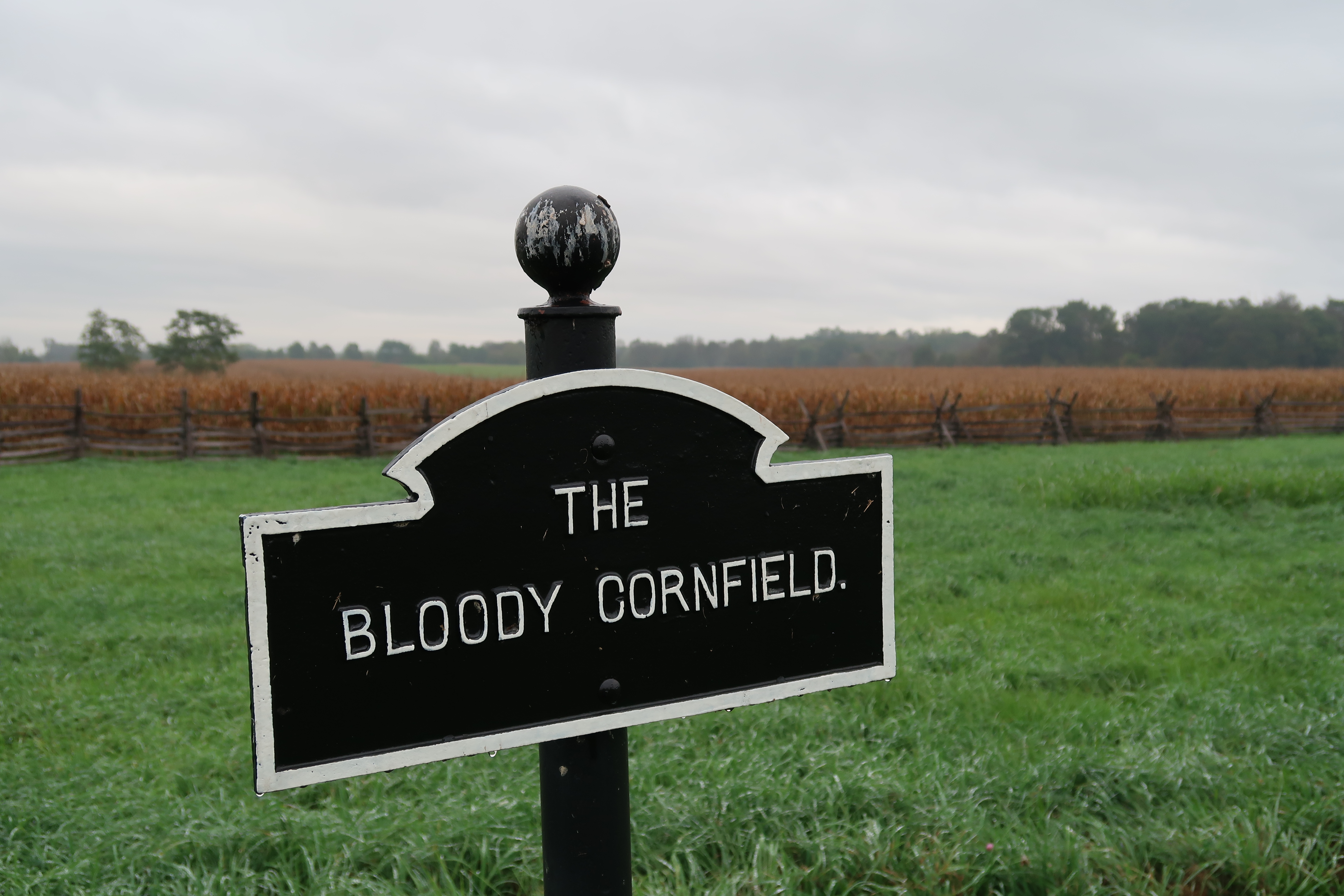
The battle started near the church on the morning of the 17th. Blood runs thought the landscape and place-names of this battlefield. To the northeast of the church was a cornfield, after the battle, it was given the infamous moniker, the Bloody Cornfield. Many men, both north and south, died in a field of life giving corn.
The Dunker Church was the center of the morning’s conflict and today, the visitors center is built near the church. When I visited, on an early October Sunday, there was an artillery demonstration in a field to the east of Dunker Church. So I stuck around because reenactors would be firing a replica Napoleon Cannon.
Civil War reenactments started in 1960, the centennial of the war. It has been a growing hobby, some might say “obsession”, since that time. One of the biggest Civil War reenactments was to celebrate the 135th Anniversary of the Battle of Gettysburg (much more on Gettysburg later). That event included 15,000 participants. It seemed that Civil War reenactments are on the wane these days and younger generations have differing views of the Civil War, its influence and it’s impact. As a result they are not taking up the replica muskets and joining a “battle”.
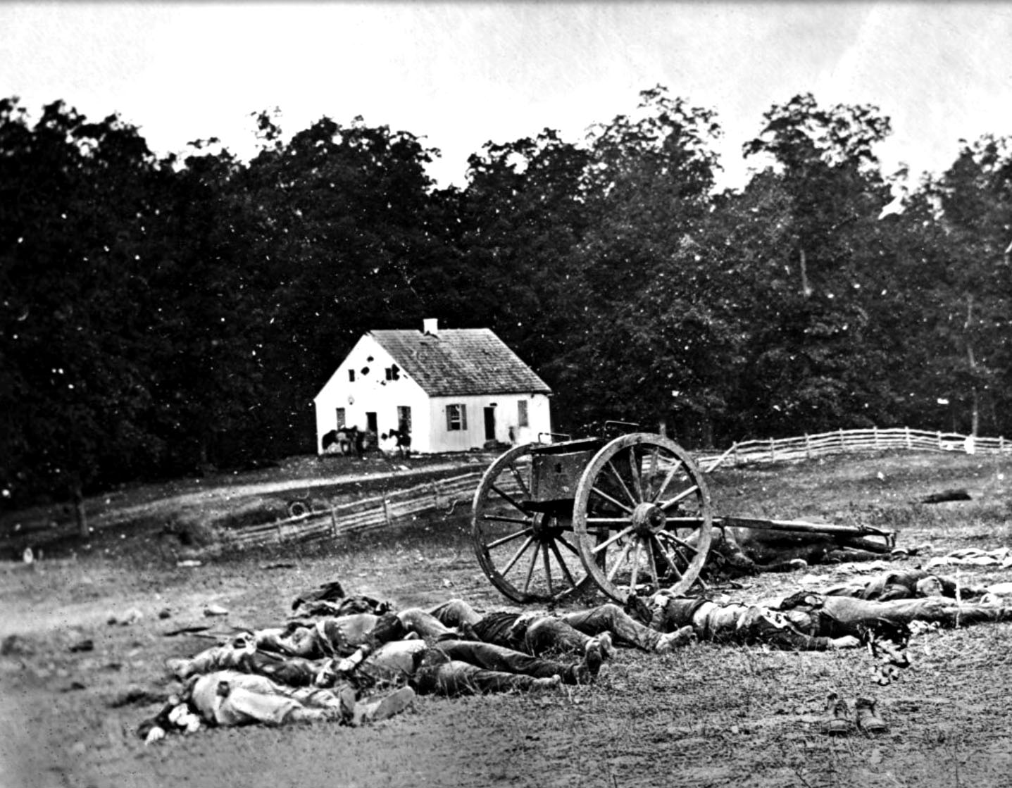
These reenactors where dressed in the mismatched uniforms of the Confederate Army. Maryland was a border state during the Civil War and Lee counted on support from the locals on his Maryland Campaign. In the end, this didn’t really happen.Fire In the Hole! The canon demonstration was both loud and powerful. It was haunting to hear the cannon echoing across the rural Maryland landscape. I’m not sure if the neighbors sleeping off Saturday’s revels felt the same.A photography taken just after the battle of Antietam showing Confederate dead in the foreground. In the background, Dunker Church shows damage from artillery fire. This is the photograph where I took inspiration for my featured field sketch.
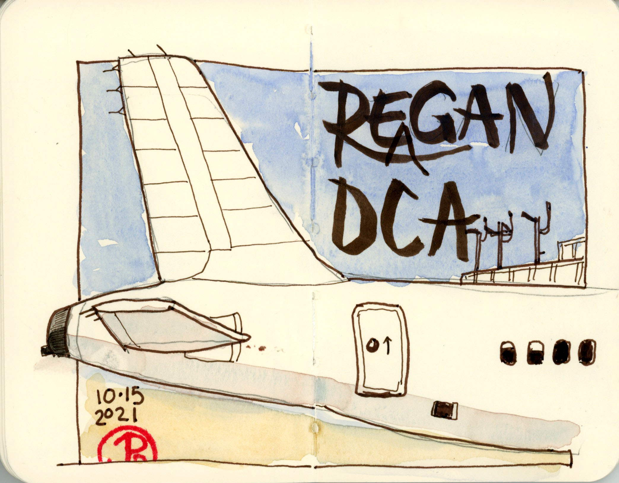
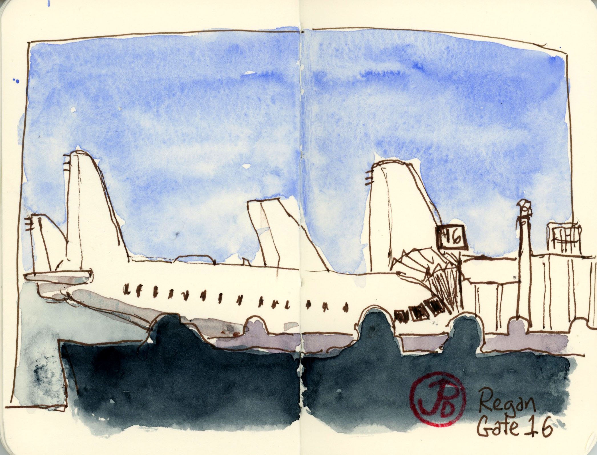
To me, there is no better way to pass time in an airport than sketching.
I always have my small Stillman & Birn Delta Series in my pocket. The reason I enjoy using this 3.5″ X 5.5″ soft-cover sketchbook is that it allows me to do quick sketches. There is not so much paper to cover as a “standard” sized sketchbook. If sketching because more easy, you tend to do more of it.
I always try to take a seat, facing a window and sketch the planes on the tarmac as they are lined up like a school of sharks at their gates. I try to sketch the plane I will be departing on. But any plane will do.
I have included a few of my sketches in this post. They were done at SFO (San Francisco) and DCA (Reagan International).
During the battle of Antietam, the Sunken Road became the Bloody Lane.
In mid morning, the fighting moved away from the Dunker Church to the area to the southeast known as the Sunken Road. The Sunken Road is a road that bisects two farm fields and as the name implies, runs below the land that flanks it; like a riverbed without the water. This road was worn down over time because of heavy wagon traffic.
This location was the setting of some of the fiercest fighting in a battle known for it’s fierce fighting. This is where the center of the Army of Northern Virginia and the Army of the Potomac came together.
Here, in the Sunken Road, the Confederates under General D. H. Hill placed this division of 2,600 soldiers along this road. Union General William French attacked this position leading to a savagely bloody conflict that lasted for almost four hours. During this battle 5,500 soliders, on both sides, where either killer or wounded. Thus the Sunken Road became the Bloody Lane.
Soldiers who were involved in the conflict later describe the Sunken Road as the “road of death” and a “ghastly flooring”.
On my visit, I placed myself about half way down the Bloody Lane and I sketched looking toward the 132nd Pennsylvania Monument and the observation tower that was built in 1896 by the War Department. Starting out early had it’s benefits because I had the Bloody Lane to myself.
After my field sketch, I headed over to the 60 foot tall observation tower to get a 360 degree view of the battlefield and the receding view of the Bloody Lane. Again, the tower was all mine.
A photo taken from the observation tower, looking down the Bloody Lane. My sketching position was where the green turns to brown, just under an oak.
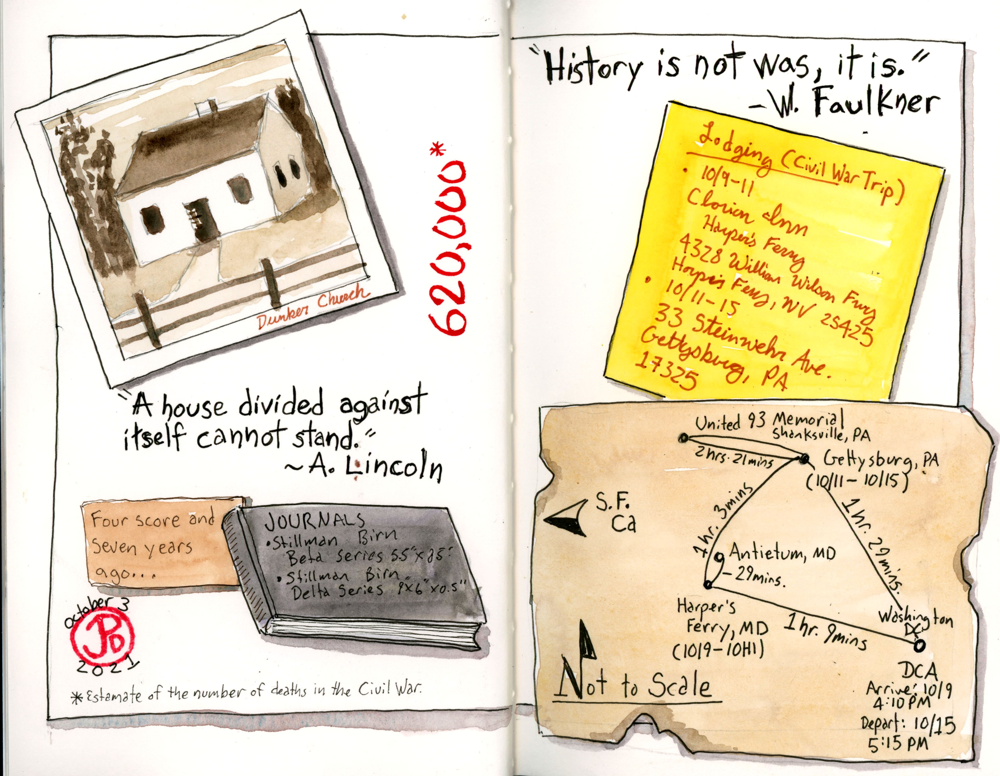
Before I go one any trip I like to add a title page and a map to my sketchbooks.
For my trip to Civi War battlefields in Virginia, West Virginia, Maryland, and Pennsylvania I chose to bring two Stillman and Birn hard cover watercolor journals. One is my new go-to favorite, the panoramic Delta Series journal. And the other is a Beta Series 5.5 ” X 8.5″ sketchbook. I love both of these papers and they are great for sketching on the road with pen and watercolor.
In the Delta journal I created the title page based on the famous image from Ken Burns’ documentary The Civil War, of a silhouetted canon and a glorious sunset in the background. This footage was filmed at Manassas in Virginia. This opening page is the featured sketch.
In my Beta sketchbooks I created a map of the places I would be visiting. All of the locations I would be visiting where within 90 minutes of each other. I distressed the map, covering it in mud and blood. Perhaps I added too much “blood”, but somehow since this is the Civil War it was fitting. It is estimated that about 620,000 Americans lost their lives during the Civil War.
In my Beta, created to spread to synthesize a lot of the information about my trip in a creative way. It is a montage of all the important facts of the trip. Well some of them at any rate. This was a fun page to do and involved a few different sketching techniques.