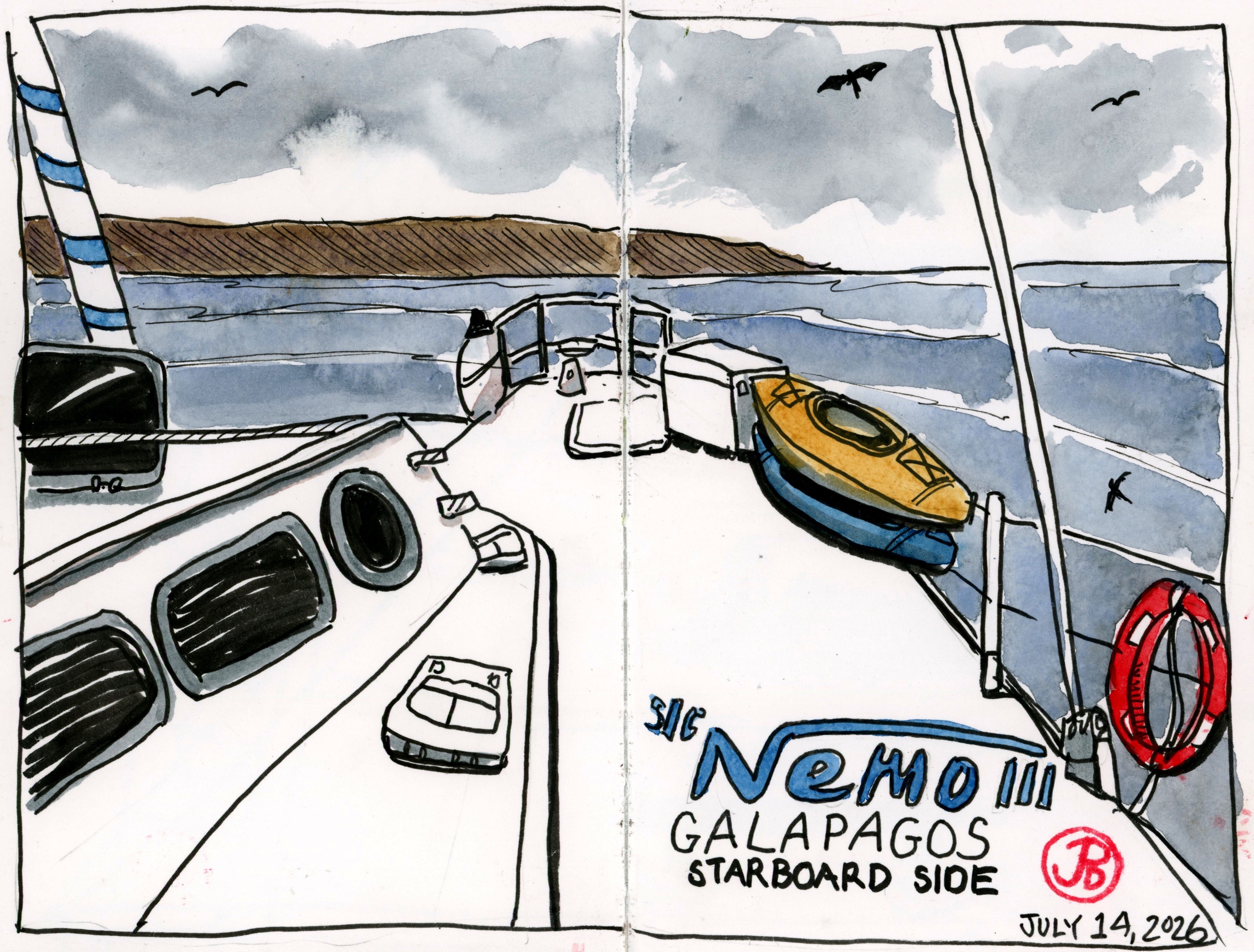
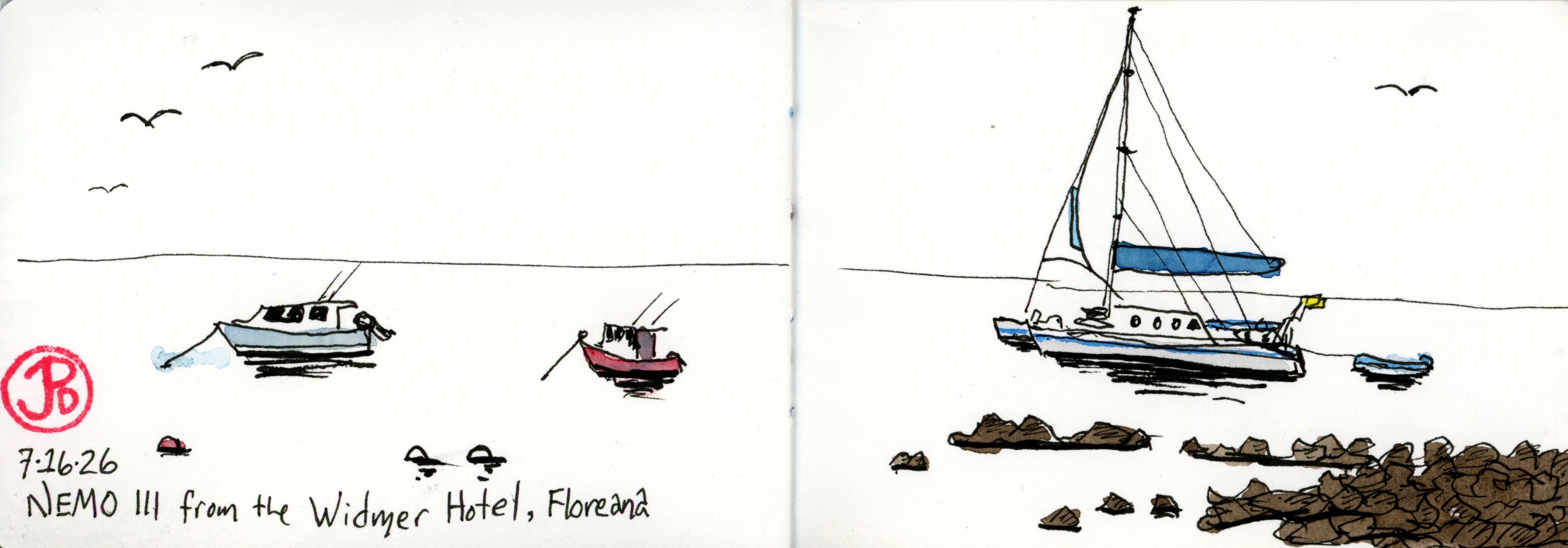
Our vessel for the Galápagos cruise was the catamaran the Nemo III.
It held all thirteen passenger (about half were birders), two guides, and a crew of six. This is like a cruise ship at a smaller scale.
The boat can accommodate 16 passengers in eight cabins. The small galley produced three hearty meals a day which was much appreciated after a day of birding and island exploring.
This catamaran would be our home away from home for eight wonderful days.
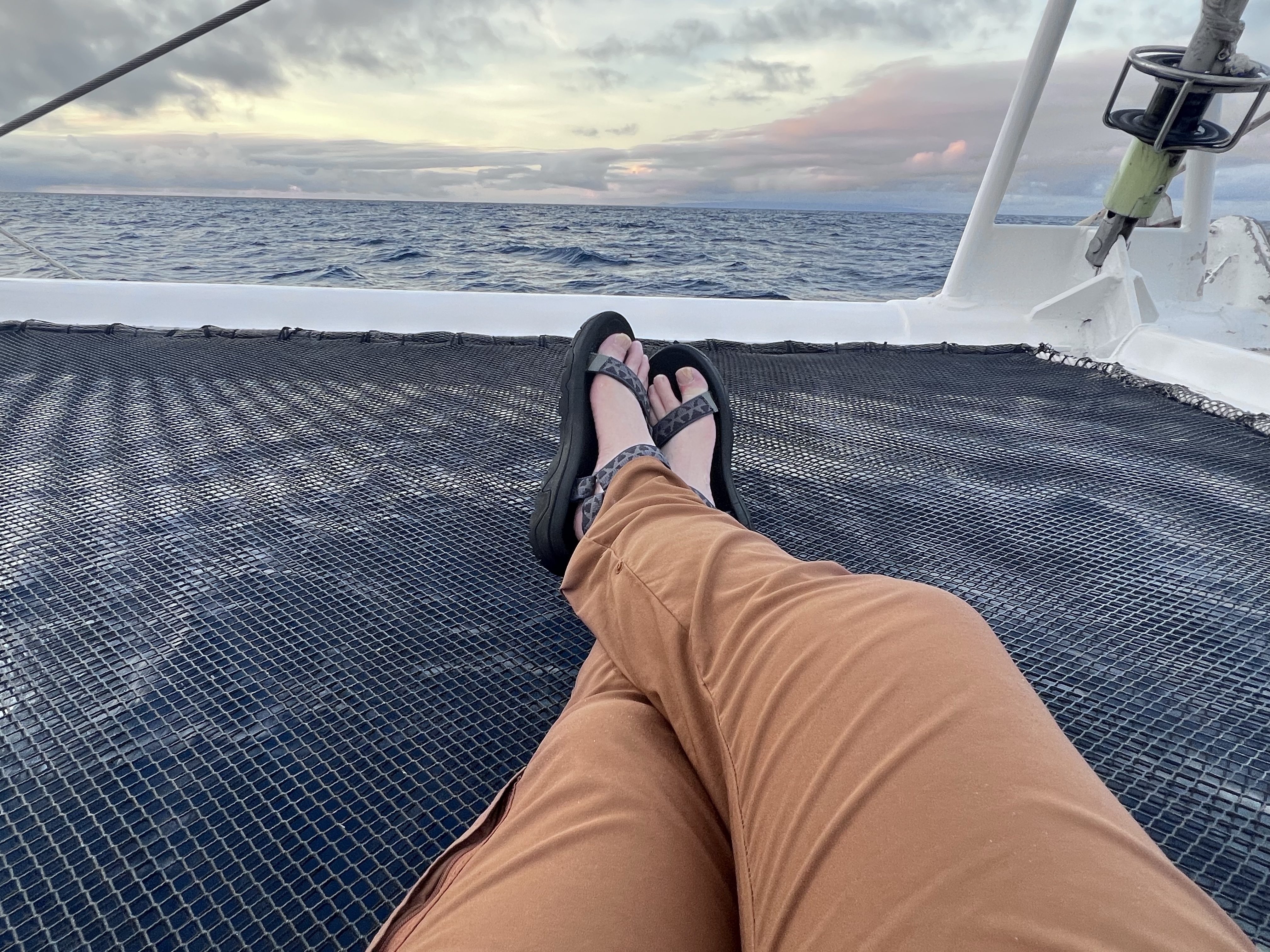
Relaxing on the bow while cruising between the islands of the Galápagos.
Over our ten day cruise visiting nine of the Enchanted Islands I sketched from the Nemo III as well as a few sketches of the catamaran from the shore.
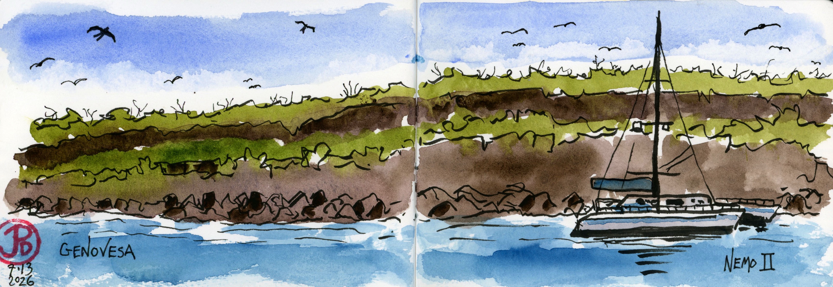
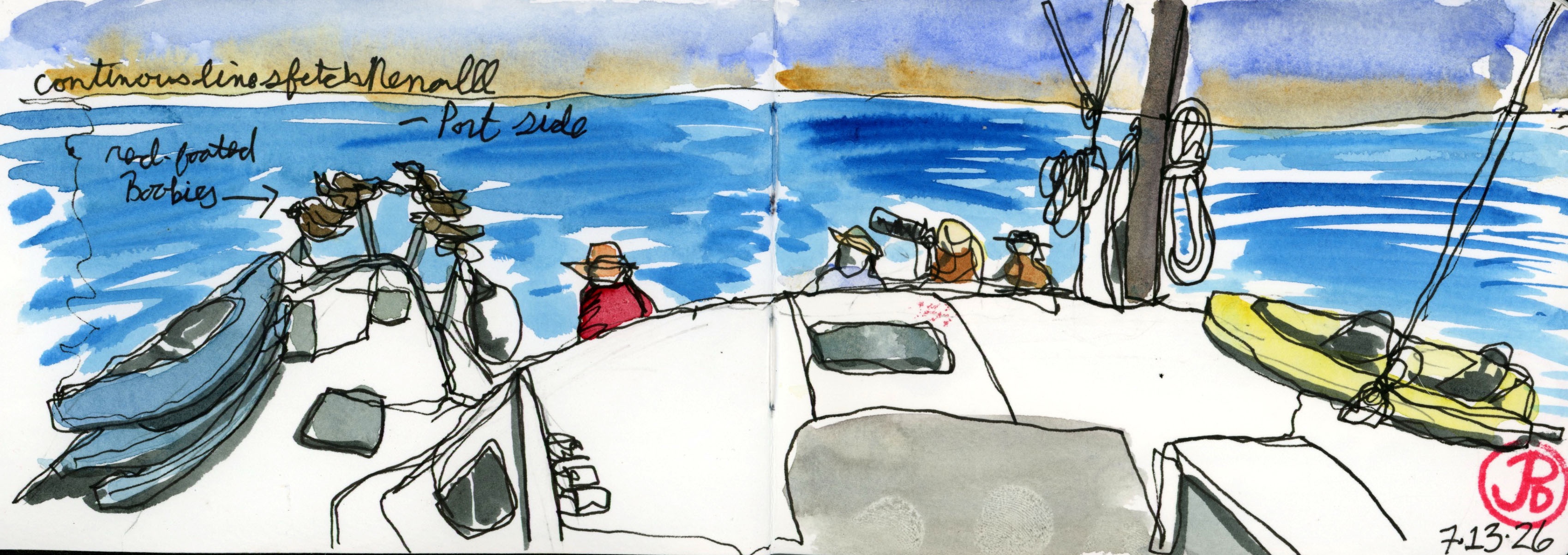
While anchored at Genovesa, I sketched our sister ship, the Nemo II.A continuous line sketch from the port side. Red-footed boobies were getting a free ride on the front railing. A sketch of the Nemo III from shore on Floreana.
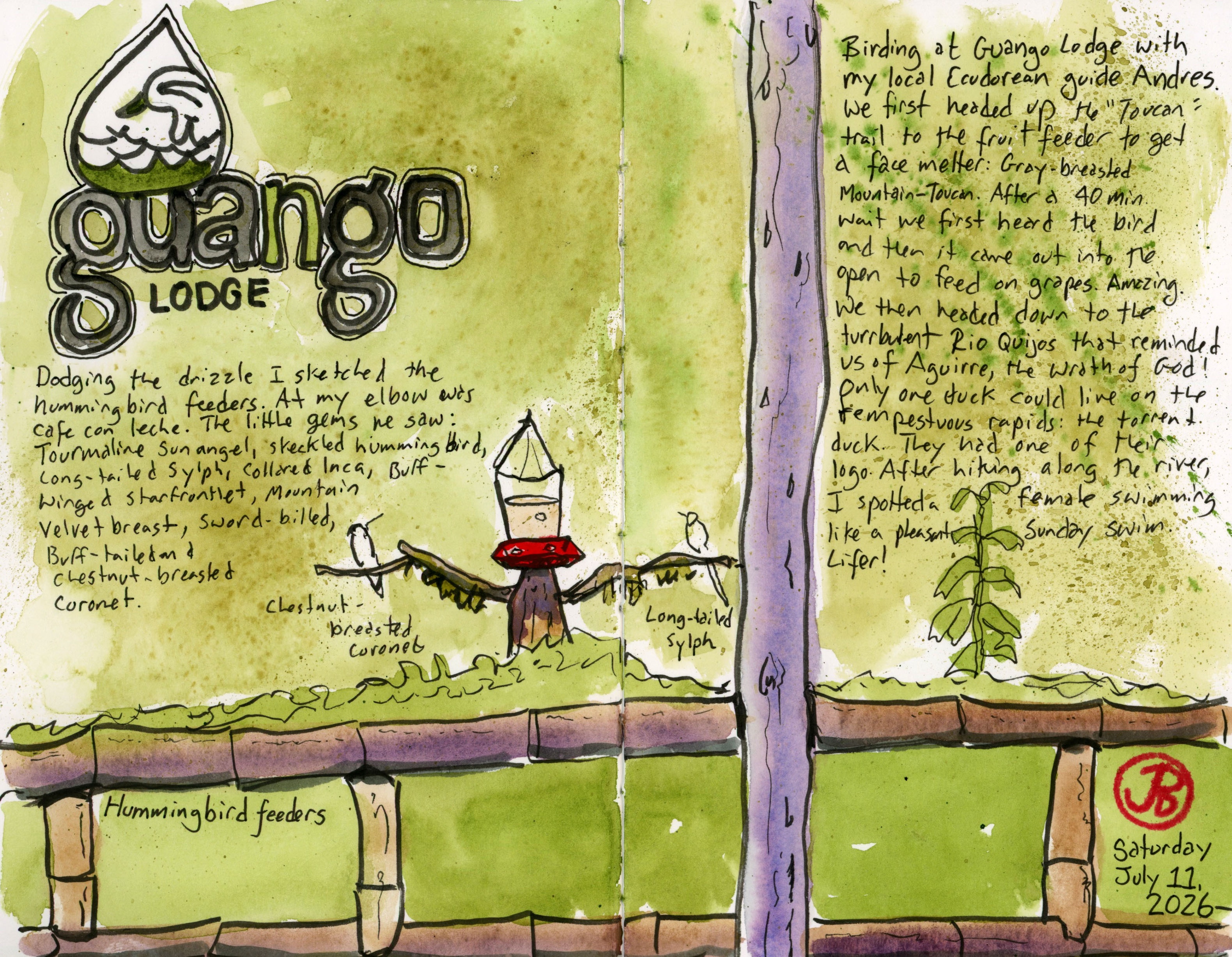
I arrived a day early before my Galápagos cruise started so I hired a guide (Andres) for the day and we headed east over the Continental Divide of the Andes Mountains to Guango Lodge.
The logo features one of the top birds on my wishlist.
There were two birds that I really wanted to see in the area and with birding, you are not guaranteed any.
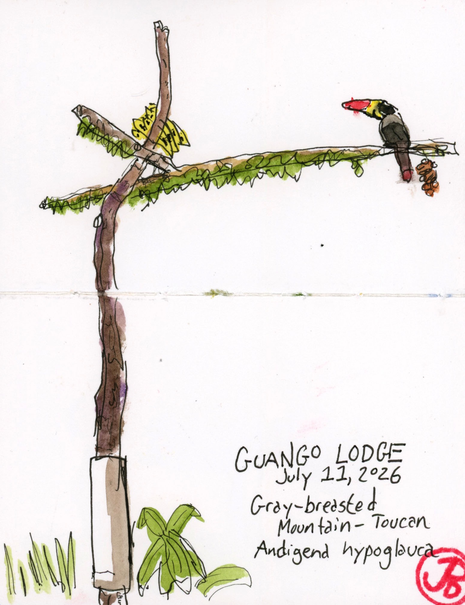
I wanted to add another mountain toucan to my list, on a previous Ecuadorian trip I got plate-billed, and now we walked up the muddy Toucan Trail in our rubber boots looking for a second species.
The trail leveled off at a hide where a vertical forked branch was set up. The caretaker, Daniel, came up behind us to add fresh bananas and grapes to the wooden feeder.
The first bird that visited the feeder was the great thrush. No toucans yet.
This would take a little patience and the hide was covered to keep us dry. While we waited I pulled out my small softbound sketchbook and sketched the wooden fruit feeder.
Waiting on a mountain-toucan.
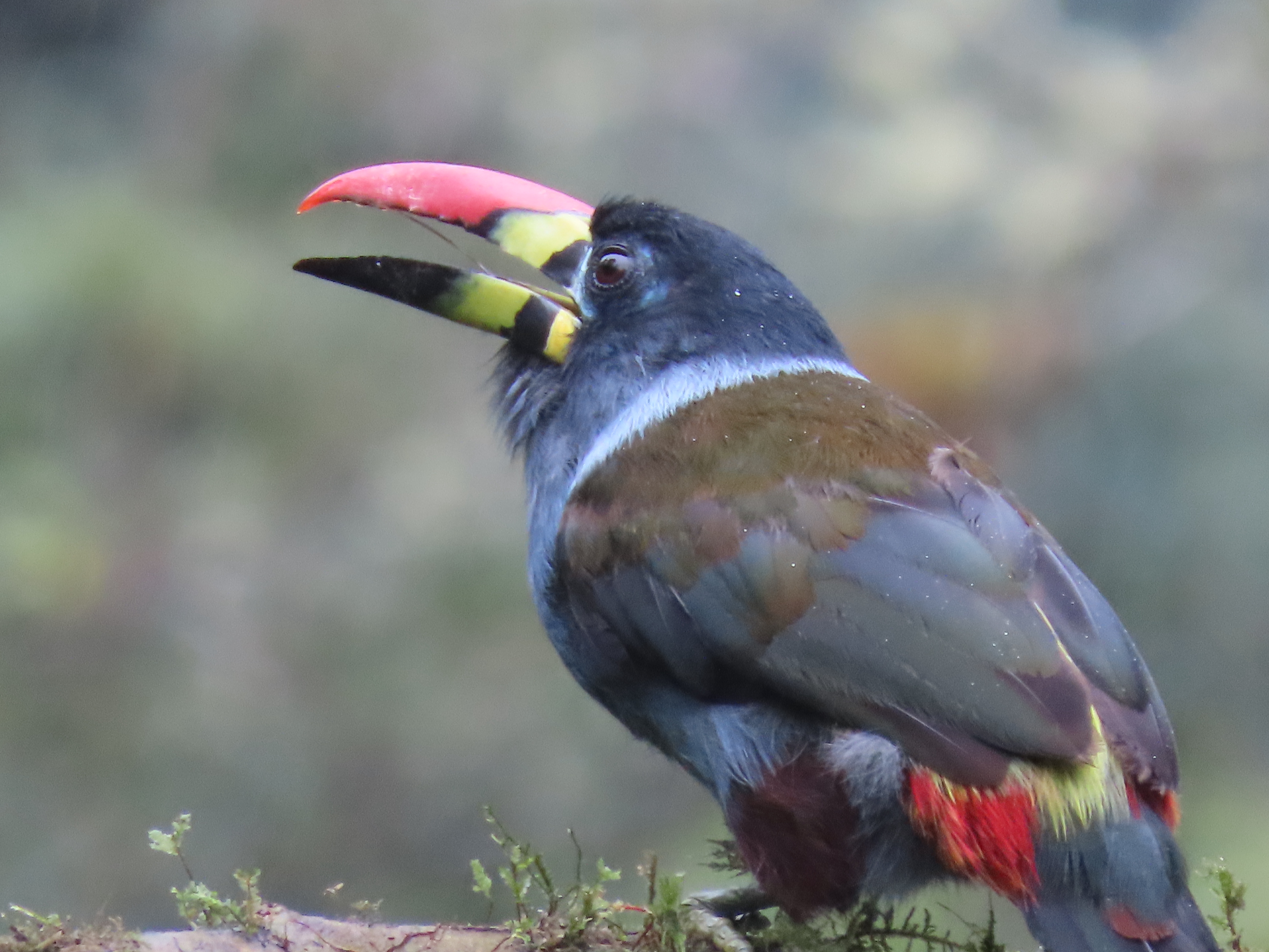
Off to our right we heard the call of the toucan. Now we waited for it to fly into the open and land on the feeding perch. The bird was cautious, making sure it was safe.
Onto the perch landed the magnificent gray-breasted mountain-toucan. A double hyphen bird of the highest magnitude! Lifer!
After watching the toucan pull grapes at the feeder we headed back to the river to look for another sought after bird.
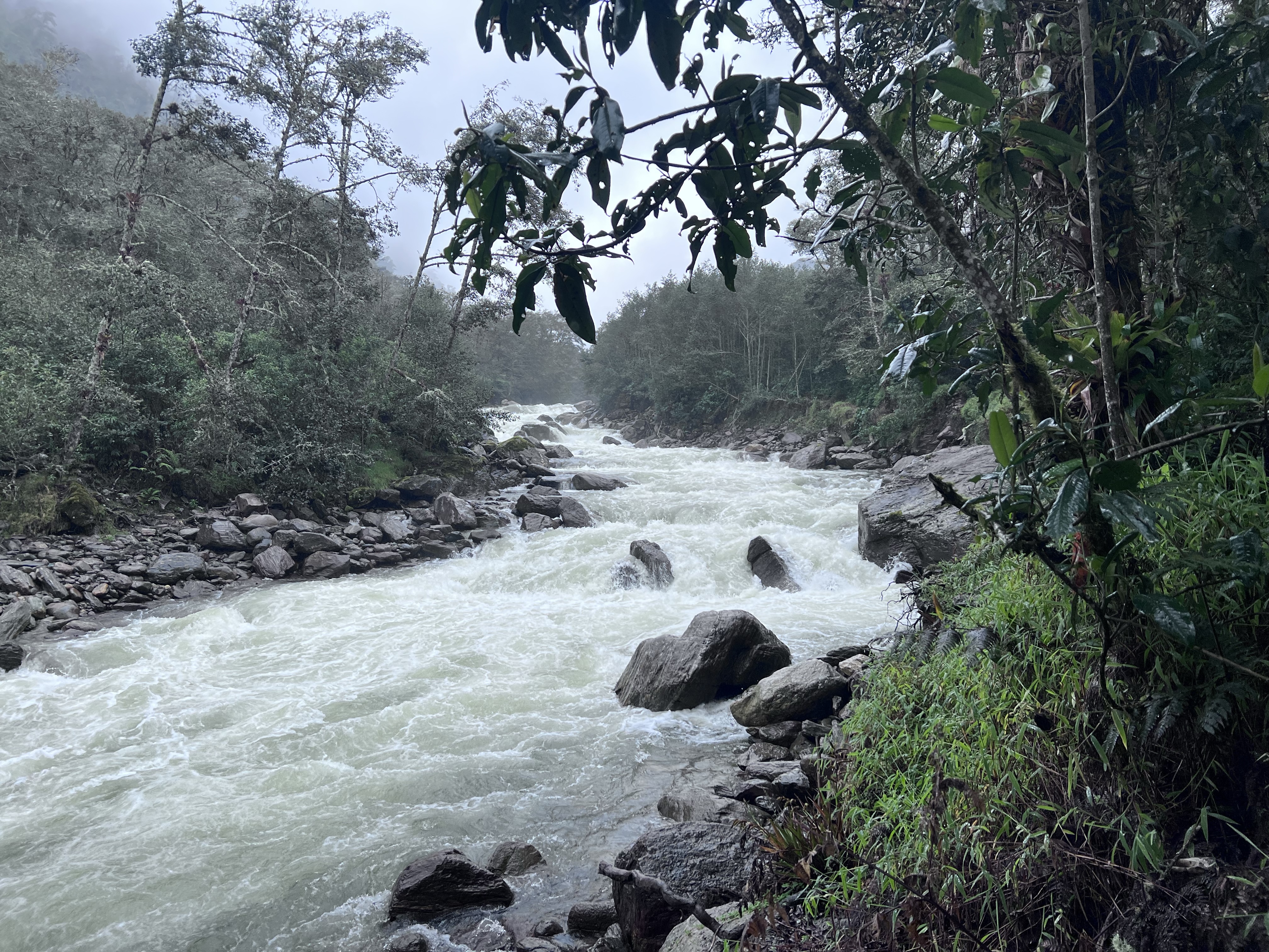
The furious and frothing Rio Quijos cloaked in gray, reminded me of Herzog’s Aguirre, the Wrath of God and Fitzcaraldo. How can a bird possibly survive here among the rapids?
Well one duck not only lives but thrives amongst the Class 6 rapids. And it’s appropriately named the torrent duck.
We walked along the river checking the waters and boulders for this iconic Andean duck.
As we neared the end of the trail I looked downstream and saw a duck bobbing in the frothy rapids. She swam across the river and walked up on a riverside boulder. What an amazingly adapted bird to its turbulent habitat. And what an amazing lifer!
A spread with sketches from my own photos.
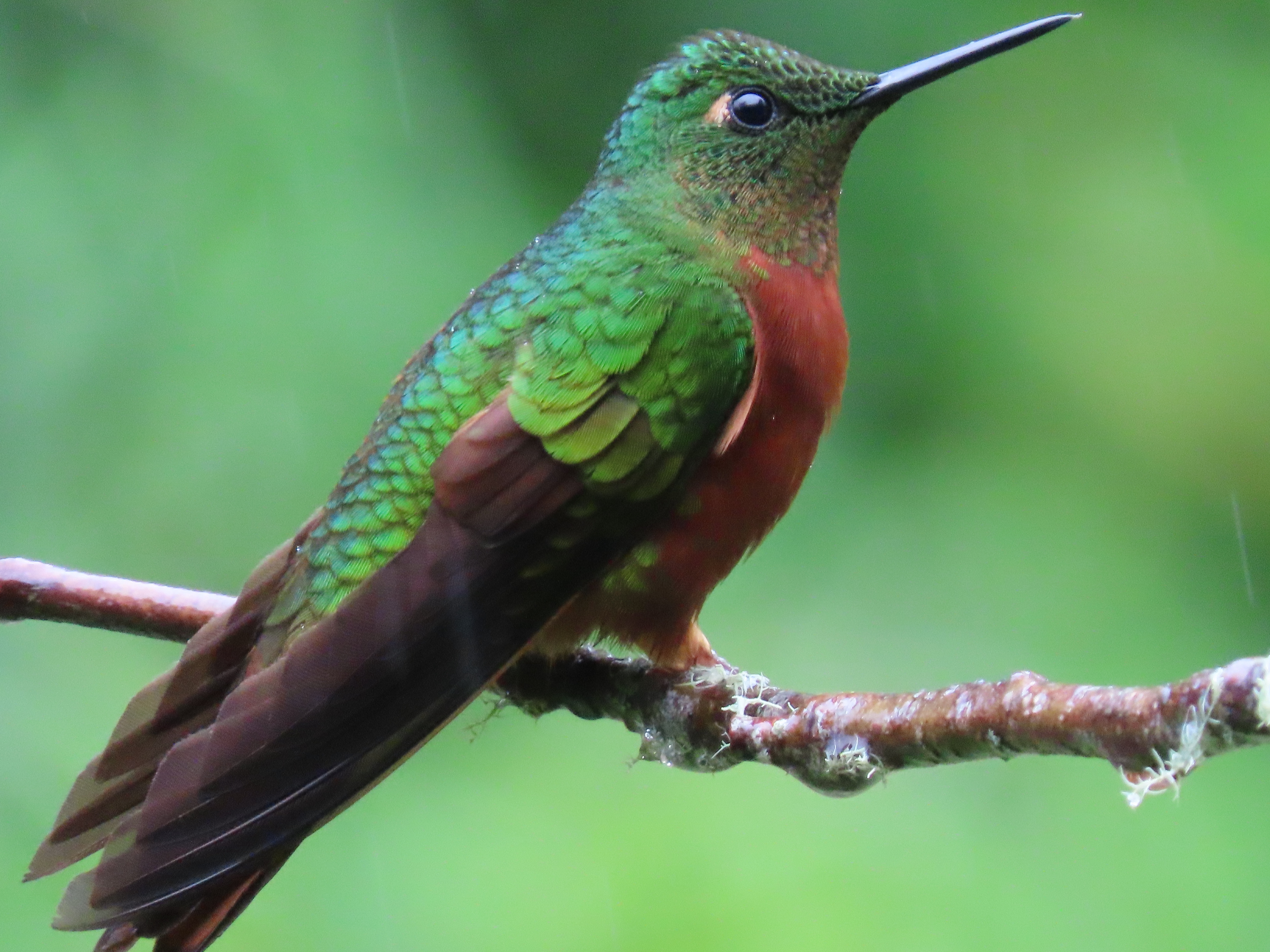
After ticking the toucan and duck we returned to the lodge and sat under a shelter from the permanent mist and drizzle, sipping cafe con leche and looked out at the three hummingbird feeders in front of us.
The feeders were very active and I sketched the scene before me (featured sketch).
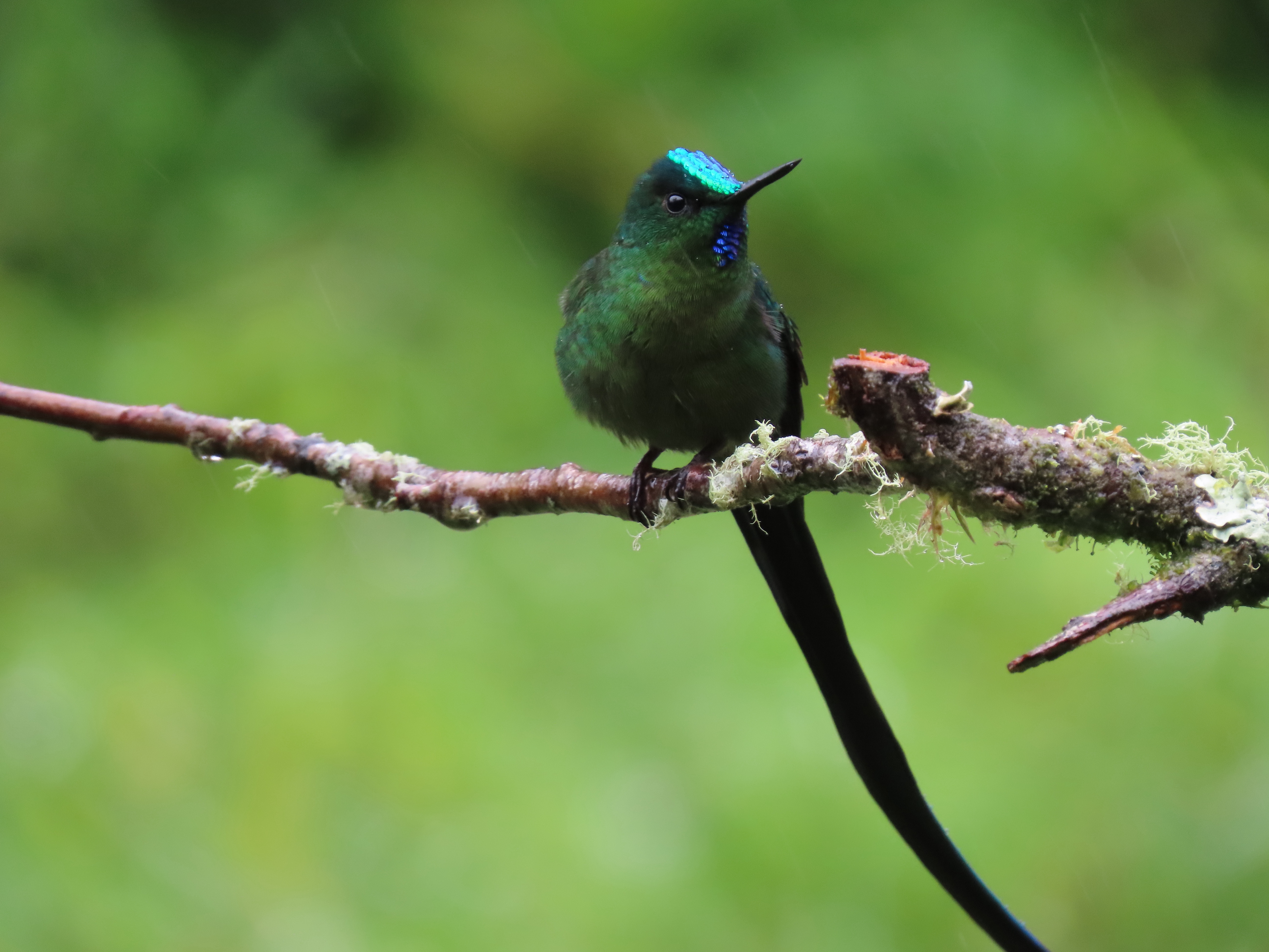
Out of the 366 species of hummingbirds in the New World (they are found nowhere else), I have seen a mere 96. I have a lot more hummingbirding to do.
Challenge accepted!
Here are a few photos of some of the visitors to the hummingbird feeders at Guango.
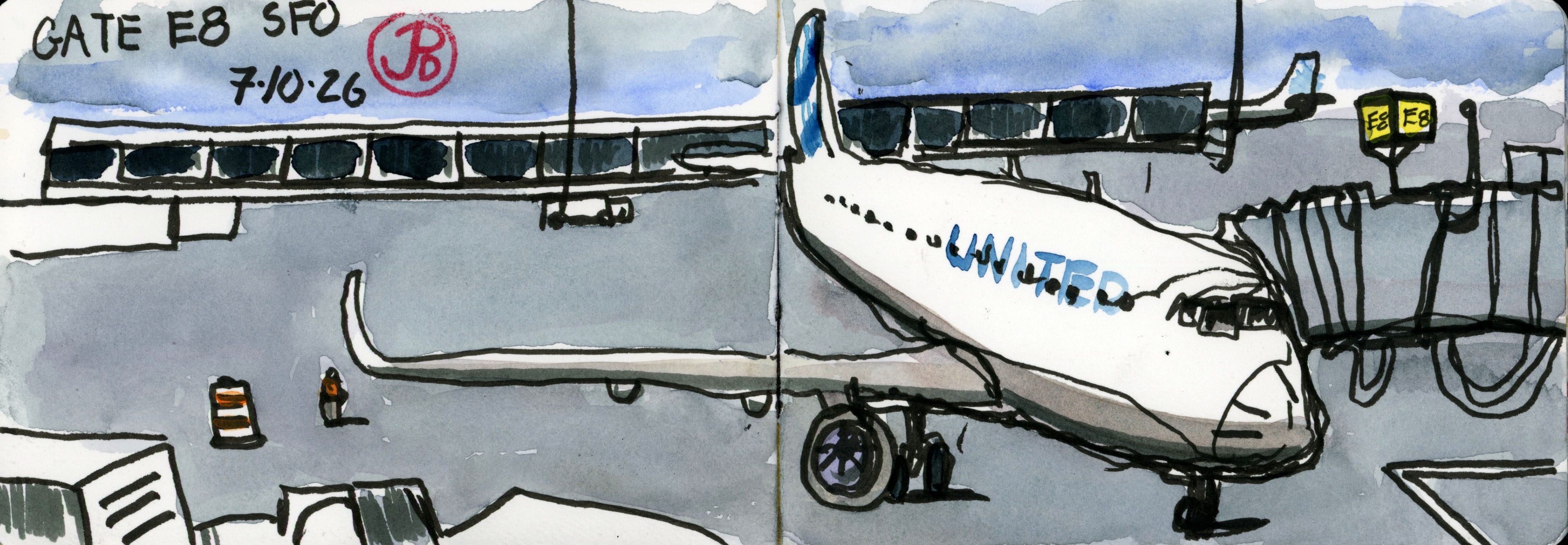
Sitting in a gray swivel chair with gray skies above and the United Boeing 737 below at gate E8.
This was not the plane taking me to Houston nor that plane continuing on to Quito. This plane was heading off somewhere else.
I pull out my sketchbook and pens and start sketching in a continuous line, starting with the nose of the Boeing and reaching back to the tail then reaching out to the starboard wing and down below to the turbine engine and back to the front landing gear.
I have done this sketch many times before at different airports of different planes at different gates.
This is a touchstone sketch, one that I return to while killing time at an airport.
Perhaps it’s not really killing time but a meditation after the chaos of security lines and X-rays, of taking off your belt and hat only to put them on again.
Yes it is a meditation as time flies by (pun intended) and moves ever closer to 8:15, boarding time.
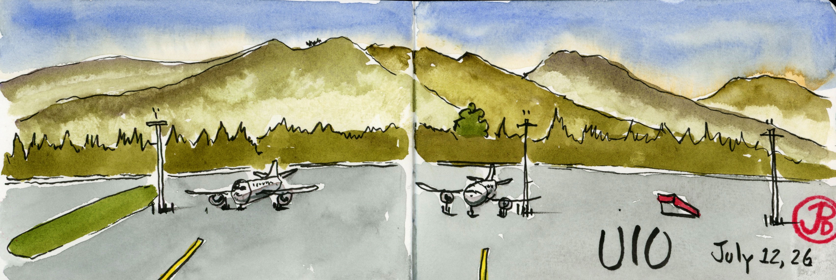
Airport sketch at Quito. UIO is a beautiful setting in the middle of the Andes.
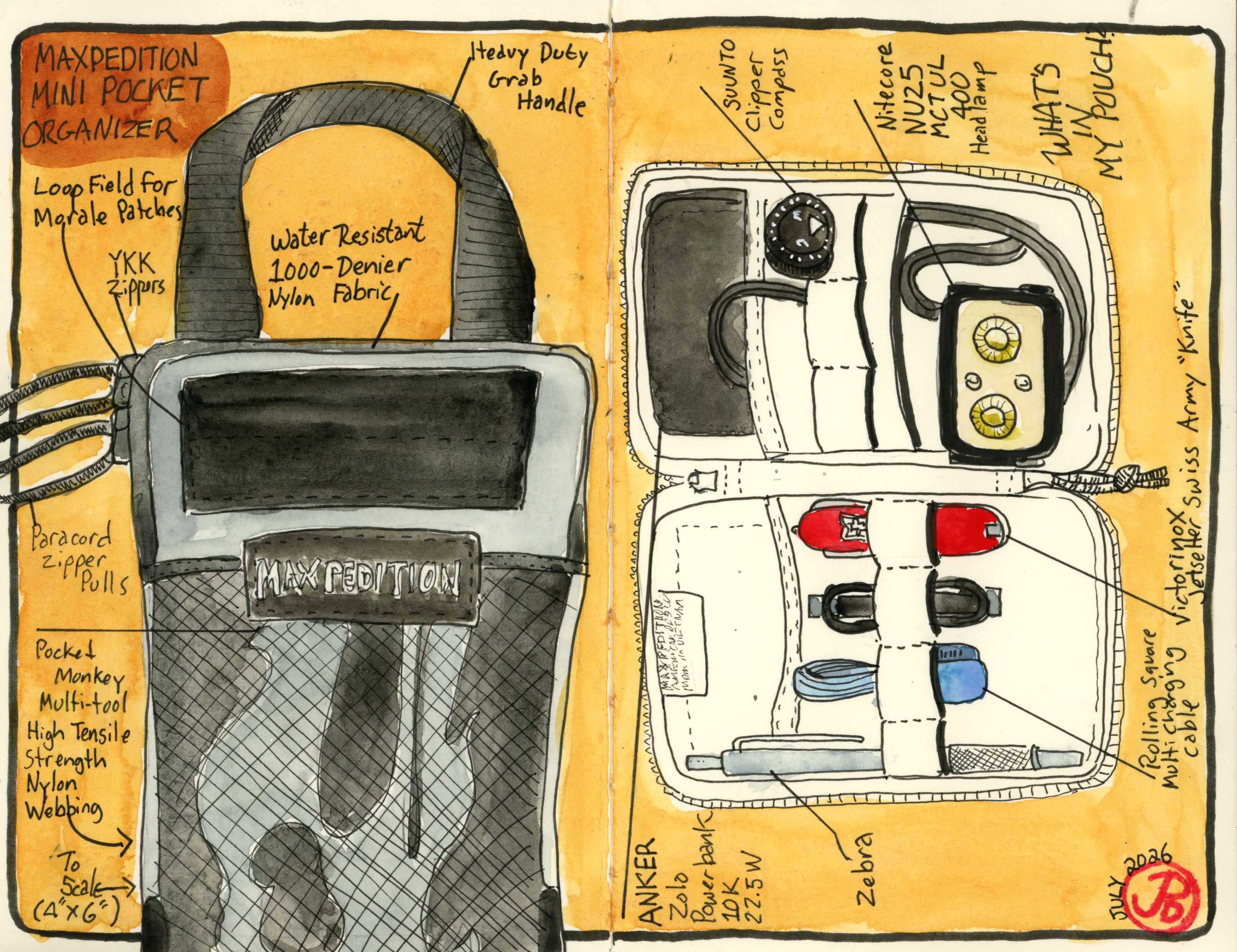
With my trip to the Galapagos I wanted to try out a new travel pouch.
This is a good way to keep things organized on the road so you aren’t on a wild goose chase looking for that adapter or power bank.
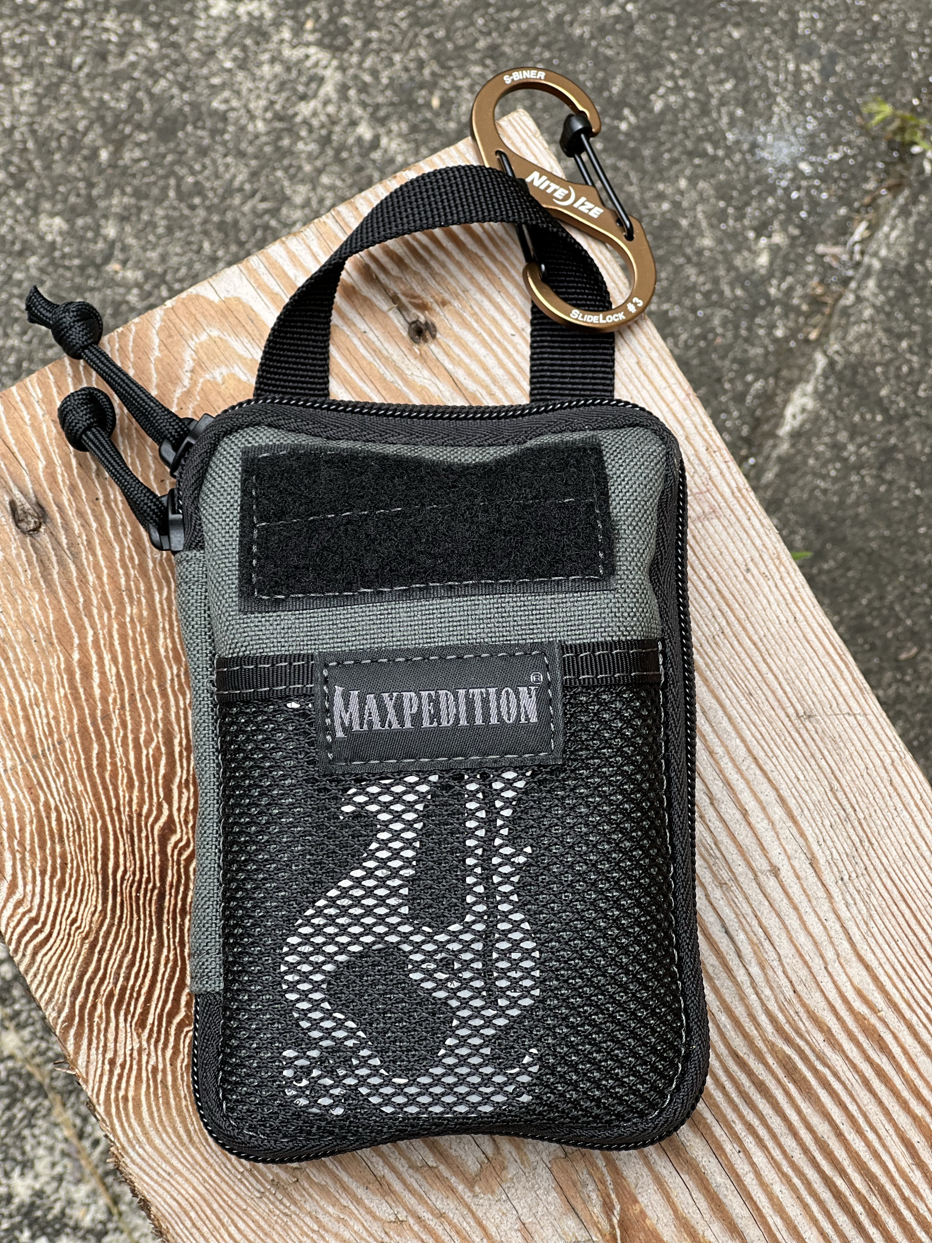
After a bit of research and YouTube binges (thank you Jon Gadget) I settled on the Maxpedition Mini Pocket Organizer. I love new gear!
As I often do, I sketch a spread about my new travel gear and what I keep inside.
On the left side is a life sized sketch of the 4” X 6” organizer, pointing out it’s specs: YKK zippers, paracord zipper pulls, water resistant 1000-denier nylon fabric, heavy duty grab handle, and high tensile strength nylon webbing on the back.
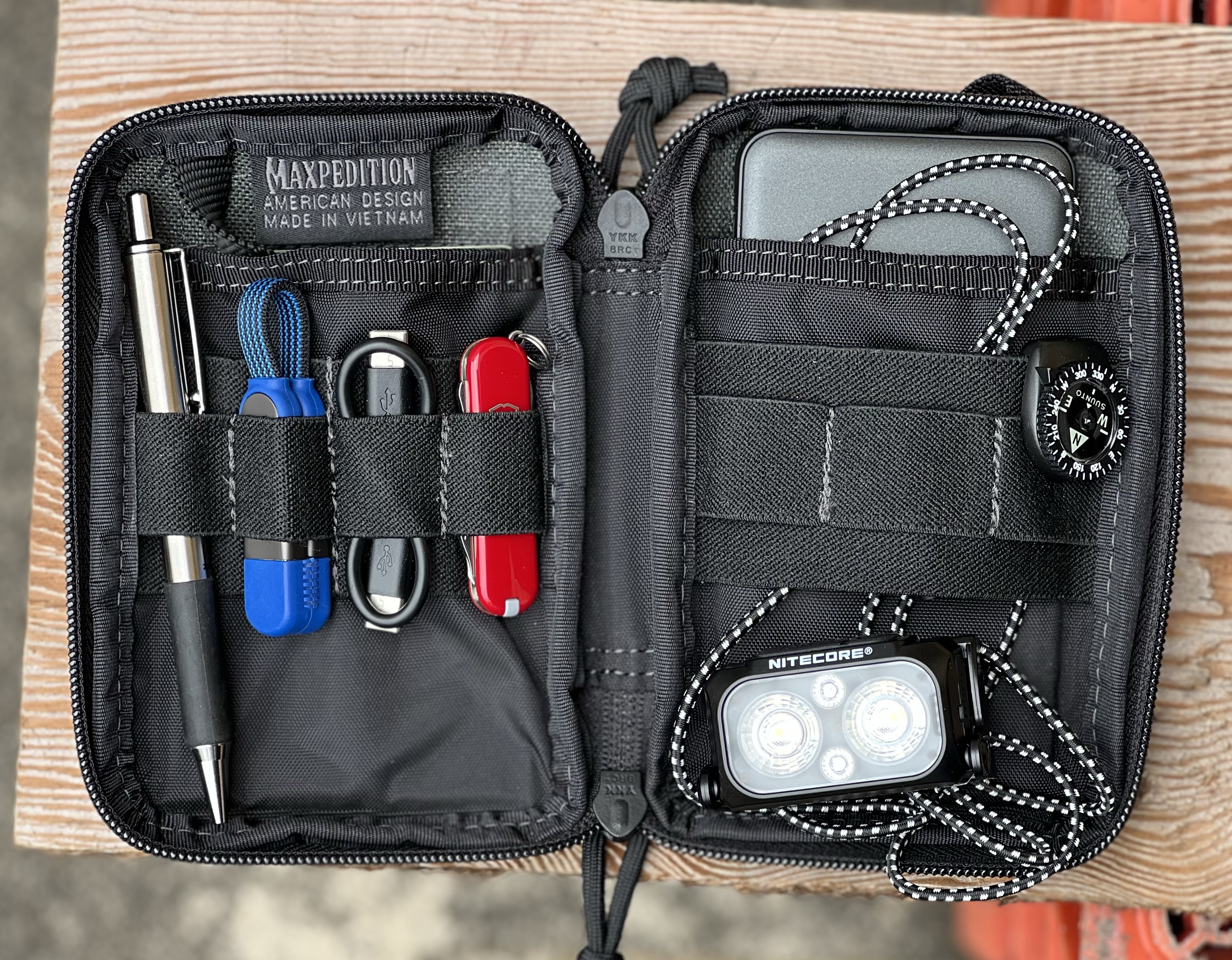
What I like about the interior is that there are a lot of pockets to help with organizing. The pouch opens up like a book giving you easy access to the interior.
I just couldn’t keep it at two journals for the Galapagos. (What if I fill up all the pages?!)
While at the art store I picked up a Stillman & Birn Softcover Beta journal. Because of its small size (3.3” X 5.5”) it is an ideal size to always keep in your pocket so you can sketch wherever you are. An Every Day Carry (EDC) journal.
I am a one bag, one backpack traveler. No checked bags for me! I try not to bring many guide books or field guides to lighten the load. There are certainly many guides relating to the Galapagos. They would stay at home but some of the information would be traveling with me through my sketches.
This is a cross section of Santa Cruz Island showing its Vegetation Zones.
What I did was use the first few pages in my small Beta journal to copy important information that I might want to reference on my trip.
You would think being on the Equator that the Galapagos would be hot but the cold Humboldt Current cools things off. I wrote some of my favorite Darwin quotes from the Voyage of the Beagle and portrayed Darwin as a Galapagos giant tortoise.
For my summer travels I will journey to a long sought after destination: the Galapagos.
I plan to bring two journals for my 10 day cruise around the islands: one Stillman & Birn Beta hardbound and a Hahnemühle 100% Cotton panoramic journal. I have used both before on previous trips and I hope to fill all the pages like Darwin noodling away in his journals.
I like narrowing my journals to just two, like the two banks of a river that contains yet gives direction to my sketches. Will the scene before fit within the dimensions of the paper? I sure will try and if my lines run out of room, it’s just part of the sketch.
These two journals have been on many trips in the past few years. I love the format and the quality paper.
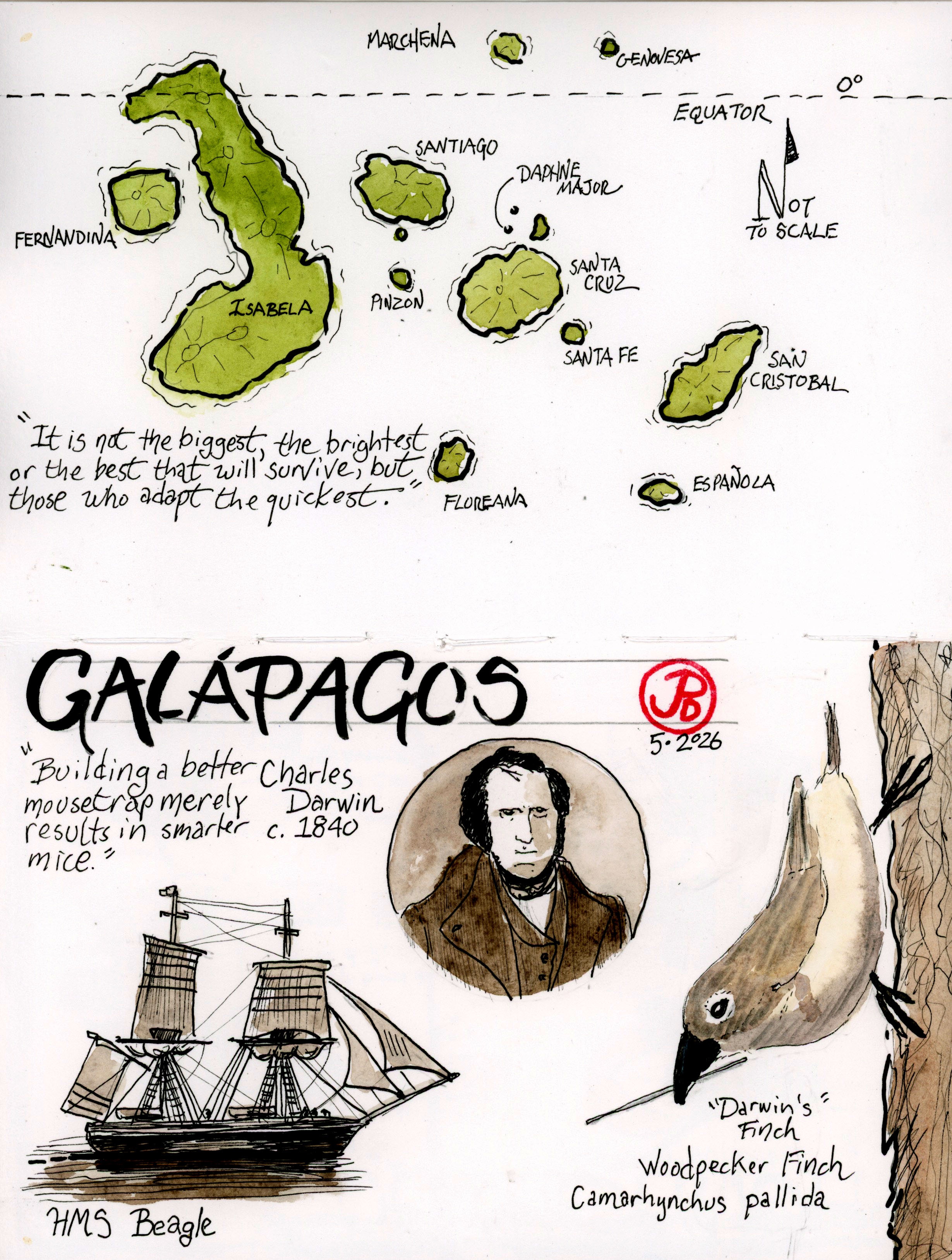
My first page in my Stillman & Birn journal is usually a map. With this map I include a portrait of man who is all over the Galapagos: Charles Darwin. He visited the otherworldly islands in 1835 as the naturalist on the HMS Beagle. And I drew one of Darwin’s finches: the woodpecker finch. (Featured sketch).
Darwin formulated much of his thoughts for his groundbreaking Origin of Species on his five year cruise on the Beagle and his observations and collections on the Galapagos.
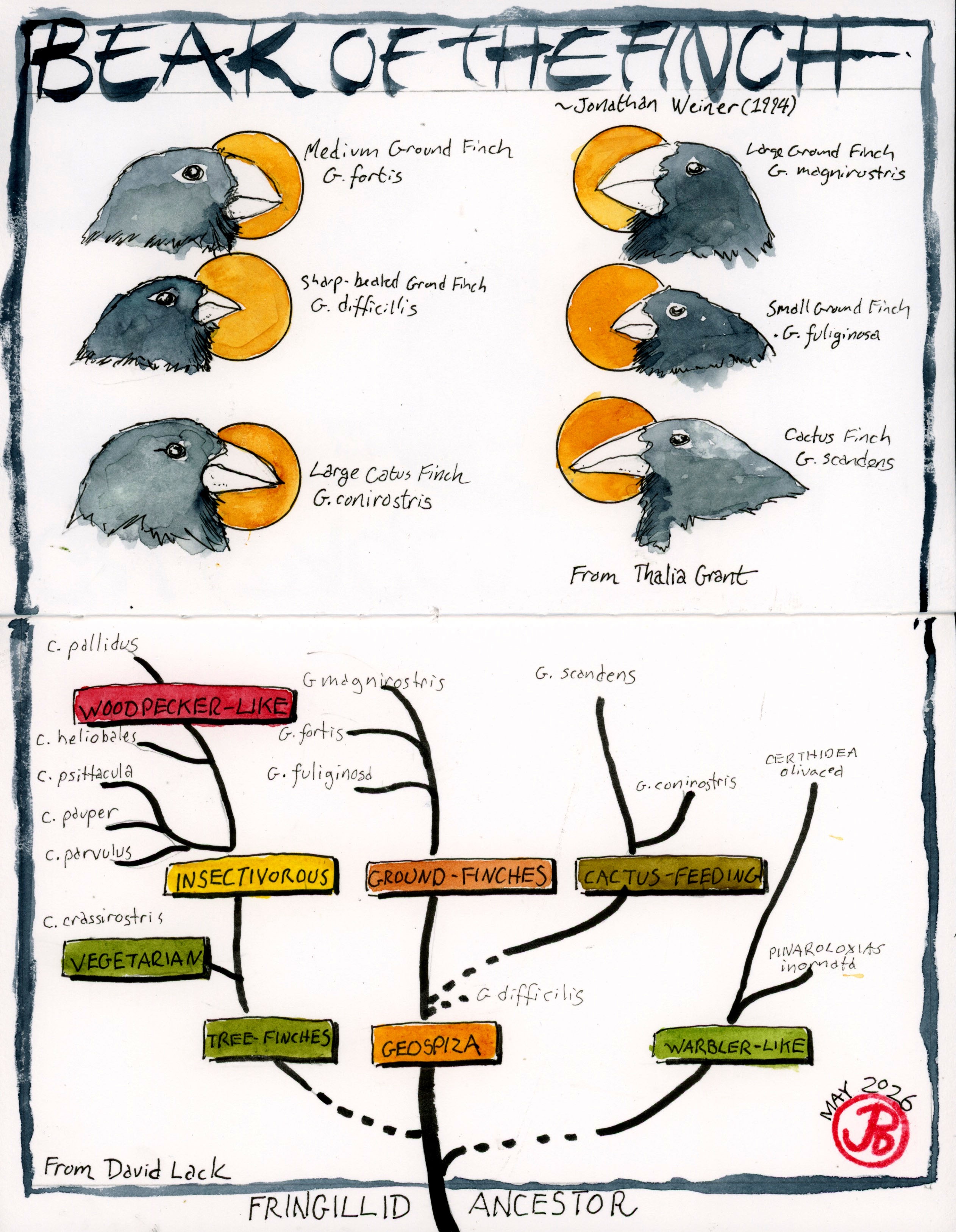
Before any trip I never want to go in blind. I want to learn about my future destination and it’s history, flora, and fauna. Before heading south towards the Equator, I read Beak of the Finch by Jonathan Weiner (1995).
This Pulitzer winning book profiles the research of the Peter and Rosemary Grant on the tiny Galapagos island of Daphne Major. There research highlighted evolution in action with the beak lengths of “Darwin’s” finches.
On a Wednesday I became a tourist in my own city and headed over Twin Peaks to the Ferry Building.
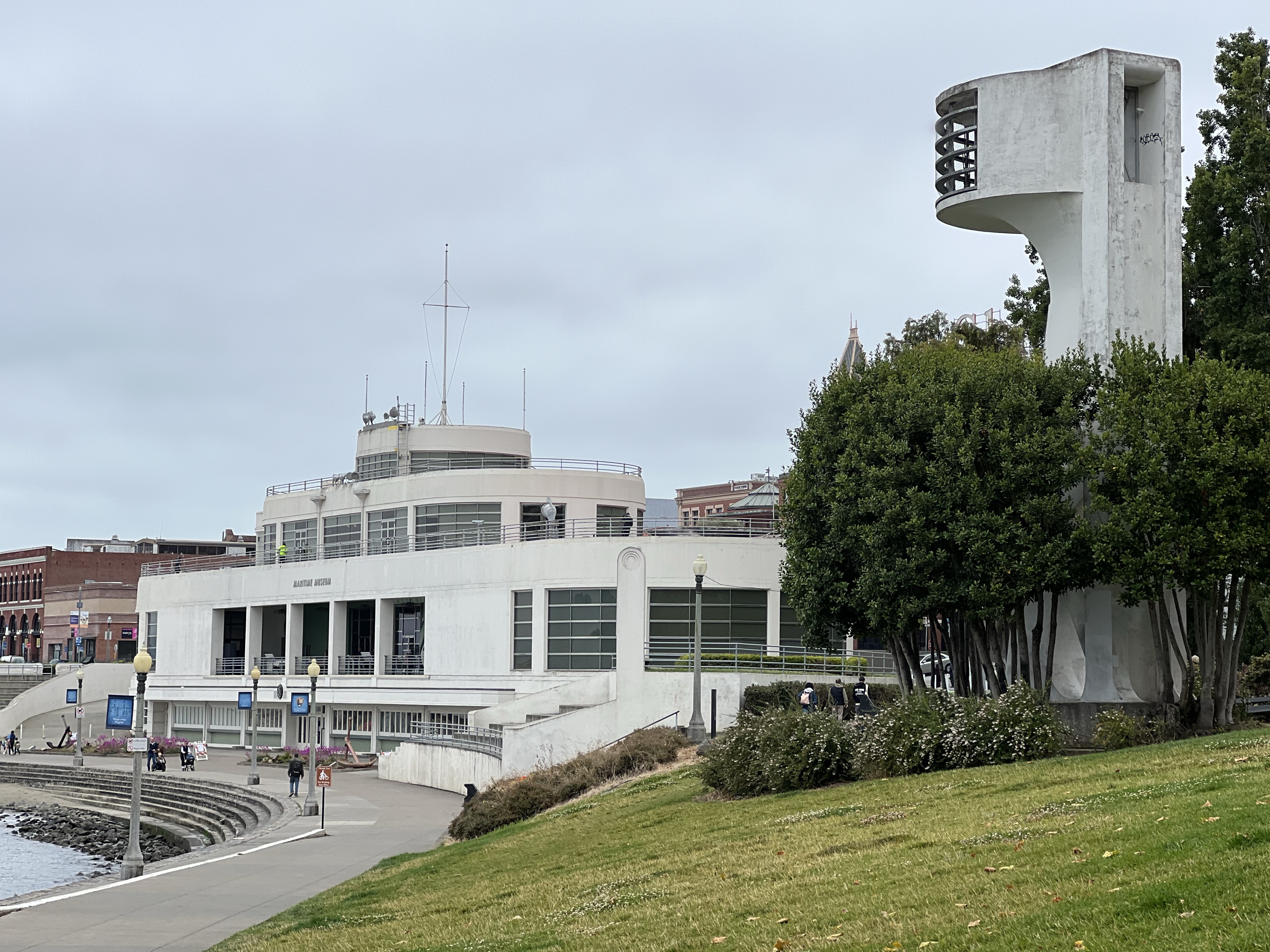
I went from the N Judah to the F Market to Fisherman’s Wharf. This is the epicenter of the tourist industry in San Francisco. I walked to Aquatic Park to the ship-like structure that is the now the Maritime Museum. It was originally built as the Aquatic Park Bathhouse and opened in January 1939.
I love this historical structure which is great example of Streamline Moderne. Being on the water, the building looks like it could sail away at any moment.
Is this a ship or a bathhouse? Well the answer is neither!
The Aquatic Bathhouse has served as a number of uses, most controversial as a Casio for the rich. The building now houses the Maritime Museum.
The murals by Hilaire Hiler on the ground floor are otherworldly. It took visitors minds away from the Depression. Benny Bufano’s frog sculpture. At least I think it is supposed to be a frog.
I picked a spot along the curve of Aquatic Park to sketch the former bathhouse in my panoramic sketchbook.
On the other side of the spread I added the Fort Mason Beltline Tunnel, which is just a short distant from my first sketching position. This tunnel is historical and featured in a classic 1971 film.
In the Don Seigel film Dirty Harry, starring Clint Eastwood, the serial killer Scorpio (based on the real Zodiac Killer) sends Inspector Harry Callahan on a wild goose chase around San Francisco. One scene features Eastwood going through the tunnel when he is stopped by some unfortunate thugs.
The State Beltline Railroad ran along the Embarcadero and served the piers along the waterfront. The railroad was in operation from 1890 to 1993.
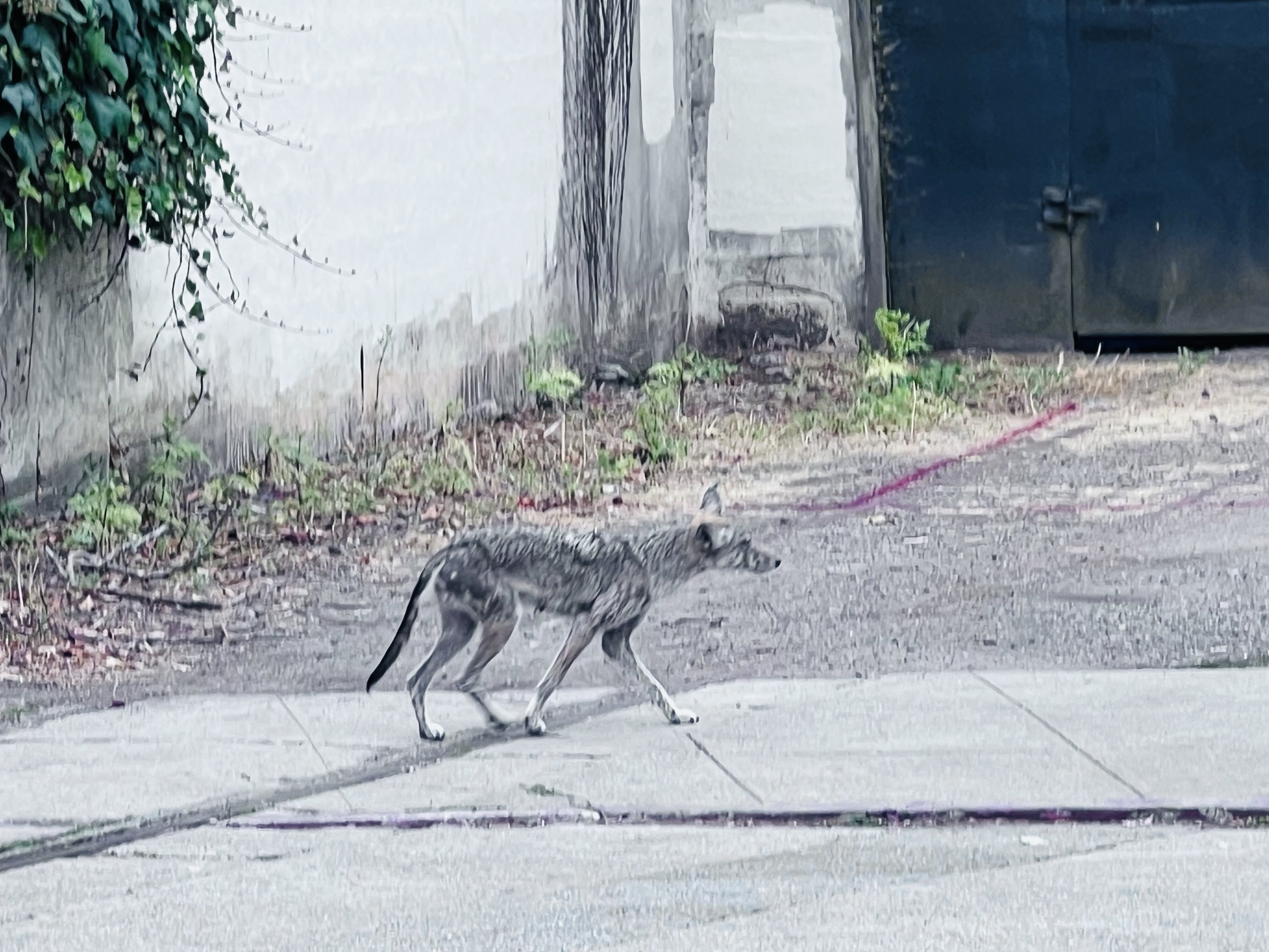
A very scrawny urban coyote walks by the boarded up Beltline Tunnel.
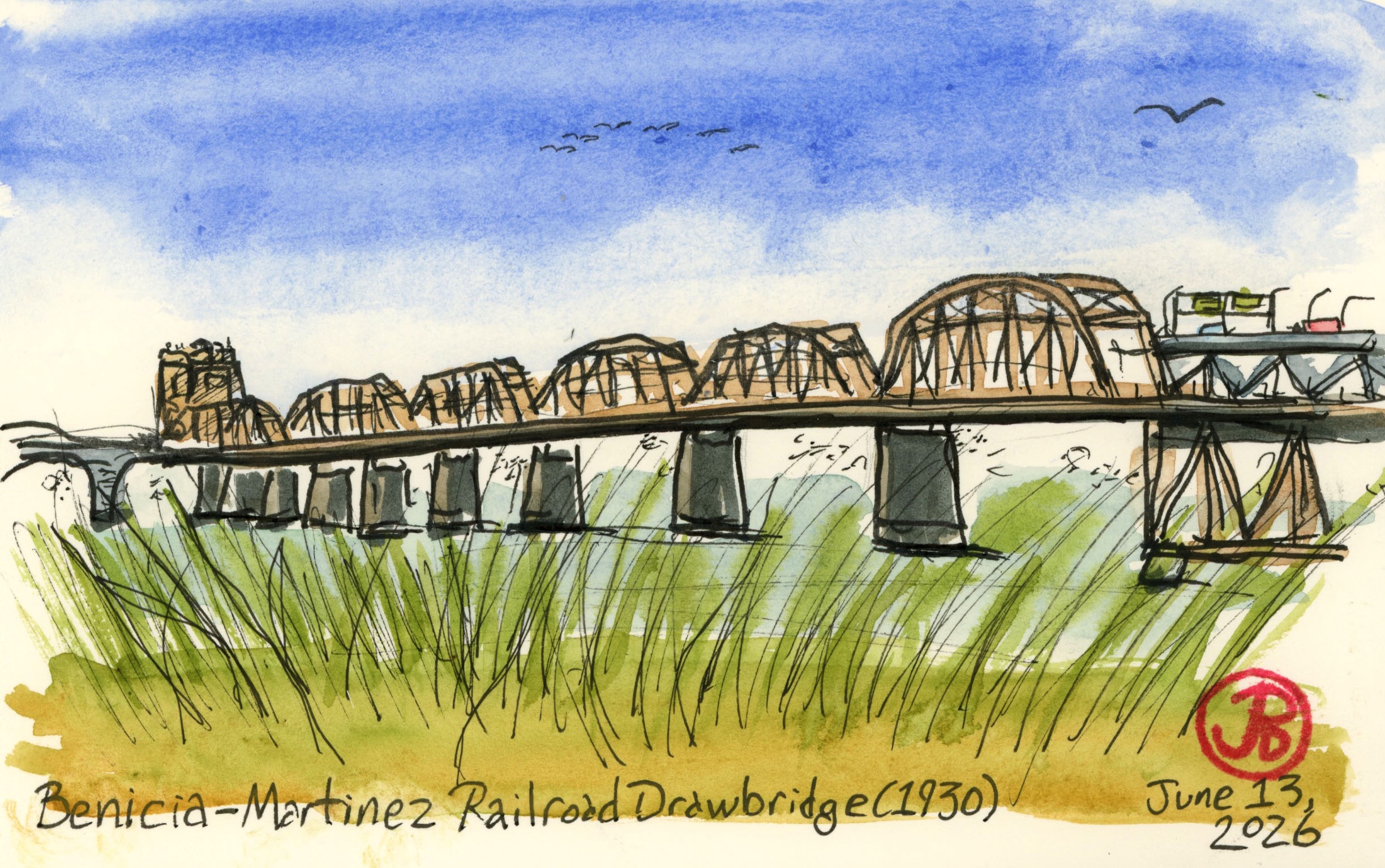
After sketching some Bay Area railroad ferry history, I wanted to sketch the 1930 railroad bridge that killed off the ferry between Benicia and Port Costa.
As rail traffic increased (both passenger and freight) and the rail ferries aged and needed repair or replacement, this caused more delays on the Overland Route (not to mention delays caused by fog). Southern Pacific looked into building another ferry but soon realized that a rail bridge spanning the strait was the best solution.
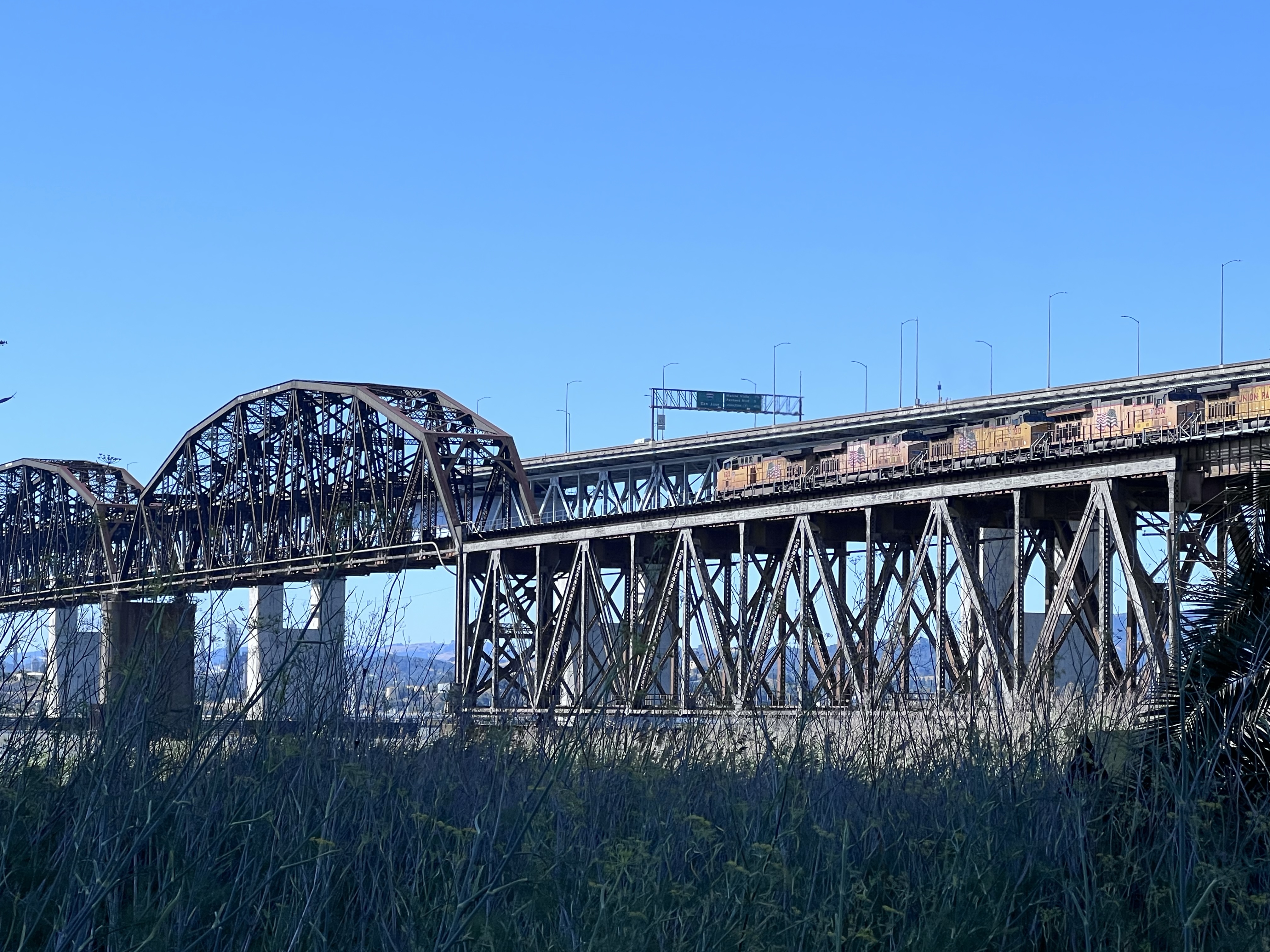
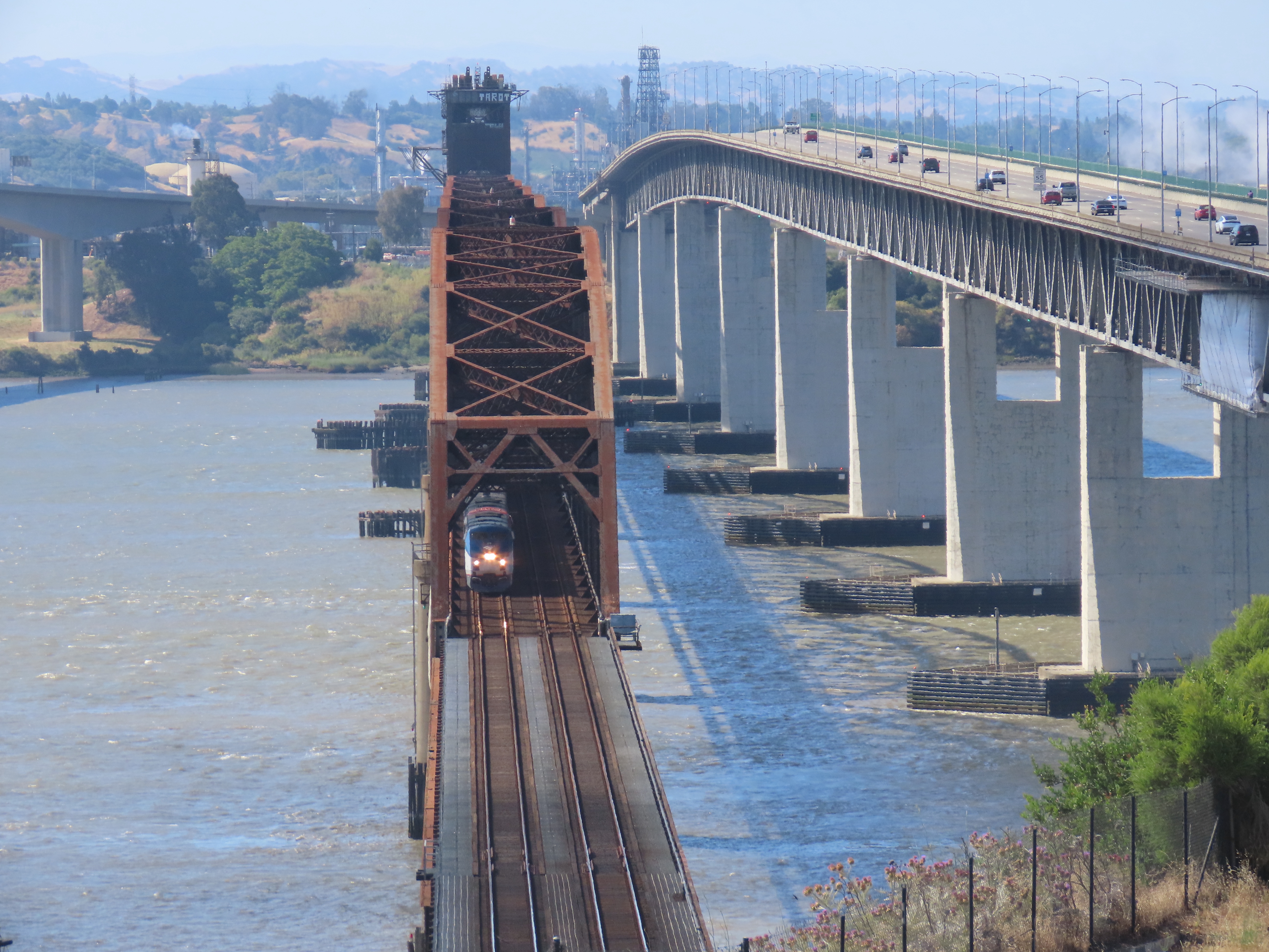
The railroad bridge was built for Southern Pacific Railroad between the years 1928 to 1930.
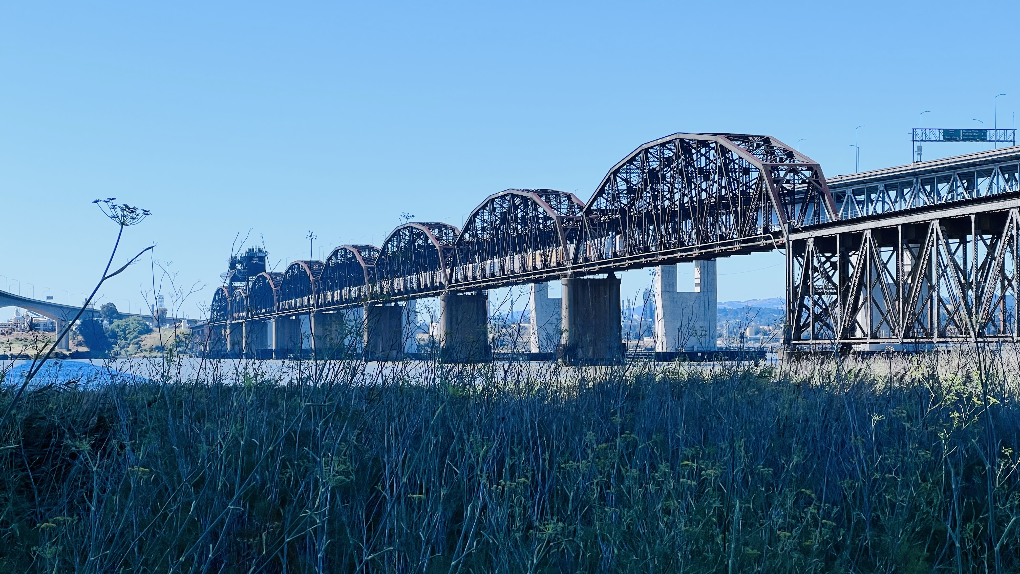
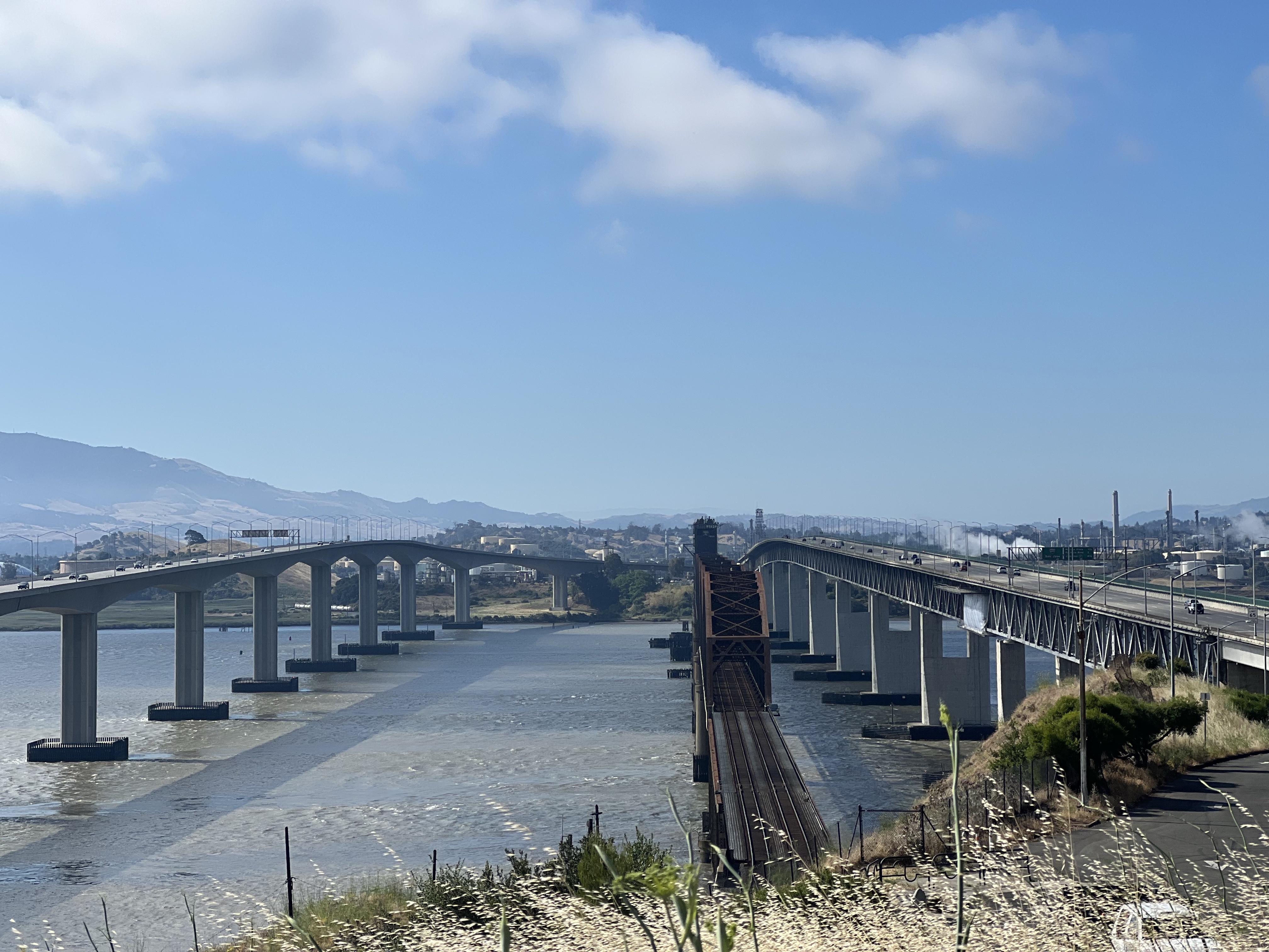
The bridge is impressive because it is the second longest railroad bridge (5,603 ft 6in long) in the country and the longest west of the Mississippi.
The railroad bridge is now flanked to two automobile bridges that cross the Carquinez Strait. One span was built in 1962 while the other completed in 2007.
The longest railroad bridge west of the Mississippi.
Because the bridge is relatively low to the water, 70 feet in fact, a midsection is a drawbridge that allows tall ships to pass through the strait. When the drawbridge is opened, it gives passing ships 135 feet of clearance.
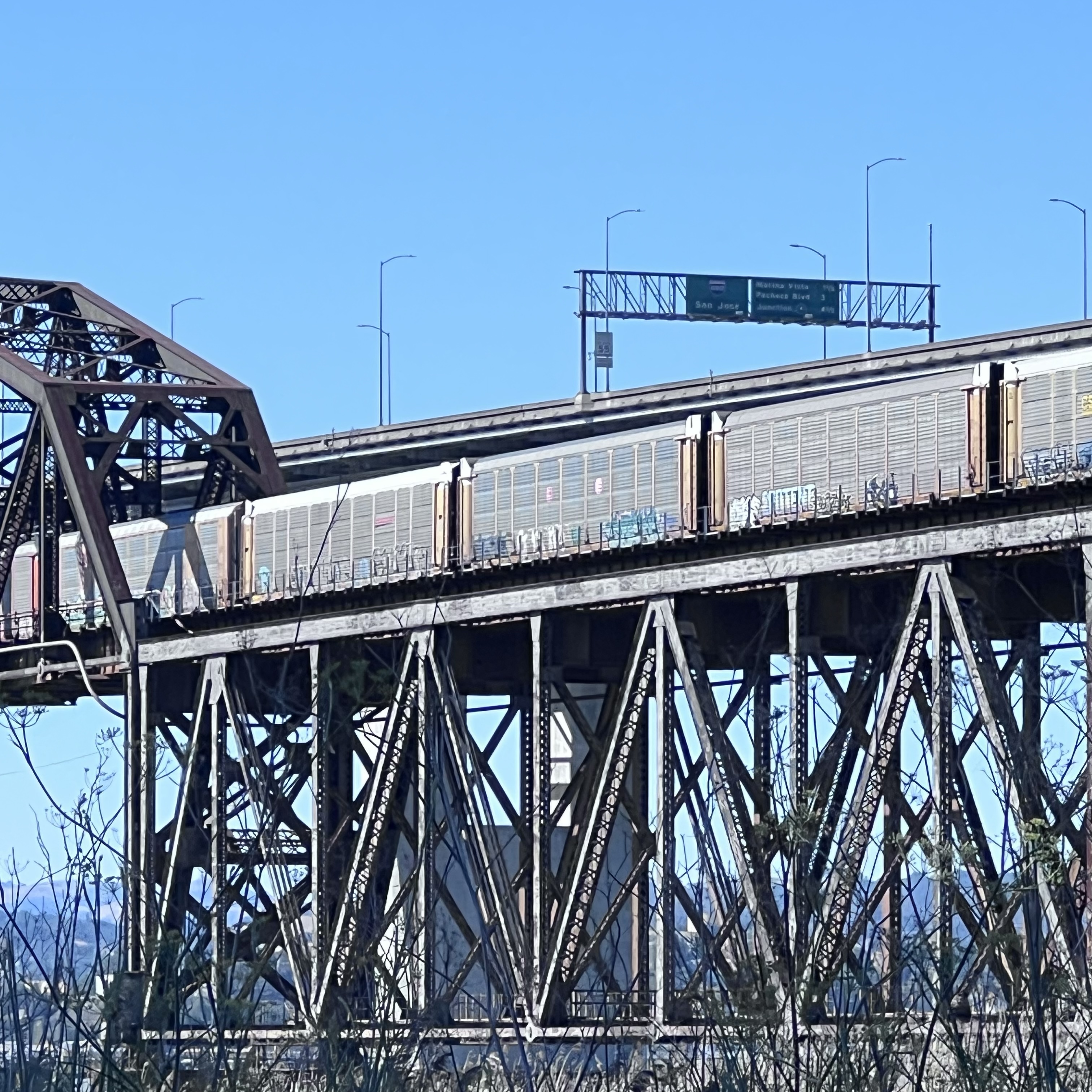
Five locomotives are on point of this Union Pacific westbound mixed consist freight as it comes onto the bridge. This long freight train would take quite a few ferry passages to shuttle across the strait before the bridge was built in 1930. Modern freight trains can be one to two miles long.There were quite a few car carriers on the consist. The area on the Benicia side is new car transfer point.
Foamer at the Bridge
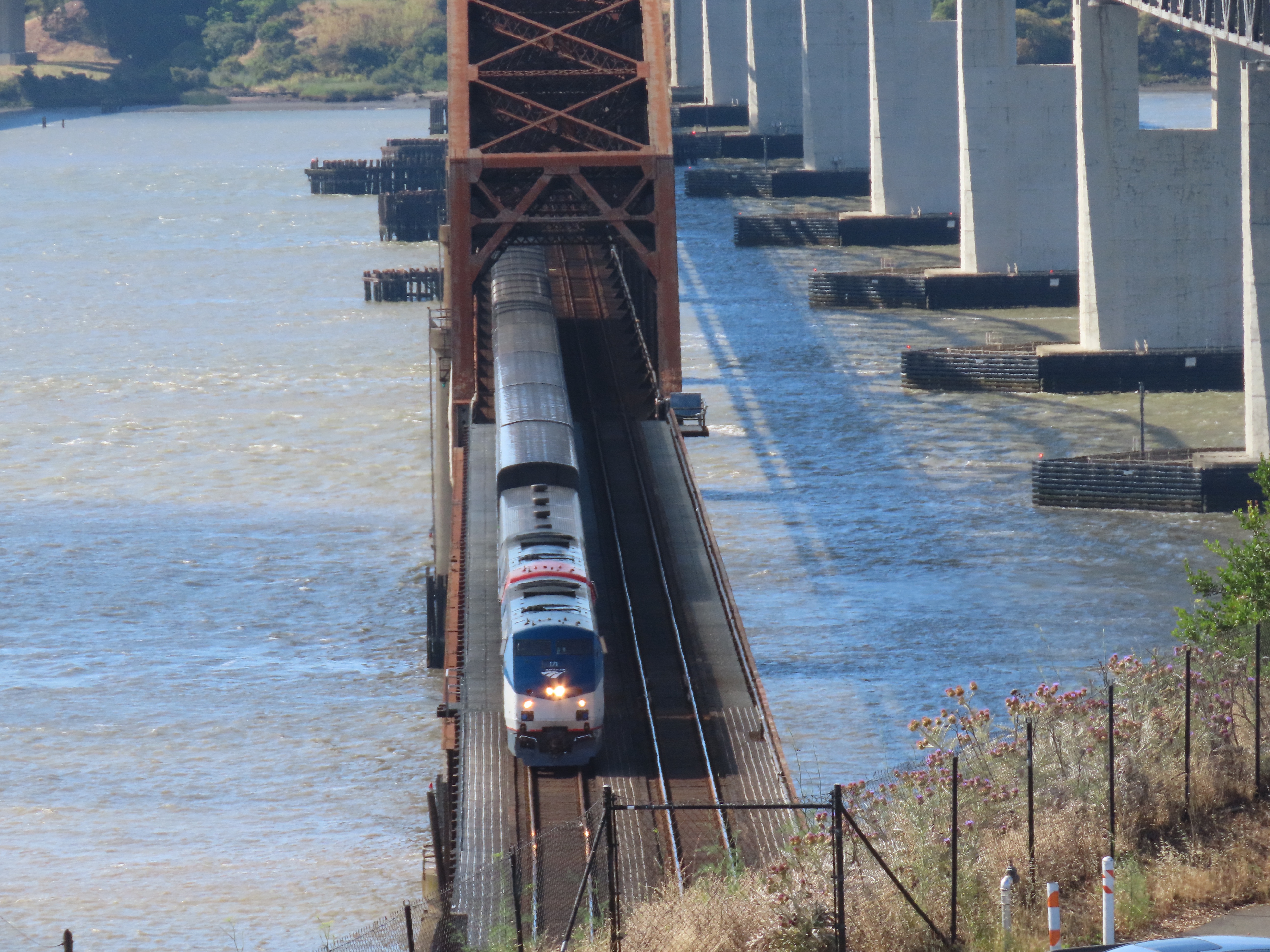
On a Sunday morning I headed up to the northern side of the Benicia- Martinez Railroad Bridge to the vista point, flanked by the two road bridges, to watch some trains transit the historic bridge.
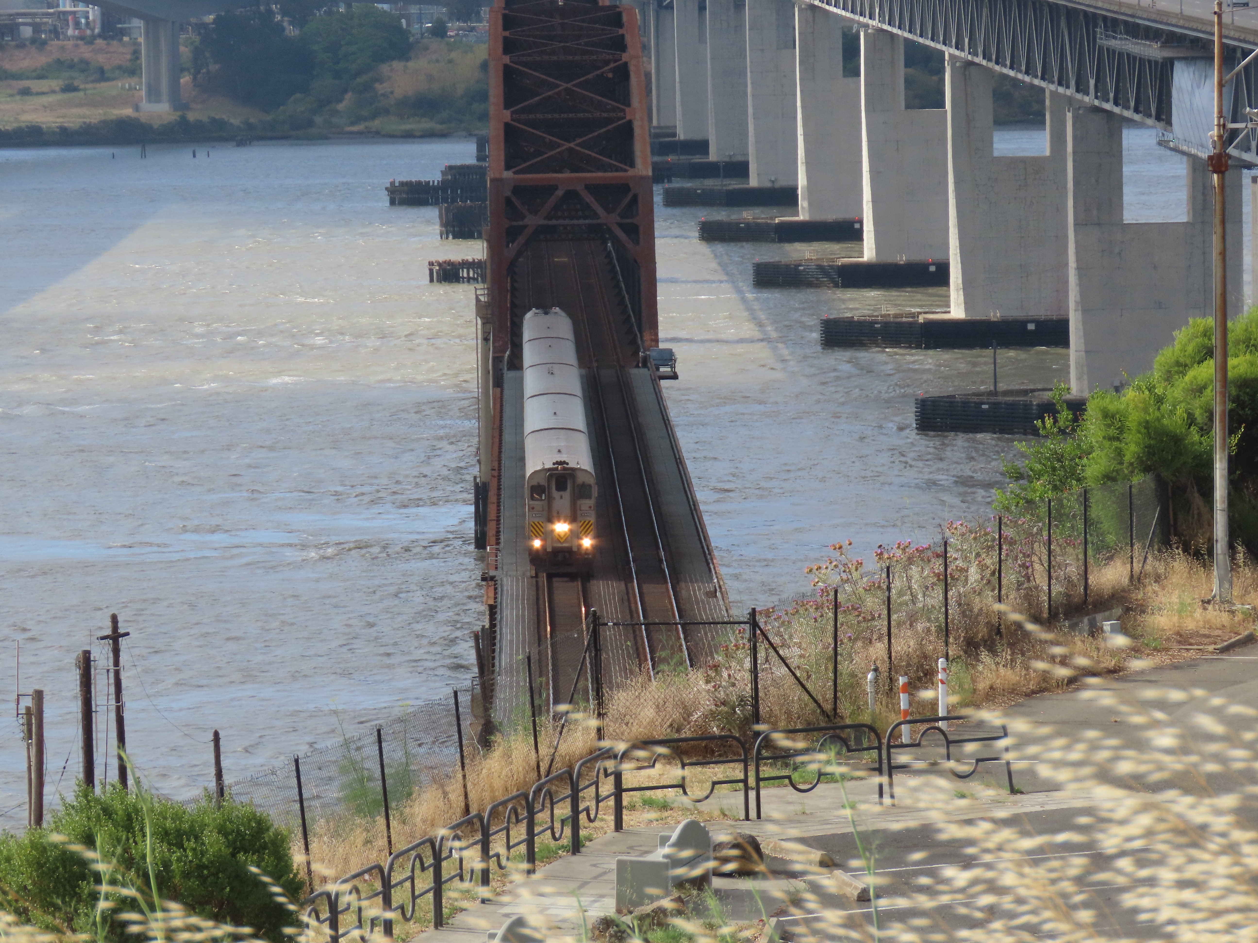
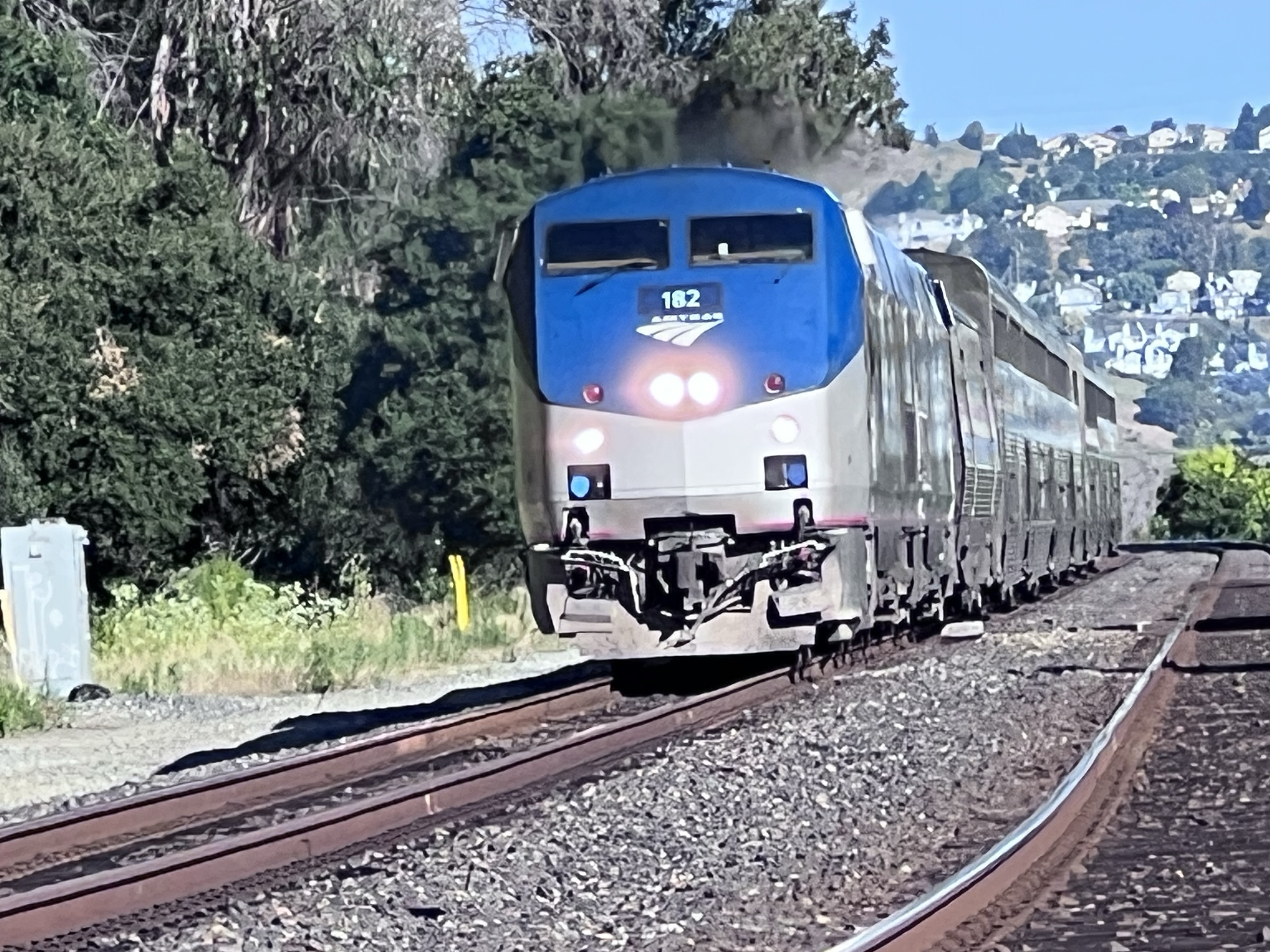
The view southeast from Vista Point. The railroad bridge is in the middle. The newer road bridge (2007) is on the left, the other (1962) is on the right. A northbound Capital Corridor train number 720 crossing the bridge. This trains’s final destination is Sacramento. The good thing about the Vista Point is that you can see northbound trains approaching across the Carquinez Strait like California Zephyr train number 6 running three minutes late. Once the train departs Martinez it will cross the bridge about four minutes later. California Zephyr Number 6 crossing the bridge. Next stop Davis.I have yet to cross the bridge on the Zephyr as I usually board the train further north in Colfax.
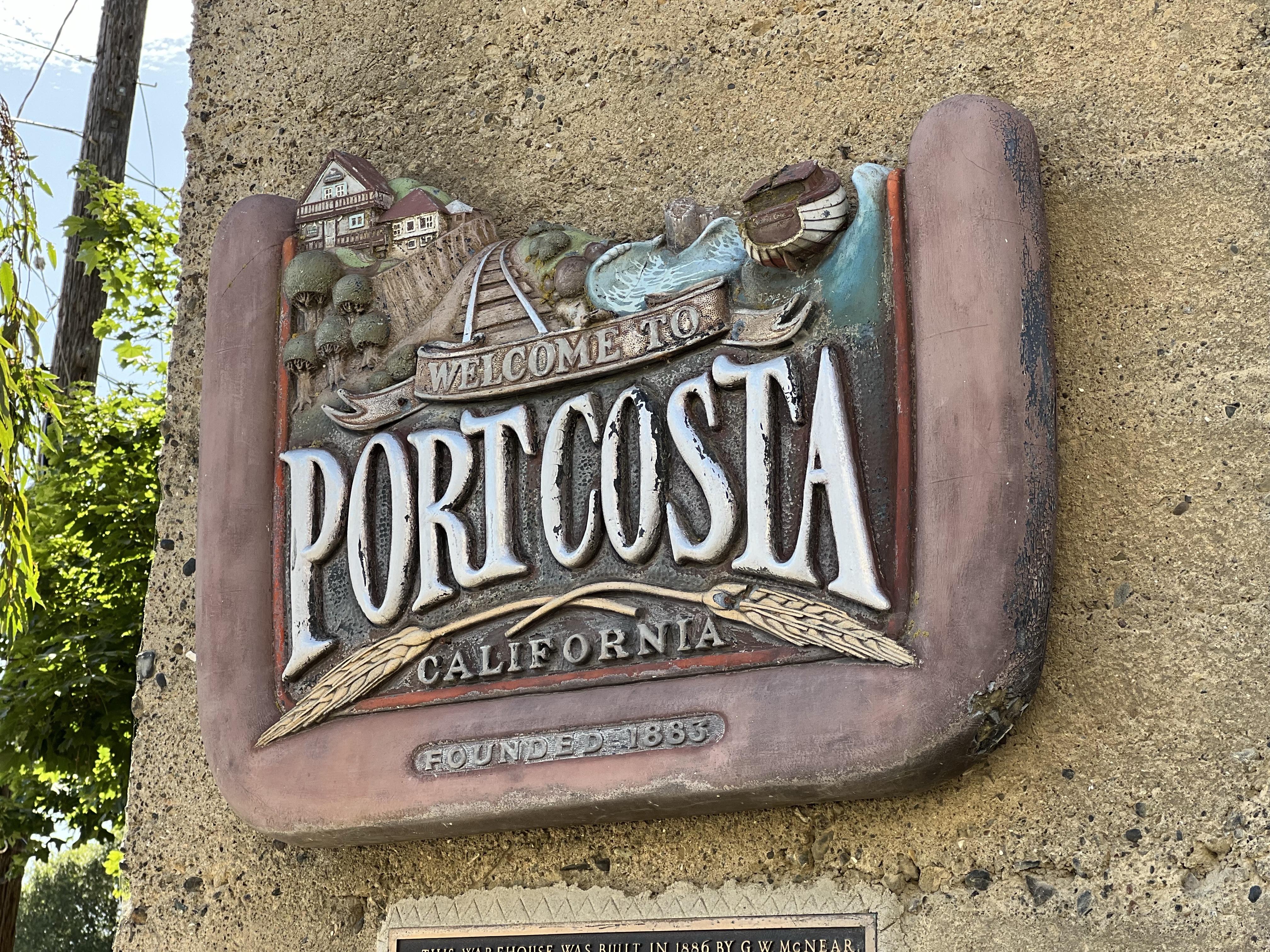
The “downtown” of Port Costa is only about a block long. The historic buildings here only hint at the size and importance of the town over 120 years ago.
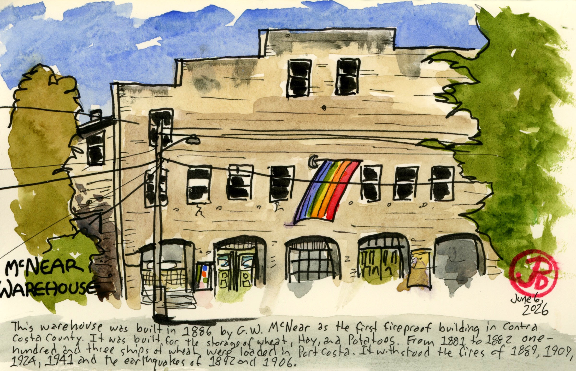
Standing in front of the massive McNear’s Warehouse you get a sense of the scale of importance of Port Costa.
The wonderful sign on McNear’s Warehouse. The railroad is both central to the sign and to the history of Port Costa.
In the distant past, that one block contained a grocery store, a barber shop, a shoemaker, a Wells Fargo office, three hotels, a department store, and eight saloons!
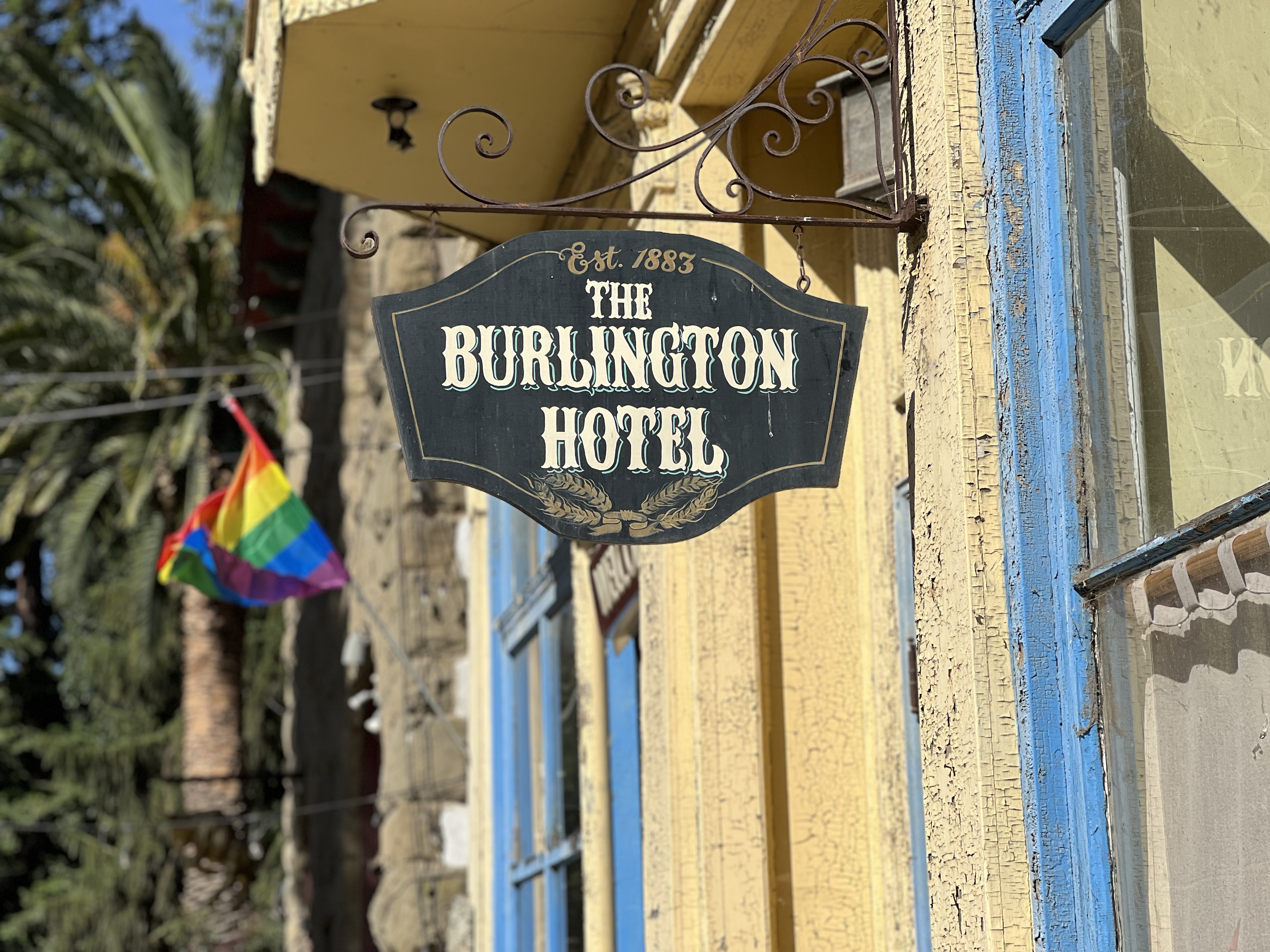
Now Port Costa has only one hotel and I’m not sure it’s open.
The concrete warehouse was built in 1886 by G. W. McNear. It was the first fireproof building in Contra Costa County having survived the fires of 1889, 1909, 1924, and 1941 (as well as withstanding two major earthquakes). It was built to store wheat, hay, and potatoes.
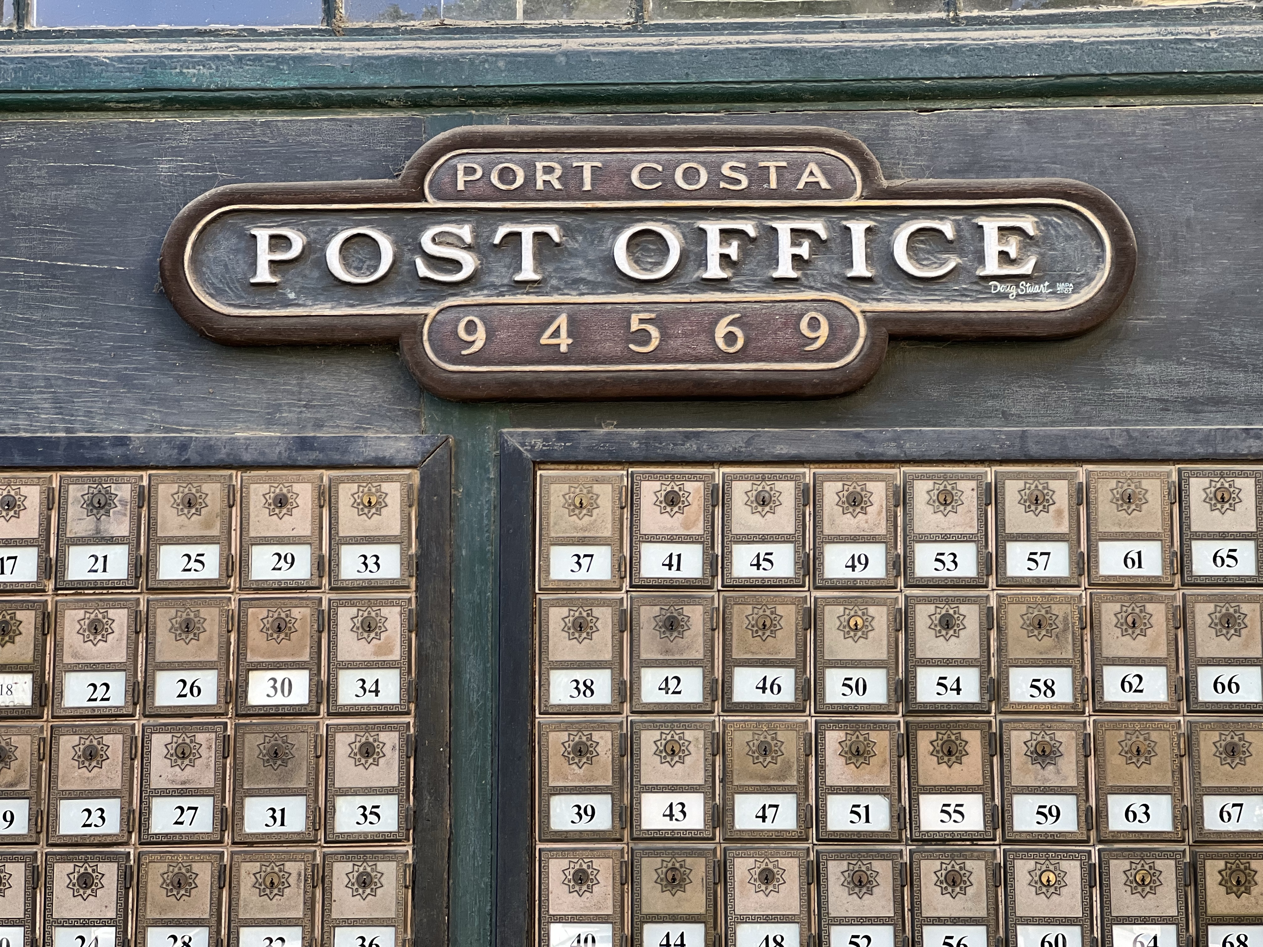
The warehouse now serves many purposes; restaurant, bar, post office, and apartments.
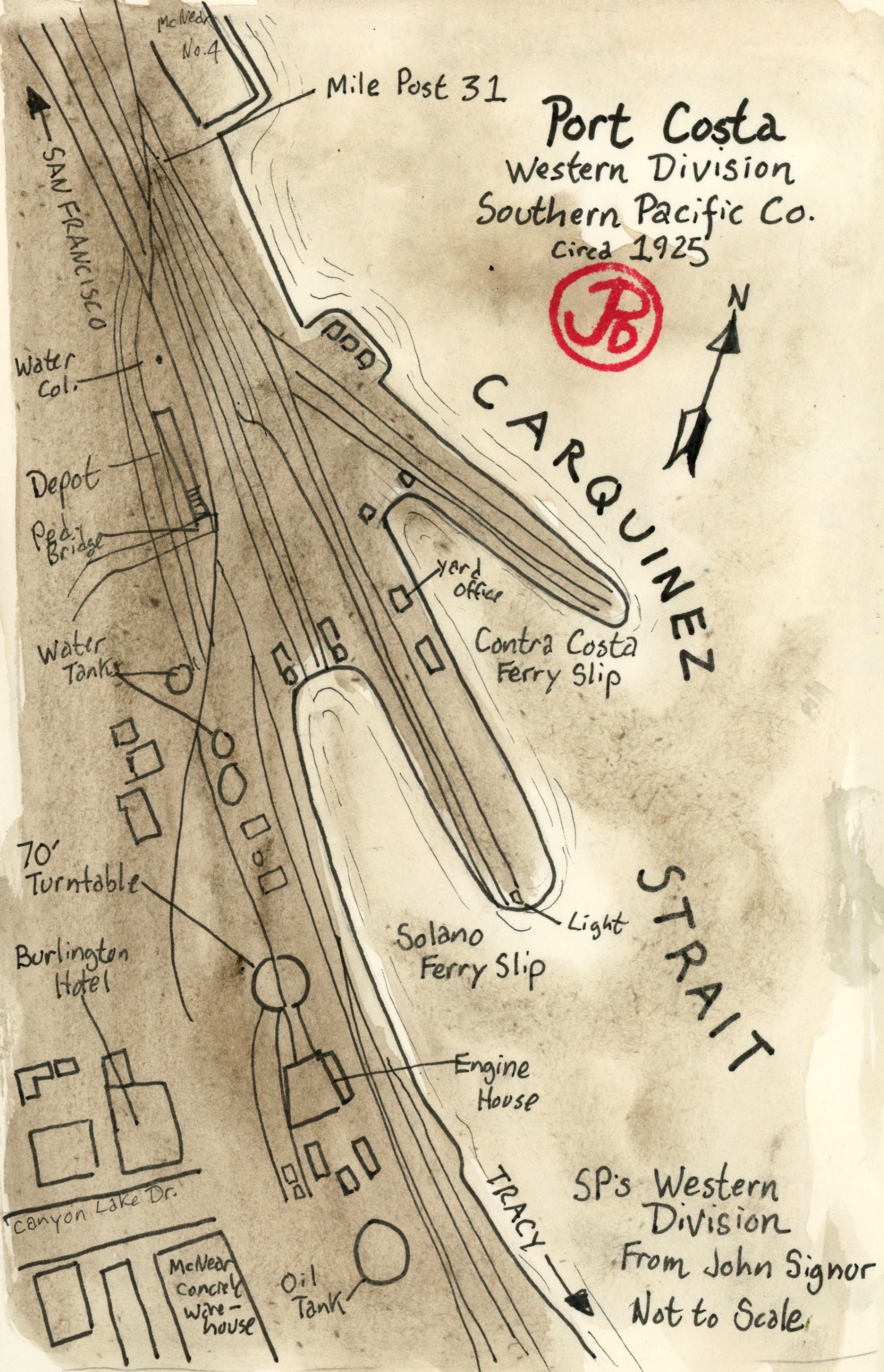
Port Costa was a busy railroad center and port. The railroad facilities included many spur tracks, a 70 foot turntable, an engine house, oil and water tanks, a passenger and freight depot, and many warehouses.
Map of Port Costa circa 1925, based on a John Signor illustration.
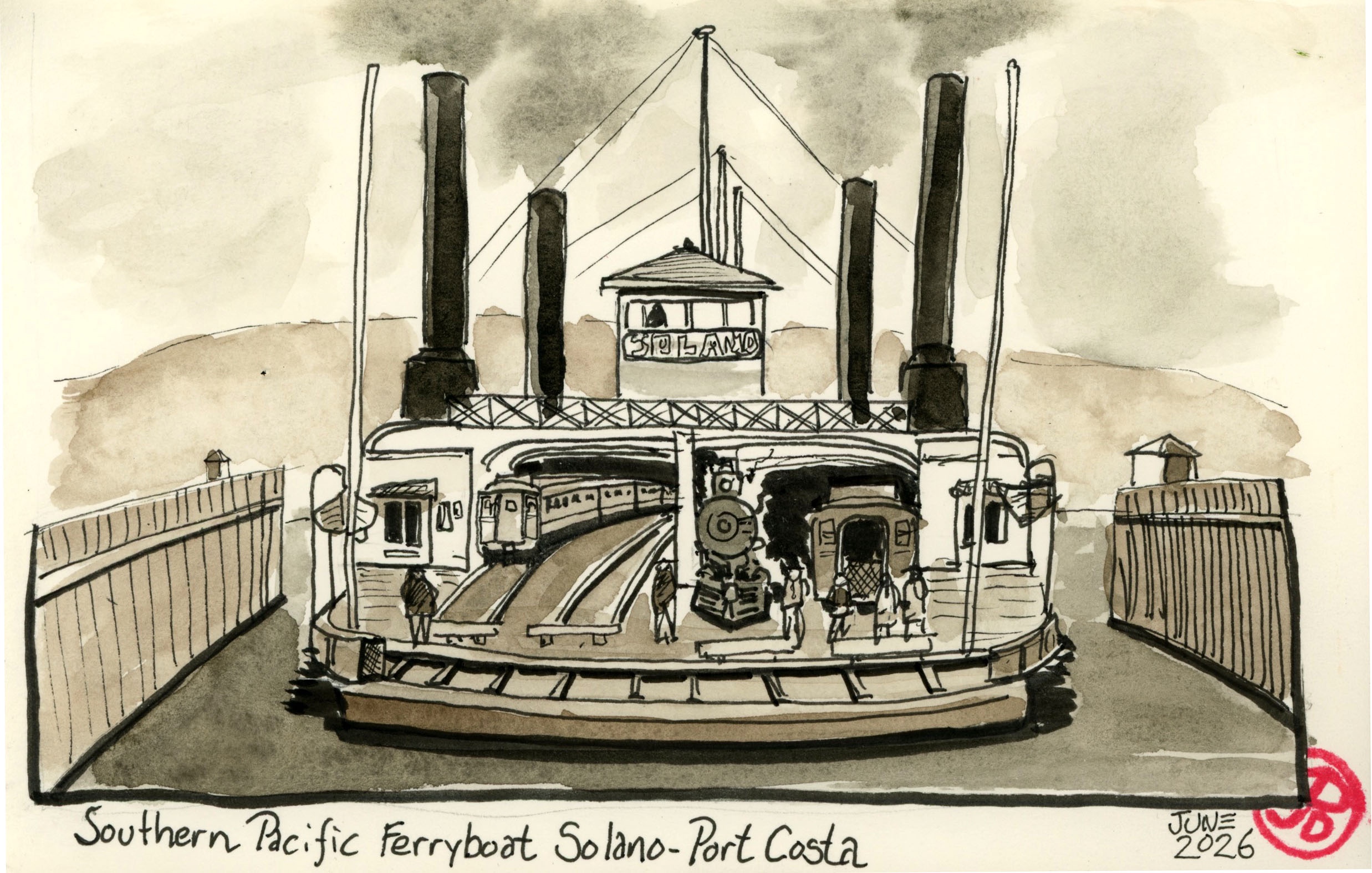
What made Port Costa tick was the railroad. At the edge of the Carquinez Strait there were two ferry boat slips where ferry boats loaded and unloaded trains, both passenger and freight, from the 10 minute crossing to Benicia. Because there was no railroad bridges spanning the strait, this was only way to cross and save time and many miles.
The train ferry Solano served for 51 years until the Benicia-Martinez Railroad Bridge was completed in 1930 for Southern Pacific, rendering the ferry obsolete.
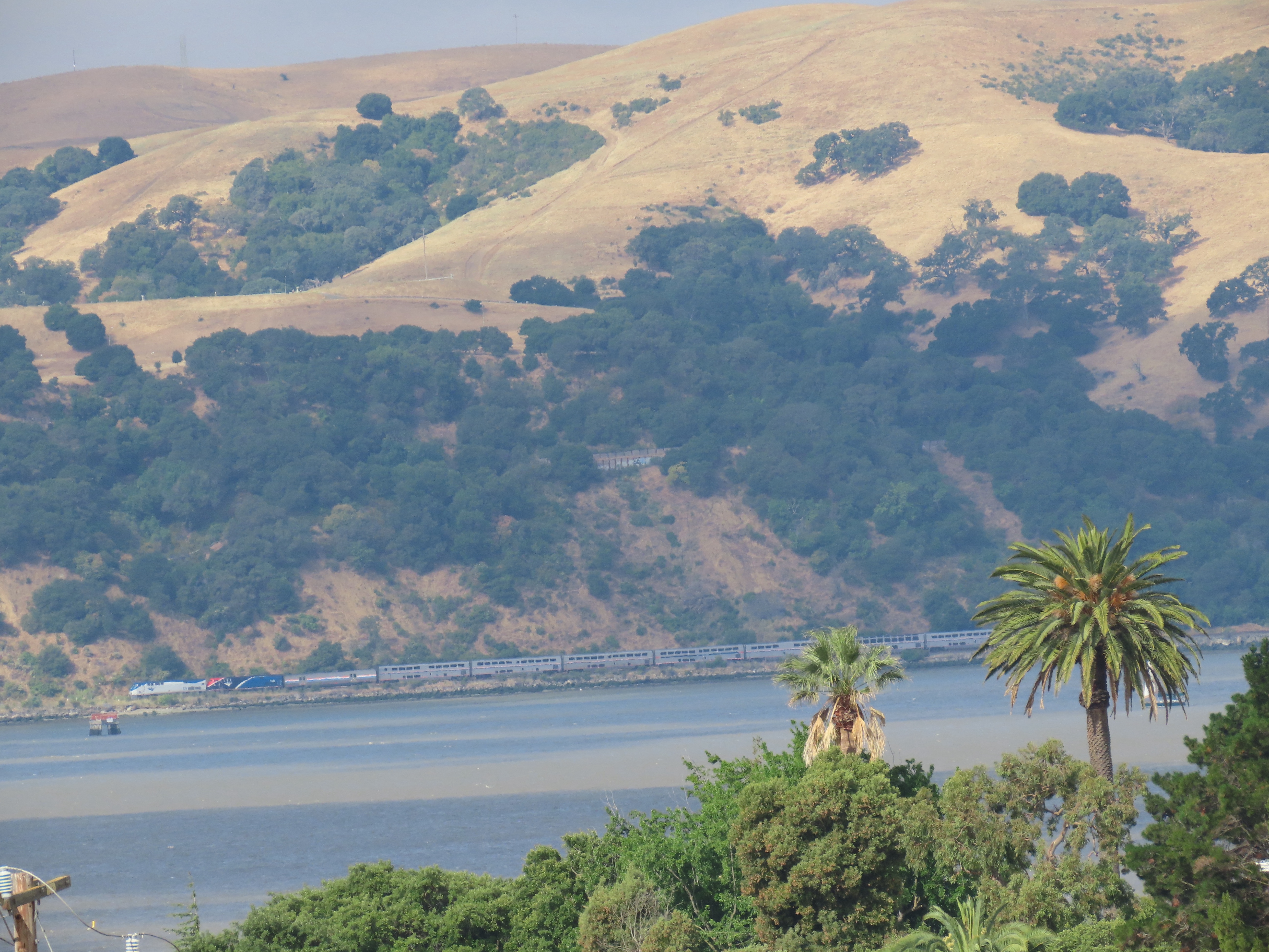
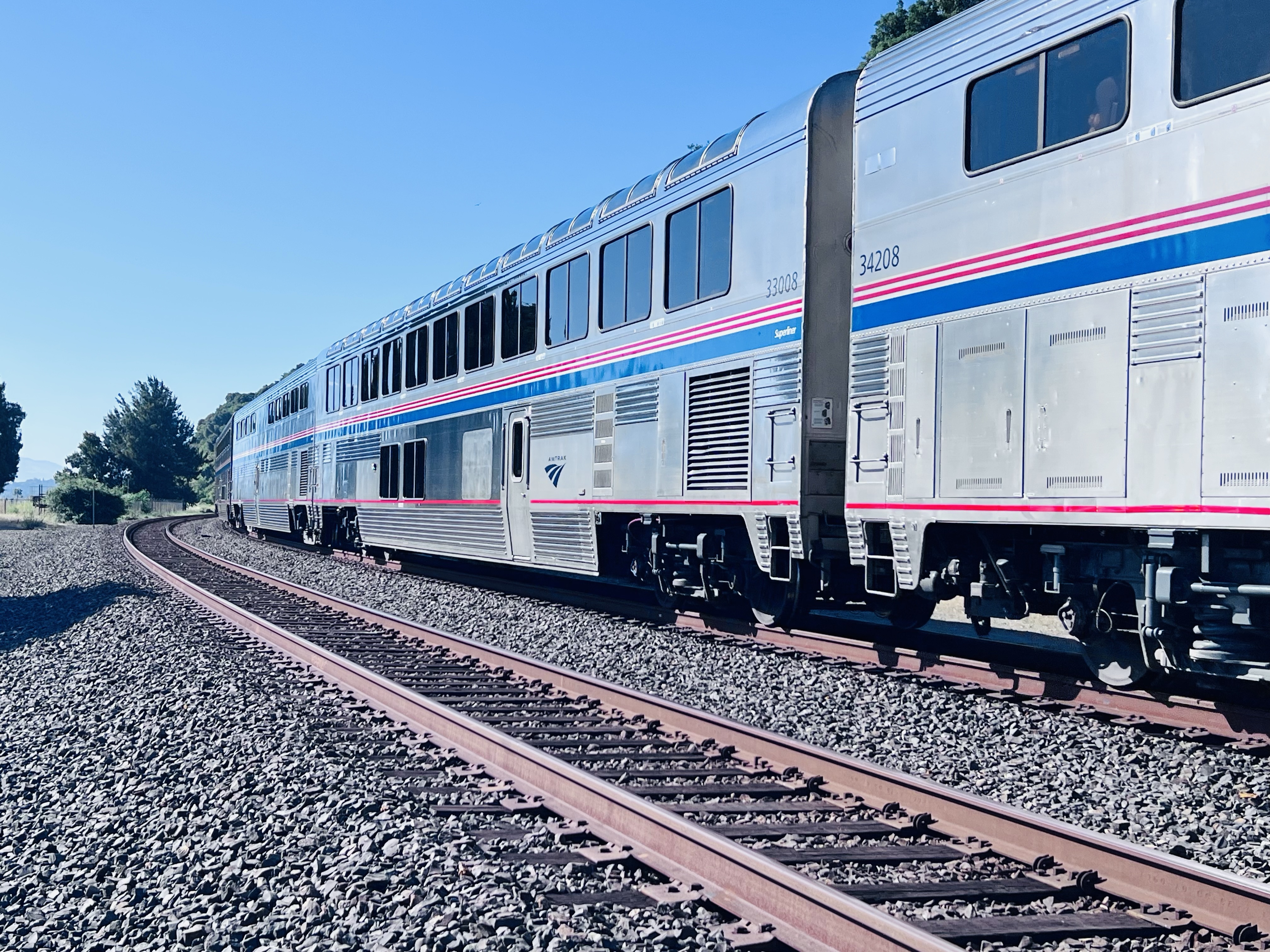
The Chicago bound California Zephyr passing through the former location of the ferry slips on the south side of Carquinez Strait. The train will cross over to the north side just past Martinez on the Benicia-Martinez Railroad Bridge (more about this bridge in the next post).
The first train ferry to operated between Benicia and Port Costa was the Solano which was built by the Central Pacific Railroad (later Southern Pacific) in 1879. She was 425 feet long and 116 feet wide. The steam powered side-wheeler was that largest train ferry of its type. It could ferry a 24 car passenger train with its locomotive or a 48 car freight train on the four sets of tracks on the lower deck. In a 24 hour period, the Solano would make 36 to 46 crossings. She was a real workhorse.
Sketched based on a period postcard of the Solano.
The Solano’s last run was on November 1, 1930 and she was decommissioned along with her sister ship the Contra Costa.
There were many steam powered ferries that moved people and freight on the waterways of the Bay Area. Today, very few exist. The Eureka at Hyde Street Pier and the Berkeley in San Diego come to mind. Some were turned into floating hotels and gambling boats but have since burned and been destroyed. Most were scrapped, very few were preserved for posterity.
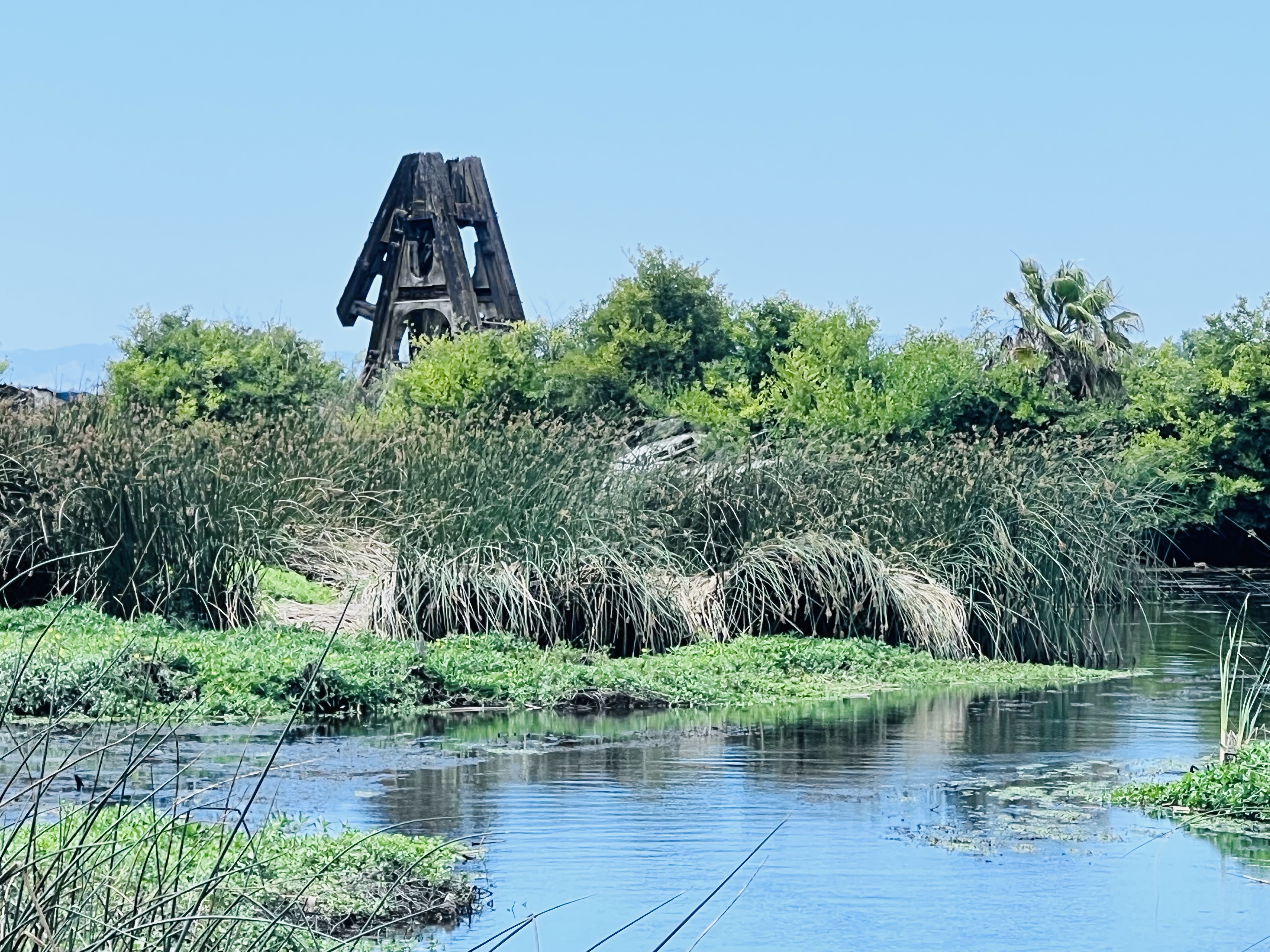
I was amazing to find out that the Solano still existed! She was not preserved and is a far cry from her proud days as the largest train ferry in the world. She is to be found about 25 miles east of Port Costa in Antioch.
In 1931 the Solano was moved upstream to be used as a breakwater for a marina in Antioch. The hull was sunk where it remains to this day.
Looking at the massive hull it appears to be a verdant island and the only giveaway that it was once a mighty train ferry is a rusted A-shaped structure projecting above the green “island”.
The A-shaped structure is the walking beam of her engine. The second walking beam has fallen over.
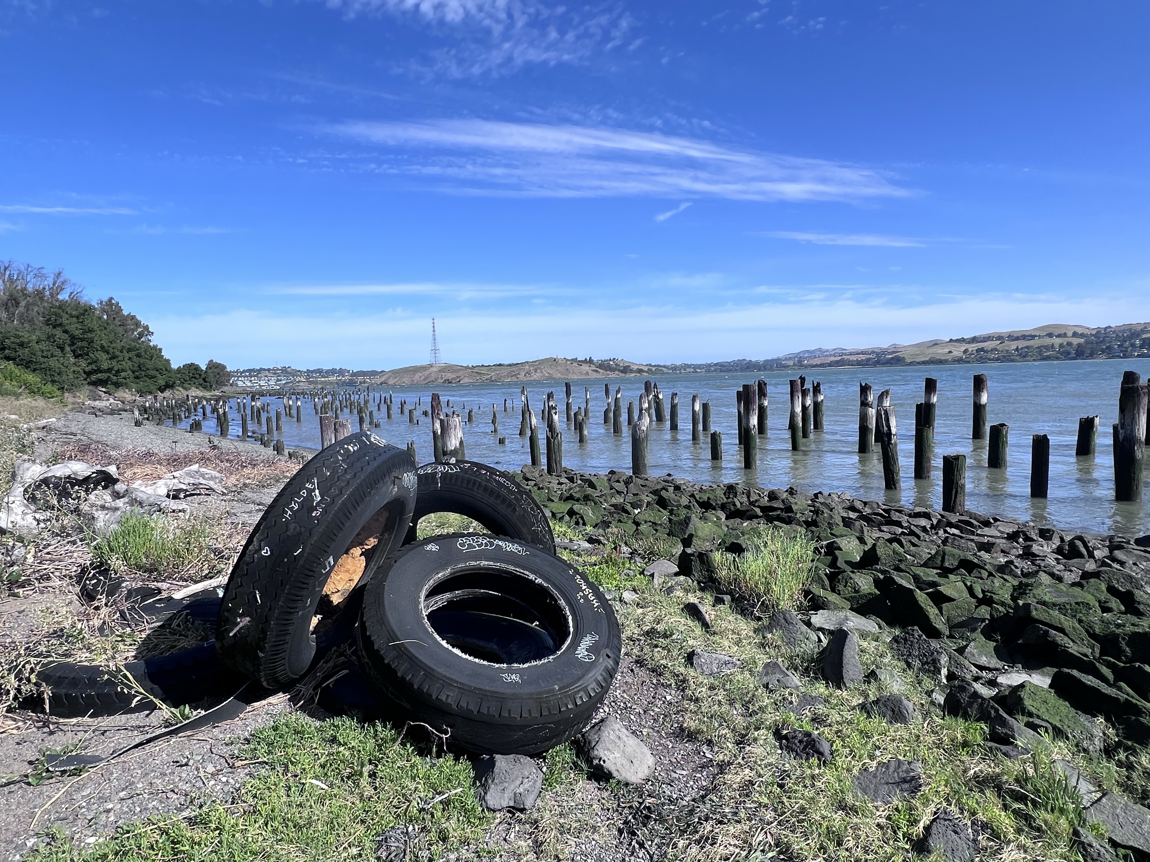
The first Saturday morning in June found me trackside in Port Costa sketching some California history.
I parked near the historic McNear’s Warehouse (more about this in another post) and walked west along the double parallel tracks looking for a sketching spot along the beach that spoke to me.
I had to be very aware here because my path is on the main line with a lot of passenger and freight traffic.
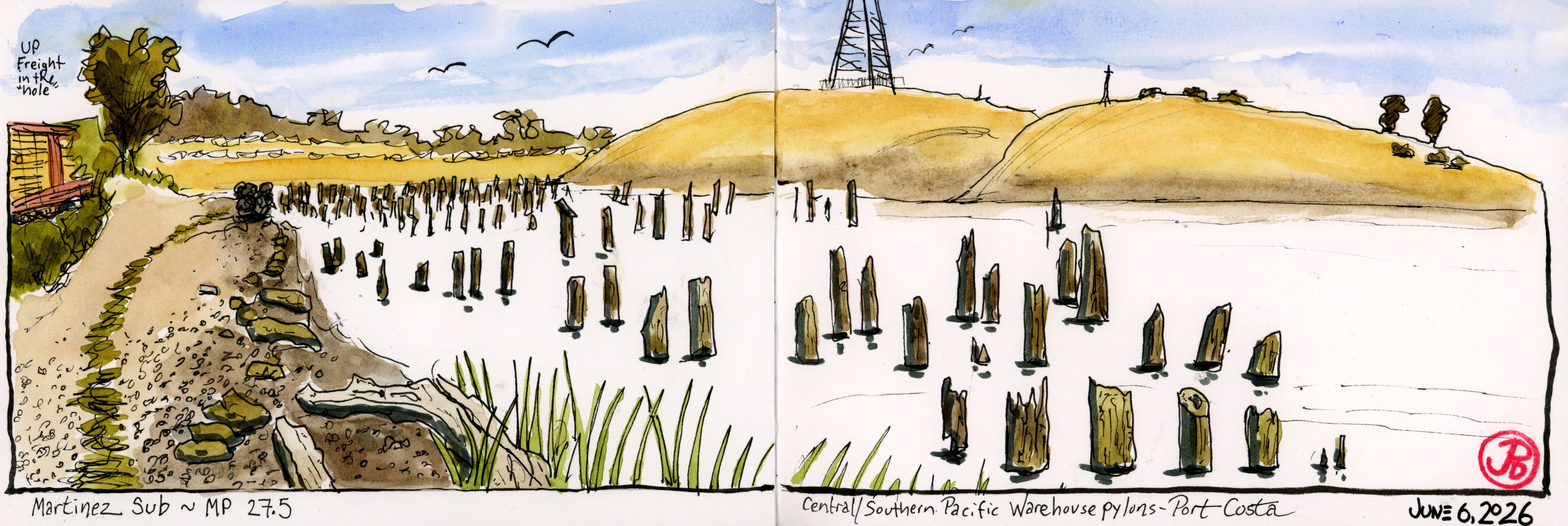
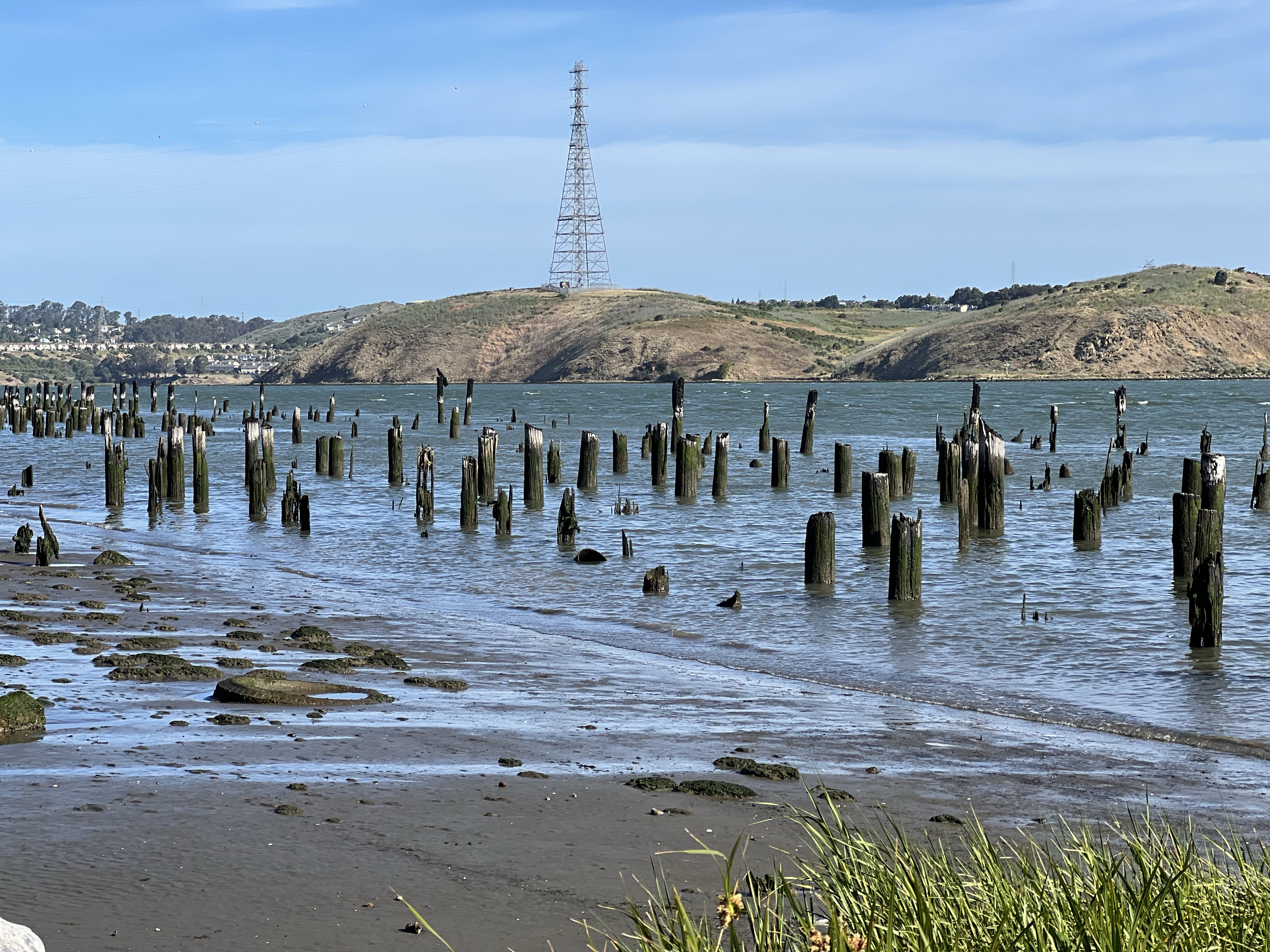
After about a five minute walk I found a short path down from the railbed to the shoreline with a nice sketching log to perch on and a great view before me.
Before me were many wooden pylons breaking above the tide. So what’s the deal with a bunch of sticks?
Bunch of sticks!
The pylons were what remains of the railroad, storage warehouses, and ferry complex and spoke of a very busy past at Port Costa.
Engineers had a challenge fitting warehouses, ferry slips, and railroad maintenance buildings and tracks into the narrow strip of land between the shoreline and the steep hills on the southern edge of the Carquinez Strait. The solution was to build out into the water.
The pylons are the only evidence of the Central/Southern Pacific Railroad complex.
Of course any chapter of historical wooden structures involve one common element: fire. The complex burned and wood rot took what remained.
Before there where any rail bridges crossing the strait they had to use ferry boats that travelled a mile from Benicia to Port Costa, a trip that took about ten minutes.
Instead of unloading trains of their passengers or freight and reloading them onto boats for the short crossing, the trains themselves were loaded onto train ferry boats (locomotives and all) on four separate tracks.
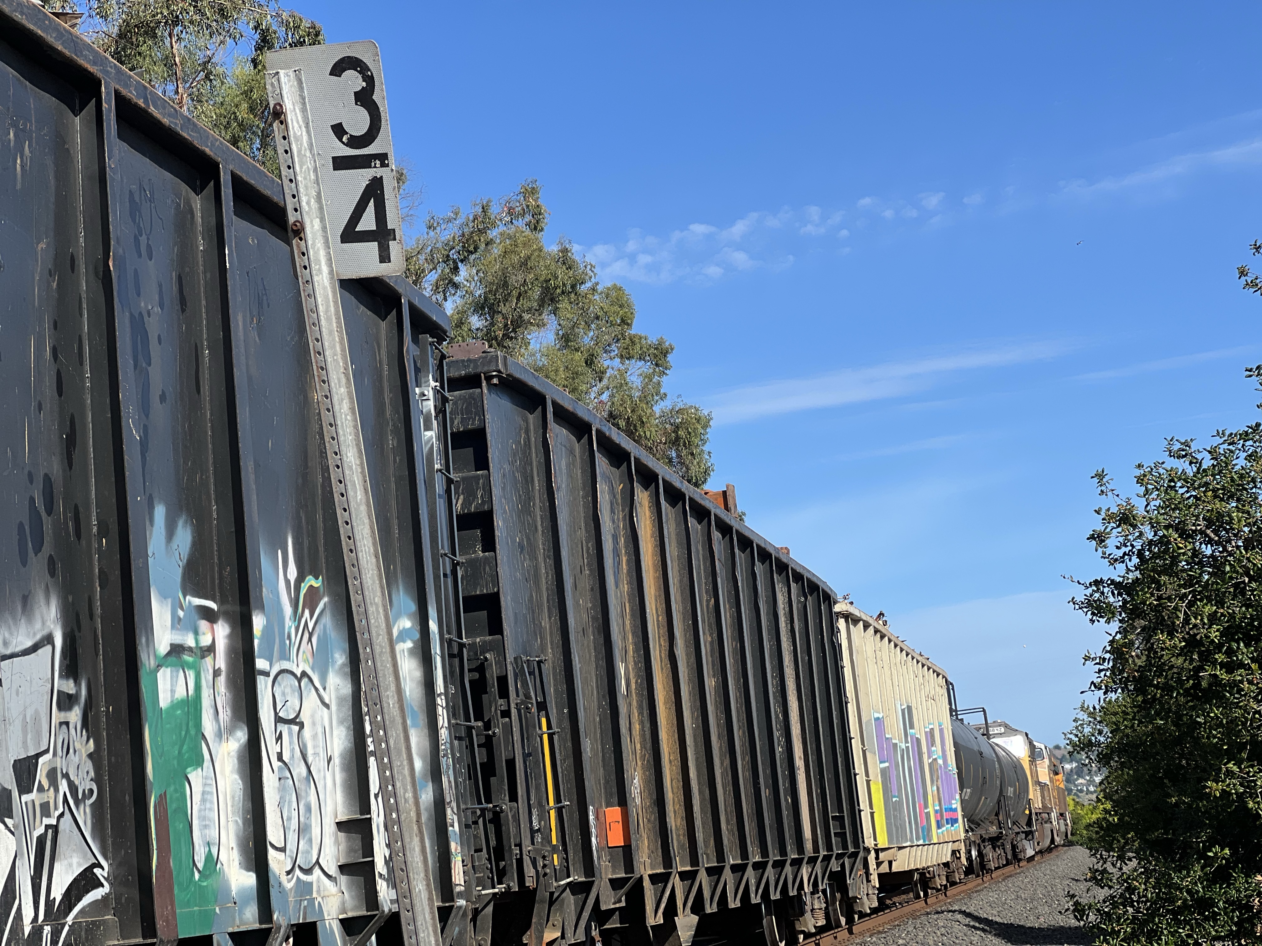
I started my sketch at mile marker 3/4 at 8:15 AM. I was keeping my eyes and ears on the double tracks to my left, especially as the clock approached 9 because the eastbound California Zephyr was due to pass Port Costa at about that time.
From previous posts it’s plain, I love the California Zephyr. I have traveled on the longest AMTRAK route four times and it was always a great experience.
In that 45 minutes, four trains passed (three passenger and one freight). This is a busy part of the high iron!
At 8:30 a mixed consist freight pulled into the “hole” to let two Capital Corridors pass.
A westbound freight waiting at mile post 3/4 for two passenger trains to pass.
The freight was stopped long enough for me to climb aboard and there were a few good rides on the consist but I resisted the urge to abandon teaching to take up the hobo life.
After the passenger trains passed, the UP freight got the high ball and the hiss of the brakes being released told me that the freight was about to move. The cars creaked to life and the train took up slack and resumed its westward journey.
California Zephyr Train No. 6 passing the remains of the train and ferry complex at Port Costa. Final destination, Chicago, Illinois. Just to the right of the end of the Zephyr is the town of Port Costa. More about this historic town in my next post.