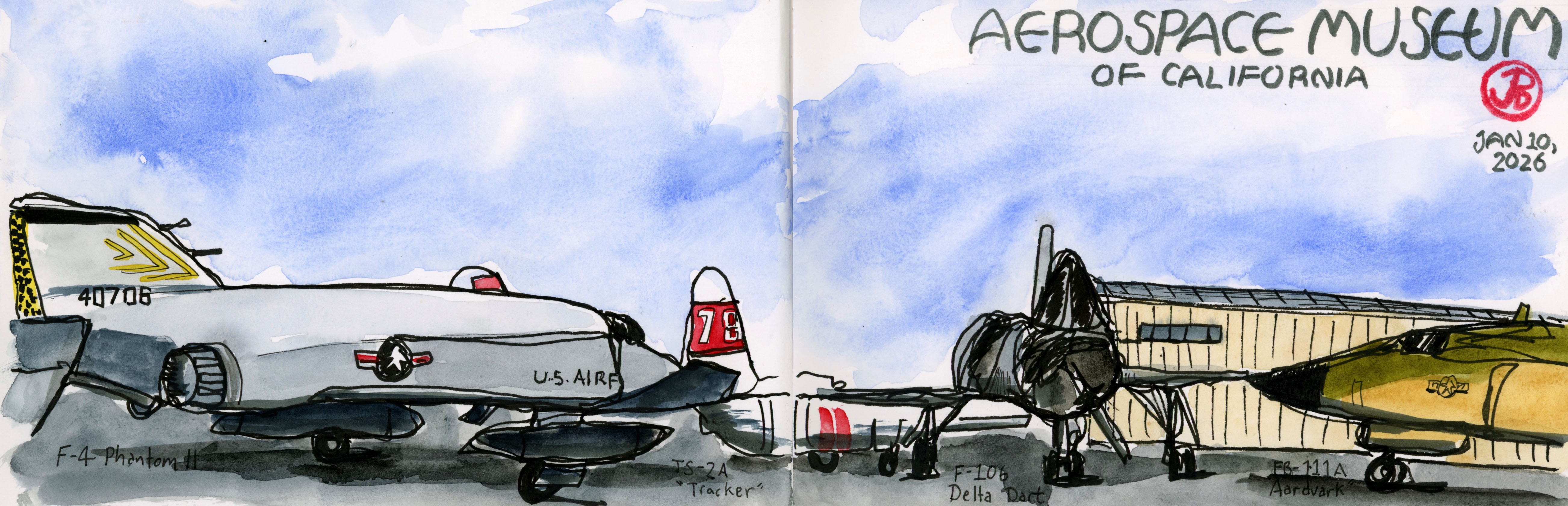
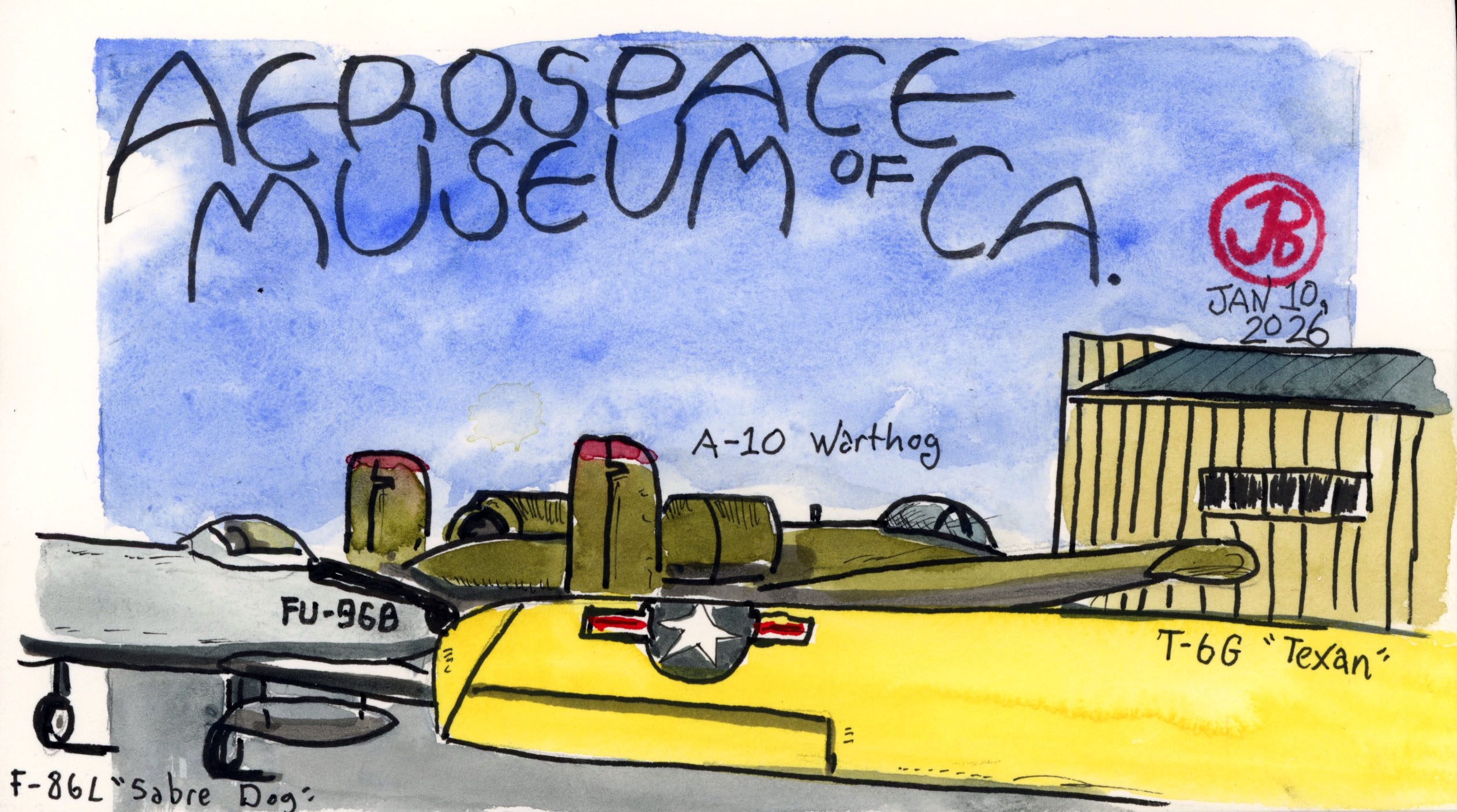
My Saturday morning sketching destination was a museum next to a former Air Force base: McClellan AFB in North Highlands Sacramento.
The museum is housed in a hangar with a solid collection of airplanes outside. To sketch the aircraft in the museum’s collection I’d have to head outside and brave the cool temps.
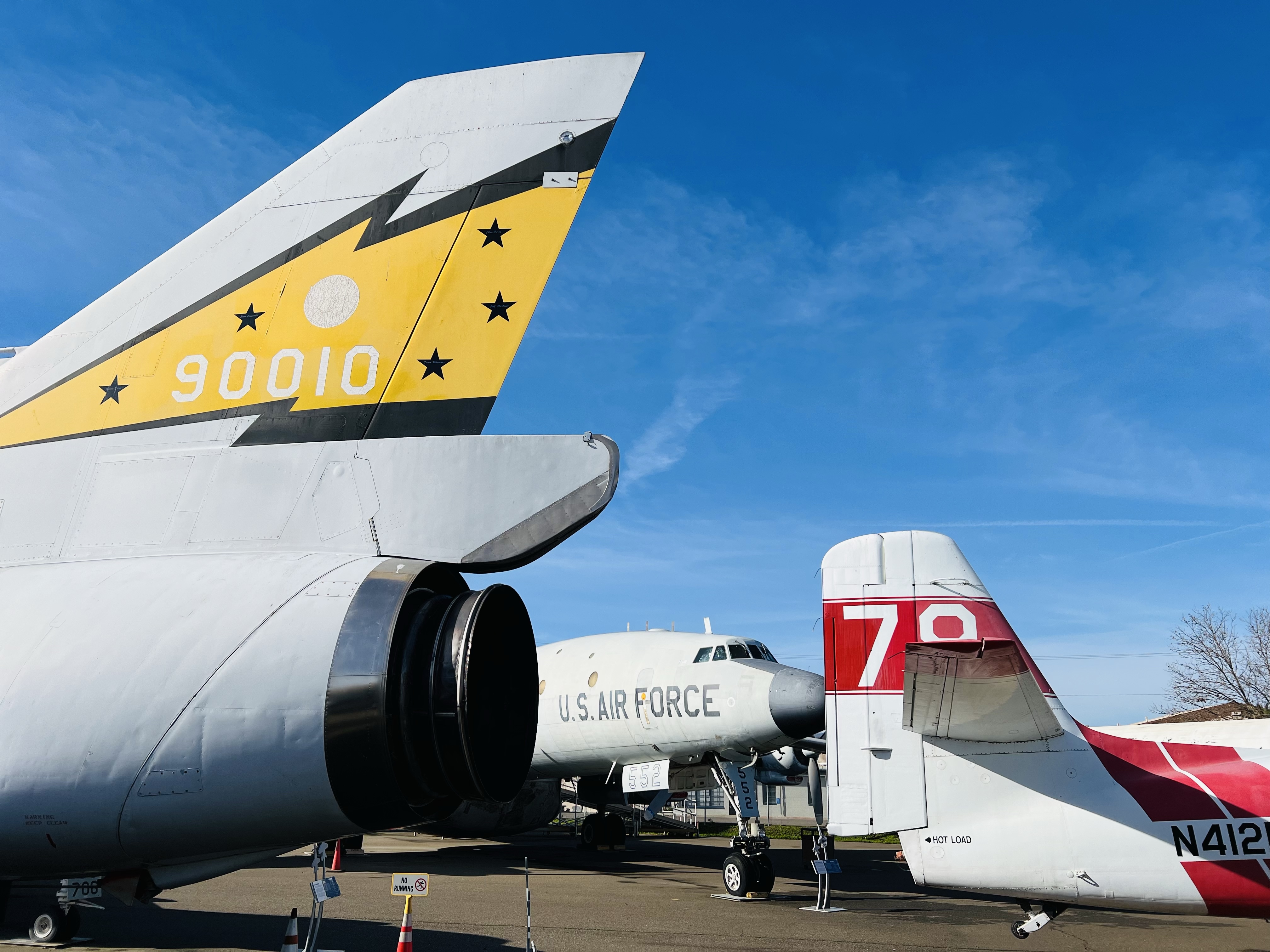
Planes, planes everywhere! The museum has a collection of both prop and jet planes spanning a wide range of aviation history.
I arrived just after the museum opened at 9. It was a cold morning under clear blue skies in the Central Valley.
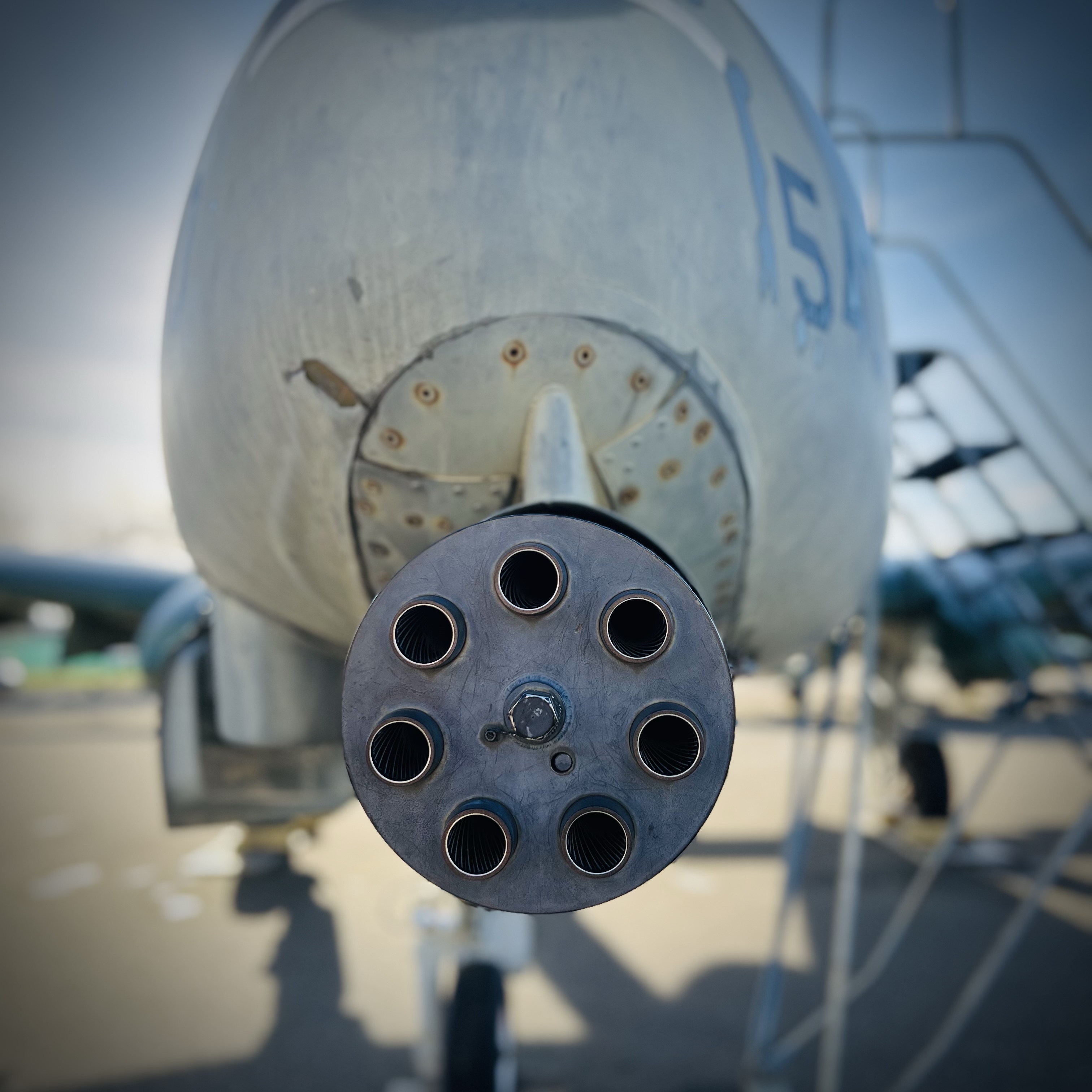
Looking at the business end of an A-10 Warthog: a 30 mm Gau-8 Avenger was designed to destroy tanks.
I did a total of three sketches including a broken continuous- line sketch (featured sketch).
For two of my sketches I sketched from an unconventional perspective from behind the featured aircraft: A-10 and the F-4.
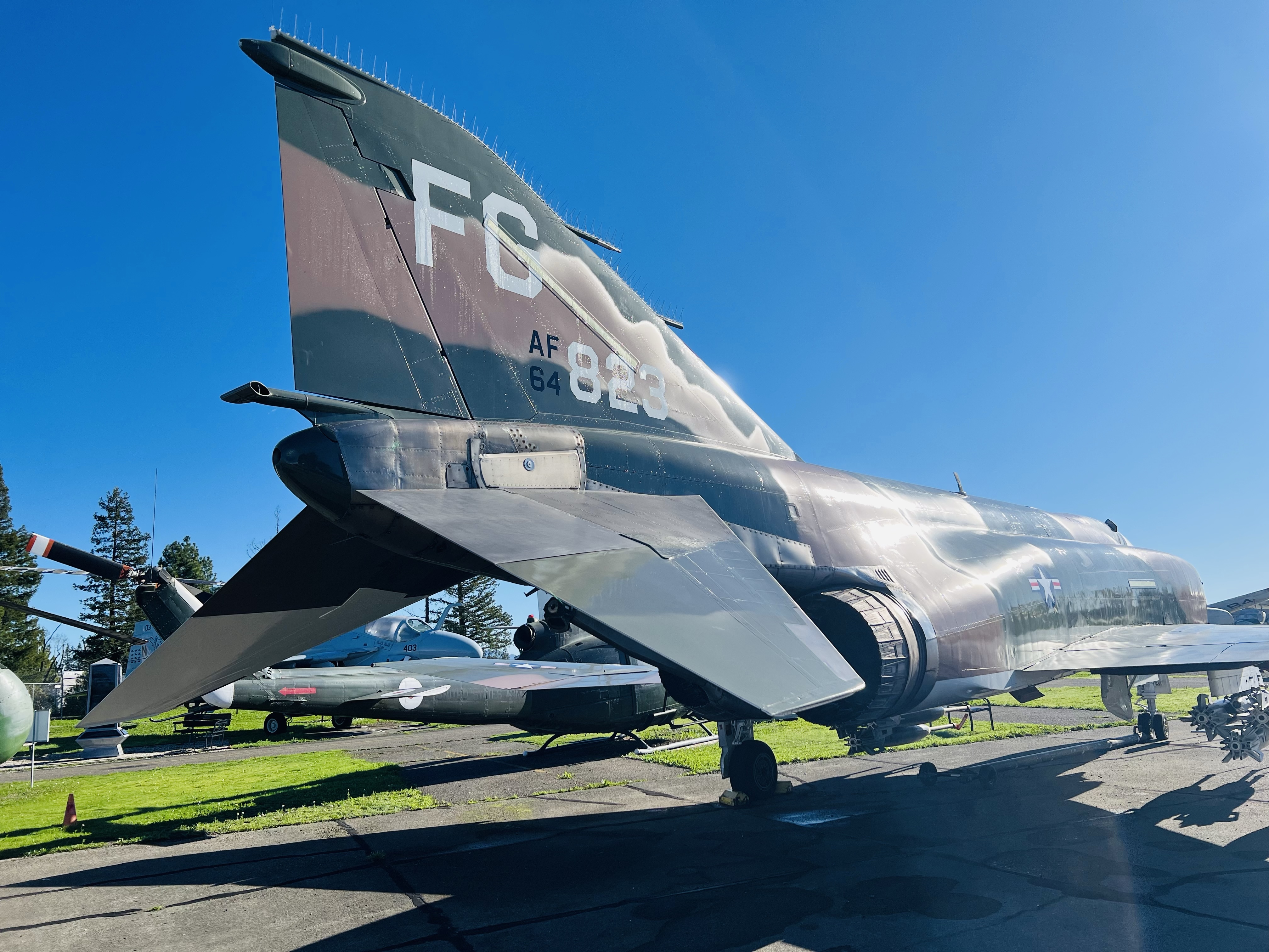
The McDonnell-Douglas F-4 Phantom II is my favorite aircraft. Each time I sketch one I think I get to know it a little better.
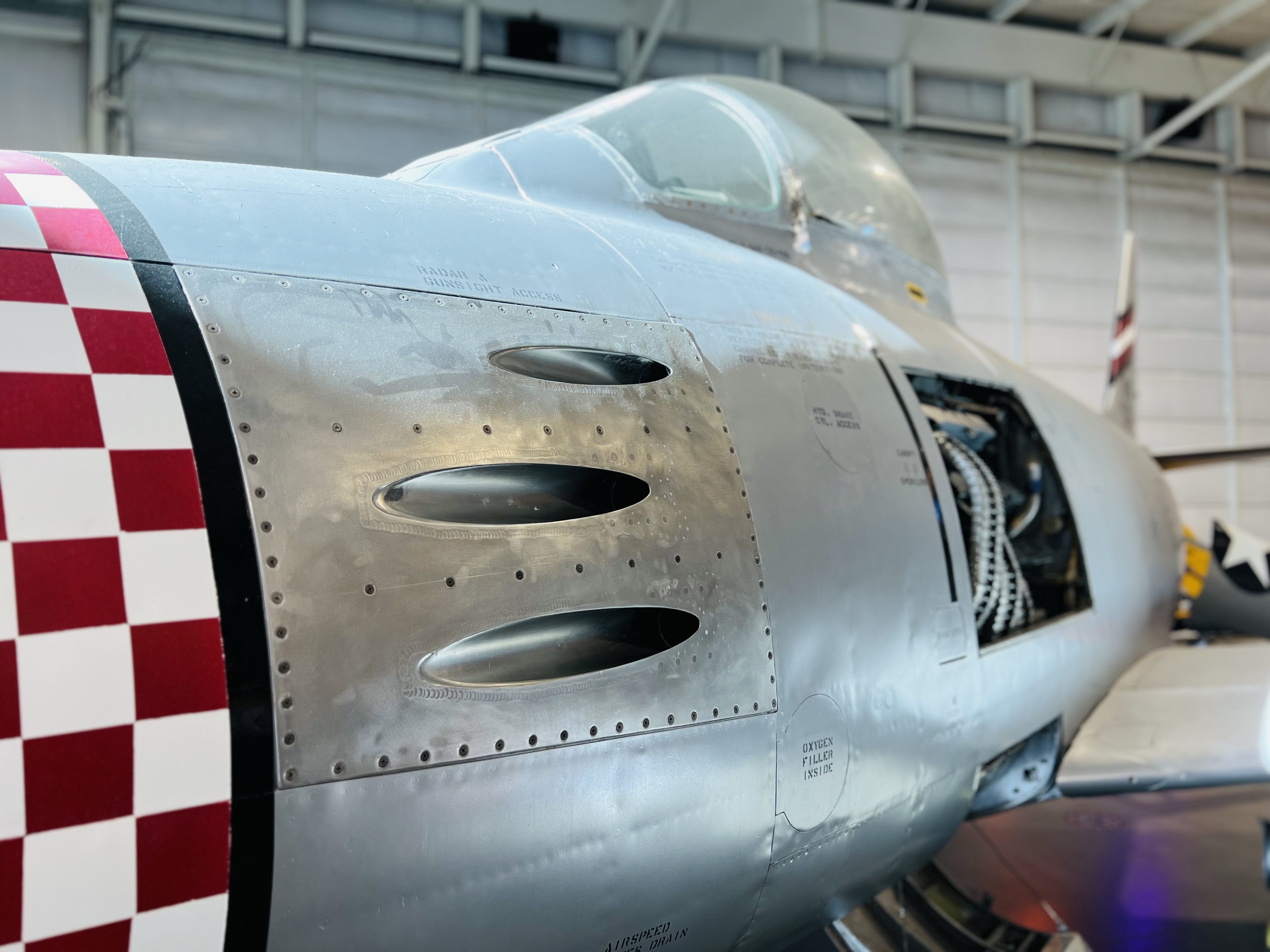
Another sketch was of an F-86 Sabre in the hangar. This was for a previously posted post about the Farrell’s disaster.
A sketch from my sketcher’s bench. The A-10 is an absolute beast.
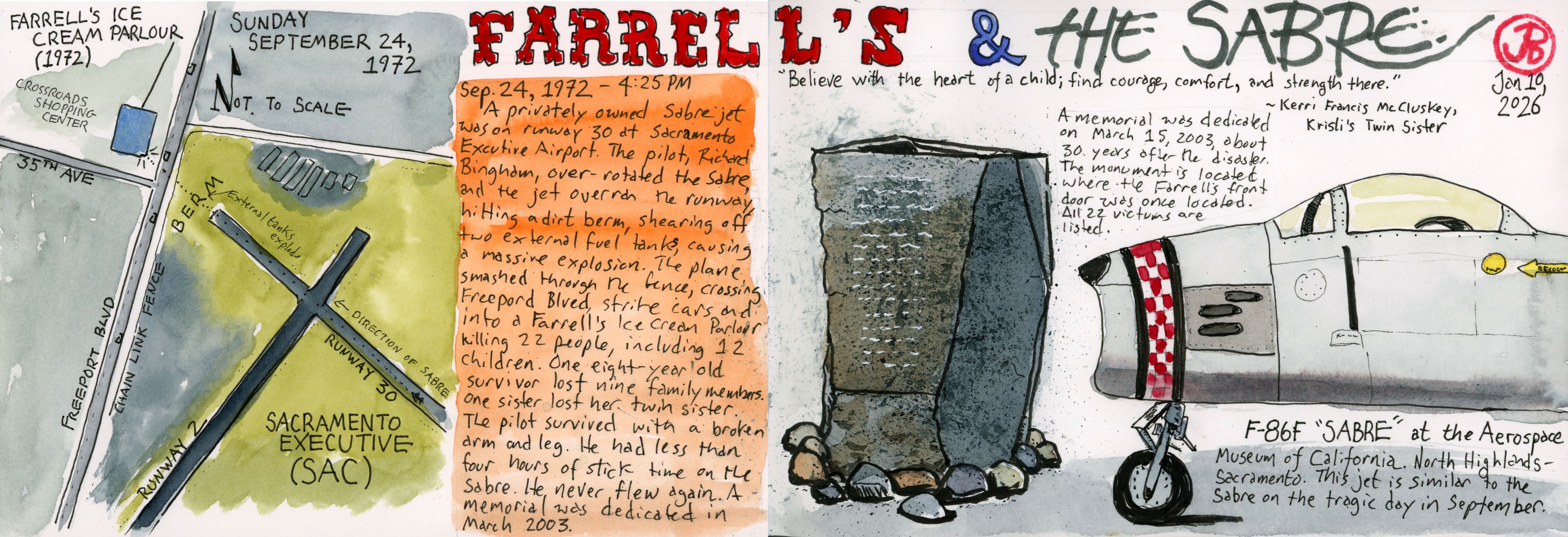
An airplane tragedy drew me to an airport just south of California’s State Capitol: Sacramento Executive Airport (SAC). At the time this was the worst air to ground disaster in United States history.
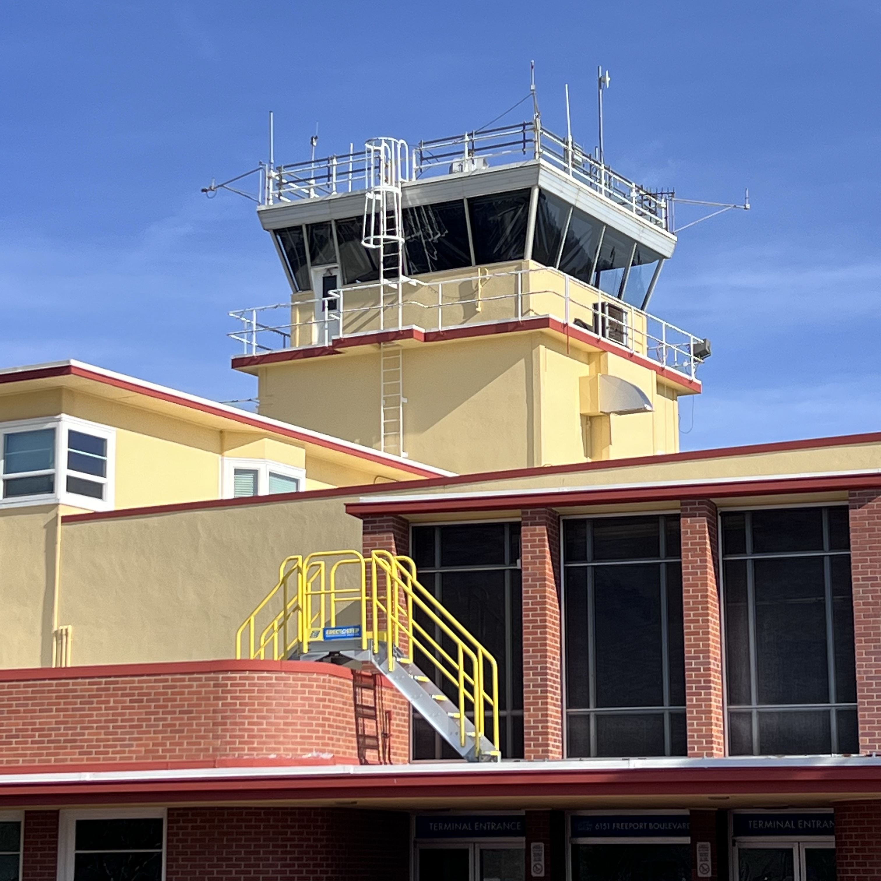
The control tower of SAC.
This was front page news when I was just over one year old in 1972. (I didn’t read the newspaper back then).
We set the scene on September 24, 1972 at about 4:25 PM.
Over the weekend the airport hosted an air show: the Golden West Sport Aviation Air Show.
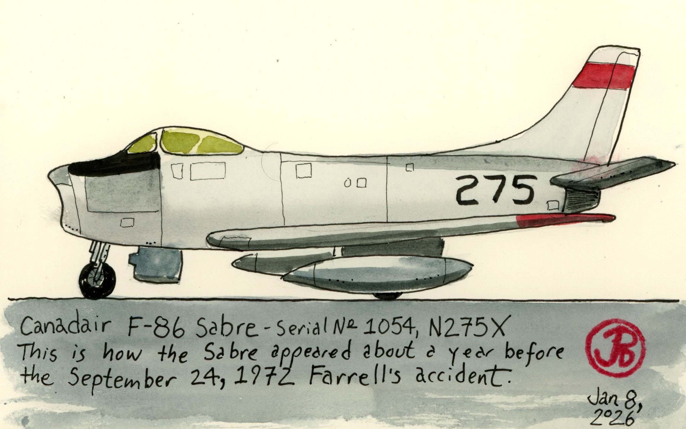
A sketch of the Canadair Sabre about a year before the September 1972.
On Sunday afternoon, one of the aircraft featured in the show, a Canadair F-86 Sabre, piloted by Richard Bingham, lined up on Runway 30 and he pushed the throttle forward for takeoff. The plane’s destination was Oakland Airport.
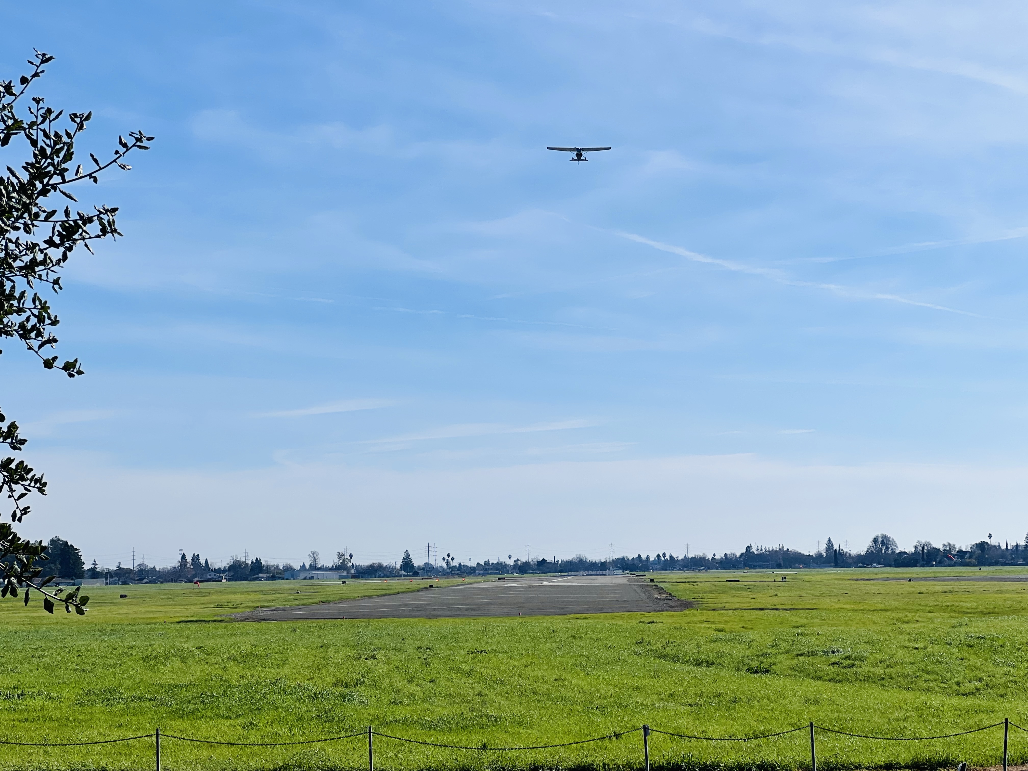
Looking down Runway 30 from Freeport Boulevard. The Cessna above has just taken off.
As the Korean War era jet gained speed on the runway, Bingham pulled back on the stick. The nose pitched up into the air at a steep angle but the pilot made a fatal mistake. He over rotated the Sabre.
Bingham, an experienced pilot, had less than four hours of flight time with the Sabre. When you over rotate on takeoff you position the aircraft’s nose at an angle at which the plane’s wings do not generate enough lift and the plane cannot take off. Each aircraft has a peak range of lift, and the Sabre was known to lift prematurely on takeoff since the 1950s.
The Sabre sped towards the end of the runway, a dirt berm, a chain link perimeter fence, Freeport Boulevard, and the Farrell’s Ice Cream Parlour, packed with families enjoying Sunday afternoon sweets.
The Sabre struck the berm shearling off the two external fuel tanks causing a massive explosion. The jet burst through the chain link fence and across Freeport Boulevard, hitting a car and killing its passengers.
The Sabre crossed into the parking lot, totaling two cars before it hit Farrell’s Ice Cream Parlour at an estimated 200 miles per hour.
The deviation was heartbreaking. In that instance, 22 people lost their lives, including 12 children who were enjoying their time at Farrell’s. 28 people were also injured.
One eight year old, lost nine family members. A young sister, lost her twin sister.
Ironically, Richard Bingham, the pilot, survived with just a broken arm and leg. He never flew again.
Some good did come from this disaster. Laws were changed regarding flying vintage aircraft and qualifying pilots. Also because burn victims had to be flown to San Francisco or Los Angeles to be treated, in the wake of the Sabre crash, a burn unit was established in Sacramento.
It’s About Time: The Memorial
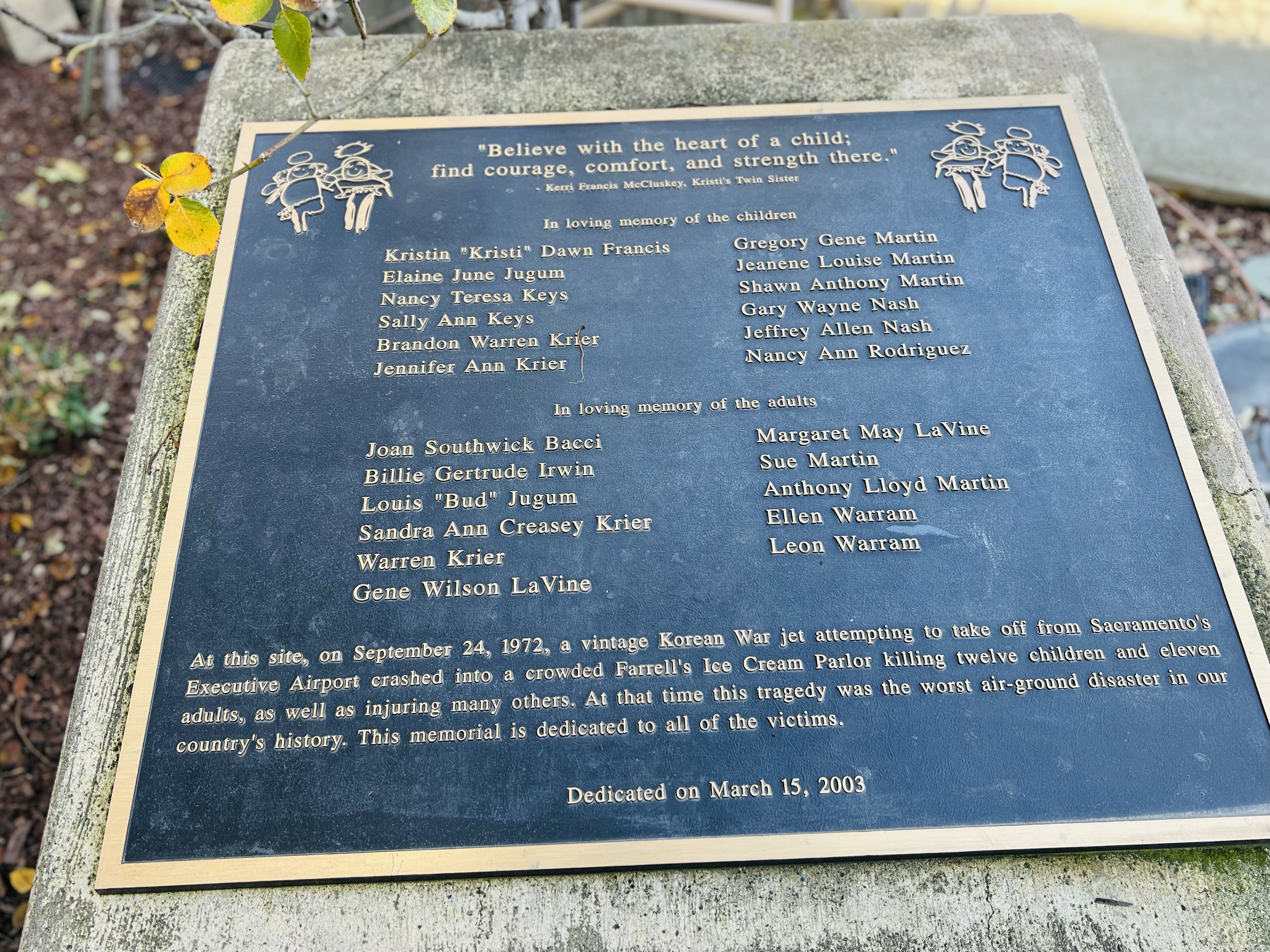
It was not until 30 years later that a memorial was placed near the location of the front door of the now gone ice cream parlor.
The memorial plaque lists the names of those who perished, first the children and then the adults. What is stunning is the repeated surnames. This tragedy destroyed families.
Here is the inscription on the plaque:
“Believe with the heart of a child; find courage, comfort, and strength there.” – Kerri Francis McCluskey, Kristi’s Twin Sister
In loving memory of the children
Kristin “Kristi” Dawn Francis · Elaine June Jugum · Nancy Teresa Keys · Sally Ann Keys · Brandon Warren Krier · Jennifer Ann Krier · Gregory Gene Martin · Jeanene Louise Martin · Shawn Anthony Martin · Gary Wayne Nash · Jeffrey Allen Nash · Nancy Ann Rodriguez
In loving memory of the adults
Joan Southwick Bacci · Billie Gertrude Irwin · Louis “Bud” Jugum · Sandra Ann Creasey Krier · Warren Krier · Gene Wilson LaVine · Margaret May LaVine · Sue Martin · Anthony Lloyd Martin · Ellen Warram · Leon Warram
At this site, on September 24, 1972, a vintage Korean War jet attempting to take off from Sacramento’s Executive Airport crashed into a crowded Farrell’s Ice Cream Parlor killing twelve children and eleven adults, as well as injuring many others. At that time this tragedy was the worst air-ground disaster in our country’s history. This memorial is dedicated to all of the victims.”
Sketching Notes
For my spread about the Farrell’s tragedy I first sketched the map of the airport and title before I went to Sacramento.
I knew that they had an F-86 Sabre at the Aerospace Museum of California and I planned to sketch the iconic nose of the fighter to the right of my sketchbook.
The machine guns of the Sabre.
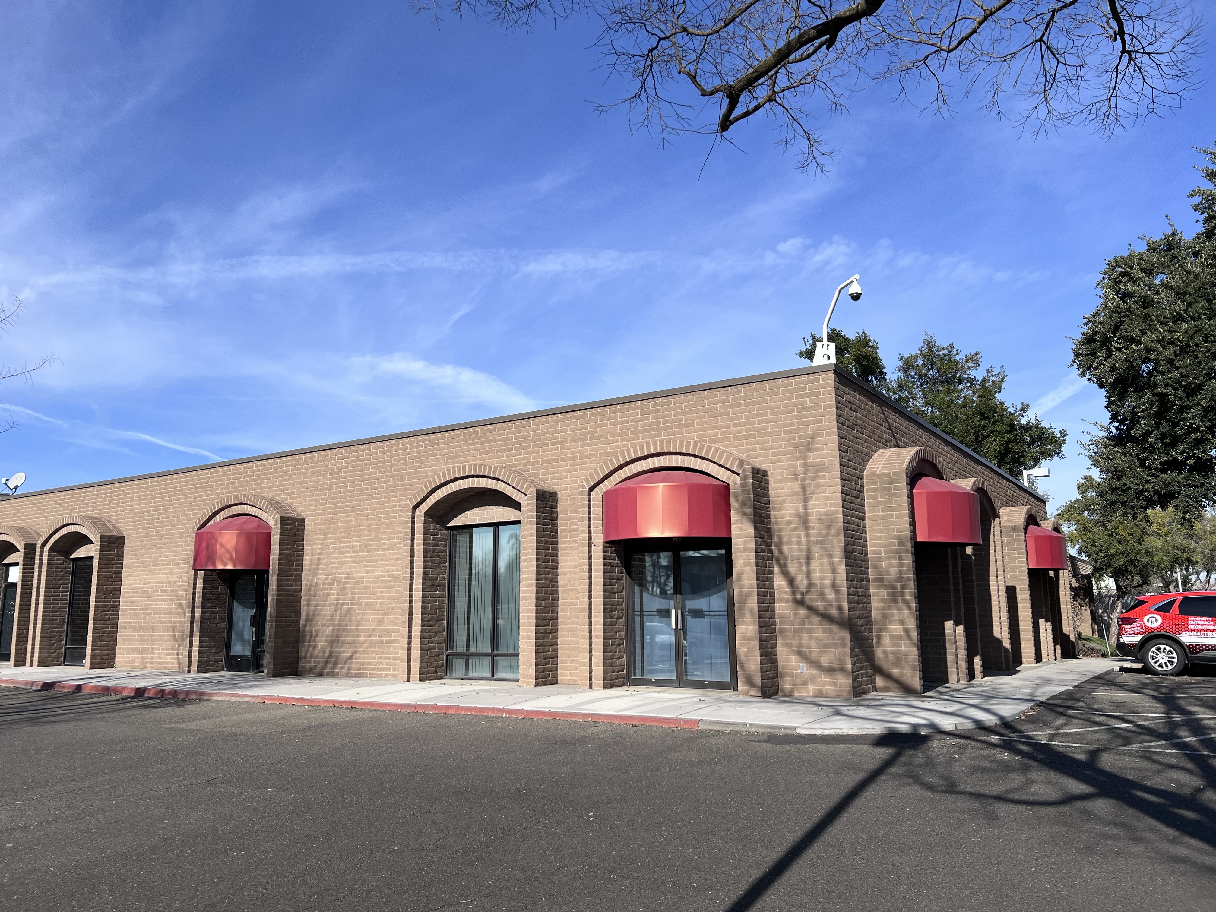
I then headed south of the State Capitol to the former site of Farrell’s to sketch the memorial.
This firefighter building is on the site of the former Farrell’s Ice Cream Parlour.
On a personal note, there was a Farrell’s in my hometown. It was one of those special occasion restaurants when someone had a birthday (you got a free sundae if it was) or if someone was visiting from out of town.
The business was started in Portland, Oregon in 1963. At the height of the company’s growth there were 120 locations nationwide.
The 1890s themed ice cream parlor featured employees dressed in period costumes, a player piano, and massive ice cream sundae called the “Zoo” which would be carried out on a stretcher by employees running wildly through the restaurant to the sound of ambulance sirens.
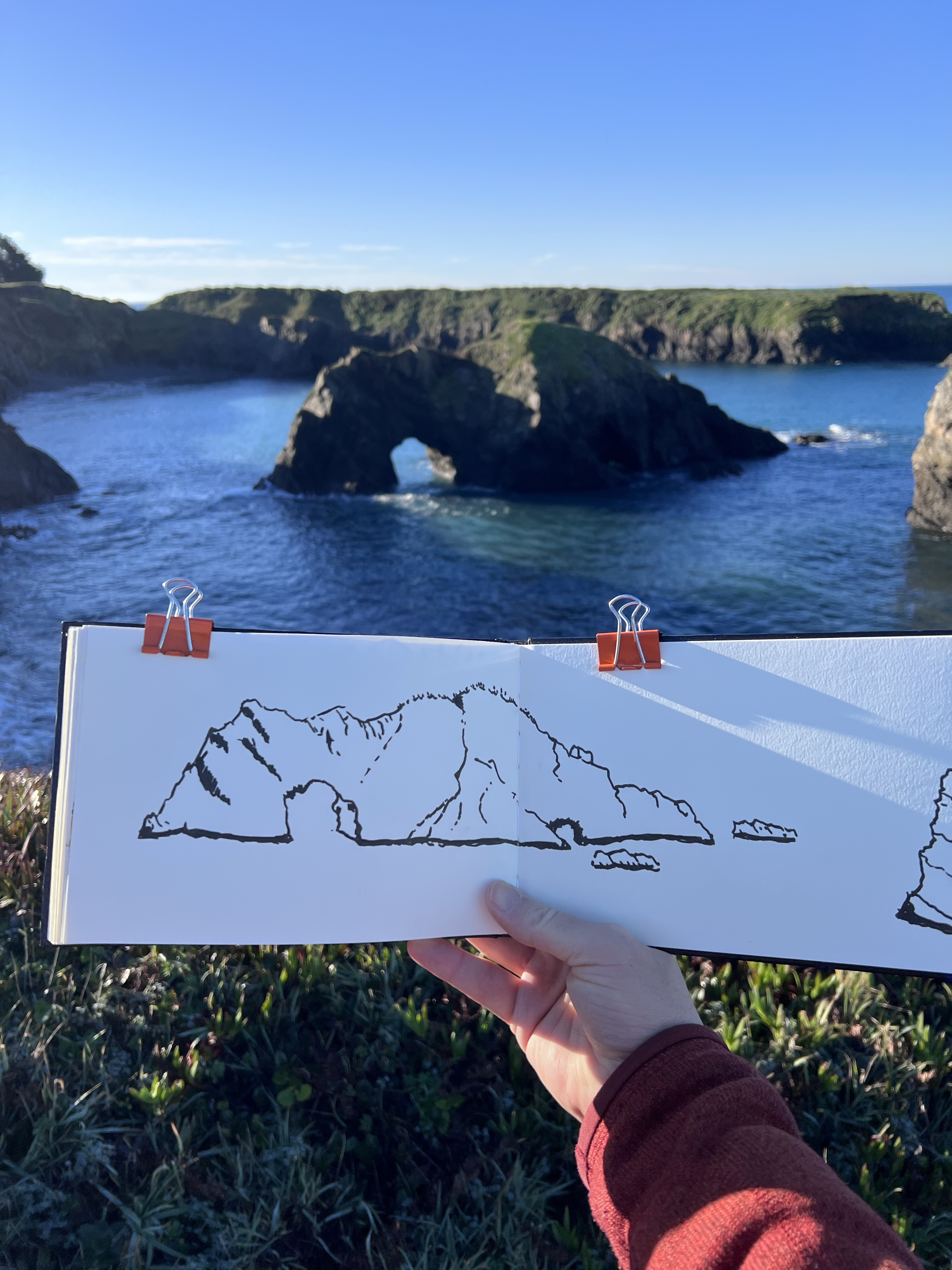
Sketching the Mendocino Headlands calls for my panoramic journal to capture the wide views. So I did.
In the early morning I headed out to the Headlands and sketched a rock form with two arched tunnels. I think I’ve sketched this rock before but from a different angle.
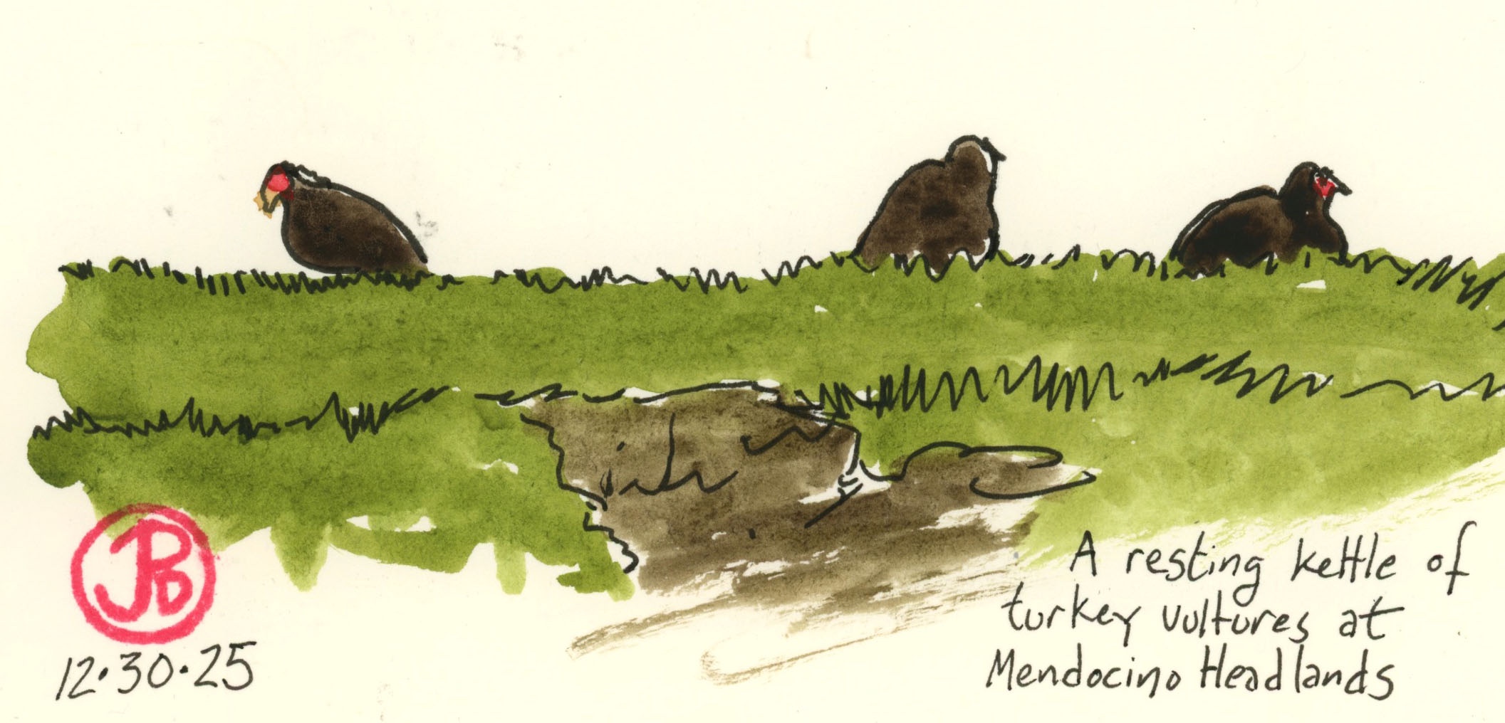
The rocks within the bays have become islands that offers a protected roosting spots for birds such as western gulls, black oystercatchers, brown pelicans, Canada goose, and turkey vultures.
I sketched three vultures, affectionately known as TVs, warming up on such an island.
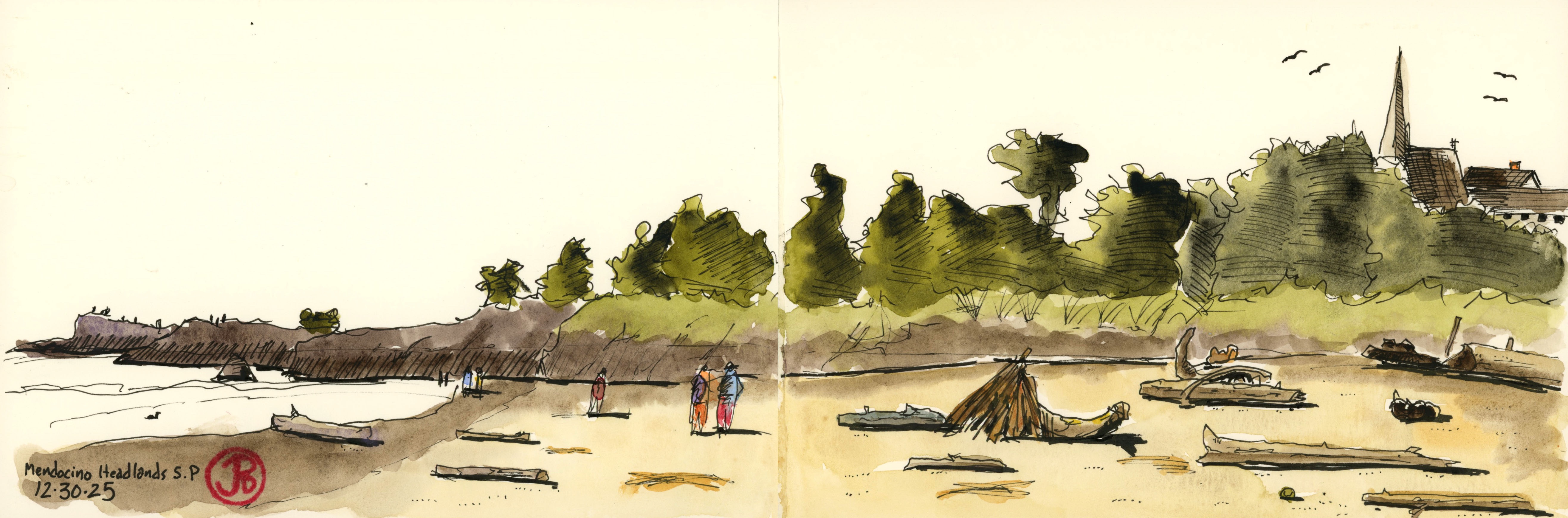
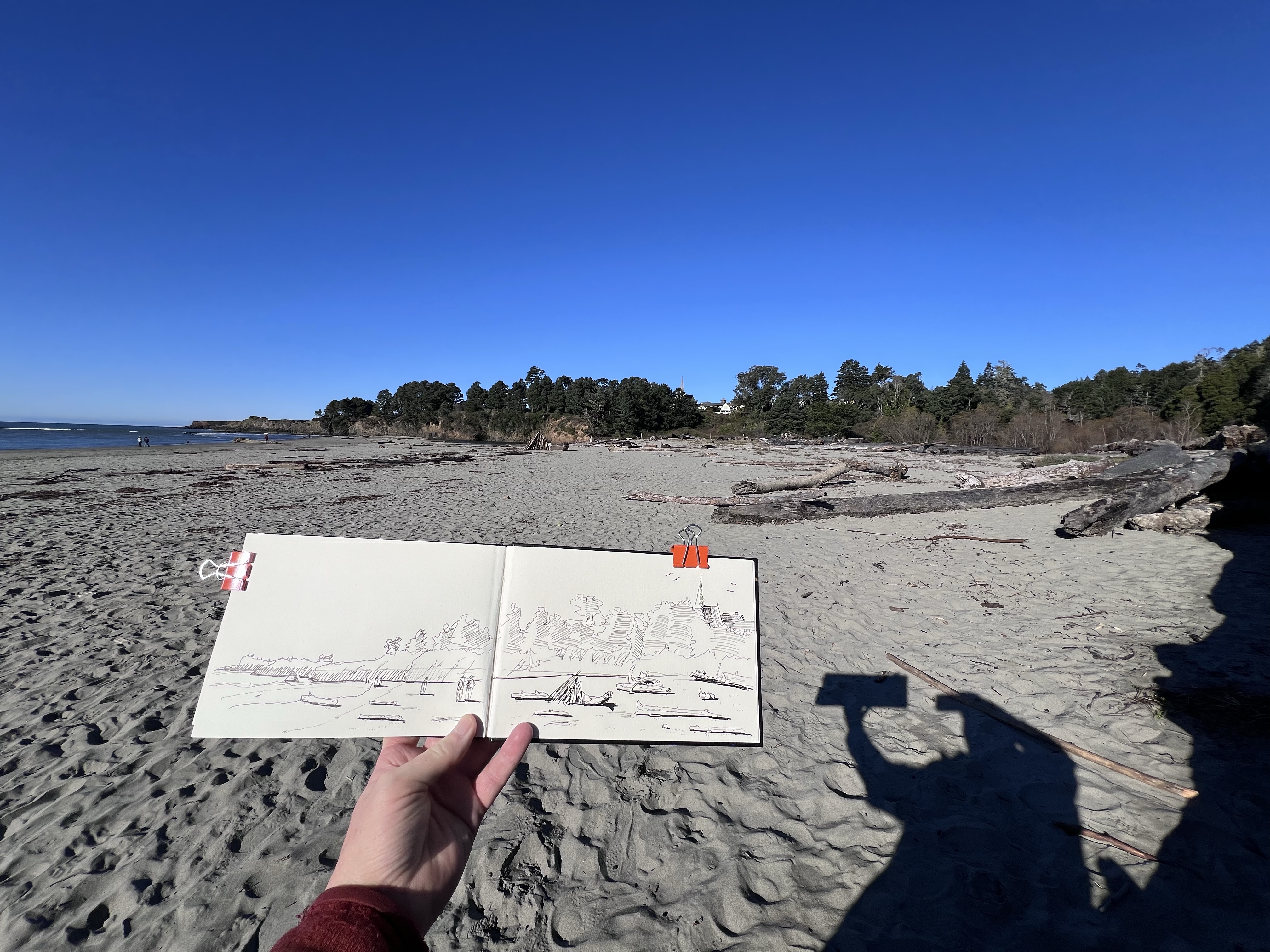
One of my favorite sketches at Mendocino Headlands State Park was from the beach where the Big River enters the Pacific just south of the historic town of Mendocino.
The beach was covered with driftwood and I found a large former tree to sit on and I started to sketch the scene before me (featured sketch).
A sketchers in Paradise!
Watertower Controversy
The residents of Mendocino are concerned with preserving the heritage of the town and keeping Mendocino, well, Mendocino.
This means keeping buildings as they are, restricting construction in historical areas, and preserving the town’s watertowers.
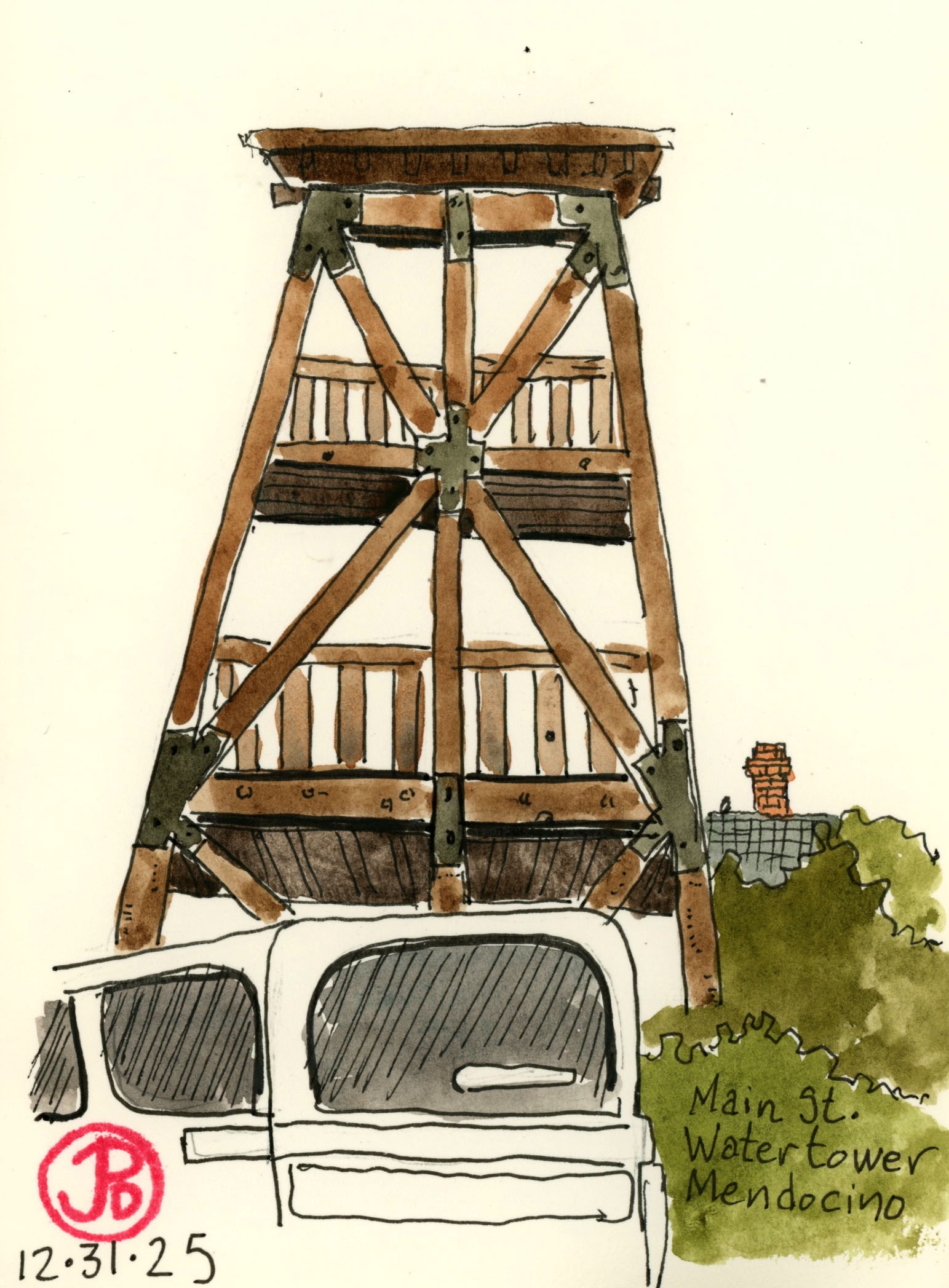
There is one watertower on Main Street that has been slated to be torn down so I thought I better sketch it while I can.
The 1904 watertower has been deemed unsafe and it is not cost effective to repair the tower so once again the battle between heritage/history and money rears its ugly head.
I saw lots of “Save the Watertower” flyers in shopfront windows. Time will tell if Mendocino can save this historic structure.
It can be a hard time for tourist railroads with the rising operational costs such as maintaining the locomotives, rolling stock, tracks, bridges, and tunnels.
The California Western Railroad aka the Skunk Train went from Fort Bragg on the coast, 40 miles east to Willits. That is until tunnel Number One collapsed in 2013, cutting the line in two disconnected segments.
The line currently runs trains out of both ends. The Fort Bragg side runs for about three miles and stops at the entrance to the tunnel (which will take about $300,000 to reopen.)
I rode the Skunk from Fort Bragg a while back and it seems just as the train gets going it stops, halted by the collapsed tunnel. Not much of a ride with the many bridges and redwood scenery on the other side of the tunnel.
The skunk train is now under diesel-electric motive power. The afternoon Skunk pulls into the Fort Bragg Depot. EMD GP9 No. 66 is on point. On the left is the M-300 motor car.
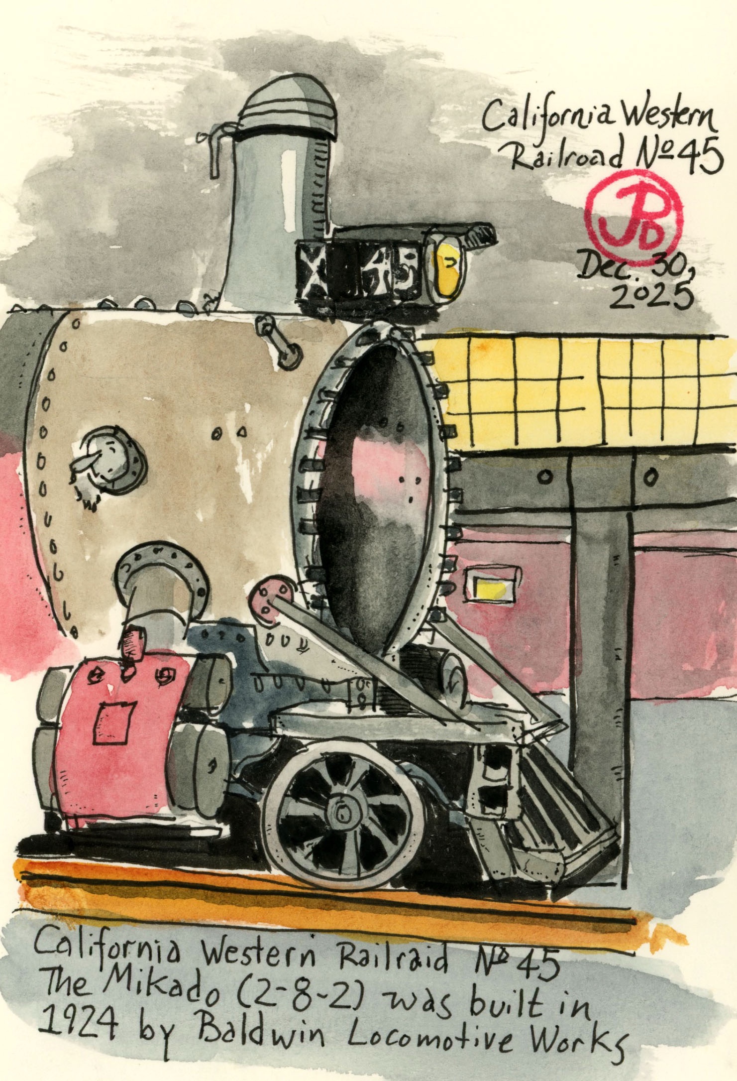
The real star of the railroad is the Mikado (2-8-2) Number 45. The steam locomotive was built by Baldwin Locomotive Works in 1924.
The 101 year old locomotive is now undergoing a rebuilt in the engine house. It will likely be a year and a half before the sounds of 45’s whistle echos along the coastline. Hopefully the line will then be opened to Willits.
The three bay engine house. In the right bay sits No. 45.
The side door to the engine house was open allowing me to get a sketch in of CWR No. 45. In her current state she seems a long way off from riding the high iron.
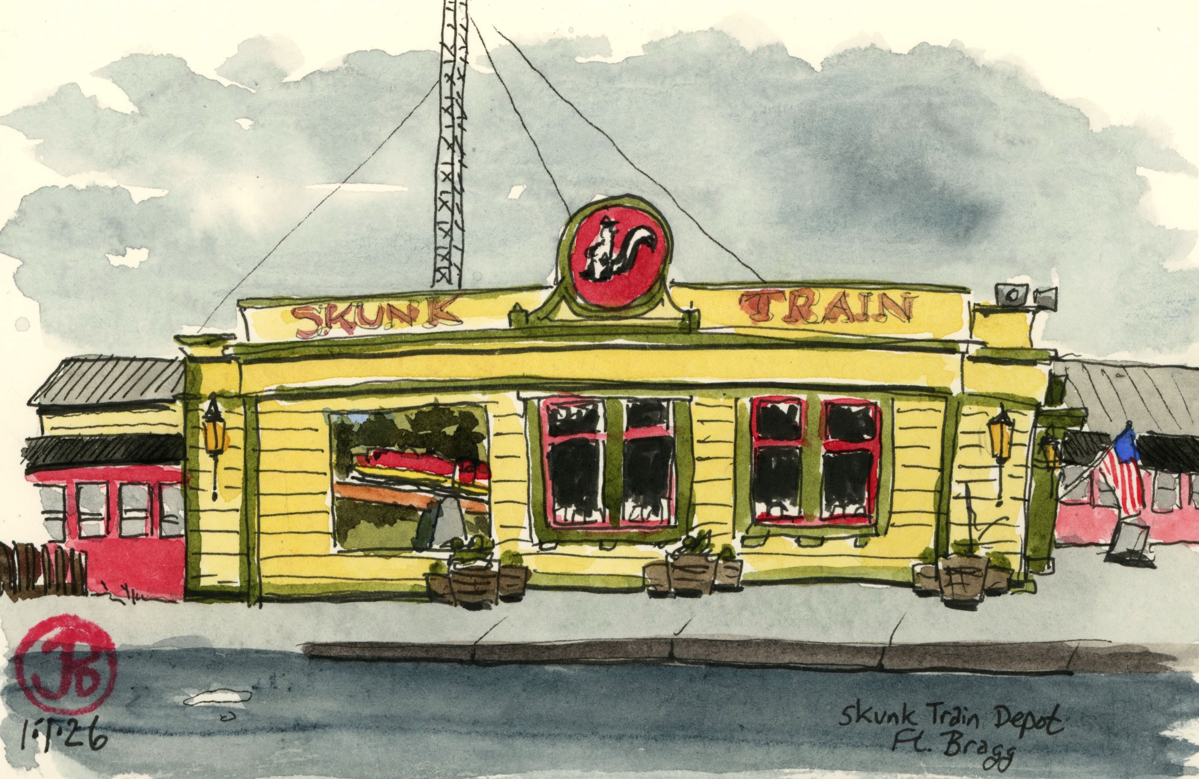
A rainy morning car sketch of the Skunk Train Depot in Fort Bragg.
I found plenty of sketching subjects on a Monday morning drive north from my Caspar digs on the Mendocino Coast: two whales and a rock shaped like an elephant.
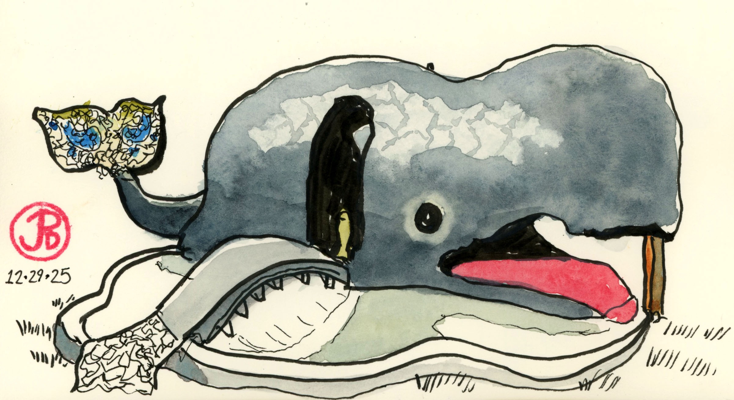
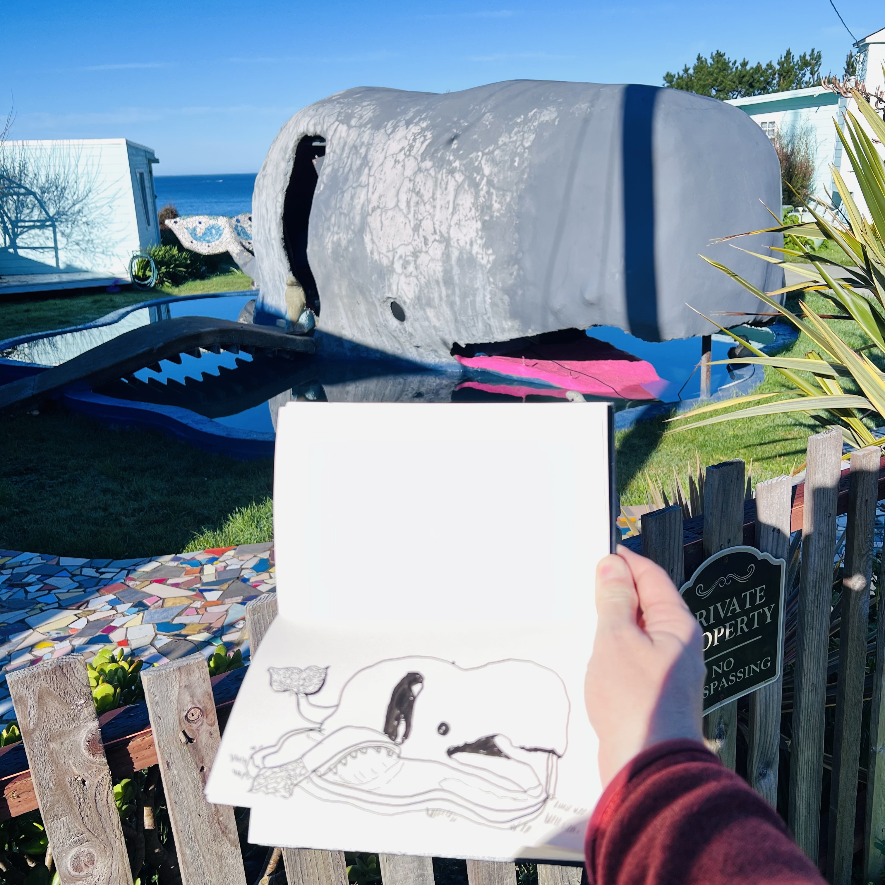
My first “whale” was to be found in Westport (population 299) about 15 miles north of Fort Bragg on Highway One.
If you build a whale, they will come. At least that’s what I think the sculpture/creator thought and I did come to sketch it. At onetime you could enter the belly of the whale and recline and watch television. Now it seemed closed to the public with a sign on the white picket fence warning of the Dalmatian. I didn’t see the Dalmatian, so I guessed I would be safe.
Thar she blows!!
Some things are beyond the realm of understanding such is the gray sperm whale in the front yard in Westport. Everyone knows that gray whales are the stars of the Mendocino Coast whale migration not Moby Dick!
Roadside attraction gone bad or failed hotel room, who knows! I sketched it anyway.
I retraced by way south to Blues Beach. My next sketching subject was a large rock which, if your squinted, looked like a pachyderm, hence the name Elephant Rock.
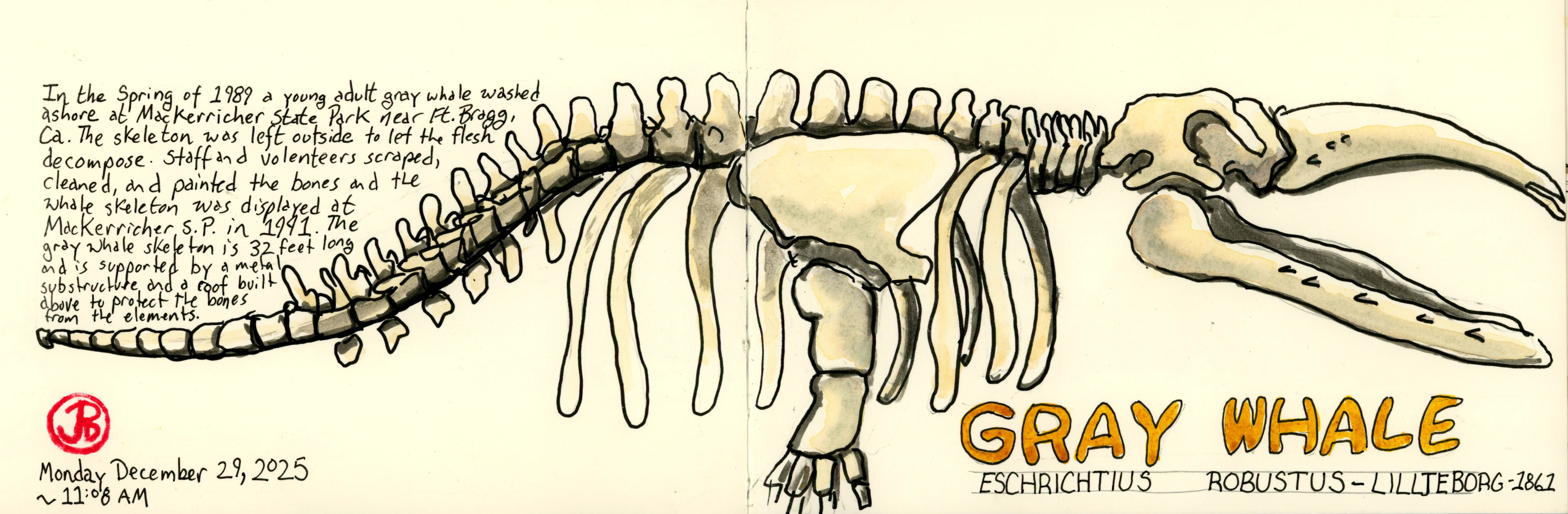
My final whale sketch was alas, a real whale. At least a former one. This was to found at MacKerricher State Park just north of Fort Bragg.
Near the visitors center is a collection of whale bones. The 32 foot gray whale skeleton was what caught my sketcher’s eye.
I seated myself on a nearby picnic table and started to sketch the jigsaw bones of the gray whale.
The gray whale migration should begin in earnest in February as adults would be heading south to their birthing lagoons in Baja California.
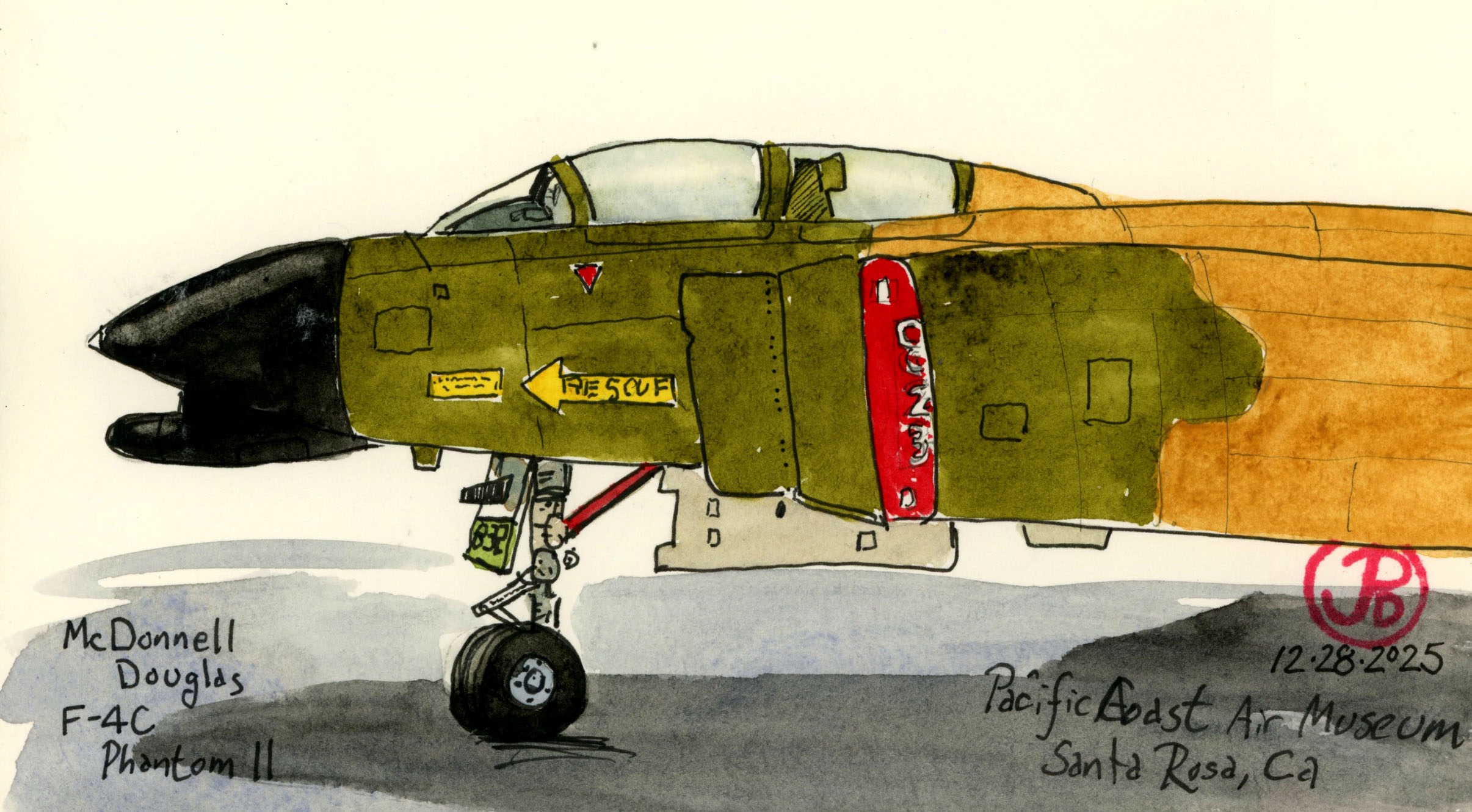
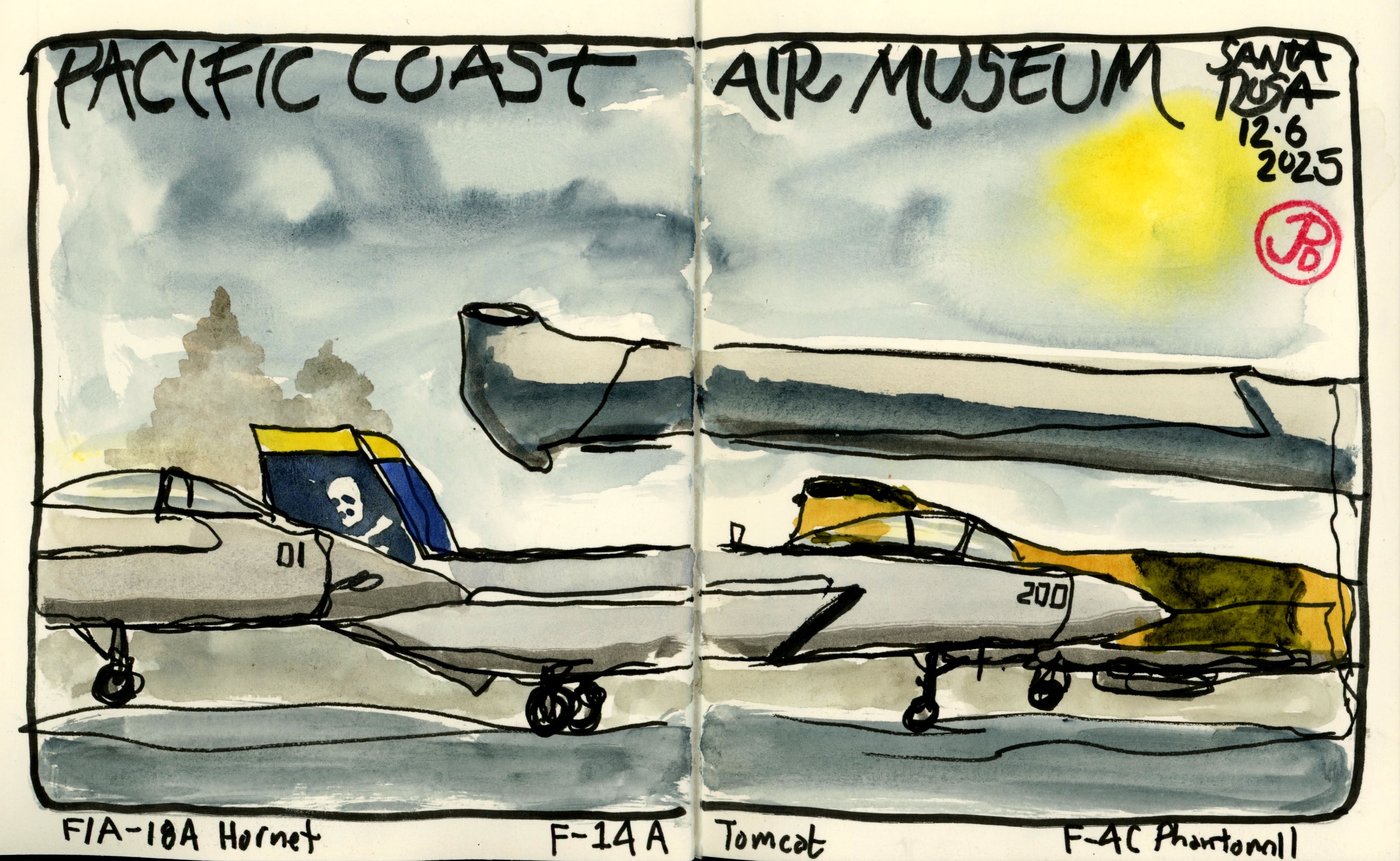
I returned to the Pacific Coast Air Museum in northern Santa Rosa to sketch one of my favorite airplanes: the F-4 Phantom II.
Throughout my life I have been fascinated by things with wings: birds and airplanes. Growing up in Sunnyvale, California, my bedroom window looked out towards the flight path on final approach to Moffett Field, US Navy base.
During my childhood, the most common aircraft that flew by my window was the submarine hunter P-3 Orion. The patrol aircraft were stationed at Moffett.
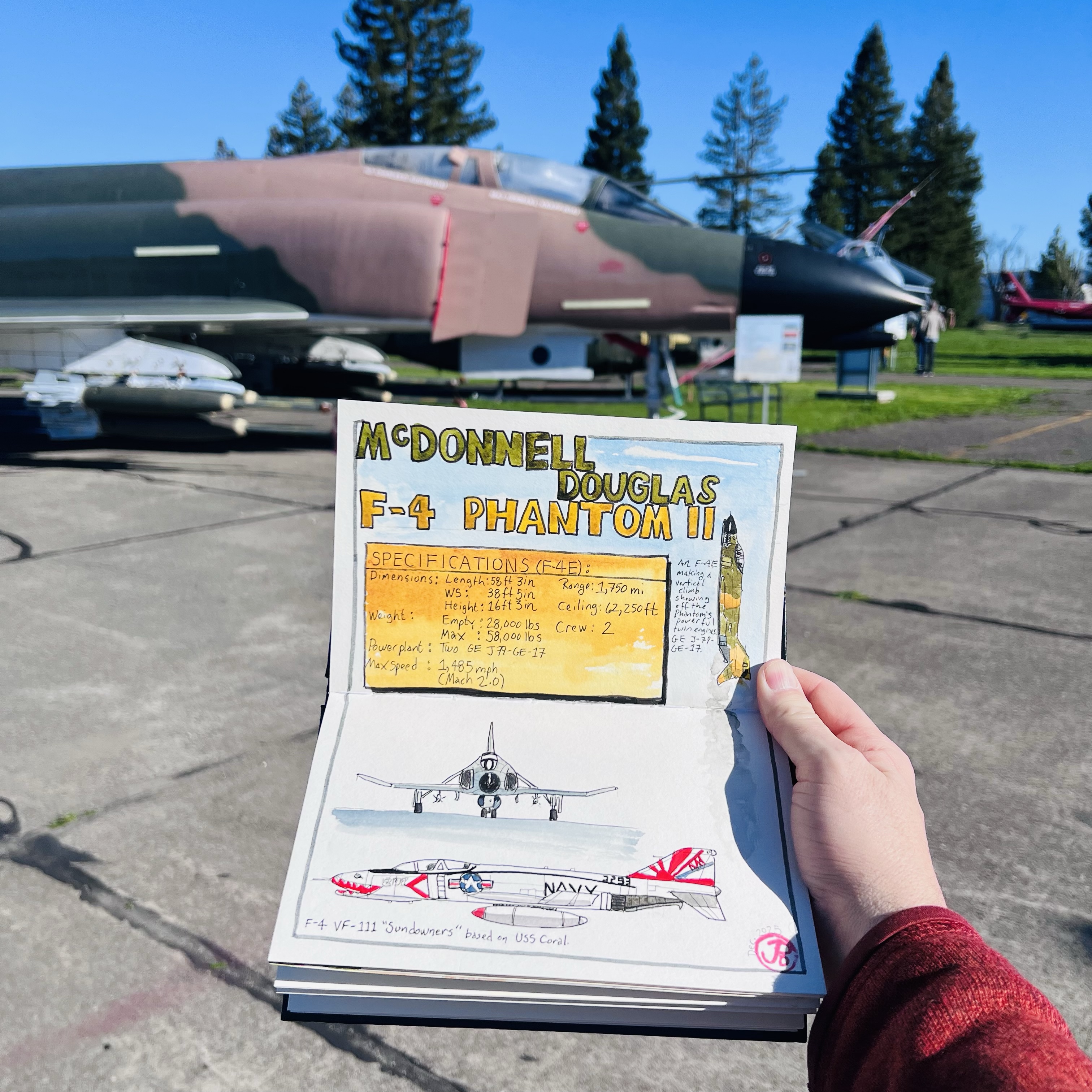
Every summer, we headed up to the roof during the annual air show to watch the Blue Angels. At the time they flew A-4 Skyhawks but in the year of my birth they, and the Air Force performance team the Thunderbirds, flew the McDonnell Douglas F-4 Phantom II.
This airplane is a beast. At the time it was one of the most powerful fighters in the air reaching speed just over Mach 2. It had earned the nickname the “Flying Brick”.
A docent at the museum who was stationed on an aircraft carrier said you new when you were in the mess when an F-4 took off because you coffee cup shook with power of the fighter’s thrust.
A pre-museum sketch of an aerial beast.
A childhood hobby was building scale model airplanes and my favorite was an F-4 hand painted camo livery.
Looking head on at the F-4C.
I was now going to Santa Rosa to sketch a full scale fighter with a similar camo paint scheme.
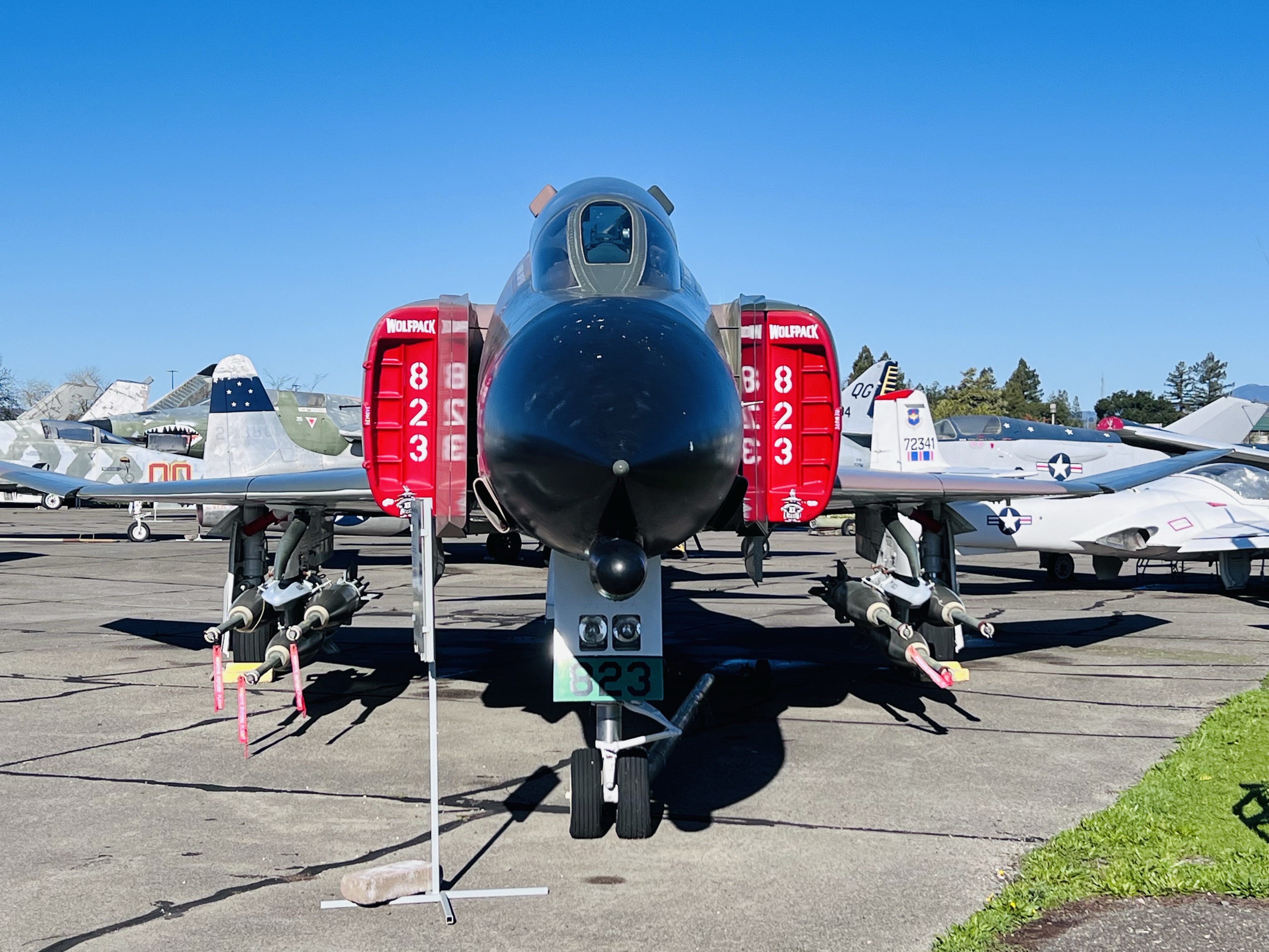
The iconic vertical and angled horizontal stabilizers of the F-4. This jet is an absolute beast. A continuous line sketch of four planes at the museum. The plane on the left, F/A 18 Hornet is what the Blue Angels currently fly. The camouflaged F-4 is on the right.
There is a little known piece of film history in Northern Santa Rosa at the airport, now called the Charles M. Shultz Sonoma County Airport.
While Hitchcock’s Shadow of a Doubt (1943) gets most of the movie history headlines in Santa Rosa, an aircraft hangar was the site of a hair-raising flying stunt in the film It’s a Mad, Mad, Mad, Mad World (1963).
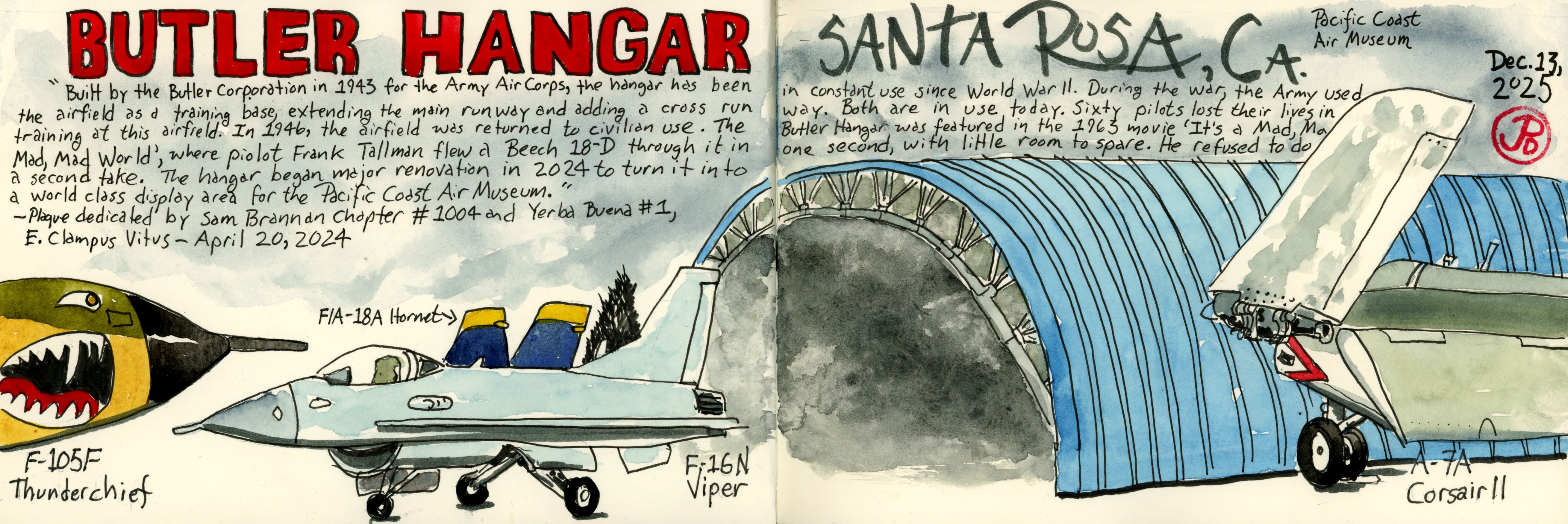
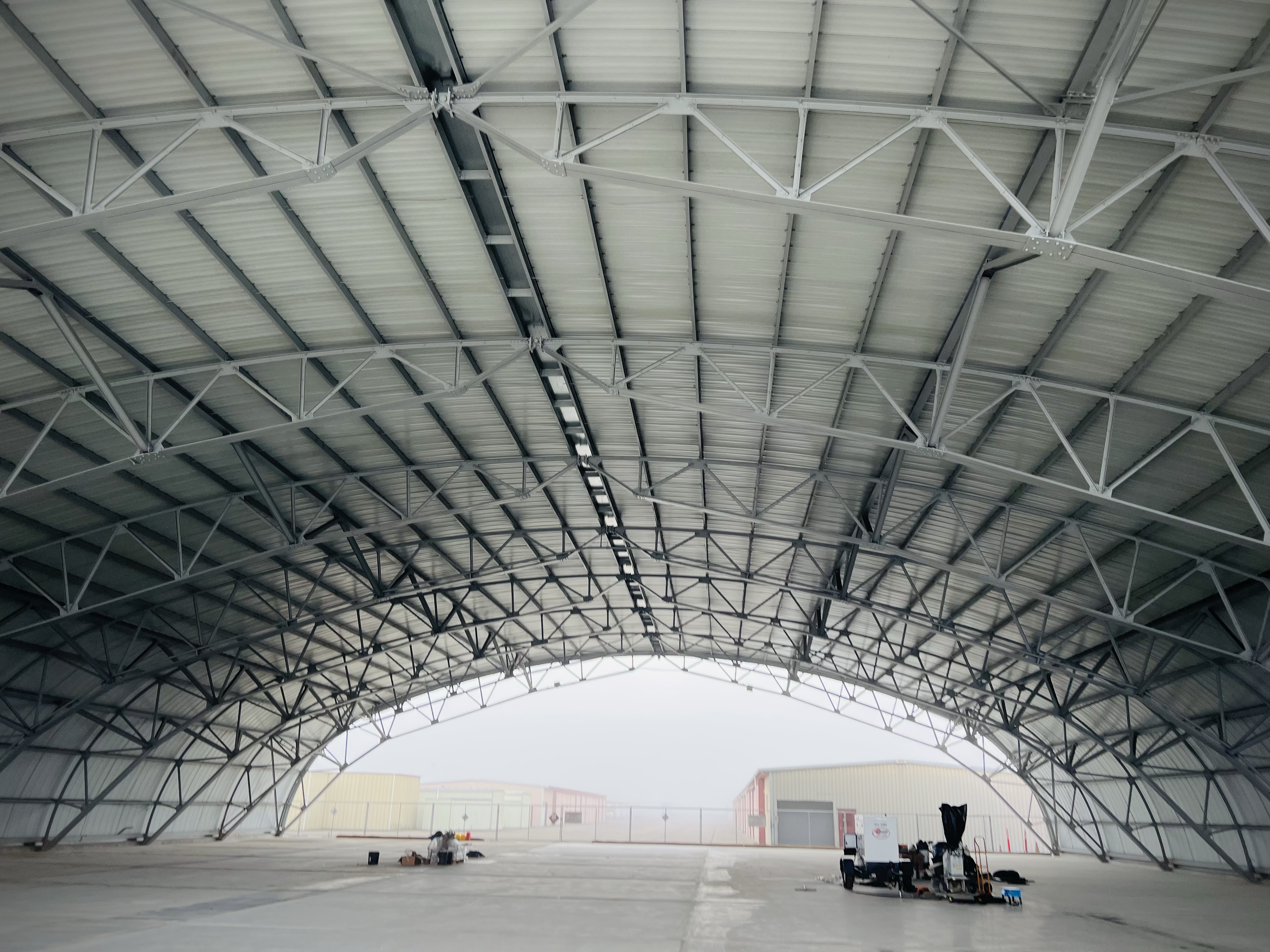
The Butler Hangar was built in 1943, the same year that Shadow was released. The airfield was used during World War Two as a training field. Sixty pilot lost their lives while training here.
One of my favorite fighters, the F-4 Phantom II with the Butler Hangar in the background. As a kid I built an F-4 model and painted it in a similar camo paint scheme.
After the war the airfield, including the hangar, was returned to civilian use and it has been in continuous use since World War Two.
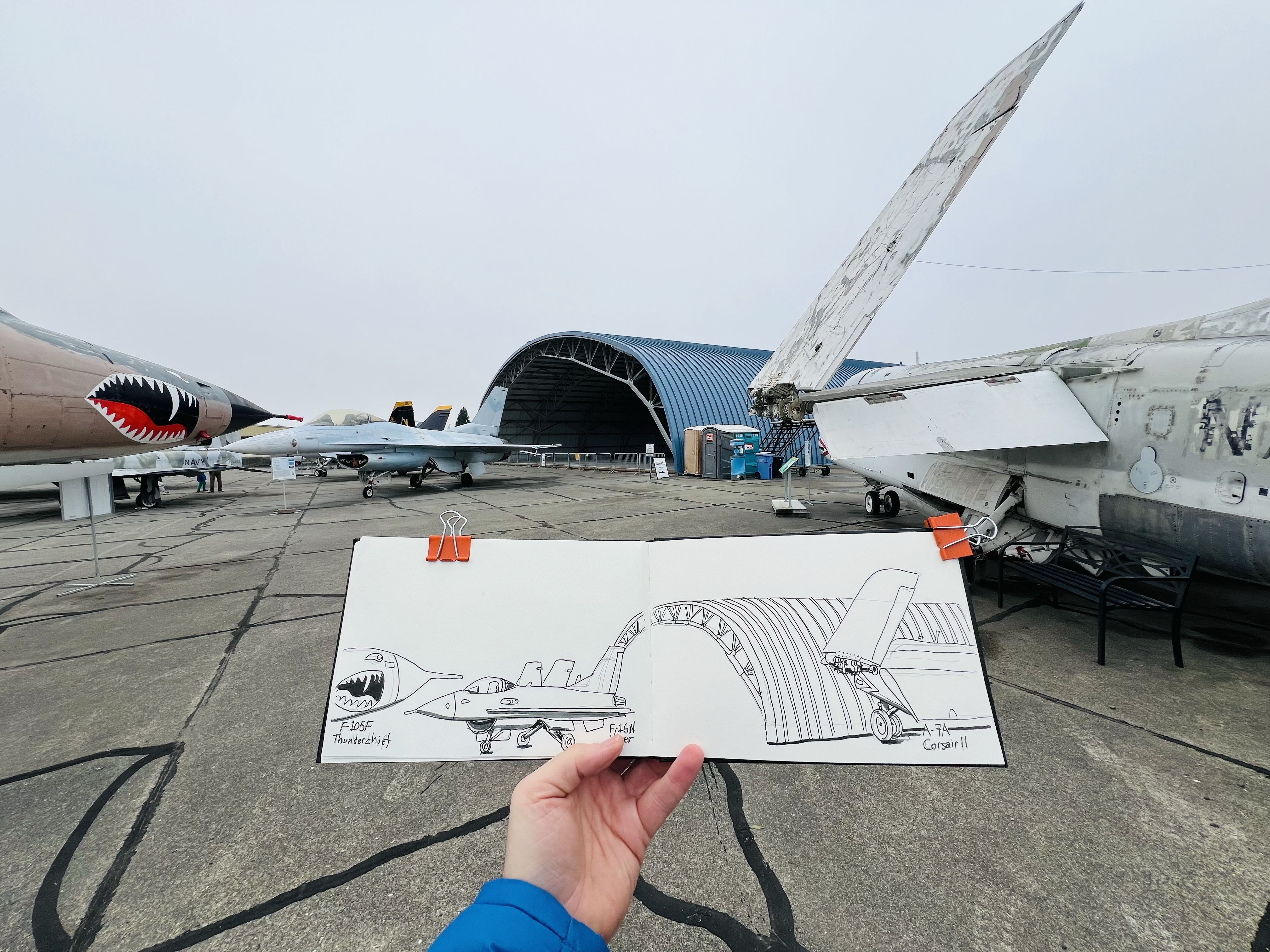
Field sketching at the airfield at the Pacific Coast Air Museum. My sketching backrest was an auxiliary fuel tank from a F-105F Thunderchief.
The hangar was featured in a very short clip of the epic comedy, It’s a Mad, Mad, Mad, Mad, World. It is a screwball road film where a cast of crazed characters, featuring a who’s who of comedy, races across the west coast to find some stolen money ($350,000). Most race in cars while a few travel by air.
Buddy Hackett and Mickey Rooney are forced to fly the twin engine Beech 18-D because the pilot/owner Jim Backus is passed out drunk or possibly dead in the back.
What ensues is some wild flying including buzzing a control tower and flying through a billboard sign (this stunt was the film’s most dangerous and caused damage to the plane).
The pilot who performed the stunts was the one-legged Frank Tallman, a veteran and legend Hollywood stunt flyer.
The stunt was performed on December 4, 1962. Tallman made two low test passes and then lined up to the west of the hangar and speed through, pulling up to avoid hitting trees to the east. He did the stunt in one take and refused to do another pass.
Looking west through the hangar. Tallman flew the Beech 18-D from this direction. The hangars in the background were not built in 1962.
The hangar is now part of the Pacific Coast Air Museum which has an impressive collection of aircraft including the F-4 Phantom, F-16 Viper, F-14 Tomcat, F-15 Eagle, F/A-18 Hornet, A-7A Corsair, A-4 Skyhawk, and many more.
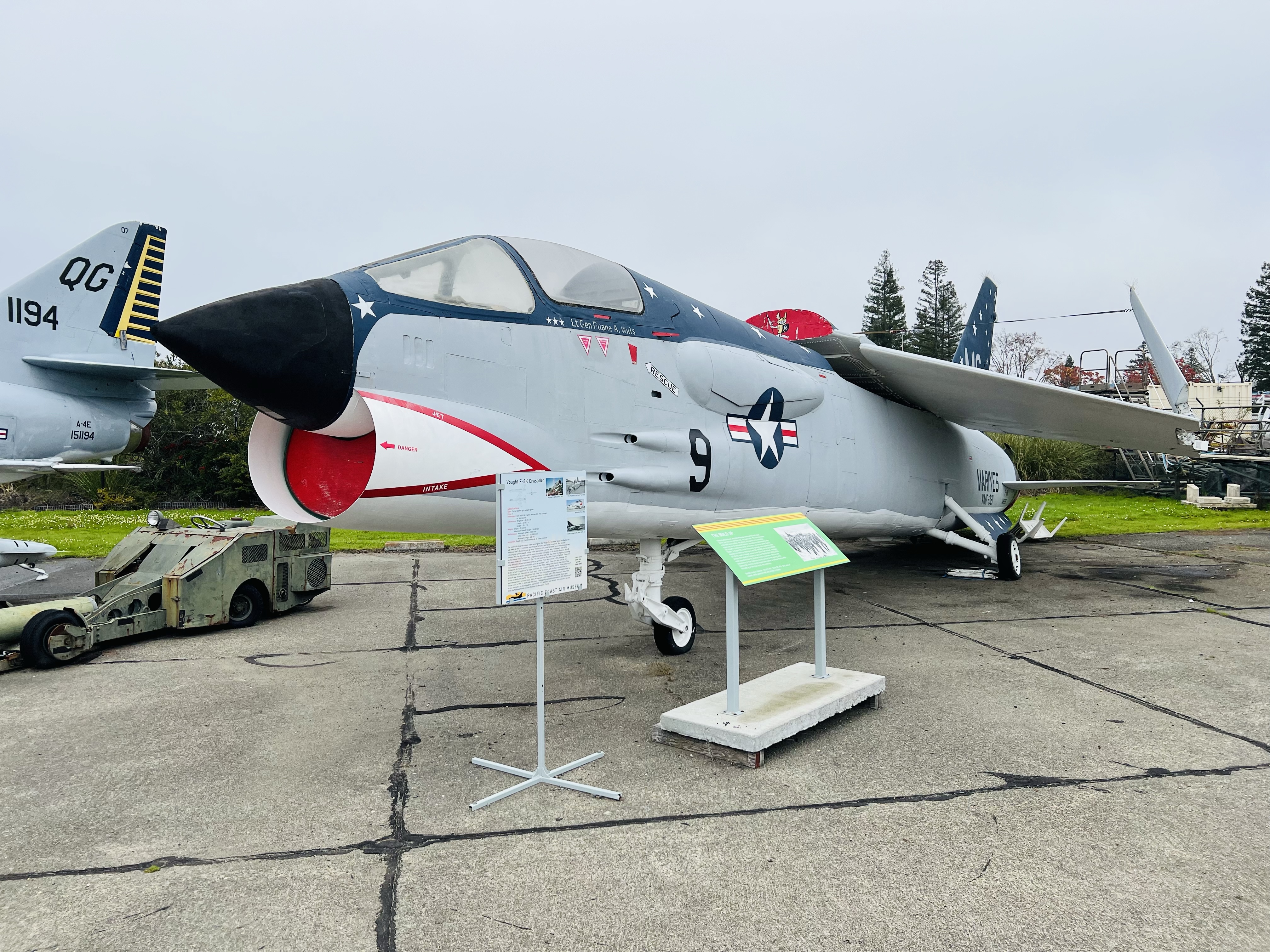
This F-8U Crusader was essentially a playground toy in a San Franciscan park, also known as “the plane in the park”. It was at Larsen Park for 20 years and I remember seeing it as my family drove north on 19th Avenue in the Sunset District. The plane was damaged from vandalism and the foggy maritime weather and was moved to Santa Rosa in 1993 and cosmetically restored.
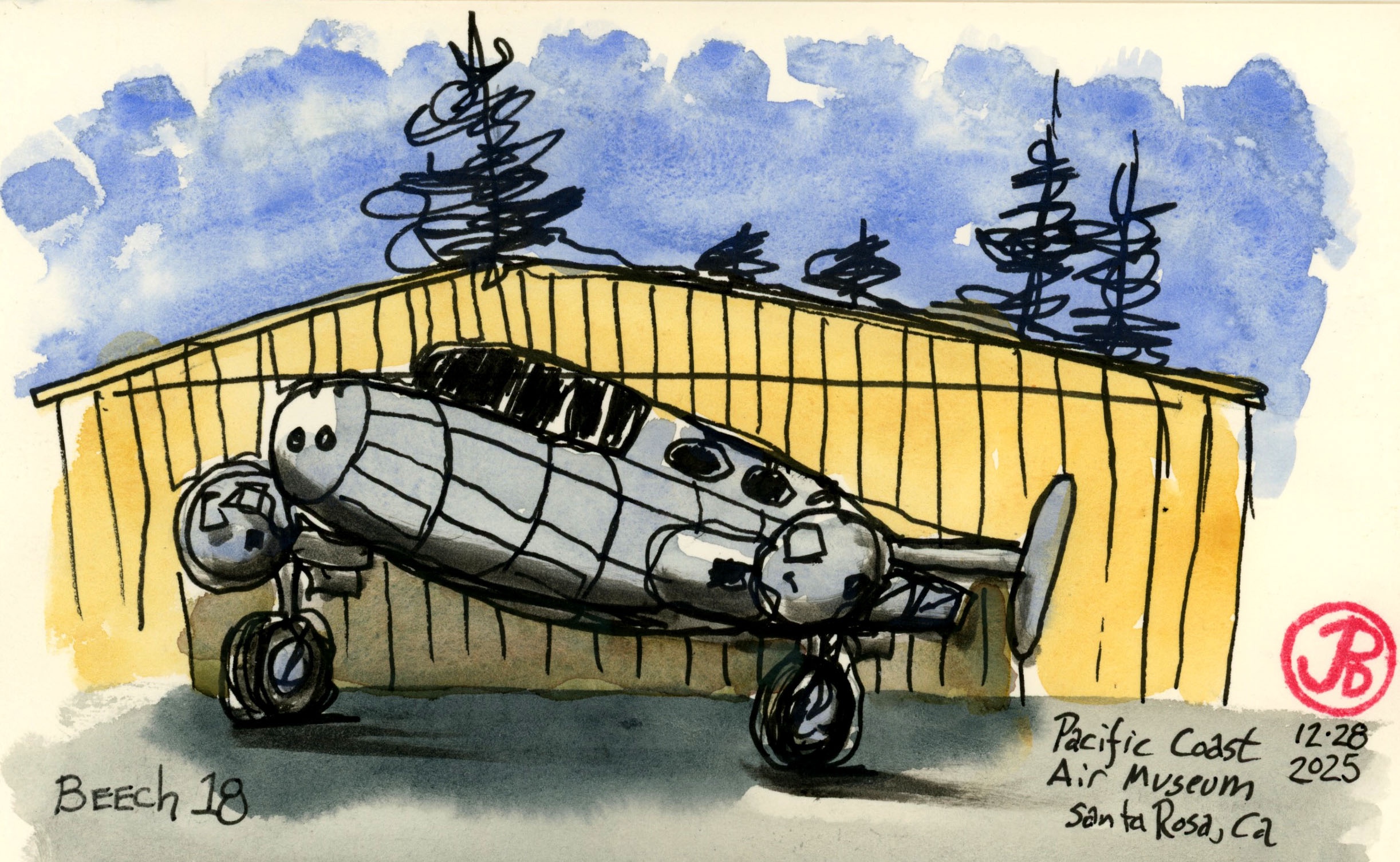
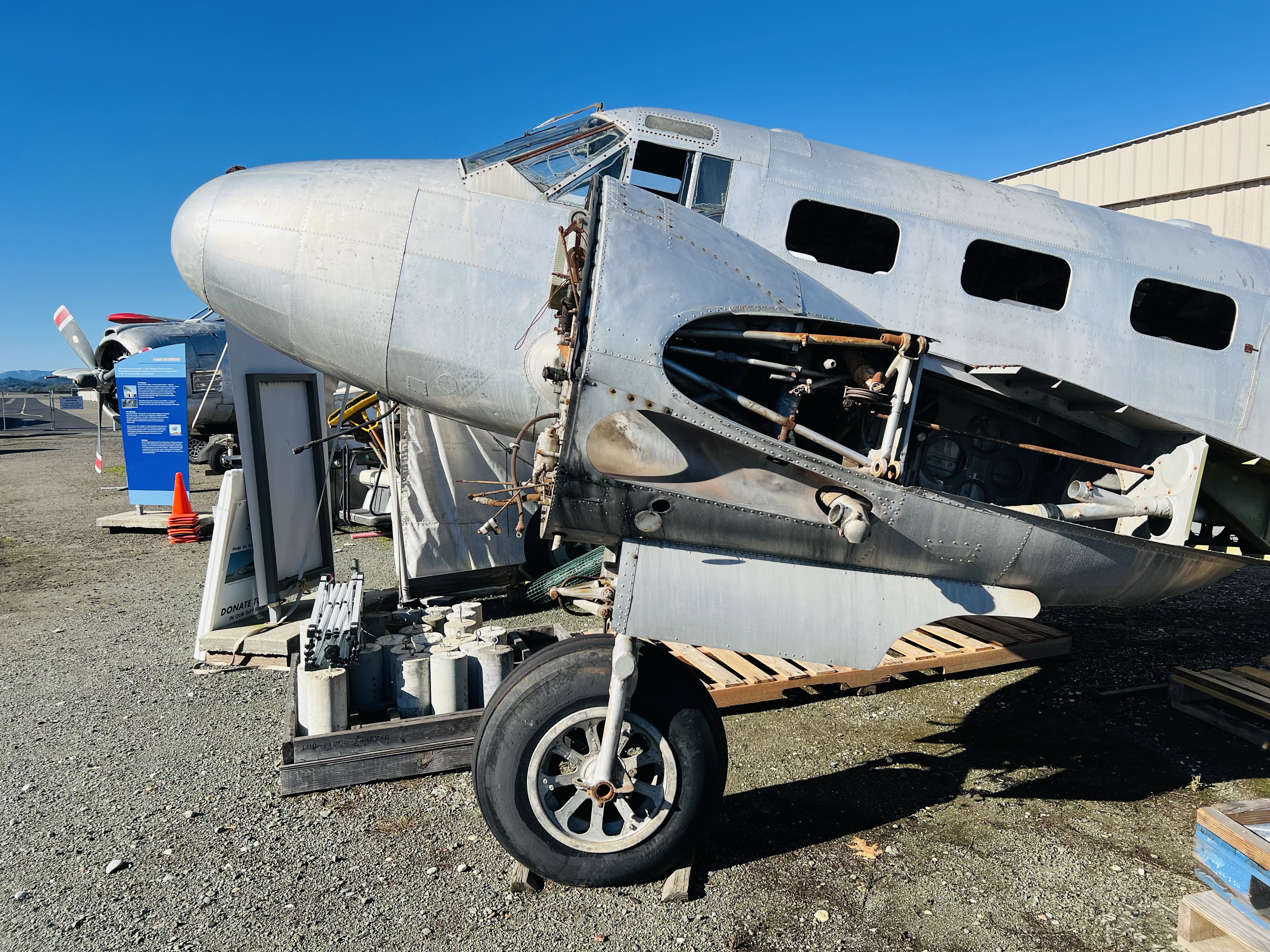
Beech 18
Near the perimeter fence and away from the limelight of the other planes in the museum’s collection sits a silver wingless, moterless twin engine plane that has clearly seen better days.
This is a Beech 18, the same plane that flew through the Butler Hangar.
In the future, plans are to restore the plane (they have the wings somewhere) and display the Beech next to the hangar made famous in an epic comedy.
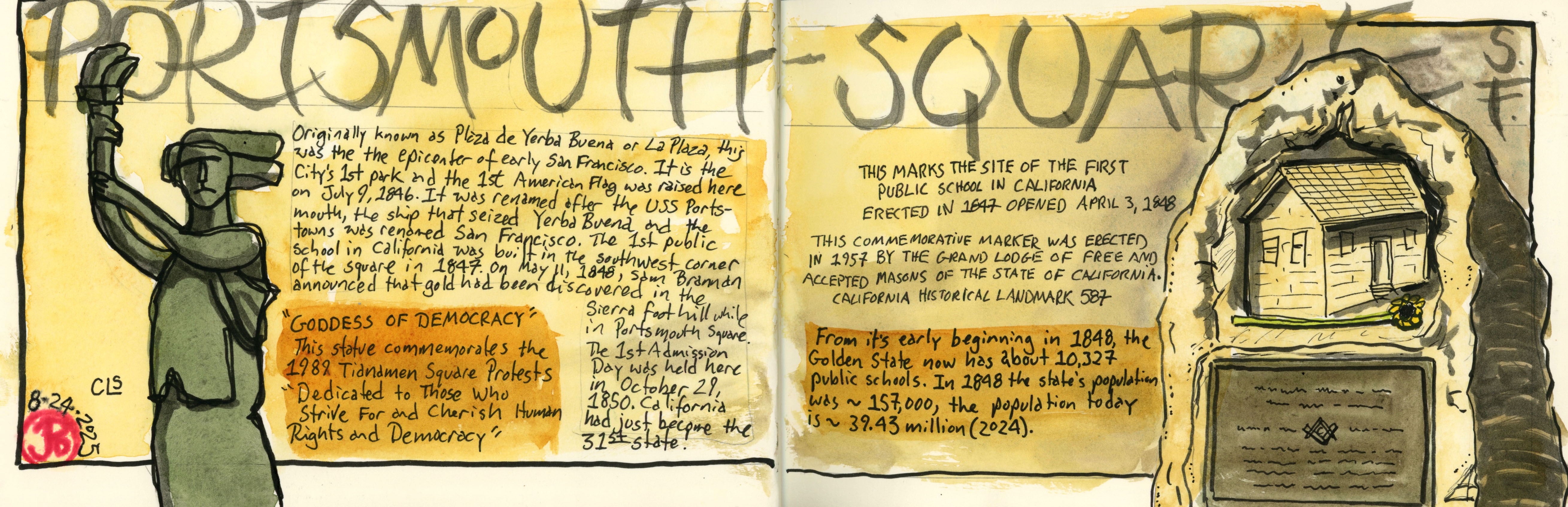
I decided to start a series of urban sketches highlighting neighborhoods in my hometown of San Francisco and I decided to start in a park of many firsts.
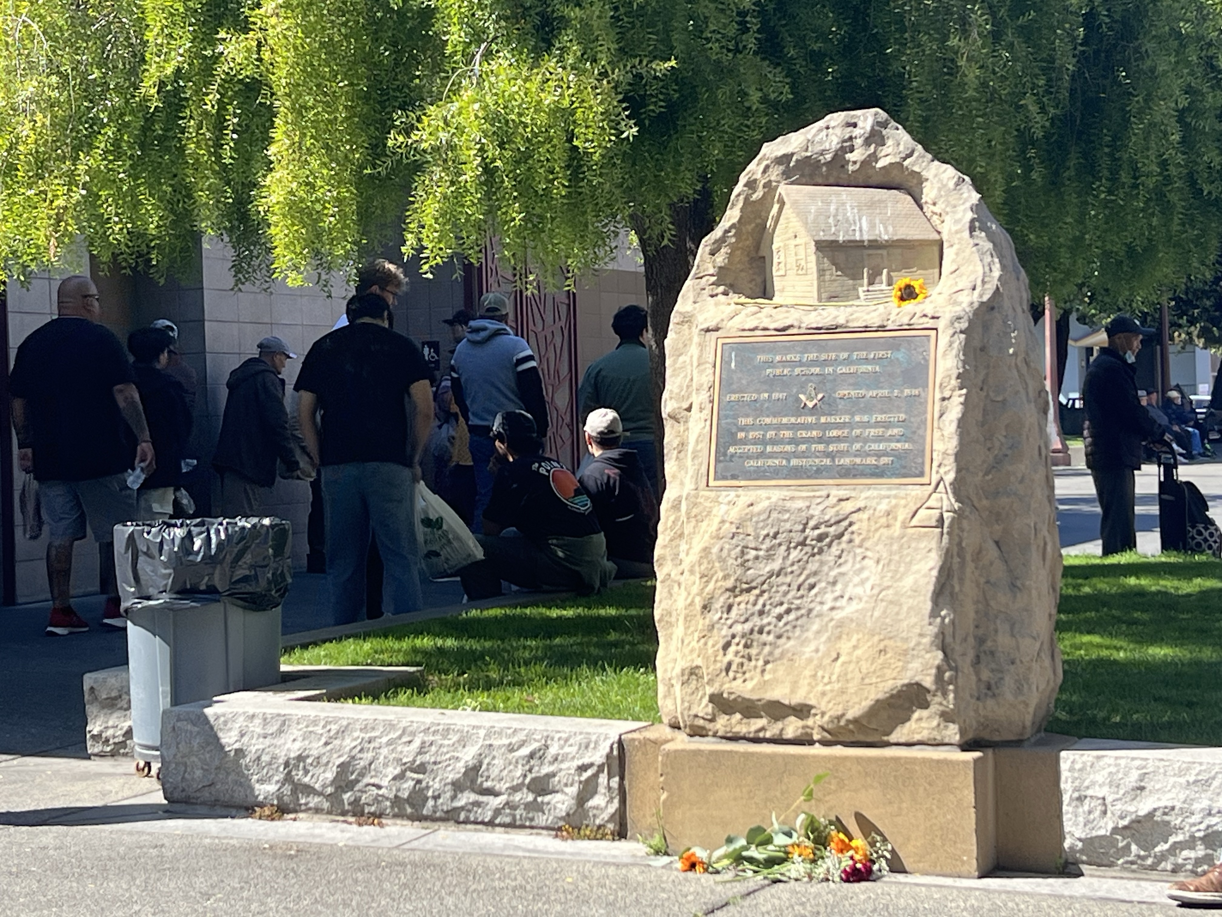
Portsmouth Square is the oldest park in San Francisco and was originally called Plaza de Yerba Buena or simply La Plaza in the pre-statehood days. This was the epicenter of the town and it was here where the first public school was built in 1847. A year before the discovery of gold in Coloma in January 1848.
It was also here that the first American flag was raised.
This seemed like a location worth sketching and the anchor of the spread and my reason for the visit was the monument to the first public school in the Golden State. And as a public educator, and as a student of California’s public schools, I should pay my homage and sketch it.
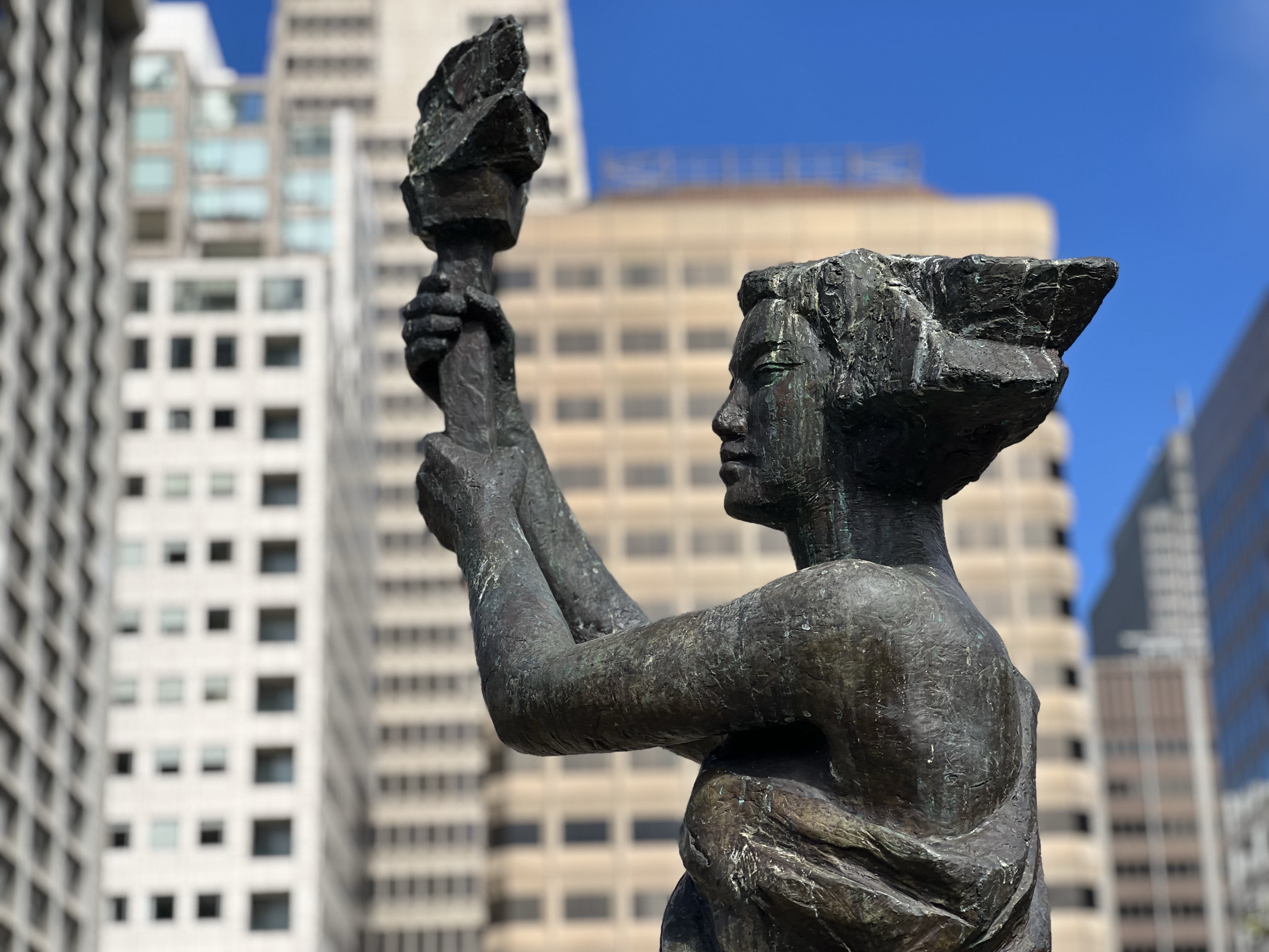
Also in Portsmouth Square is another statue that I added to my spread. It is titled “Goddess of Democracy”.
This is a smaller replica of a statue erected by activist-artists in Tianamen Square in 1989. The Portsmouth statue was created by Thomas Marsh and dedicated in 1994.
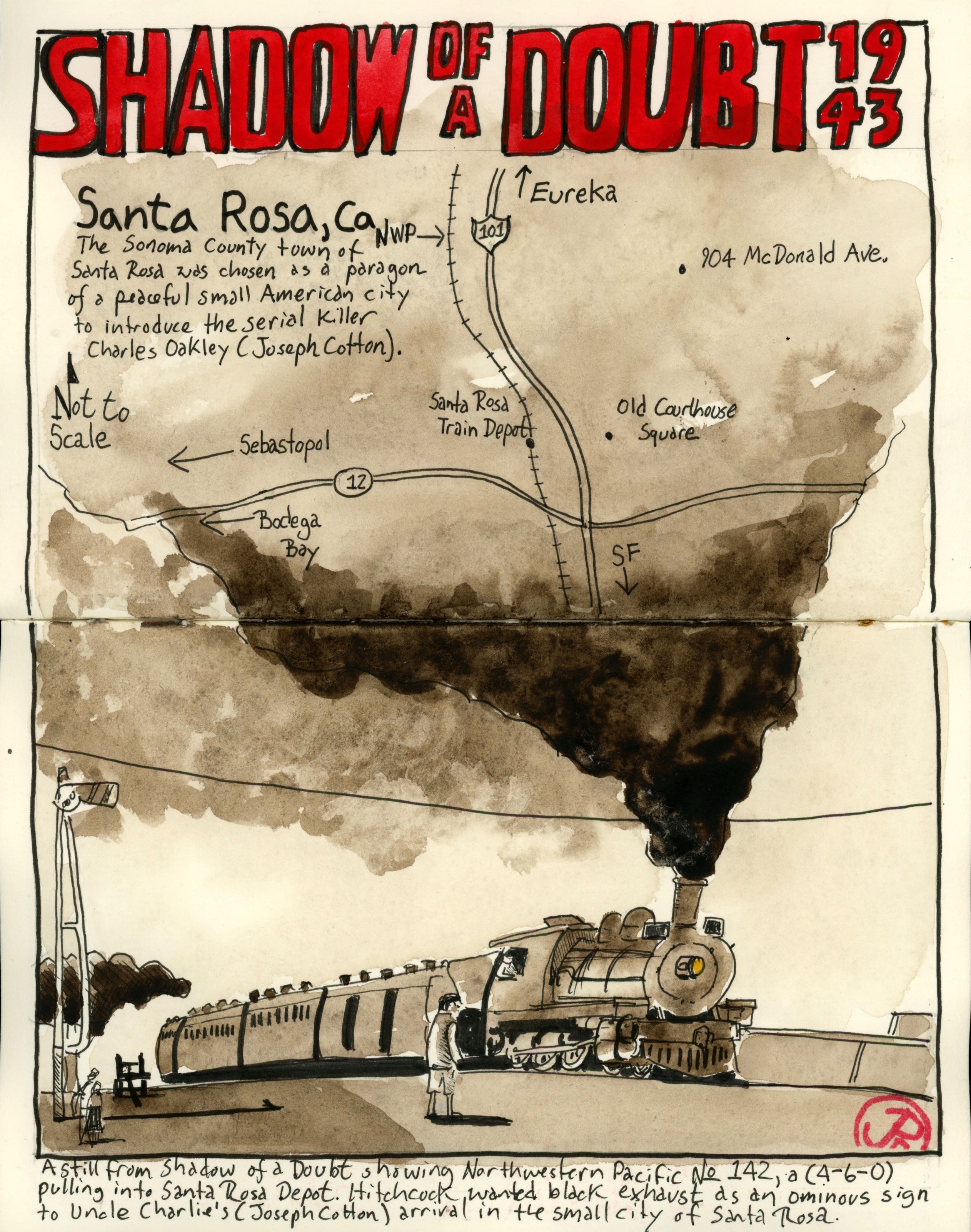
There are two other Santa Rosa Shadow of a Doubt filming locations I wanted to visit and sketch.
The first was a ten minute walk from the Railroad Depot under Highway 101 into downtown.
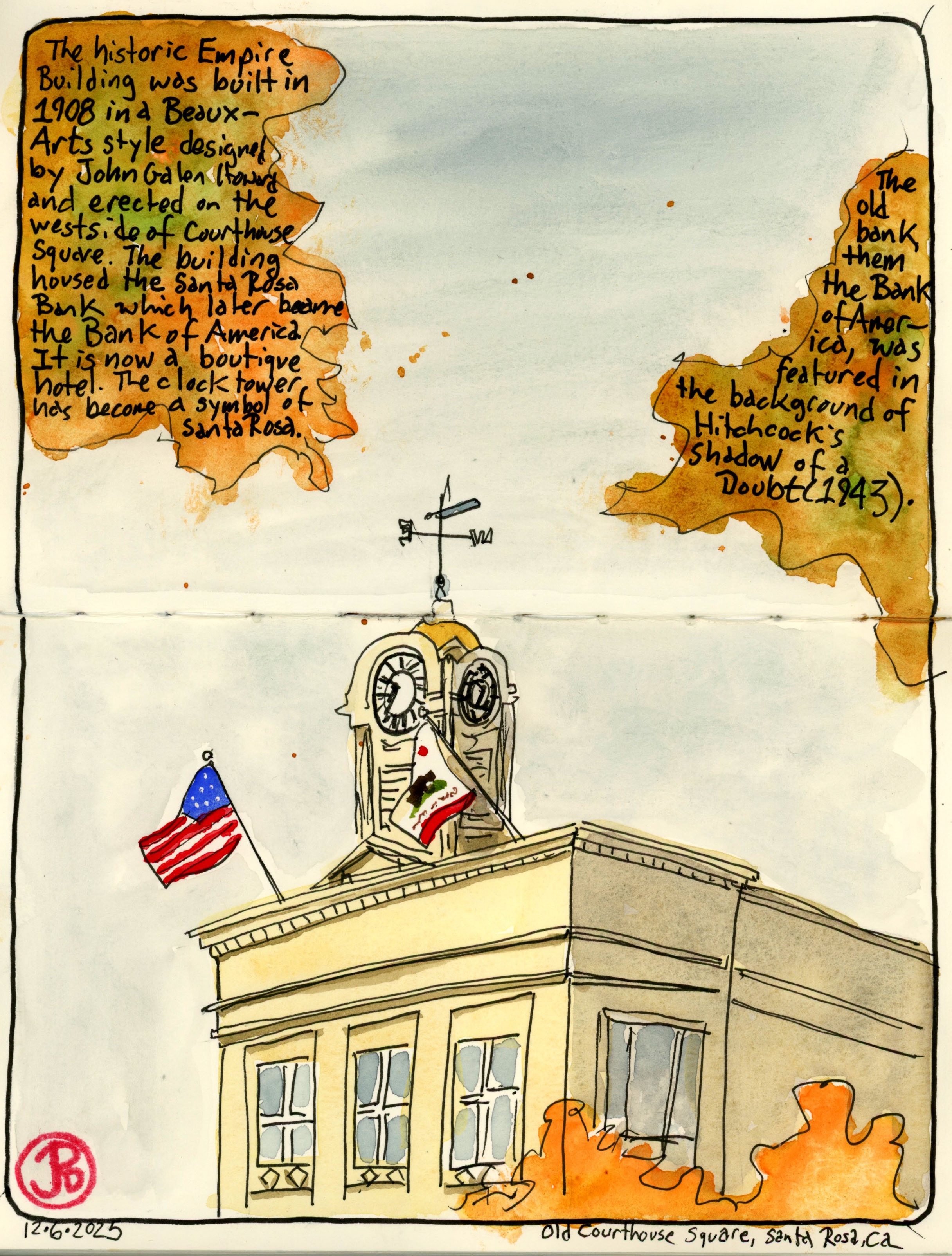
My destination was Old Courthouse Square. And my subject was the 1908 Beaux-arts building crowned with an iconic clock tower. This is the historic Empire Building on the western side of the square. I had previously mistaken the building for the old courthouse which was damaged by the 1906 Earthquake and later torn down.
The Empire Building now houses a boutique hotel.
The Empire, then a Bank of America, is prominently featured in the background of the film during scenes with Charlie, or the two Charlies, walking in downtown Santa Rosa.
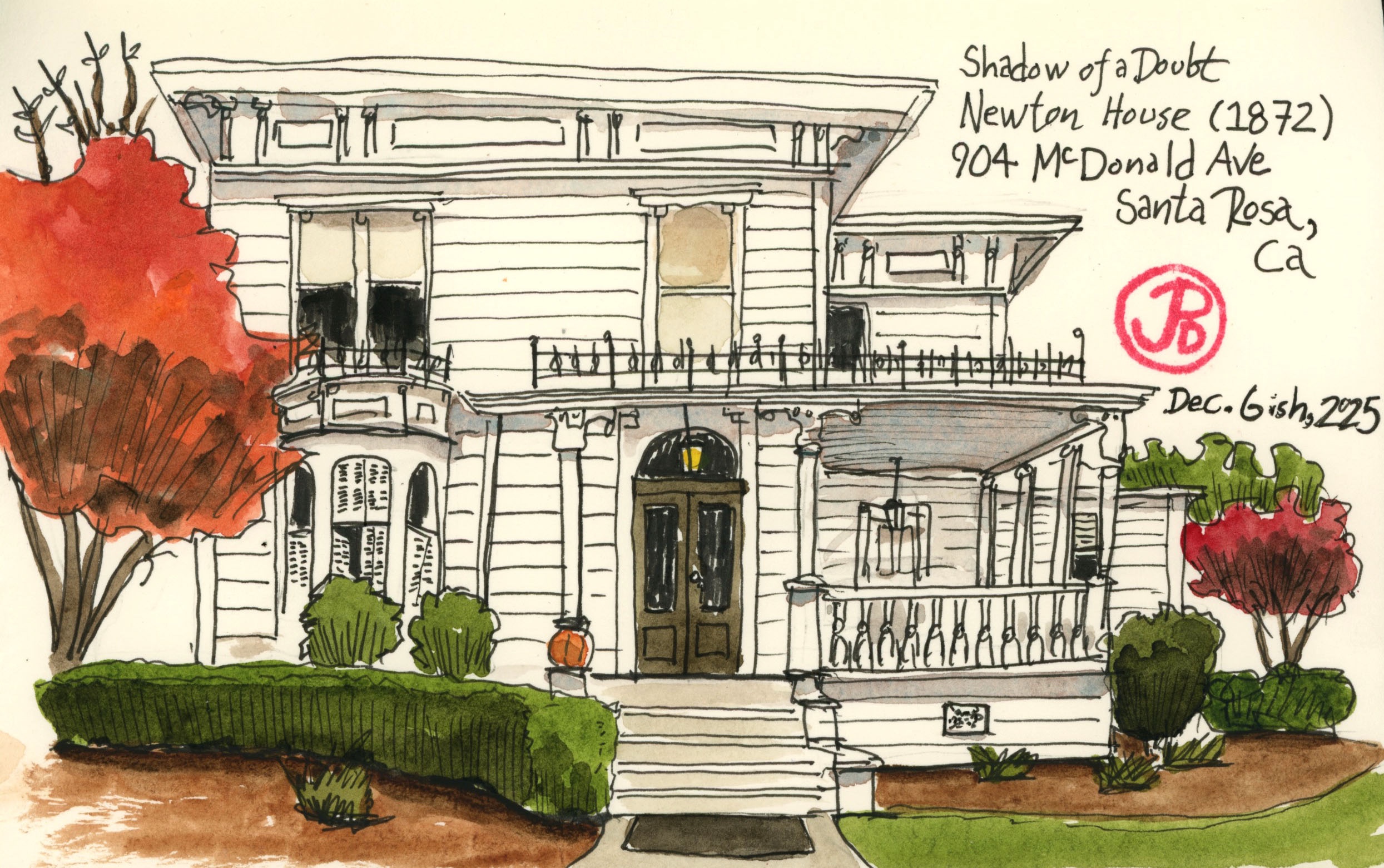
There is one other house I wanted to visit again in Santa Rosa on a quiet residential street that was used as the Newton’s house where Uncle Charlie stays during his visit.
The Italianate-style house at 904 McDonald Avenue was built in 1872. The beautiful house’s exterior was used as the Newton Family home where much of the story takes place (interiors and a few exteriors were shot on a soundstage). The setting underscores that evil can enter a place you think is safe and secure: your own home.
I wanted to do a field sketch of the house but there was construction work in progress across the street and I didn’t want to disturb the current residents by camping out in front of the house with a sketchbook, so I took some reference photos and sketches from those. Yes I broke the Urban Sketcher’s creed, oh well.
Alfred Hitchcock’s own favorite film was his 1943’s Shadow of a Doubt starring Teresa Wright and Joseph Cotton.
The noir thriller was filmed in the Sonoma County city of Santa Rosa. The city was picked by Hitchcock and his team as a quaint and peaceful small city in which to inject the Merry Widow Murderer (Cotton). The script was cowritten by Our Town playwright Thornton Wilder in an attempt to capture the flavor of life in a small town.
Uncle Charlie is eventually foiled by his namesake Charlie (Wright) as she slowly realizes who he really is and meets his end on a pilot of a freight train (spoiler alert!).
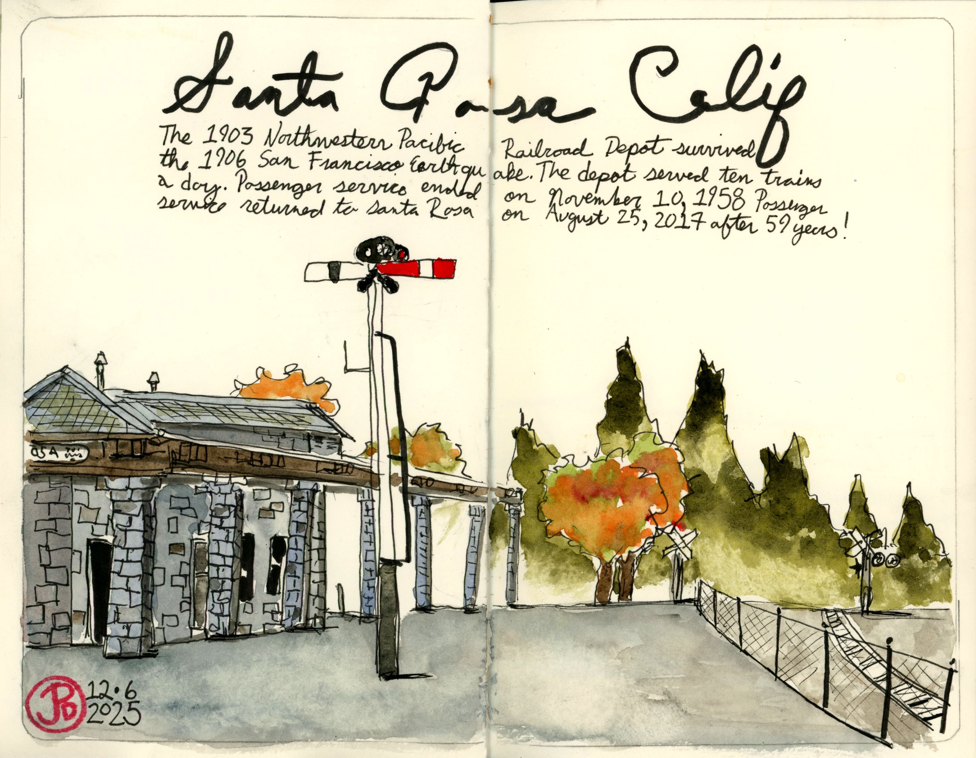
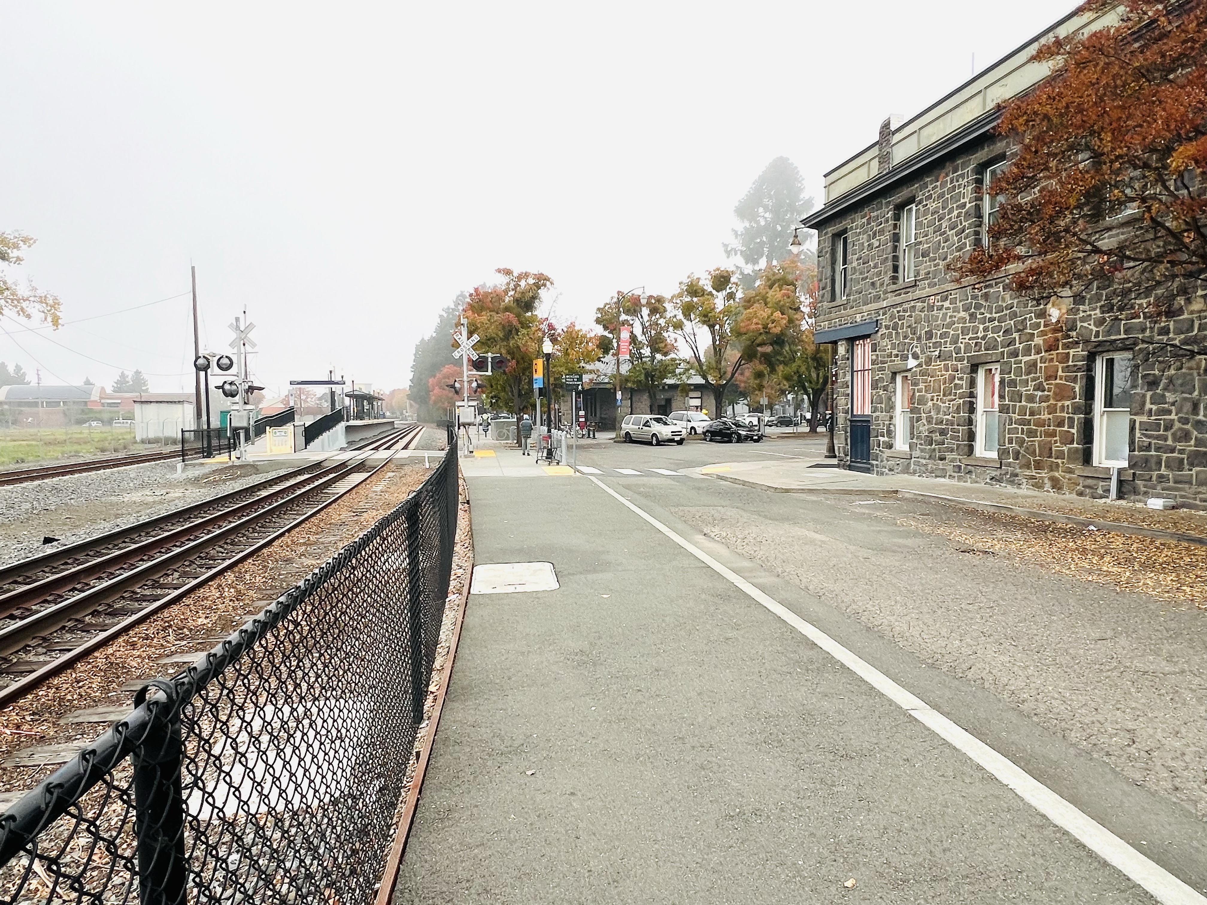
Uncle Charlie first enters idyllic Santa Rosa at the stone Northwestern Pacific (NWP) Depot (1904). The depot looks very much the same as it did in 1943, as it has withstood various earthquakes that have destroyed many of it’s contemporary surrounding buildings.
As the train approaches the depot the exhaust from the locomotive is an ominous pitch black and as the train pulls past the camera, a shadow envelopes the platform. This was all planned by Hitchcock as a modern “something wicked this way comes”. The arrival of Uncle Charlie to Santa Rosa.
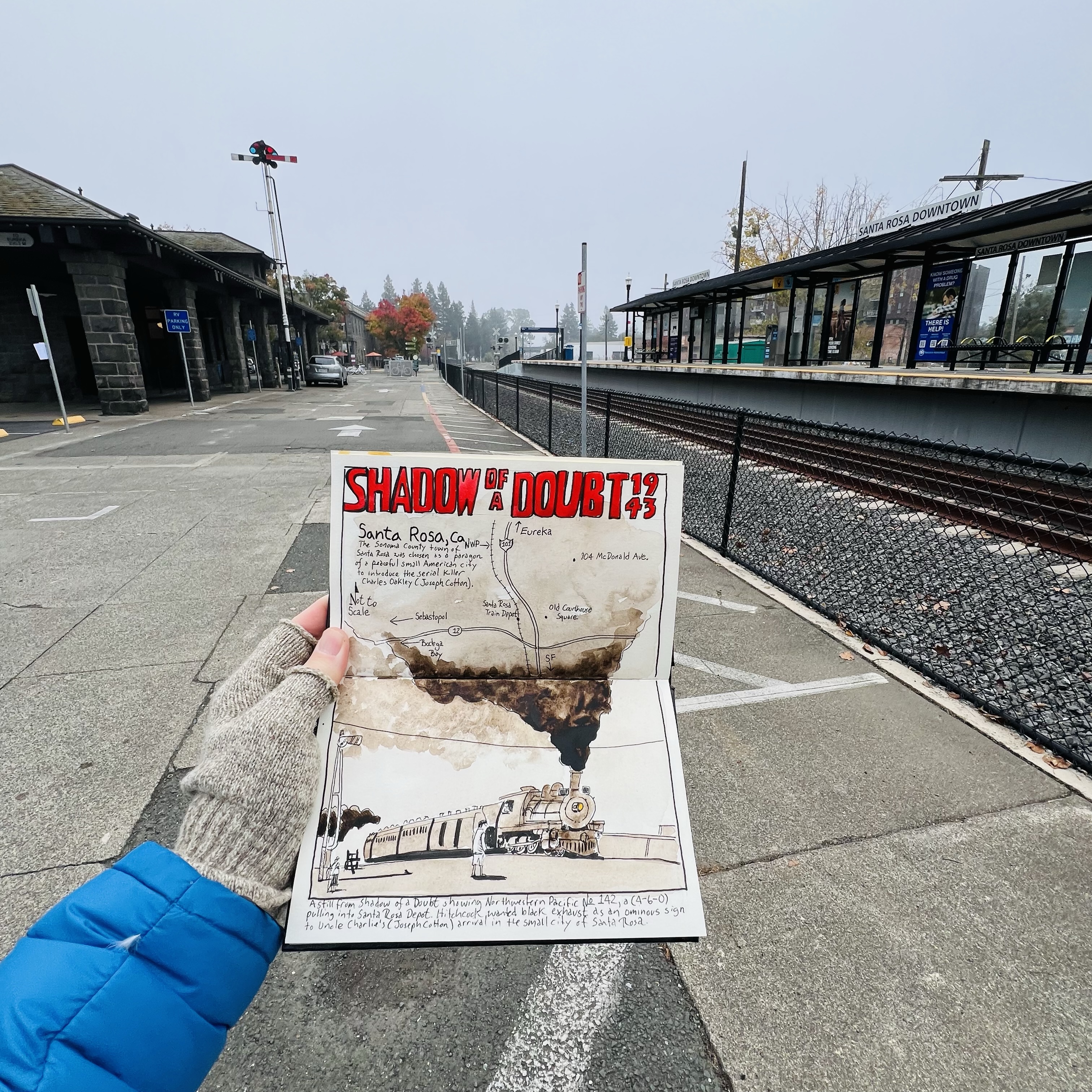
A pre-trip sketch of a frame from the film of Northwestern Pacific No. 142 pulling into Santa Rosa Depot.
I sketched the depot and platform from the approximate camera position when the northbound train first arrives. It was a frigid morning and my fingerless gloves came in handy.
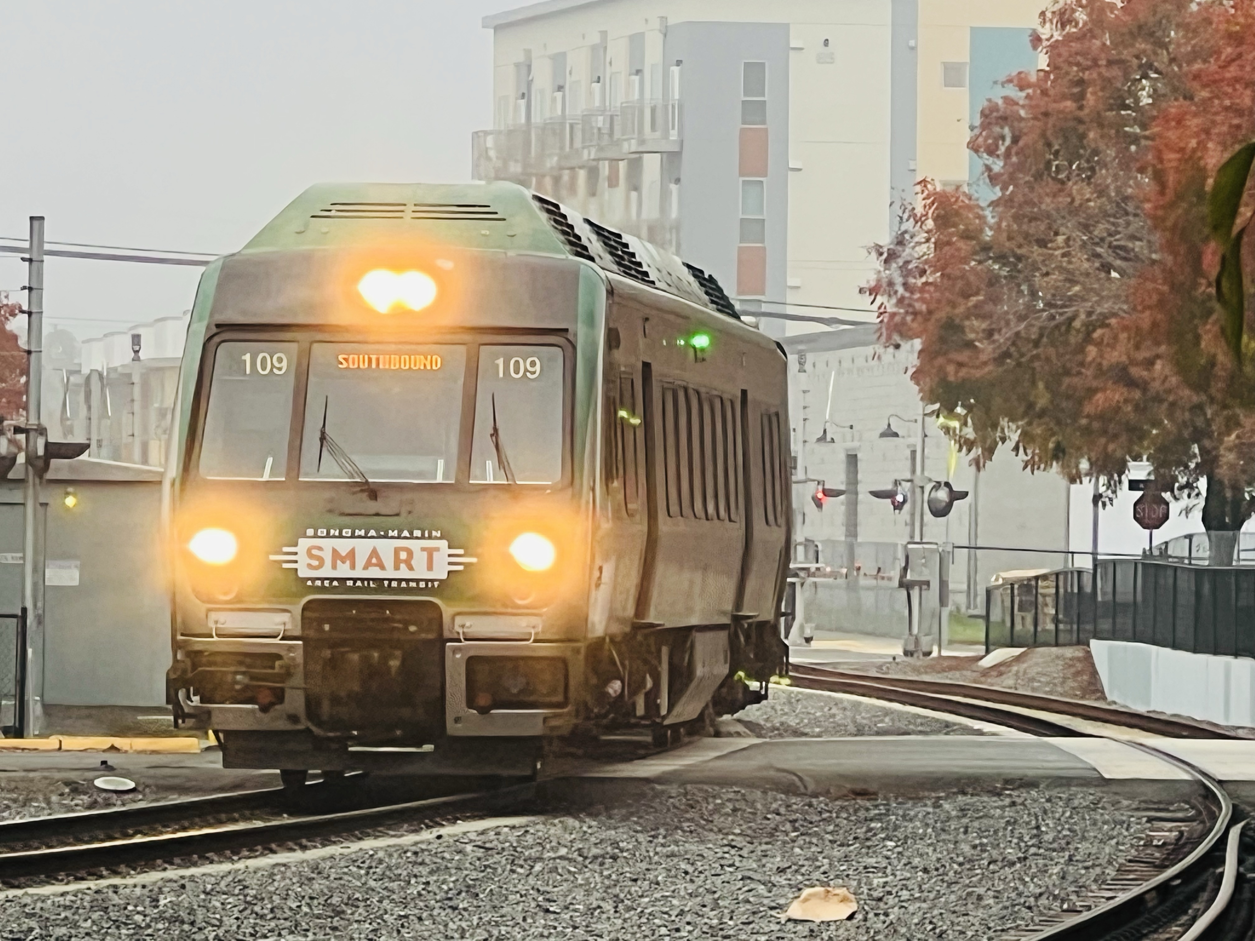
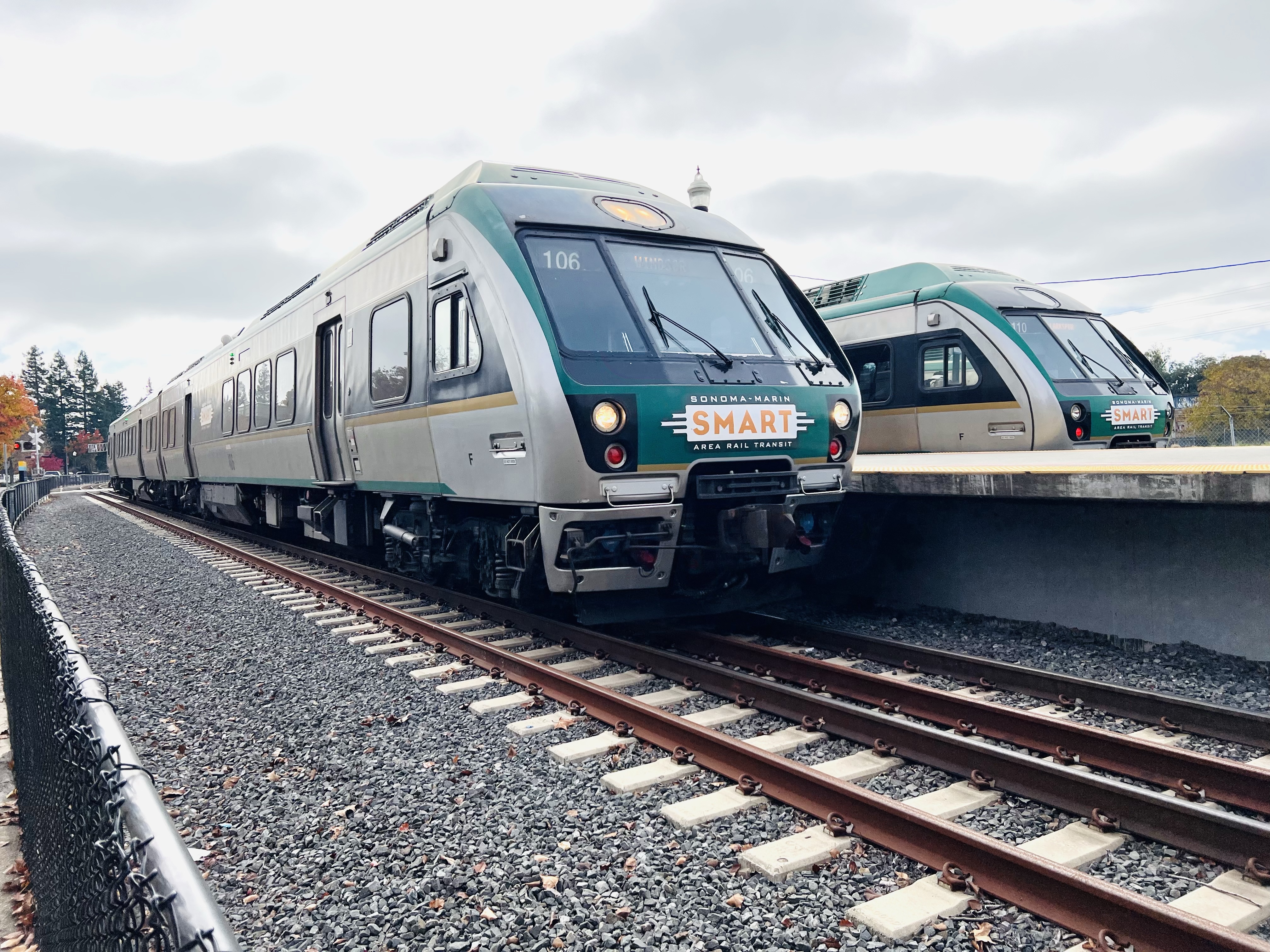
Looking north along the platform towards the depot. This is approximately where Joseph Cotten detrains from the last passenger car.Passenger service to Santa Rosa ceased in 1958. After 67 years, passenger service is alive and well at the Santa Rosa Depot with the SMART train providing service to Larkspur and north to Windsor. Two SMART trains at the Santa Rosa Depot. The near train is a northbound, heading the same direction as NWR No. 142 at the beginning of the film. At one time the line went north, 230.3 miles, to Eureka, California.