I arrived a day early before my Galápagos cruise started so I hired a guide (Andres) for the day and we headed east over the Continental Divide of the Andes Mountains to Guango Lodge.
There were two birds that I really wanted to see in the area and with birding, you are not guaranteed any.
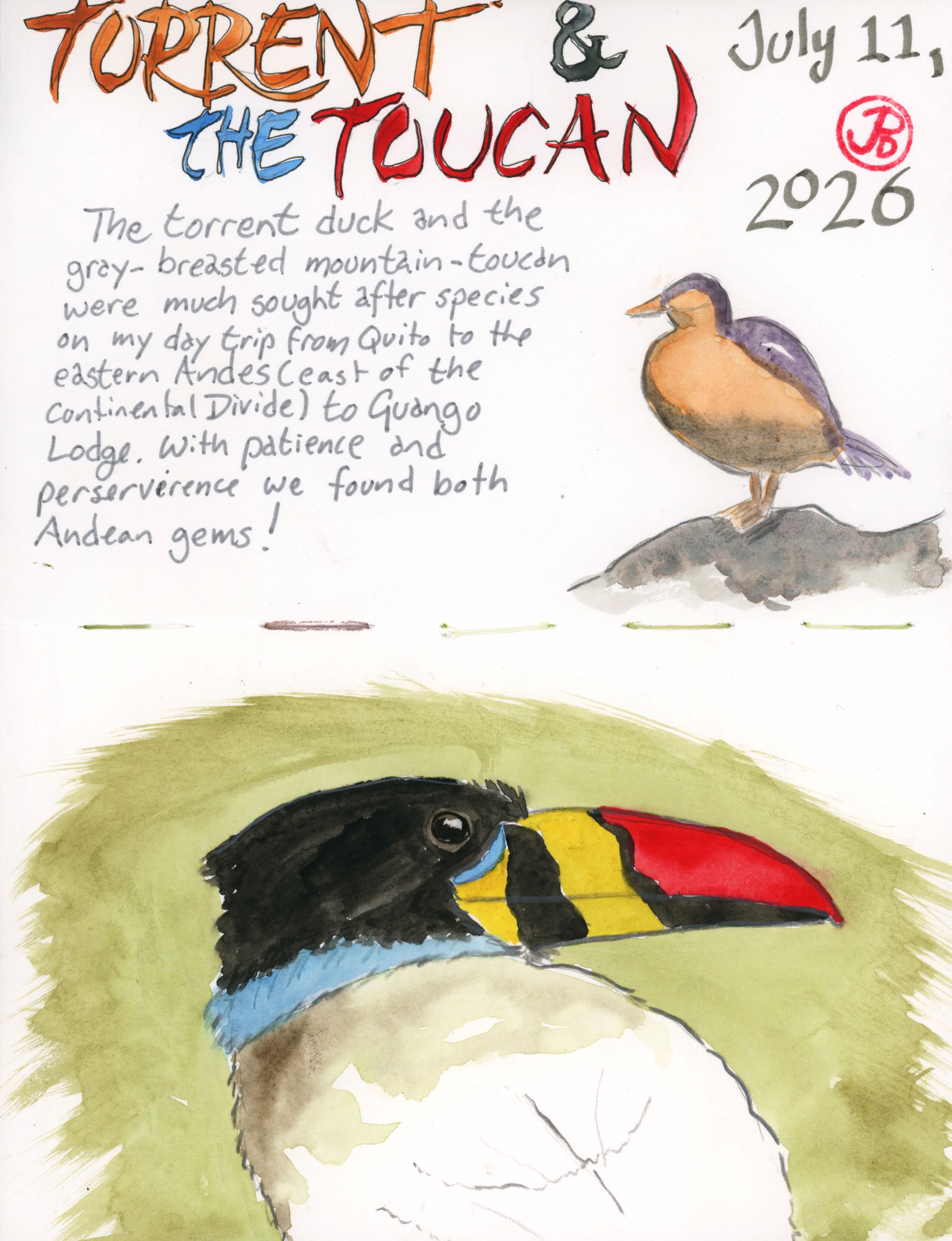
I wanted to add another mountain toucan to my list, on a previous Ecuadorian trip I got plate-billed, and now we walked up the muddy Toucan Trail in our rubber boots looking for a second species.
The trail leveled off at a hide where a vertical forked branch was set up. The caretaker, Daniel, came up behind us to add fresh bananas and grapes to the wooden feeder.
The first bird that visited the feeder was the great thrush. No toucans yet.
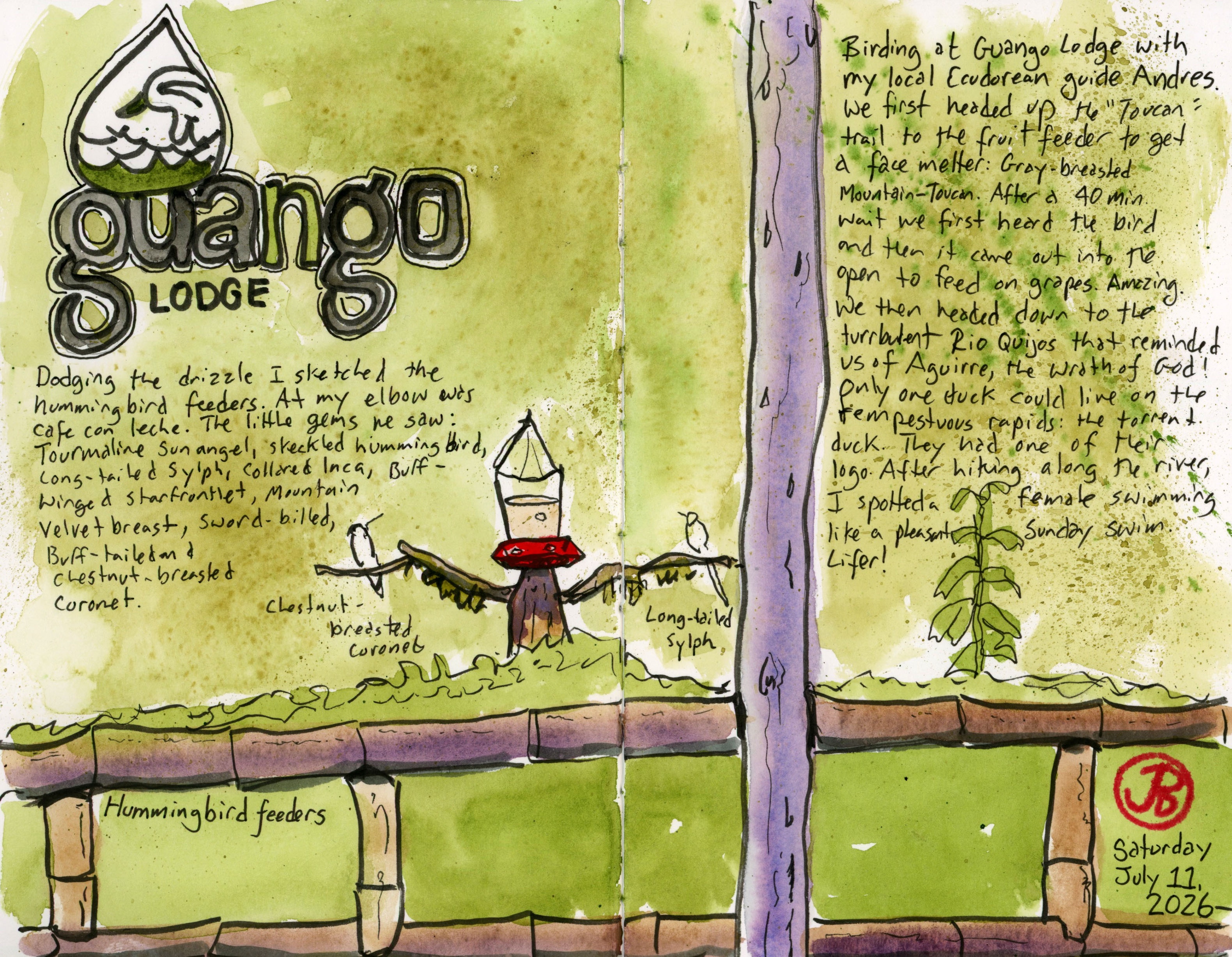
This would take a little patience and the hide was covered to keep us dry. While we waited I pulled out my small softbound sketchbook and sketched the wooden fruit feeder.
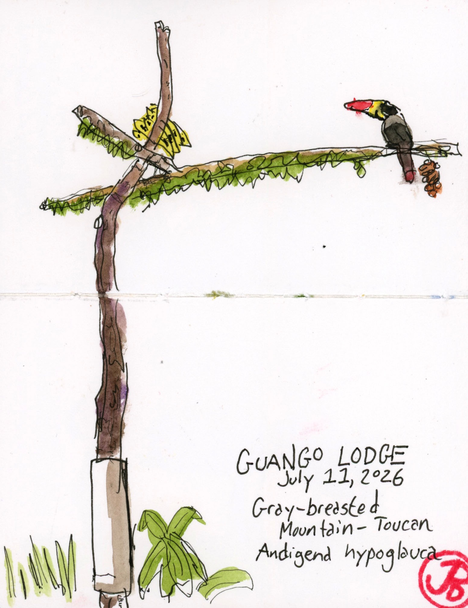
Off to our right we heard the call of the toucan. Now we waited for it to fly into the open and land on the feeding perch. The bird was cautious, making sure it was safe.
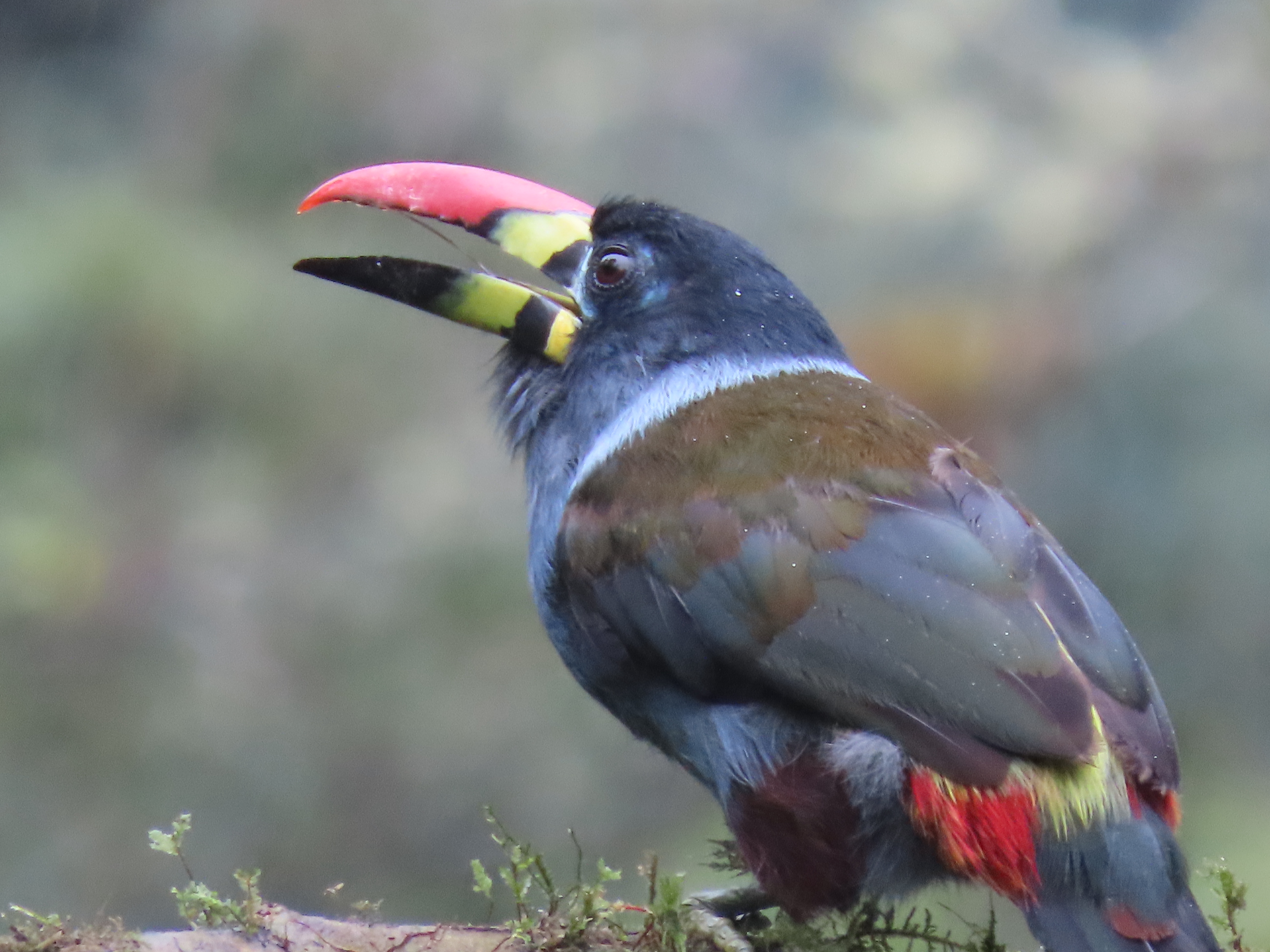
Onto the perch landed the magnificent gray-breasted mountain-toucan. A double hyphen bird of the highest magnitude! Lifer!
After watching the toucan pull grapes at the feeder we headed back to the river to look for another sought after bird.
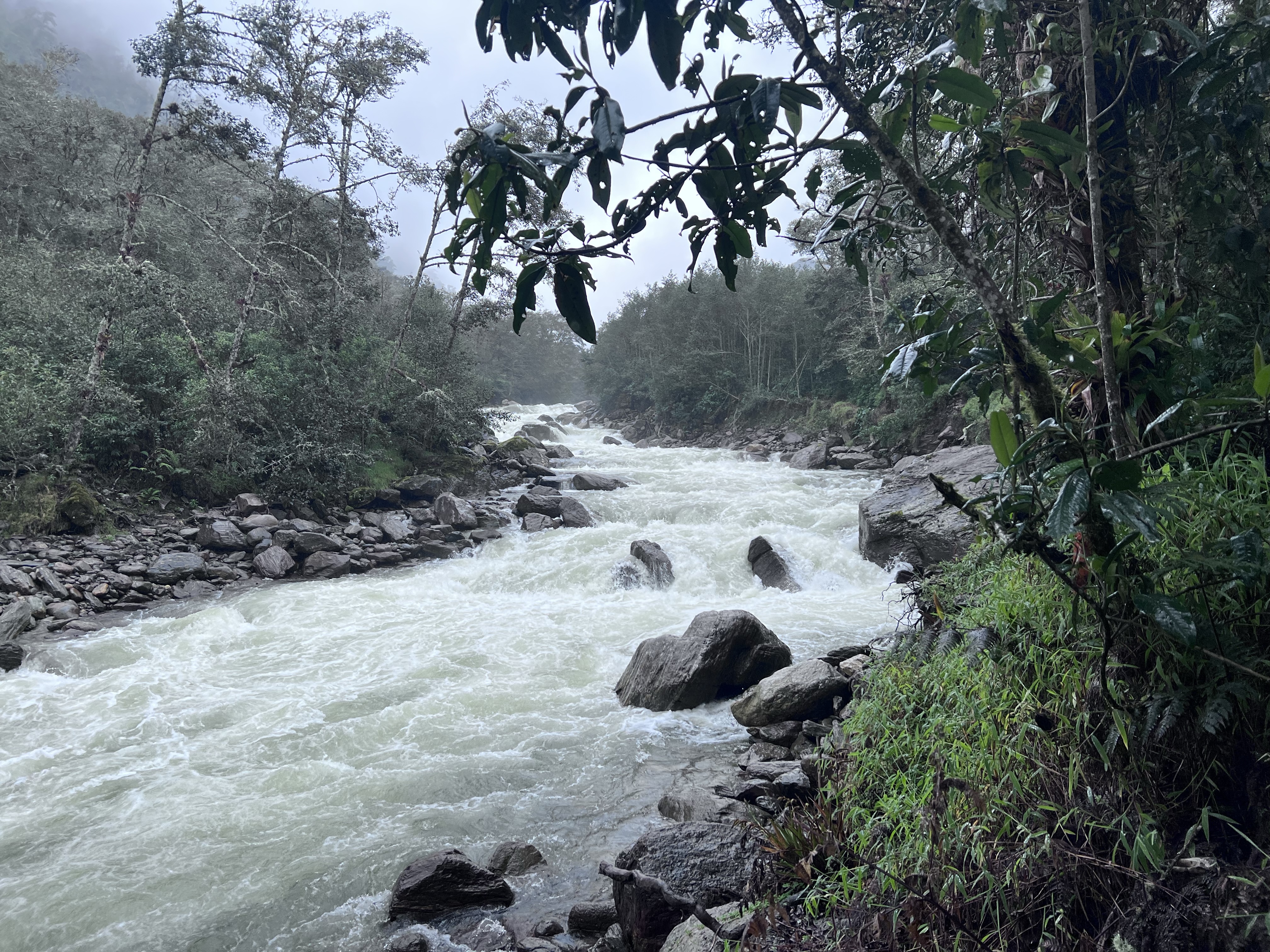
The furious and frothing Rio Quijos cloaked in gray, reminded me of Herzog’s Aguirre, the Wrath of God and Fitzcaraldo. How can a bird possibly survive here among the rapids?
Well one duck not only lives but thrives amongst the Class 6 rapids. And it’s appropriately named the torrent duck.
We walked along the river checking the waters and boulders for this iconic Andean duck.
As we neared the end of the trail I looked downstream and saw a duck bobbing in the frothy rapids. She swam across the river and walked up on a riverside boulder. What an amazingly adapted bird to its turbulent habitat. And what an amazing lifer!
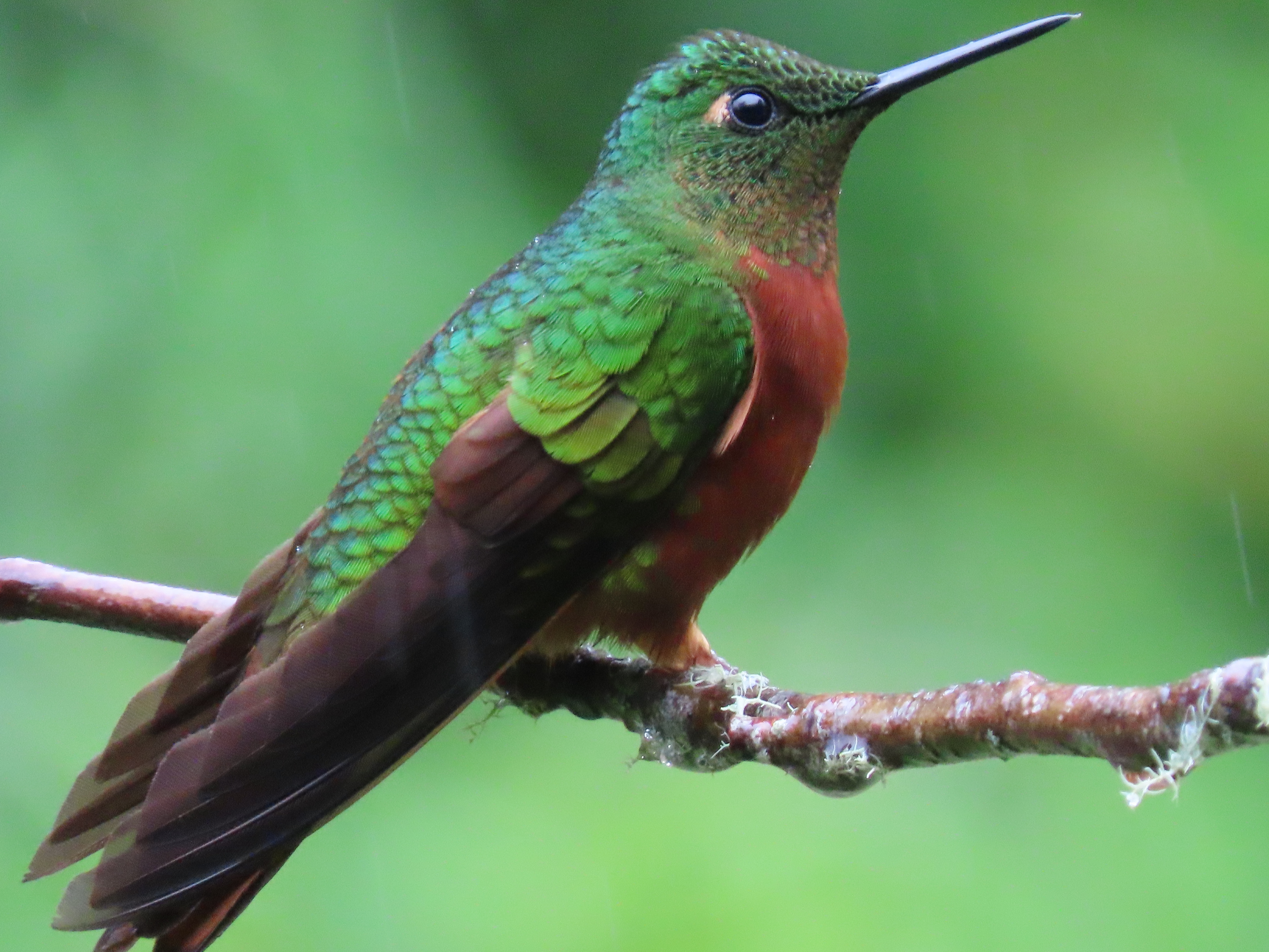
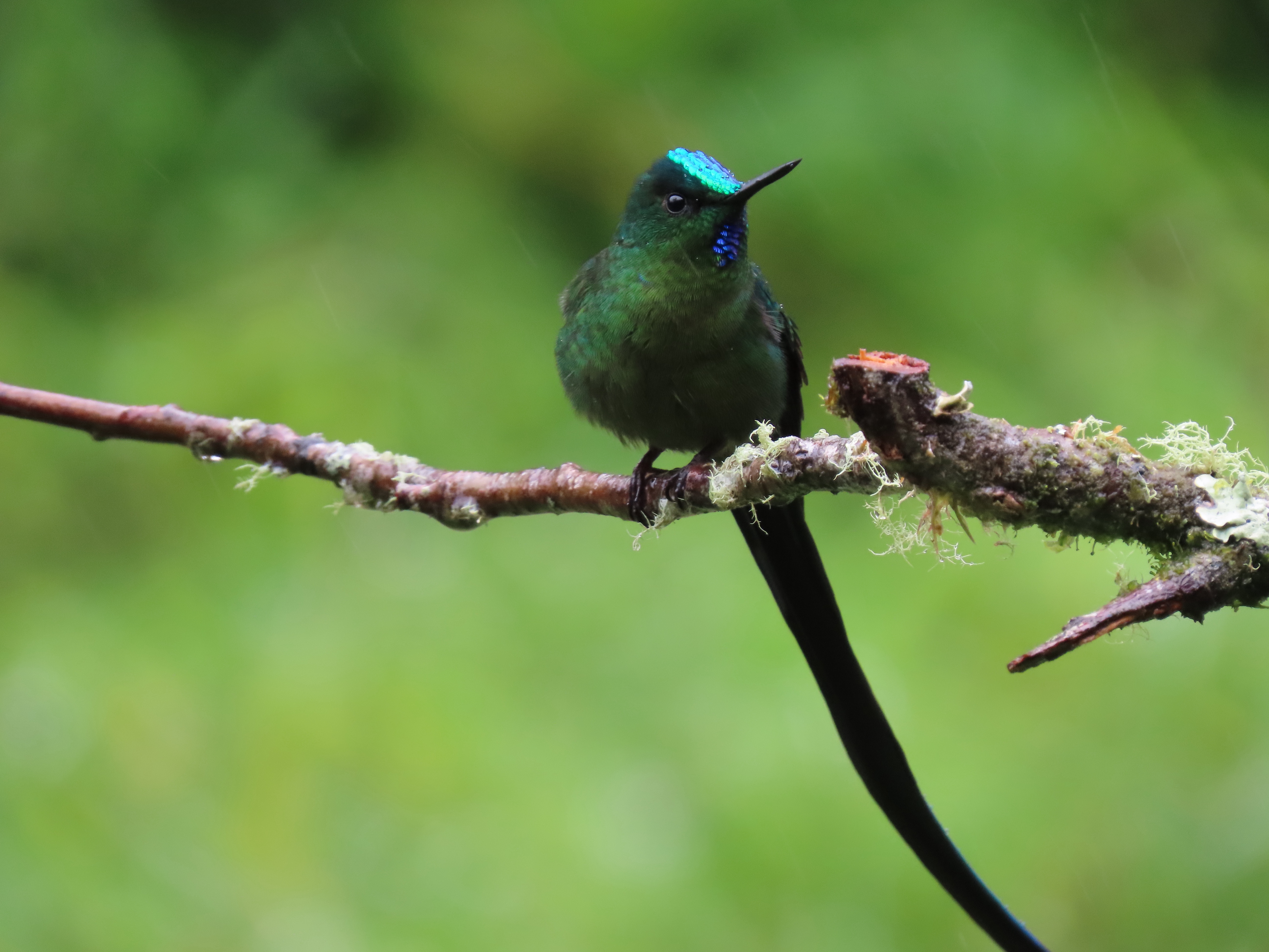
After ticking the toucan and duck we returned to the lodge and sat under a shelter from the permanent mist and drizzle, sipping cafe con leche and looked out at the three hummingbird feeders in front of us.
The feeders were very active and I sketched the scene before me (featured sketch).
Out of the 366 species of hummingbirds in the New World (they are found nowhere else), I have seen a mere 96. I have a lot more hummingbirding to do.
Challenge accepted!
Here are a few photos of some of the visitors to the hummingbird feeders at Guango.