The Santa Cruz County town of Scotts Valley is bisected by Highway 17. The highway sees a lot traffic as travelers from the Bay Area head to the seaside town of Santa Cruz.
The Santa Cruz area already has it’s attractions, the Santa Cruz Beach Boardwalk and the Mystery Spot being some of the most visited. Scotts Valley needed to capture some of those tourist dollars.
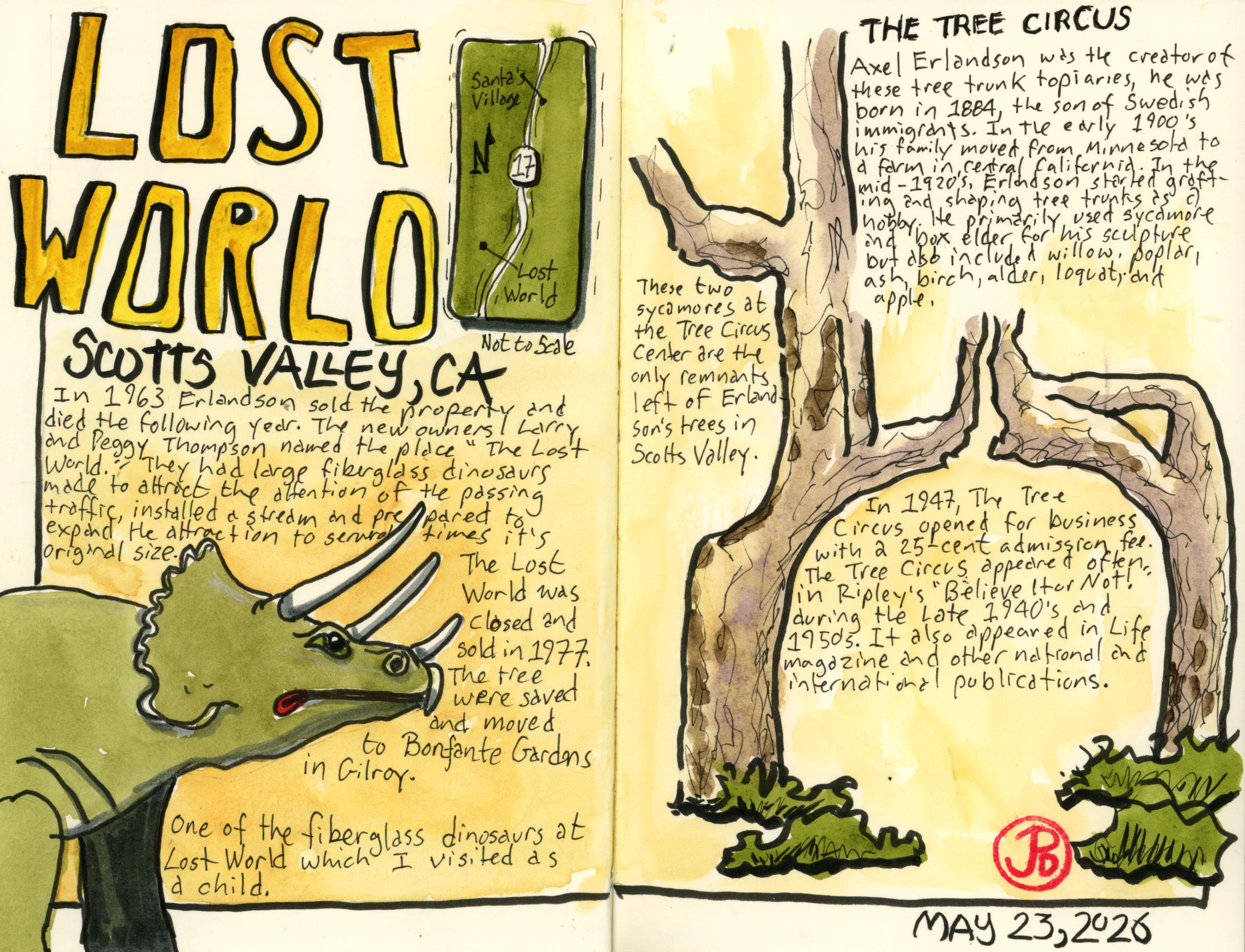
Two attractions were build on either side of the highway. Both attractions are now gone and there is little evidence that they ever existed. But I was going to sketch the only trees left in Scotts Valley that were part of the attraction called The Tree Circus.
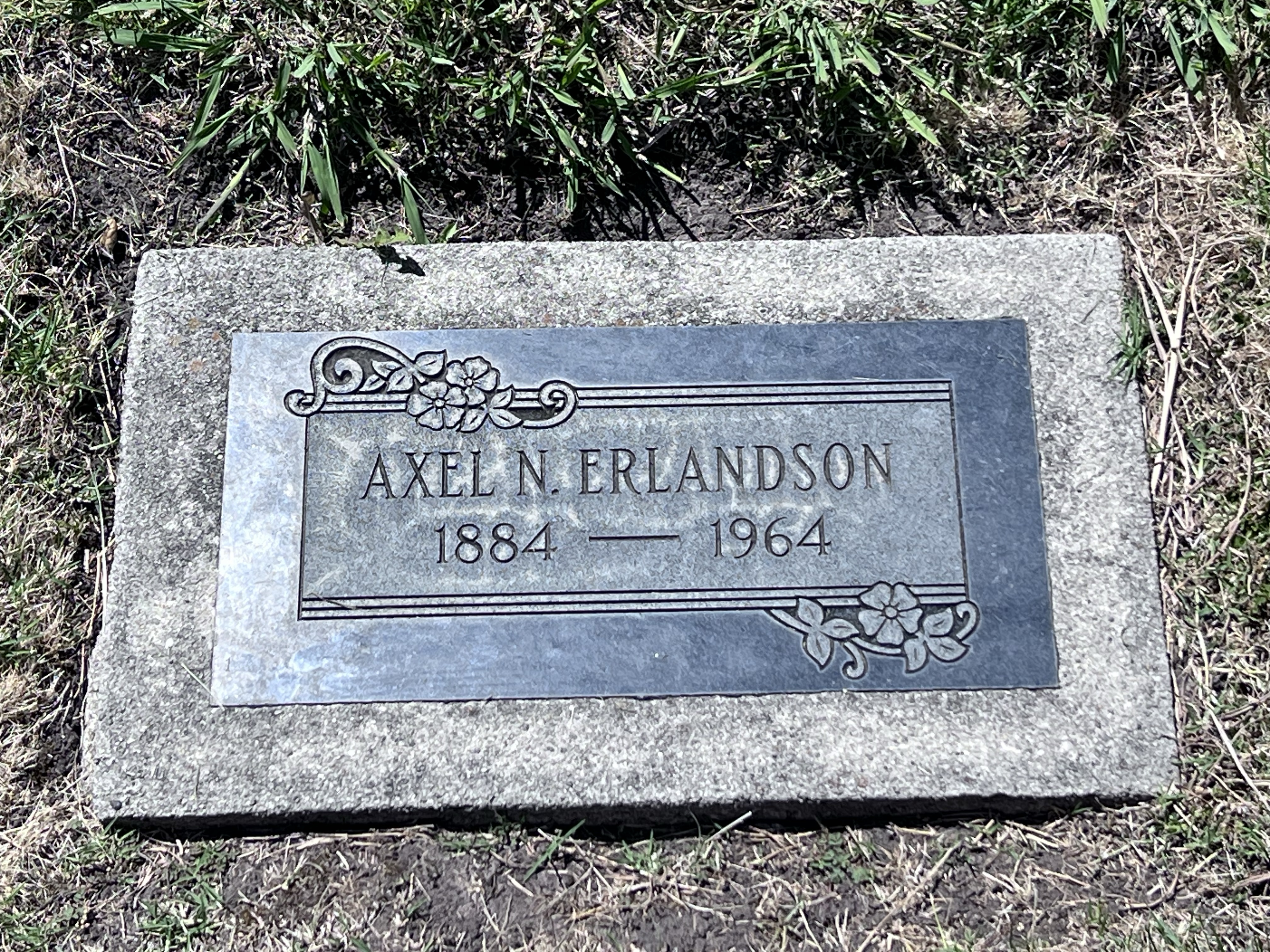
The genesis of the Tree Circus was a Swedish-American named Axel Erlandson. In the early 1900s Erlandson’s family moved from Minnesota to California’s Central Valley.
While there, Erlandson began grafting and shaping trees in various shapes. He primarily used sycamores and box elder for his arboreal sculptures.
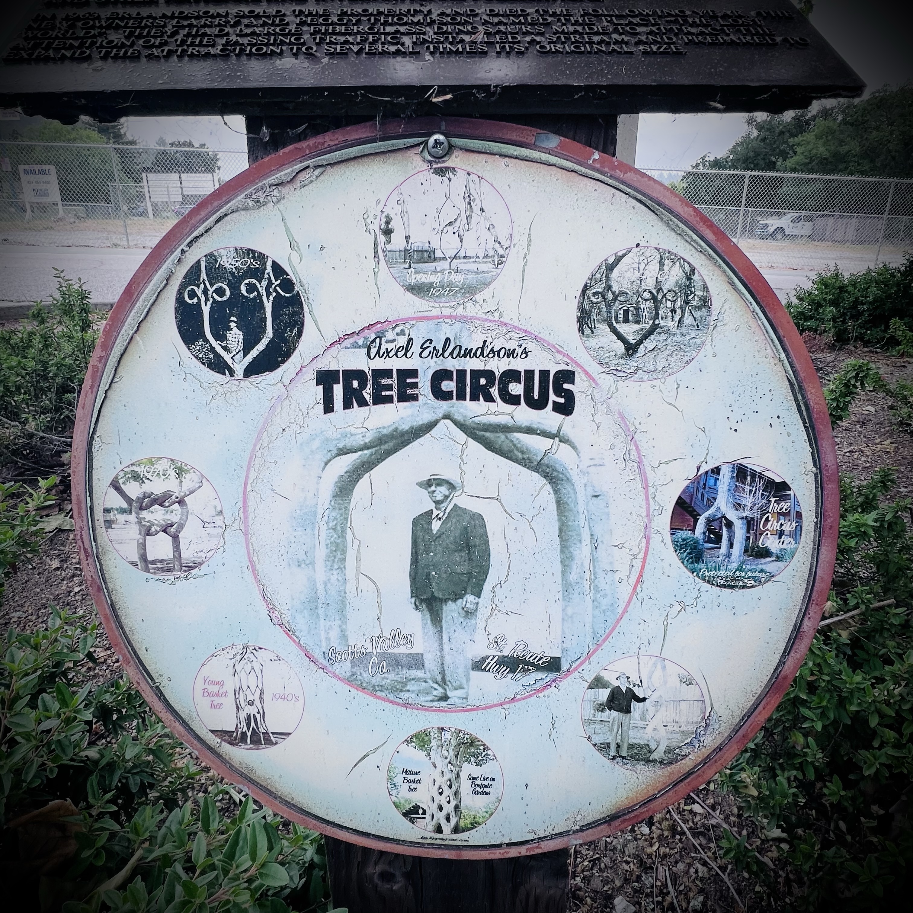
Erlandson was looking for a location for his wooden oddities and he opened The Tree Circus in 1947 in Scotts Valley on the western side of Highway 17. The advertising slogan he used was, “See the World’s Strangest Trees Here.” At the time admission was just 25-cents. The attraction was featured many times in Ripley’s “Believe it or Not!” and other publications such as Life magazine.
In 1940, Highway 17 opened, bypassing the old stage road, Scotts Valley Drive, where the Tree Circus was located.
In 1963 Erlandson sold the property to Larry and Peggy Thompson. Erlandson died a year later.
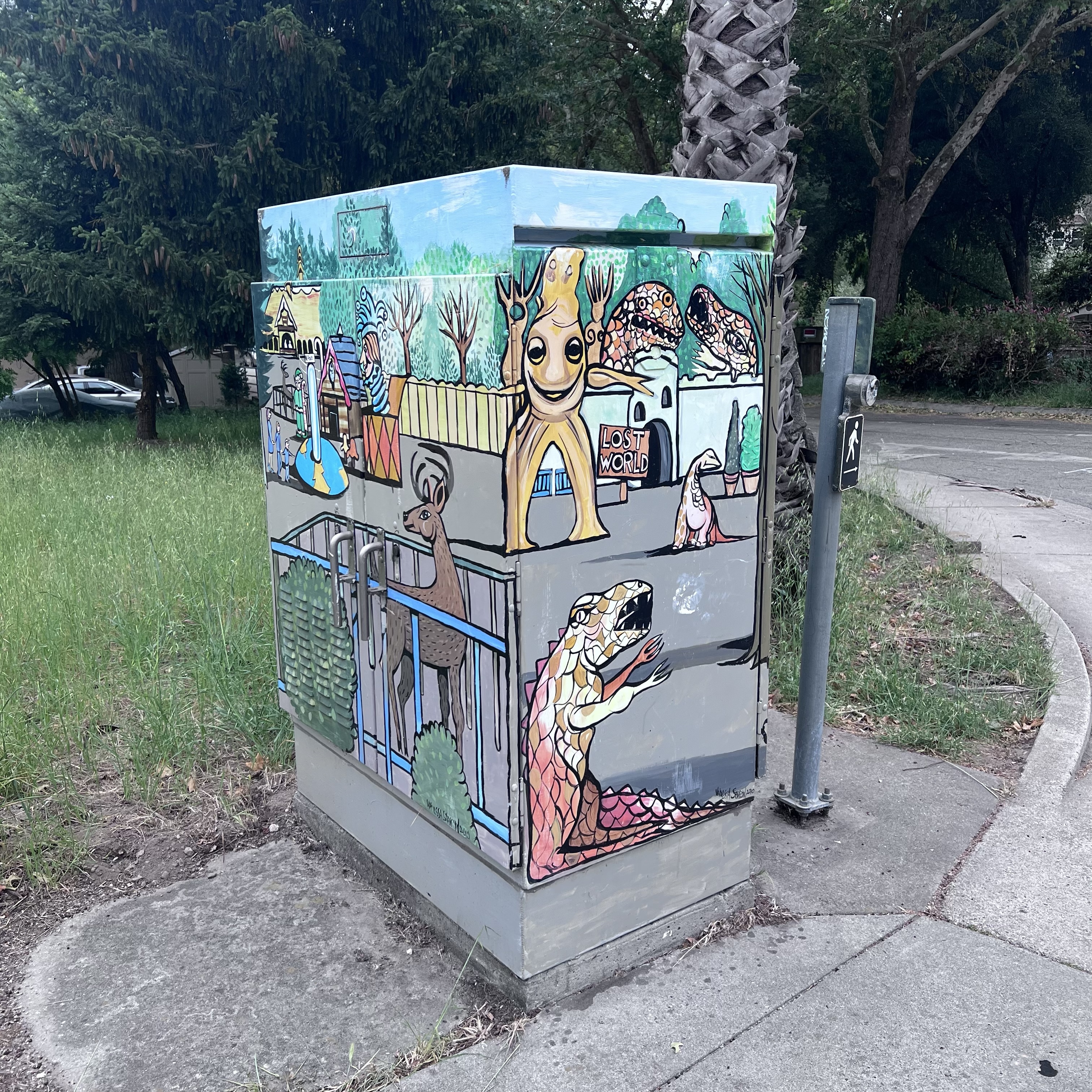
The Thompsons added 30 fiberglass dinosaurs, created a stream through the property, and renamed the grove of Erlandson’s tree “The Enchanted Forest”.
The new attraction was named “Lost World”. I remember visiting the park as a kid during this time. From Highway 17 you could see the large T. Rex and triceratops.
The attendance slowed and Lost World was eventually closed and sold in 1977.
The trees were saved and bought by Michael Bonfante, owner of a local supermarket chain, who replanted them in his new amusement park in Gilroy called Bonfante Gardens (now called Gilroy Gardens).
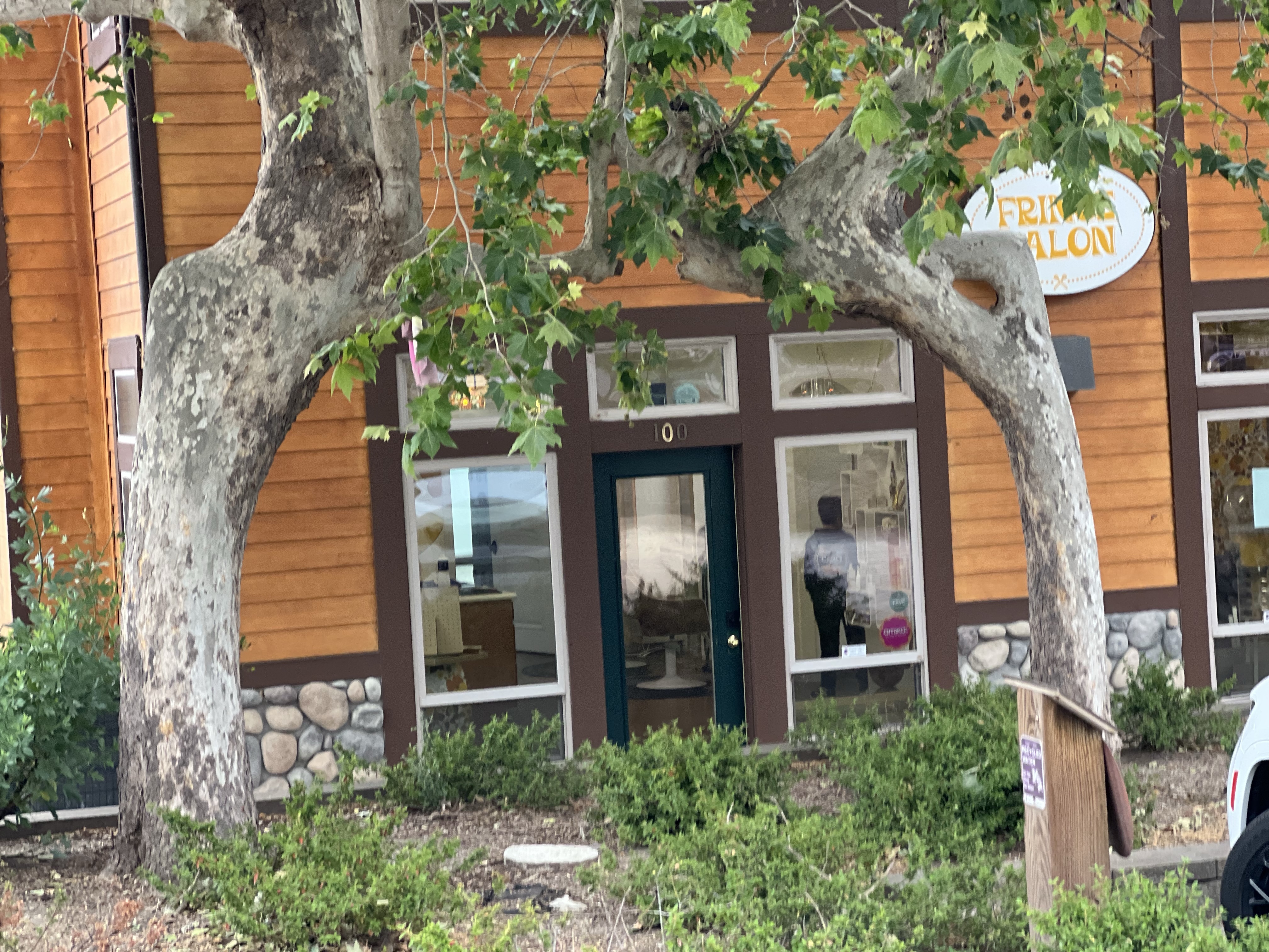
On Saturday I arrived at the Tree Circus Center, sounds like a perfect place to find remnants of Erlandson’s art. The only business open at this hour was a hair salon.
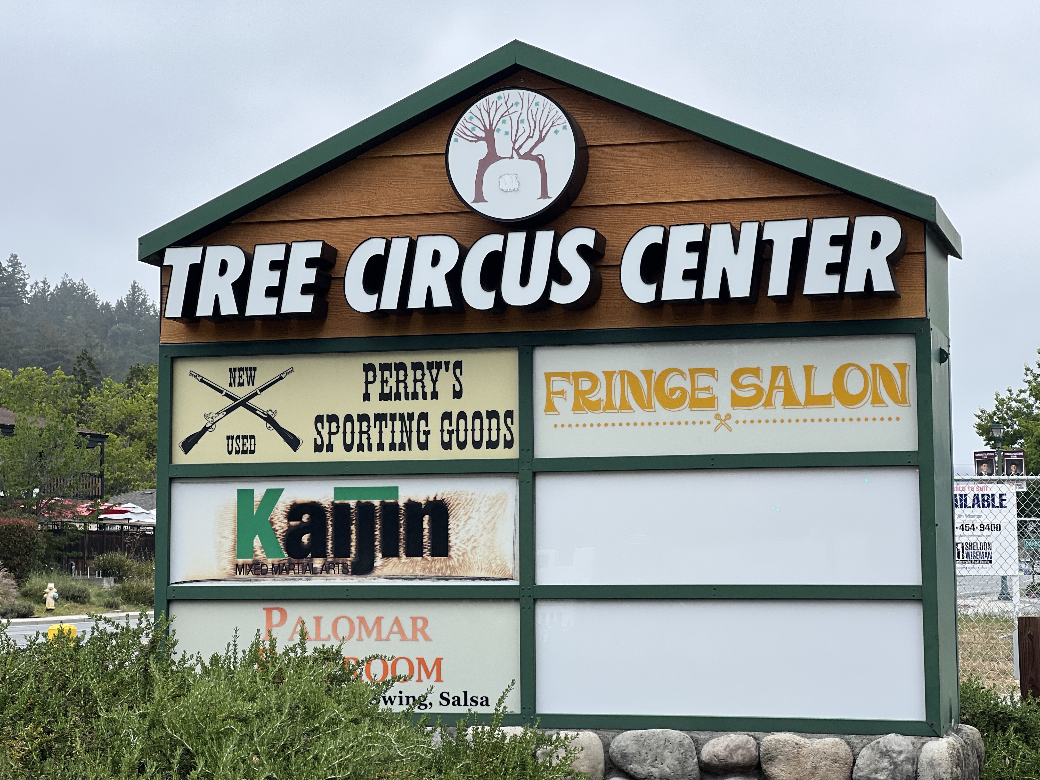
Before me was two sycamores leaning towards each other in an unnatural way. This is all that remains in Scotts Valley of the Erlandson’s Tree Circus.
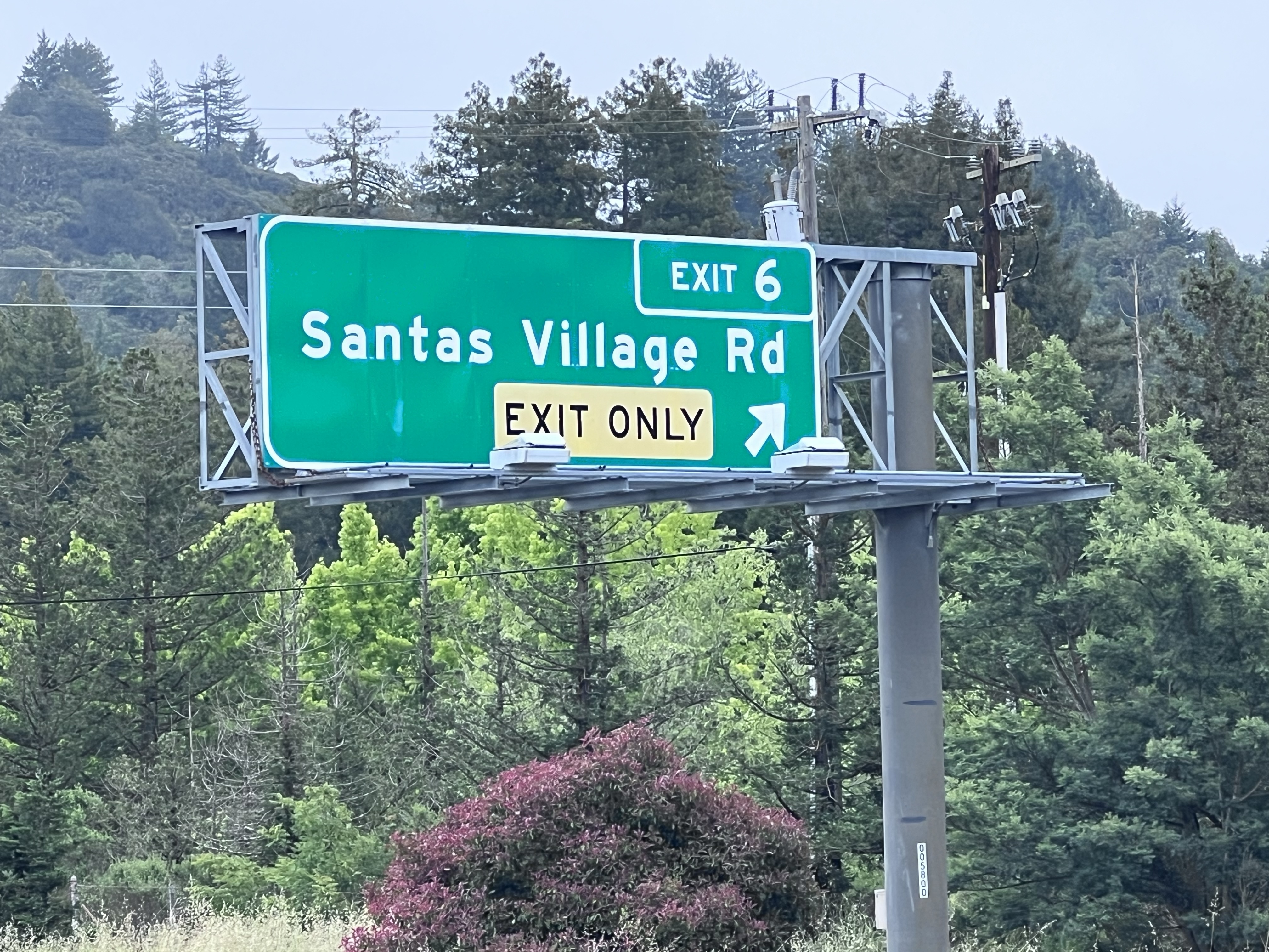
Evidence of Santa’s Village is even harder to find. There is nothing left of the former Christmas themed amusement park (yes it was open all year long), which I also attended as a child.
It open in 1957 and remained in business until 1979. There is now a row of houses on the property. But the exit from Highway 17 homeowners take to get to their houses is telling;