In the last post I was reexploring the Old Ways, hikes and routes that I had travelled years ago, a pathway of the mind as well as the soil.
On the Saturday of the Memorial Day weekend, I decided to do the Big Loop, a route I had hiked with my friend Erik, at least 30 years ago when we were both much younger, full of confidence, and much closer to birth than death. Now I would do the Big Loop solo.
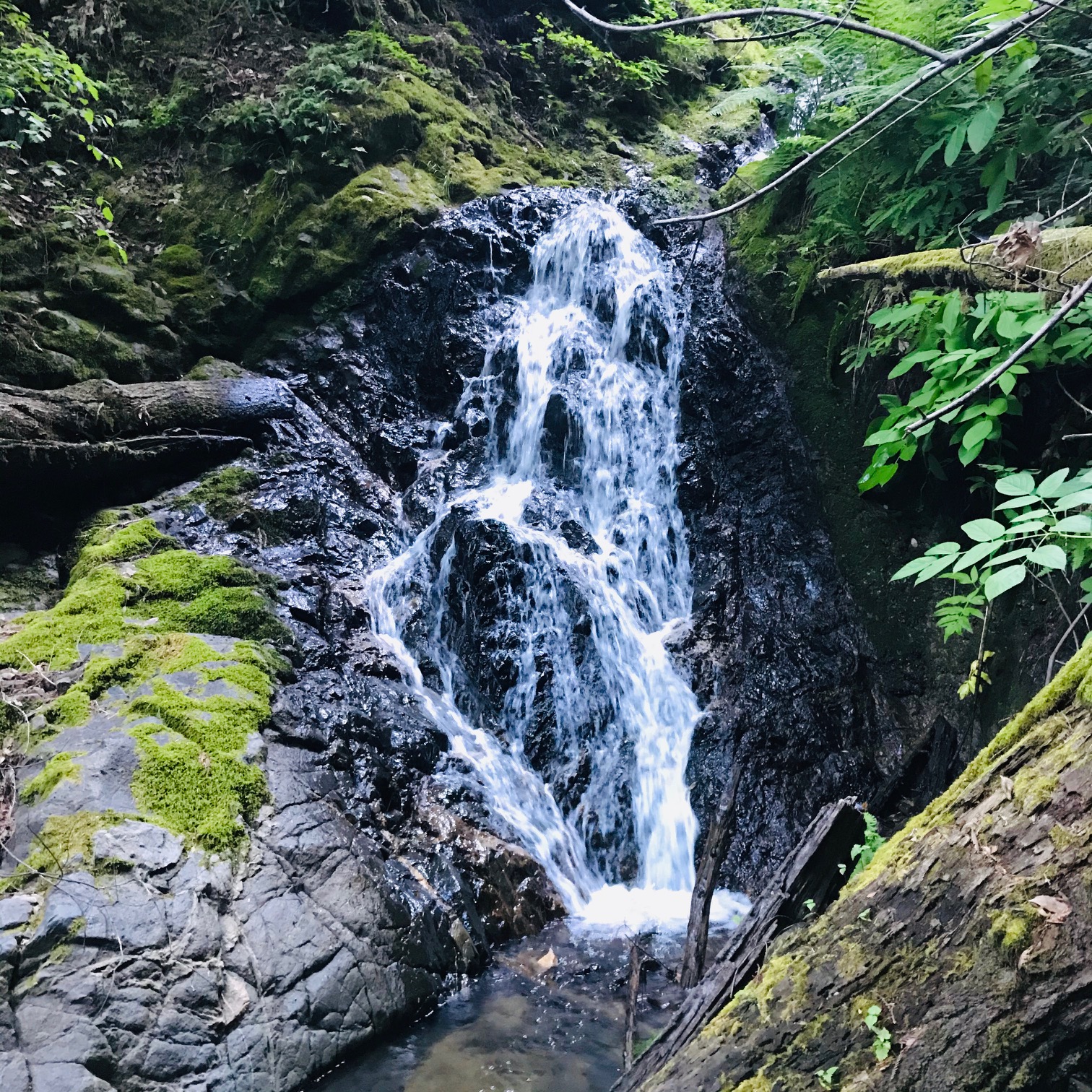
The start of the loop was heading up Shrine Way and then hiking up Powder Mill Creek. I had done this hike the week before but I had stopped at the falls, pausing to sketch and then turned back. But not today. Today I was going to scale the waterfall.
I’m sure in my 20s, climbing this three-tiered waterfall didn’t cross my mind as something that could be dangerous. I thought no more about the challenge than breathing. But now, the night before the hike, I knew that this was going to be the most challenging and technical part of the journey.
The three pitches required some unaided technical climbing. I had confidence in my climbing ability having spent hours in the climbing gym (a few years ago) but climbing outdoors certainly provides other challenges. The challenge on this route was that the rocks were wet and in some places I would be climbing in the waterfall. Here I was not roped in. A fall from one of the waterfall pitches probably wouldn’t kill me but it could introduce a bit of maim into my life. And I would have no one around to help me out to safety in the event of a fall, midway between the cascade.
These thoughts went through my mind as I headed up Powder Mill Creek. I reached the bottom of the falls at 8:15 AM. While the sky was clear, in the cold shade of the canyon, it was cold.
I folded up and stowed my trekking poles, bowed to the creekside alter, and started up the first pitch of the climb on the right side of the lower falls. Just to get to rock, I had to struggle through a fallen branch tangle to get a hand and then foothold on rock.
I methodically completed the first pitch, no need for speed climbing here. I was rewarded by the beautiful middle falls, which fell into a pool, surrounded in luscious greens.
Once up the middle falls I came to the final upper falls. This was the last technical part of the journey and once this was behind me, I could really get hiking. With each pitch I was gaining confidence as I understood the rock more and more.
It is all about keeping three points of contact with the rock. I read the rock, looking for the best hand and footholds. Often times, young trees where perfect handholds as I looked to place a foot in a position to raise me upward towards the point where the watershed flattened out.
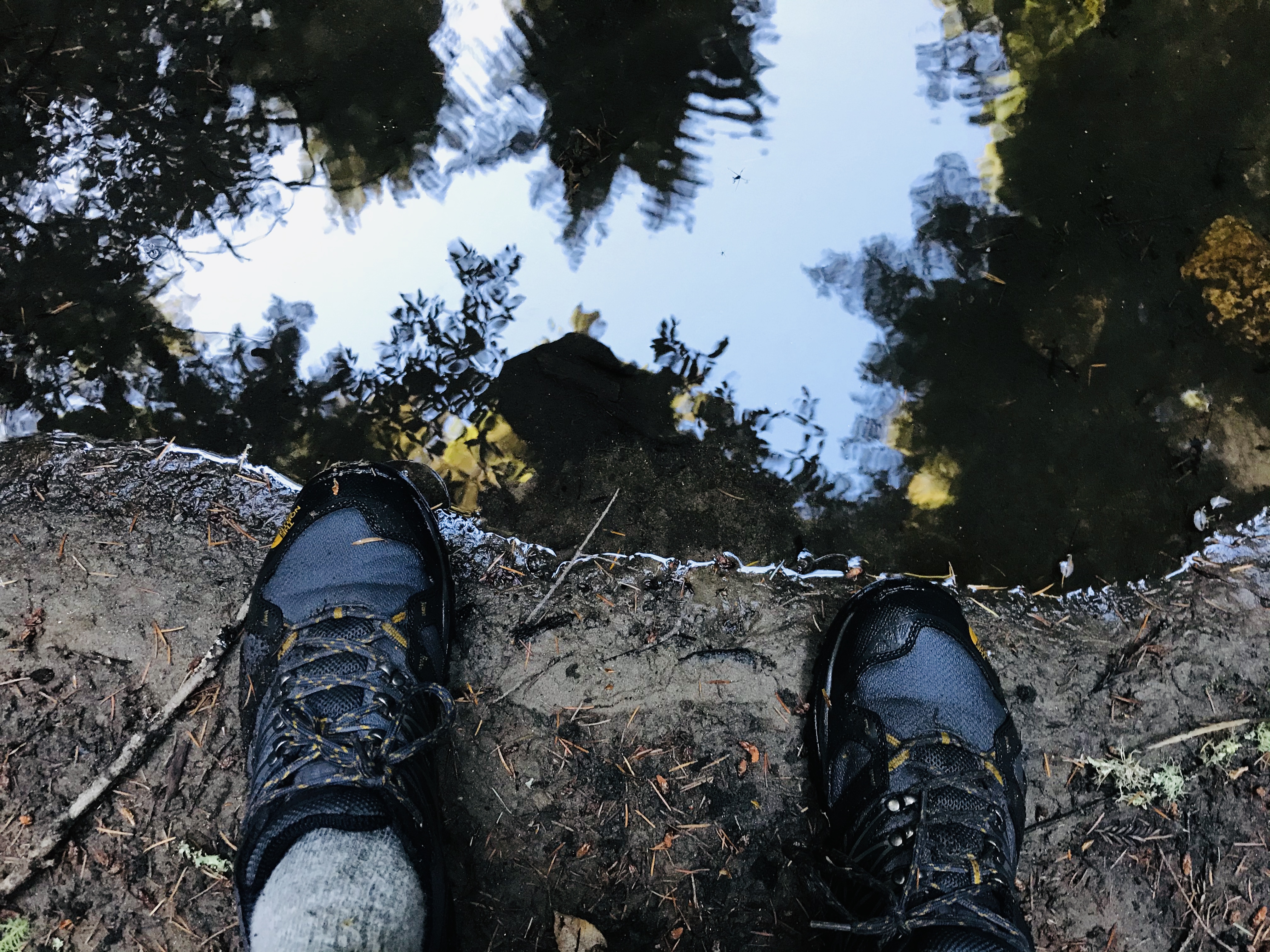
I had made it, the toughest part of the journey was now behind me! Now the creek canyon flatten out and the only challenge now was climbing over or under fallen redwoods and not fully immersing my feet in creek.
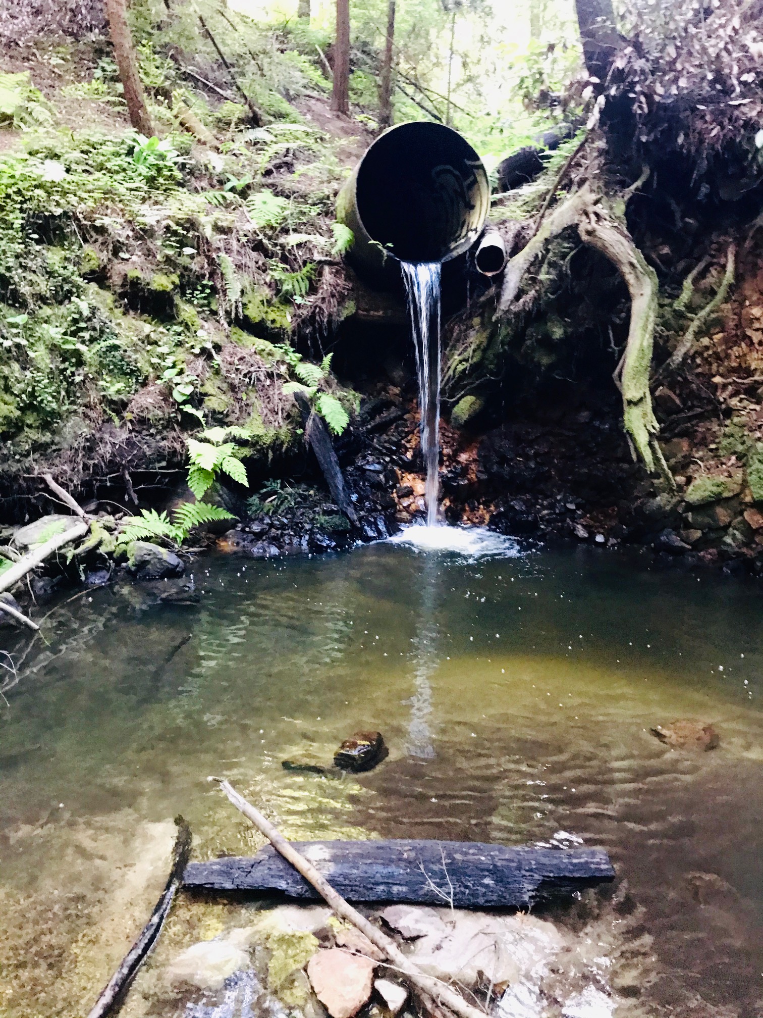
The whole hike, from the base of the lower falls to Pipeline Road, was perhaps just under a mile. I covered the distance in 25 minutes. The romance of the wild Power Mills Creek is dashed when you come to the point where Pipeline Road in Henry Cowell State Park, crosses over the creek. The creek is routed under the road in a pipe and falls out the other side into a pool.
I scrambled up and out of the creek on to Pipeline Road. I was now in Henry Cowell State Park. Pipeline is a paved road, a much different substrate than what I had just traversed. I not headed northwest up the road.
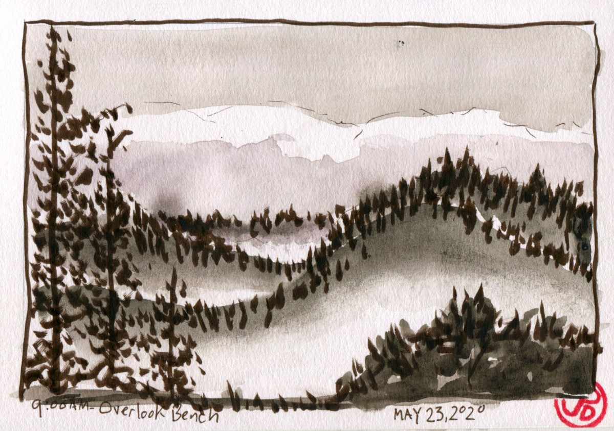
Twenty-five minutes later I was at the Overlook Bench. At this viewpoint you look out to south with wooded ridges overlapping wooded ridges giving way to the flats of Santa Cruz with the Giant Dipper roller coaster silhouetted against Monterey Bay.
I pulled out my Stillman & Birn Beta Series spiral sketchbook and sketched in the view with my sepia brush pen (featured sketch). This finished sketch has a Japanese feel to it, reminiscent of the sumi ink paintings of Japanese-Californian artist Chiura Obata.
To complete the loop, I continued northwest along Pipeline Road, off on a hiking trail to Cable Car Beach (where I swapped socks) and then along the River Trail to the 1909 Railroad Trestle which I used to cross the San Lorenzo River and then back south along the railroad. I passed over Coon Gulch with the osprey nest on my left. At this point I was about 40 minutes from my cabin.
I completed the Big Loop in three hours and 40 minutes. This included a few snack stops and sketches and a chinwag with a ranger who was guarding the entrance to Garden of Eden Beach from the hordes of three-day weekenders.
