Image

The China Wall of Donner Pass

The construction of the Central Pacific Railroad from Sacramento over the Sierra Nevada Mountains, would not have been possible without the thousands of Chinese laborers that gave their blood, sweat, and lives to the construction of the railroad. The workers, at their highest number, was 12,000, making the Chinese the largest work force on America at the time.

Many lost their lives to explosions, extreme cold, and avalanches. The Central Pacific Railway never kept records of Chinese fatalities, the true toll will remain a mystery to history.

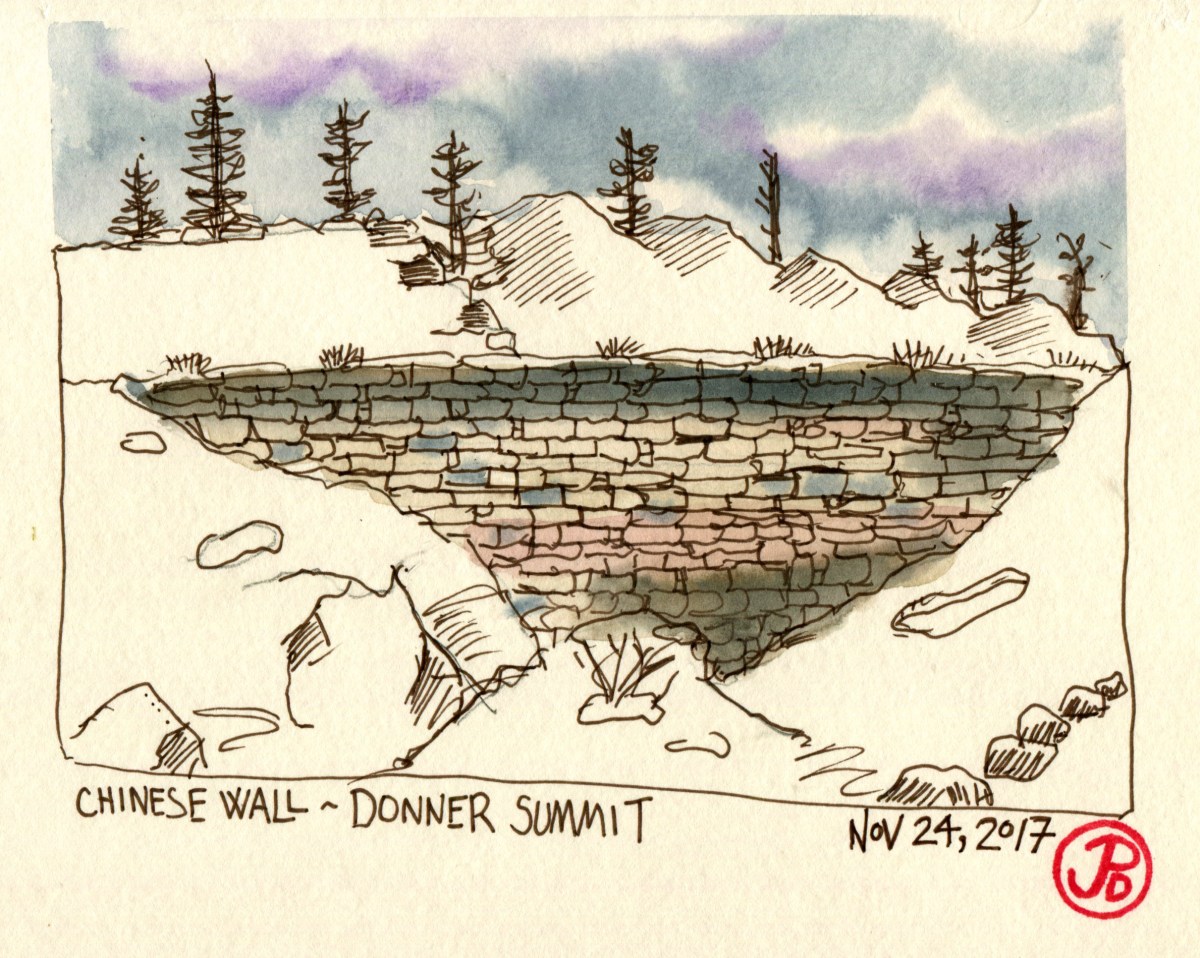
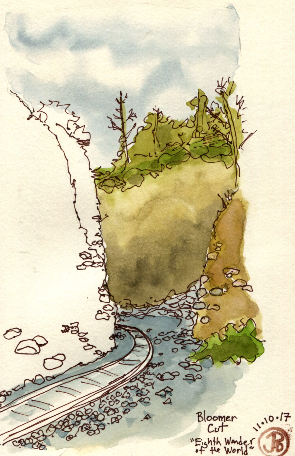
On the the Old Donner Pass Road (Highway 40), just past the Rainbow Bridge, is the historical marker, “China Wall of the Sierra”. Looking just beyond the marker, a quick scramble up the hill, is the granite wall that holds up the roadbed between Tunnels #7 and 8. I sat on a bench of granite and sketched the wall from below.

The wall, which was built in 1867, was created to fill in a ravine and is 75 feet high. It is a testament to the workers, that after 150 years later the wall is still intact.

The upper China Wall on the right and the entrance to Tunnel #8 looking east along the now abandoned railroad bed.

An eastbound Union Pacific freight train at Norden, near Soda Spring Ski Resort. Around Donner Summit, the mainline has now been double tracked to the south of the original route of the Transcontinental Railroad. This stretch of iron was built by the Central Pacific which later became the Southern Pacific and then the SP merged with the Union Pacific on September 11, 1996.

Image

Yellowstone’s Fauna

The Lamar Valley has been called America’s Serigetti because of the large number of animals that wander through the Valley. Bison, grizzly and black bear, bald eagle, and the recently reintroduced gray wolf.

The most productive times are dawn and dusk for wildlife viewing. But because of icy road conditions and a visit to Roosevelt Arch, I rolled into Lamar Valley just after noon. What impressed my about Yellowstone is the amazing animals I had seen in the park for the first time: Bison, grizzly bear, and trumpeter swan. Today the bison where covering the near distant hills and gazing near the Lamar River. On the near shore was an adult bald eagle accompanied by two ravens. It was a beautiful panorama but my target animal, the gray wolf, was evading my view. I would try again the following day, which would be my last day in Yellowstone. And the setting of my search would be another wolf hotspot: Hayden Valley.

A sketch of Lamar Valley while waiting for a bear or wolf to appear. They didn’t but I have a sketch to prove I was there.

I had to take a round about route to Hayden Valley because of road closures so I entered the Valley a little over two hours after I left West Yellowstone. Aside from far off bison and a pair of feeding trumpeter swans, there was no sign of Canis lupus.

Our largest swan, the trumpeter swan (Cygnus buccinator). A lifer for me.

At one turnout a couple pulled up, unloaded a scope and scanned the far off hills. This was good sign, they were wolf watchers. The woman told me that they had just seen four mollies feeding on an elk carcass. I asking for clarification, what did she see? Mollie was the name of one of the wolf packs whose territory was in the northern part of Yellowstone Lake. The man described the location in great detail. He told me to look for the lake to the left and on the far shore was something that looked like a “brown suitcase”, this was the elk carcass and the wolf pack had wandered off into the trees. I reversed course and headed south, in search of the most sought after mammal in our Nation’s first National Park.

I arrived at the location 25 minutes later. It was just as the wolf watcher described it. As I pulled up, I saw a dark mammal on the far shore. The prerequisite roadside cars were in attendance. I parked on the roadside and crossed over. I didn’t need my binoculars to tell me what I was looking at: Canis lupus. 

My first signing of Canis lupus, a black Mollie near what had become the brown and red suitcase on the shore of the small lake just north of Yellowstone Lake.

A field sketch of the black wolf from the Mollie pack.

The two journals I brought with me on the Oregon Trail and to Grand Teton and Yellowstone National Parks. A Strathmore bound watercolor book (in front) and a Sillman & Birn spiral bound Delta Series. The journals are covered with stickers representing the animals I saw and sketched on my journey: bison, grizzly bear, and moose.


Image

The Transcontinental Railroad

Since visiting Promontory Summit, where the Central Pacific and the Union Pacific met, thus completing the Transcontinental Railroad, I wanted to visit the location where the railroad started in California. So it was that I found myself on a Friday morning in “Old Town” Sacramento, on the banks of the Sacramento River.

A sign on the the side of the Central Pacific Railroad Freight Depot, notes, “You are standing where the First Transcontinental Railroad in America had its western origin, at Front and K Streets in Sacramento.” This location made sense because all of the materials used for the building was shipped up the Sacramento River from San Francisco and it was unloaded here. On January 8, 1863, then Governor and President of the Central Pacific, Leland Stanford, turned a shovelful of dirt, the official start of building the western leg of the Transcontinental Railway.

IMG_2777Just below this sign, is the birthplace of the Transcontinental Railway on the banks of the Sacramento River.

The other reason I found myself in Old Town was to visit the California State Railway Museum. The museum was opened in 1981 and I was there with my father to see SP’s No. 4449 and UP’s No. 8444 (now numbered 844) on the opening day. But today as these engines where back in Portland and Cheyenne and I was here to see a another very important steam engine: the Central Pacific’s No. 1 the Gov. Stanford.

This American type 4-4-0 was the first locomotive purchased by the Central Pacific at a cost of $13,688. The engine was built in Philadelphia in 1862 and then shipped on the Herald of there Morning around the horn of South America to California where it was reassembled in Sacramento. Stephan Ambrose notes of the 50,000 lb locomotive, in his book Nothing Like in the World, “the Governor Stanford [was] the biggest man-made thing in California”. This engine has many notable firsts for the Central Pacific: it hauled the first excursion train and the first passenger train on April 15, 1864 and the first freight train on March 25, 1864. It also took part in building the Transcontinental Railway with hauling supplies for the construction of the line over the Sierra Nevada mountains.

The engine was slated to be scrapped in 1895 but it was saved and donated to Jane Lathrop Stanford, widow of Leland Stanford, in 1899 where it was put on display at Stanford University. It was later loaned to the California State Railway Museum where it is on display near where it first steamed to life on November 6, 1863, on the banks of the Sacramento.

Image

Bloomer Cut and Cape Horn

After my visit to the California State Railway Museum I headed to a lasting vestige of the Transcontinental Railway, an engineering feat called, “the eighth wonder of the world”. It was about 30 minutes north of Sacramento between Newcastle and Auburn. This was the 63 foot deep and 800 feet long man-made canyon known as Bloomer Cut.

Like the still present ruts of the Oregon Trail, this rail cut is still there. It was blazed in 1864 with blood, sweat, and black powder. The builders did not have the heavy machinery of modernity but hundreds of laborers with pick, shovel, and wheelbarrow. This is one of the few remnants of the Transcontinental Railway, a permanent scar in the earth that shows it extisted. I was reading the Stephen Ambrose book Nothing Like it in the World and now I was reading it in the landscape.

I sat on a small boulder next to the rail line just where the cut began and I got a sketch in before it started to rain. Two things that don’t go together are watercolor painting and rain.

In the middle of Bloomer Cut, looking out to the southern end towards Newcastle, Roseville and Sacramento.

After reading about one of the other incredible engineering feats on the western reaches of the Transcontinental Railway, a cut made around a rock face, high above the North Fork of the American River called Cape Horn, I desided to see if it still existed. A quick google search not only confirmed its existence but also that it was located near Colfax, a mere 30 minutes east from my mother’s house in Penn Valley. I simply could not pass up this sketching opportunity.

Camp 20, which was later renamed Colfax to honor a visit to the railroad by then Speaker of the House, Schuyler Colfax. The town was the staging area for the first real assault on conquering the heights of the Sierra Nevada Mountains.  Railway grades cannot exceed 2%, that is a rise of two feet over 100 feet of rail. This provided one of the major engineering challenges for laying track across the Sierras. Many tunnels were blasted through granite to reduce the climb  and a roadbed had to be blasted into the side of the cliff at Cape Hope to make the ascent on the western slope of Sierra Nevada.

This incredible engineering feat would not have been possible without the thousands of Chinese laborers who worked on the line.  The workers had to be lowered over the cliff in reed baskets where there would drill a hole in the rock by hand and then fill the hole with black power. When they lit the fuse they had a short time to be hauled back up out of harm’s way. They gave their sweat, blood, and lives to make the cut around Cape Horn. The Central Pacific did not keep records of Chinese fatalities so we will never know the true toll in lives sacrificed in order to make a railroad that spread from sea to shinning sea a reality.


A field sketch of Cape Horn from the viewpoint of Highway 174 near Colfax.

Cape Horn railway bed is still in use today. Eastbound California Zephyr just leaving Colfax headed to Chicago, Ill.

Image

American Bison

The most visible large animal in Yellowstone National Park is the American bison (Bison bison). I would see many of these large grazers in all parts of Yellowstone but I hoped to see this emblematic animal in the snow, and I didn’t have long to wait.

When I first entered Yellowstone from the south, it began to snow, the first real snow of the season.

The first snow of the trip, just as I entered the southern boundary of America’s first National Park. The National Park Service arrowhead (on the right) features a sequoia tree and a bison to represent wildlife.

I drove north into Yellowstone along the road towards West Thumb, the snow falling but not yet sticking to the pavement. At the junction I headed west and then north towards the ever popular Old Faithful geyser. After I passed Old Faithful, the road was paralleled by the Firehole River. Up ahead a few cars were pulled over. I soon learned to stop because this always meant there was something interesting to see near the road. Could it be a bison, bear, or bald eagle? How about a bison in the snow? Check.

American bison in the snow on the banks of the Firehole River.

A few days later, when I was on a wolf hunt in the Lamar Valley I came upon a ranch: the Lamar Buffalo Ranch. The American bison was close to being hunted to extinction in the United States. In the late 19th century, poachers where hunting bison in Yellowstone and only 40 bison remained. In 1907 the Lamar Buffalo Ranch was founded with the mission of protecting and increasing the bison herd in Yellowstone. The ranch was in operation until 1952. Because of these efforts there are now about 2,000 free roaming bison in Yellowstone.

The entrance to the now closed Lamar Buffalo Ranch in the Lamar Valley, Northeastern Yellowstone, Wy.

A Yellowstone traffic jam. The bison always have the right of way.


Image

Where’s the Moose?!

If there is an unofficial animal for Jackson Hole and Grand Teton National Park it would have America’s largest deer. The moose is featured in and on paintings, sculpture, bumper stickers, t-shirts, hats, postcards, etc. A moose rack hangs above the four famed Antler Arches in the Jackson Town Square, each painted with the words: “Jackson Hole, Wy”.

The Antler Arches of Jackson. A few words come to mind, “tacky” and “garish” are but two.

Now finding a moose should be as easy as throwing a snowball and hitting a millionaire in Jackson. I started my search turning left at Moose Junction and heading southwest on Moose-Wilson Road (no joke). I drove down and back, no moose! I searched the ponds and creeks in the area, ideal moose habitat, no moose! I checked all the moose hotspots in the park, no moose! I searched areas outside of the park like the Gros Ventre River, no moose (but I did see my first herd of bison). Who knew that finding the world’s largest deer would prove to be so tough? I returned to the Anvil Hotel, crestfallen, that I have not seen my first moose in one of the moosest National Parks in the world.

Not a moose but the first of many bison in Grand Teton and Yellowstone.

I lit out of Jackson early because there was a storm bearing snow, soon to arrive and I wanted to make all the passes in Yellowstone so I could make it to my digs in the town of West Yellowstone, Montana. I left at 8:00 AM and stopped to fuel up. I headed north toward Grand Teton and Yellowstone, past a picnic area and this is what I saw:

And just when I wasn’t searching for a moose, I found moose! A cow with her calf.

Image

Grand Teton National Park

If you are going to one, you have to go to the other. Grand Teton and Yellowstone are next door neighbors and if you pay to get into one then it seemed like a great “twofer” deal. And it certainly was!

Grand Teton National Park lies to the south of Yellowstone. When you think of what an archetypical mountain range might look like then a picture of the Grand Teton range might be the photograph that appears in the dictionary definition of “mountain range”.

IMG_1732
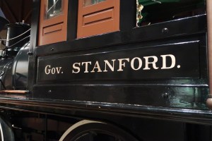
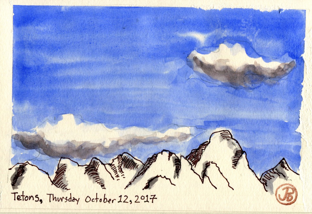
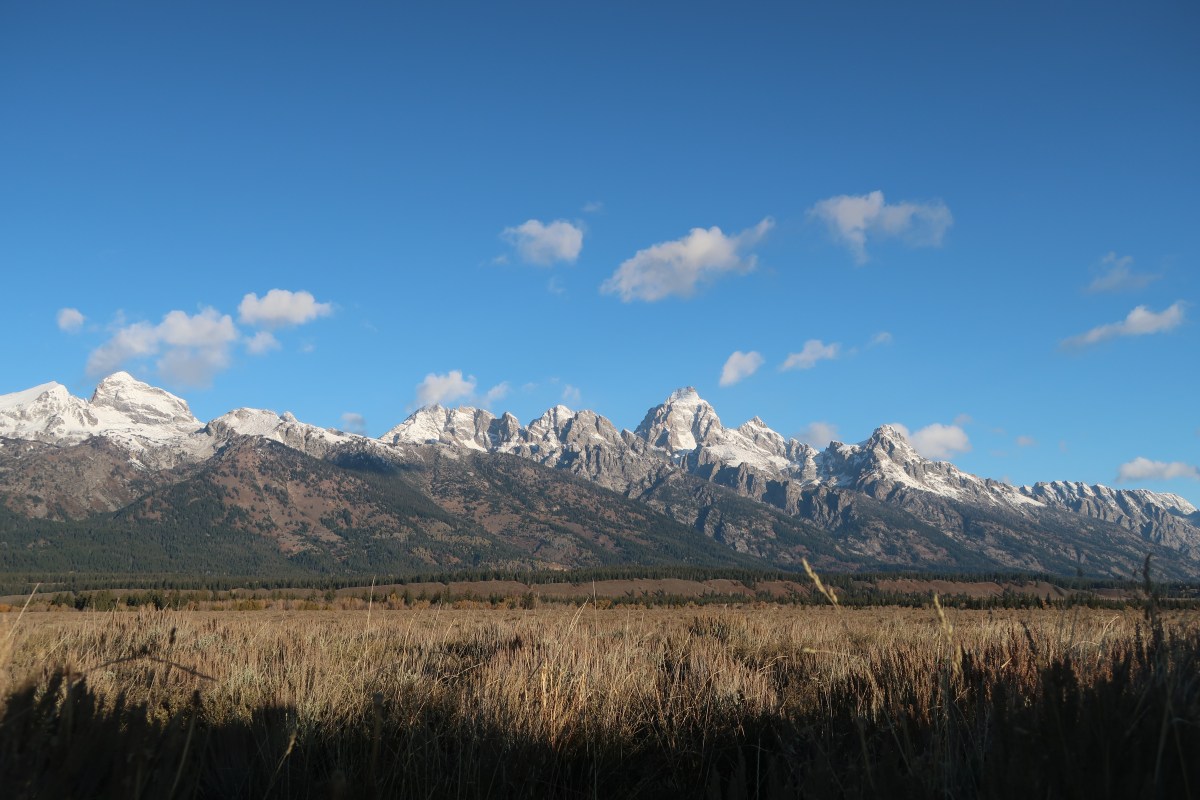
Now that’s what I call a mountain range!

It was while I was out on a moose mission (see my next post)  in the northern part of the park when I came upon cars pulled over on both sides of the road and a ranger keeping visitors at bay. Now this is always is a good sign. At first I though that everyone must be looking at a roadside bison. There was a large brown creature foraging in the field to the right side of the road. But no, it was so much more. It was a lone grizzly bear fattening up before it’s winter hibernation.

The grizzly bear is the official state mammal of California, but the only place you will see is a grizz in on the state flag. We are are the only state in the union to have an extinct official state mammal. The last grizzly in California was killed in 1922. One was reported to have been seen two years later in Sequoia National Park and since then, no grizzly has ever been seen in California.

A sketch from my photo of the grizzly.