Image

Scotts Bluff

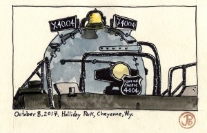
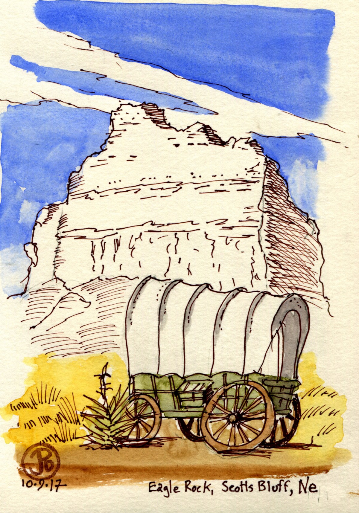
Scotts Bluff is a narrow pass that the Oregon, California, and Mormon Trails all passed through. Any emigrant, no matter where their jumping off point was, converged and crossed at this point on their way to the west coast.

I pulled out my sketching bag, grabbed my sketching stool (yes I packed it in my suitcase) and I walked down the trail at Scotts Bluff National Monument to the three replica wagons along the trail. Rising behind the wagons was the impressive Eagle Rock. I picked my spot, set up my stool and started to sketch. In the late afternoon, I seemed to have the entire park to myself. There was no tourist standing in front of me and my subject asking, “Whatcha do’in? (Long Pause)  “Drawl’in?” Okay maybe I’m exaggerating but only just.

A faux ox with Eagle Rock in the background.

While sketching you enter another world where your focus is complete and the scene before you is translated into lines, shapes, and hashmarks. But a call, from somewhere behind we broke my focus. It was a loud bugle of a call, a call I knew but had trouble placing because I had not heard it a long while. I looked up and I could just make out the flying “V”s heading in a southern directed. These were not the “V”s found in a student handwritting book, no, these were  “V”s like the motion of water around an obstacle on a gently flowing stream. It was the southern migration of the sandhill cranes! I watched as hundreds if not thousands passed on their way to the fallow rice field to the south, their wintering grounds.

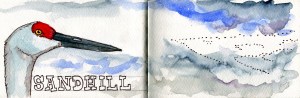
The passage of the sandhills was an unexpected bonus, the type of serendipity that can happen on the road when everything seems to come together to make a memorable moment. The late afternoon light, Eagle Rock, the replica wagon, sketching on my sketching stool, the sandhill cranes, and me being in the right spot at the right time. This produced one of my favorite field sketches of the trip. 


Image

Golden Spike

On my final morning I left my digs at West Yellowstone early in the morning, on my way to Salt Lake City for my flight home but I had one more stop before I headed west to the Golden State. This trip was bookended with our railroading history. One one end was the Union Pacific Steam stronghold and the largest steam engines that ever rode the rails and on the other end I was going to one of the most revered locations in United States railroading history.

I headed off the highway, north of the Great Salt Lake, to a destination that has been described as “45 minutes from nowhere”.  Here I was in high desert and the temperature was heading into the low 70’s, a heat I hadn’t felt all trip.

My destination was where the Transcontinental Railroad met and was completed in 1869, known today as the Golden Spike National Historic Site. This was where the Central Pacific and the Union Pacific finally united the country from coast to coast thus making overland travel by wagon a thing of the past.

I had only a limited time here because I had to return my Jeep and make my flight so I did not have time for any field sketches. I took plenty of photographs and my feature sketch is based on one of these photographs.

Golden Spike

A drawing based on the famous photograph by A. J. Russell “East and West Shaking Hands at Laying of Last Rail”, May 10, 1869 at Promontory Summit, Utah.

Golden Spike Stanford

The Golden Spike at Stanford University’s Cantor Arts Museum. The spike was a gift to Leland Stanford and lends its name to the National Historic Site. The sketch was drawn from life in Palo Alto, Ca. 

Image

Independence Rock, The End of My Trail

My final destination on the Oregon Trail, before I headed to Grand Teton and Yellowstone National Parks, was Independence Rock. This was another destination, like Chimney Rock, that I was really looked forward to seeing and sketching. It would be the end of the road for me on a journey that started at California Hill in Western Nebraska and passed through some of the most scenic and emblematic scenes on the Oregon and California Trail.

My base camp was Casper, Wyoming and Independence Rock was about an hour’s drive to the  southwest. I was really heading into sparsely populated country (Wyoming is the least populated state in the Union), where the highway, the North Platte River, the trees, and the snow-capped mountains were my traveling companions.

Independence Rock appeared as a large, low chunk of granite,  just left of the highway. And like the pioneers that passed this way, this was also a rest stop for modern travelers.

I walked around the rock until I found a place to climb up on the rock to find the real gold on this piece of granite. The reason that Independence Rock is such an important site for the present day is that it is known as Register of the Desert because emigrants that paused to rest here, ascended the rock, just like I was doing, and took the time to carve their names and date of passage into the granite. And what is most amazing, like the wagon ruts at California Hill, the signatures are still legible today!

 On my way to the summit I came across this name. Could this be a relative of mine?

A signature writing into the history books of Independence Rock: “I. J. Hughes July 4 1850”.

One of the thousands of names carved into the granite of Independence Rock. This one reads, “Milo J. Ayer, age 29. 1849.” It is amazing that this signature of a 49er still exists!

My last field sketch from the Oregon Trail before I headed back to Casper and then across the state of Wyoming to Grand Teton and Yellowstone National Parks.

Image

Chimney Rock

There was one landmark that I was looking forward to seeing and sketching, more than any other.  And like the emigrants, I saw it miles before I reached it.

A good number of the pioneers were midwestern flatlands and their first sightings of Chimney Rock must have made them feel like they were in a completely different world, in a landscape they could not quite comprehend.

Seeing the spire of Chimney Rock, through my windshield was like a beacon that drew me toward it. No wonder why this unique landform is the most mentioned landmark in pioneer journal accounts.

As I pulled into the visitor’s center parking lot, I noted the numerous rattlesnake warning signs. The center was closed for Columbus Day so I skirted around the building, keeping my eyes down, scanning for a snake in the grass, to reach the viewing deck.

The winds and the rains of the morning seemed a thing of the past. The storm covered Cheyenne in six inches of snow and closed highway 80 for 9 hours but now the majestic prairie clouds rolled above the spire.

I could picture the masses of wagons, livestock, and people, populating the plains around the rock where now a few cows grazed. As I sketched the landmark, I was continuing a long tradition of drawing the landscape along the trail. At the time the spire was much taller in the mid 19th century due to erosion and a little pioneer vandalism. I read one pioneer pastime included shooting at the spire and collecting what ever pieces were blown off and kept as souvenirs. Another pastime was carving their names into the rock. Now all names have eroded away but in two locations further to the west, emigrates signatures are still visible to this day. But more about that in another post.


Image

Roosevelt Arch

There was one site in Yellowstone than I wanted to see and sketch more than any other. This includes Old Faithful, the many geysers, or the Grant Canyon of Yellowstone. This was the Roosevelt Arch at the northern entrance of Yellowstone in the gateway town of Gardiner, Montana.

This monument is the spiritual and metaphorical gateway to our Nation’s National Parks. Yellowstone became the first National Park on March 1, 1872, and it became the template for all of the 57 National Parks that followed. These parts of land where not bought up and reserved for the wealthy for their own private views, but instead, they were preserved for the people. The inscription above the Arch reads: “FOR THE BENEFIT AND ENJOYMENT OF THE PEOPLE”.

Roosevelt Arch, viewed from the southside. Only one car at a time can fit through the arch. I went through twice.

The cornerstone laying ceremony was held on June 1, 1904 with President Teddy Roosevelt in attendance. He had arrived in Gardner, Montana two weeks previously and he rode out with only one companion and heading into Yellowstone to explore the land. During his speech Roosevelt said of Yellowstone:

The Yellowstone Park is something absolutely unique in the world so far as I know. Nowhere else in any civilized country is there to be found such a tract of veritable wonderland made accessible to all visitors, where at the same time not only the scenery of the wilderness, but the wild creatures of the Park are scrupulously preserved … The creation and preservation of such a great national playground in the interests of our people as a whole is a credit to the nation

The arch was one of first entrances to the park to serve visitors arriving by rail but now most visitors use other entrances. But by the numbers of visitors on this late October morning, the Roosevelt Arch is still a popular destination in this very popular National Park.

Corvidsketcher in action at Roosevelt Arch.


Image

A Californian on California Hill

The first major incline on the Oregon trail was California Hill in western Nebraska. The emigrants would have just crossed the Platte River and this was one of many tests along the trail they would encounter on their long journey west.

To begin my first journey on the Oregon and California trails, I drove to Brule and headed west on highway 30, passing corn fields and grazing cattle and keeping highway 80 and the Union Pacific mainline to the south (both parallel parts of the original trails). Four miles from town, to my right, the California Hill historical marker came into view. I read the plaque and now it was time to get the Grand Cherokee dirty!

I turned north on a rutted dirt road with rolling fields stretching off on both sides. If it weren’t for the cows, barbed-wire fences and power lines, I could be on the Oregon Trail back in 1850.

On the left there was a gap in the barded-wire fence, the gateway to the ruts of  California Hill. Julie Fanselow, in her guide: Traveling the Oregon Trail (my Bible for this journey) describes the ruts as, “some of the finest Oregon Trail ruts to be seen anywhere along the route”.

On a post werethe shields of the Oregon and California trails. I was in the right place. Now I just needed to find the ruts.

IMG_1384
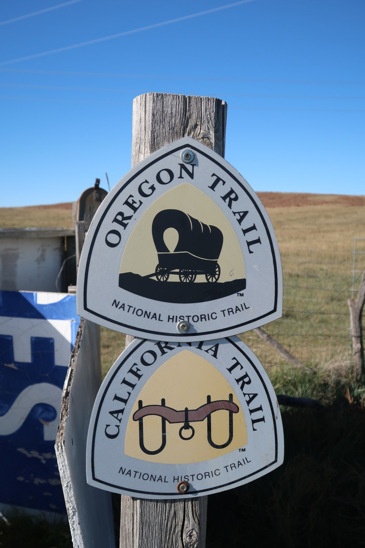
I passed through the narrow gate, skirted a cattle trough, and spotted a trail marker on the brow of a gentle hill. I headed towards it.

IMG_1380

The Oregon Trail marker and the ruts of California Hill just to the left of the marker, at the brow of the hill.

Once I crested the hill, the passage of thousands and thousands of emigrants was clear. Ruts wound up the hill and amazingly, over 170 years later, they were still visible. The ruts were helped by the erosion of wind and rain, etching the passage of the pioneers into the landscape.

Over the next few days I would be seeing other etchings upon the landscape that spoke of the thousands of travelers that passed by these historic trails, some for a better life, other to an early trailside grave.

Image

Union Pacific’s Big Boys

Union Pacific Railroad created the largest steam engines in the world to tackle the Sherman Grade from Cheyenne to Ogden, Utah. The articulated 4-8-8-4, if stood on end, would be as tall as a 12 story building and the engine and tender weighed 1,250,000 lbs. 

Of the 25 “Big Boys” built between 1941 to 1944, only eight of them remain, the rest were scrapped. Seven of them are on static display, and one of them, No. 4014, is being restored to working order in Cheyenne, Wyoming at Union Pacific’s Steam Shop. Of the seven on display, I would be seeing and sketching two of them: No. 4004 in Holliday Park in Cheyenne and No. 4005 at the Forney Museum of Transportation in Denver, Colorado.

The Forney Museum of Transportation is only 30 minutes from DEN, so I picked up my Grand Cherokee (I was in the true west after all) and headed to northeastern Denver.

The museum was full of vintage motorcycles, automobiles, aircraft, and bicycles but I made a B-line to the largest single piece in their collection: the impressively massive UP No. 4005.

Up close and personal with a true beast of the era of steam.

The Big Boy doesn’t get many points for style, it was function over form for this freight locomotive. It is not a beautiful engine like the streamlined passenger express engine, SP No. 4449, the steam engine I followed on excursions with my father. But what the Big Boys lacks in style, they made up with pure power and size. The Big Boy is essentially two engines in one, capable of hauling long freight trains over steep grades.

No. 4005 also bears the dubious distinction of being the only Big Boy involved in an accident. In 1953, the engine jumped a track switch at 50 mile per hour while it was hauling a 62 car consist. The engine pitched to her left side killing the engineer and fireman. The engine received massive damage but was repaired at Union Pacific’s Cheyenne facility.

The second Big Boy was No. 4004 in Cheyenne’s Holliday Park. Cheyenne actually has two of these massive engines. No. 4014 is currently being restored to working order in UP’s Steam Shop.

Union Pacific’s Steam Shop, where they are currently restoring Big Boy No. 4014 to working order. I tried to sign up for a tour but it was sold out a month in advance.

I remember my father telling me about the Big Boy on display in a park in Cheyenne and I have always wanted to see one. Once I checked in at the Historic Plains Hotel, across the square from the impressive train depot, I headed down the street to Holliday Park where Big Boy No. 4004 has been on static display since Union Pacific donated the engine to the city of Cheyenne in 1963.

The driving train and and two and the 16 driving wheels of No. 4004 in Cheyenne.

This is one massive engine! Union Pacific always goes big and the Big Boy is the tops in steam power.

A sketch from one of my photographs for Big Boy No. 4004 in Holliday Park, Cheyenne, Wy.