Image

Moffet Field

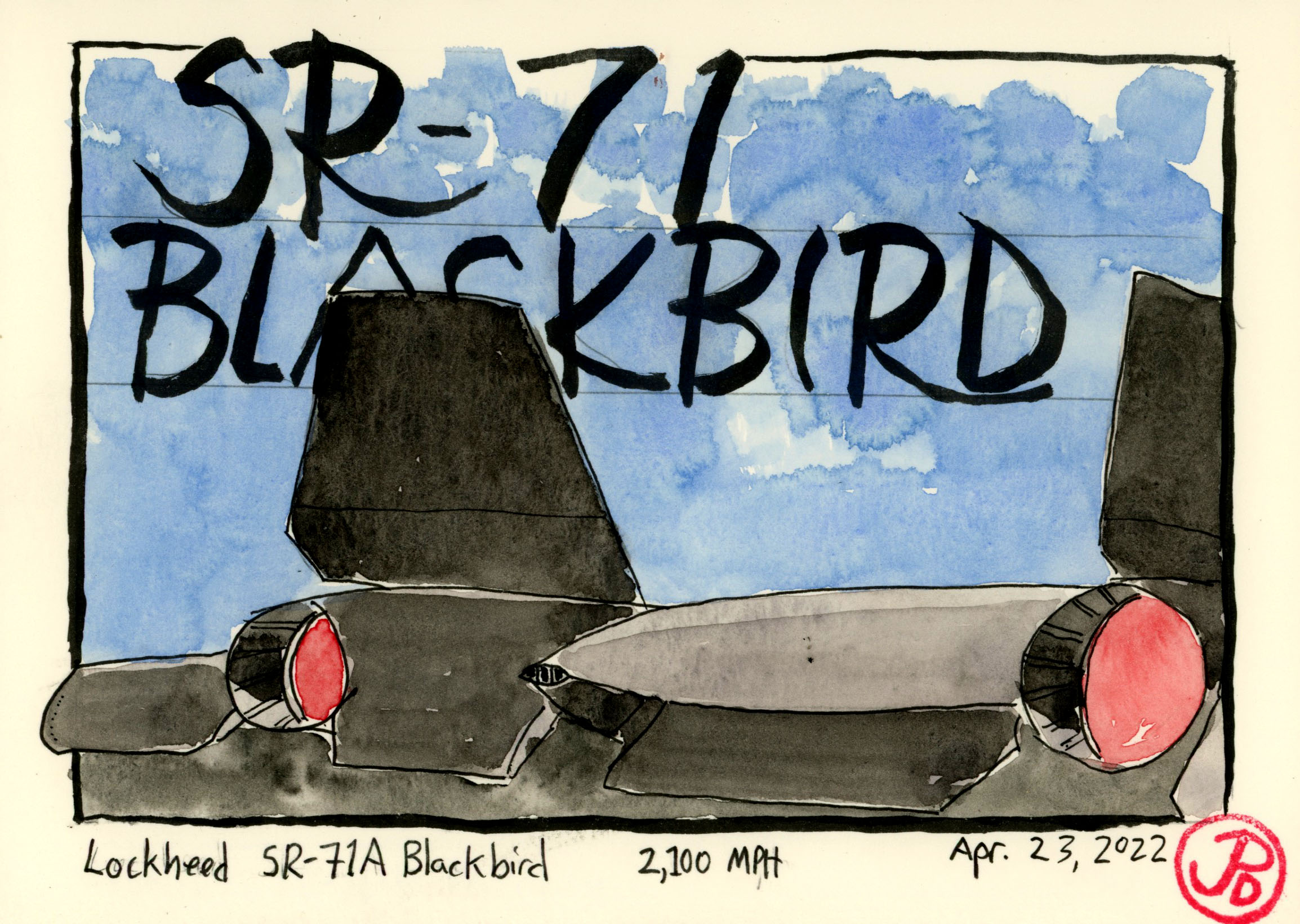
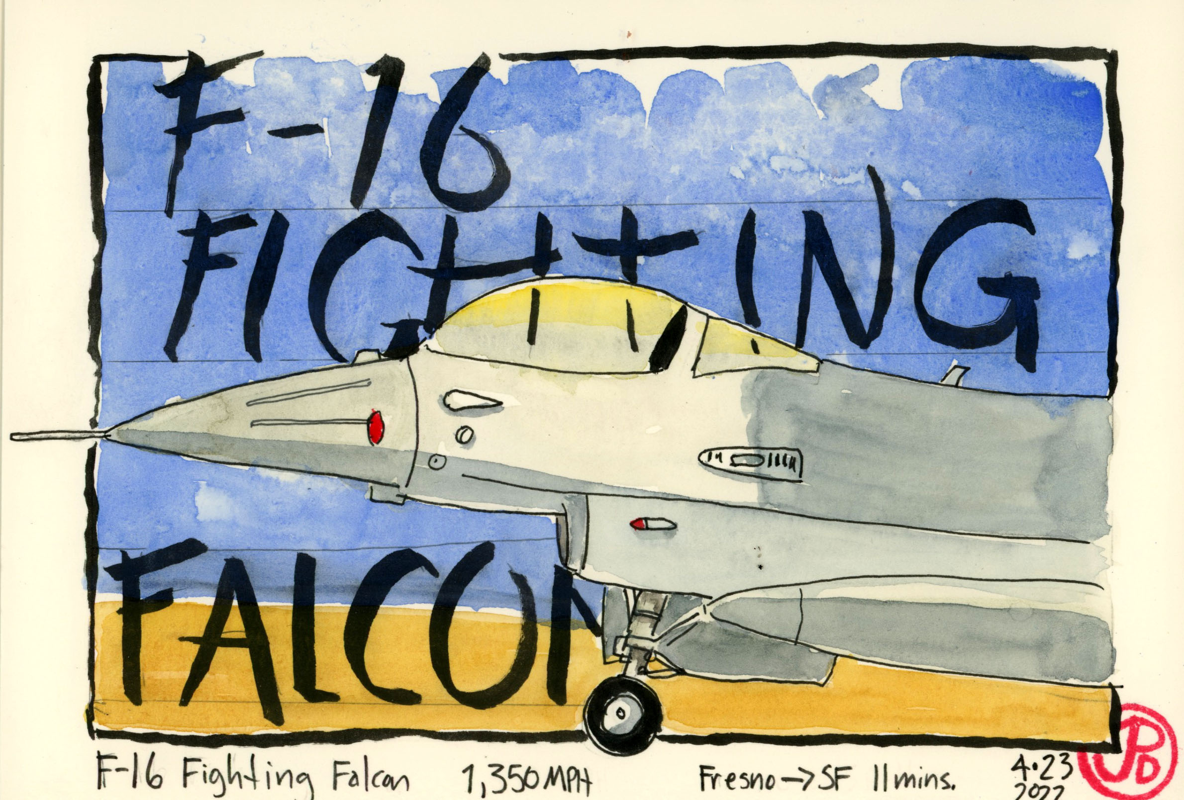
Moffet Field looms large in my childhood, from the P-3s returning from their submarine patrols past my bedroom window to watching airshows on the base (often times from my roof). Although I did not visit or see the Navy Base very often, it’s presence was felt (and heard) every day.

The 1920s saw the rise of the airships, the dirigibles. These lighter than air, airships where being used to transport passengers and also as a means to keep an eye on the enemy’s fleet. They seemed to have a bright future both for civilian and military applications.

Germany was the true innovators with their Zeppelins. These are the airships that bombarded England during World War I but were also victim to antiaircraft fire. 71 % of German Zeppelins were lost in combat and 40% of their crews lost their lives.

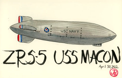
Between the World Wars the US Navy was looking for a new base of operations on the West Coast for the ZRS-5 USS Macon. The Macon was built in 1929 and launched on August 8, 1931. The Macon was 785 feet long with a displacement of 7,401,260 cubic feet. It had a top speed of 75 knots (86 mph) and a range of 6,840 miles. The Macon, and her sister ship, the Akron, where just 20 feet shorter than the more well known Hindenburg. While the Hindenburg was filled with hydrogen (with disastrous results), the Macon and the Akron where the largest helium filled dirigibles ever built.

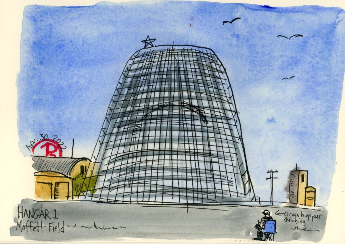
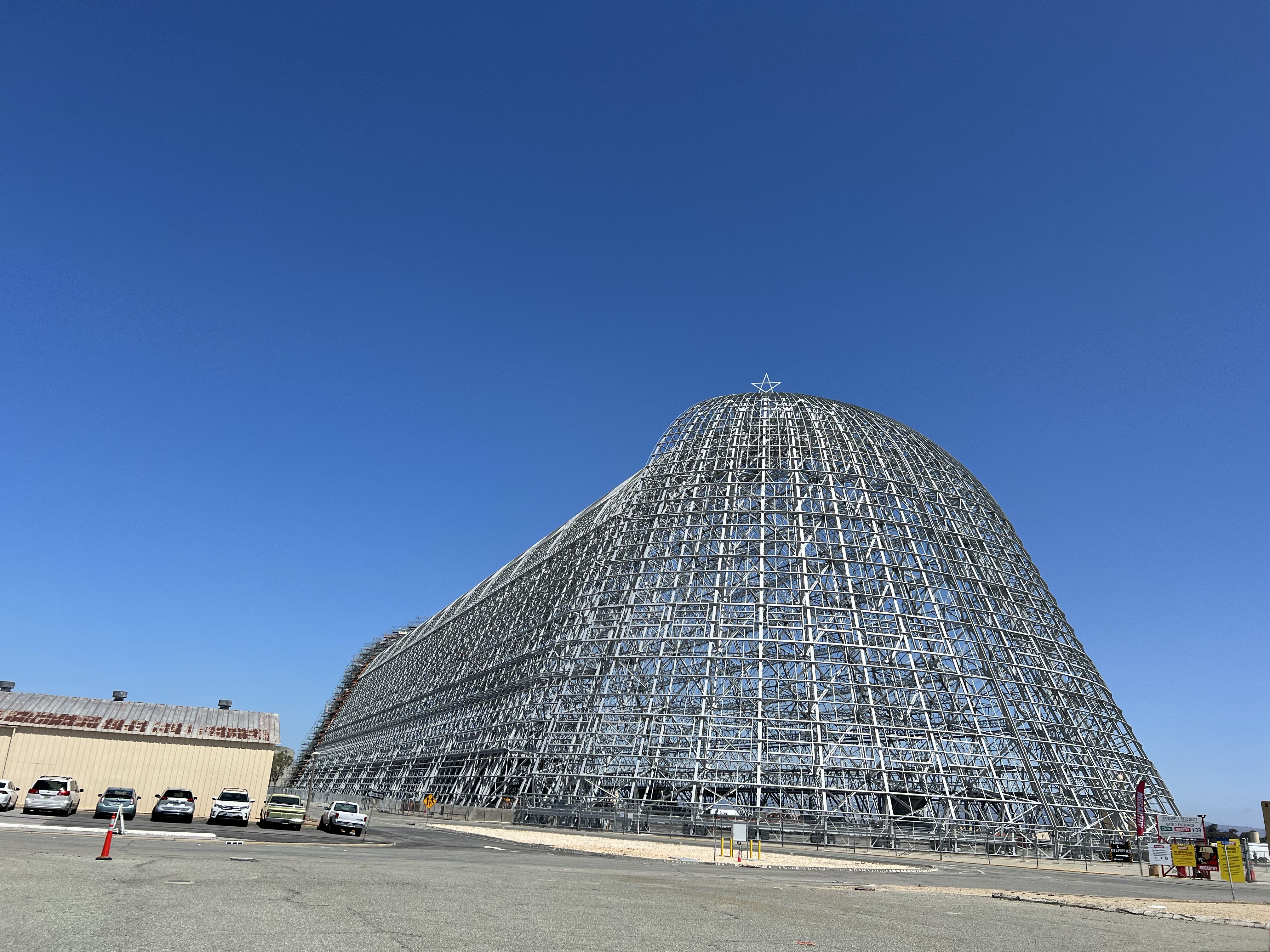
A base site was chosen in the farmlands of the southern Bay Area at Sunnyvale (my home town). Construction on the Navy base started in October 1931 and the centerpiece of the base was, and still is, Hangar No. 1. The hangar was built to house the Macon and other dirigibles. Hangar 1 is considered the largest freestanding structure in the world. The hangar is 1,138 long, 308 feet wide, and is 210 feet tall. The internal area is 351,000 square feet, that is just over eight acres! To give you an idea of the massive size of this hangar, three RMS Titanic ships can fit, side by side, in the hangar, with room to spare!

Hangar 1 is now striped of it’s siding and is currently being restored.

The Navy base was originally named Naval Air Station Sunnyvale but was later renamed after Rear Admiral Donald Moffet who was the Director of Aviation. He was the Captain of the USS Akron (ZRS-4) when it was destroyed in a thunderstorm on April 4 1933 while cruising off the coast of New Jersey. Moffet, along with 72 others perished in the crash, making it the deadliest airship crash in history. As a comparison, in the Hindenburg disaster, 36 people lost their lives, when she burst into flames at Lakehurst, New Jersey on May 6, 1937.

The USS Macon was christened on March 11, 1933 by Rear Admiral Moffett’s widow. The Macon flew from Lakehurst, NJ on October 12, 1933 to her new base on the other side of the country: Moffet’s Field.

The golden age of the great airships was relatively short lived. The USS Macon first flight was on April 21, 1933, and her final flight was on February 12, 1935. A whole two years of service after about 50 flights. She was only at Moffet Field for four months.

Why only 50 flights? Like the Akron before and the Hindenburg afterwards, USS Macon crashed.

On February 12, 1935, The Macon crashed into the Pacific Ocean off the coast of Big Sur. The cause of the crash is debated but her upper fin was damaged in a storm and the airship lost helium causing her to plunge into the ocean. The Macon was fitted with life jackets, unlike like her sister ship and out of 83 crew members, only two perished.

The wreck of the USS Macon now lies on the ocean floor at 1,500 feet below sea level, where it has been added to the National Register of Historic Places. The Macon’s final resting place is within the Monterey Bay National Marine Sanctuary.

With the crash of the USS Macon, the Navy put an end to the airship program and the short era of the Great Airships in the United State was over. The Macon was the last of the great airstps built by the United States Navy.

Sketching Notes: I sketched the framework of Hangar 1. I was more focused on shape and form than the individual details. I sketched in Grasshopper in the foreground for scale. He was sketching the water tower to the left of Hangar 1.

Image

Castle Air Museum

From my childhood bedroom window on Cormorant Court, I looked down at the scrub-jays, mourning doves, and house sparrows at the feeder and birdbath in the backyard. These noticings fueled a lifelong passion for birds.

To look skyward, to the east, was the flight path of planes as they approached Moffett Field, a naval base in Sunnyvale. The sound of the P-3 Orion’s turboprops were the sound of my childhood, along with the calls of scrub-jays and mourning doves. I learned to identify planes as I identified birds. I knew a C-5 from a C-130, an A-4 from an F-4. I just loved things than fly!

I built models of airplanes such as the F-4, B-52, and KC-135 and hung them from the ceiling with push pins and dental floss. I shared this hobby with a neighbor two doors down and he now is a pilot for United Airlines.

So there should be no surprise that I left Santa Cruz at 6:40 AM, my destination was Atwater, two hours and ten minutes away. My destination was the Castle Air Museum. This air museum is one of the largest collections of military planes (or any planes) on the West Coast.

I am always looking for new sketching challenges and Castle’s collection of almost 70 aircraft would fit the bill. In the end, I did ten sketches in just under three hours.

A sketch of the business end of one of the aircraft that mesmerized me as a child, the world’s fastest plane: SR-71 Blackbird. It’s top speed was Mach 3.3, four times as fast as the average cruising speed of a commercial jet. 32 of these high-speed, high-altitude, reconnaissance aircraft where built, 26 still exist and like this Blackbird, are on static display in museums.

The trip was also a dip into nostalgia as I was sketching an F-4 Phantom, one of the planes I built a model of when I was a kid. As I’ve noted before, you really get to know something when you sketch it.

The business end of an F-4 Phantom. This jet is painted in the livery of the Thunderbirds No. 5, the Air Force Demonstration Squadron. When I was a kid, I built four F-4s in the Blue Angels livery. I would watch the Blue Angles’ performance from my roof.
A sketch of an F-16 Fighting Falcon. This plane was part of the National Guard, stationed in Fresno. The F-16 could cover the distance between it’s base in Fresno and San Francisco in 11 minutes!
F-86H Sabre, a Korean War swept-wing fighter with a top speed of 600 mph. It’s painted nose is a throw back to the P-40 of World War II.
Image

Hawai’i Volcanoes National Park

I make an effort to visit a National Park if any are near. The only show in town on the Big Island is Hawai’i Volcanoes National Park. And what a wonderful National Park.

On this day, April 5, 2022, my visit to a National Park had special relevance. It was the one year anniversary of my younger brother’s death and when I heard the news, a year ago, I was in another National Park, Rocky Mountain National Park, looking for white-tailed grouse at 11,990 feet. It seemed like a worthy tribute, to spend time, and reflect on the natural beauty of a National Park. My brother and his family visited many National Parks on their family road trips across the US.

I would say this park is a sketcher’s paradise because of the lava shapes and the rain forests except that it rained almost the entire time I was there. Rain and pen and rain and watercolor, do not go hand and hand. So my sketchbook stayed in the dry bag for most of the time I was in Volcanoes National Park, until. . .

I drove the 18.8 miles from the Visitors Center to the Pacific on the Chain of Craters Road. In the lowlands, where the road parallels the coastline, the rain ceased just as the Chain of Craters Road ceased, obliterated by a lava flow.

The road was built in 1965 and then was covered four years later by a lava flow from the Maunaulu eruption. This road have been covered by lava many times and been rebuilt a like number of times. In over five decades, the road has only been drivable in its entirety for only thirteen years. During the eruption of Pu’o O’o (1983-2018), nine miles of the road was covered.

On the road, you pass through nene territory. The state bird of Hawaii is not so good at getting out of the way of moving cars so it’s important to take it slow on the Chain of Craters Road as you descend from mountain rainforest to the coast. I had heard you had a better chance of seeing a nene on a golf course than in Volcanoes National Park and I had not seen one yet.

About halfway from the coast, I spotted a nene on the opposite side of the road, grazing on the soft shoulder. I was able to get some nice photos and then decided to leave it to it’s roadside munching.

The road, after some switchbacks, eventually parallels the coast and then ends at a gate when the road has been closed by lava. I could not go any further by car but I could explore by foot.

A watercolor sketch of a nene, seen on the side of Chain of Craters Road. Based on my photograph.

I walked for about a mile and suspecting that a downpour was not imminent, although I could see rain shrouds moving over the land upslope. I took a seat on hardened lava, pulled out my sketchbook and pencil bag, looked towards the west from whence I came, and began to sketch the scene before me. On the horizon was a group of palm trees which the lava flow had spared. All around was the dark, alien lava-desert of the Pu’u O’o flow. Liquid movement stopped in time.

This island of Hawaii is always growing.
Image

Snorkeling Kealakekua Bay

Probably one of the more touristy things I did on the Big Island was taking the Fair Winds II to the amazing snorkel site at Kealakekua Bay and the Captain Cook Memorial.

This marine sanctuary is reported to be the best snorkeling site in the entire state. CNN Travel, Smithsonian Magazine, and Travel and Leisure all include the Big Island on their lists of the top snorkel sites in the world and they all specifically mention Kealakekua Bay because of its mix of technicolor coral, large numbers of fish, turtles, and dolphins and it’s deep history.

It is here in January of 1778 that British Explorer James Cook, “discovered” Hawaii. He named his new discovery, the Sandwich Islands, to honor his patron, the Earl of Sandwich. At first, Cook and his crew were welcomed by the native people but that soon soured. On a later visit on February 14, 1779, Cook and his crew were killed by the Hawaiians.

Before I left the mainland for the Big Island, I did a little homework by doing a spread about fish I wanted to see at Kealakekua Bay, by sketching the fish beforehand. Identifying them in the water would be a little easier. I titled the sketch, ” A School of Hawai’i Reef Fish”. I ended up seeing seven out of the twelve fish that I illustrated.

The Fair Winds II is a double-decker catamaran that can handle one hundred people. We were a few short of triple digits as we headed out of Keauhou Harbor, the same harbor I set off from to see manta rays.

The boat ride south was about 45 minutes and Captain Dante, kept his eyes open for marine mammals such as spinner dolphins and humpback whale. Off to our starboard side we saw two humpback whales showing off their flukes as they dove down. After a pause of the cetacean encounter, Cap. Dante throttled up and we headed off to snorkeling paradise.

While we where nearing the bay, I spotted one of the birds on my wishlist flying over the waters to the southwest: a white-tailed tropicbird. This bird was likely flying back to it’s nest site, on the high cliffs that surrounded Kealakekua Bay. While we where in the bay, I spotted many more of these tropicbirds circling above the cliffs.

On the north side of the Kealakekua Bay, near where Cook was killed, there is a 27 foot high obelisk erected to Cook’s memory. The Fair Winds II pulled up just offshore of the monument for the snorkelers to grab a few shots. We then moved just to the south to our mooring.

As I was slathering on another layer of reef-safe sunscreen, I looked up at the cliffs, trying to find more tropicbirds, I spotted a dark bird with a forked tail and long, pointed wings. This was the classic silhouette of a frigatebird, in this case, a great frigatebird. Lifer!!

Now it was time to get wet and see fish. The Fair Winds II has many ways to enter the water: two slides on the bow, a high dive on the second story amidship, or steps off the stern. There was a jam at the stern steps as snorkelers fussed with their fins that I took the fourth option of egress: a big step off the side.

Once the bubbles cleared and I adjusted my mask, the colorful world of Kealakekua Bay came to life. Yellow tangs, Hawaiian sergents, black triggerfish, peacock groupers, parrotfish, and orangespine unicornfish. This was like visiting another planet!

Snorkeling and SCUBA diving (I’ve been certified since 2000) feels like flying. Flying above the hills and mountains of the coral reef. The fish are other “birds”. You cross over one “mountain range” and drop into a sandy valley that has it’s own collection of fish.

I swam toward the shoreline and I came upon a pair of exquisite Moorish idols. I had only seen these fish in the aquarium, and now here they were in their true and wild environment.

I passed over a shallow reef, careful not to kick so I wouldn’t damage the reef on impale myself on a sea urchin. I floated down into the next “valley” of sand and I saw a most desired fish. This was the official State fish of Hawaii and I had memorized it in second grade. It was a humuhumnukunukuapua’a or “fish that grunts like a pig”. This is Rhinecanthus rectangulus or the wedge tail triggerfish. I dove down to get an eye to eye view of the humuhumnukunukuapua’a, the fish was clearly on it’s patch of sand as it didn’t swim far from it’s sandy stronghold. Lifer!!

I had been somehow waiting for this moment since 2nd grade! And I loved it!

Sketching notes: I sketched the cliffs above bay in between snorkels from the top deck of the Fair Winds II. I later added the names of the fish I encountered in the bay on the cliff face.

Image

Night of the Manta

One of the quintessential Kona experiences is taking a night dip with manta rays (Manta alfredi).

While I was here on the Big Island to see the feathered fauna, I also wanted to experience life below sea level.

I arrived at 6:30 PM at Keauhou Harbor. This trip is kept to a maximum of 12 participants. There are many other companies that go out for night snorkel with manta rays that have larger consists. Twelve seemed like nice numbers of snorkelers.

I was curious about how night snorkeling with wild manta rays started. Keauhou Bay is renowned for experiencing manta rays because you have a higher likelihood of seeing mantras here compared to other locations and it’s a short three minute boat ride out and you’re in the water with mantas. This snorkel sight in known as Manta Ray Village.

It all stared at the Kona Surf Hotel (now the Outrigger Kona Resort) on the southern side of Keauhou Bay. In the 1970’s, the hotel shined bright floodlights into the surf so diners could watch the waves as they ate dinner. These lights attracted plankton. Plankton is the favored food of manta rays and it began to attract mantas to the bay. This became an attraction for tourist who viewed the manta from the restaurant or their rooms.

About a decade later, SCUBA boats led tours to the area for night dives and this location became world famous as a reliable spot to encounter mantras in the wild.

In 2002, the Kona Surf Hotel was closed and the floodlights where shut off and the mantas disappeared. The floodlights were again turned on in 2004 when the hotel reopened as the Sheraton Kona Resort and the mantas and the snorkel and SCUBA tours returned.

The former Kona Surf Hotel and the Sheridan Kona Resort is now the Outrigger Kona Resort. The Manta Ray Village is in the water in front of the hotel.

Our tour, with Hawaii Oceanic, was one of many that was in the bay to get close, really close, to manta rays. We picked up our mask, snorkel, and ankle floats from the back of a van in the harbor parking lot. After a brief briefing, we boarded our boat for the short ride out to Manta Ray Village.

The way they attract mantas is to place a board in the water that is surrounded by handles. LED lights on the bottom of the board shine into the water column which attracted plankton and we know what this attracts!

We entered the water and moved down along the board, holding on to the handles in the “Superman” position, arms and legs out straight and head down in the water searching for mantas. In the LED lights you could see plankton and further down, small fish. We would only be in the water for about 20 to 30 minutes, so I was hoping we didn’t get skunked.

We didn’t have long to wait long, at the edge of the light I spotted a ghostly gray and white manta! Our ray guide shouted out, “Here they come!” Out of my periphery came a manta, inches from my mask. The ray was so close it brushed my arms! Mantas were barrel rolling, passing under the LED lights, upside down, scooping up plankton as it “flew” by.

At one point there were seven mantas below us, barrel-rolling inches from our masks. Our manta guide was calling out their “names”. Each manta can be identified by the makings on their ventral sides. One manta has a group of spots that looked like the greeting, “Hi”. They have names like: “Sugar Ray”, “Hip Hip Hooray”, “Big Bertha”, and “Lefty”

Before we knew it we where back up on the boat and heading back to harbor. What a wonderful and memorable encounter!

Image

A Troubled Paradise

While most see the Hawaiian Island chain as an unspoiled tropical paradise, the islands have a darker side.

The islands also bears the undesirable moniker of “The Extinct Bird Capital of the World”.

Over 200 years ago, early scientists described and categorized the native avian endemic species of the Hawaiian Islands. Unfortunately now, over half of these endemics are now extinct. Fading away to diseases, competition from introduced species, and habitat loss.

Native Hawaiian species are under assault from so many sources. These threats have all been brought to the islands primarily by humans.

When you first step off the plane, the first bird you see is most likely introduced. Most visitors, who don’t head up into the higher rainforests will not likely ever see a true Hawaiian endemic species. Over 150 avian species have been introduced to the Hawaiian Islands, where they are known as “alien” species.

The bird that I encountered most, the bird I jokingly labeled Hawaiian starling, is the common myna. This bird was introduced to Hawaii in 1865 and originally hails from India and Southern Asia. The myna was introduced to the Hawaiian Islands to help control agricultural pests. But now they have a large breeding population that competes with native species for food resources and nesting sites.

A common myna, doing what it was brought to Hawaii to do: eat bugs.

The myna has also been introduced in Australia, New Zealand, and Madagascar. It is listed on the International Union for Conservation of Nature’s list of the 100 of the World’s Worst Invasive Alien Species. Three out these invasive species are birds and all three: common myna, red-vented bulbul, and European starling can be found in Hawaii.

All the invasive species compete with the sometimes less resilient natives species. It is not just avian species that decimate the locals but one of the largest mammalian land predators on the Hawaiian Islands (which is not very large) preys on ground nesting species eggs such as the state bird of Hawaii, the nene or Hawaiian goose.

The one endemic Hawaiian bird that visitors might encounter on the Big Island, especially if you play golf, is the nene or Hawaiian goose. This group was found grazing on a golf course. Note the human intervention, which saved the nene, in the leg bands.

The nene has since been brought back from the brink of extinction by extensive human efforts through protection and captive breeding programs. It would be a sad sign to have your state bird go extinct.

This is the terror to any ground-nesting bird, or any creature that can’t out run, climb, or fly this hyperpredator the Indian mongoose.

The Indian (small Asian) mongoose (Herpestes javanicus) was introduced to Hawaii in 1883 to control rats on sugar cane plantations. This prolific predator is also on the list of the 100 of the World’s Worst Invasive Alien Species. Good thing this mongoose cannot climb trees or more bird species would be affected.

Many of the introduced species have lived and thrived on the Hawaiian Islands for over a 100 years. They are countable on lifelists but many birders want to find the endemic Hawaiians before there disappear from the face of the Earth.

The absolutely stunning male common peafowl (known as a peacock) has been a resident of the Hawaiian Islands for over 150 years. They were first introduced, from India, in 1860.
The flawed beauty of the male kaliji pheasant. Flawed because it is an introduced game bird from the Himalayan foothills. It was the most common bird seen in Volcanoes National Park, usurping the common myna for a brief part of my travels.
Image

‘Akaka Falls

One of my first stops on the rainy and windy windward side of the island was the impressive ‘Akaka Falls.

When I pulled into the nearly full parking lot, the rain had ceased, for now. I might have a short window to get a sketch in.

So I hiked with purpose, passing others with selfie sticks. I kept an eye on the clouds as I moved along the mile long loop trail and they looked like they could squeeze out a mild downpour at any moment. Hopefully not this moment!

Before I got to the waterfall viewing platform, I had already had pre-visualized the sketch. I knew because of the ever changing weather conditions, that I would have to work quickly, so that meant brush pen. I also wanted to simplify the form of the falls adding ink to frame the white of the paper which would represent the water of the waterfall. Short, quick, concise and hopefully not smeared by rain.

I could hear ‘Akaka Falls first before I saw it. Heading down the paved path, the free-flowing waterfall came into view.

I oriented my sketchbook vertically, uncapped my brush pen, and started sketching. While I was sketching, I had a sense that I was being watched. This often happens when I am sketching at a popular destination. A kindly women remarked, “That’s beautiful! I could never do that!” I though about which of my standard responses I would use and I went with, “Well I don’t watch a lot of television.” And I reassured her that anyone can draw, it just takes willpower and practice. That seemed to stop her in her tracks.

Walking down the path to “Akaka Falls.

“Akaka Fallsisa free-falling falls. In this case, from the top of the falls to the pool below, water falls 442 feet, twice the height that Niagara Falls falls.

This women is thinking, “I bet I could draw this.”

Image

Birding Pu’u O’o Trail

One of my first destinations on the Big Island was not the beach or swimming pool but to the southern flanks of Mauna Kea to look for endemic Hawaiian birds. This is the birding hotspot Pu’u O’o Trail.

The trail started over a lava flow and soon descended into the verdant rainforest. The trail was marked with lava rock cairns. As long as I kept the cairns to my left, I wouldn’t stray from the trail.

The forest was a riot of bird song and despite my years of birding experience and notching up almost 1,700 species worldwide, I felt like a novice again. The birds were easy to hear but much harder to see. Hearing their songs was like listening to a foreign tongue, which I couldn’t understand, despite listening to recordings of many Big Island endemics. For some reason Kurt Vonnegut’s quote about the difficulties of writing came to mind, “When I write, I feel like an armless, legless man with a crayon in his mouth.”

I was finally able to get a decent look at a Hawaiian endemic, one of the most common endemic forest birds, the bright red honeycreeper called ‘apapane.

Butt-view of the endemic honeycreeper, ‘apapane.

On my wishlist was the most iconic Hawaiian honey creeper: the endangered i’iwi, but while I know what it looked like, I struggled to identify it by it’s voice. It doesn’t help that the ‘apapane have an series of varied and confusing calls that could have been mistaken for it’s more famous cousin.

I planned to hike the first two miles of the trail. This part snakes through a kipuka. A kipuka is an island of mature forest that has been isolated by lava flows. In these environments, bird life is intensely concentrated. Indeed it is a birder’s paradise!

In the mid canopy I heard a song that resembled the beeps and pips of R2D2. It belonged to the endemic thrush called ‘oma’o. It can only be found on the Big Island. It stayed in view long enough for me to take a series of photos. I enjoyed brief time with this Big Island endemic.

‘Oma’o, an endemic thrush only found on the Big Island.

After about two miles, I made it to the edge of the forest and the trail wound off south into the dark lava fields. I had not yet seen my number one target bird, the i’iwi, but I though I might have heard it. Or was that just another ‘apapane?

I retraced my steps, this time the lava cairns were to my right. I would have another opportunity to see the elusive i’iwi. This time I felt I understood the forest and it’s hidden fauna, just a little better but so far away from mastery. My Hawaiian birding training wheels where still firmly attached.

At the edge of a clearing I thought I heard the honeycreeper, and a few seconds later a bird appeared on the top of a tree singing. Long downturned beak, vibrant red plumage and black wings. 

The impressive i’wii was mine!

Kipuka in the foreground and the snow covered peak of Mauna Kea, the tallest mountain in the Hawaiian Islands.
Image

Volcanoes of Hawai’i

The two volcanoes that dominate the island of Hawai’i are Mauna Kea and Mauna Loa.

Volcanoes are the genesis of the largest island in the Hawaiian Island chain and volcanoes continue to add to the acreage of the younger island in the chain.

The volcano Mauna Loa (meaning Long Mountain) makes up about 50% of the total land mass of the Big Island. And from it’s base on the sea floor to it’s peak, it’s considered the tallest mountain in the world, about 2,972 feet taller than Mt. Everest.

Since 1843 (when records were first kept) Mauna Loa has erupted 33 times. One eruption in 1863 caused a 7.9 earthquake, the largest quake ever recorded in Hawaii.

Perhaps because of it’s vastness, Mauna Loa does not appear as prominent as it’s northern cousin, Mauna Kea. Mauna Loa’s peak appears as a tall rounded hill unlike the tall pointed alpine peak of the Alps which tends to be our quintessential version of a mountain.

At 13,803, Mauna Kea, meaning White Mountain, is the highest mountain, above sea level, in the Hawaiian Island chain. It’s snow covered peak is visible, when not shrouded in clouds, can be seen from many points in the northern parts of the island.

Both volcanoes were on my “to sketch” list and I sketched them with broad pen brush strokes, attempting to capture the overall form, rather than the details.

I find when I’m field sketching with a brush pen I am more likely to sketch because I can work quickly, leaving more time in the day for more sketches. This was my approach with the two sketches of Mauna Loa and Kea.

Image

Kona Pelagic

I was happy to see that a pelagic birding trip was scheduled while I was on the Big Island. It is an excellent opportunity to add some wanted lifers that I would not be able to see with feet firmly planted on solid ground.

We boarded a fishing boat in the wee hours at Honokohau Harbor. While Captain Brian was going over safety, I saw a bird that was flying over from the north: white-faced ibis! This is a rare bird in Hawaii and a good omen for the pelagic.

We headed out into the waters west of the Big Island. Looking off to the northwest looked to be another part of the Big Island but in reality was the island of Maui. To our south, fishing boats where headed off in parallel paths to the big fish fishing grounds. Five minutes out of the harbor we saw our first marine mammal, spinner dolphins.

Our first pelagic bird was a brown booby and then we where seeing a smattering of wedge-tailed shearwaters, the most common shearwater in these waters (lifer!). Within the mix of shearwaters were sooty shearwaters, the most common shearwater off of the west coast of California.

Just after 8:00 AM the bird activity started to pick up with the rare (for these waters) Juan Fernandez petrel. Our guide Lance, pointed it out as it crossed our bow heading to the starboard. This was a new bird for me and it was followed by other lifers: Bulwer’s petrel and sooty tern.

Off to the starboard, Lance called out a much desired tern for this trip: white tern (this bird is also known as common fairy-tern and white noddy). The white tern can be easily seen in Honolulu parks, where it nests in trees, laying a single egg right on a flat, horizontal branch.

A little further south and we can upon a Hawaiian petrel, resting on the water! This was later followed by a mottled petrel, both were lifers for me. I was slowly coming to a birding milestone: 1,700 world species seen. If my math was correct, which is always in doubt, I was one bird away from 1,700! I wondered what it would be and if it would even be on this pelagic.

We got great looks at the Hawaiian petrel before it flew off.

I looked up to the bridge where Captain Brian was blasting reggae. I asked Brian, “How’s the view up there?” His response surprised me, “Come on up and have a look!” Now being invited to the bridge simply does not happen on California pelagic trips. Things are just a little more looser or friendlier or both here on the islands. I climbed up and while it was much more pitchy up here (luckily I never get seasick) the view was incredible.

The view from the bridge was outstanding!

Shortly afterward we spotted a tiny bird on the water. It was like an old friend because red phalaropes are frequently seen on Californian pelagic trips.

A short time later I spotted a tropicbird flying towards our position and something looked at little different, the bird was awfully white. I called out, “Red-tailed tropicbird!” Lance got bins on the bird and confirmed it. And just like that, red-tailed tropicbird became my 1,700th species seen on planet Earth! I celebrated with a high-five from Captain Brian!

How did I identify a tropicbird I have never seen before? I did my homework. This pre-trip spread compared the three species and red-tailed really stood how with is’s all-white dorsal side. It also helps that is has a bright red streamer flying behind!
This is a white-tailed tropicbird seen on the pelagic. Note the black on the wings and the white tail.

One of the things I like about pelagic birding trips is that it’s not just about birds. Birders tend to appreciate all nature and so most boats will stop to look at marine mammals. In California I have seen different species of dolphin and porpoise and humpbacked, gray, and blue whales. The only marine mammal we had seen on this Kona pelagic were the spinner dolphins, just outside the harbor. But I didn’t think we would see a shark! In this case a hammerhead!

The menacing dorsal fin of a hammerhead shark.

This pelagic was an amazing experience and I saw many birds (eight of them lifers), some dolphins, and a shark.

I can’t image coming to the islands and not taking in it’s incredible flora and fauna.

Why sit by a swimming pool when you have the Pacific Ocean?

Note: Much thanks to our pelagic birding guide, Lance Tanino. If you are in need of a birding guide on the Big Island, I would highly recommend Lance. He really knows his Hawaiian birds and he knows where to find them! Check out his website at: www. hawaiibirdingguide.com.