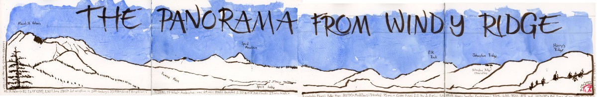
Perhaps the best view of Mount St. Helens, takes the longest drive, but the payoff is worth it.
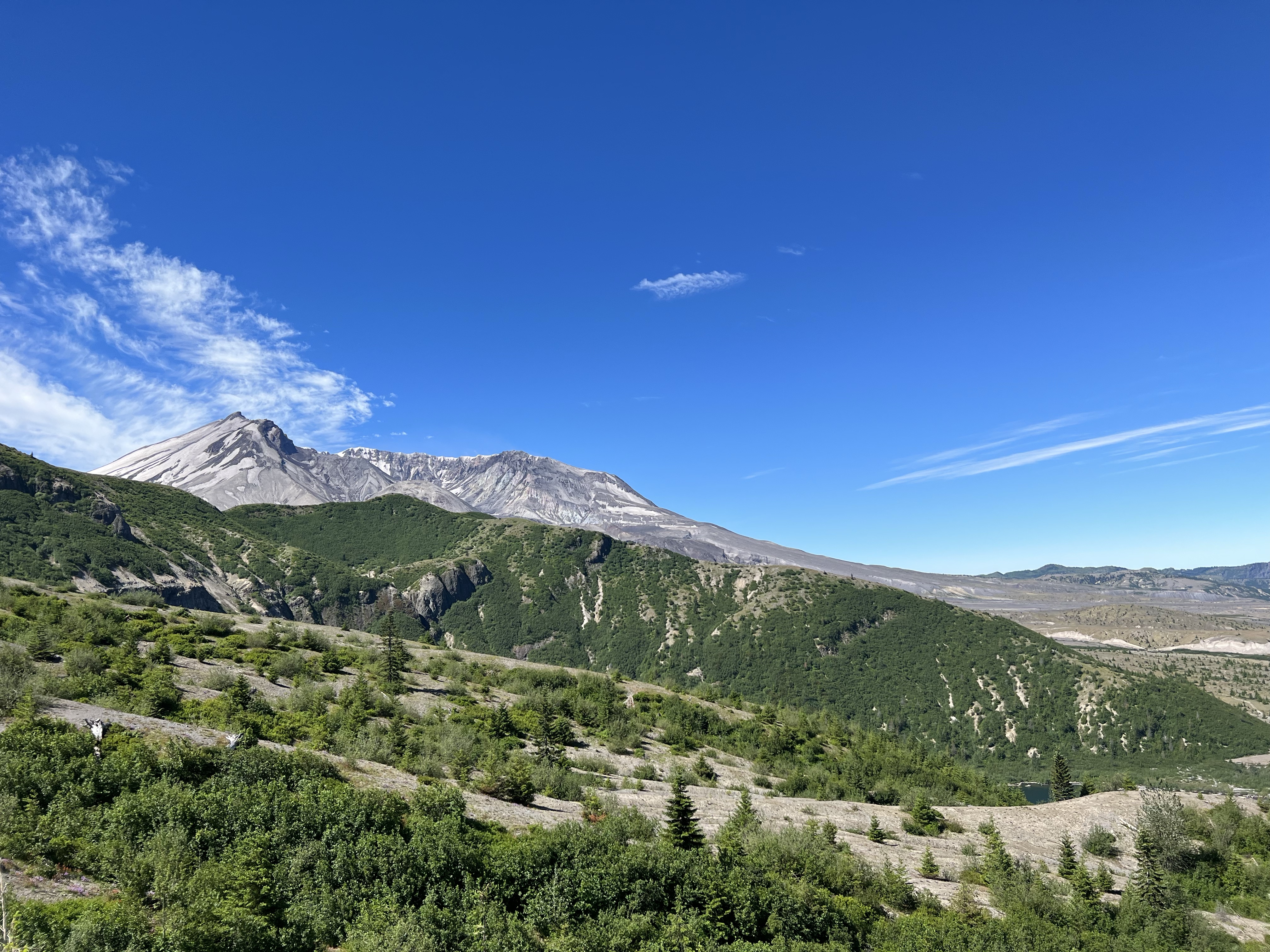
This is Windy Ridge, five miles from the crater of Mount St. Helens. From the viewpoint you can see the U shaped peak of the volcano to the left and Sprit Lake to the right. Everything before you was part of the devastation zone.
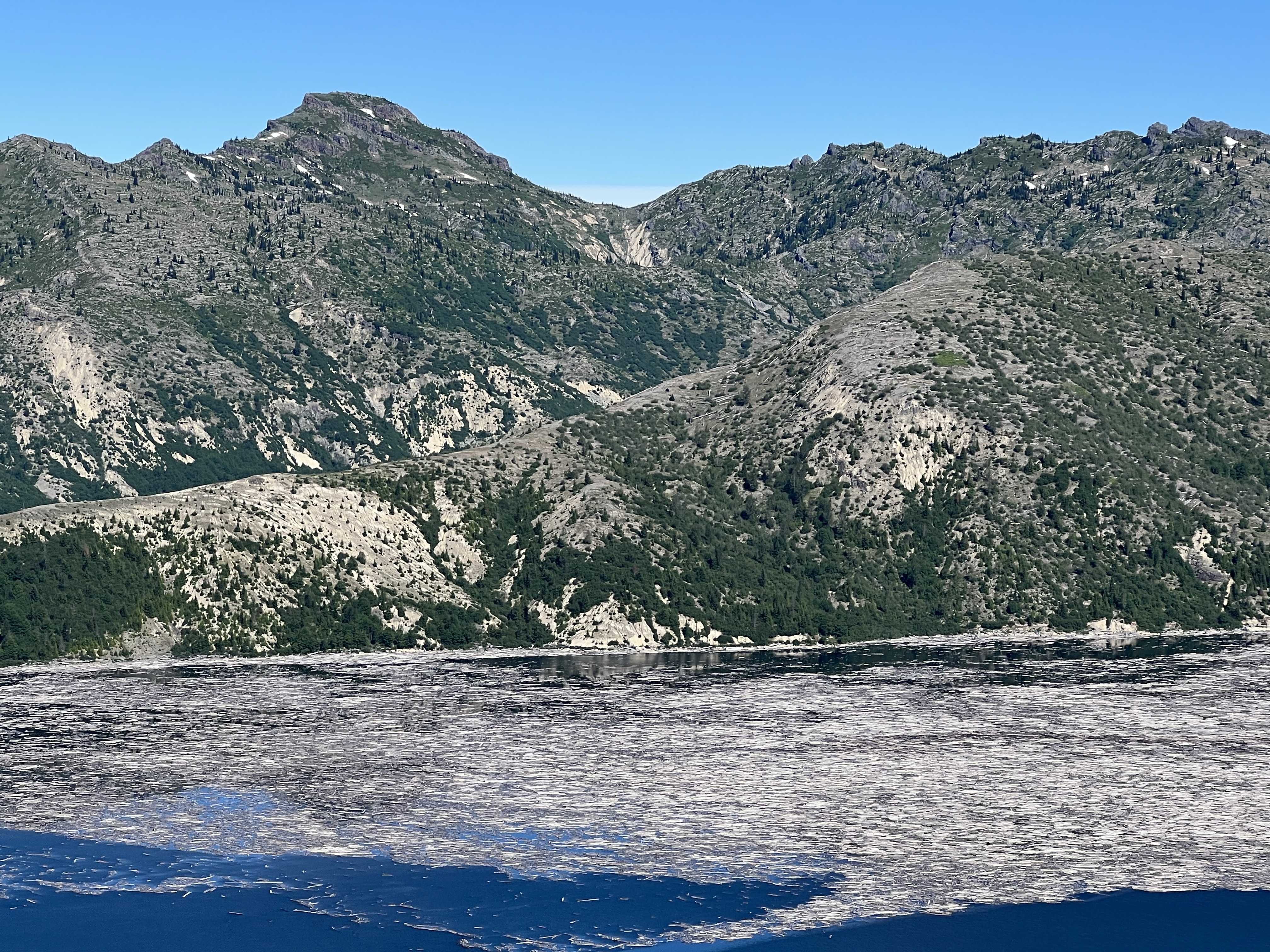
All these year later the Pumice Plain still looks like a moonscape and Spirit Lake still has a raft of fallen logs that travels around the lake with the wind.
The matte of logs, looking here like toothpicks, from the 1980 eruption at Spirit Lake.
To capture this expansive panorama took four pages in my panoramic journal. In the field, I sketched in the forms of the landscapes with a sepia brush pen.
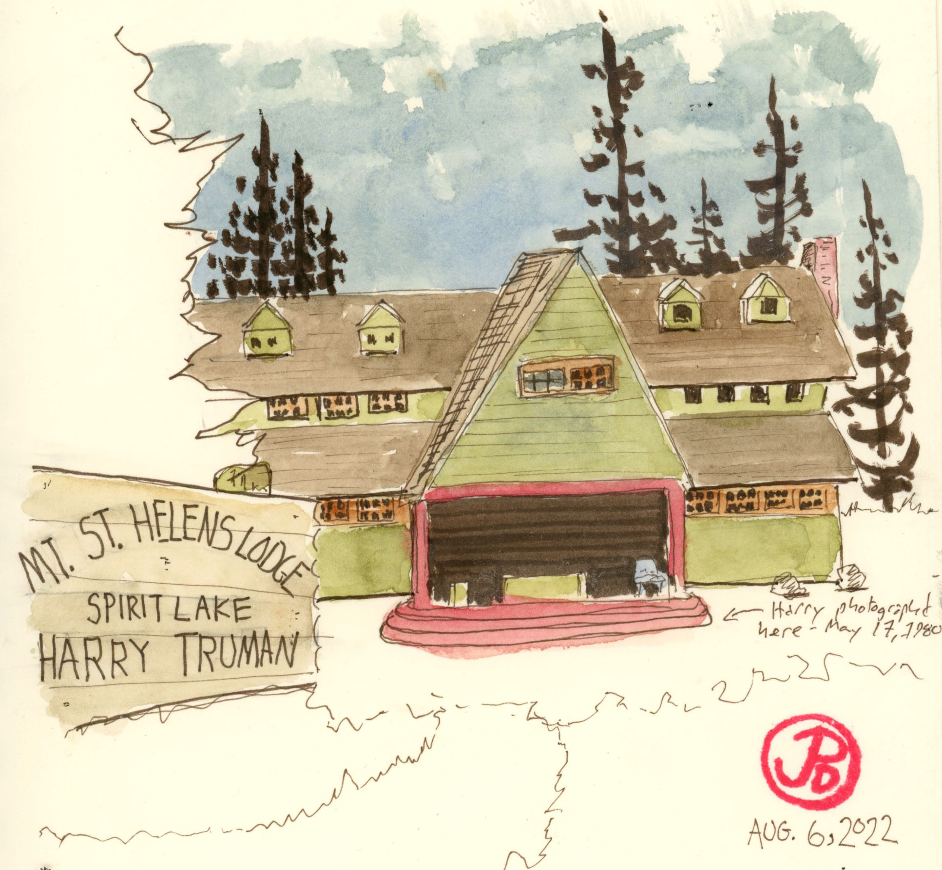
Soon after the earthquakes started in March of 1980, Harry Truman was urged to leave the lake and lodge he loved.
Harry R. Truman was born on October 30, 1896 in West Virginia. When he was a child, his family relocated to the state of Washington and settled in the eastern part of the state on 160 acres of farmland.
Harry first came to Spirit Lake in 1926. He then ran a shop and gas station that also rented boats. Over the years he built up Mount St. Helens Lodge which was on the shores of Spirit Lake and at the base Mount St. Helens. He ran his lodge for 52 years with the help of his third wife Edie.
Sprit Lake was a summer paradise, ringed with many camps, resorts, and lodges. Visitors enjoyed swimming, canoeing, and fishing on the cold waters and enjoyed stunning views of the mountain that loomed over the lake. Harry was looking forward to visitors for the upcoming summer season (being a curmudgeon, perhaps he was not so optimistic). But then the mountain started shaking.
Residents close to the mountain where evacuated but Harry refused to go. He had lost his wife five years previously and he had been wedded to the lake, the resort, and the mountain for fifty years. He was not going to leave.
Truman became a media darling and a folk hero. Many reporters where flown in to interview him. Truman often had his favorite drink in his hand, Coca-cola and Schenley whiskey. Harry once told a reporter that he hates to drink but people drive him to it. He also told another reporter, “If the mountain goes, I’m going with it. This area is heavily timbered, Sprit Lake is in between me and the mountain, and the mountain ain’t gonna hurt me.”
He could not have been more wrong. Just like the government officials, the press, and some members of the USGS who underestimated the incredible power of the sleeping giant that is Mount St. Helens. They certainly found out at 8:32 AM on May 18, 1980. But for Harry, he had little time to reassess his situation.
It has been estimated that Harry had about 22 seconds from when the landslide started to it’s arrival at his lodge. Harry must have heard and felt it coming but could do nothing to save his life.
He would become the first of the 57 causalities of the eruption of Mount St. Helens. And his body has never been found but is buried under 300 feet of the landslide that was the northern flank of Mount St. Helens. The mountain that Harry had loved and hiked upon now was his earthen grave.
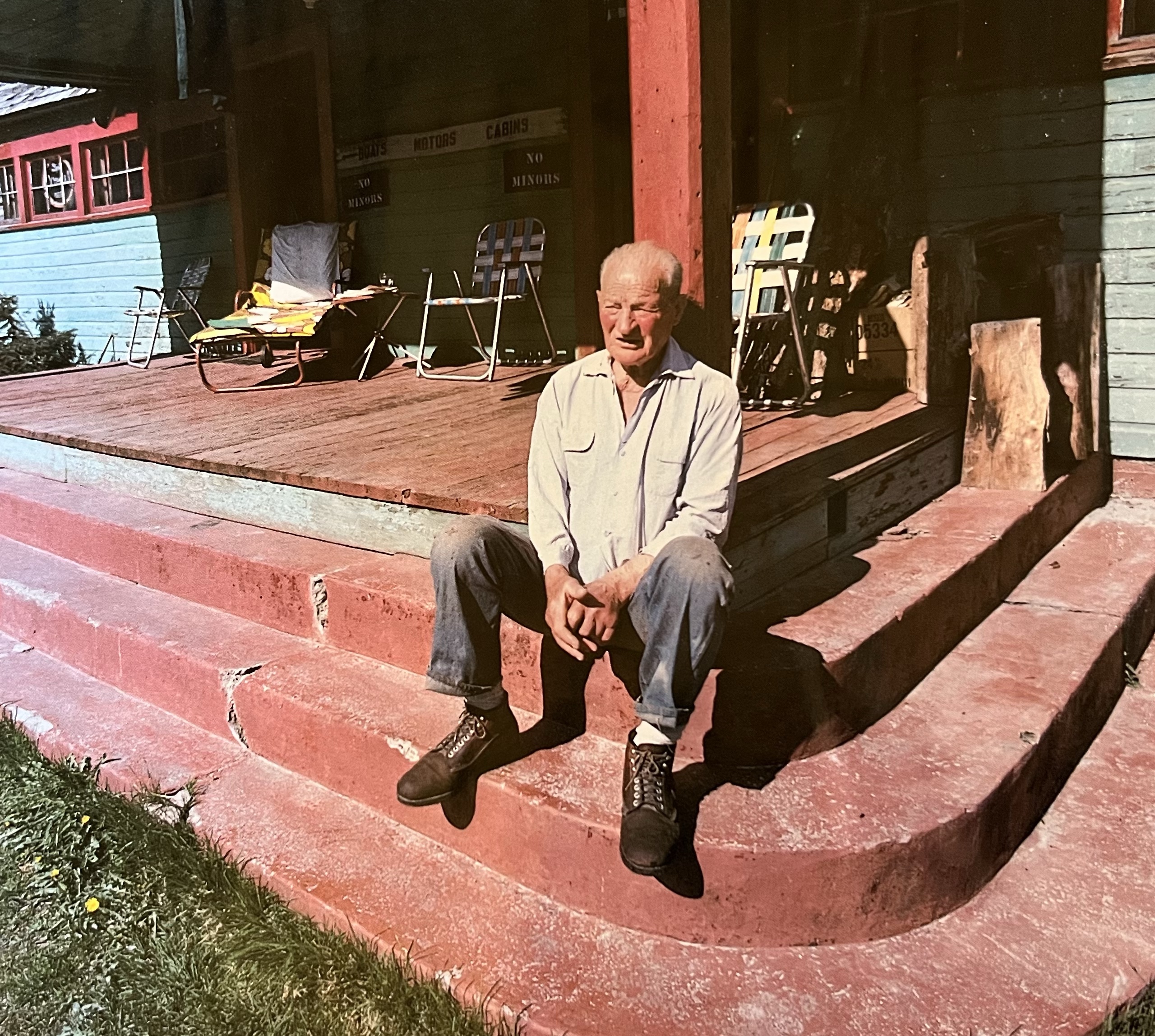
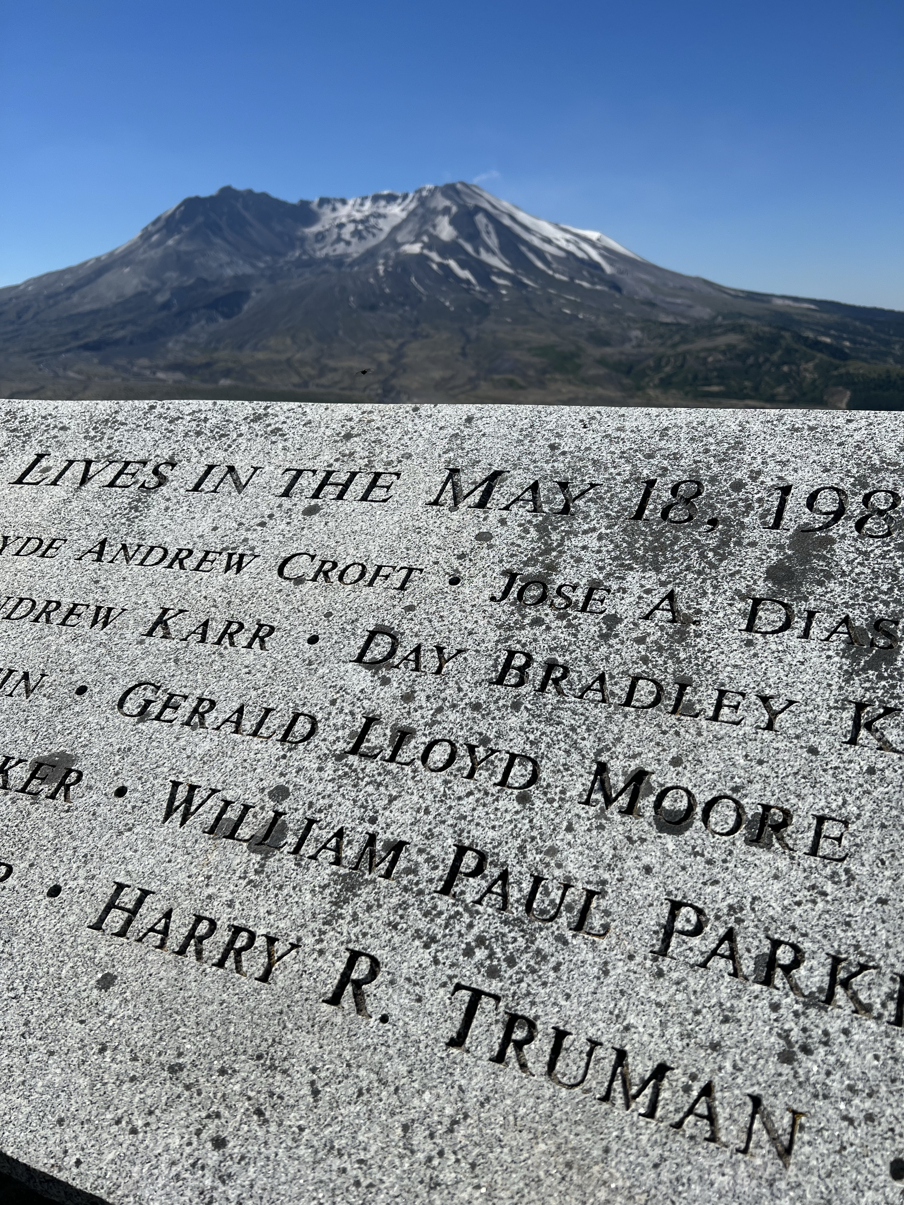
This Roger Werth photograph of Truman sitting on the front steps of the Mount St. Helens Lodge was taken the day before the volcano erupted. The only thing missing from the photo is his cap and his drink.Trumans name on the memorial to those that perished during the May 18, 1980 eruption of the mountain behind the memorial.
The two volcanoes that dominate the island of Hawai’i are Mauna Kea and Mauna Loa.
Volcanoes are the genesis of the largest island in the Hawaiian Island chain and volcanoes continue to add to the acreage of the younger island in the chain.
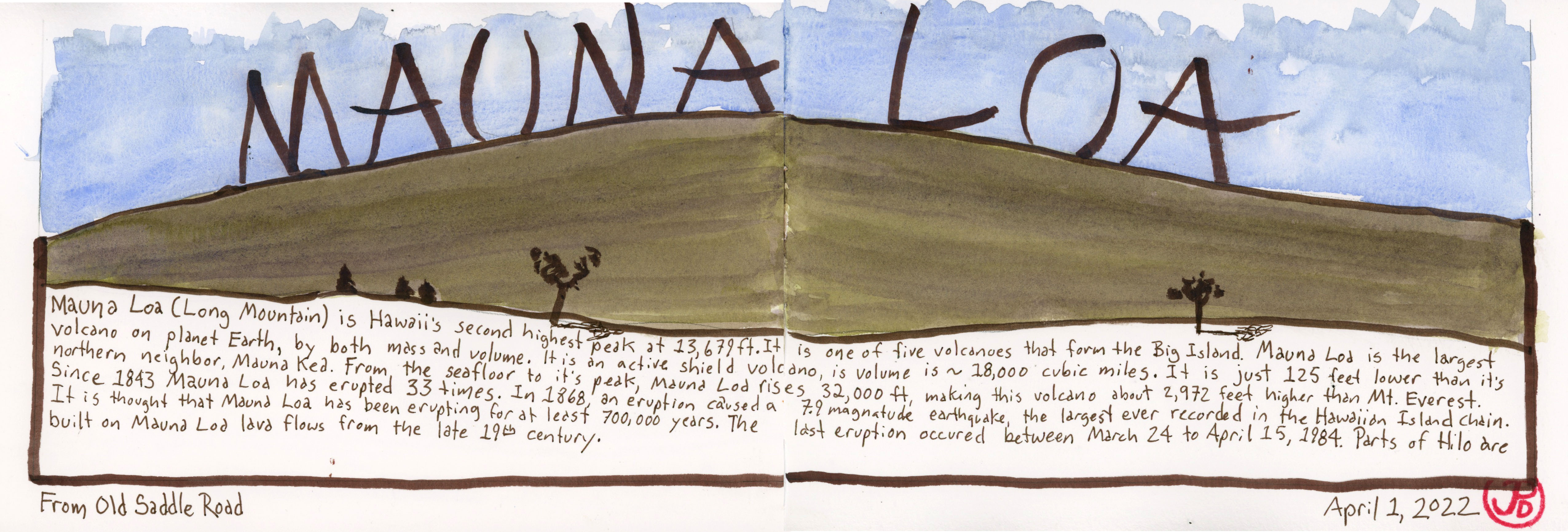
The volcano Mauna Loa (meaning Long Mountain) makes up about 50% of the total land mass of the Big Island. And from it’s base on the sea floor to it’s peak, it’s considered the tallest mountain in the world, about 2,972 feet taller than Mt. Everest.
Since 1843 (when records were first kept) Mauna Loa has erupted 33 times. One eruption in 1863 caused a 7.9 earthquake, the largest quake ever recorded in Hawaii.
Perhaps because of it’s vastness, Mauna Loa does not appear as prominent as it’s northern cousin, Mauna Kea. Mauna Loa’s peak appears as a tall rounded hill unlike the tall pointed alpine peak of the Alps which tends to be our quintessential version of a mountain.
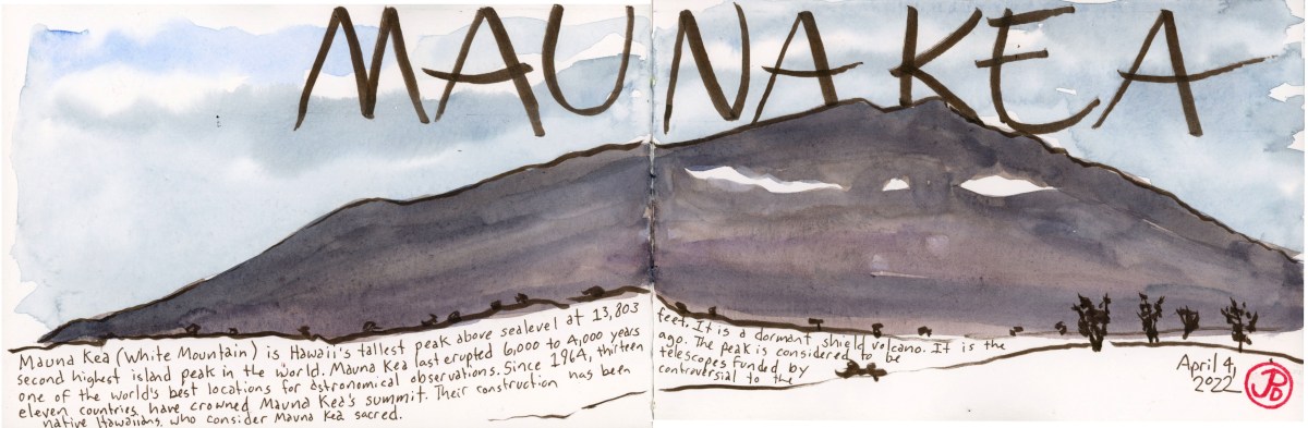
At 13,803, Mauna Kea, meaning White Mountain, is the highest mountain, above sea level, in the Hawaiian Island chain. It’s snow covered peak is visible, when not shrouded in clouds, can be seen from many points in the northern parts of the island.
Both volcanoes were on my “to sketch” list and I sketched them with broad pen brush strokes, attempting to capture the overall form, rather than the details.
I find when I’m field sketching with a brush pen I am more likely to sketch because I can work quickly, leaving more time in the day for more sketches. This was my approach with the two sketches of Mauna Loa and Kea.
I look forward to seeing and sketching the world’s largest volcano on the planet earth, Mauna Loa, the Long Mountain.
The volcano is so big, and such a major part of the island of Hawaii, that is tough to get a firm perspective of the mountain, so I was going to have to get a little creative with my viewpoints on how to capture the mountain in sketch.
I before I stand before the mighty mountain, pencil and sketchbook in hand, I wanted to do a pre trip sketch to help put the scale of Mauna Loa into perspective.
A volcano I had visited in recent memory was Mount Lassen. This was a volcano that had erupted sometime ago (in May of 1917) but it was clear to see in quite easy to sketch. I was looking forward to comparing both of these volcanoes and how they were alike and different.
A brush pen sketch of Lassen Peak from October 2020. A spread on the different types of volcanoes at Lassen National Park. Mauna Loa is a shield volcano, which is a volcano that is a broad dome with gentle slopes extending to the ocean floor.
For my spread about Mauna Loa, I based of my sketch on part of a map I picked up at REI. The map was produced by Franko Maps and is titled “Hawaii Adventure Guide”.
The specs of Mauna Loa are incredible. It’s the largest active volcano in the world. It rises 13,100 feet above sea level. But if you look at the base of the seafloor where Mauna Loa rises, it is a 32,000 ft making it the largest mountain on planet Earth. That is almost 3,000 feet taller than Everest. Mauna Loa extends for 74 miles and covers half of the island of Hawai’i and it’s area adds up to about 85% of the area of all the other Hawaiian Island combines.
One of Mauna Loa’s eruptions produced the largest earthquake in Hawaiian history.
Mauna Loa is a very active volcano having erupted 33 times in recorded geologic history. It’s last eruption was in 1984, which is a extremely short time ago on the geological timeline. That eruption came within seven miles of Hilo.
Will Mauna Loa erupt again? It is not a question of “if” but “when”.
Pretrip planning would not be complete without a map.
I was excited to be visiting the Big Island for the first time and one of the best ways to get to know a place is to map it. Drawing imprints information better than any other note taking strategy. Drawing is an active, not a passive, pursuit.
There are two distinct sides to the largest and youngest island in the Hawaiian Island chain. The Kona side (west) and the Hilo side (east). The Kona side is the more sunny and the most popular side. Hilo is on the windward side and experiences more rain (about 130 inches per year) than the leeward or Kona side. I planned to visit both sides. And sketching a map of the islands, helped me put towns and sites into perspective.
I also did a spread that is a visual checklist of some of the sights and experiences I wanted to encounter on the Big Island (featured sketch). Snorkeling at the Cook Monument at Kealakekua Bay, Mauna Kea, Birding on Saddle Road, Pu’uhonua o Honaunau National Historical Park, manta rays, ‘Akaka Falls, Hawai’i Volcano National Park, Kona coffee, and a tropical reef fish called a Moorish idol.
Lassen was the final National Park in California that I needed to visit in order to visit al the National Parks in my home state. It always seemed less well known and remote than other parks in the state, with the exception of Channel Islands National Park because you have to take a one hour boat ride to get there. California has the most National Parks in the Union with nine.
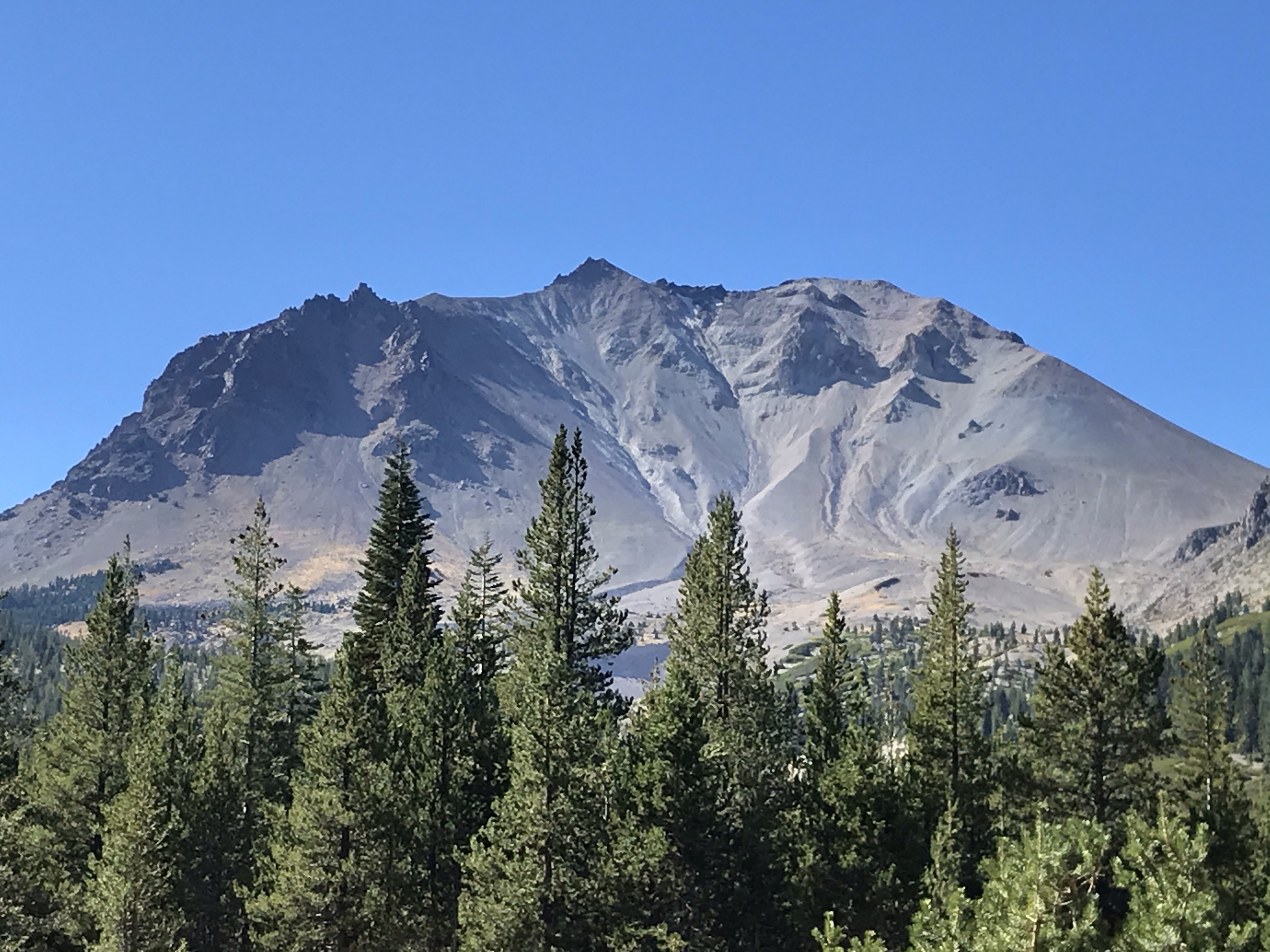
Lassen Volcanic is an apt name for this National Park because volcanos and Lassen Peak dominate the landscape of this northeastern part of California.
A pre-trip sketch of the four types of volcanos and their examples, found in Lassen Volcanic National Park: Cinder Cone (Cinder Cone) Composite (Brokeoff Mountain), Shield (Prospect Peak), and Plug Dome (Lassen Peak). Lassen Peak is the largest example of a Plug Dome volcano in the world.
This 106,000 acre park features all four types of volcanos and Lassen Peak represents the last volcano to erupt in California. Even through that was just over one hundred years ago, that eruption, or more accurately, eruptions, left its mark all over the landscape. This is easily seen in the part of the park northeast of Lassen Peak called the Devastated Area.
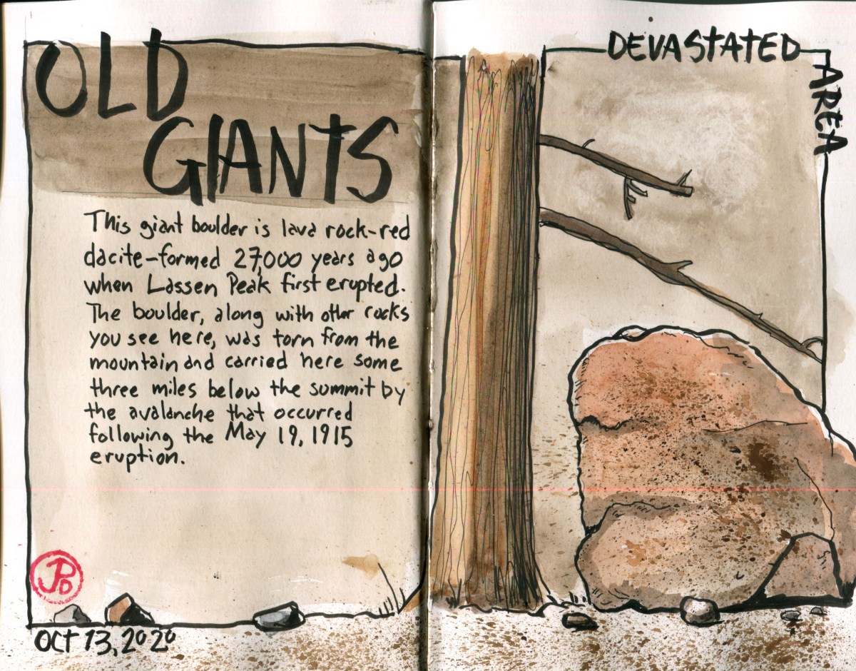
The view of Lassen Peak from the Devastated Area.
The short interpretive trail features giant boulders that had travelled over three miles to find their angle of repose after an avalanche on May 19, 1915. Some of the massive boulders are estimated to have travelled at over one hundred miles an hours on their journey from the summit.
Lassen was active between 1914 and 1917 but it’s largest eruption occurred on May 22, 1915 when a massive eruption sent gas and ash 30,000 feet into the air. The eruption could be seen 50 miles away to the west in Anderson. The flows headed down the Lost and Hat Creek waterways, destroying everything in it’s path. This is now the area called the Devastated Area. The trees and vegetation has grown back but the large volcanic boulders tell of a turbulent time.
I picked a spot on the ground near the trail and sketched a large reddish dacite boulder formed about 27,000 years ago. Reading about this boulder’s journey helped understand these erratic rocks. It’s reddish hue reflected the origins of it’s birth, the reds I was seeing at the peak of Lassen.