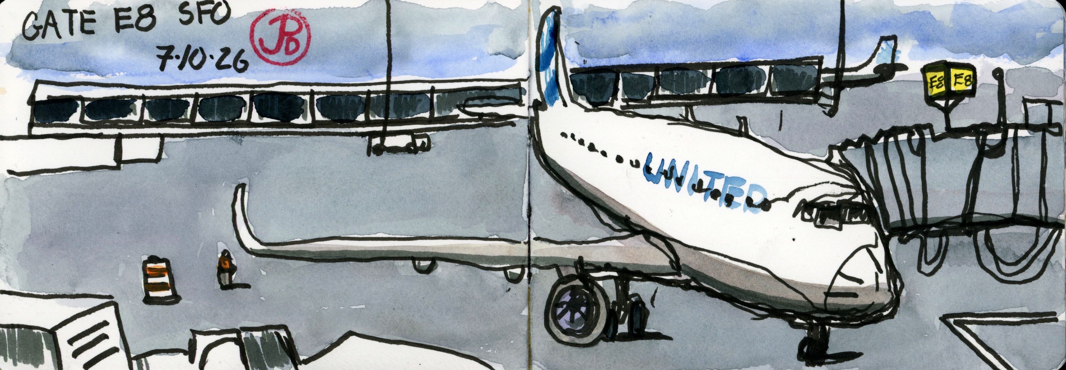
Sitting in a gray swivel chair with gray skies above and the United Boeing 737 below at gate E8.
This was not the plane taking me to Houston nor that plane continuing on to Quito. This plane was heading off somewhere else.
I pull out my sketchbook and pens and start sketching in a continuous line, starting with the nose of the Boeing and reaching back to the tail then reaching out to the starboard wing and down below to the turbine engine and back to the front landing gear.
I have done this sketch many times before at different airports of different planes at different gates.
This is a touchstone sketch, one that I return to while killing time at an airport.
Perhaps it’s not really killing time but a meditation after the chaos of security lines and X-rays, of taking off your belt and hat only to put them on again.
Yes it is a meditation as time flies by (pun intended) and moves ever closer to 8:15, boarding time.
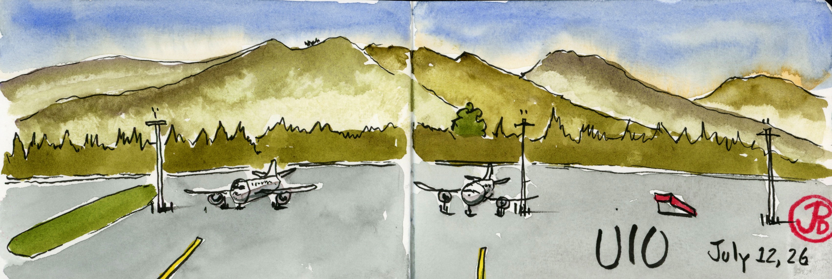
Airport sketch at Quito. UIO is a beautiful setting in the middle of the Andes.
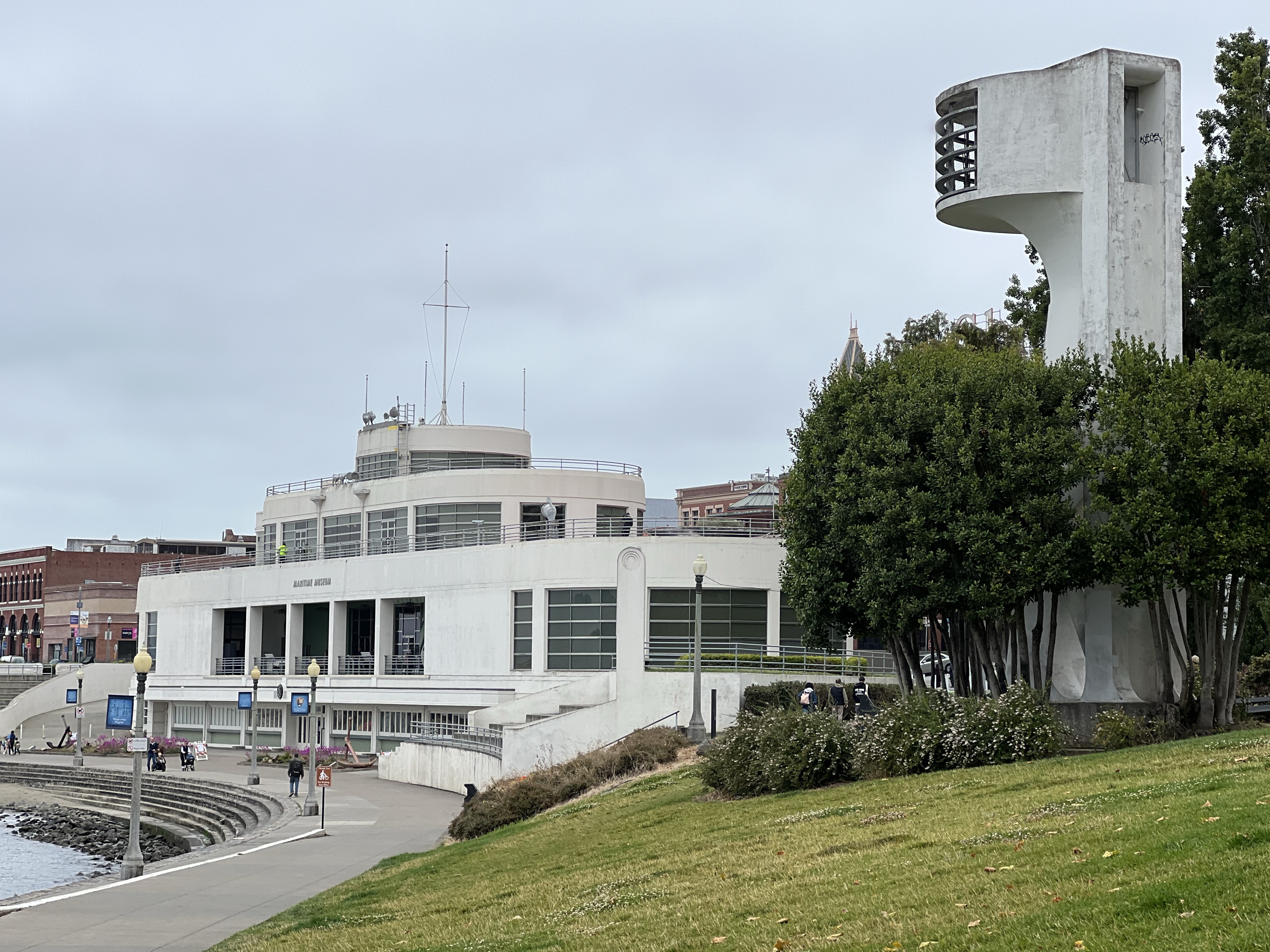
On a Wednesday I became a tourist in my own city and headed over Twin Peaks to the Ferry Building.
I went from the N Judah to the F Market to Fisherman’s Wharf. This is the epicenter of the tourist industry in San Francisco. I walked to Aquatic Park to the ship-like structure that is the now the Maritime Museum. It was originally built as the Aquatic Park Bathhouse and opened in January 1939.
I love this historical structure which is great example of Streamline Moderne. Being on the water, the building looks like it could sail away at any moment.
Is this a ship or a bathhouse? Well the answer is neither!
The Aquatic Bathhouse has served as a number of uses, most controversial as a Casio for the rich. The building now houses the Maritime Museum.
The murals by Hilaire Hiler on the ground floor are otherworldly. It took visitors minds away from the Depression. Benny Bufano’s frog sculpture. At least I think it is supposed to be a frog.
I picked a spot along the curve of Aquatic Park to sketch the former bathhouse in my panoramic sketchbook.
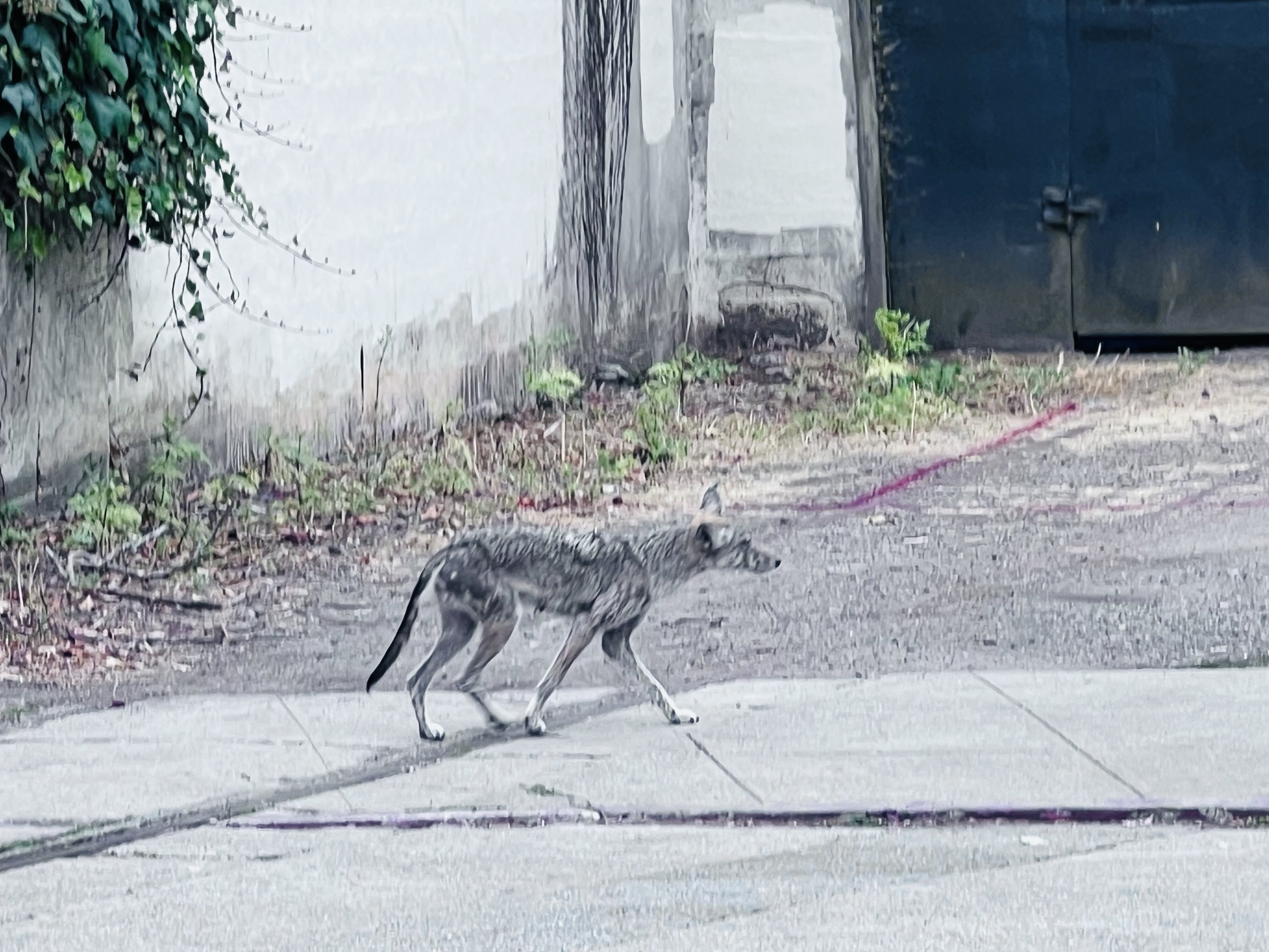
On the other side of the spread I added the Fort Mason Beltline Tunnel, which is just a short distant from my first sketching position. This tunnel is historical and featured in a classic 1971 film.
In the Don Seigel film Dirty Harry, starring Clint Eastwood, the serial killer Scorpio (based on the real Zodiac Killer) sends Inspector Harry Callahan on a wild goose chase around San Francisco. One scene features Eastwood going through the tunnel when he is stopped by some unfortunate thugs.
The State Beltline Railroad ran along the Embarcadero and served the piers along the waterfront. The railroad was in operation from 1890 to 1993.
A very scrawny urban coyote walks by the boarded up Beltline Tunnel.
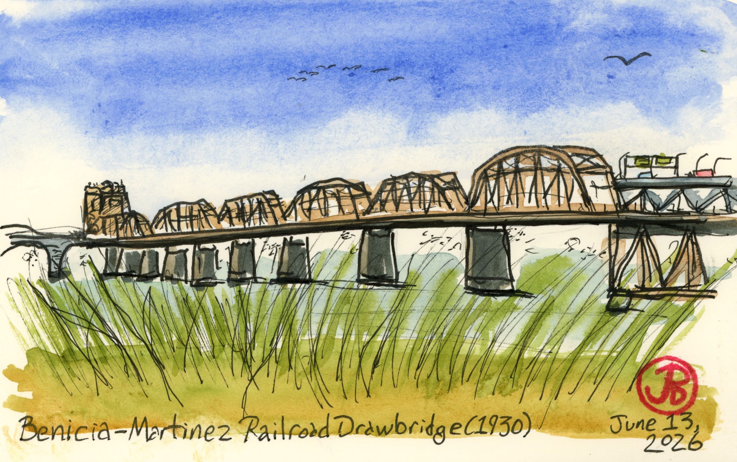
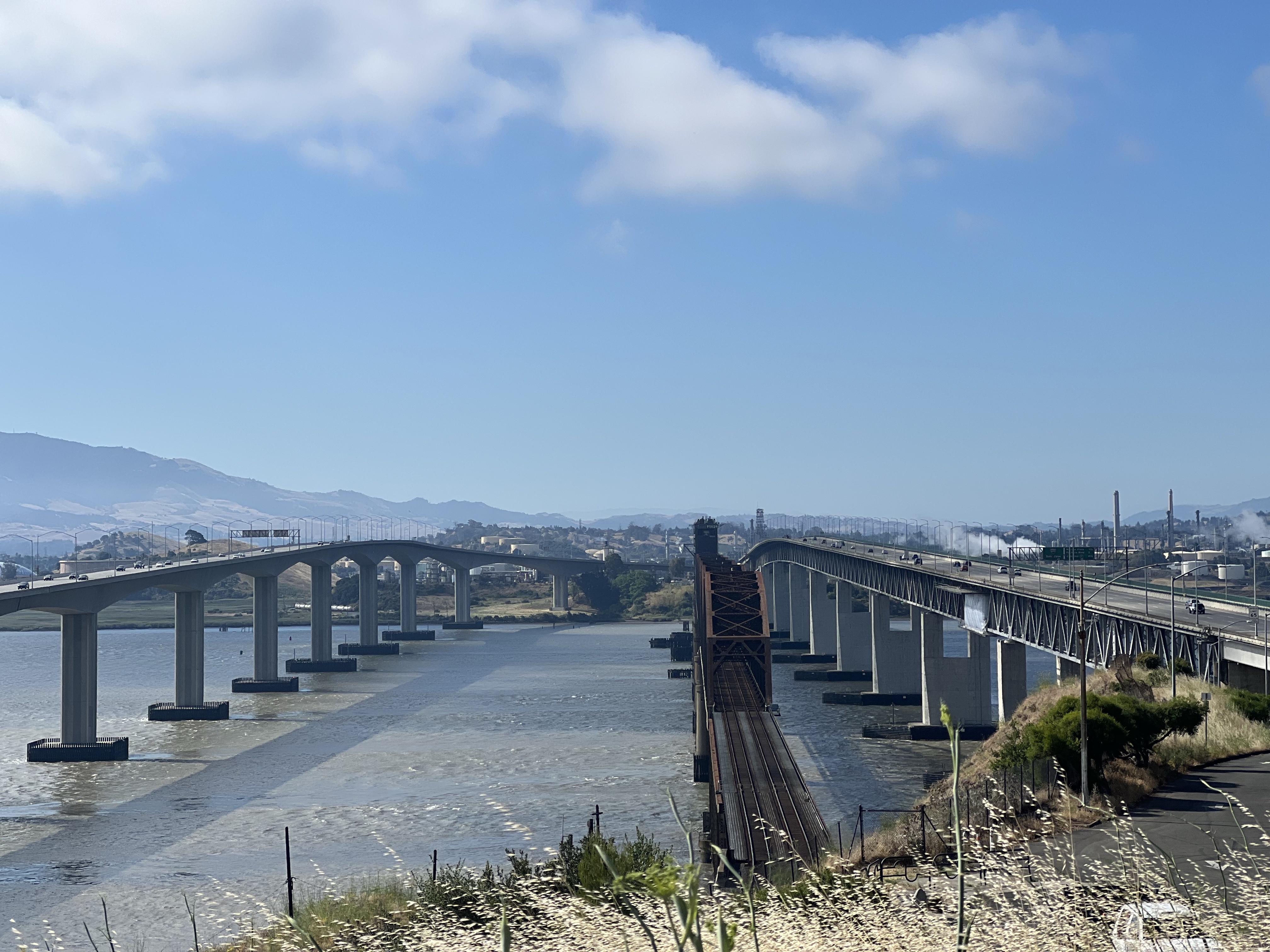
After sketching some Bay Area railroad ferry history, I wanted to sketch the 1930 railroad bridge that killed off the ferry between Benicia and Port Costa.
As rail traffic increased (both passenger and freight) and the rail ferries aged and needed repair or replacement, this caused more delays on the Overland Route (not to mention delays caused by fog). Southern Pacific looked into building another ferry but soon realized that a rail bridge spanning the strait was the best solution.
The railroad bridge was built for Southern Pacific Railroad between the years 1928 to 1930.
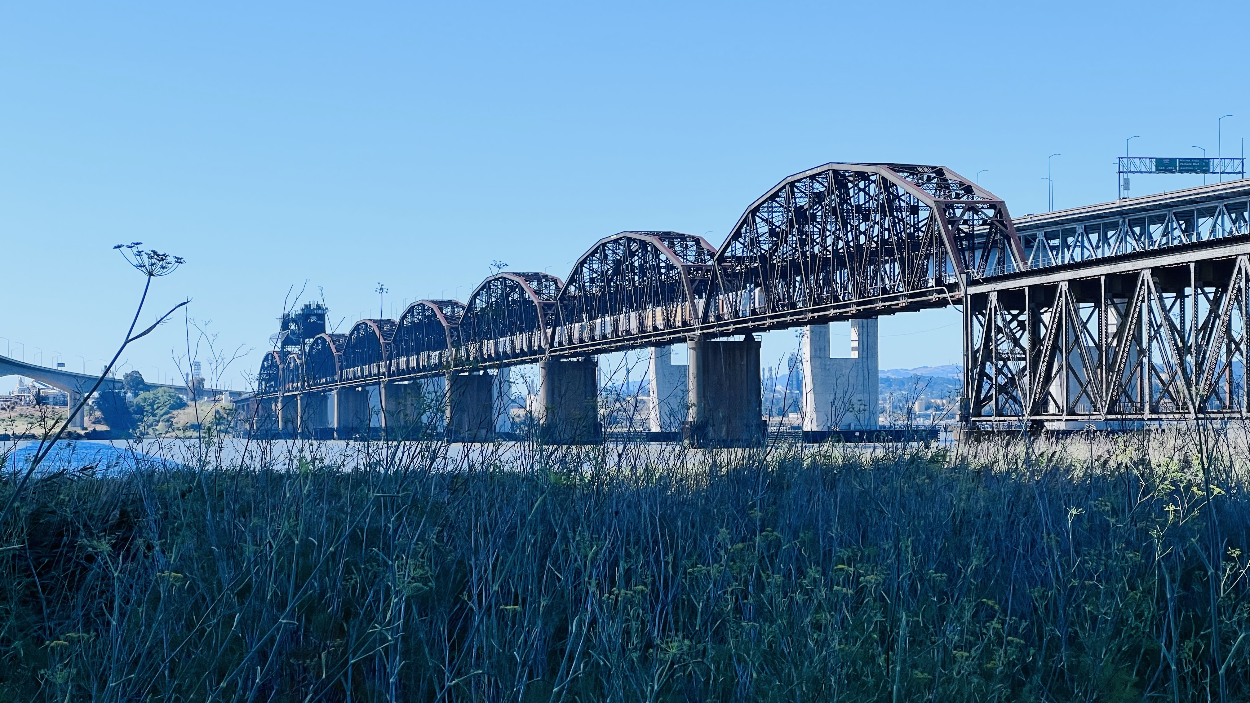
The bridge is impressive because it is the second longest railroad bridge (5,603 ft 6in long) in the country and the longest west of the Mississippi.
The railroad bridge is now flanked to two automobile bridges that cross the Carquinez Strait. One span was built in 1962 while the other completed in 2007.
The longest railroad bridge west of the Mississippi.
Because the bridge is relatively low to the water, 70 feet in fact, a midsection is a drawbridge that allows tall ships to pass through the strait. When the drawbridge is opened, it gives passing ships 135 feet of clearance.
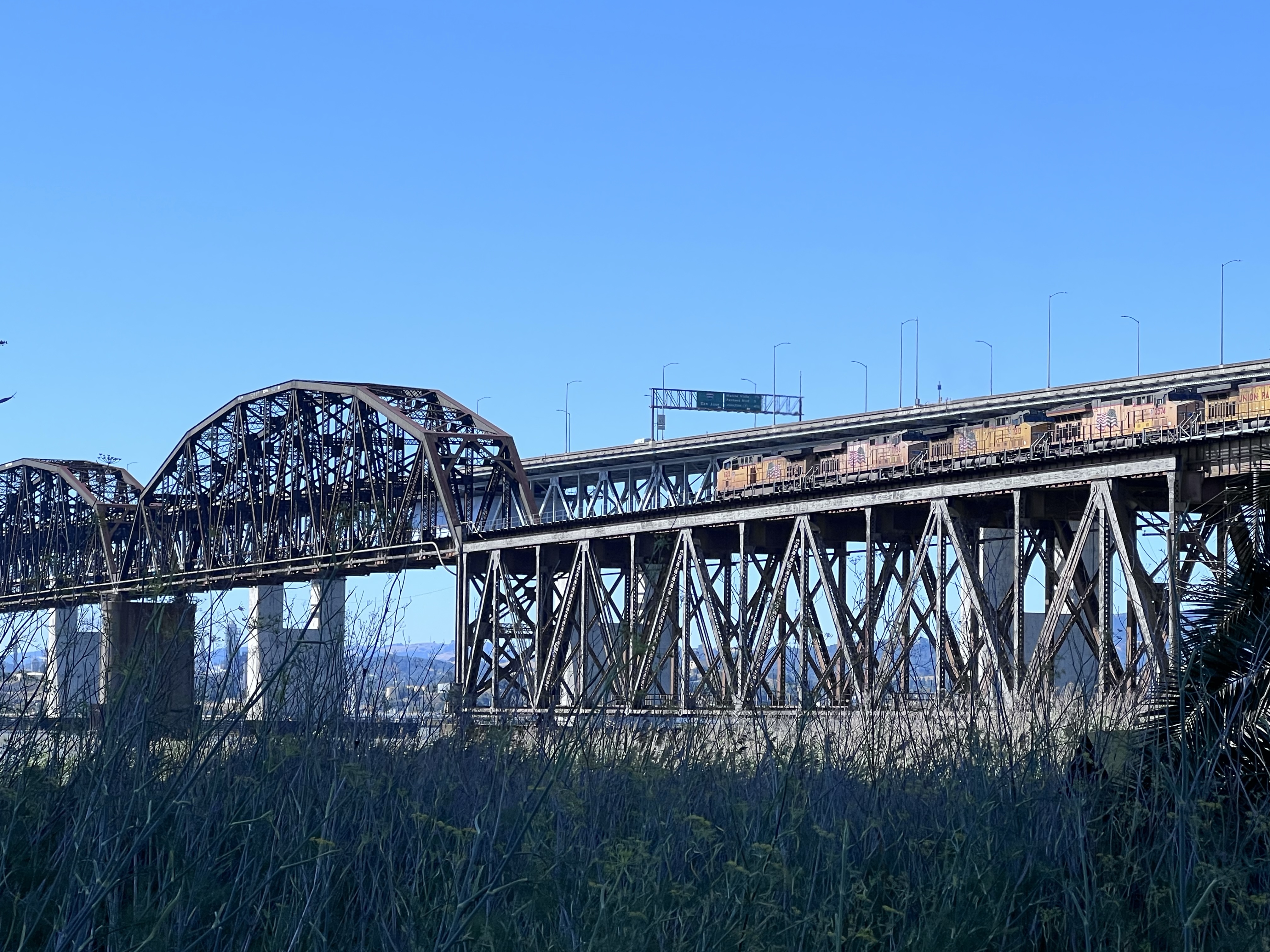
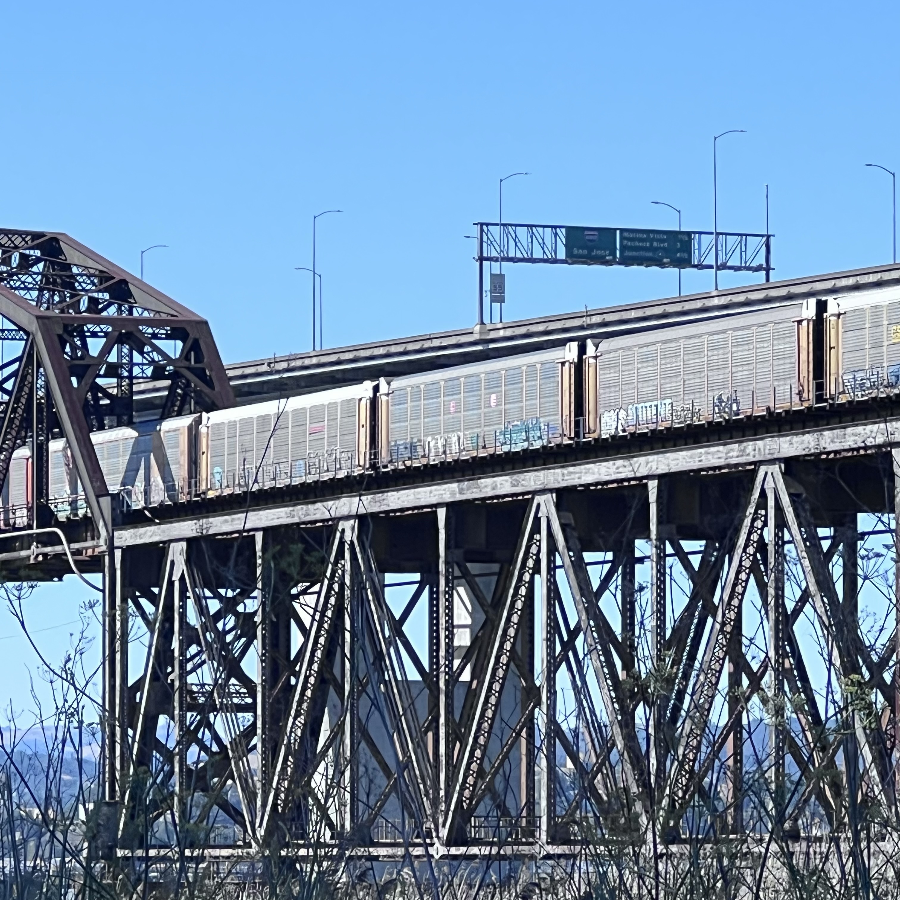
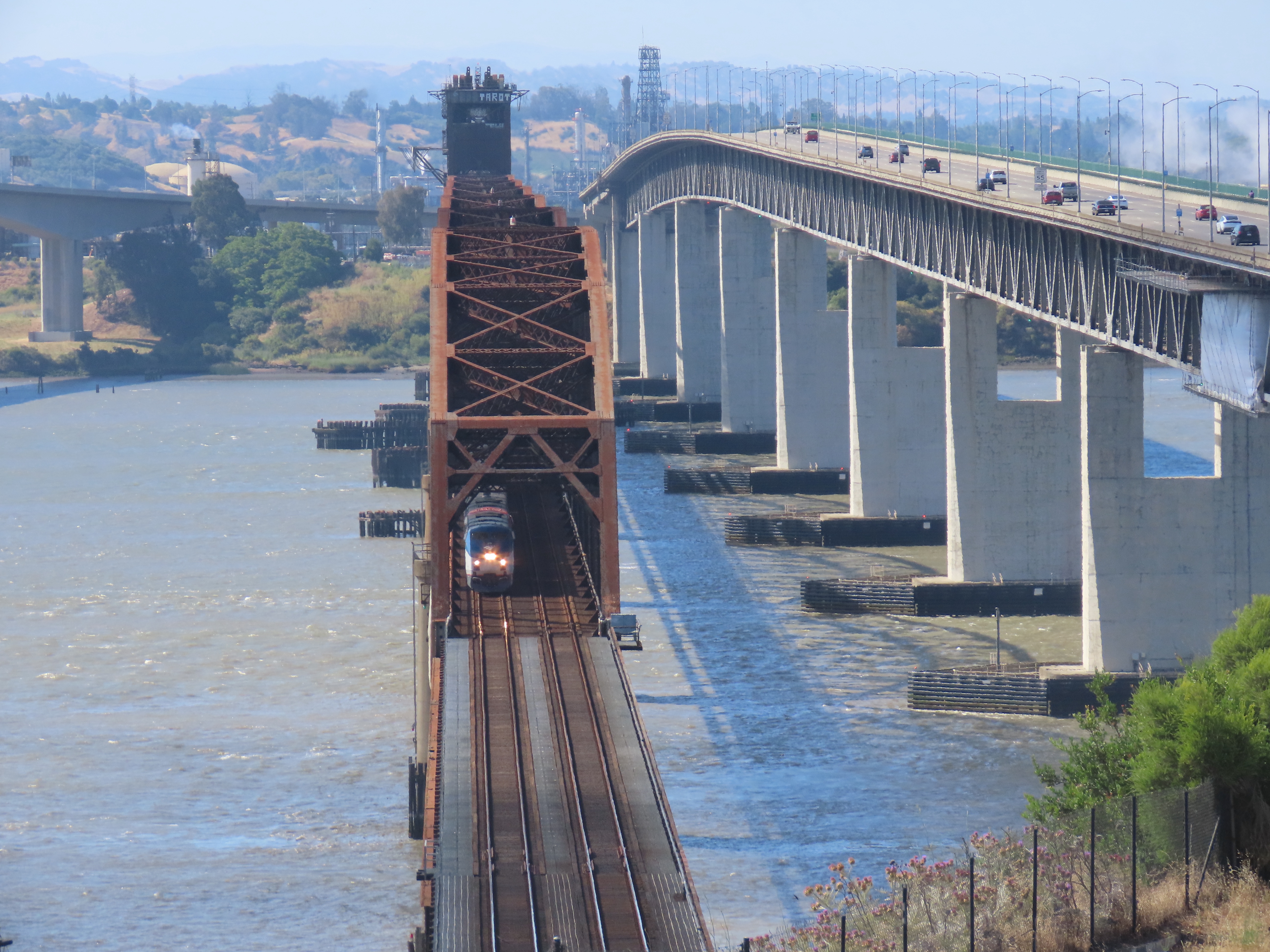
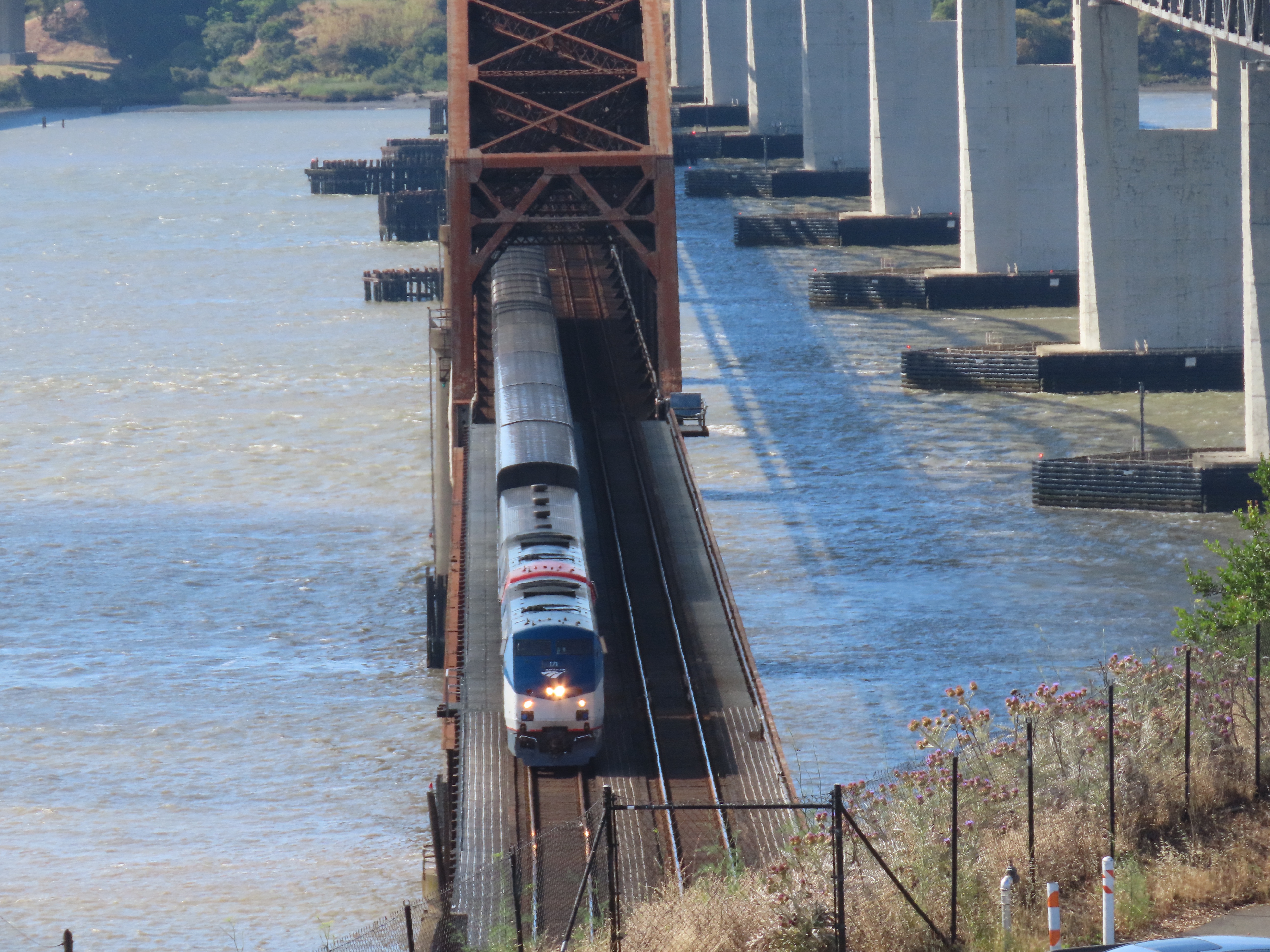
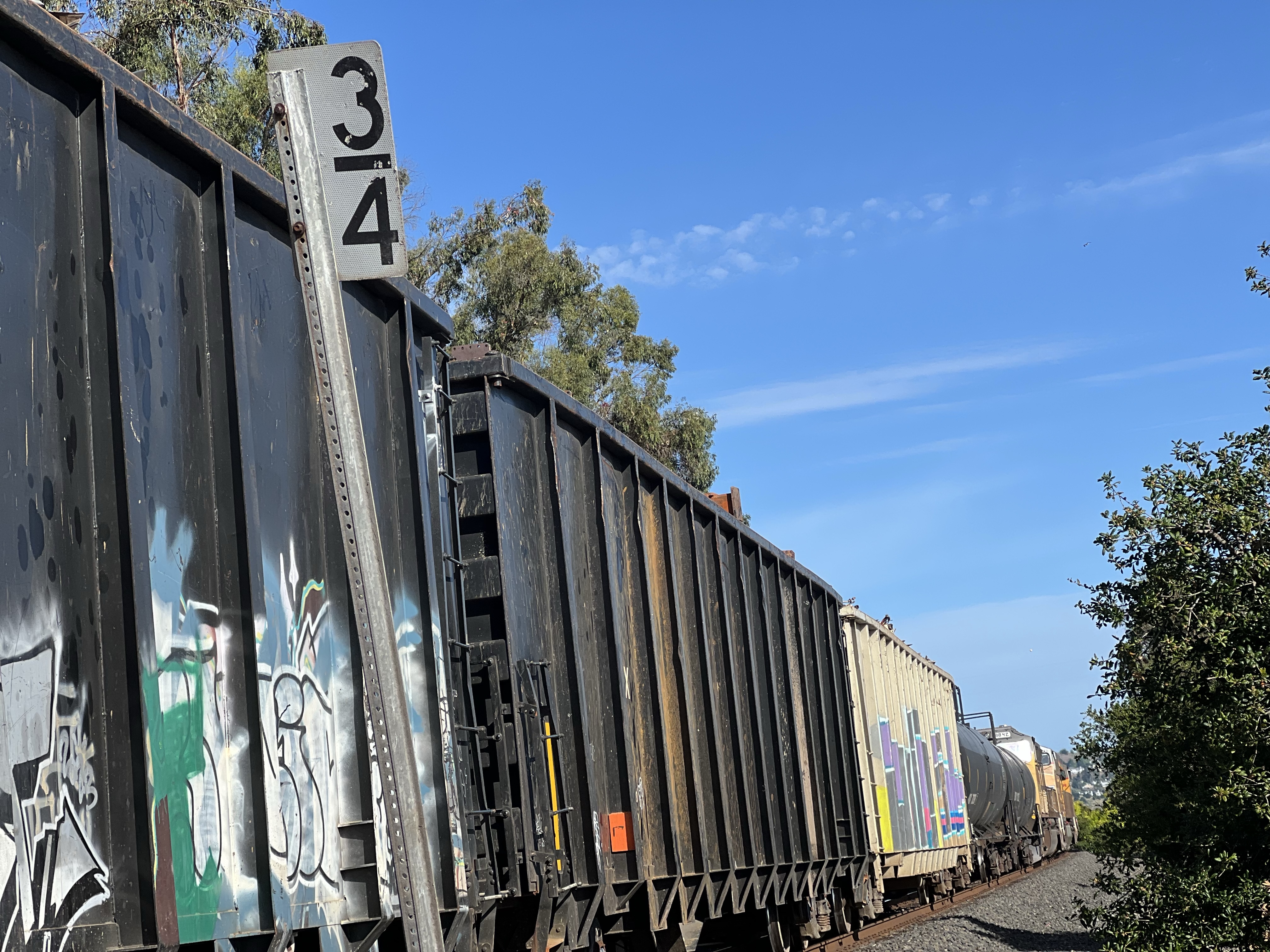
Five locomotives are on point of this Union Pacific westbound mixed consist freight as it comes onto the bridge. This long freight train would take quite a few ferry passages to shuttle across the strait before the bridge was built in 1930. Modern freight trains can be one to two miles long.There were quite a few car carriers on the consist. The area on the Benicia side is new car transfer point.
Foamer at the Bridge
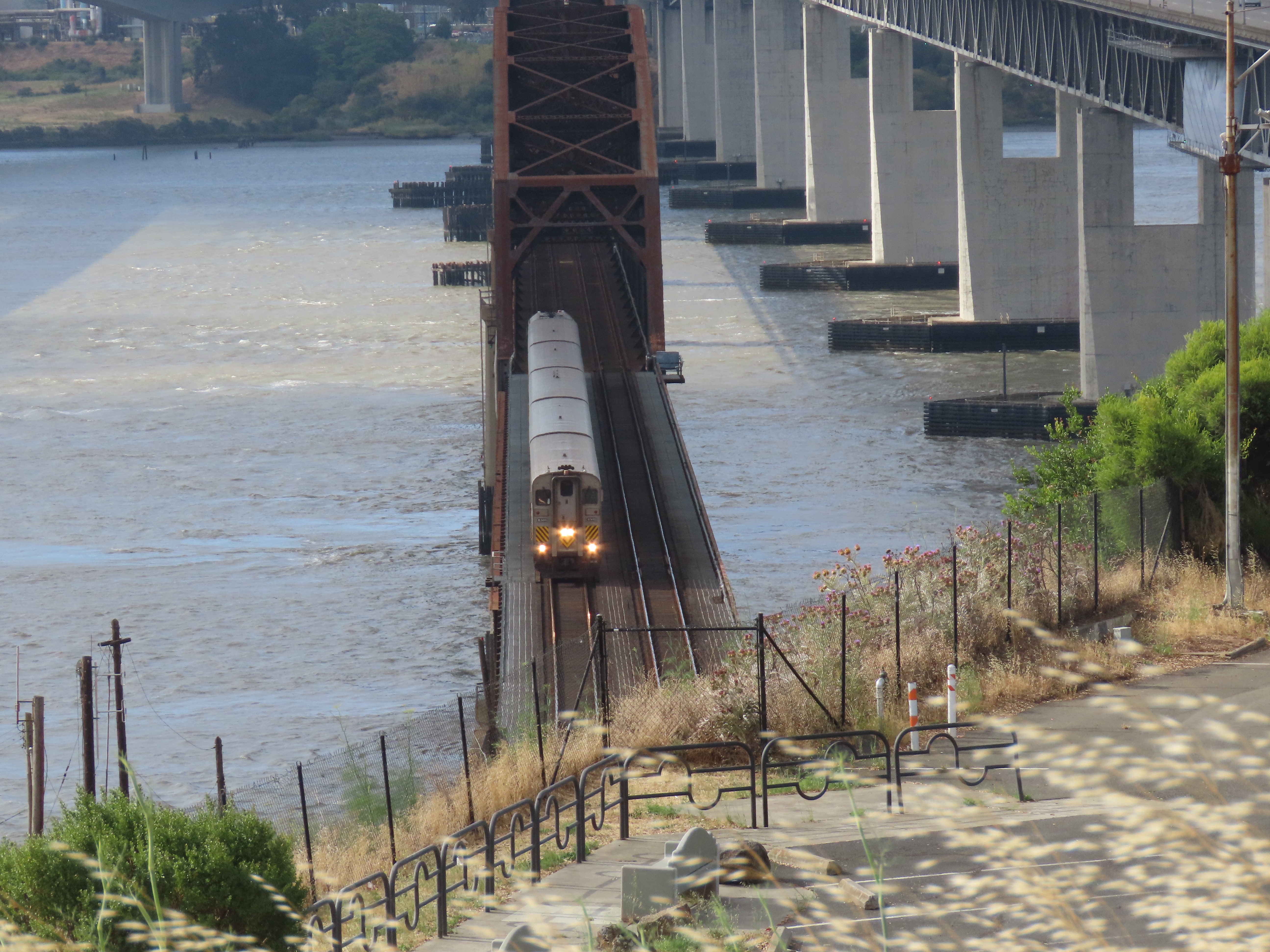
On a Sunday morning I headed up to the northern side of the Benicia- Martinez Railroad Bridge to the vista point, flanked by the two road bridges, to watch some trains transit the historic bridge.
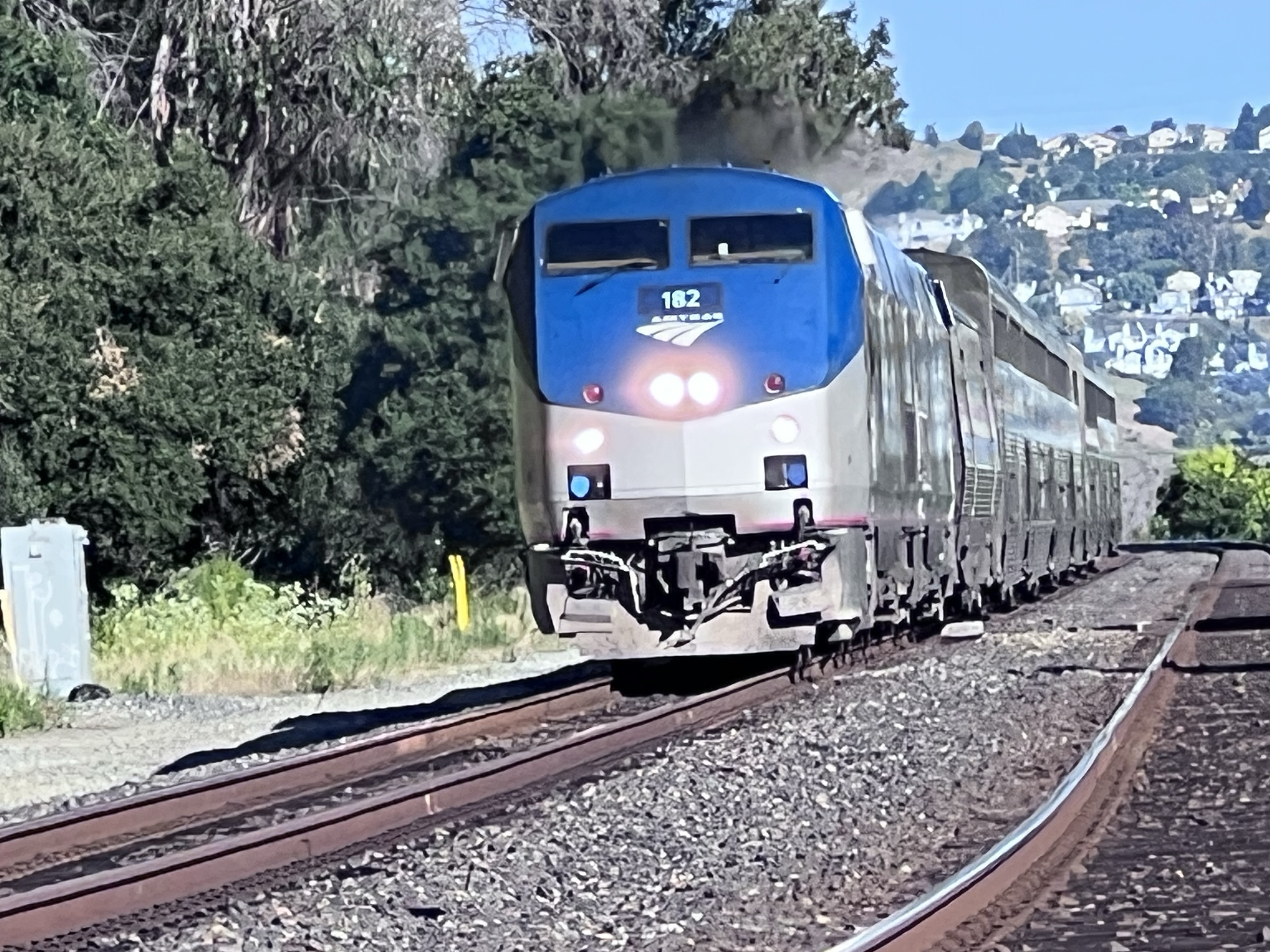
The view southeast from Vista Point. The railroad bridge is in the middle. The newer road bridge (2007) is on the left, the other (1962) is on the right. A northbound Capital Corridor train number 720 crossing the bridge. This trains’s final destination is Sacramento. The good thing about the Vista Point is that you can see northbound trains approaching across the Carquinez Strait like California Zephyr train number 6 running three minutes late. Once the train departs Martinez it will cross the bridge about four minutes later. California Zephyr Number 6 crossing the bridge. Next stop Davis.I have yet to cross the bridge on the Zephyr as I usually board the train further north in Colfax.
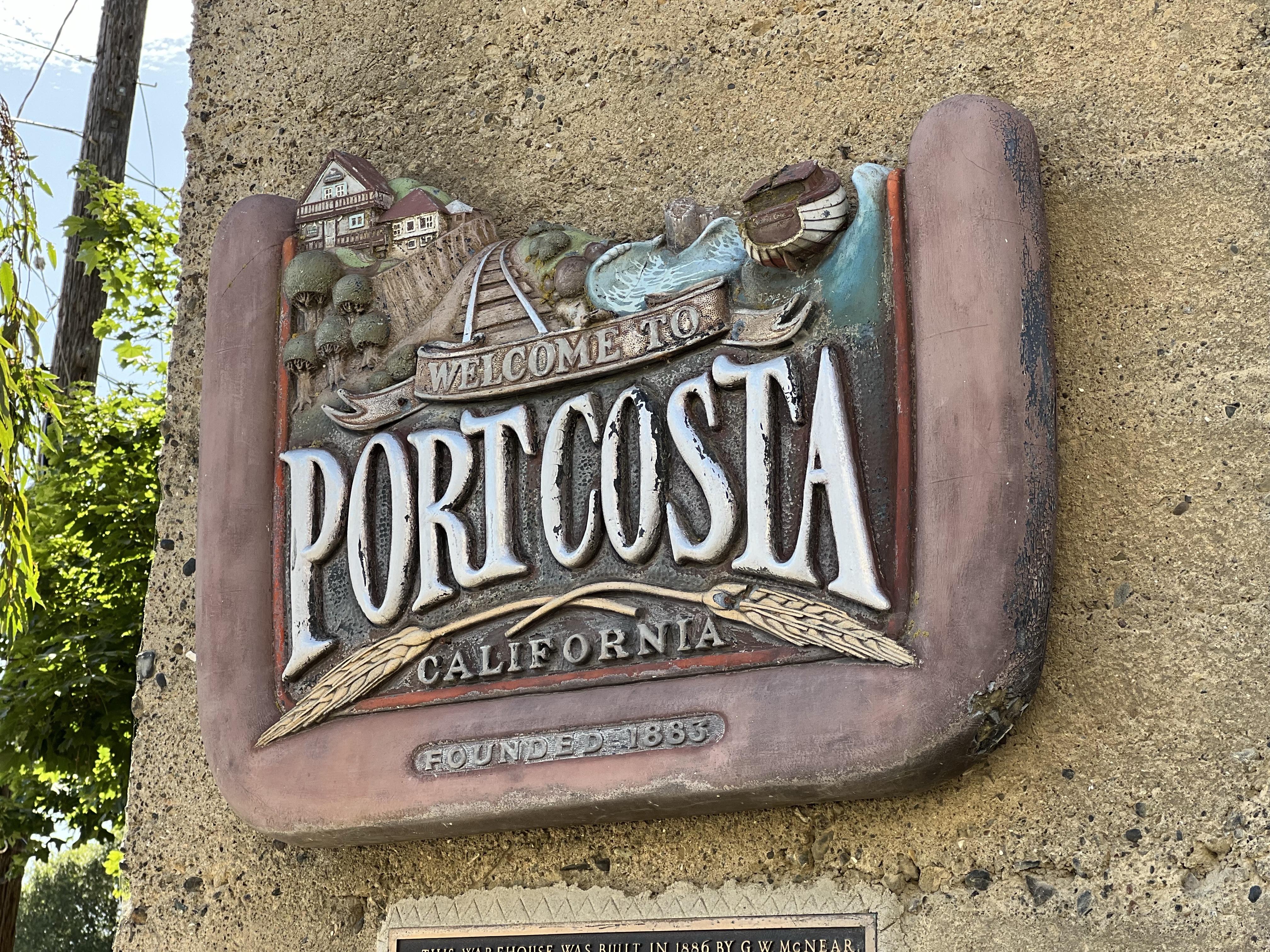
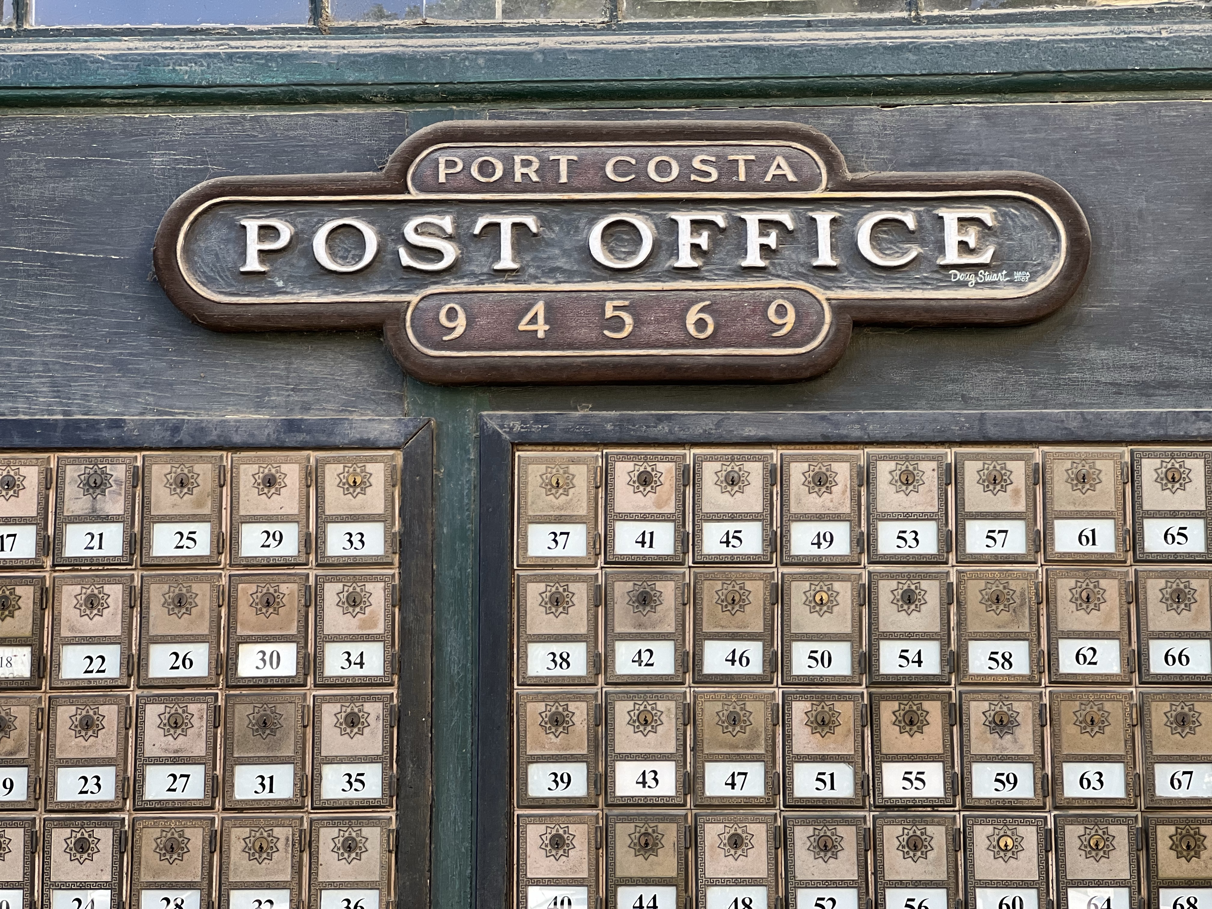
The “downtown” of Port Costa is only about a block long. The historic buildings here only hint at the size and importance of the town over 120 years ago.
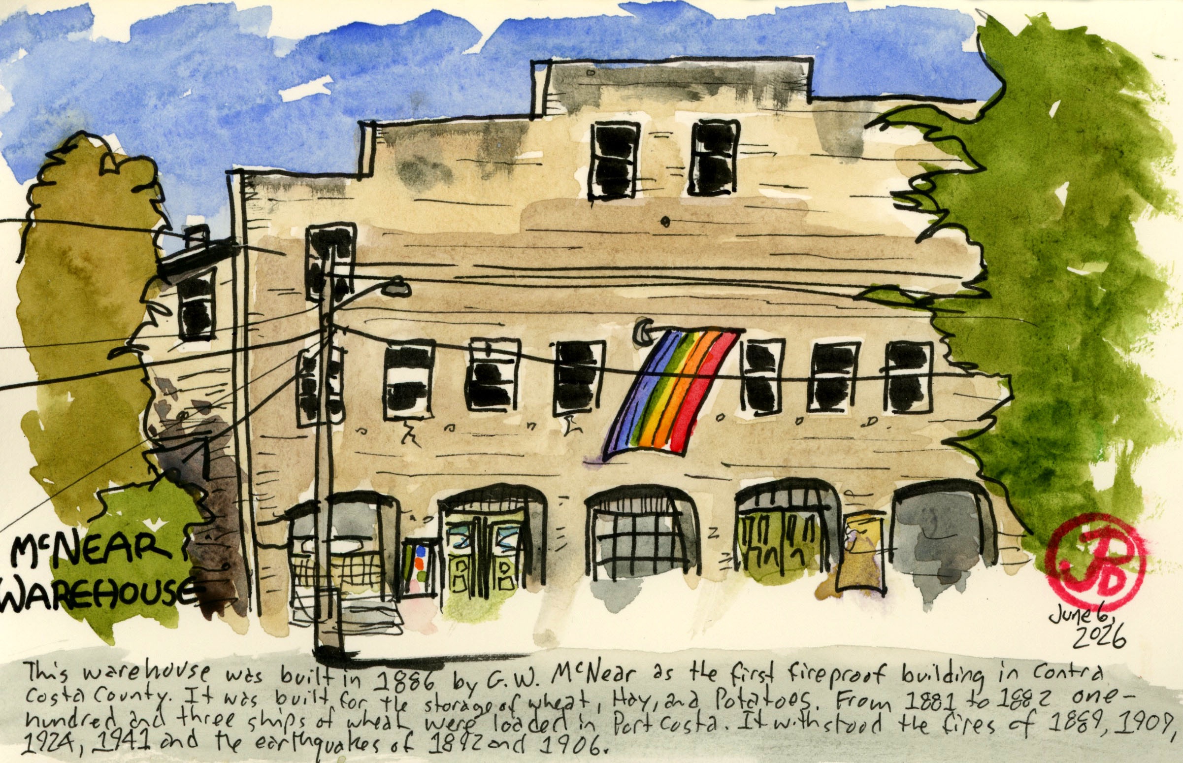
Standing in front of the massive McNear’s Warehouse you get a sense of the scale of importance of Port Costa.
The wonderful sign on McNear’s Warehouse. The railroad is both central to the sign and to the history of Port Costa.
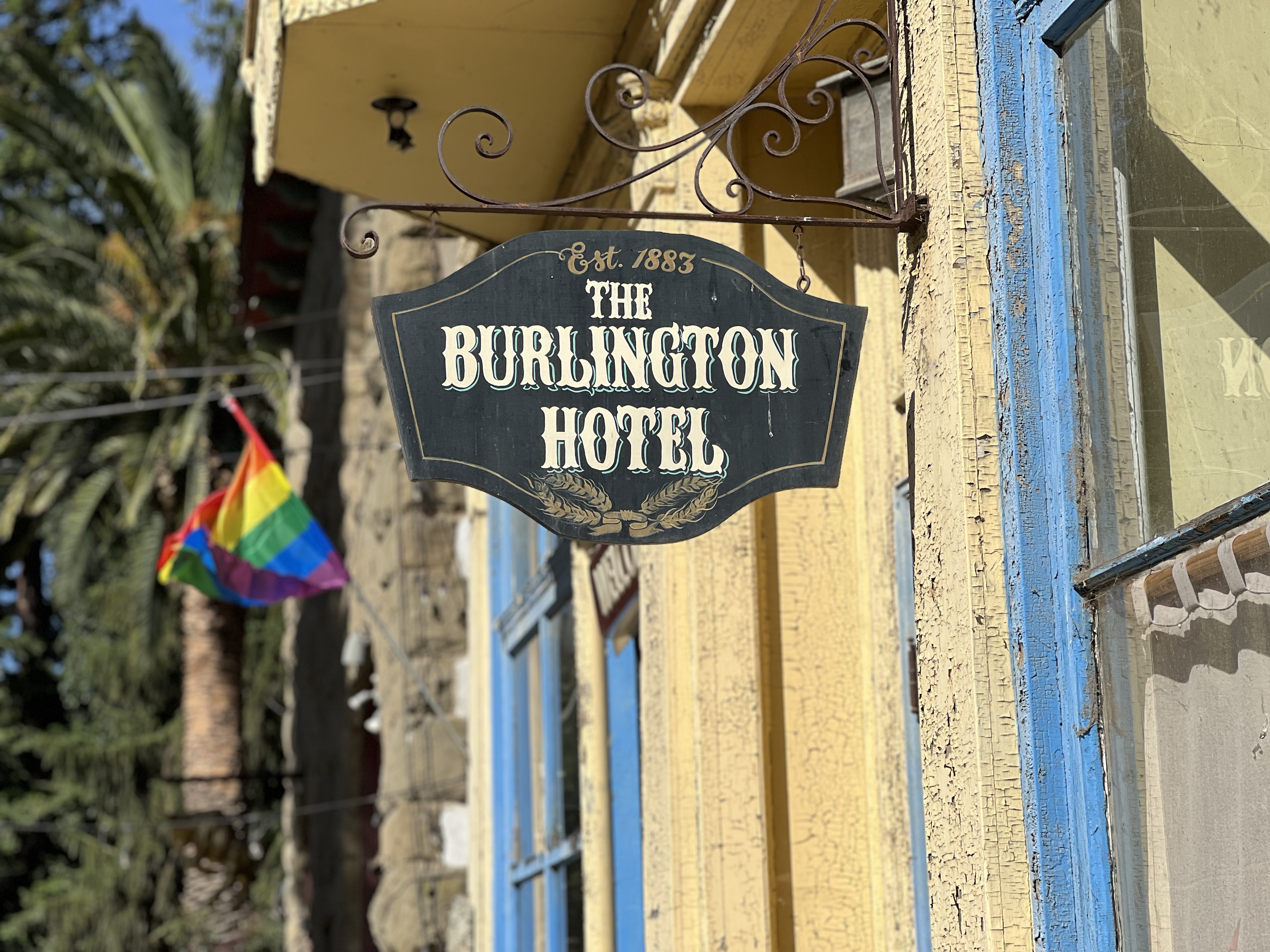
In the distant past, that one block contained a grocery store, a barber shop, a shoemaker, a Wells Fargo office, three hotels, a department store, and eight saloons!
Now Port Costa has only one hotel and I’m not sure it’s open.
The concrete warehouse was built in 1886 by G. W. McNear. It was the first fireproof building in Contra Costa County having survived the fires of 1889, 1909, 1924, and 1941 (as well as withstanding two major earthquakes). It was built to store wheat, hay, and potatoes.
The warehouse now serves many purposes; restaurant, bar, post office, and apartments.
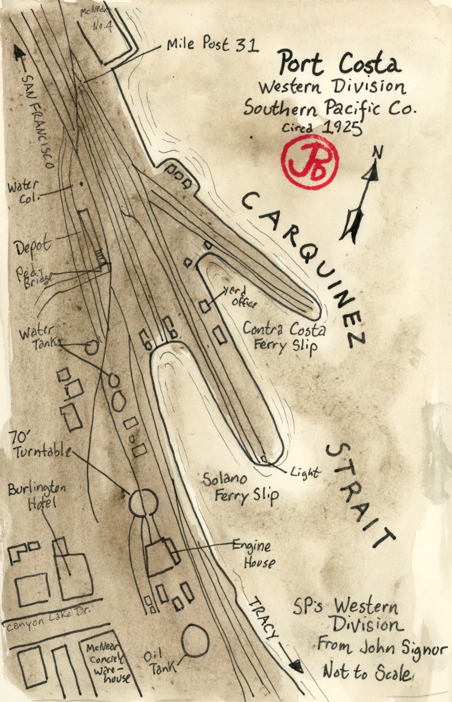
Port Costa was a busy railroad center and port. The railroad facilities included many spur tracks, a 70 foot turntable, an engine house, oil and water tanks, a passenger and freight depot, and many warehouses.
Map of Port Costa circa 1925, based on a John Signor illustration.
What made Port Costa tick was the railroad. At the edge of the Carquinez Strait there were two ferry boat slips where ferry boats loaded and unloaded trains, both passenger and freight, from the 10 minute crossing to Benicia. Because there was no railroad bridges spanning the strait, this was only way to cross and save time and many miles.
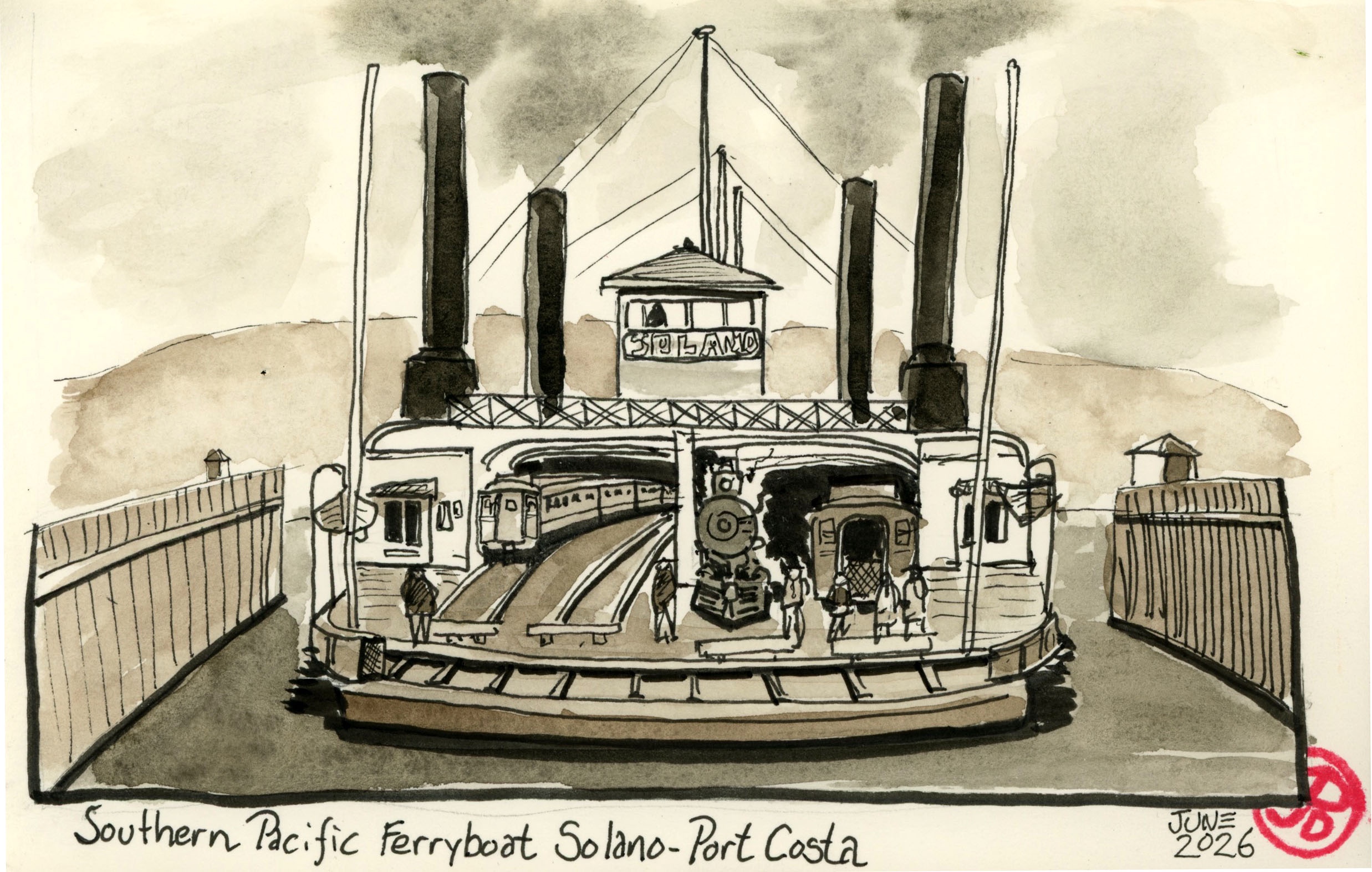
The train ferry Solano served for 51 years until the Benicia-Martinez Railroad Bridge was completed in 1930 for Southern Pacific, rendering the ferry obsolete.
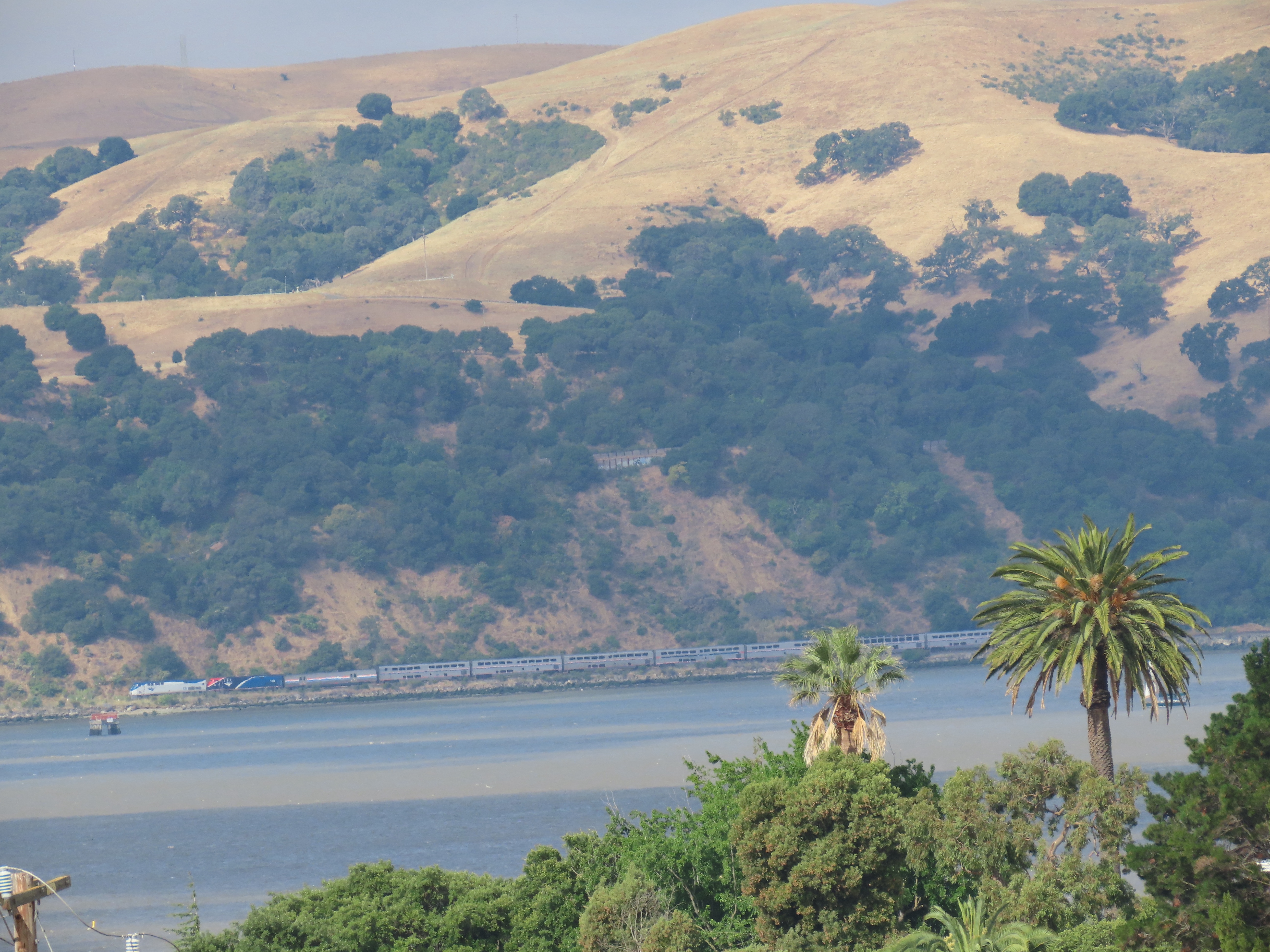
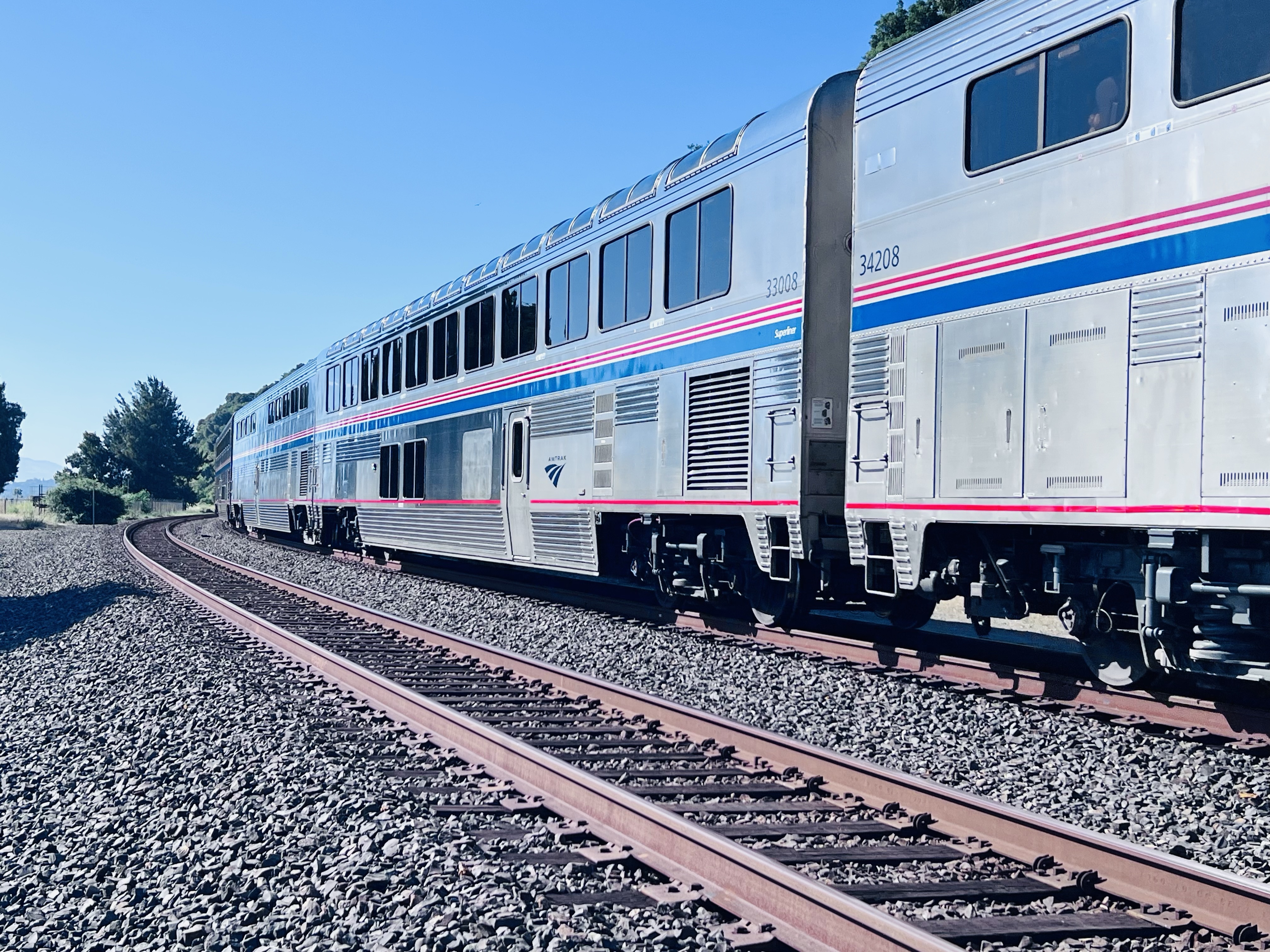
The Chicago bound California Zephyr passing through the former location of the ferry slips on the south side of Carquinez Strait. The train will cross over to the north side just past Martinez on the Benicia-Martinez Railroad Bridge (more about this bridge in the next post).
The first train ferry to operated between Benicia and Port Costa was the Solano which was built by the Central Pacific Railroad (later Southern Pacific) in 1879. She was 425 feet long and 116 feet wide. The steam powered side-wheeler was that largest train ferry of its type. It could ferry a 24 car passenger train with its locomotive or a 48 car freight train on the four sets of tracks on the lower deck. In a 24 hour period, the Solano would make 36 to 46 crossings. She was a real workhorse.
Sketched based on a period postcard of the Solano.
The Solano’s last run was on November 1, 1930 and she was decommissioned along with her sister ship the Contra Costa.
There were many steam powered ferries that moved people and freight on the waterways of the Bay Area. Today, very few exist. The Eureka at Hyde Street Pier and the Berkeley in San Diego come to mind. Some were turned into floating hotels and gambling boats but have since burned and been destroyed. Most were scrapped, very few were preserved for posterity.
I was amazing to find out that the Solano still existed! She was not preserved and is a far cry from her proud days as the largest train ferry in the world. She is to be found about 25 miles east of Port Costa in Antioch.
In 1931 the Solano was moved upstream to be used as a breakwater for a marina in Antioch. The hull was sunk where it remains to this day.
Looking at the massive hull it appears to be a verdant island and the only giveaway that it was once a mighty train ferry is a rusted A-shaped structure projecting above the green “island”.
The A-shaped structure is the walking beam of her engine. The second walking beam has fallen over.
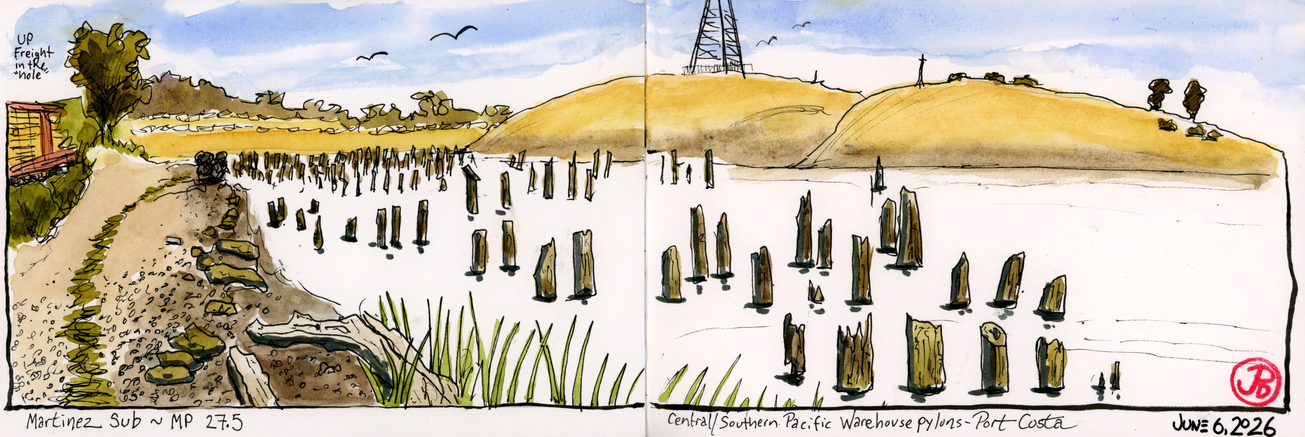
The first Saturday morning in June found me trackside in Port Costa sketching some California history.
I parked near the historic McNear’s Warehouse (more about this in another post) and walked west along the double parallel tracks looking for a sketching spot along the beach that spoke to me.
I had to be very aware here because my path is on the main line with a lot of passenger and freight traffic.
After about a five minute walk I found a short path down from the railbed to the shoreline with a nice sketching log to perch on and a great view before me.
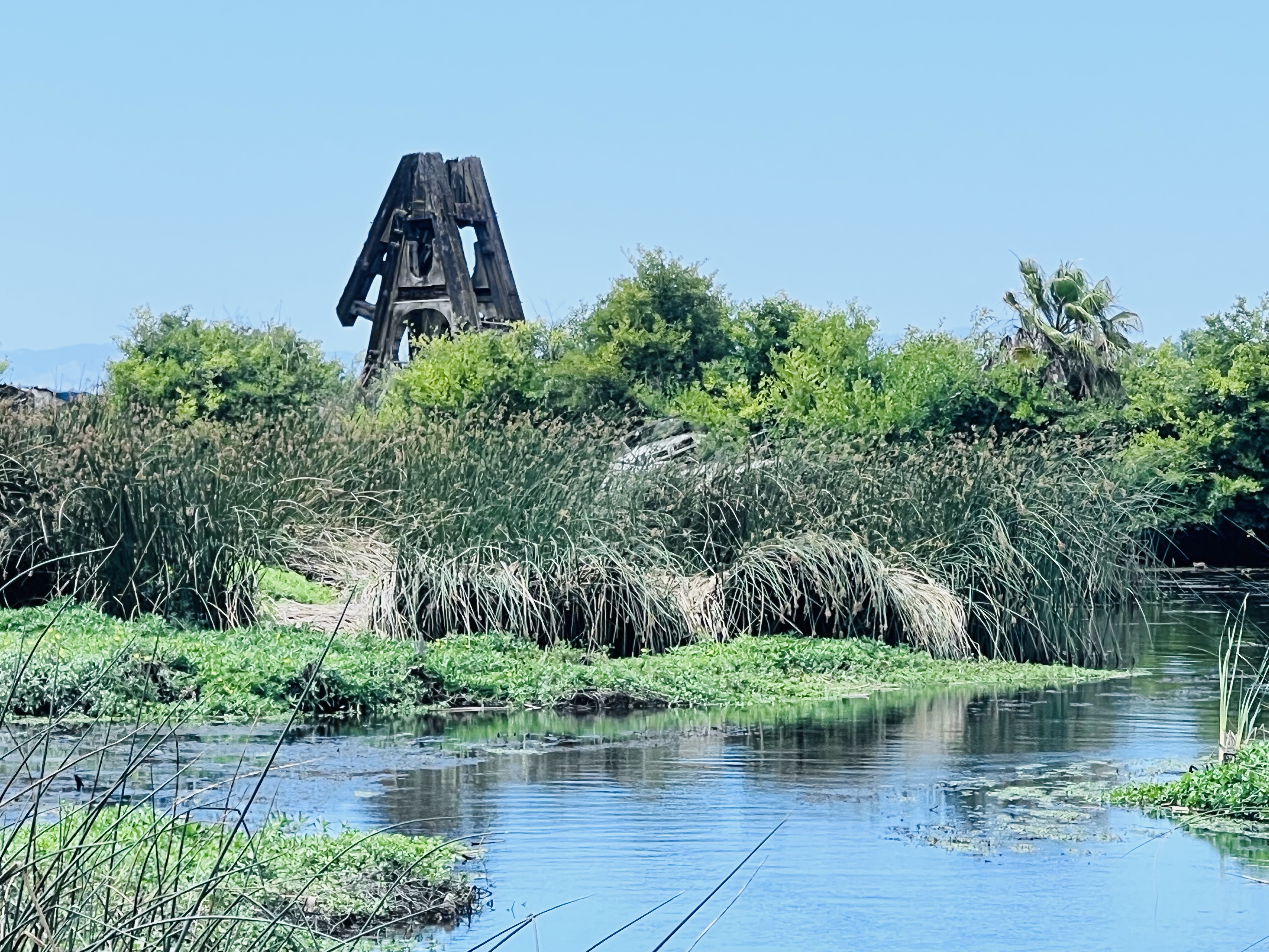
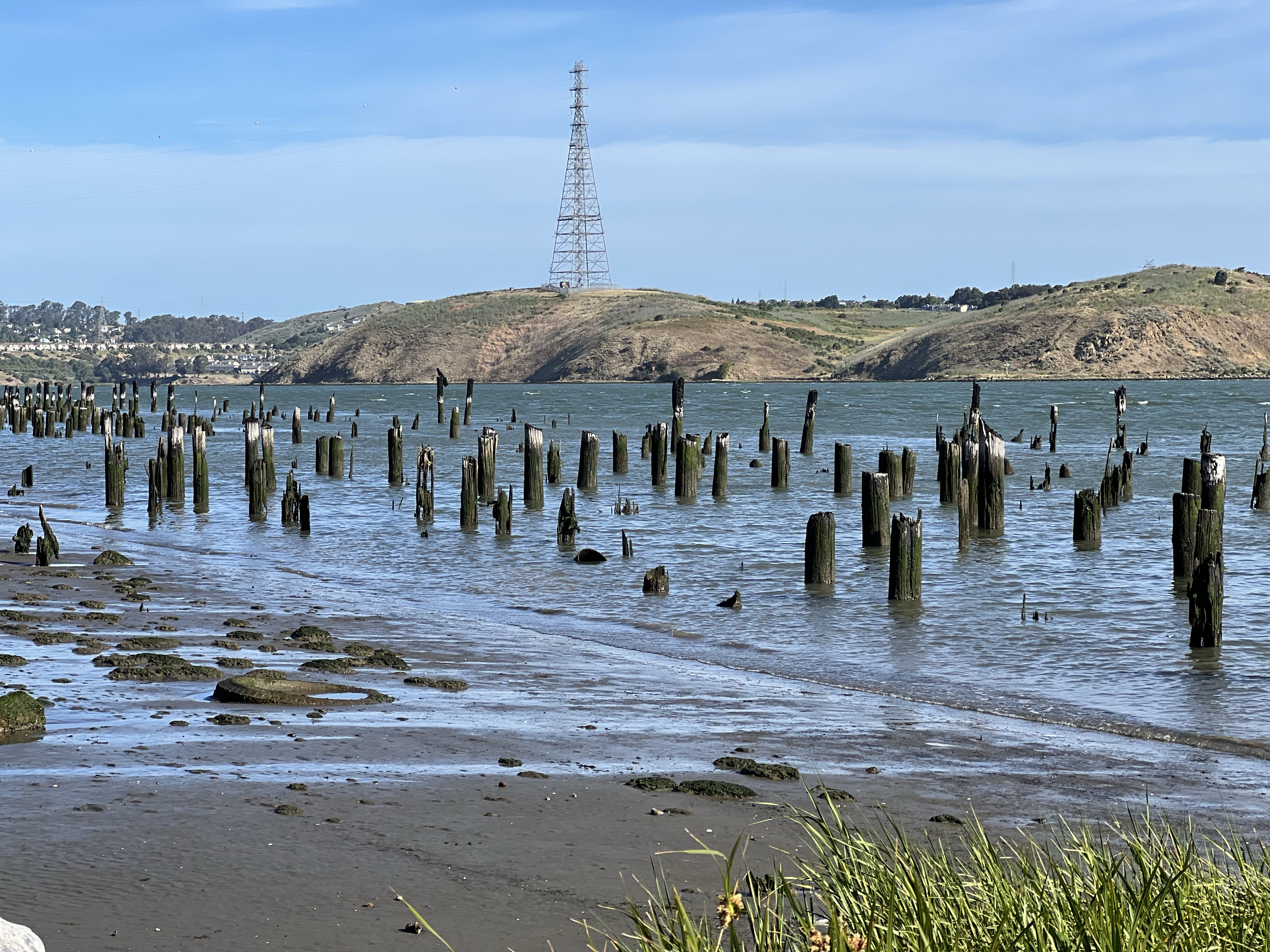
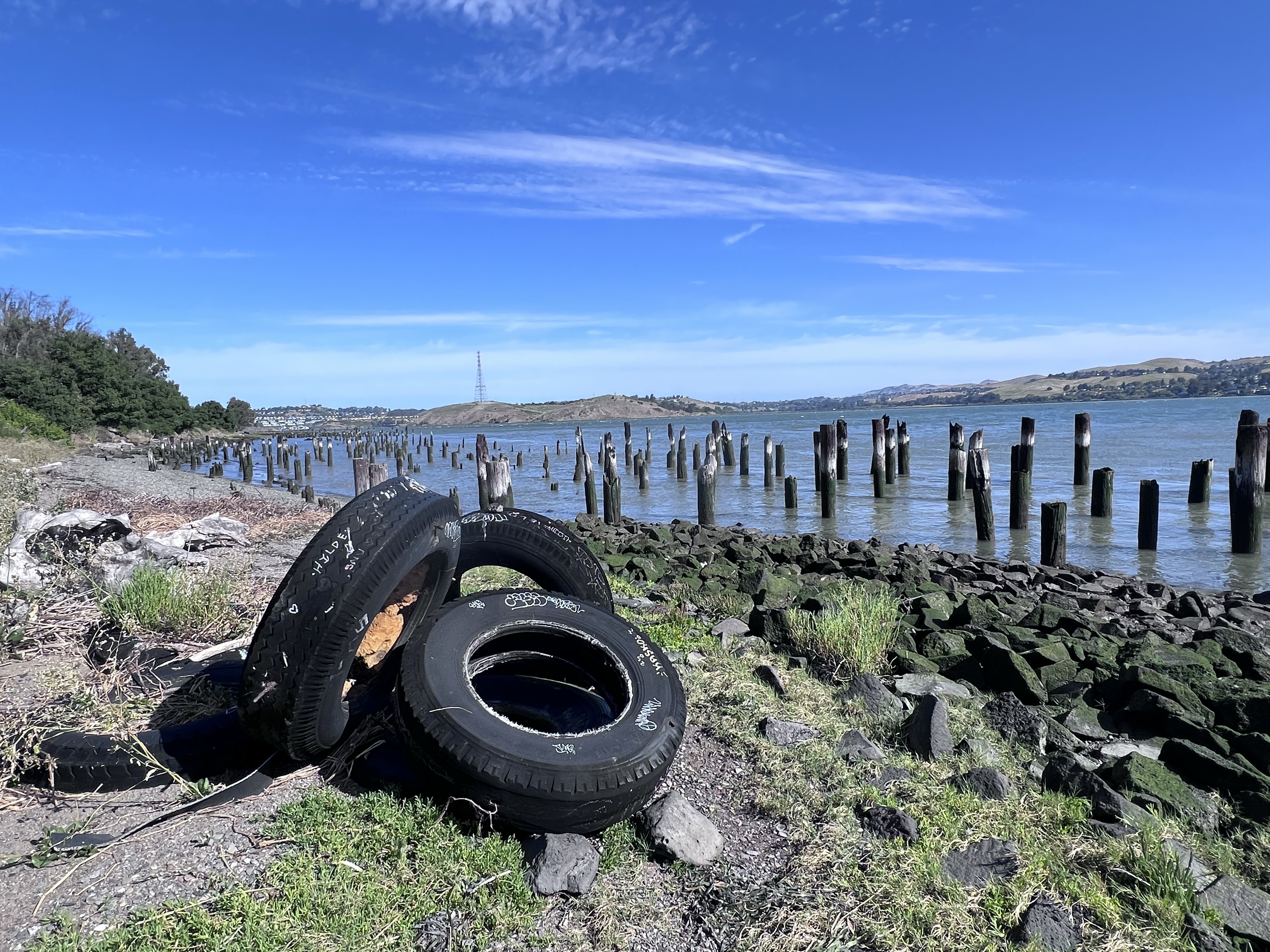
Before me were many wooden pylons breaking above the tide. So what’s the deal with a bunch of sticks?
Bunch of sticks!
The pylons were what remains of the railroad, storage warehouses, and ferry complex and spoke of a very busy past at Port Costa.
Engineers had a challenge fitting warehouses, ferry slips, and railroad maintenance buildings and tracks into the narrow strip of land between the shoreline and the steep hills on the southern edge of the Carquinez Strait. The solution was to build out into the water.
The pylons are the only evidence of the Central/Southern Pacific Railroad complex.
Of course any chapter of historical wooden structures involve one common element: fire. The complex burned and wood rot took what remained.
Before there where any rail bridges crossing the strait they had to use ferry boats that travelled a mile from Benicia to Port Costa, a trip that took about ten minutes.
Instead of unloading trains of their passengers or freight and reloading them onto boats for the short crossing, the trains themselves were loaded onto train ferry boats (locomotives and all) on four separate tracks.
I started my sketch at mile marker 3/4 at 8:15 AM. I was keeping my eyes and ears on the double tracks to my left, especially as the clock approached 9 because the eastbound California Zephyr was due to pass Port Costa at about that time.
From previous posts it’s plain, I love the California Zephyr. I have traveled on the longest AMTRAK route four times and it was always a great experience.
In that 45 minutes, four trains passed (three passenger and one freight). This is a busy part of the high iron!
At 8:30 a mixed consist freight pulled into the “hole” to let two Capital Corridors pass.
A westbound freight waiting at mile post 3/4 for two passenger trains to pass.
The freight was stopped long enough for me to climb aboard and there were a few good rides on the consist but I resisted the urge to abandon teaching to take up the hobo life.
After the passenger trains passed, the UP freight got the high ball and the hiss of the brakes being released told me that the freight was about to move. The cars creaked to life and the train took up slack and resumed its westward journey.
California Zephyr Train No. 6 passing the remains of the train and ferry complex at Port Costa. Final destination, Chicago, Illinois. Just to the right of the end of the Zephyr is the town of Port Costa. More about this historic town in my next post.
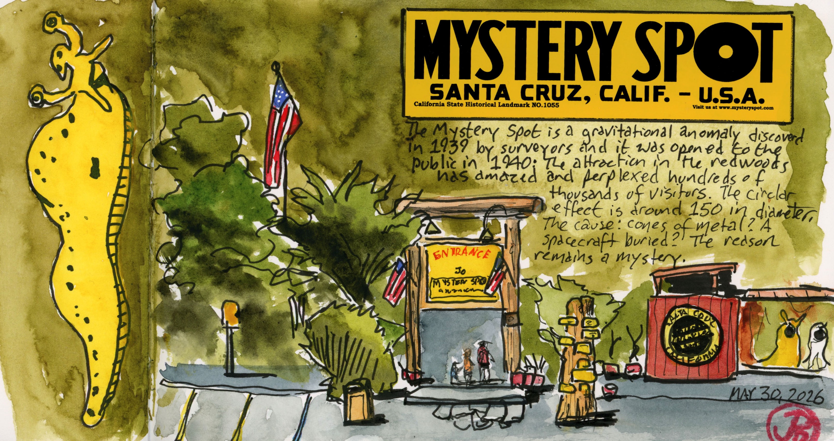
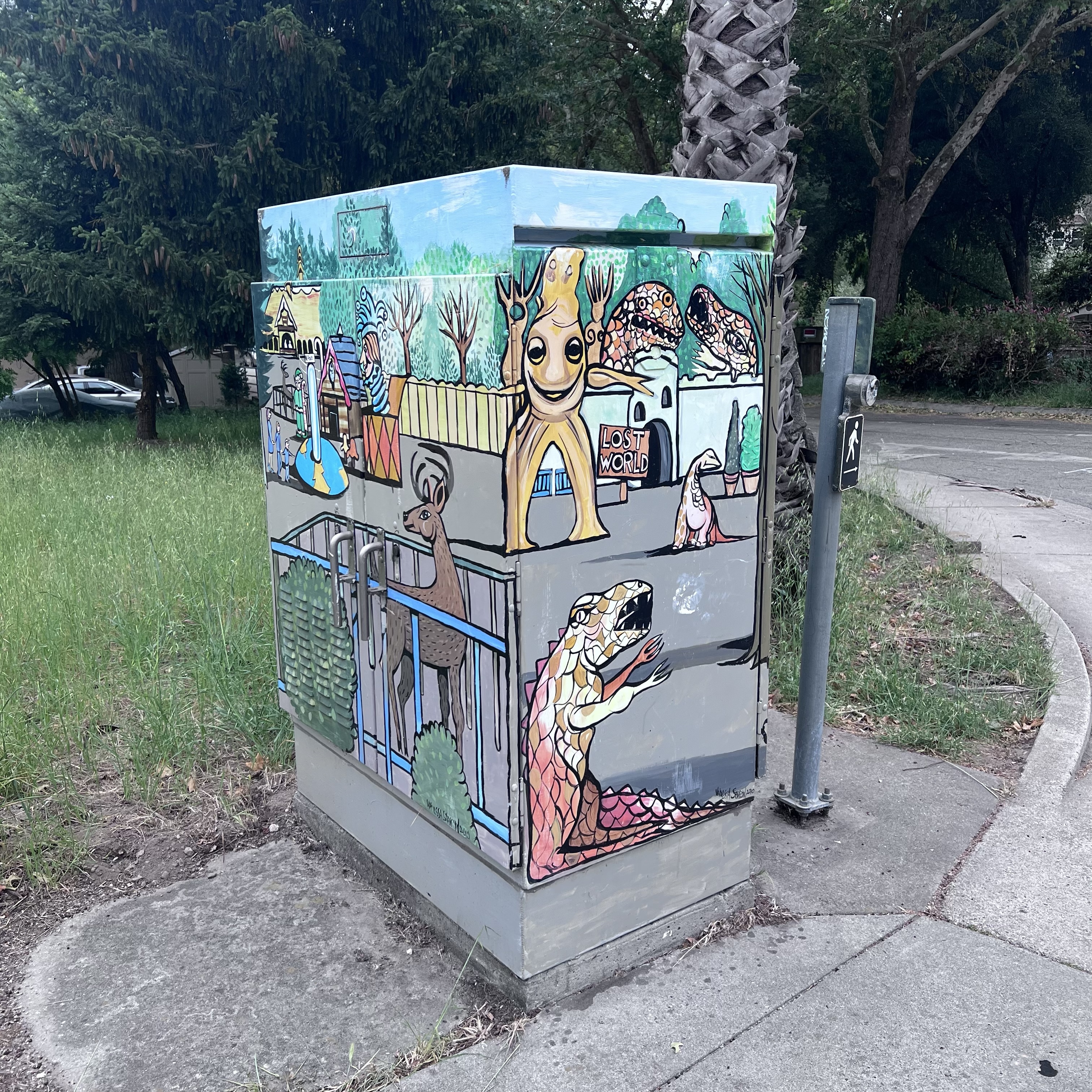
Sketching and researching the history of local roadside attractions of the past such as Lost World and Santa’s Village, made me want to sketch a historic tourist attraction that is still alive and well.
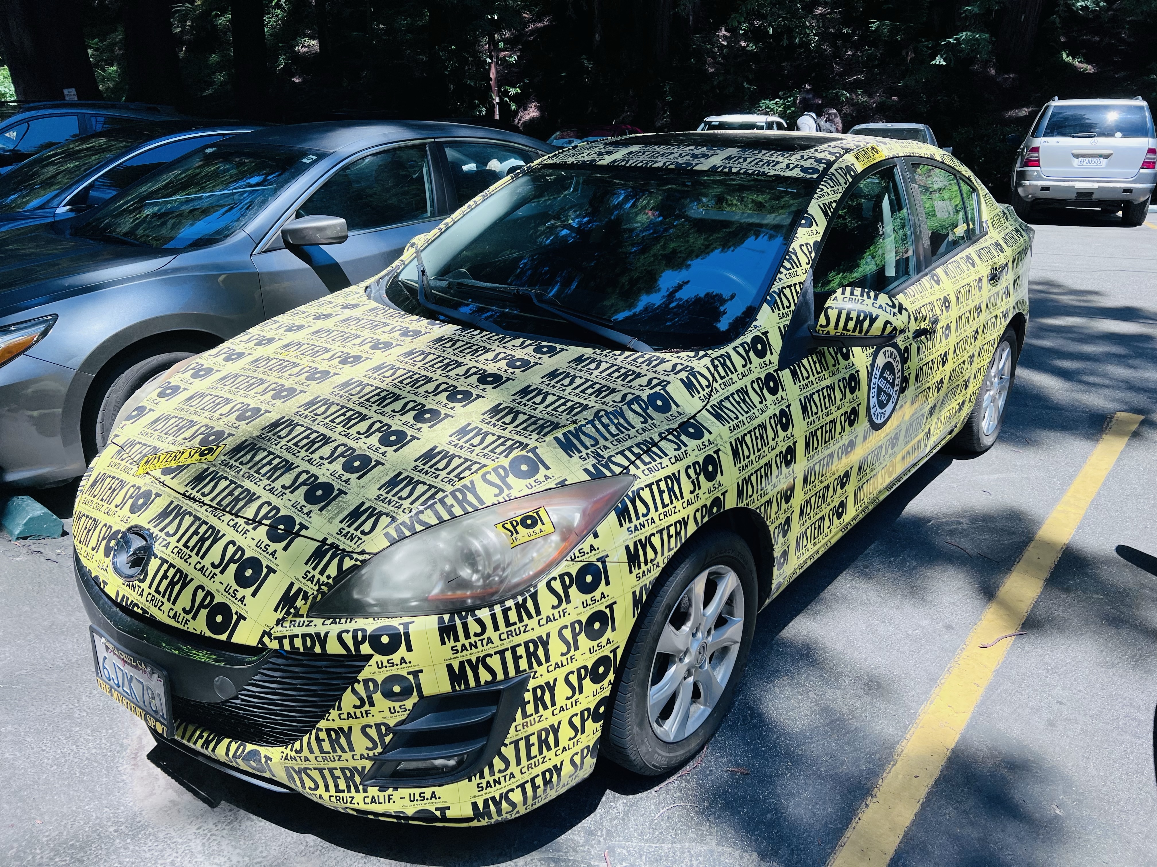
If you’ve never been to the Mystery Spot it highly likely that you have seen the bright yellow bumper stickers on cars in the Golden State.
This car’s owner either really loves the Mystery Spot, uses bumper stickers to hold the car together, or is an employee shamelessly promoting their employer; probably all three.
While my family visited the Boardwalk and even Lost World and Santa’s Village, we didn’t make our way up Branciforte into the redwoods. Perhaps the Mystery Spot was just too strange.
I first visited the quirky attraction as an adult and am still trying to decide if it was really worth the time and expense. It some sense it reminded me of the title of a Shakespearean comedy.
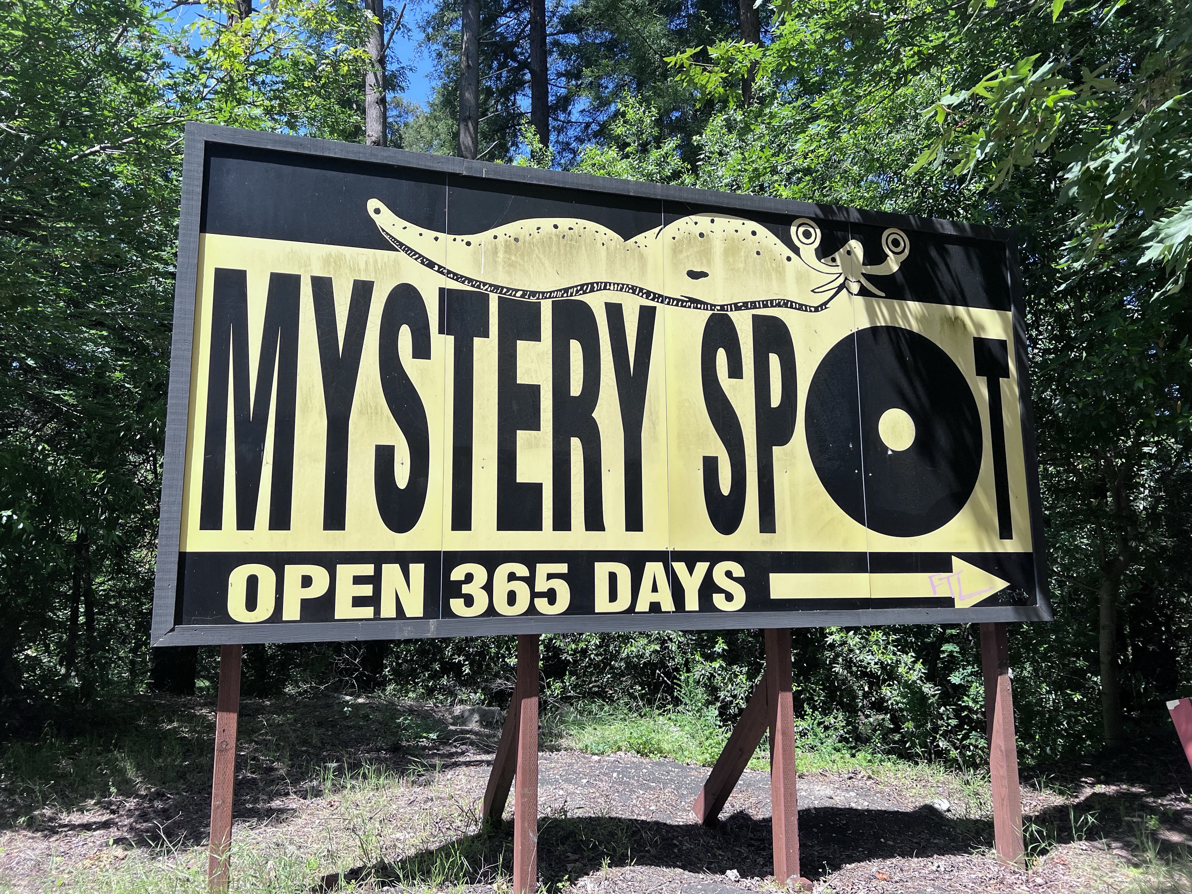
You know you are near with billboards leading the way. I love the funky banana slug which I added to my sketch.
The Mystery Spot was first discovered in 1939 by George Prather and was opened to the public a year later. Since the attraction has garnered enough visitors to keep it open for over 85 years, 365 days a year. But what exactly is the Mystery Spot?
The main attraction to this roadside attraction is that it is a “gravity hill” (the first in California), meaning that the area appears to defy gravity.
In 1941 Prather built a “crazy house” where guides now lead tours to highlight the Mystery Spot’s bewildering effects.
Is this real or just a visual illusion? Spoiler alert: the house is slanted at a 20 degree angle.
The Mystery Spot was designated a California Historical Landmark (# 1055) in August of 2014.
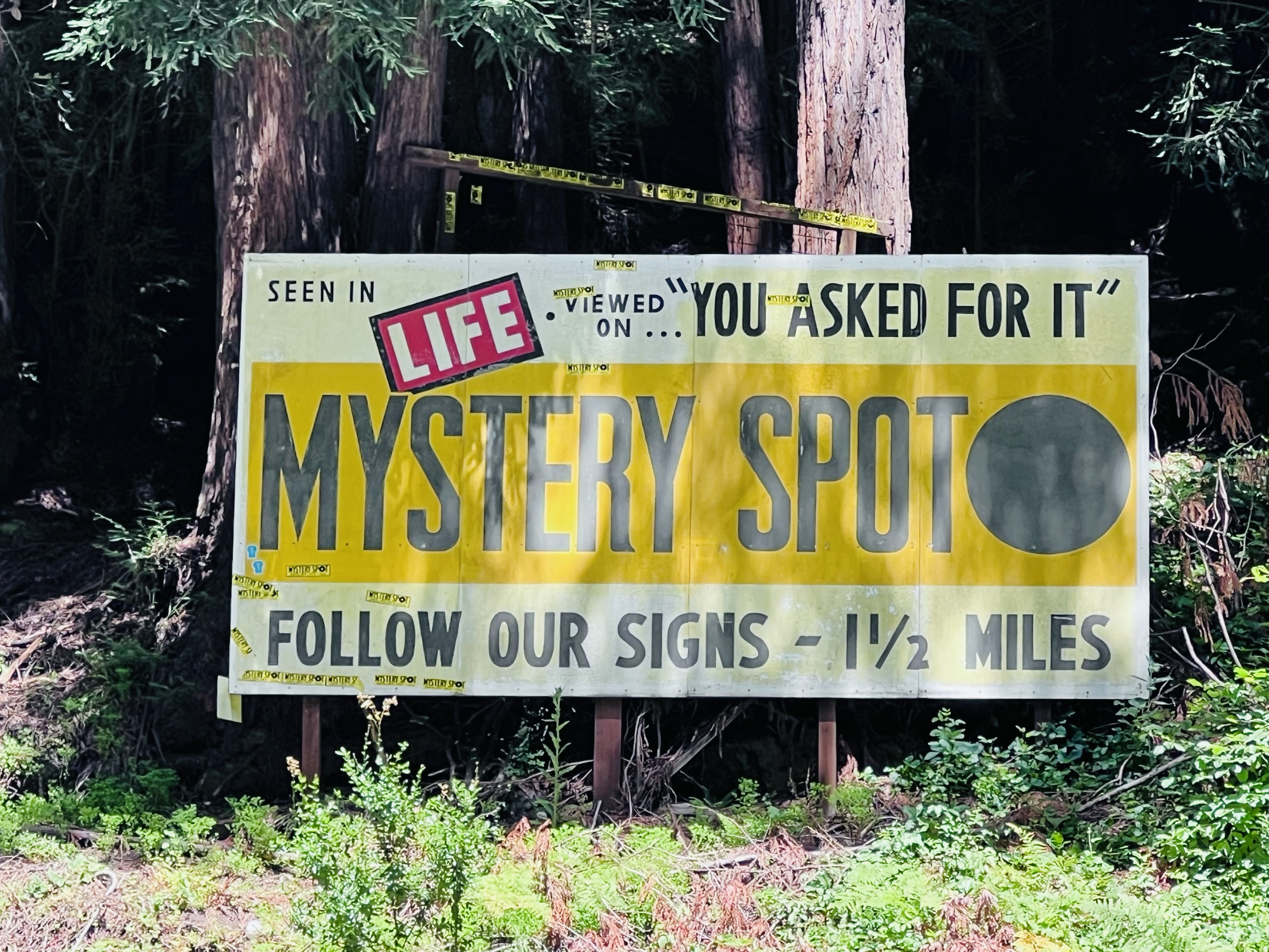
An old billboard, which I assume was located 1 1/2 miles from the Spot. Most contemporary visitors would not know what Life, “You Asked For It”, or even a magazine are!
I arrived on a Saturday afternoon and the parking lot was almost full, proving that this is still a very popular attraction. Now I needed to avoid the crowds and find a good sketching angle.
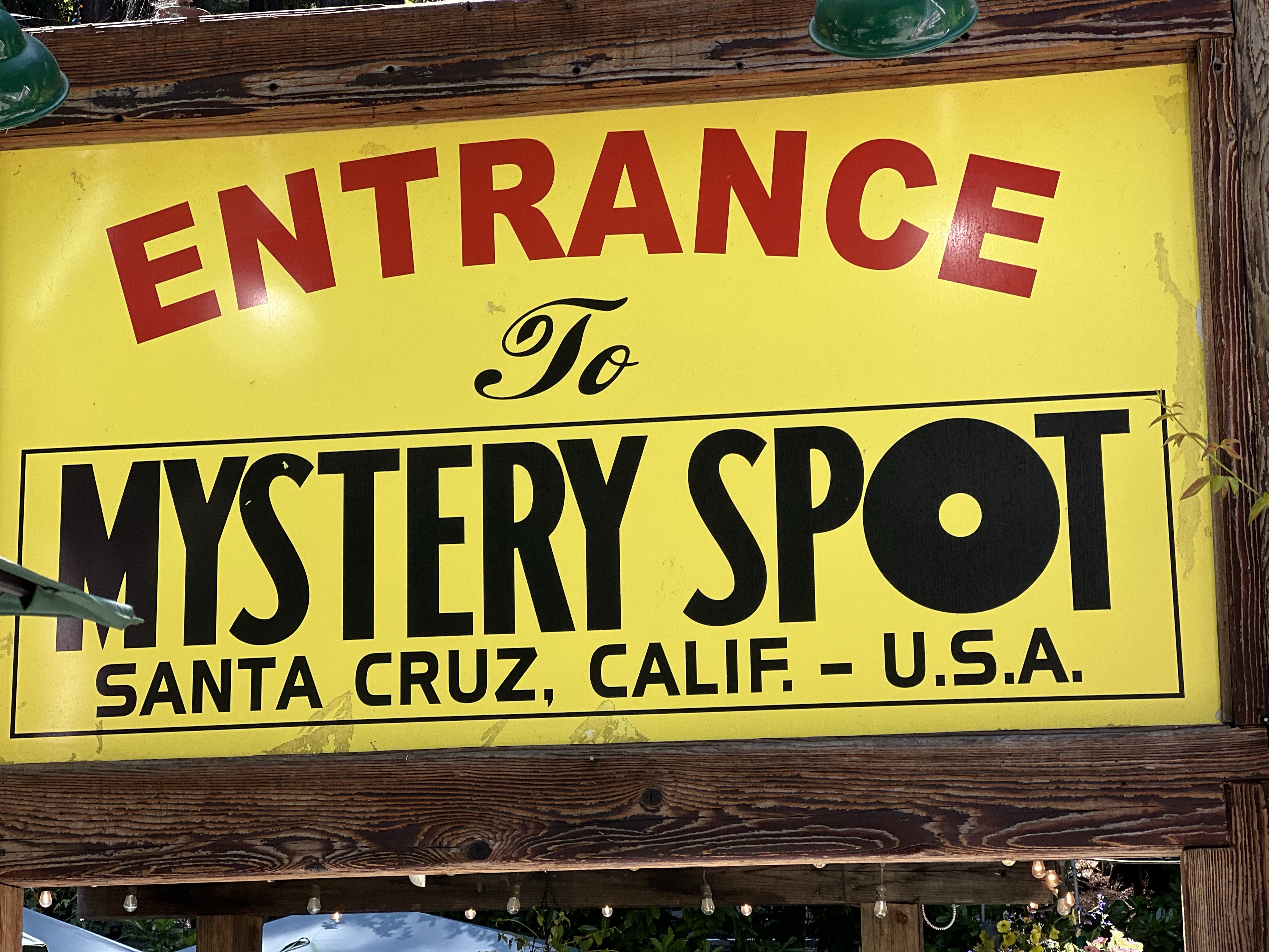
I took the hiking trail which gave me some elevation and a nice perspective to sketch the entrance (featured sketch).
The Santa Cruz County town of Scotts Valley is bisected by Highway 17. The highway sees a lot traffic as travelers from the Bay Area head to the seaside town of Santa Cruz.
The Santa Cruz area already has it’s attractions, the Santa Cruz Beach Boardwalk and the Mystery Spot being some of the most visited. Scotts Valley needed to capture some of those tourist dollars.
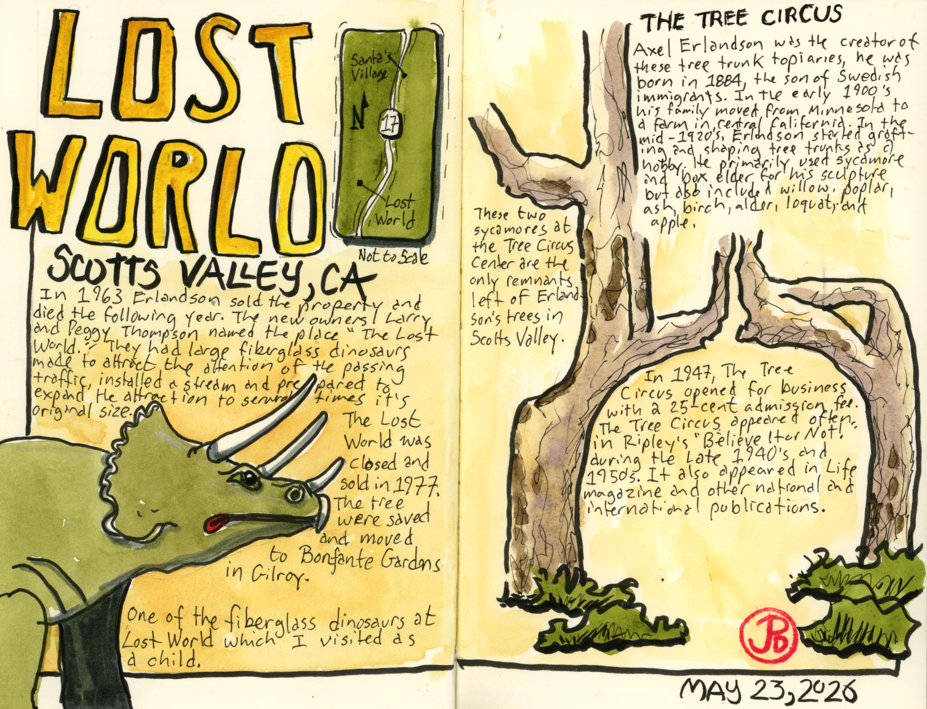
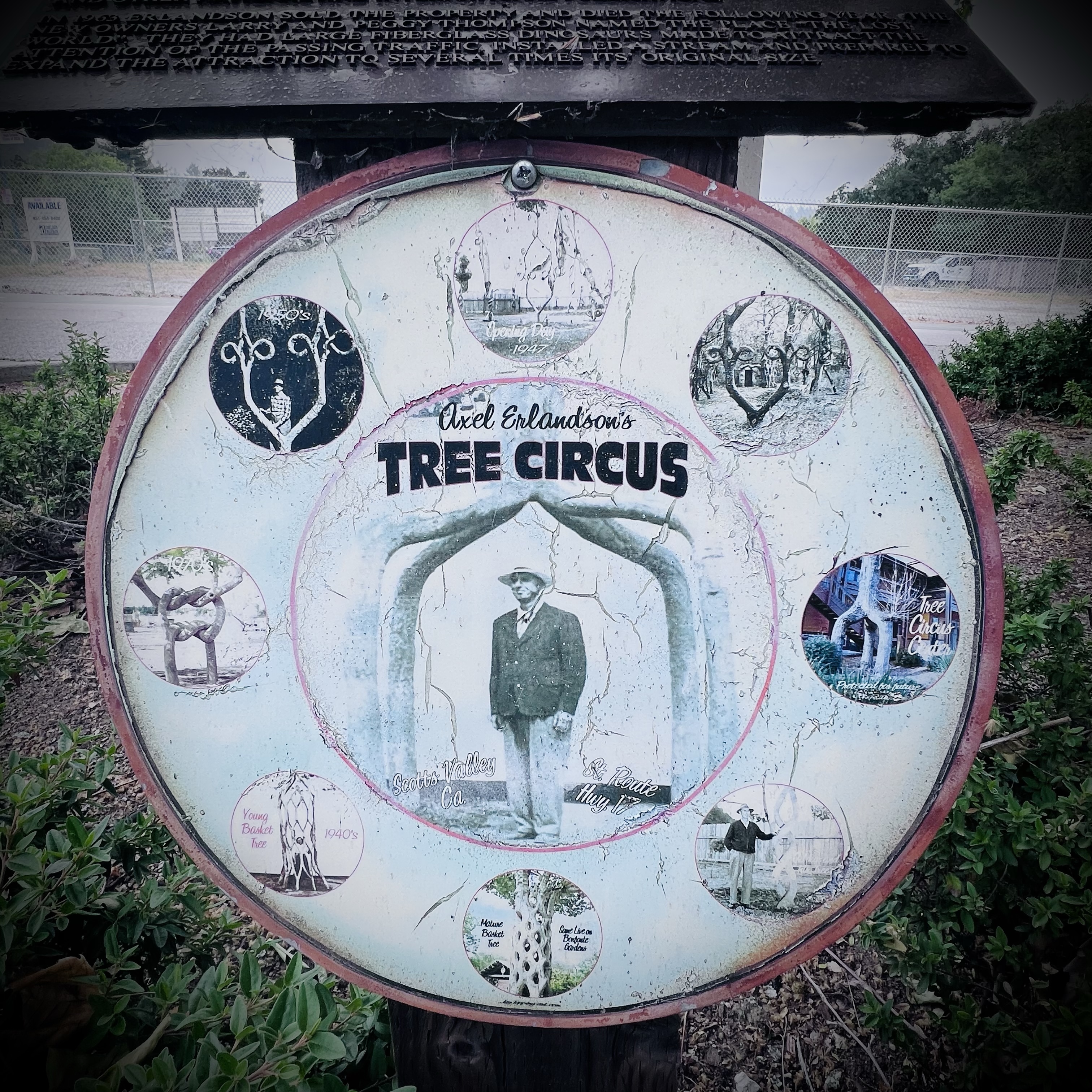
Two attractions were build on either side of the highway. Both attractions are now gone and there is little evidence that they ever existed. But I was going to sketch the only trees left in Scotts Valley that were part of the attraction called The Tree Circus.
The genesis of the Tree Circus was a Swedish-American named Axel Erlandson. In the early 1900s Erlandson’s family moved from Minnesota to California’s Central Valley.
While there, Erlandson began grafting and shaping trees in various shapes. He primarily used sycamores and box elder for his arboreal sculptures.
A plaque featuring some of Erlandson’s trees.
Erlandson was looking for a location for his wooden oddities and he opened The Tree Circus in 1947 in Scotts Valley on the western side of Highway 17. The advertising slogan he used was, “See the World’s Strangest Trees Here.” At the time admission was just 25-cents. The attraction was featured many times in Ripley’s “Believe it or Not!” and other publications such as Life magazine.
Some murals shows Scotts Valley’s roadside attractions of the past.
In 1940, Highway 17 opened, bypassing the old stage road, Scotts Valley Drive, where the Tree Circus was located.
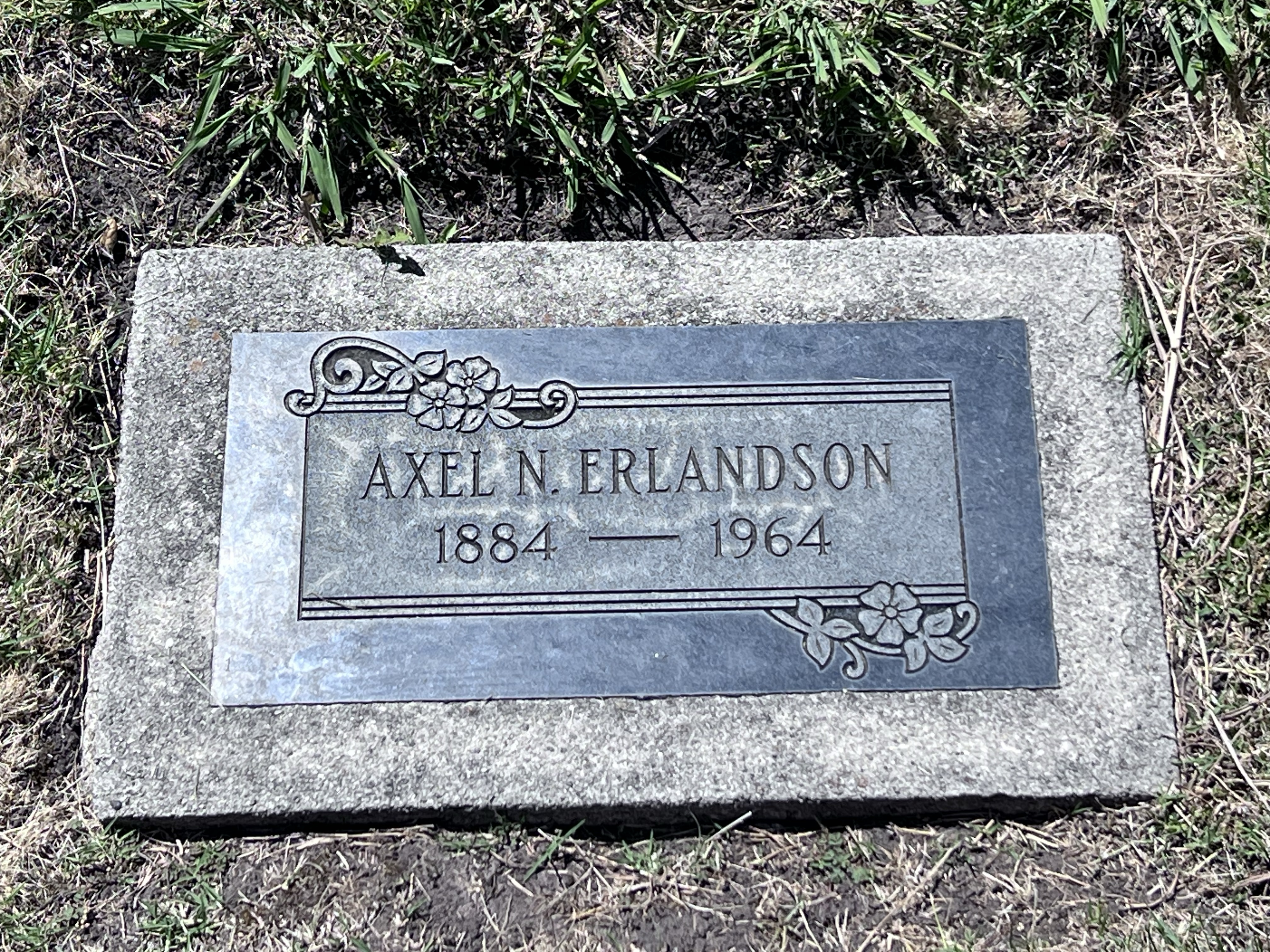
In 1963 Erlandson sold the property to Larry and Peggy Thompson. Erlandson died a year later.
Erlandson’s final resting place at Oakwood Cemetery in Santa Cruz.
The Thompsons added 30 fiberglass dinosaurs, created a stream through the property, and renamed the grove of Erlandson’s tree “The Enchanted Forest”.
The new attraction was named “Lost World”. I remember visiting the park as a kid during this time. From Highway 17 you could see the large T. Rex and triceratops.
The attendance slowed and Lost World was eventually closed and sold in 1977.
The trees were saved and bought by Michael Bonfante, owner of a local supermarket chain, who replanted them in his new amusement park in Gilroy called Bonfante Gardens (now called Gilroy Gardens).
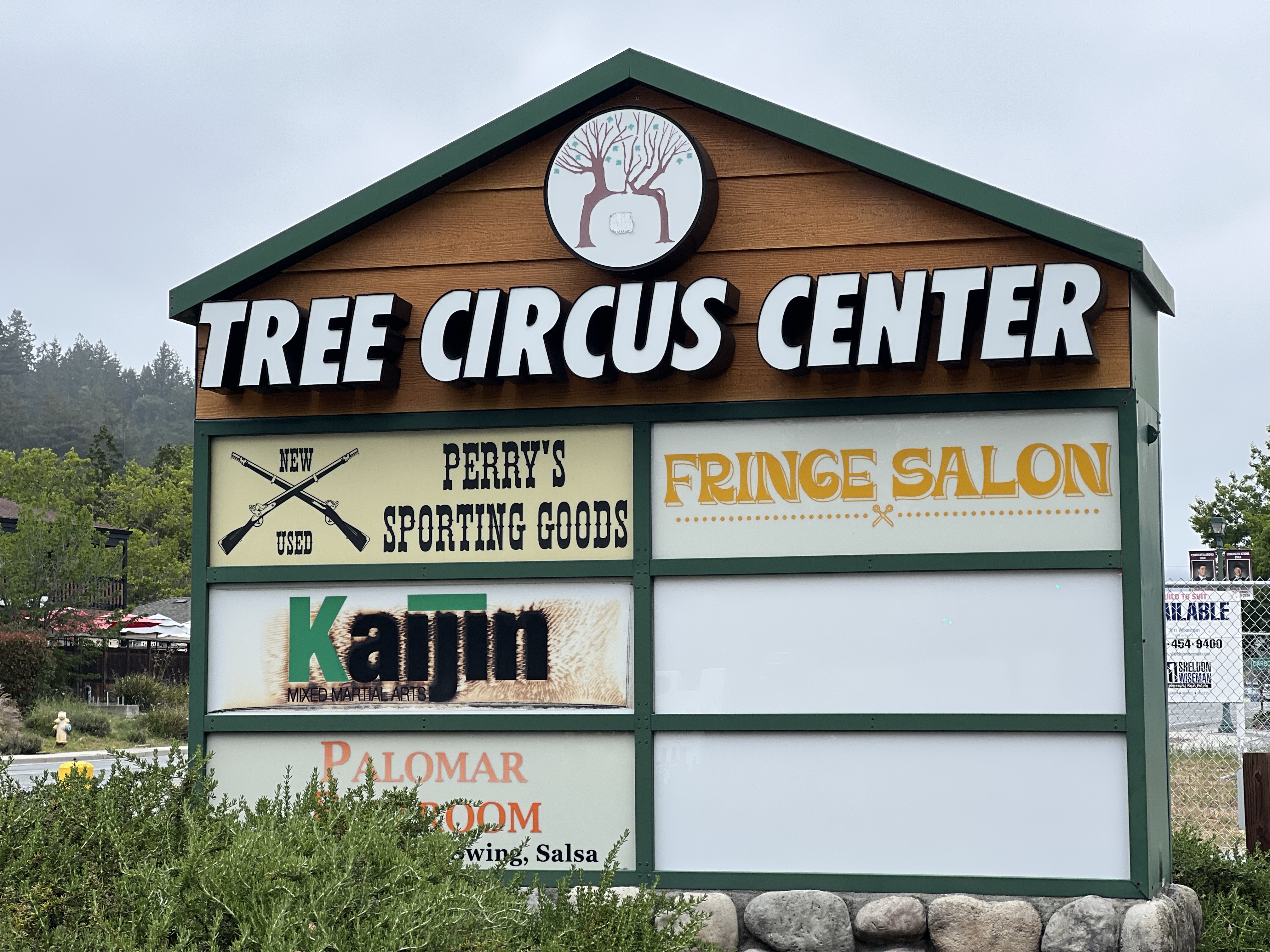
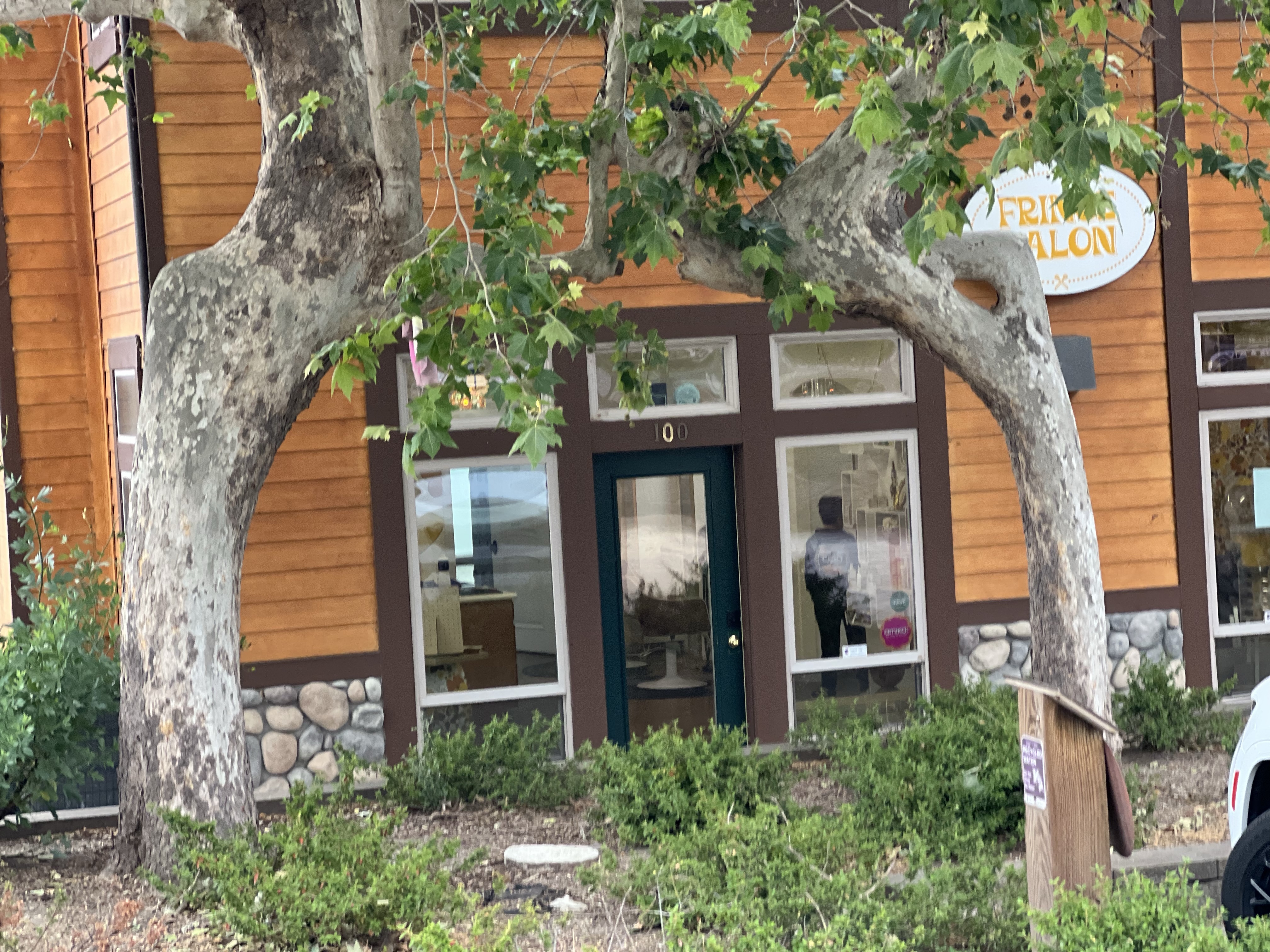
On Saturday I arrived at the Tree Circus Center, sounds like a perfect place to find remnants of Erlandson’s art. The only business open at this hour was a hair salon.
I did know I owned a sporting goods store in Scotts Valley!
Before me was two sycamores leaning towards each other in an unnatural way. This is all that remains in Scotts Valley of the Erlandson’s Tree Circus.
Two lone sycamores.
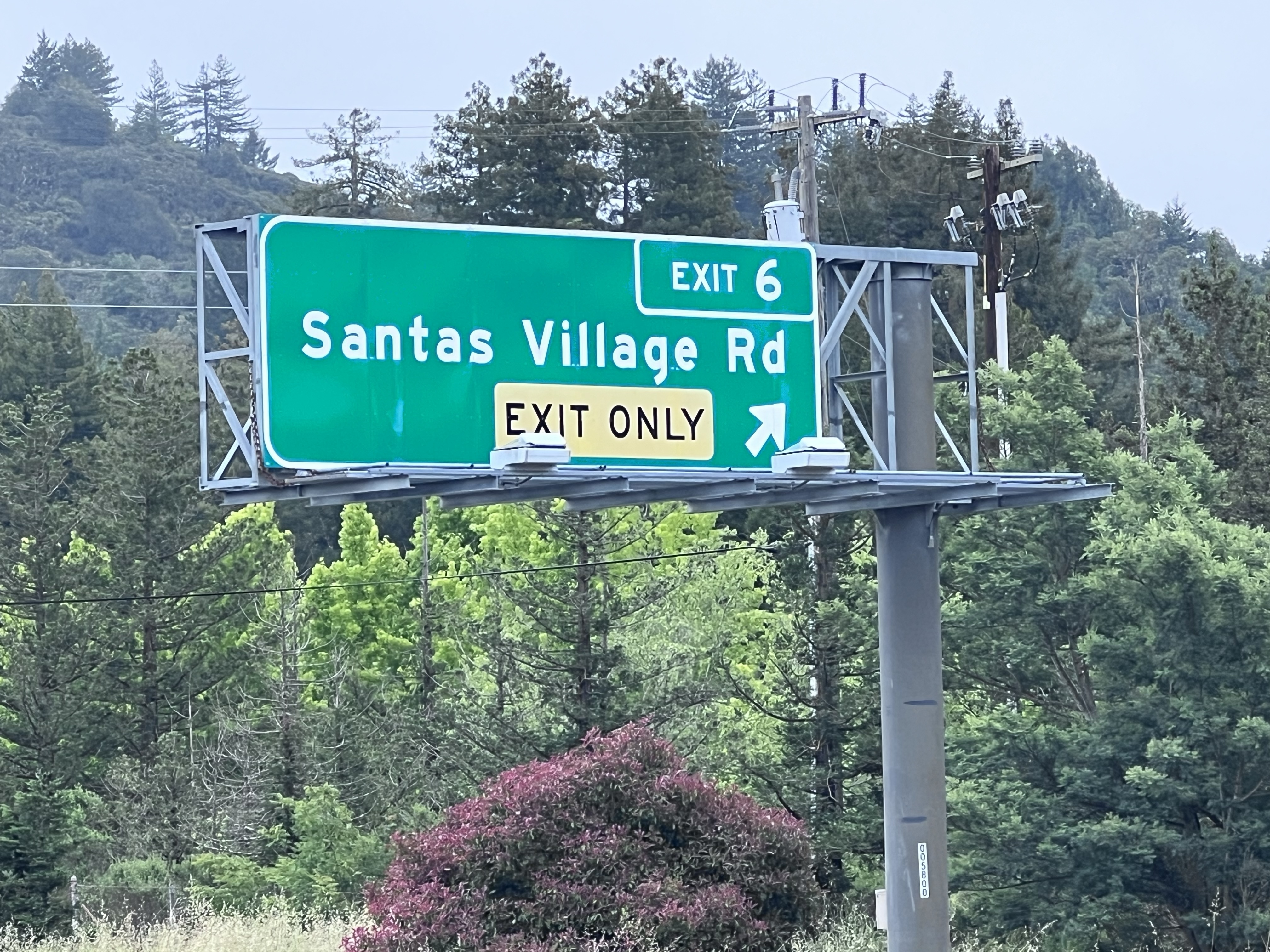
Evidence of Santa’s Village is even harder to find. There is nothing left of the former Christmas themed amusement park (yes it was open all year long), which I also attended as a child.
It open in 1957 and remained in business until 1979. There is now a row of houses on the property. But the exit from Highway 17 homeowners take to get to their houses is telling;
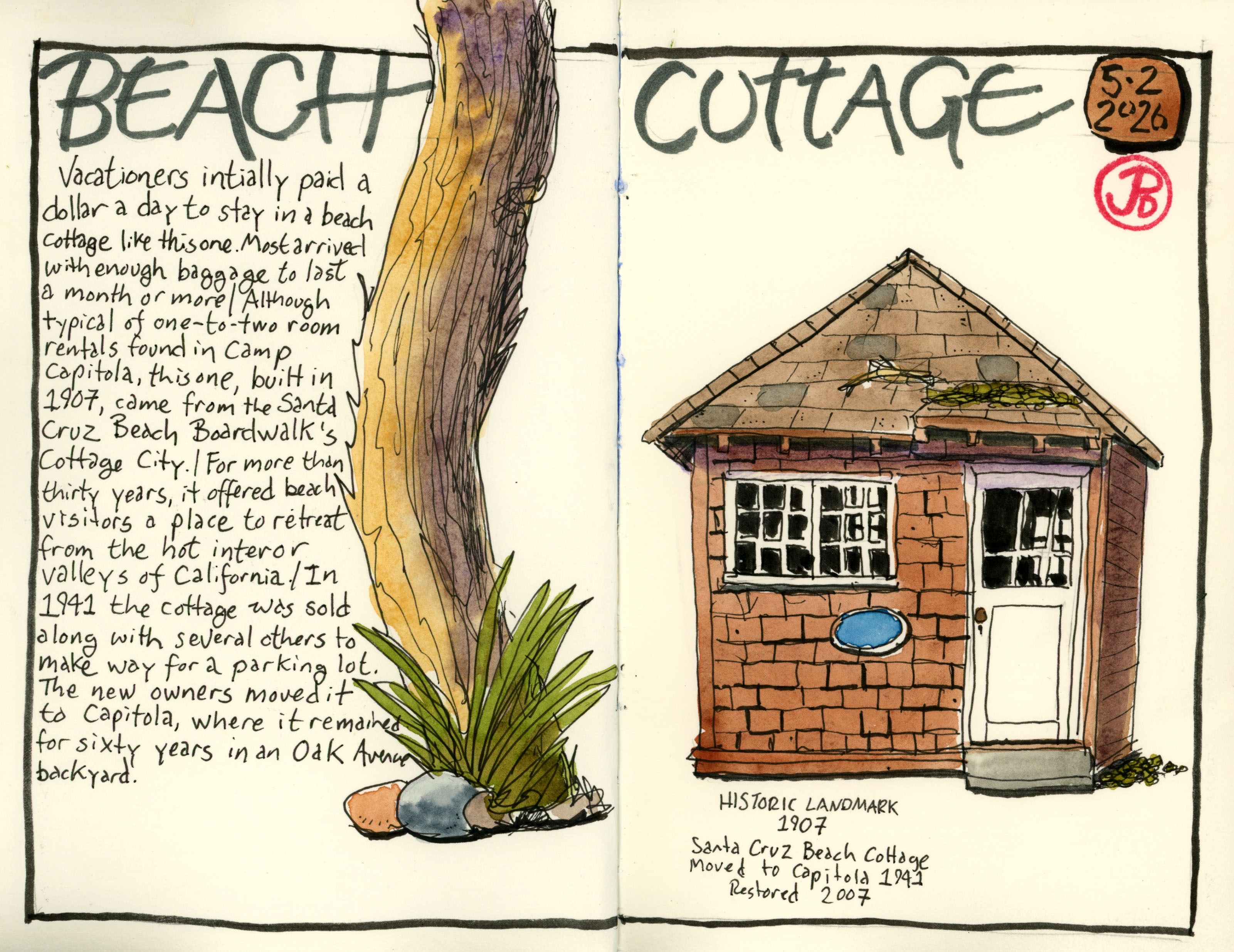
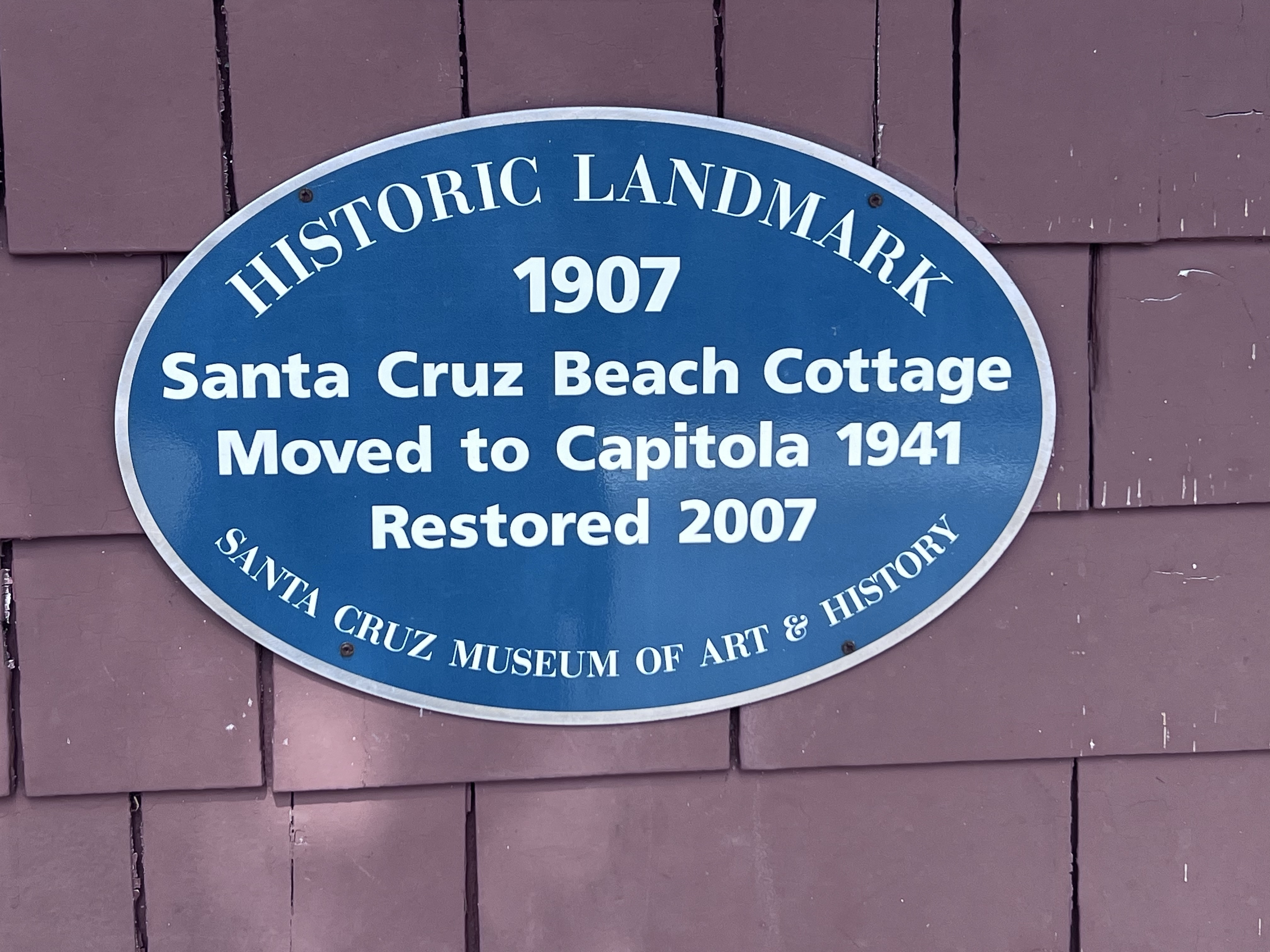
For this Small Shacks sketch I headed to Capitola on Monterey Bay.
My subject was a small one room shack built in 1907. It was in Santa Cruz right next to the Santa Cruz Boardwalk in “Cottage City”. The Beach Cottage was used as a home away from home for summer beach visitors who were escaping the hot summer heat of Central Valley summers.
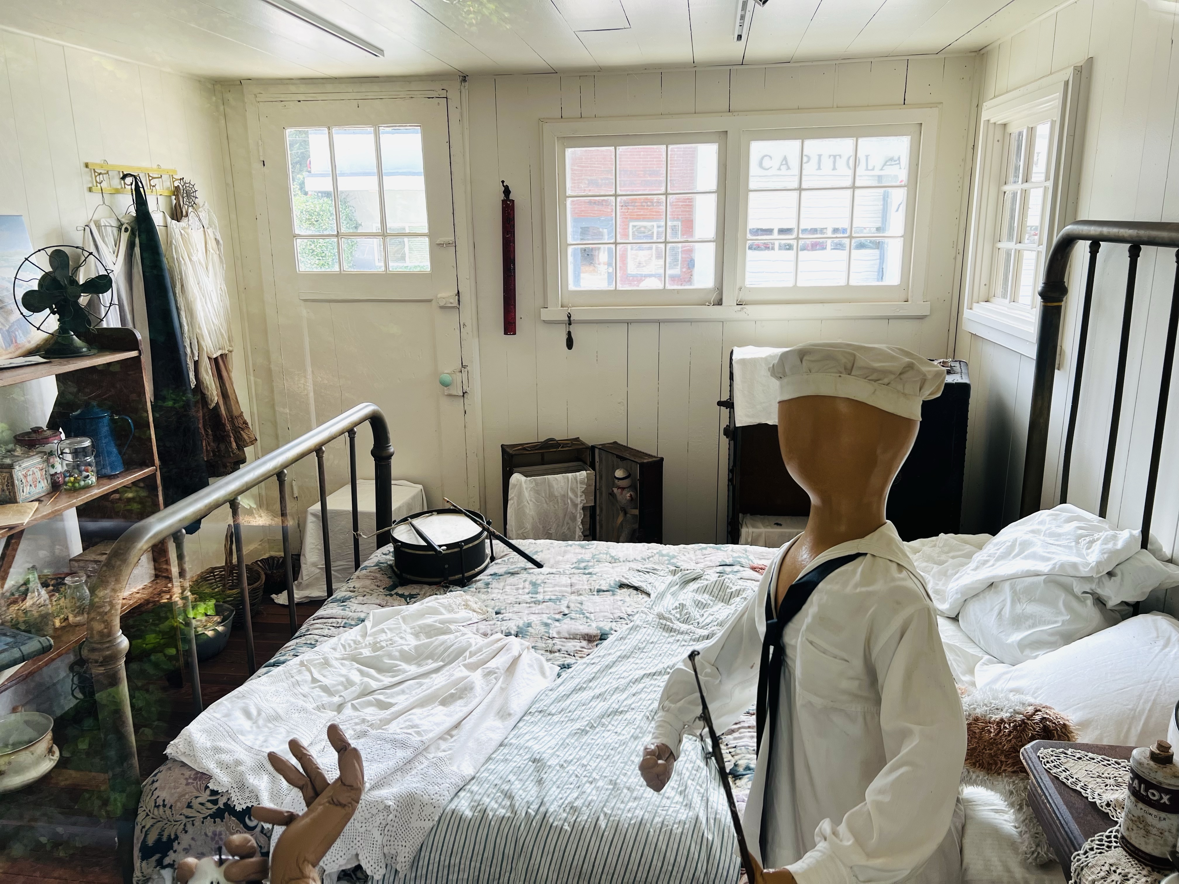
The interior of the Beach Cottage.
The cottage could be rented for a dollar a day and a family would enjoy their seaside vacations for weeks or months.
This cottage provided a pleasant abode to vacationers for over 30 years. In 1941, the cottage was sold to make room for a parking lot and moved to Capitola, where it remained in a backyard on Oak Avenue.
In 2004 the cottage was moved to the Capitola Museum and restored to its present condition.
The historic blue “Historic Landmark” plaque on the beach cottage.
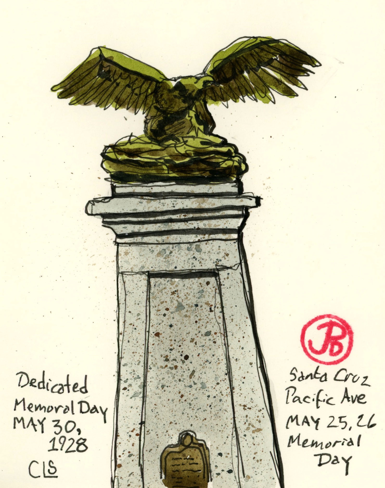
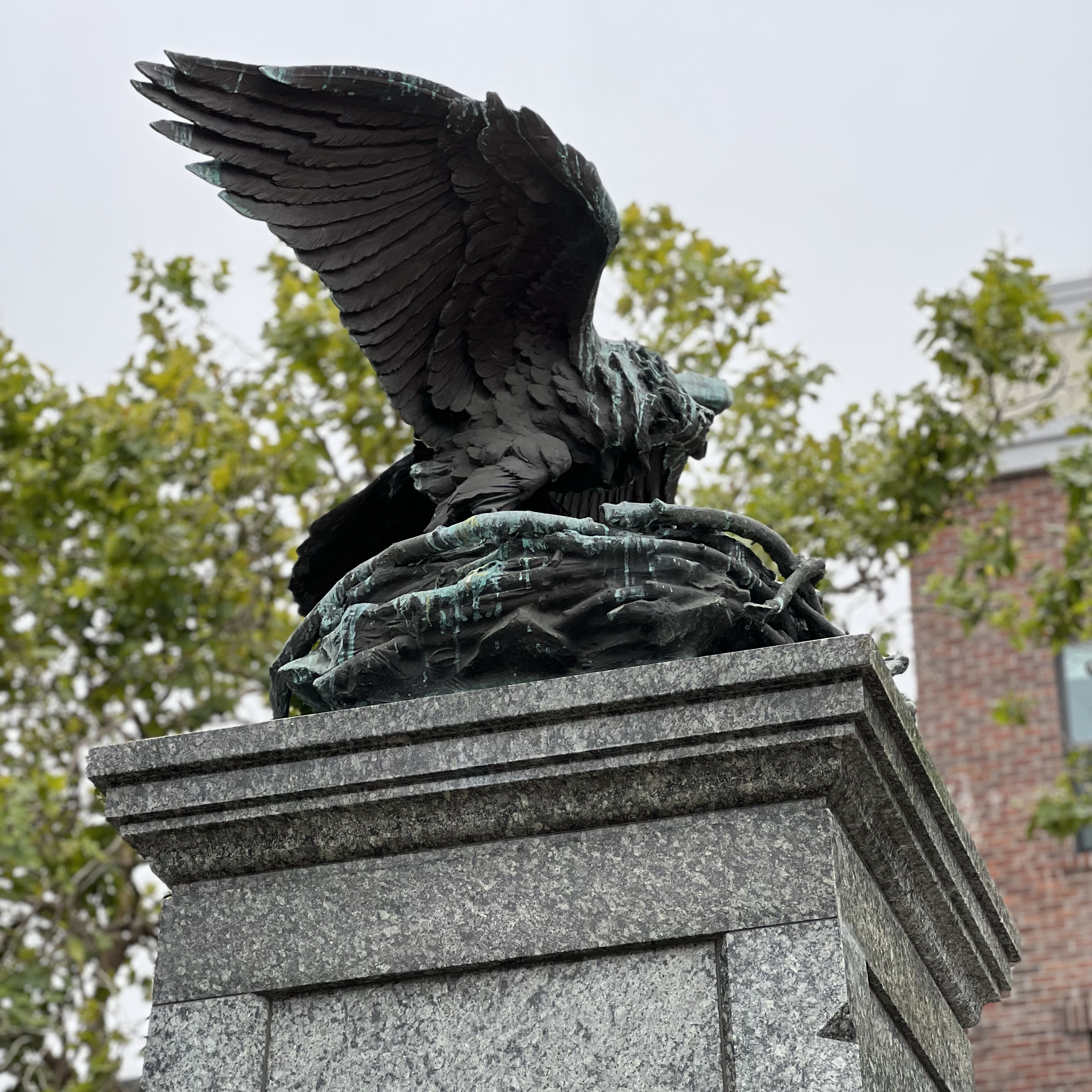
This post is my Memorial Day Continuous-Line Sketch from downtown Santa Cruz.
The World War I monument was dedicated on Memorial Day 1928. This monument of an eagle on a nest is at the start of Pacific Avenue near the Veterans Memorial Building.
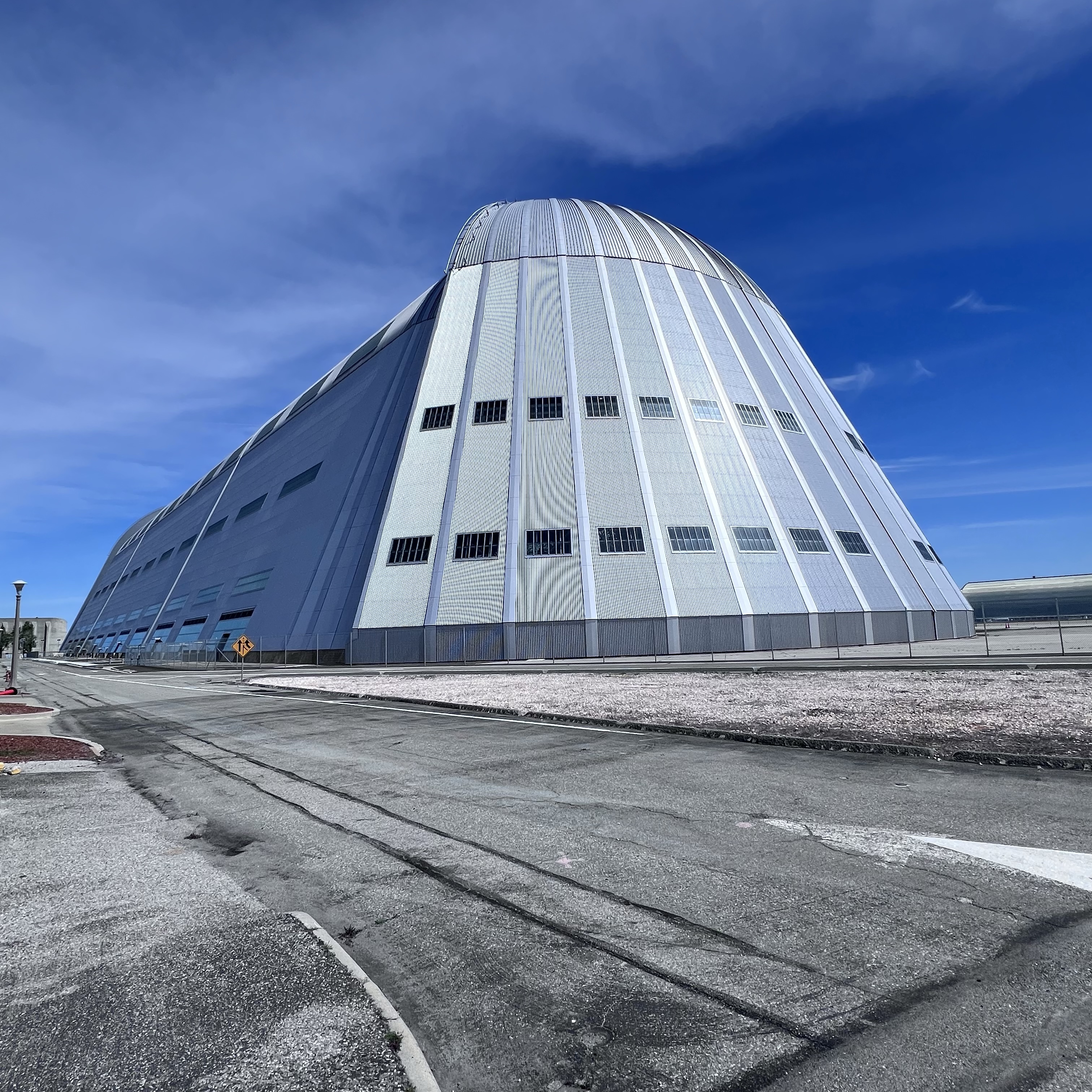
The last time I sketched Hanger 1 at Moffett Field near Sunnyvale, the side panels had been removed leaving the skeletal supports. The massive hangar was in the process of being restored.
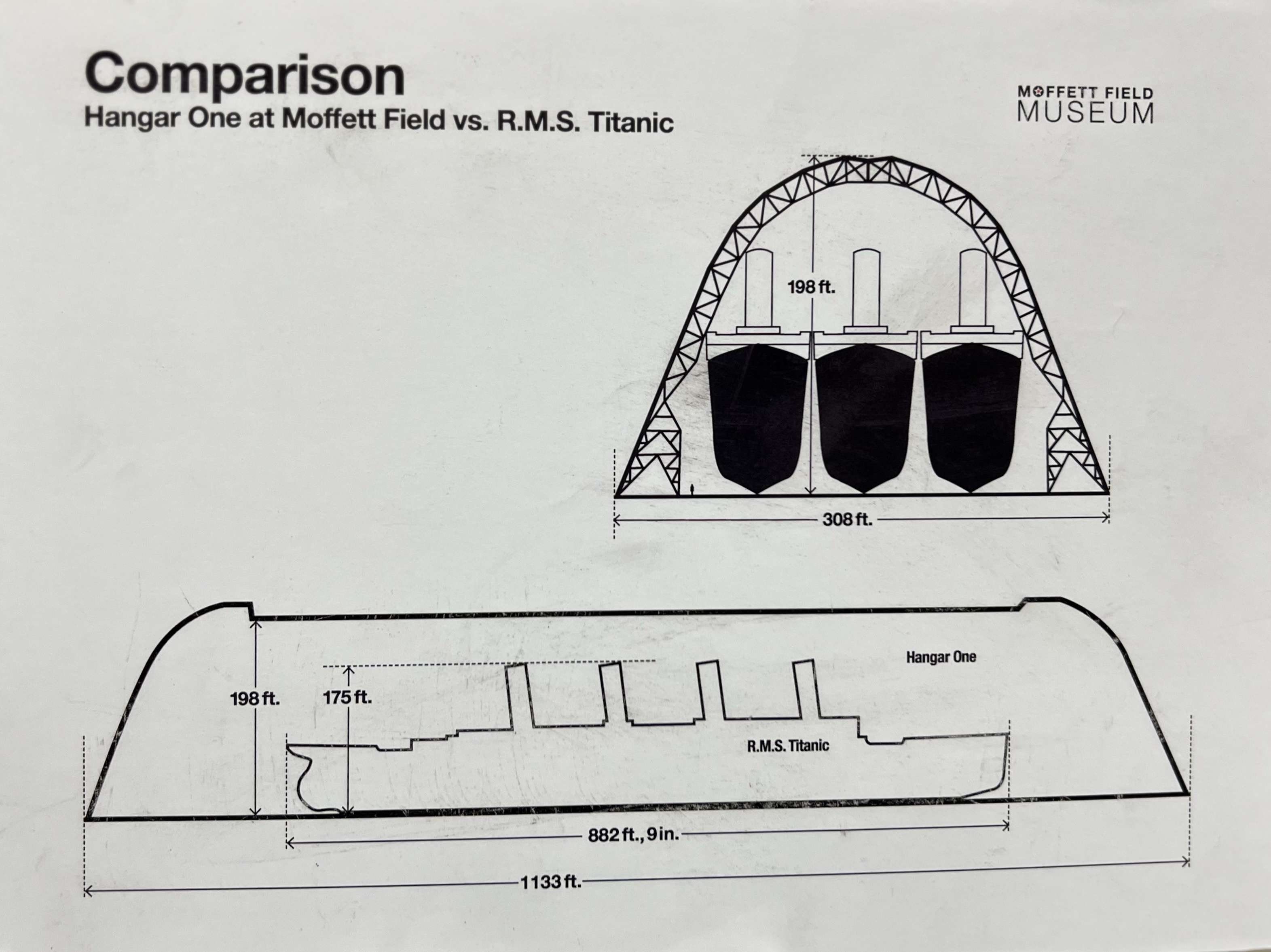
The hangar was built in 1933 to house the dirigible USS Macon. It covers eight acres of floor space. It is one of the largest freestanding structures in the world.
The hangar size comparison with the RMS Titanic at the Moffett Field Museum.
After Moffett was decommissioned as a Naval Airbase, the hangar sat unused. Eventually Google agreed to restore the hanger to the tune of $33 million. This would be my first time sketching the hanger reborn.
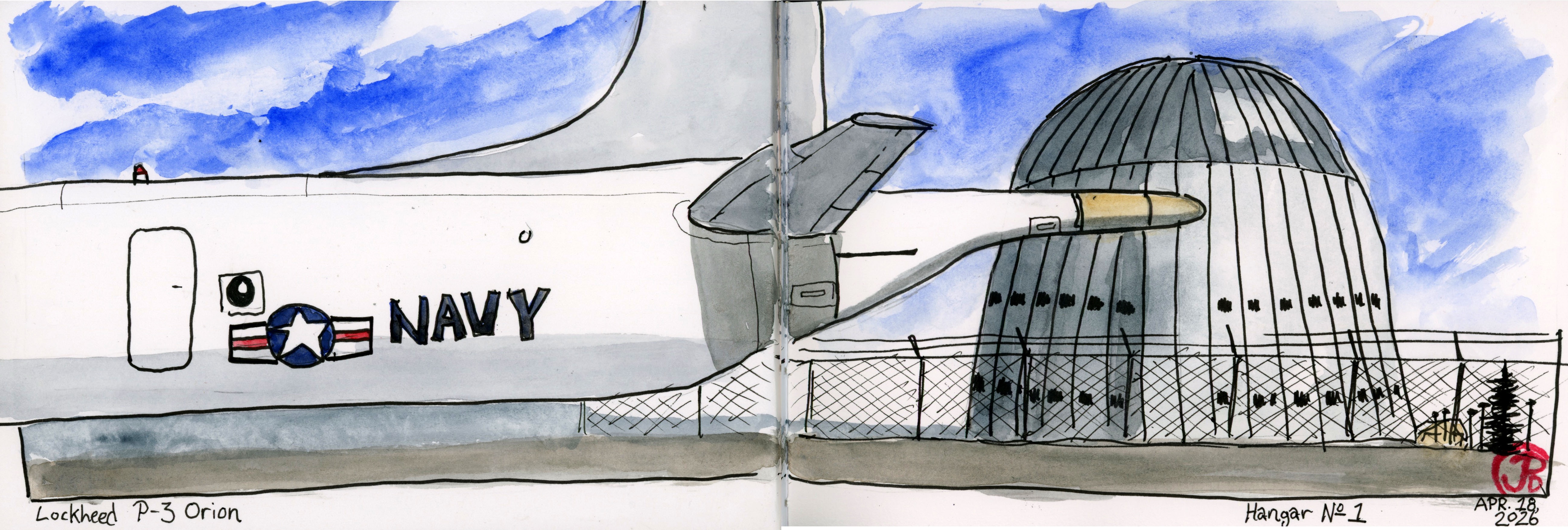
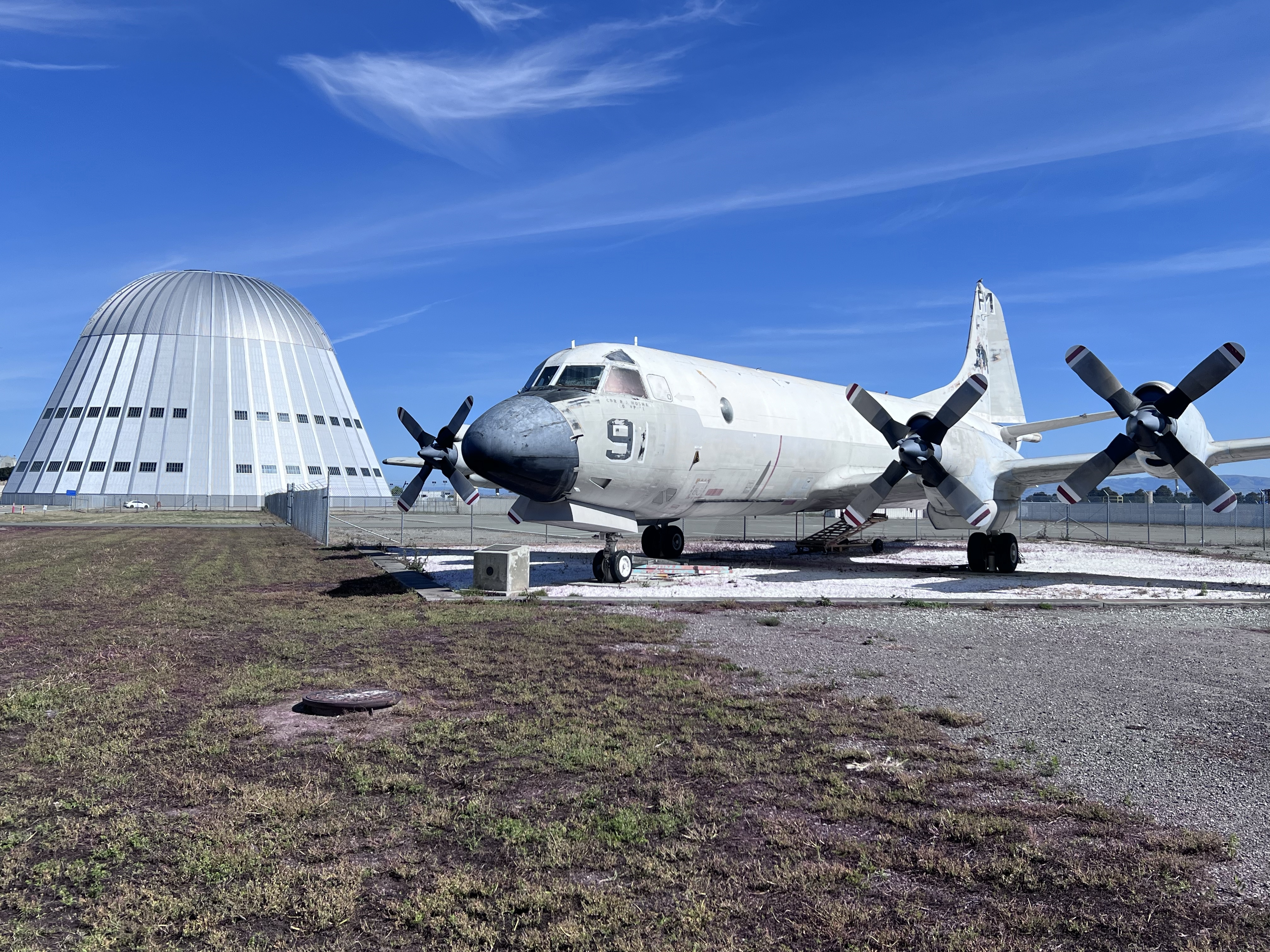
To enter the former Naval base you have to show an id at the front gate. This morning it was manned by four policemen. I was a little early for the opening of the Moffett Field Museum but I figured I would get a sketch in of Hangar 1 with the P-3 Orion in the foreground.
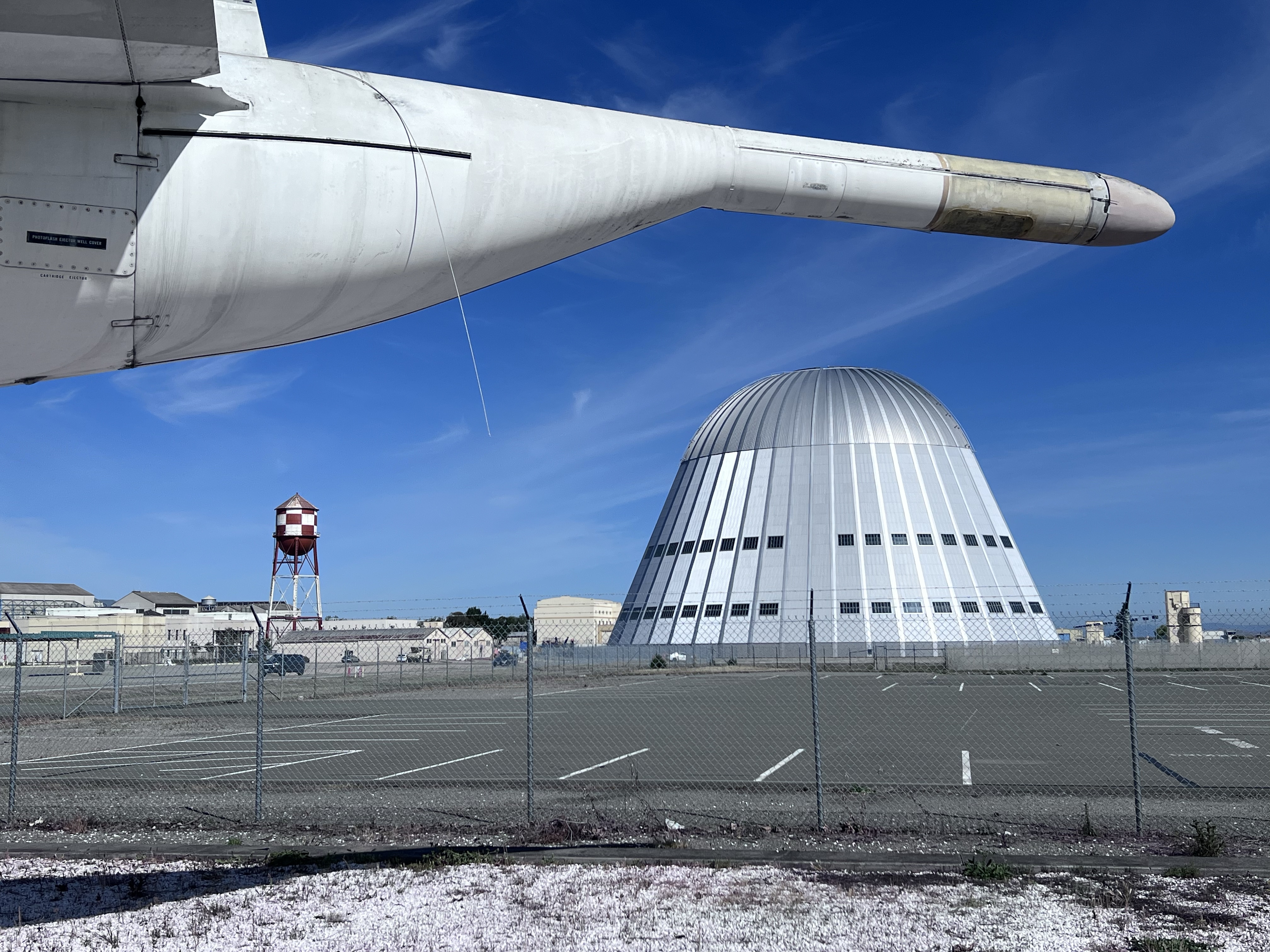
The newly restored Hangar 1 and the aircraft of my youth: the P-3 Orion.
I picked a spot in the shade and set up my sketching chair. I planned to sketch and paint the scene before me.
Hanger 1 and the distinctive MAD boom or stinger tail of the P-3A.
For this sketch I first penciled in the shapes in my panoramic sketchbook and then laid in washes. When the washes dried, I tied the scene together with pen work.
Around this time I noticed some movement behind me over my right shoulder. I turned to see a young police officer approaching me.
Oh no, here we go!
He asked me what I was doing and I told him that I was drawing the refurbished hangar and the P-3. He said he saw me photographing the airplane and (in his head), I might be photographing classified equipment on a military plane (that wasn’t there) on the tarmac.
The young officer was soon joined by three other squad cars. This was clearly the most exciting thing that has happened all week!
At this point a more senior officer took over the questioning. Perhaps to see if I had any dangerous weapons about me like a mechanical pencil or a soft eraser.
I told him that I was drawing the hangar and the Orion (at which point he complemented my work) and that I grew up in Sunnyvale and the P-3 was the plane that flew past my bedroom window. With this explanation and the evidence of my field sketch, I think he realized I was not a threat to National Security and perhaps his young officer had overreacted a bit.
The officers retreated to their vehicles and talked shop as if they were reluctant to leave me to my sketch. They eventually left, I finish my sketch, and then headed over to the museum.
This is one massive building. The structure is so large it generates its own weather system inside usually in the form of fog.
When I visited the museum I related my encounter with the police to a docent who was retired Navy and was also very opinionated. He said their behavior was chicken sh*t and that was one reason he left the Navy.
I talked to another docent at the museum about what Google planned to do with the new and improved hangar and no one seems to know. Mysterious.