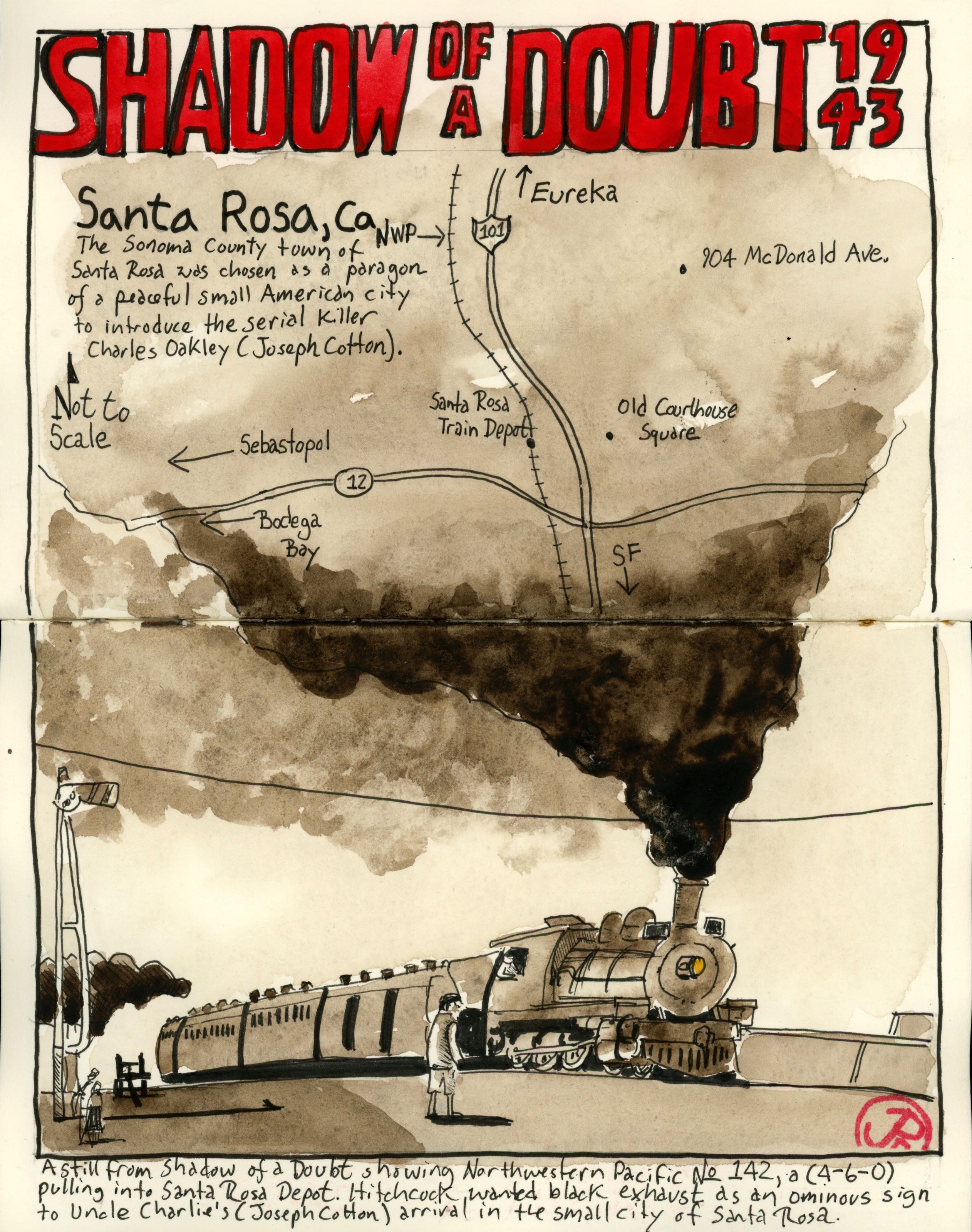
Alfred Hitchcock’s own favorite film was his 1943’s Shadow of a Doubt starring Teresa Wright and Joseph Cotton.
The noir thriller was filmed in the Sonoma County city of Santa Rosa. The city was picked by Hitchcock and his team as a quaint and peaceful small city in which to inject the Merry Widow Murderer (Cotton). The script was cowritten by Our Town playwright Thornton Wilder in an attempt to capture the flavor of life in a small town.
Uncle Charlie is eventually foiled by his namesake Charlie (Wright) as she slowly realizes who he really is and meets his end on a pilot of a freight train (spoiler alert!).
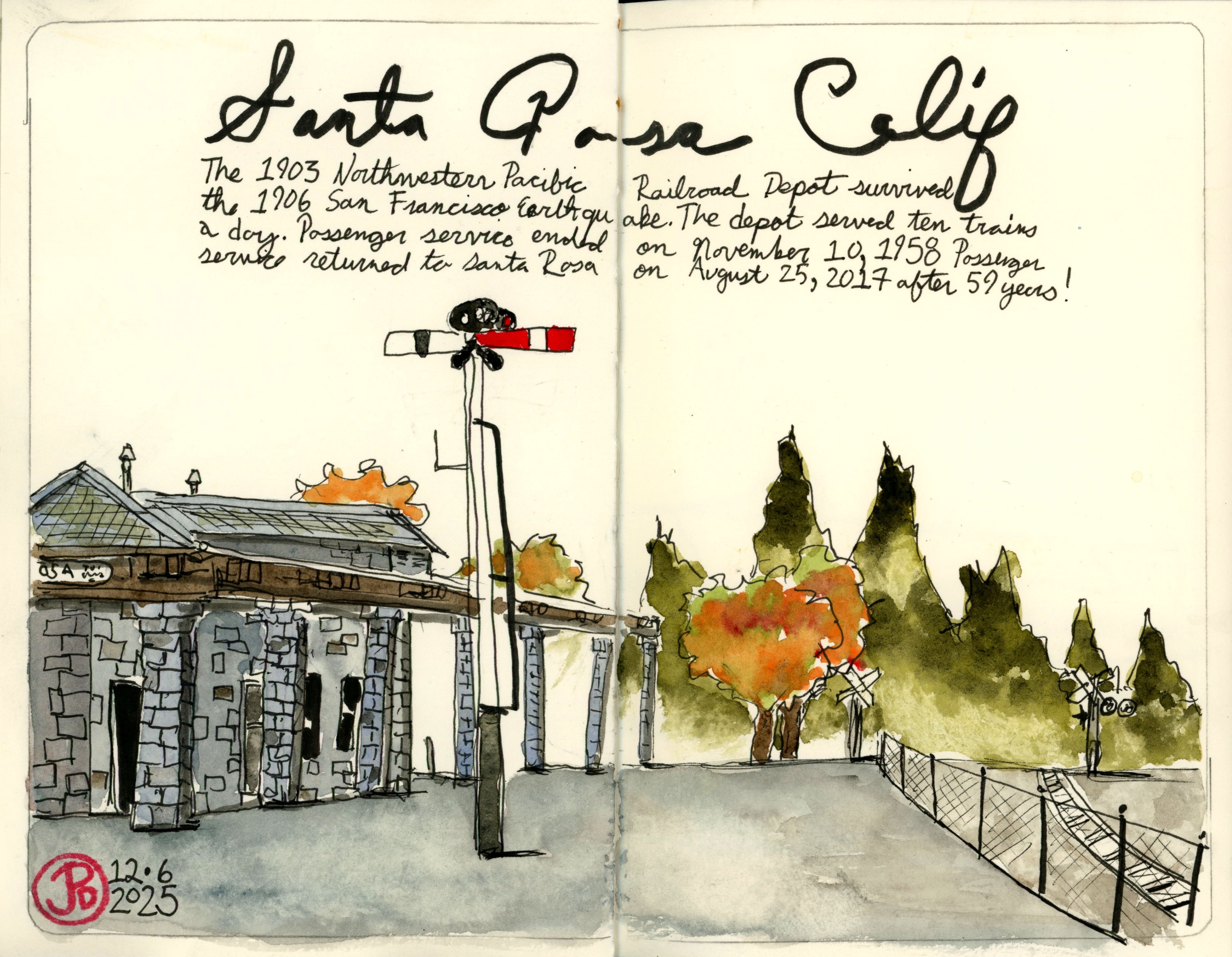
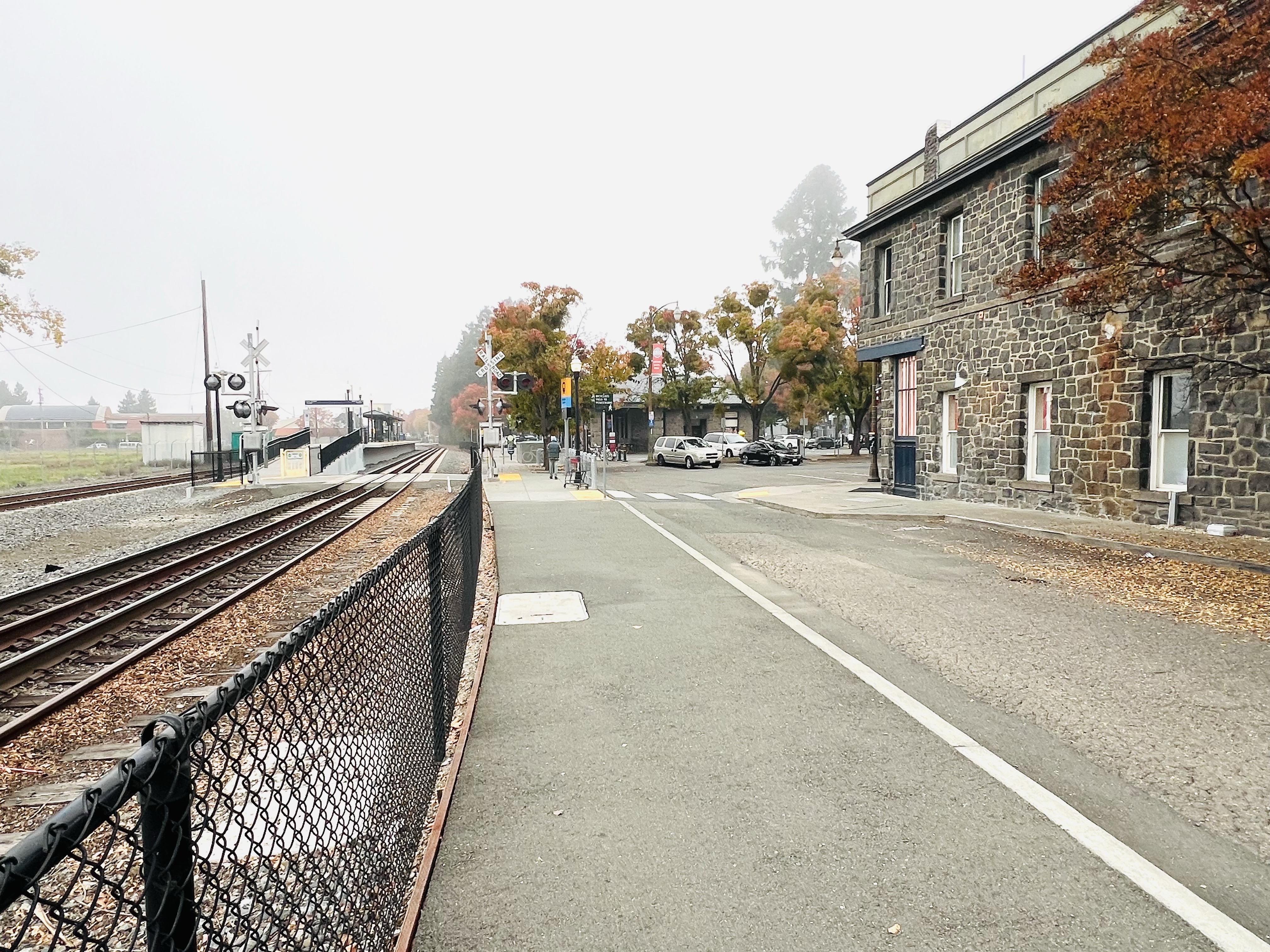
Uncle Charlie first enters idyllic Santa Rosa at the stone Northwestern Pacific (NWP) Depot (1904). The depot looks very much the same as it did in 1943, as it has withstood various earthquakes that have destroyed many of it’s contemporary surrounding buildings.
As the train approaches the depot the exhaust from the locomotive is an ominous pitch black and as the train pulls past the camera, a shadow envelopes the platform. This was all planned by Hitchcock as a modern “something wicked this way comes”. The arrival of Uncle Charlie to Santa Rosa.
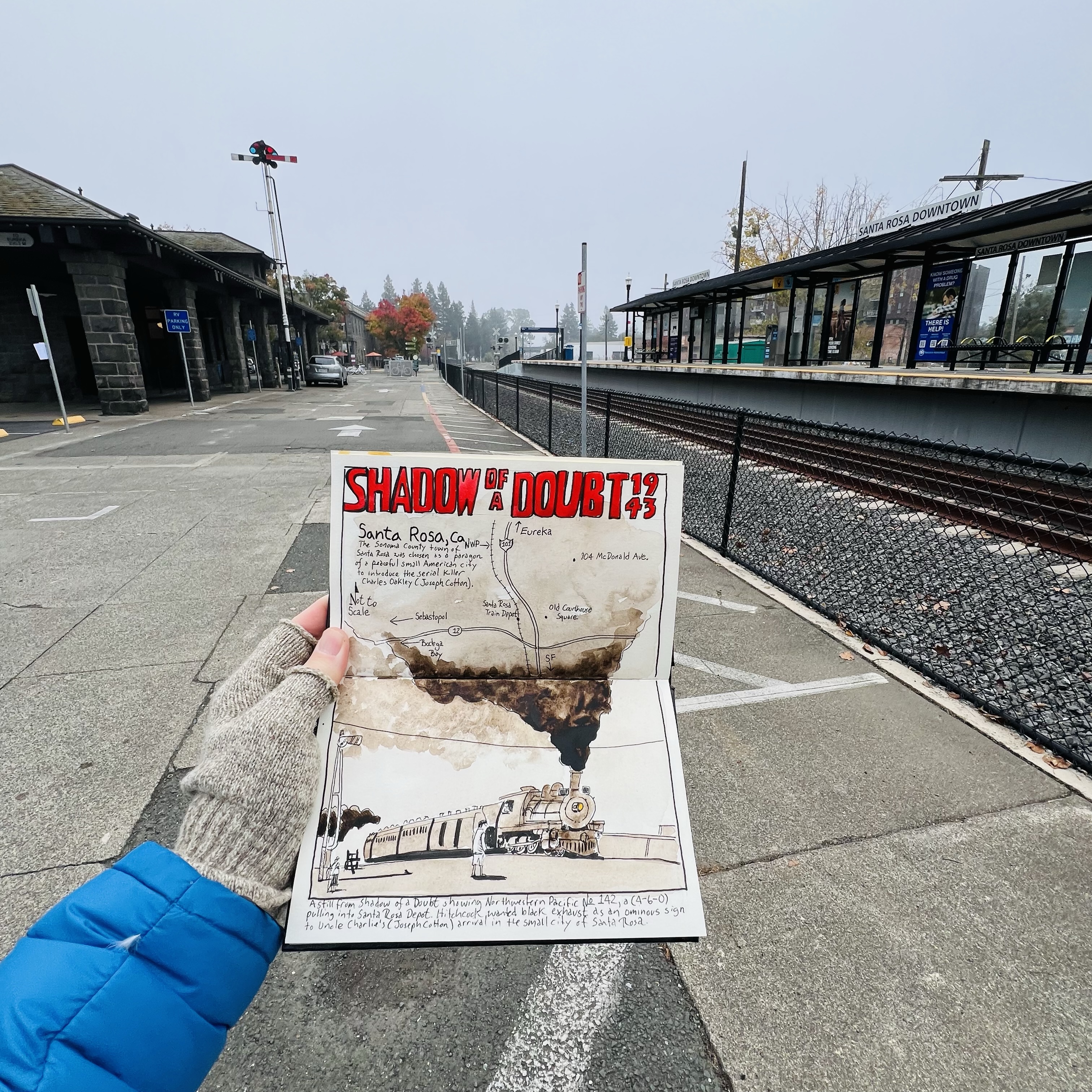
A pre-trip sketch of a frame from the film of Northwestern Pacific No. 142 pulling into Santa Rosa Depot.
I sketched the depot and platform from the approximate camera position when the northbound train first arrives. It was a frigid morning and my fingerless gloves came in handy.
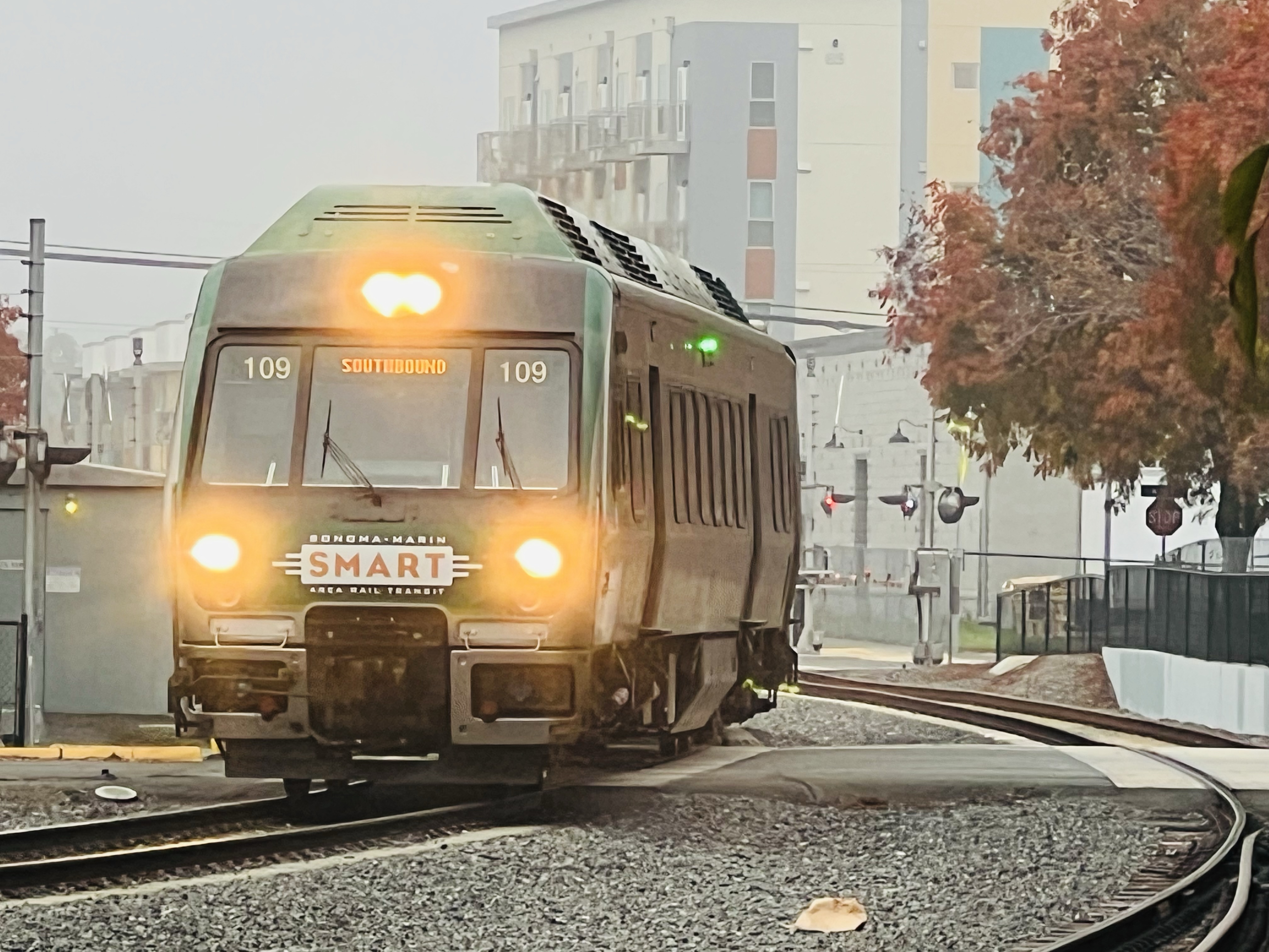
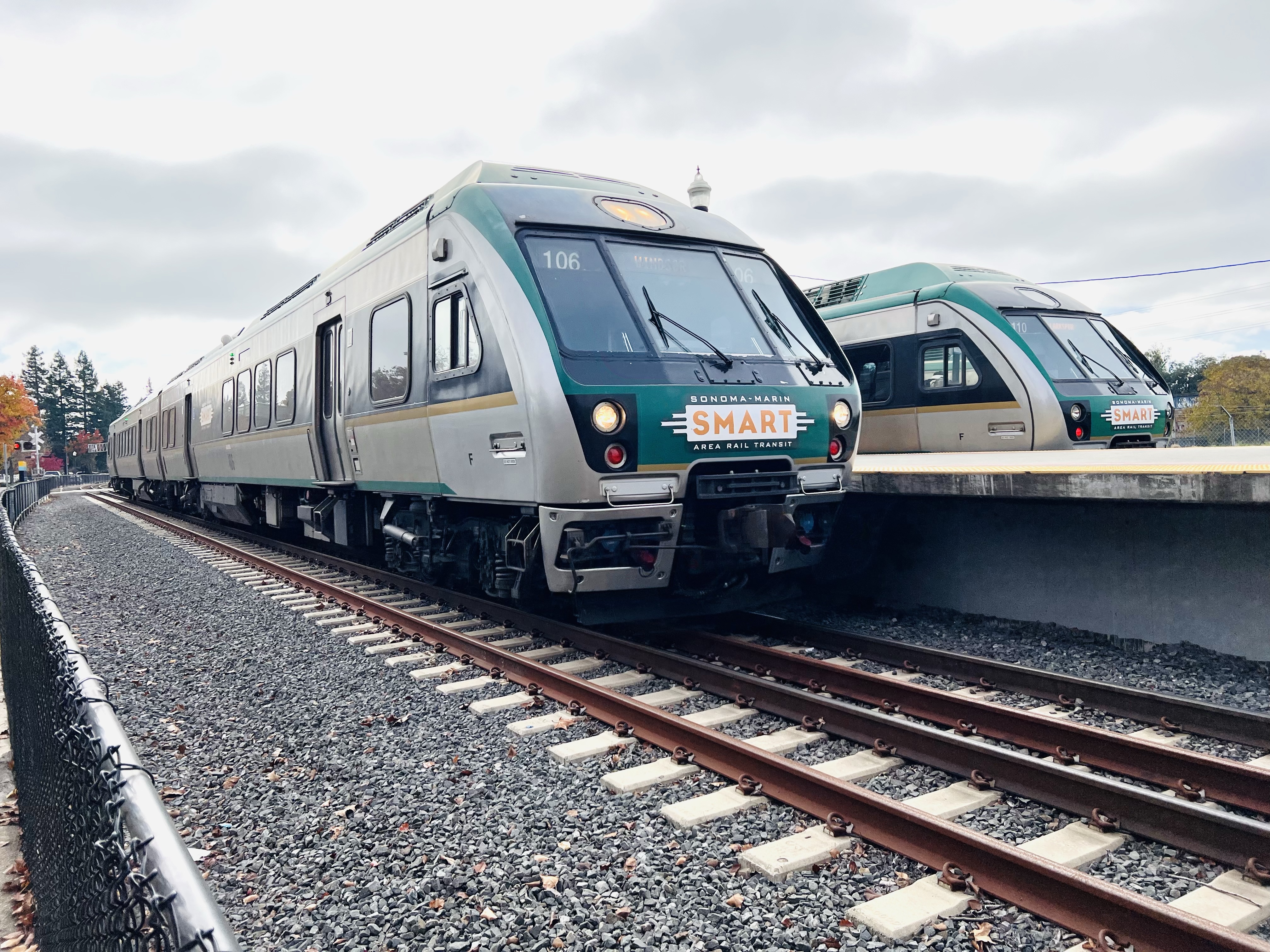
Looking north along the platform towards the depot. This is approximately where Joseph Cotten detrains from the last passenger car.Passenger service to Santa Rosa ceased in 1958. After 67 years, passenger service is alive and well at the Santa Rosa Depot with the SMART train providing service to Larkspur and north to Windsor. Two SMART trains at the Santa Rosa Depot. The near train is a northbound, heading the same direction as NWR No. 142 at the beginning of the film. At one time the line went north, 230.3 miles, to Eureka, California.
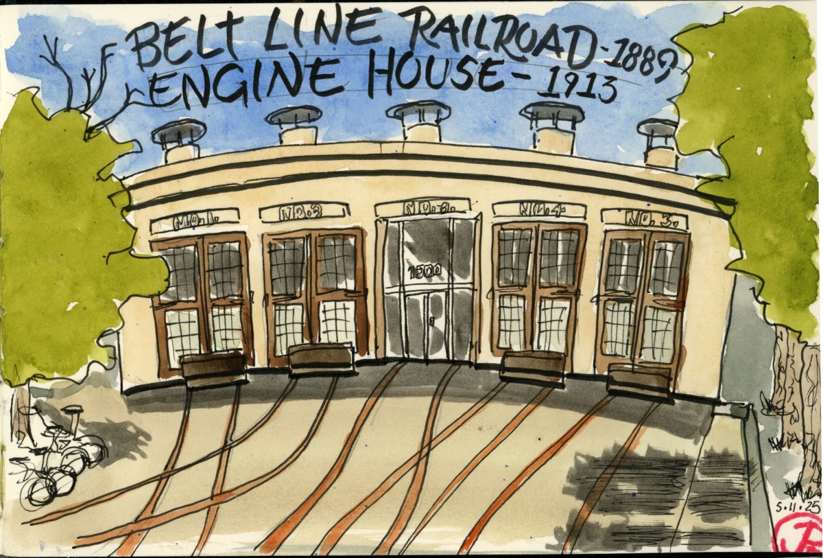
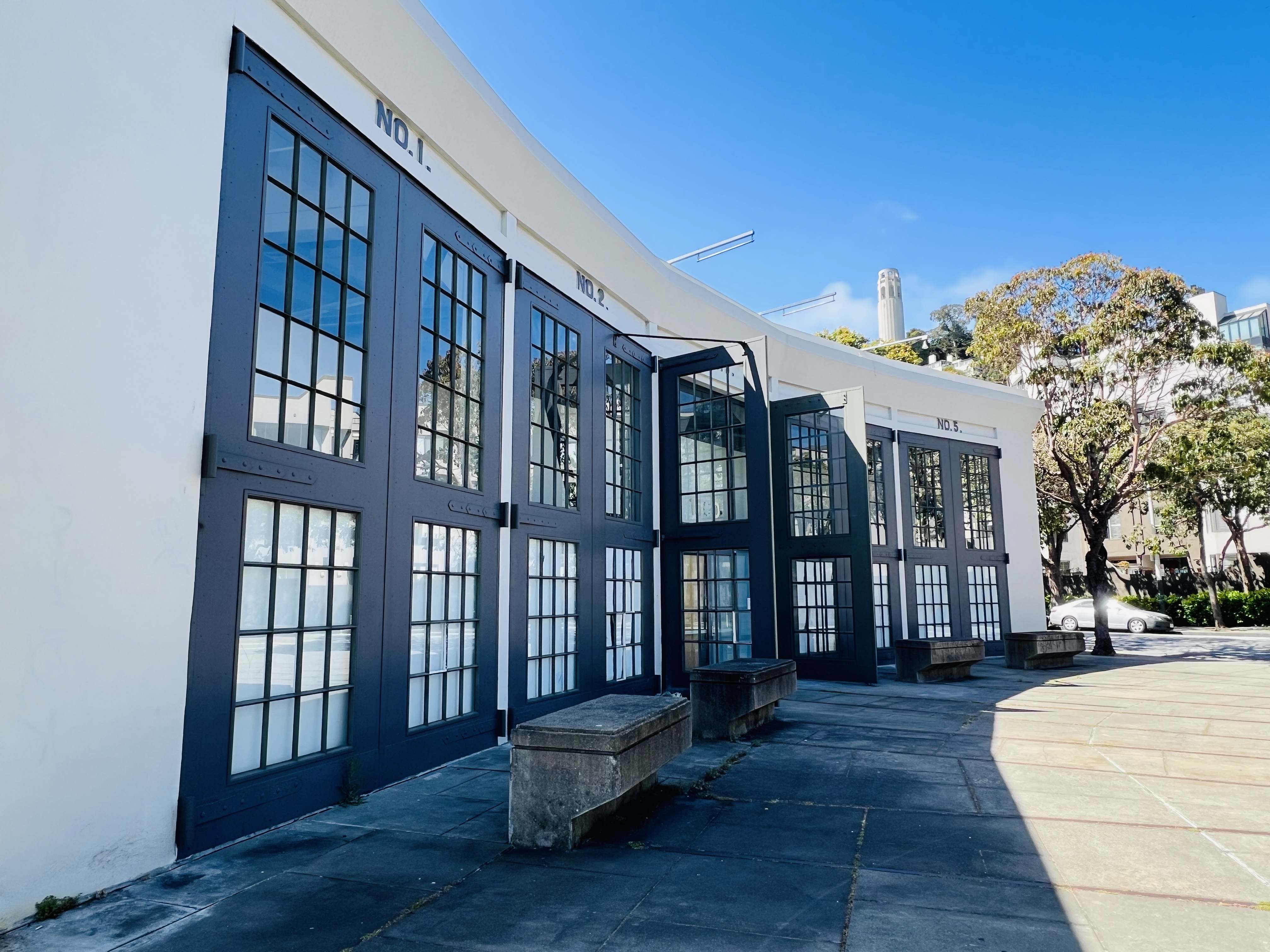
On Sunday I took the N Judah to Embarcadero Station with the intention of sketching a little San Francisco rail history. My main sketching target was the Belt Line Railroad Engine House or Roundhouse at Embarcadero and Sansome.
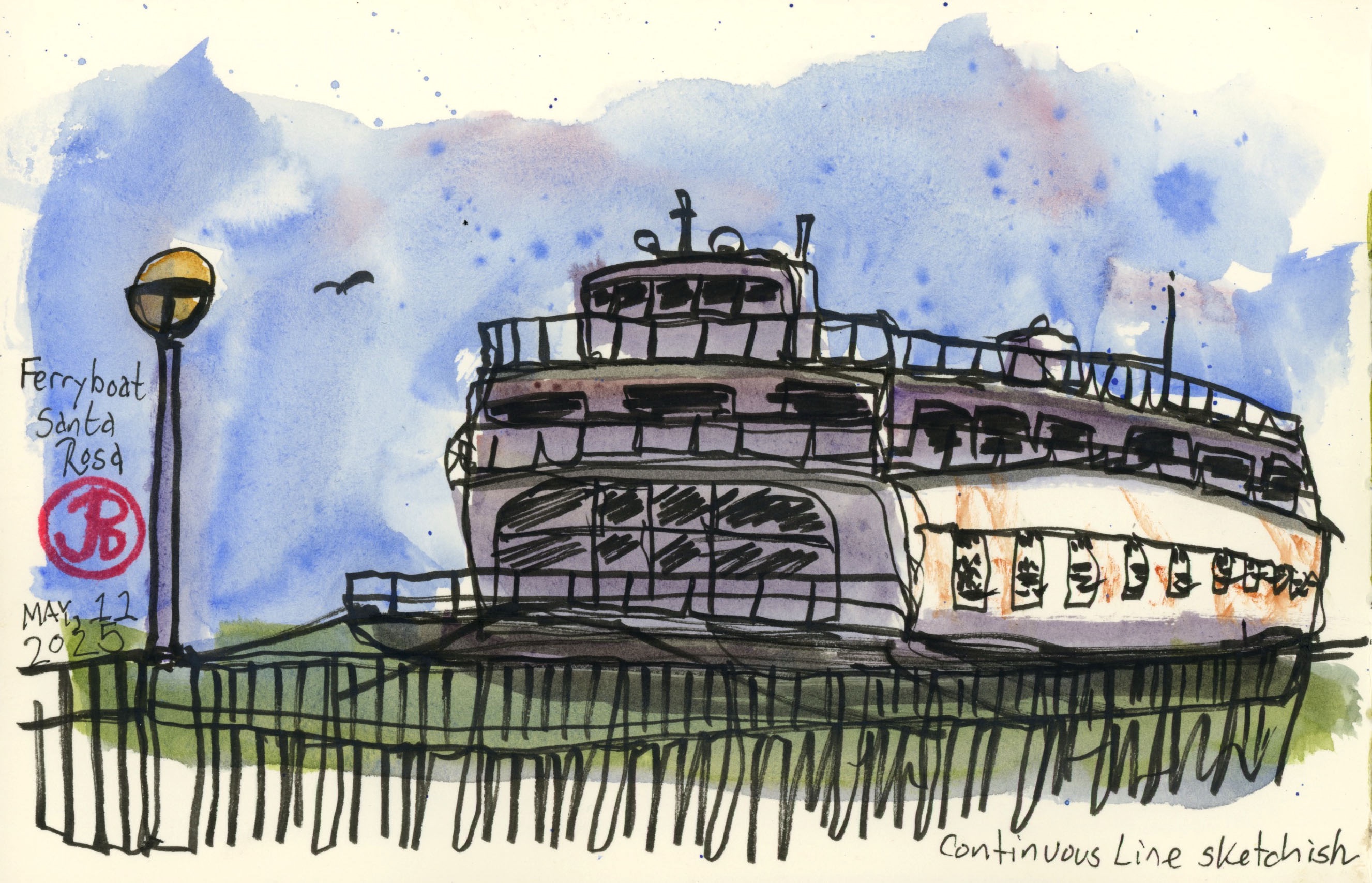
On the walk from the Ferry Building I came upon the 1927 ferry Santa Rosa at Pier 3 and I thought I would head back after my roundhouse sketch to add this piece of rail and nautical history to my spread.
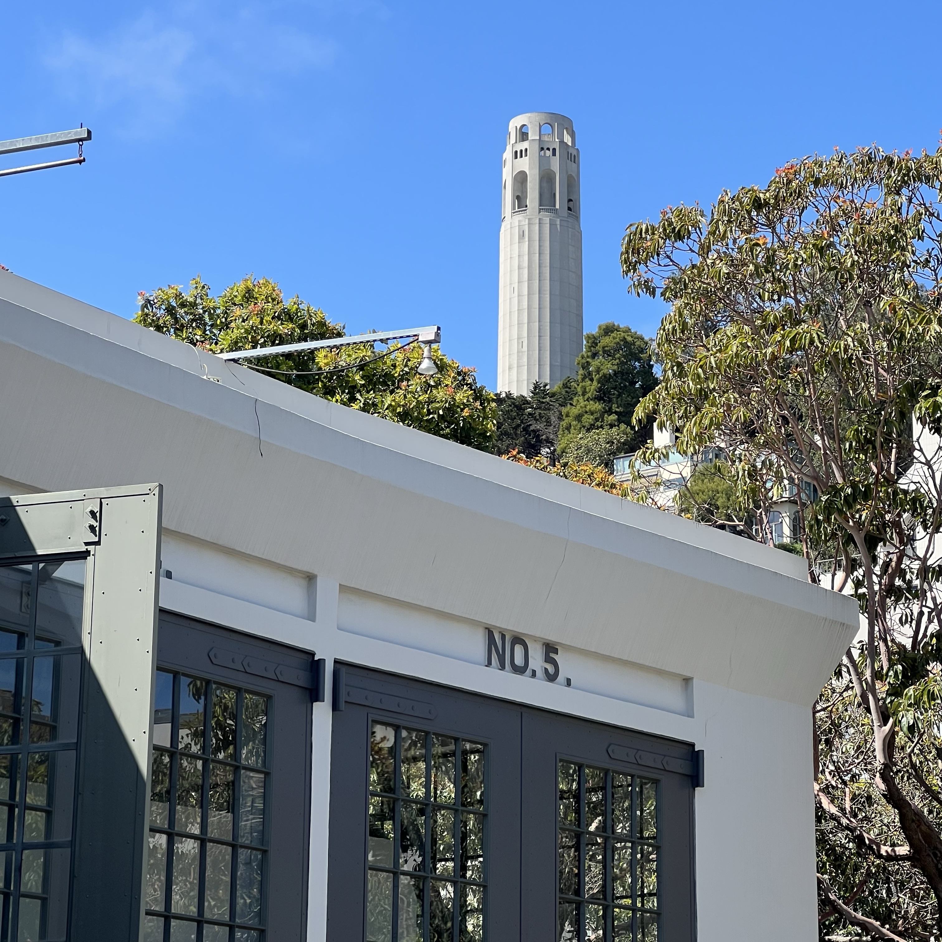
Bay No. 5 with Coit Tower in the background.
The Belt Line Railroad was founded in 1889. The railroad connected the Port of San Francisco with many of the piers and warehouses. The railroad shipped freight cars from the ferry freight terminal (at Pier 43) for railroads such as the Western Pacific, Northwestern Pacific, and the Aitchison, Topeka, & Santa Fe Railway. It also had connections with Southern Pacific on the southern portion of its line. The railroad also served Ft. Mason, the Presidio, and Chrissy Field through the Ft. Mason tunnel.
At its height, the railroad had 67 miles of track. The Belt Line operated 12 steam locomotives and six diesels.
Over time, the Port of San Francisco was eclipsed by the Port of Oakland and shipping traffic slowed. The railroad eventually folded in 1993.
Before me was the reinforced concrete Belt Railroad Engine House or Roundhouse. It was built in 1913 and is now designated as City and County of San Francisco Landmark #114.
The house contains five bays with five tracks snaking out of each bay. The tracks disappear under paving at the intersection of Chestnut and Embarcadero. It was nice to see that some of the the rails were still in place although the engine house now houses another business.
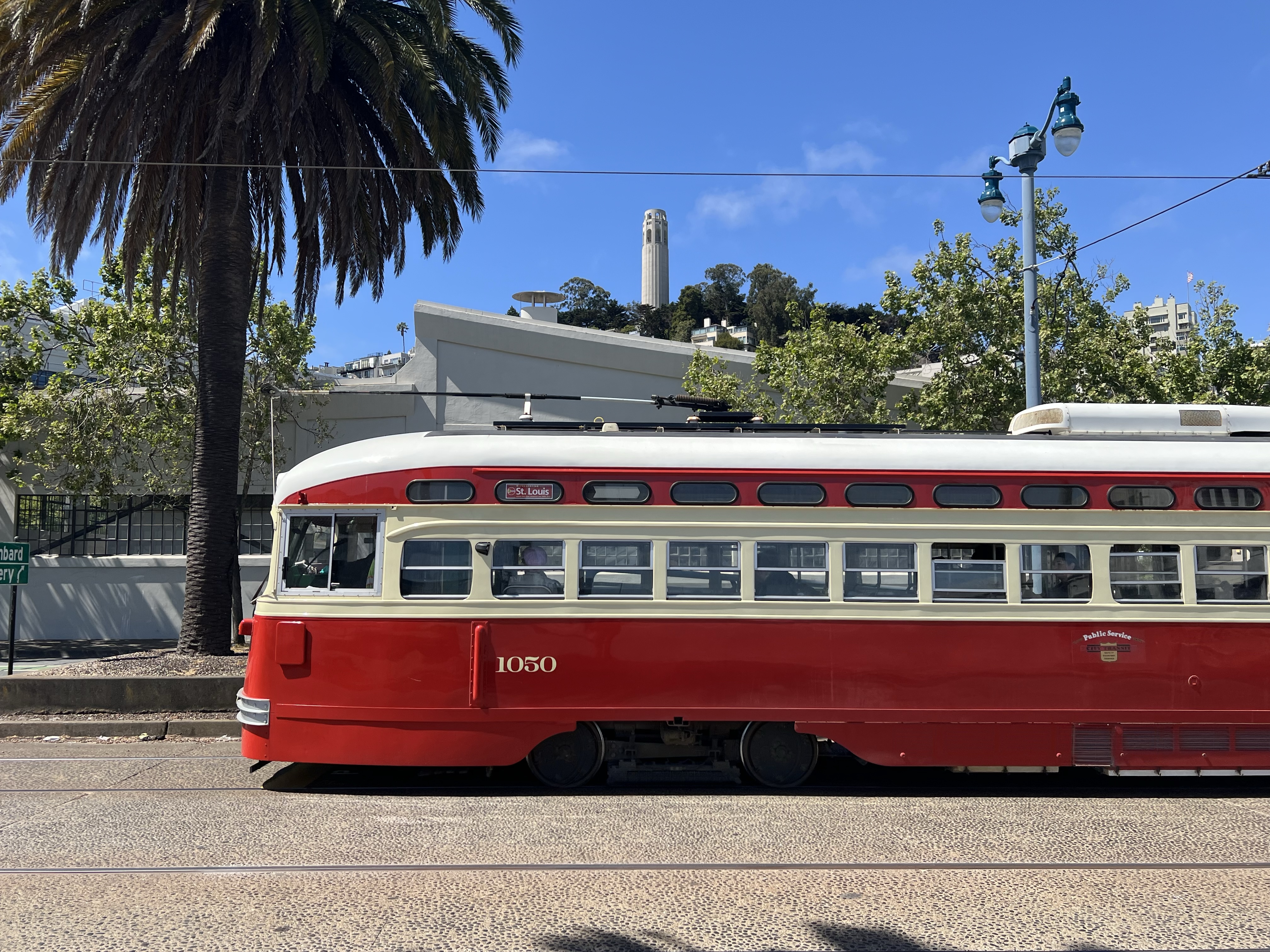
PCC car No. 1050 passes by the Engine House on the F Line. The car is painted in St. Louis livery.
After my sketch I headed back to the Santa Rosa and found a nice sketching bench.
For this sketch I chose to keep it loose and render the ferry in a continuous line sketch. Although I did lift my pen a few times to add some details and shading. So I’ll call it a broken line continuous sketch. For this sketch I experimented with a thicker more expressive pen, my Faber-Castell FM (Fude Medium). I love sketching with this pen!
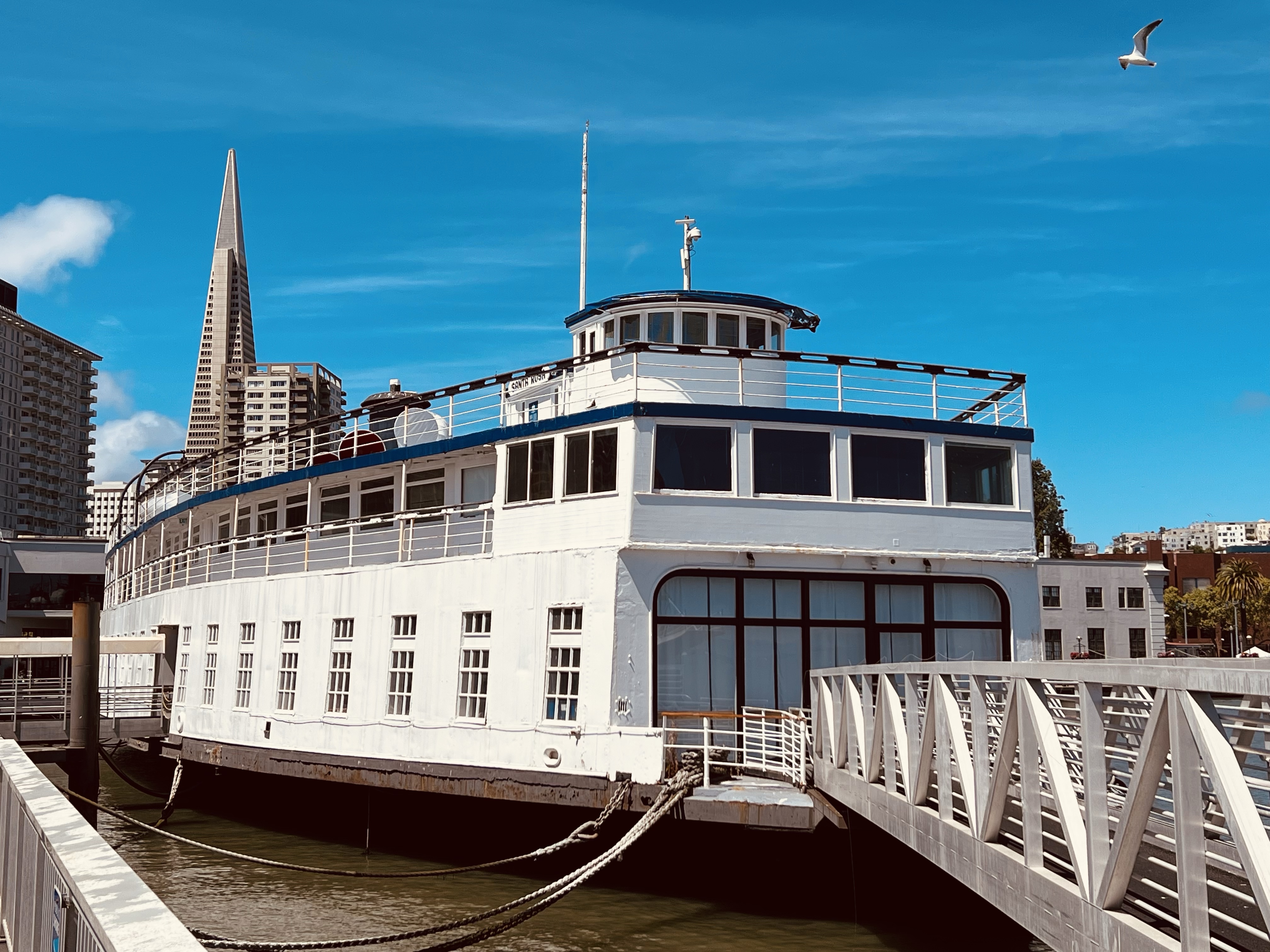
The Santa Rosa was built in 1927 for the Northwestern Pacific Railroad and was in service until 1968. She was sold to the Puget Sound Navigation Company in 1940 and was renamed MV Enetai. She returned to San Francisco Bay in 1968 and sat unused until Hornblower purchased the ferry in 1989.
The Santa Rosa is now the corporate offices of Hornblower.
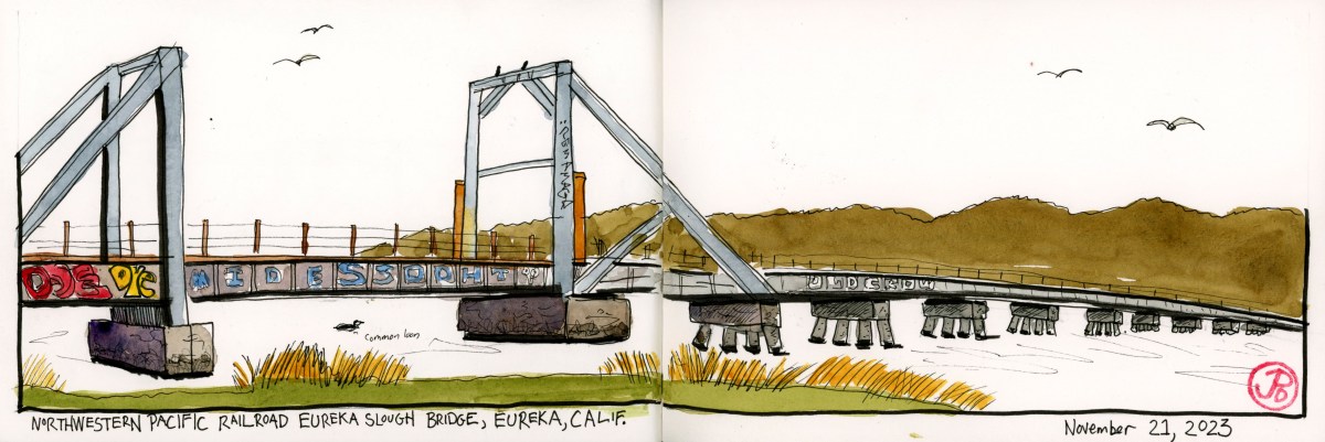
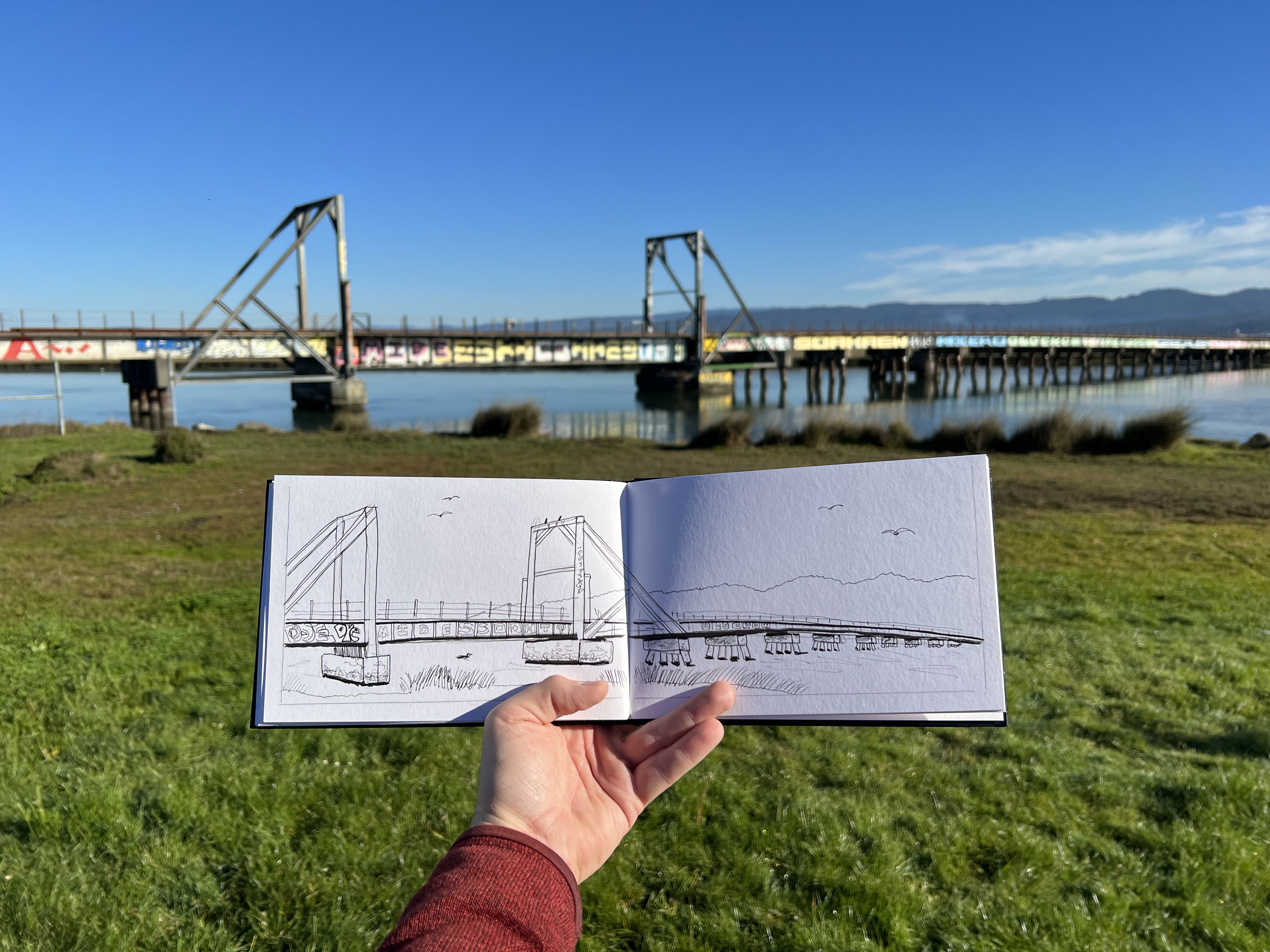
It was a cold, clear, and crisp morning in Eureka, a perfect day for railroad sketching.
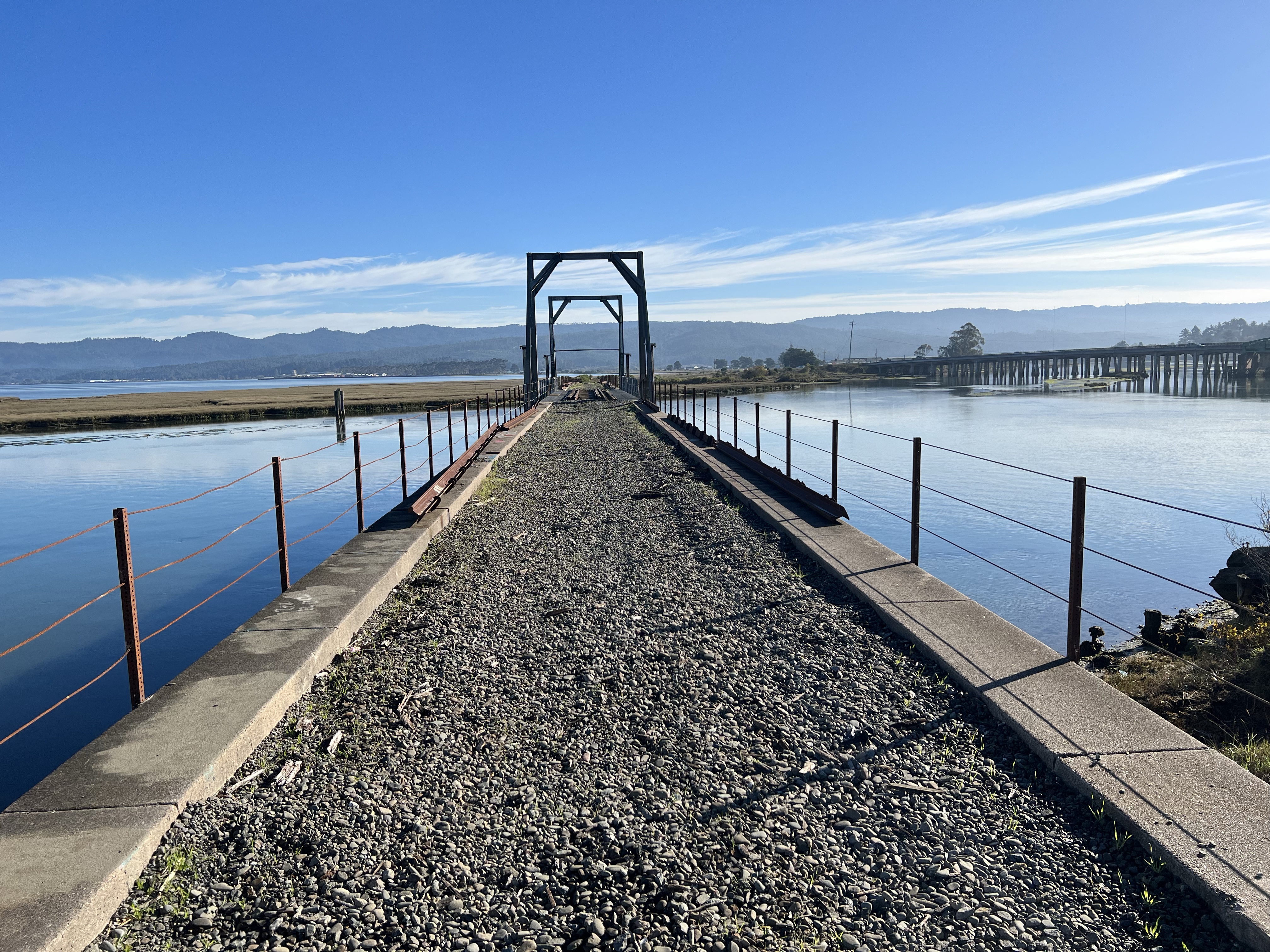
Pre-trip, the Northwestern Pacific bridge over Eureka Slough was high on my sketch list. This bridge has had a major rebuild at least once and now looks to be in good shape
I pulled onto Y Street, any further north and I’d be in Arcata. At the end of the street is the rusted railroad and pedestrian path that follows the shoreline (The Waterfront Trail). I headed right on the trail (north) to where the path comes to the slough and then heads east. Of course the railroad proceeded north by conquering Humboldt Slough with a bridge. And that’s what I was here to sketch.
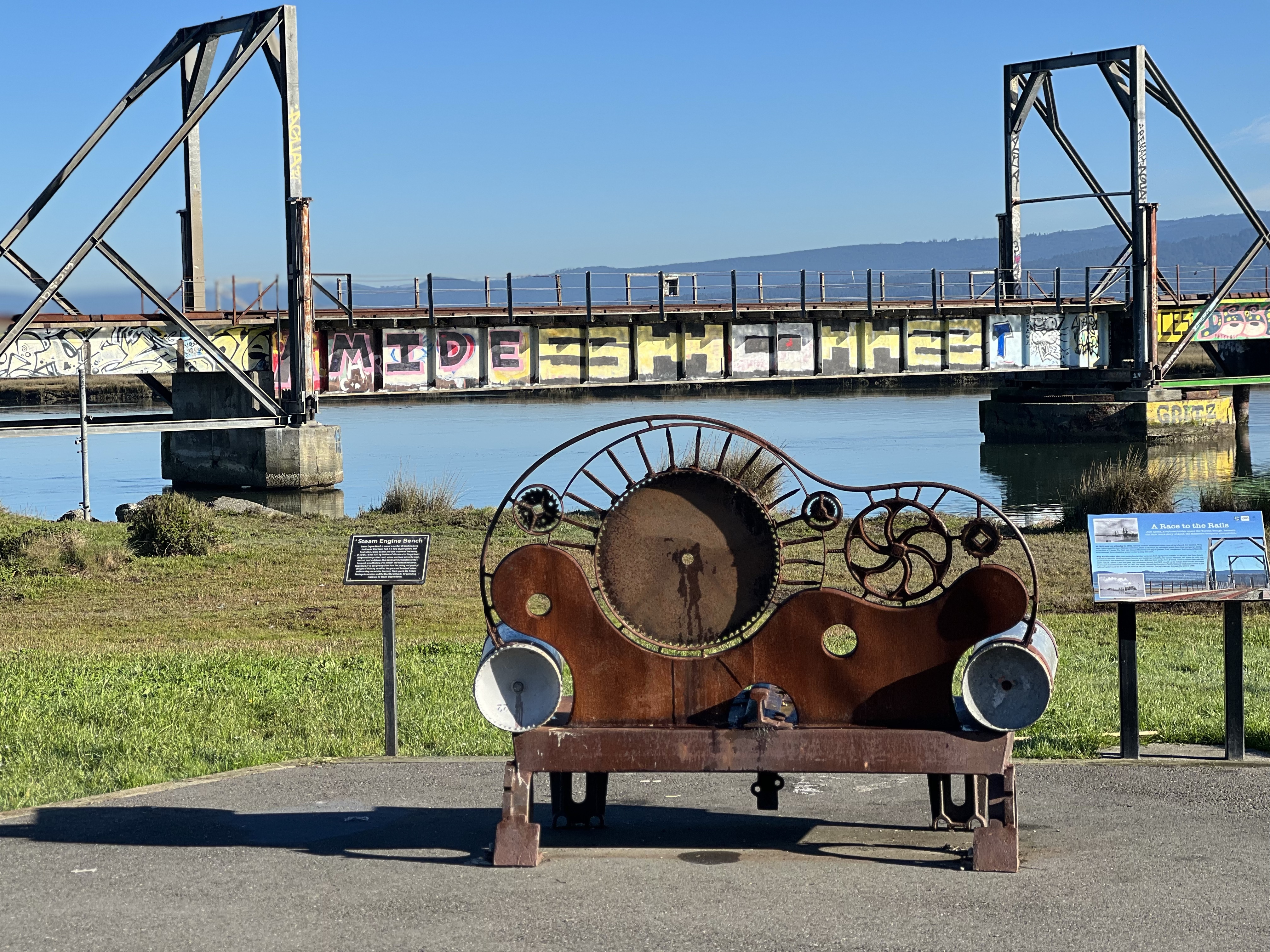
I had thought about bringing along by sketching chair but when you have the Steam Engine Bench with a capital view of the slough and bridge, why bother?
The Steam Engine Bench has to be one of the best sketching seats I have ever sketched from!
It was a beautiful morning to sketch and my pants absorbed the wet bench. I had to use a lot of sketcher’s shorthand and leave off the vast amount of graffiti that the bridge was covered in. I did keep the words, “OLD CROW” painted into seven panels of the bridge.
The bridge looking north towards Arcata which was as far as Northwestern Pacific ever reached. Sketched from life!
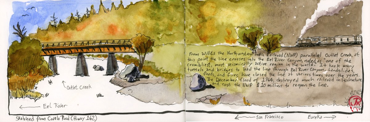
One of the biggest challenges of building a railroad from Willits to Eureka is the Eel River Canyon. And the Northwestern Pacific Railroad (NWP) definitely had their hands full with this engineering challenge.
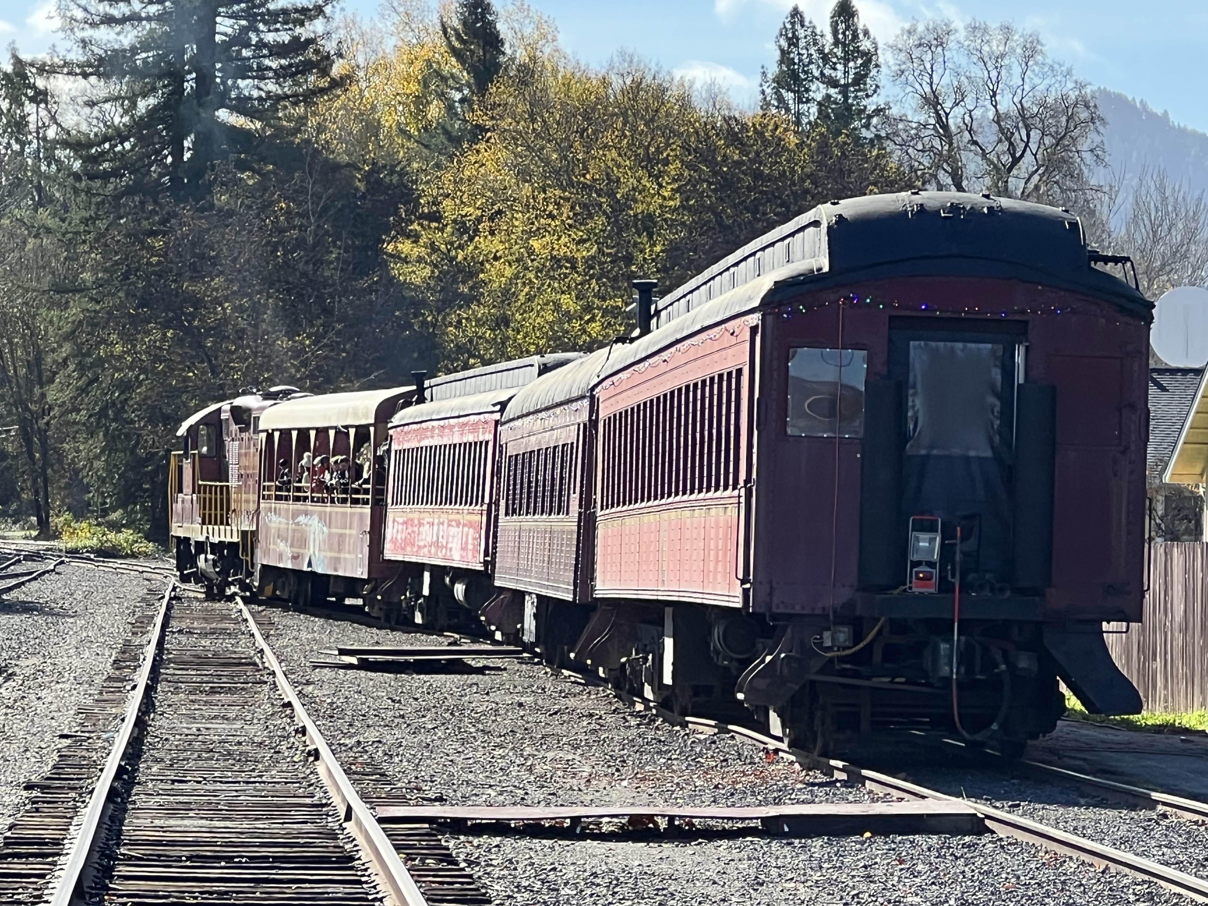
Parts of the NWP mainline is still in use as the Skunk Train pulled onto the mainline at the Willits Depot. Unfortunately the Skunk is heading in the opposite direction of Eel River Canyon. (For very good reasons).
13 miles north of Willits the Northwestern Pacific (NWP) line crosses Highway 101 and begins to parallel Outlet Creek.
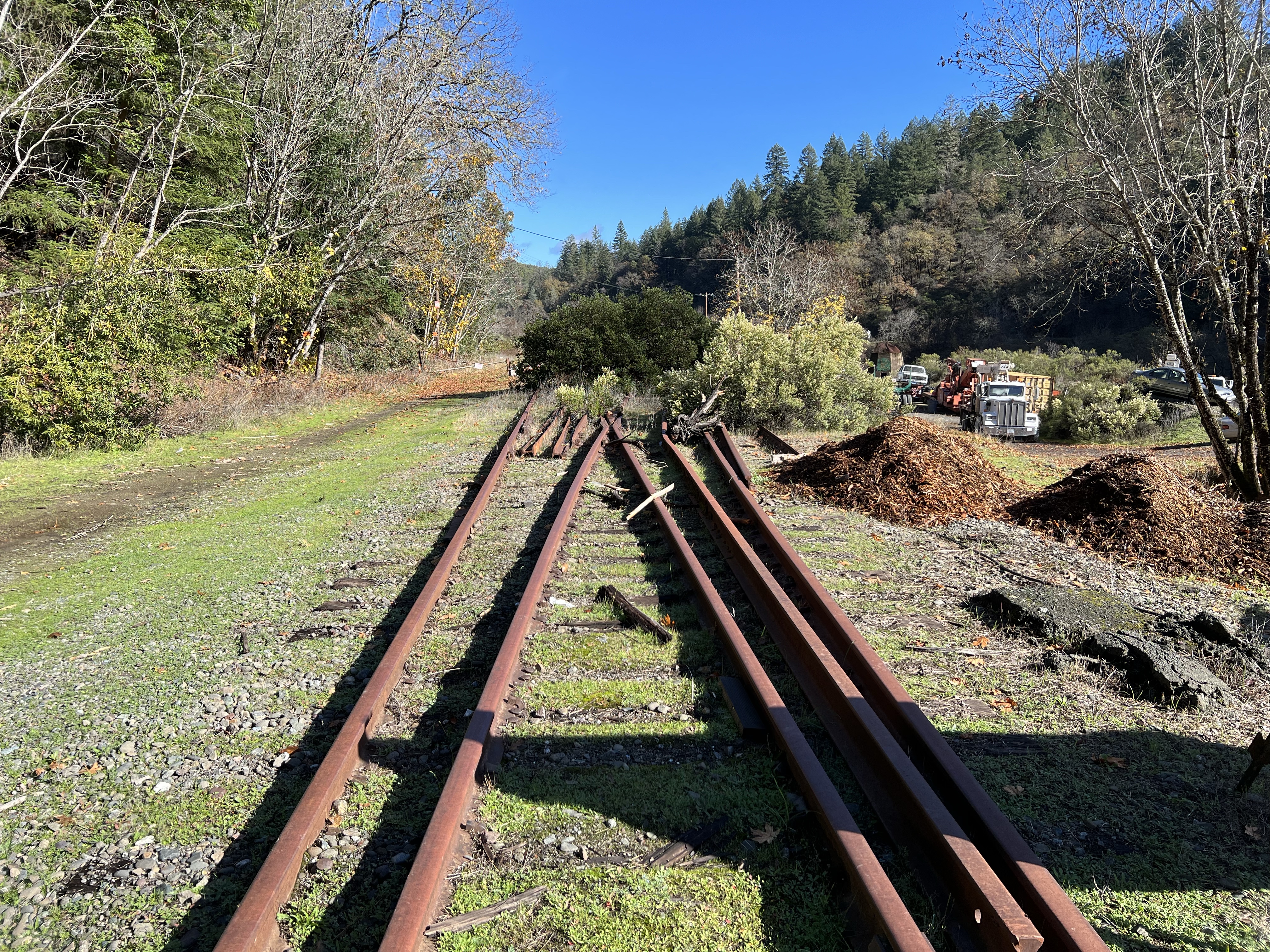
The rusted rails of the NWP heading north towards Eel River Canyon.
Just north of Willits I turned left onto Highway 162 (Covelo Road). I wanted to follow the railroad as far north up the Eel River Canyon that I could. I figured I would get as far as Dos Rios before I ran out of road.
There were some key sites in the Eel River Canyon that I wanted to see: Cain Rock and Island Mountain but these were so far off Highway 101 on long and windy roads (some on private roads that seemed very inaccessible). I wanted to avoid trespassing in Mendocino or Humboldt Counties! (Think shotgun!)
One of my sketching destinations was the train trestle over Outlet Creek near the confluence of the creek with the Eel River.
I pulled over just as I crossed the Eel River and set up my sketching chair to add the trestle in my Beta panoramic book (featured sketch). The field sketch is on the left side and as the pictures moves to the right, the color turns to sepia and a steam locomotive pulling a passenger consist, is heading down canyon towards the trestle. The spread is a look back in time.
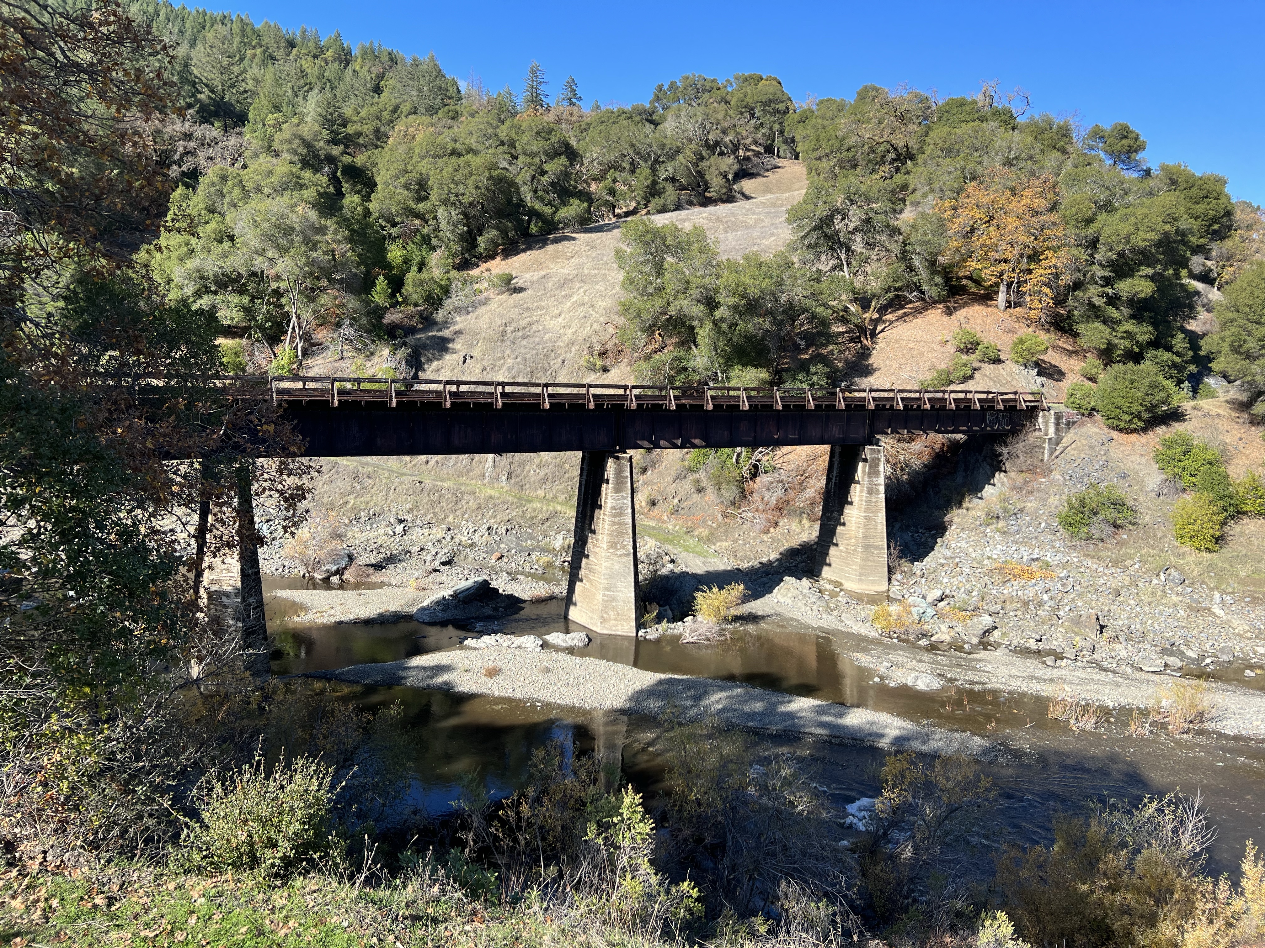
After the sketch I continued to follow the line towards Dos Rios on Highway 162. I came upon a tunnel, NWP Tunnel 14.
Tunnel 14 in the Eel River Canyon. This photo shows one of the problems with keeping the line open, both then and now. Here a landslide has covered a large section of the track. Think how expensive it would be to stabilize the hillside and reopen the line. This is one of many slides along the canyon.
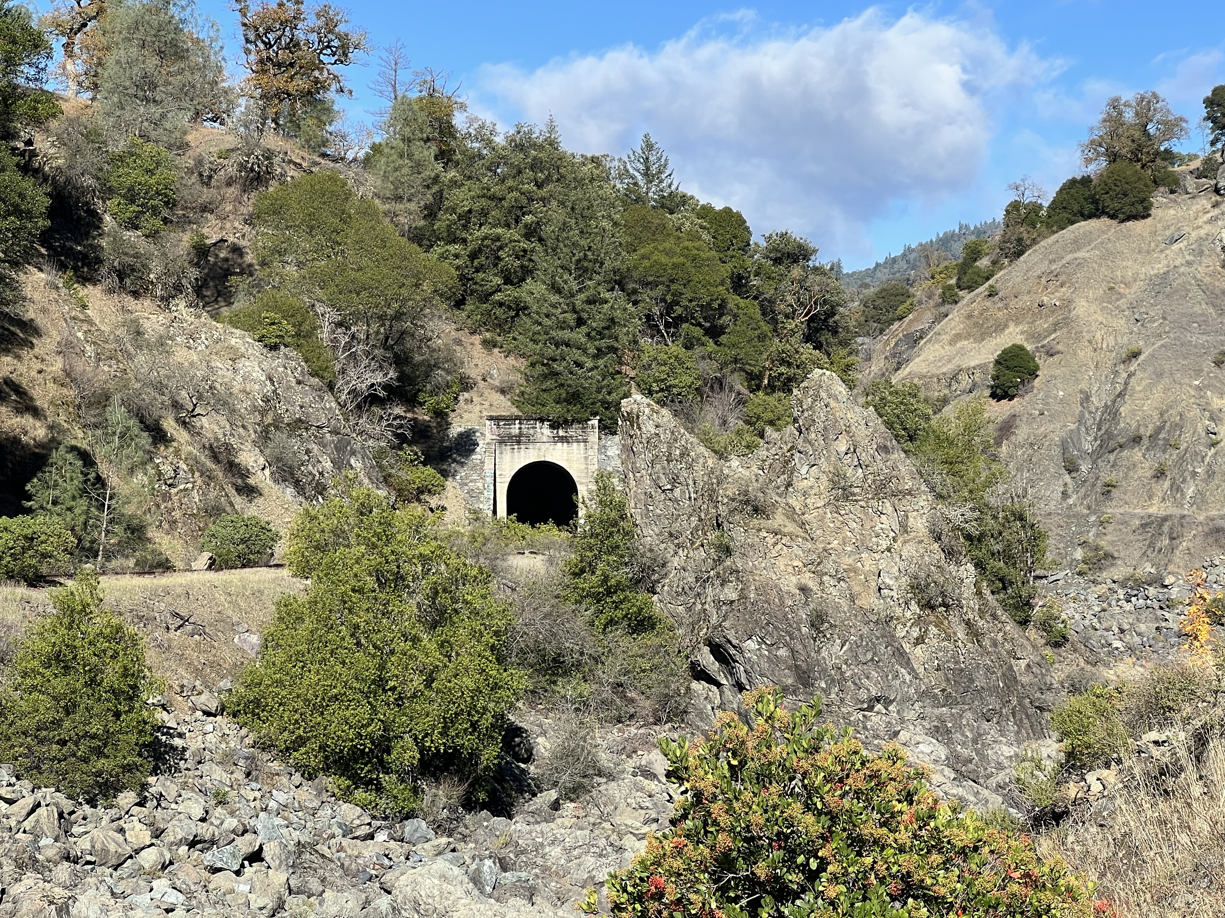
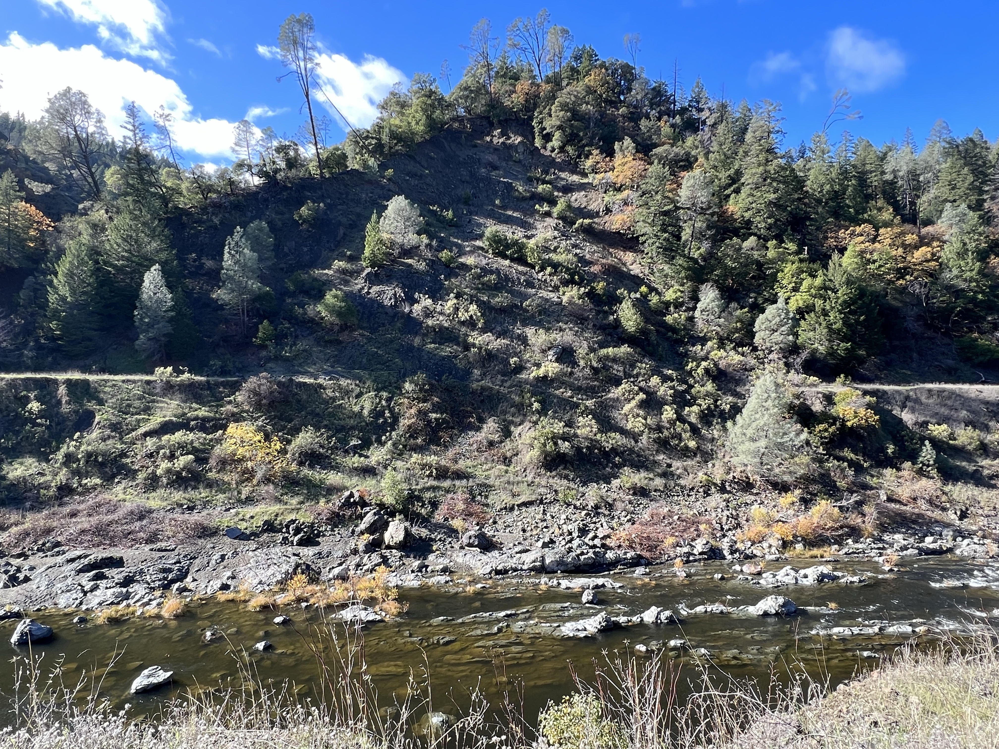
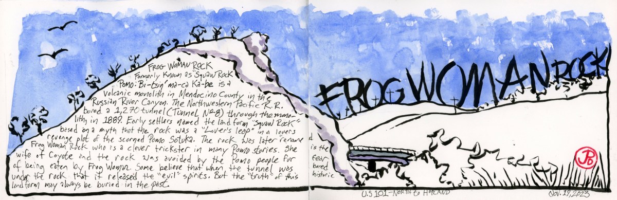
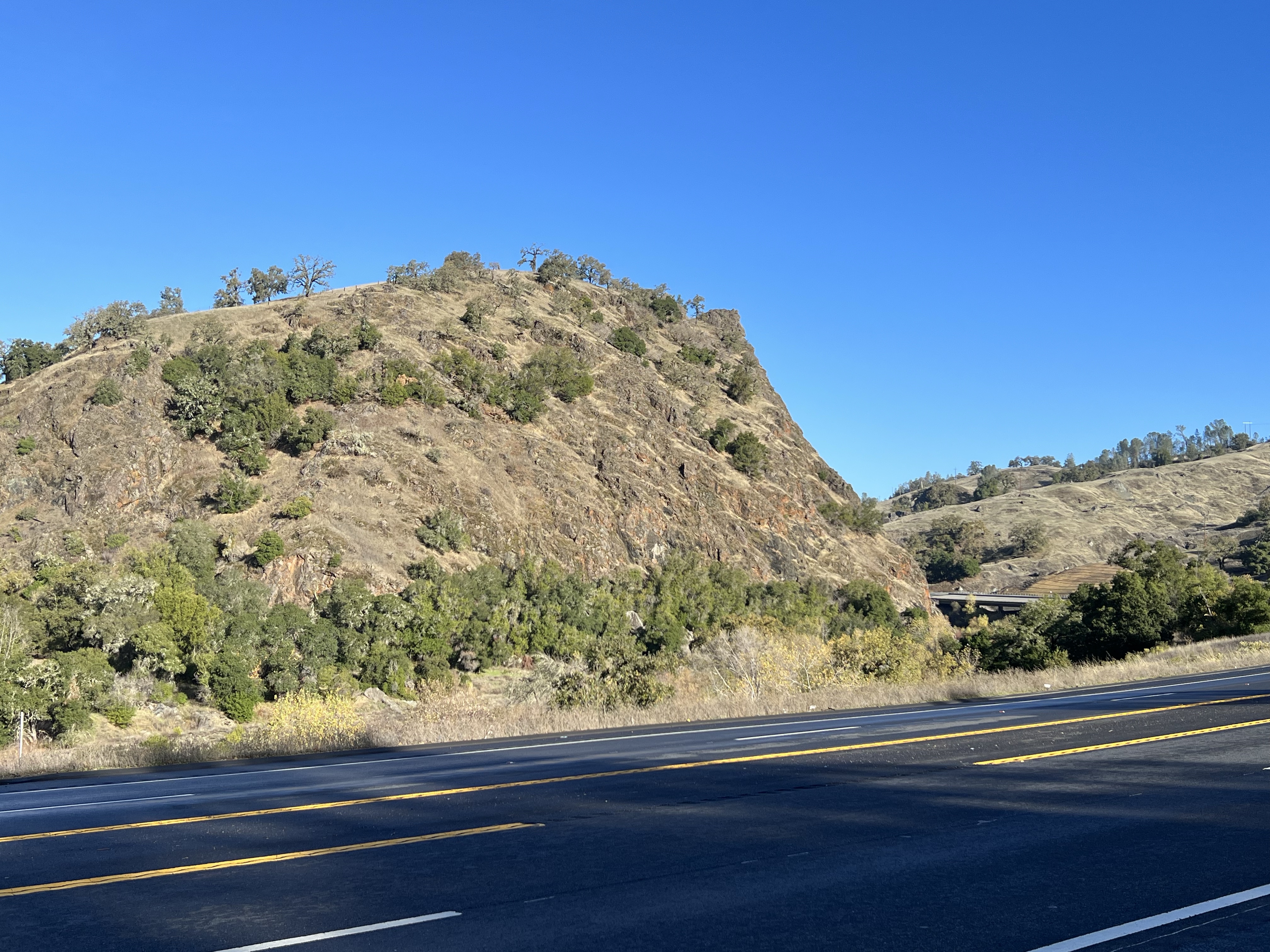
An imposing landmark on Highway 101, just south of Hopland is Frog Woman Rock (formerly known as Squaw Rock).
This was a barrier to the progress of the railroad that was following the Russian River on it’s West Bank. They could not go around the monolith so they had to tunnel through it.
This became the 1,270 foot Tunnel No. 8 on the Northwestern Pacific Railroad (NWP). While this monolith was a new delay to the railroad’s northern progress, the local Pomo people knew this location very well.
Frog Woman Rock with Highway 101 in the foreground.
To them it was know as Bi-tsin’ ma-ca Ka-be, Frog Woman Rock.
There are various legends of how the rock got its name. One Pomo story, filtered through early settlers, is that the rock was a sort of “Lover’s Leap” featuring in a lover revenge quarrel of the scorned Sotuka. Other say Sotuka is the wife of Coyote the trickster and the Pomo people avoided the rock. While others believe when the railroad tunnels through Frog Woman Rock, it released evil spirits.
Whatever the “truth” behind the legend of the rock, it was always be hidden in the past.
In 2024, Frog Woman Rock was designated California Historical Landmark No. 549. The plaque reads:
Since time immemorial, this monolith has been revered by Pomo people as the home of Frog Woman, the consort of coyote, and a special being in her own right. For native people it is a place of sacred power and a reminder of the connection we still have with our spirituality and natural environment. The presence of this great rock on the local landscape is a solemn witness that will forever be a local symbol of our indigenous collective conscience, strength, and perseverance.
The abandoned NWP train station at Hopland, six miles north of Frog Woman Rock, with rusted rail leading north (to the right) to Willits and Eureka.
Just north of the Victorian town of Ferndale is the small Humboldt County town of Lotleta (population 783).
The name of the town is shrouded in a bit of mystery but the name is supposedly the Wiyot word for “pleasant place at the end of the tide water” or according to Wikipedia, “Go f___ yourself “ or “Let’s have intercourse”. So many varied derivations! Take your pick.
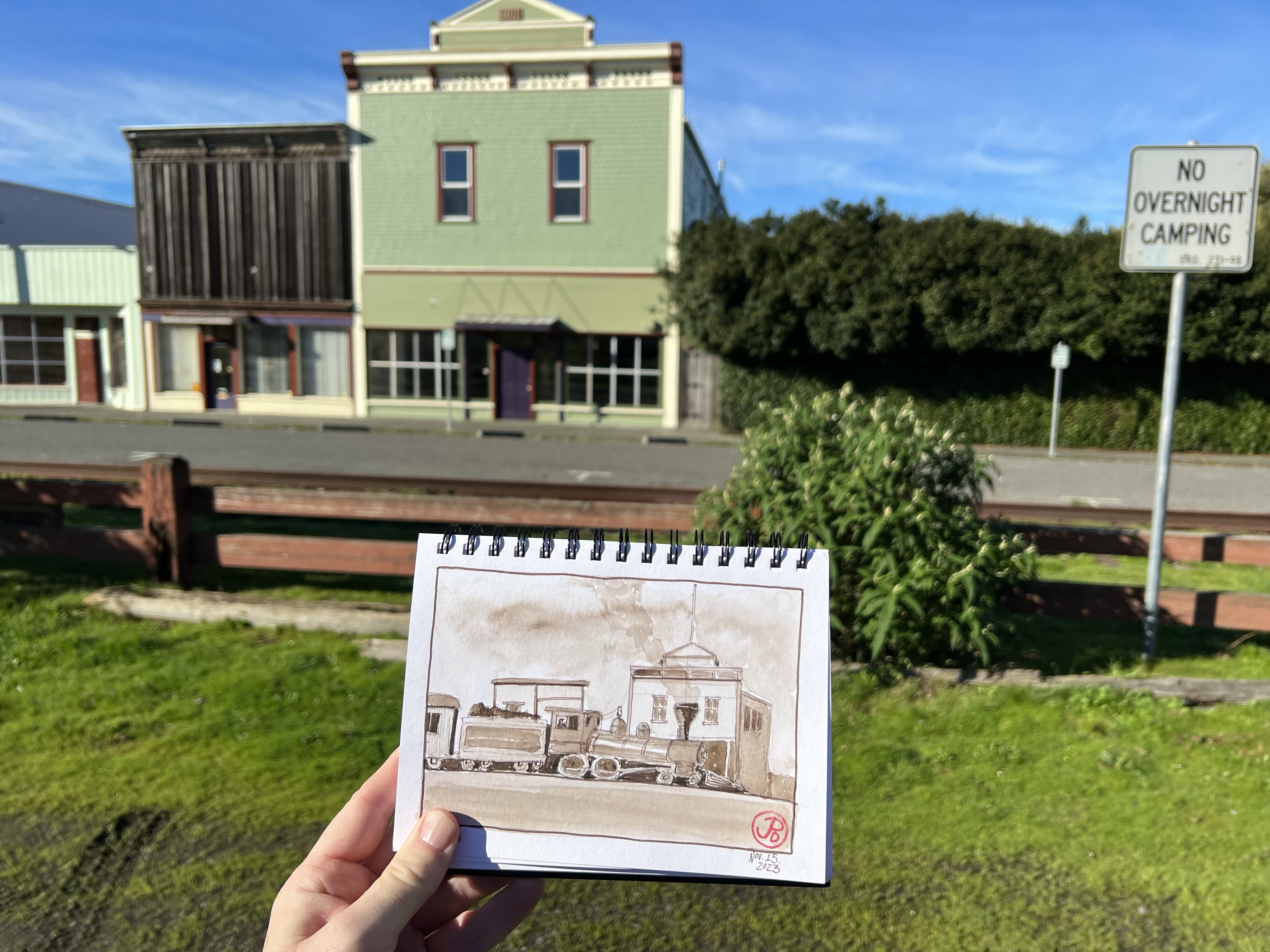
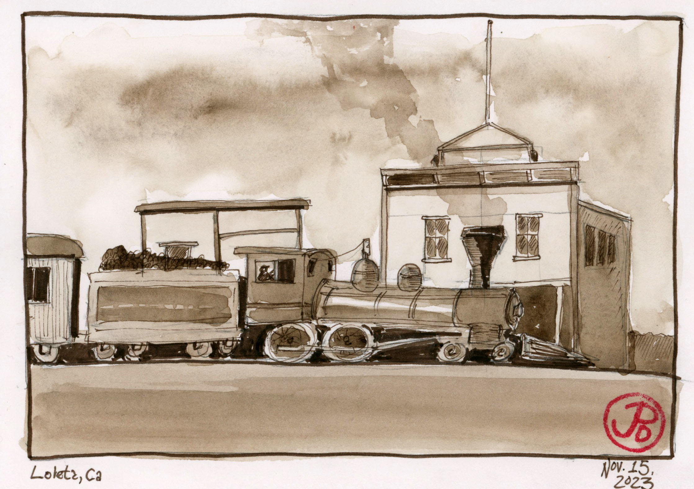
A pre-trip sketch from a vintage photograph. Parts of Loleta have changed very little over the ages.
Through the center of town runs the rusted rails of the Northwestern Pacific Railroad (NWP). Dairy was a very big in this part of Northern Californian economy and this area supplied San Francisco with dairy products. The railroad played a big part in transporting dairy to markets south.
There is a “hiking trail”, much overgrown, along the rails to the abandoned Loleta Tunnel (Tunnel No. 40). I was about to set off on an adventure!
I think this is where the hiking trail begins to the Loleta Tunnel (hard to tell from the sign). In the background is the NWP line. At the grade crossing, the sign reads, “ TRACKS OUT OF SERVICE”.
I set out on the hiking “trail”or the “ING RAIL” which was following the route north of the Northwestern Pacific right of way. In many places the rails were swallowed up in mud or vegetation or both. The Loleta Tunnel was about a mile from “downtown” Loleta. Near the tunnel was a washed out trestle over a small ravine, leaving the NWP rail suspended in midair. Perhaps this is a just metaphor for the hopes of restoring rail to this part of California.
The suspended trestle.
I did not attempt to cross the trestle (or lack of a trestle) but a path had been worn down one side of the ravine and up the other. From here is was a short but muddy slog to the south portal of the Loleta Tunnel.
The Loleta Tunnel runs under Highway 101. This is the much decorated south portal.
Before I headed up to Loleta I did two historic sepia sketches based on period photographs when steam locomotives rumbled through the small town (featured sketch). Parts of Loleta are very recognizable to this day.
Schellville is not really a town, just an intersection of a two lane highway and a country road in incorporated Sonoma County. But this is a very important railroad junction.
This is the last bastion of the once great Northwestern Pacific Railroad (NWP).
Schellville was an important rail junction on the NWP and there is a two mile rail yard south of the former train station.
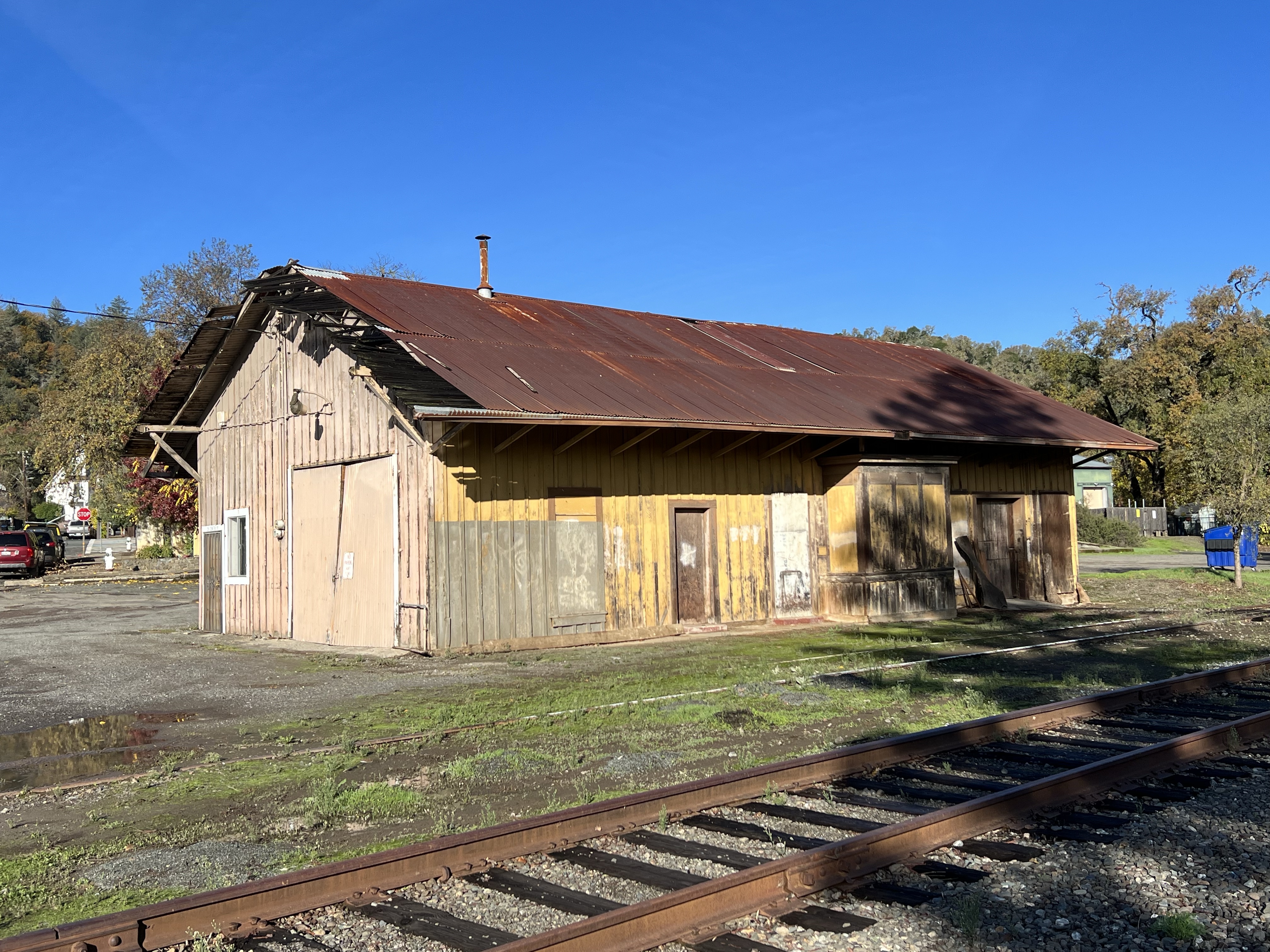
The Schellville Depot has seen better days, just like the rest of the former Northwestern Pacific system. Now it is used for storage.
This was NWP’s only outlet to the greater Southern Pacific rail network. All passenger and freight traffic from Eureka in Humboldt County south to Willits, Santa Rosa, Petaluma and San Rafael in Marin County, had to pass through Schellville.
At one point, post World War II, 11,000 cars a month passed through the junction at Schellville. Many cars went on, under Southern Pacific steam, to the division point at Roseville.
Over the years, declining passenger and freight service, landslides, and the severe winter floods of 1964, sent NWP on a downward decline. The railroad was operated by Southern Pacific and once SP merged with Union Pacific in the mid-1990s, NWP changed hands many times, holding on to it’s diminished existence.
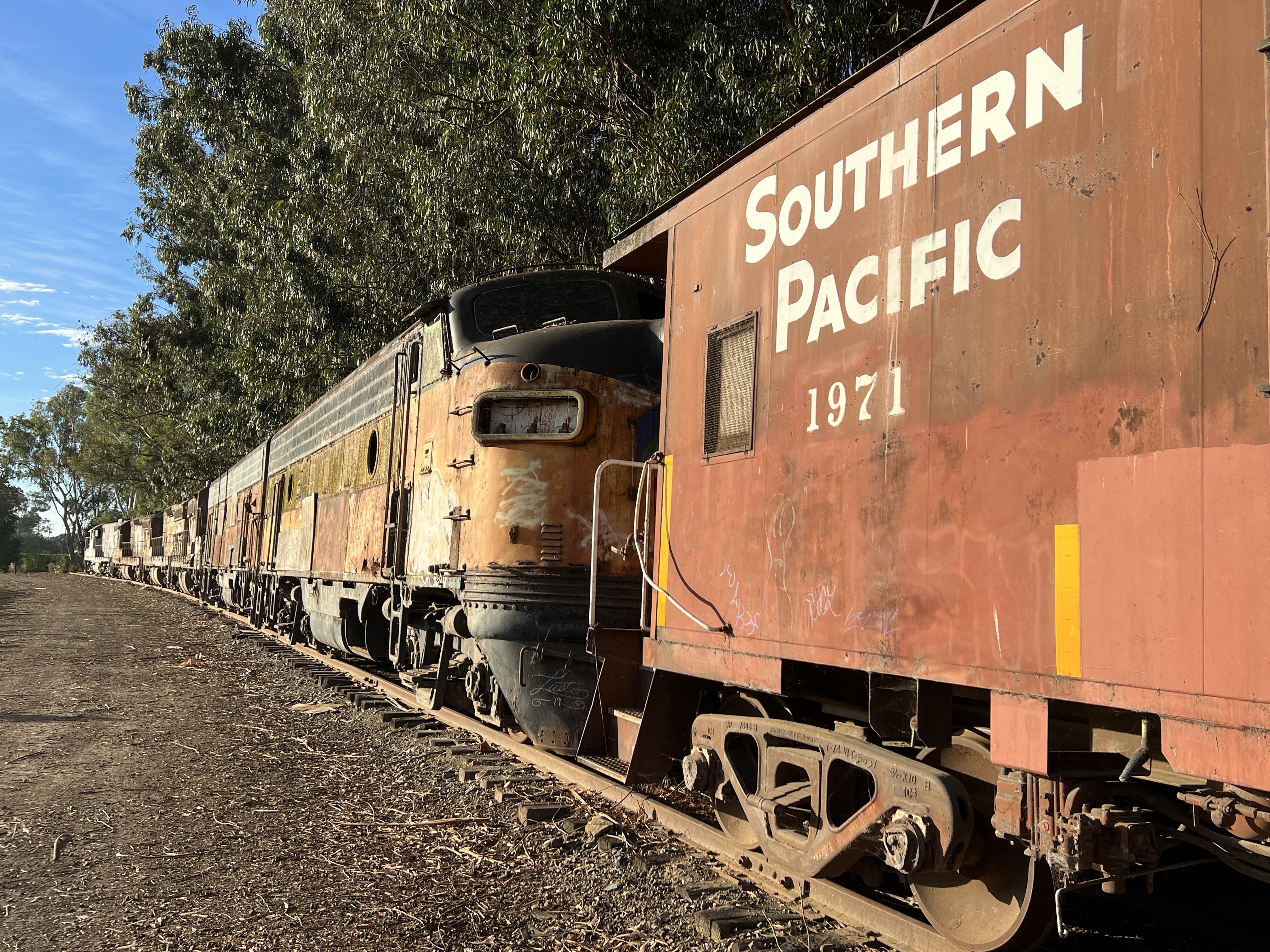
It seemed that the entire fleet of four locomotives where fenced in near the station. This motley collection were painted in the livery of other railroads.
NWP No. 1501 painted in the Southern Pacific “bloody nose” livery.
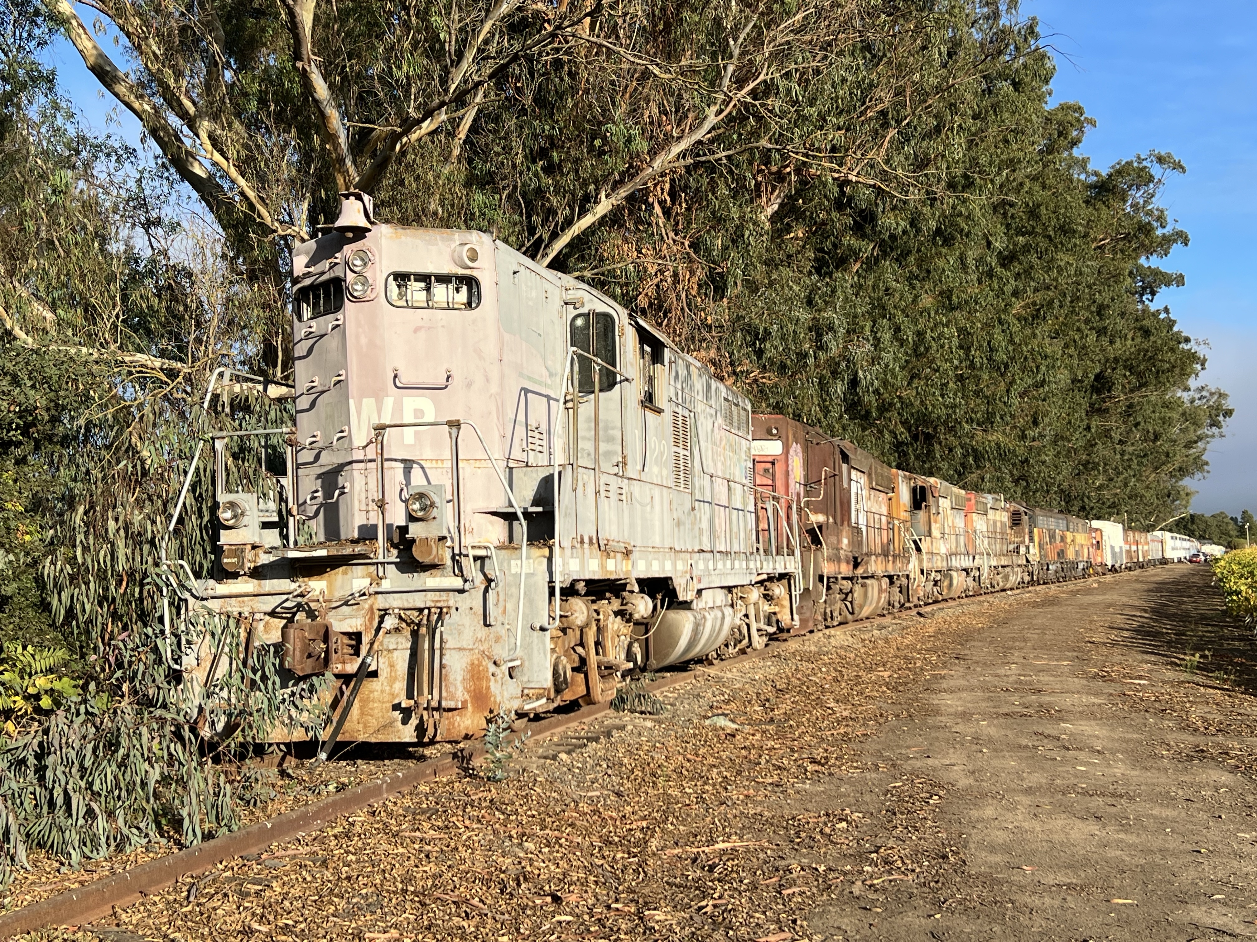
From the Y track at the station I headed north along the line, vineyards flanking either side of the rusted rails. I crossed a short trestle and before me stood a railroad graveyard, a mothballed fleet of NWP and SP diesels and rolling stock.
The mothball fleet is mainly Southern Pacific locomotives and a mix other other rolling stock. The locomotive on point is Northwestern Pacific EMD GP 9 No. 1922, faded and being returned to nature.At the end of the diesels is Southern Pacific caboose 1971. The locomotive coupled to the caboose is the former Bessemer and Lake Erie F7 numbers 718 A and 716 B.
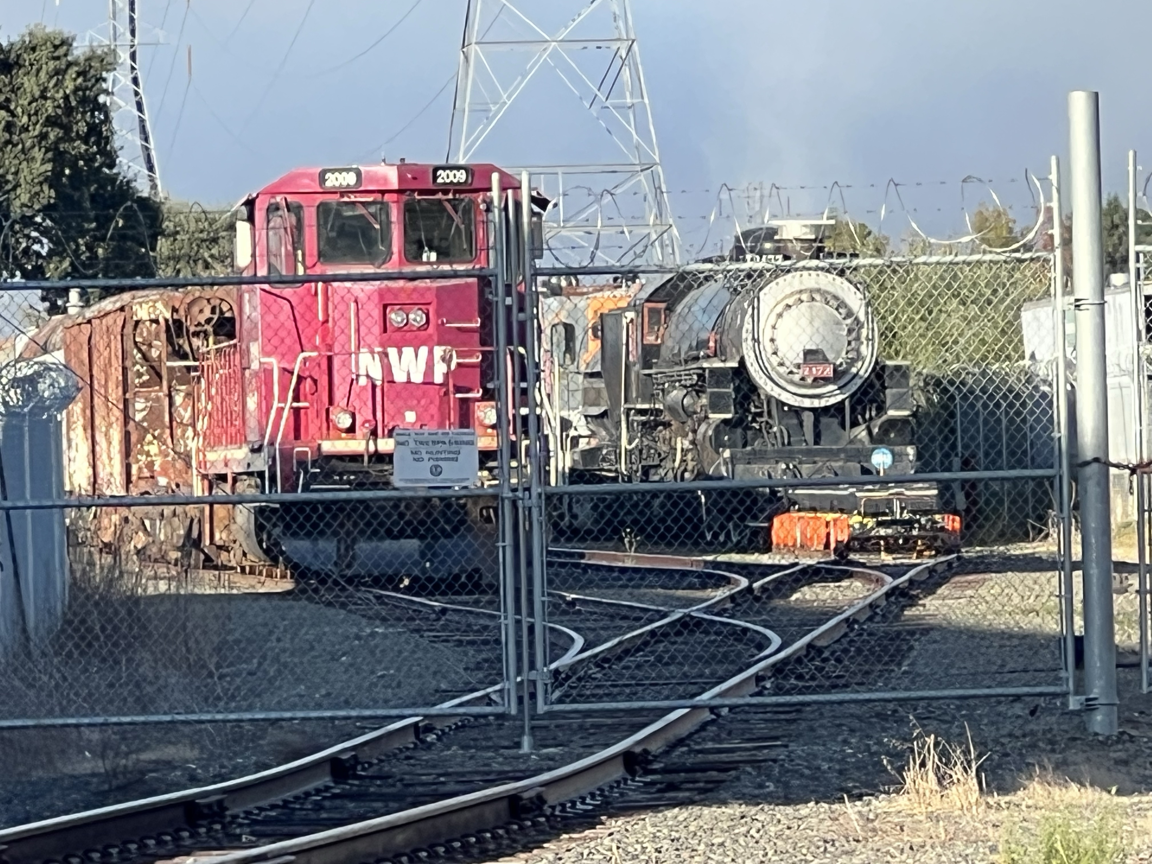
While these locomotives had seen better days I was surprised to see a Southern Pacific Steam Locomotive on a siding across 8th Street.
At first I couldn’t believe my eyes. Could this be one of a handful of operable SP steam locomotives? I could barely make out the road number.
It was P-8 Class No. 2572 a 4-6-2 “Pacific” type built by the Baldwin Locomotive Works in 1921.
2472 was retired in 1957 and donated to the city of San Mateo and put on public display at the San Mateo County Fairgrounds.
In 1976 a group decided to restore the SP workhorse to working order. The group, the Golden Gate Railroad Museum, had 2472 ready for Railfair 91 in Sacramento which feature another Southern Pacific legend, 4449.
For many years 2472 operated steam excursions in Niles Canyon but was moved to Schellville on March 1, 2020.
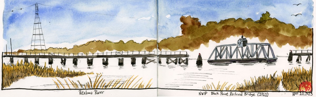
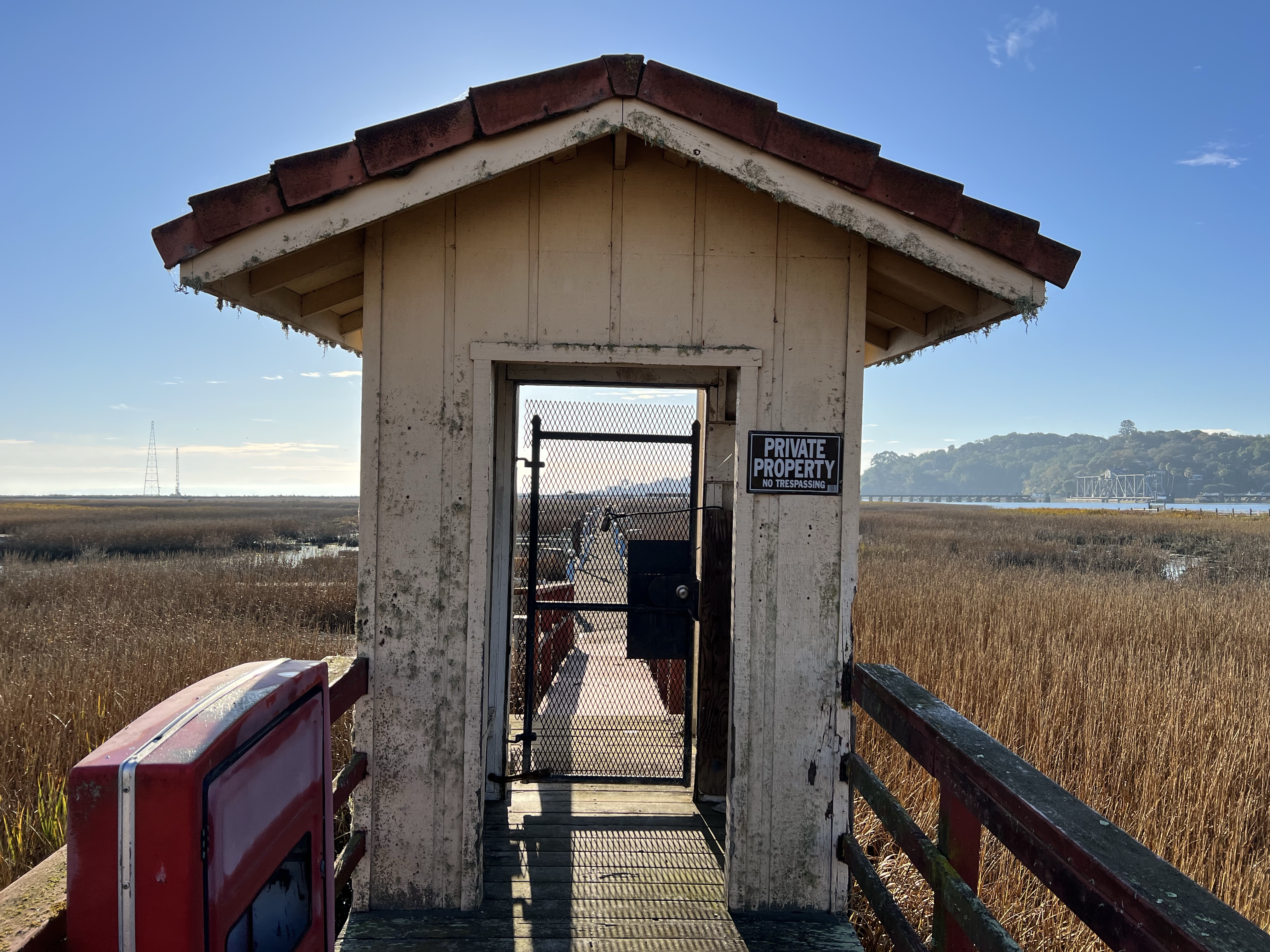
An important bridge that kept Northwestern Pacific Railroad connected with the mainline rail network is the Black Point Bridge.
The 50 foot rail bridge at Black Point is a steel swinging truss bridge that turns perpendicular to the rail line to allow boat traffic on the Petaluma River to pass downstream to San Pablo Bay.
In the days of heavier rail traffic, the bridge was aligned with the railroad but now with fewer freight traffic, the bridge is open to allow river traffic to pass.
The Black Point Bridge, which spans the Petaluma River which is the boundary between Marin and Sonoma Counties, was built in 1911 and then rebuilt in 2011.
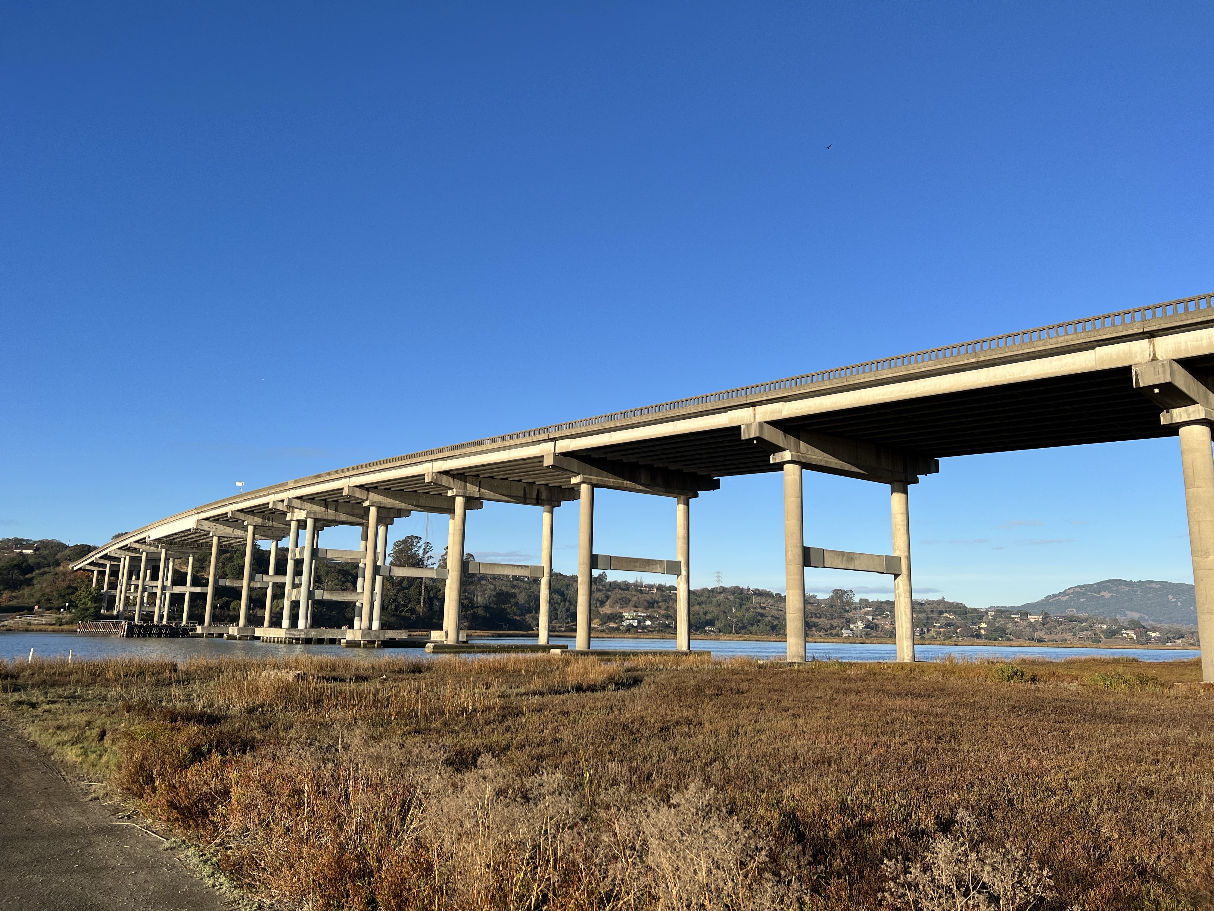
The Highway 37 bridge over the Petaluma River. The Black Point Bridge is just downstream from here.
Atop the bride is the Operator’s House where the bridge operator lived. He was in charge of opening and closing the bridge in the days when all the freight north to Eureka, had to cross this vital span to take freight to the rail junction at Schellville and beyond to the wider rail system. The bridge is now operated remotely.
On either side of the steel span, a wooden trestle reaches out into the river.
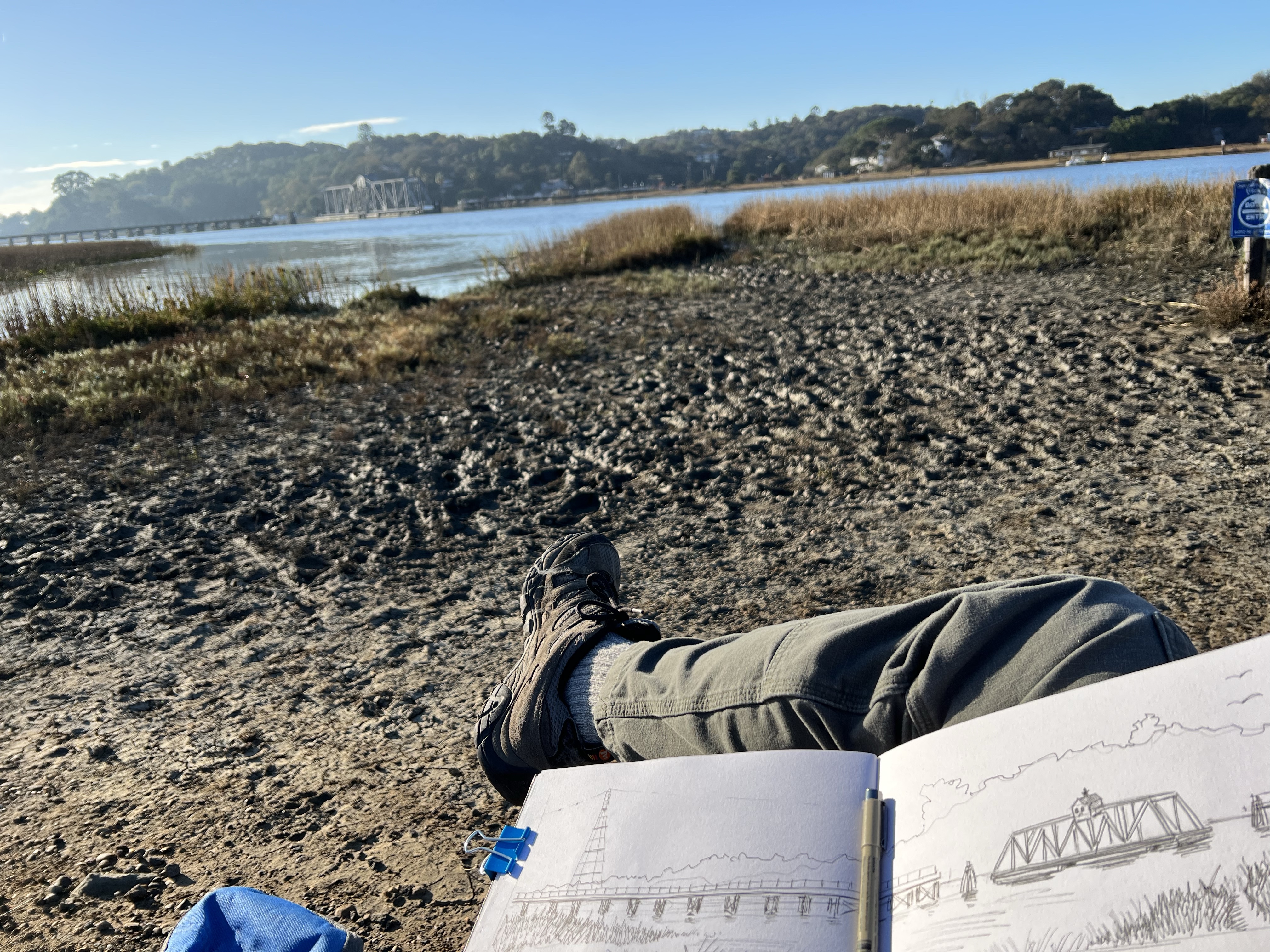
The marina at Port Sonoma has seen better days. The boat slips are now empty and the reeds are slowly taking over.
I parked in the overgrown parking lot, walked past the abandoned marina, and then headed down the river trail to find a good vantage point to sketch the bridge.
I parked my sketching chair near the outlet of the marina, took a sip of joe, and started to sketch (featured sketch).
A sketcher’s view and beautiful weather for a morning sketch.
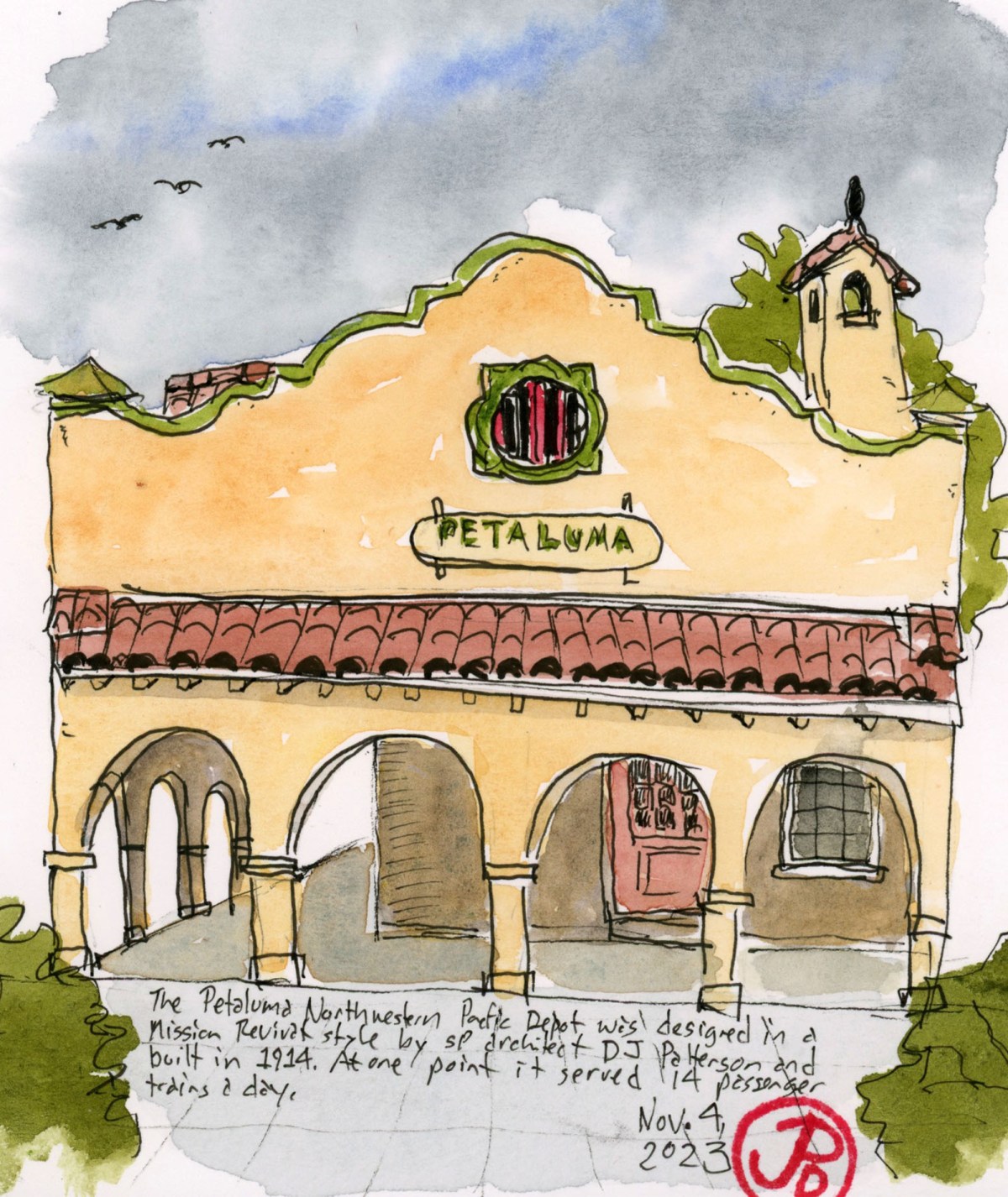
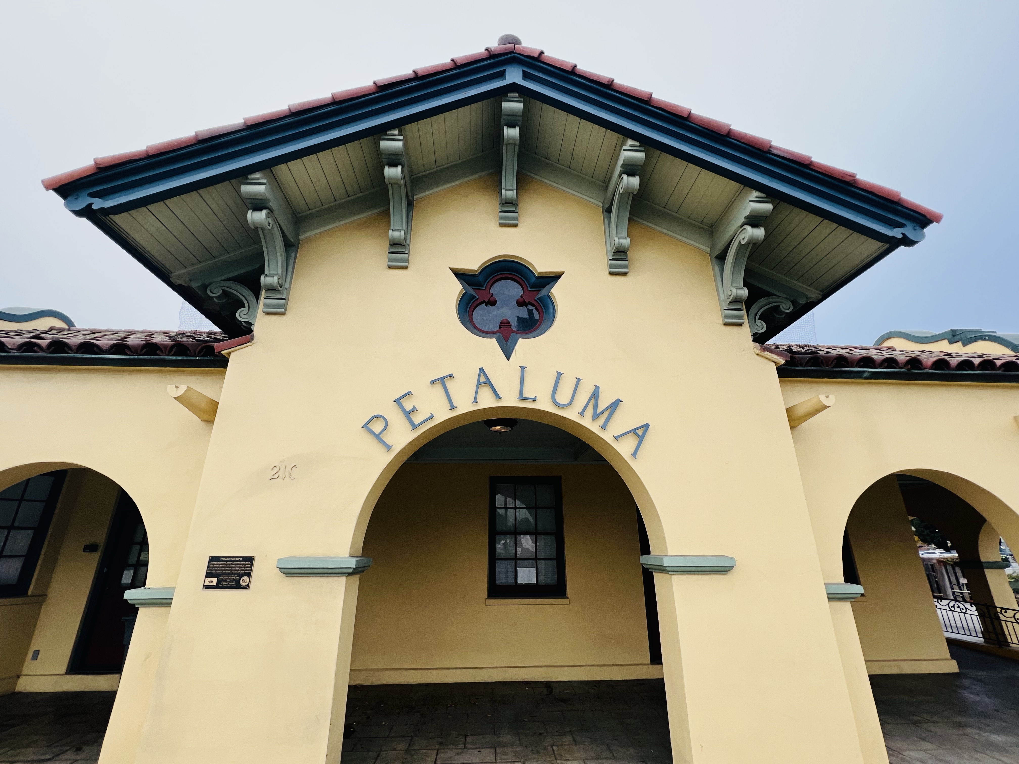
One of the nicest Northeastern Pacific rail depots still in existence, is to be found in the Sonoma County city of Petaluma.
This 1914 depot is designed in the Mission Revival style by Southern Pacific Railroad architect, D. J. Patterson. The passenger station originally cost $7,000 to build. The new station replaced the 1871 wooden stations. Patterson also designed the Galveston, Harrisburg, and San Antonio station. He also designed the Willits Station for the Northwestern Pacific, north of Petaluma.
This was a busy station with 14 passenger trains stopping at Petaluma daily. The construction of the Golden Gate Bridge cut into the passenger numbers and the last passenger train departed from this station in 1958.
That was until almost 60 years later in June 29, 2017 that a passenger train stopped In Petaluma.
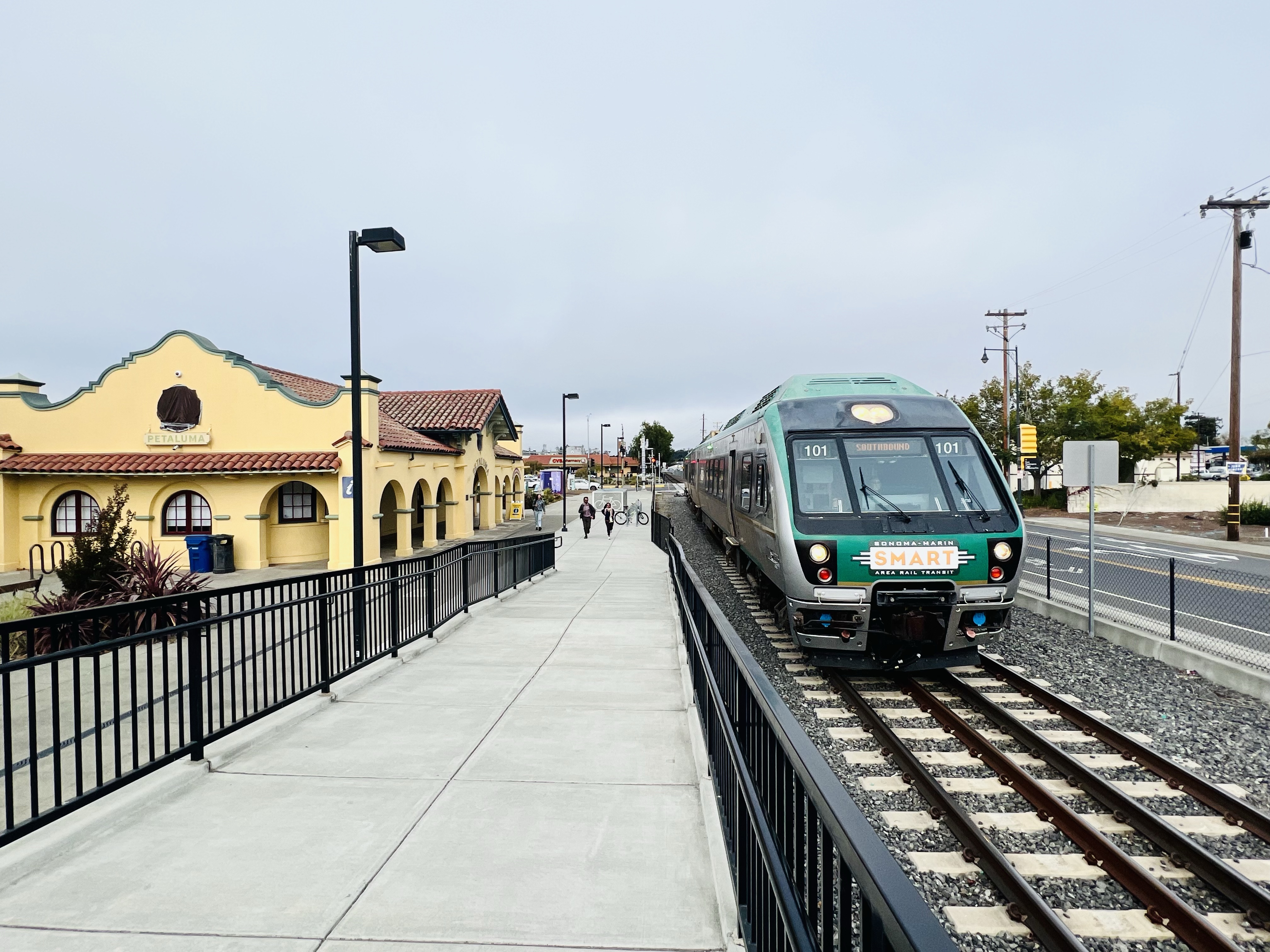
The spot now housed the Petaluma Visitor’s Center but passenger service still lives in the form of SMART trains that travel from Santa Rosa to the ferry terminal at Larkspur.
A southbound SMART train pulls into the Downtown Petaluma station.
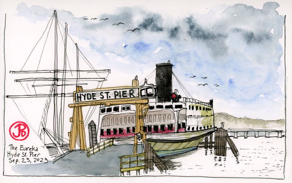
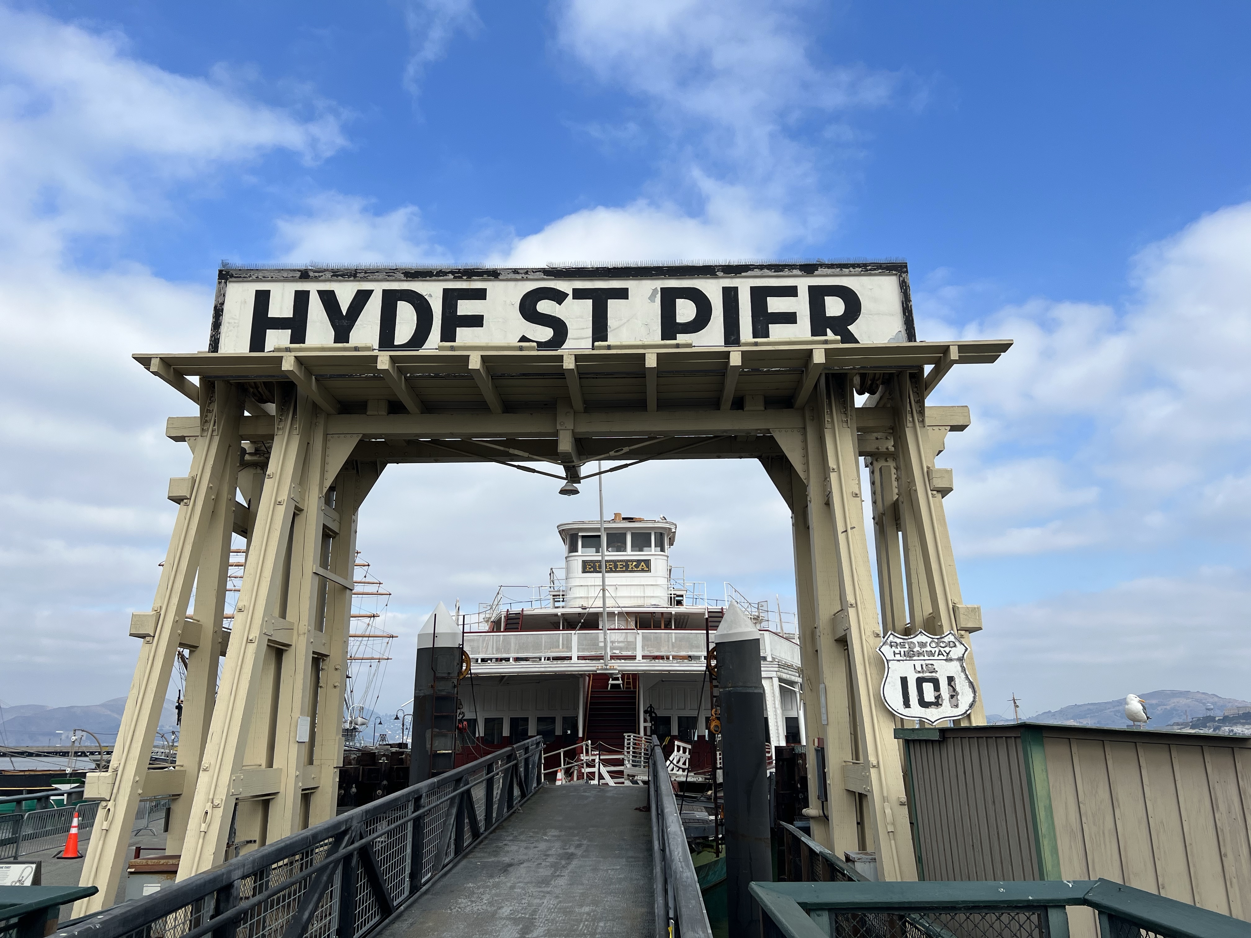
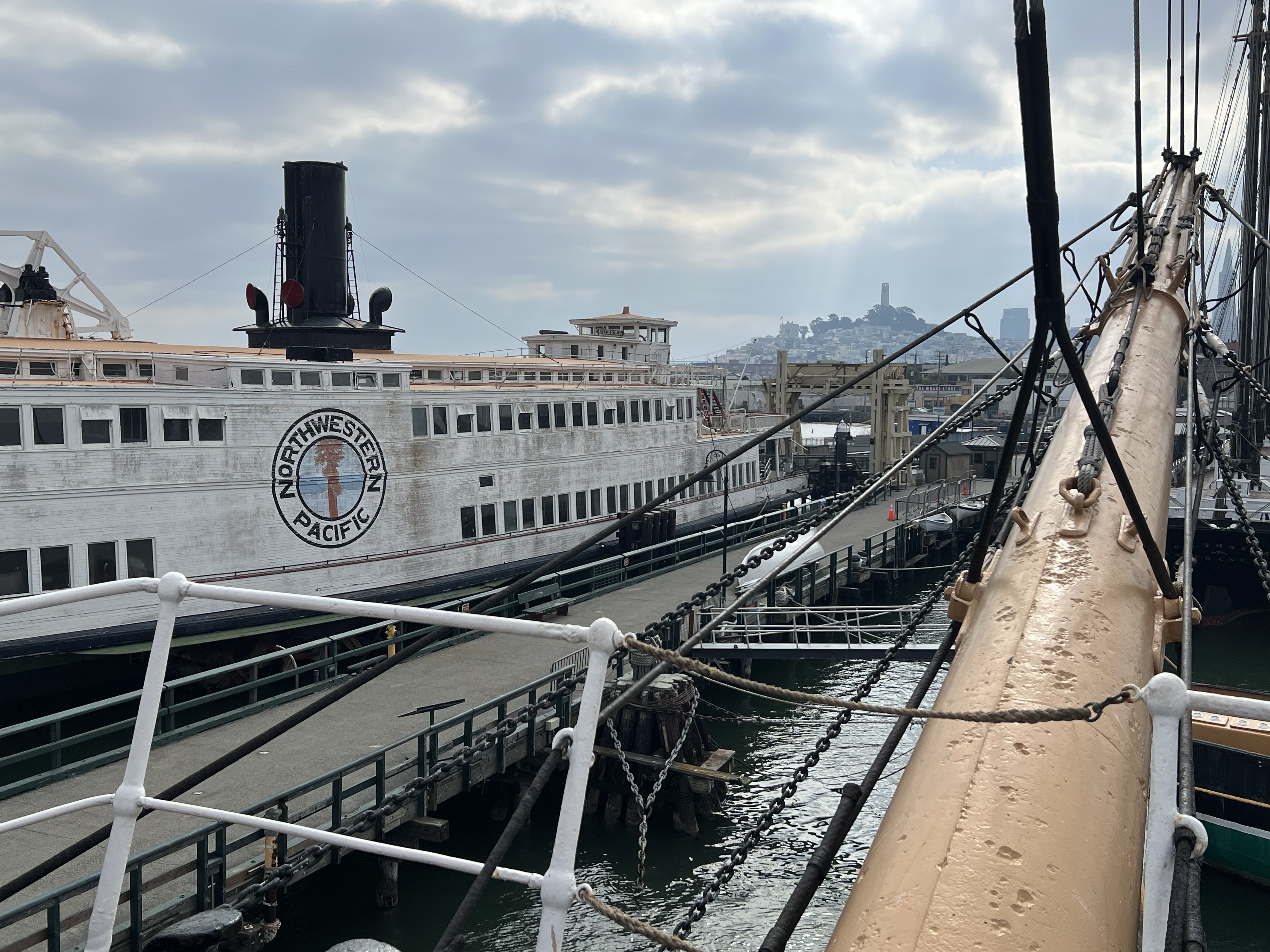
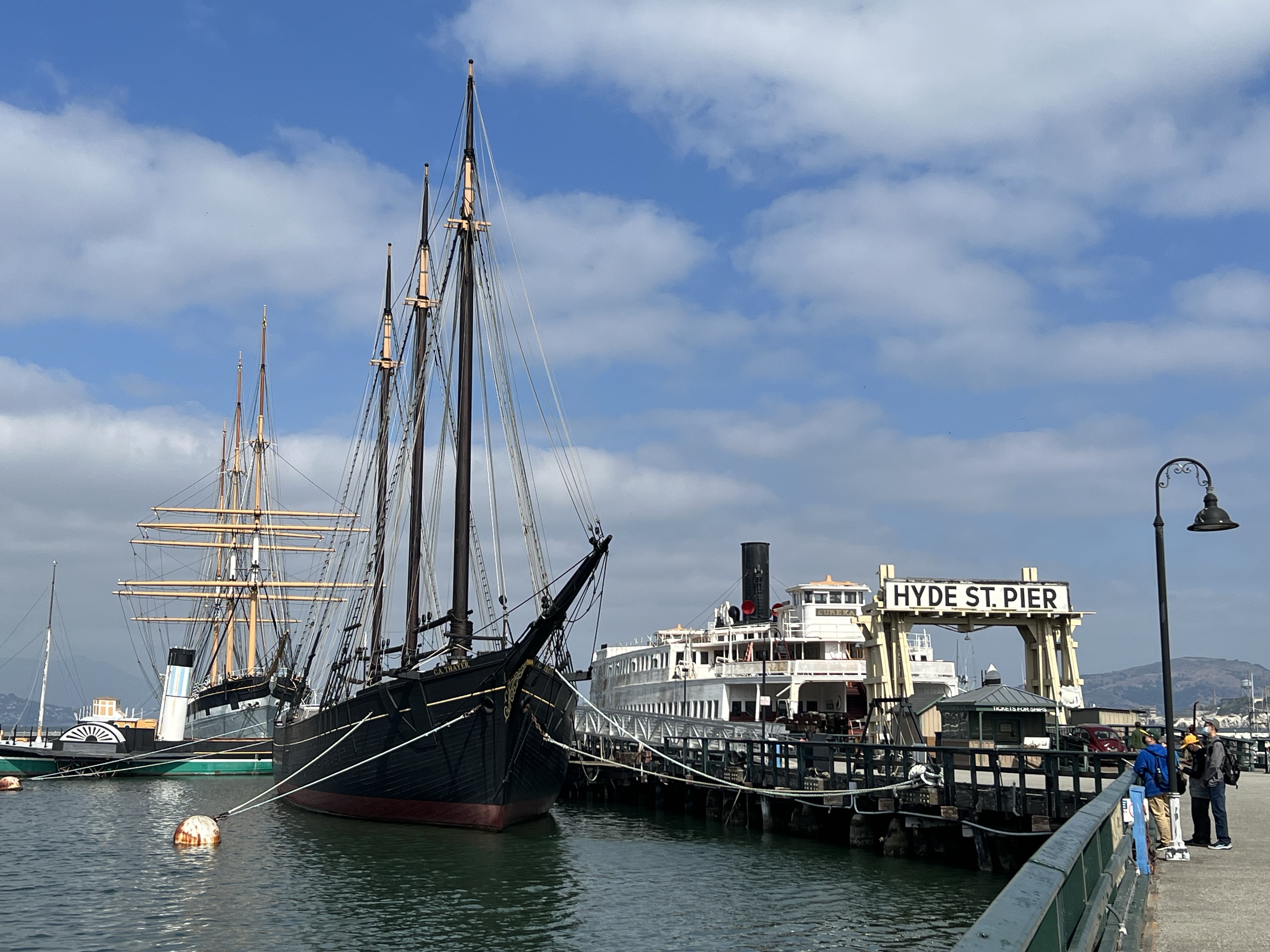
One of the ships docked at the Hyde Street Pier is the former Northwestern Pacific ferry boat Eureka.
In the era before bridges, (the Bay and Golden Gate), the only way to get from San Francisco to Marin or Oakland by rail, was by rail ferry.
The passenger cars would be boarded on the ferry and then, well, ferried, across the Golden Gate to Sausalito or Tiburon where they would be unloaded and continue north on the rails of Northwestern Pacific.
The ferry and the Hyde Street Pier was actually considered part of Highway 101.
The boat was built in 1890 in Tiburon by San Francisco and North Pacific Railroad Company and was originally named the Ukiah, which was as far north as the line reached. The Eureka is a double-ended, wooden hulled ferry-boat that was originally built to hold train cars. Two standard-gauge tracks where built into the main deck.
This 277 foot, 2,564 tonnage boat is the largest wooden-hulled boat afloat in the world.
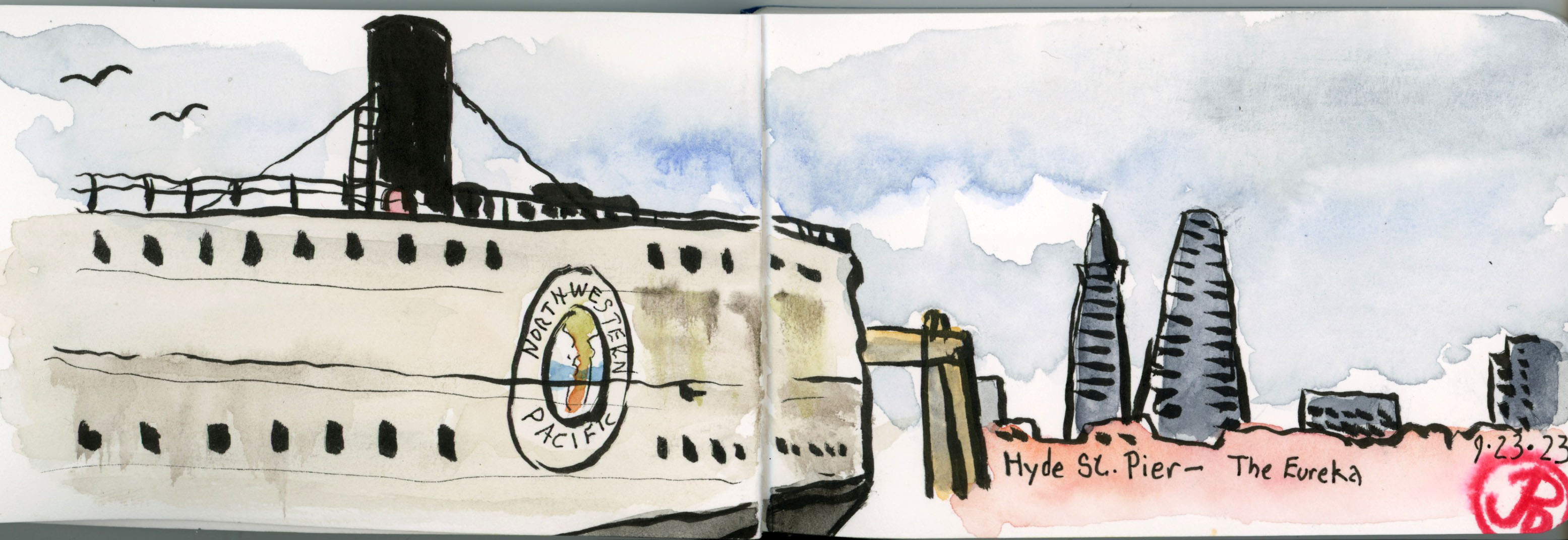
A pen brush field sketch of the Eureka, displaying the Northwestern Pacific circular logo, and the modern San Francisco skyline.
The Ukiah was initially in service to ferry people from San Francisco to Tiburon during the day and then carry freight cars during the night. In 1907 the Northwestern Pacific Railroad took ownership of the Ukiah and it was routed to the Marin port of Sausalito.
During World War I, the ferry was rebuilt and the refurbished ferry was renamed the Eureka, in honor to the northernmost station on the Northwestern Pacific Railroad.
The Eureka from the bow of the Balclutha and Coit Tower echoing the steam stack of the Eureka.
The ferry was later used to ferry automobiles on her main deck and had a capacity of 2, 300 passengers and 120 cars. At this time, the Eureka was the largest and fastest double-ended passenger ferry in existence and because of this, the Eureka was called up for the busiest commuters times from Sausalito to San Francisco. Hyde Street pier was the primary auto terminal to connect San Francisco to points north and east.
When the Golden Gate Bridge was completed in 1937, ferry service passengers dried up and Northwestern Pacific abandoned all ferry service in 1941.
The Eureka found a new life in the 1950s with a new owner, the mighty Southern Pacific. The Eureka now linked passengers on SP’s overland service from Oakland to San Francisco.
Today the Eureka is docked with the C. A. Thayer (foreground), the Eppleton Hall, and the Balclutha (background).