Image

The Bayshore Yard and Roundhouse

I was on the hunt for some Bay Area rail history. I was specifically looking for some ghosts of the Southern Pacific Railroad: the Bayshore Yard.

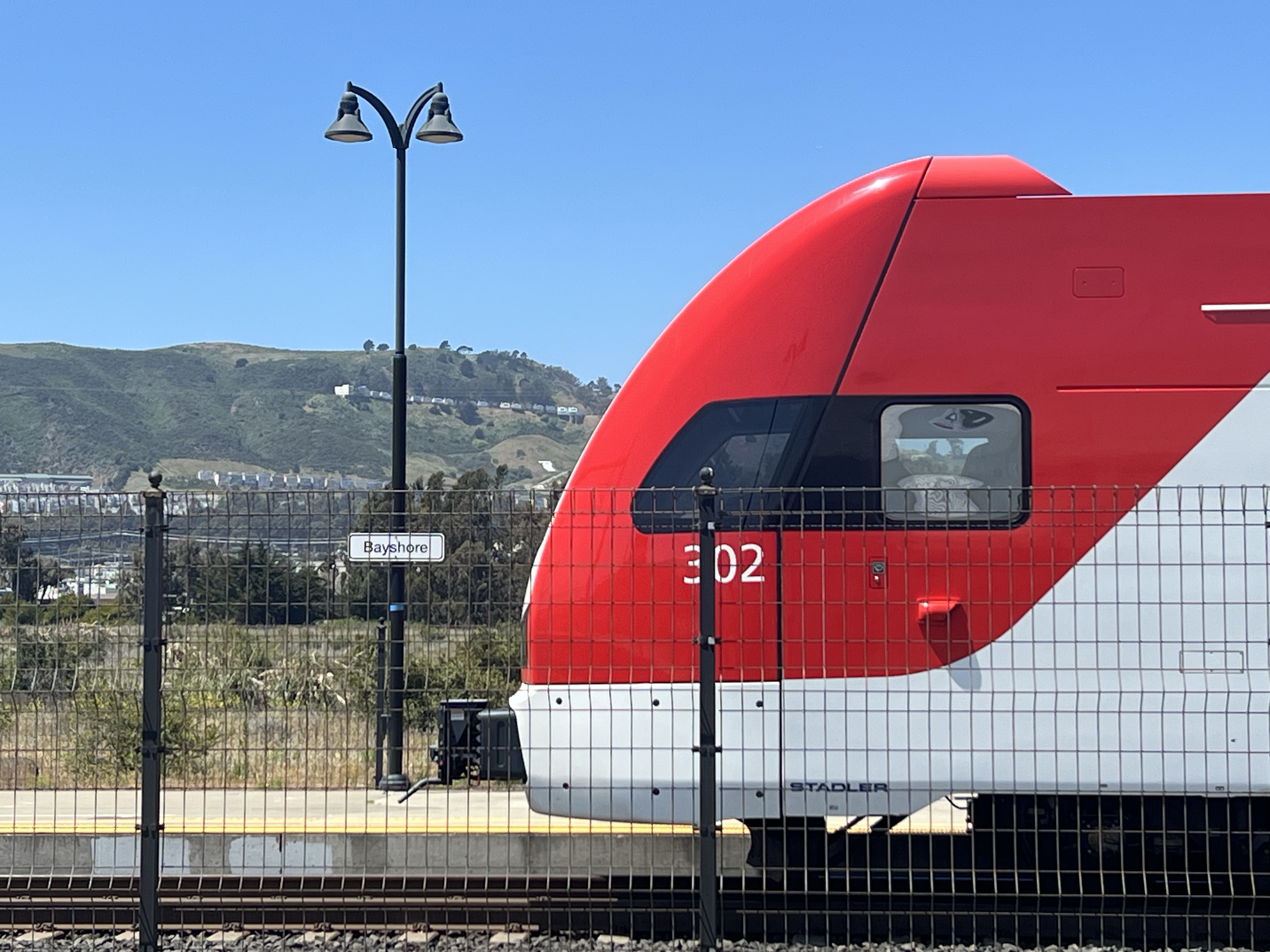
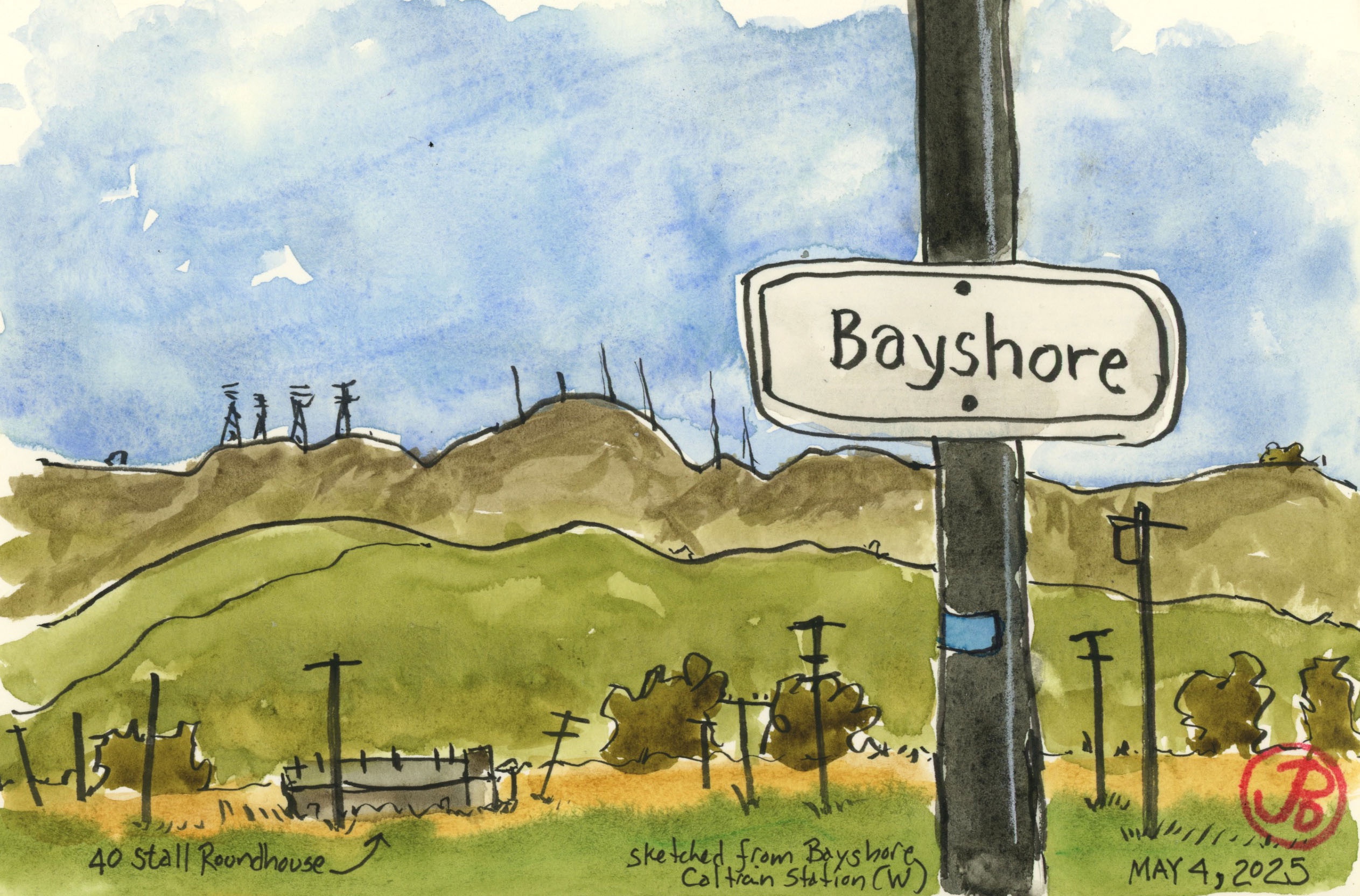
I started my search at the Bayshore Caltrain Station. Uncanny! Who would have thought?

An EMU at Bayshore Station. I was here to see the overgrown fields beyond the tracks.

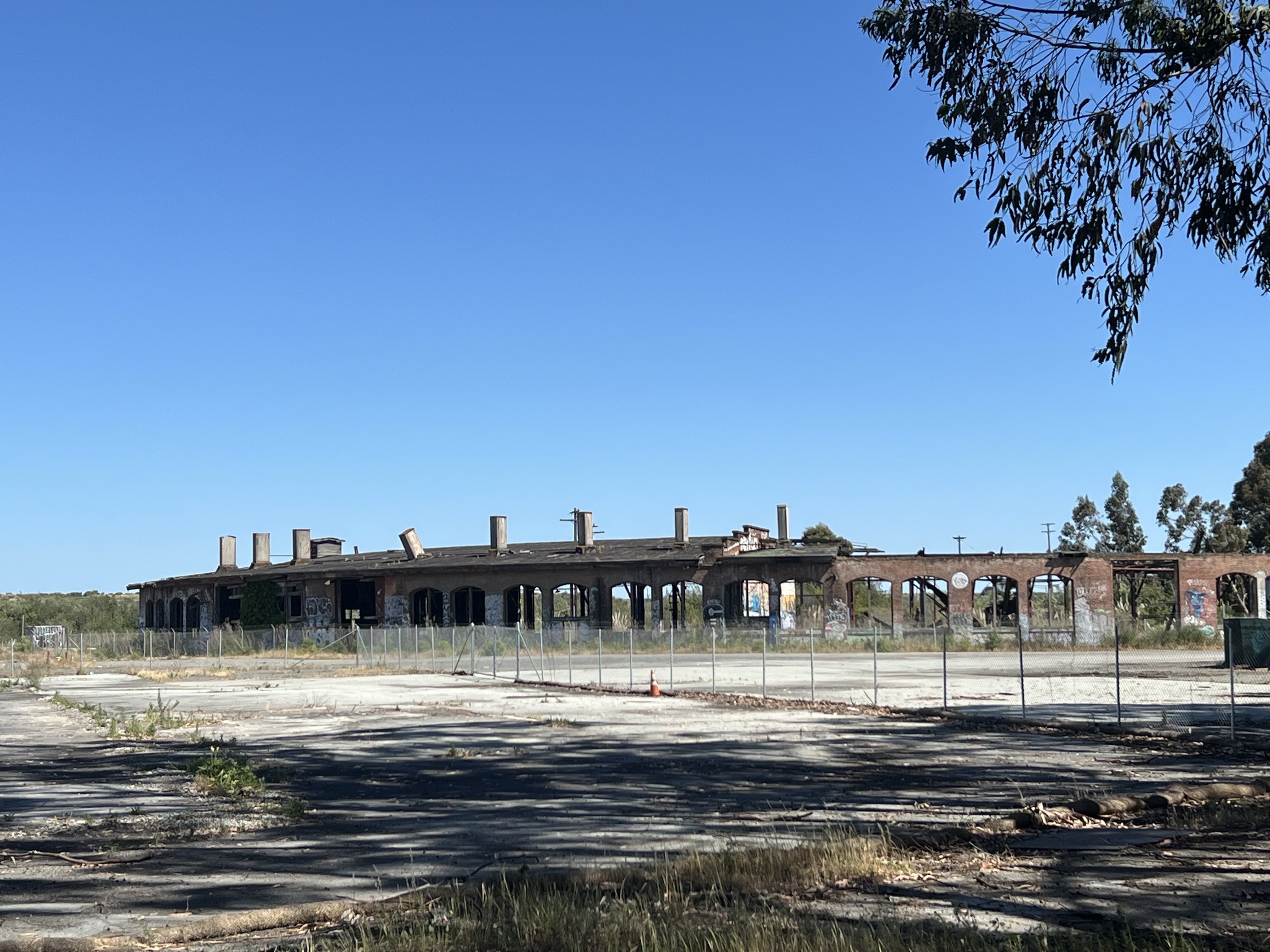
To the west of the tracks is a large overgrown open space punctuated by wooden power poles and bordered by the San Bruno Mountains. On the far edge of the open fields are some dilapidated and graffitied buildings.

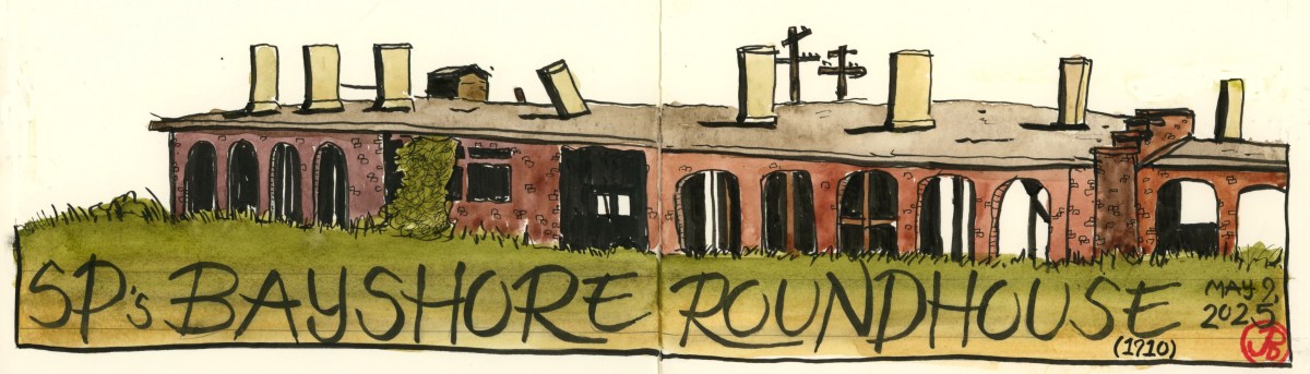
The brick roundhouse and the tank and boiler shop are the only remaining structures of a once bustling train yard and shops. How bustling?

The yard contain 50-65 miles of track, had a capacity of over 2,000 freight cars, and employed 3,000 people.

This was SP’s most heavily travelled stretch with 46.5 million gross tons per mile during WWII.

The story of the yard and shops starts with the Bayshore Cutoff.

This drawing is highly influenced by a map John Signor drew from his excellent book on the Coast Line.

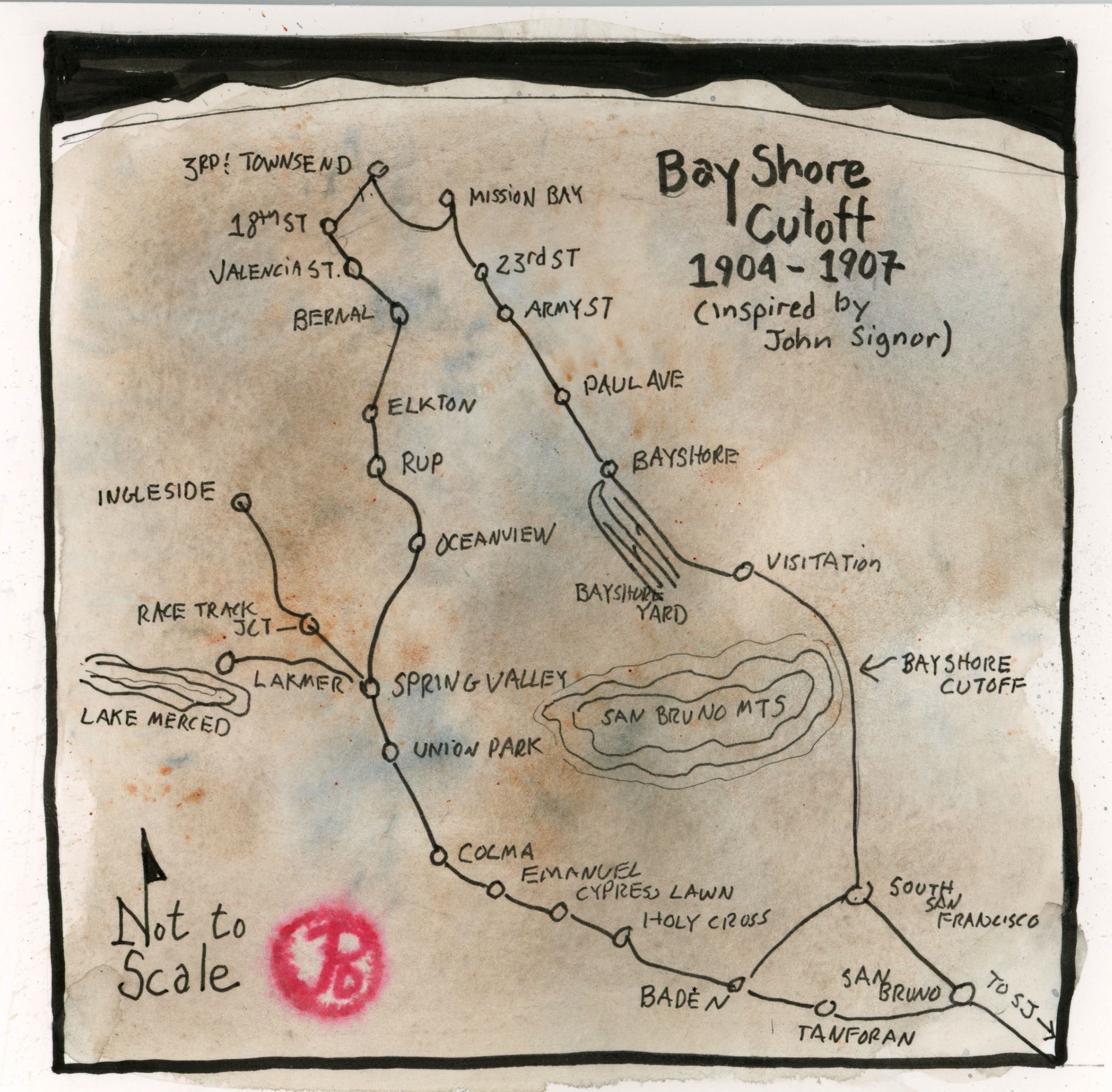
As the name implies the Bayshore Cutoff is a short cut that straighten the line around San Bruno Mountain’s southern edge, from San Francisco to San Bruno.

A southbound EMU seven car set leaving Bayshore Station under the tangle of signal gantries and power lines. To the right is the former yard. The current line is along the Bayshore Cutoff.

The cutoff was completed 1907 and cost Southern Pacific $7 million. One reason for the high price tag is that the railroad had to construct five tunnels (20% of the cutoff was in tunnels). The fill from these tunnels was used to fill in Brisbane Lagoon which became Bayshore Yard and Shops.

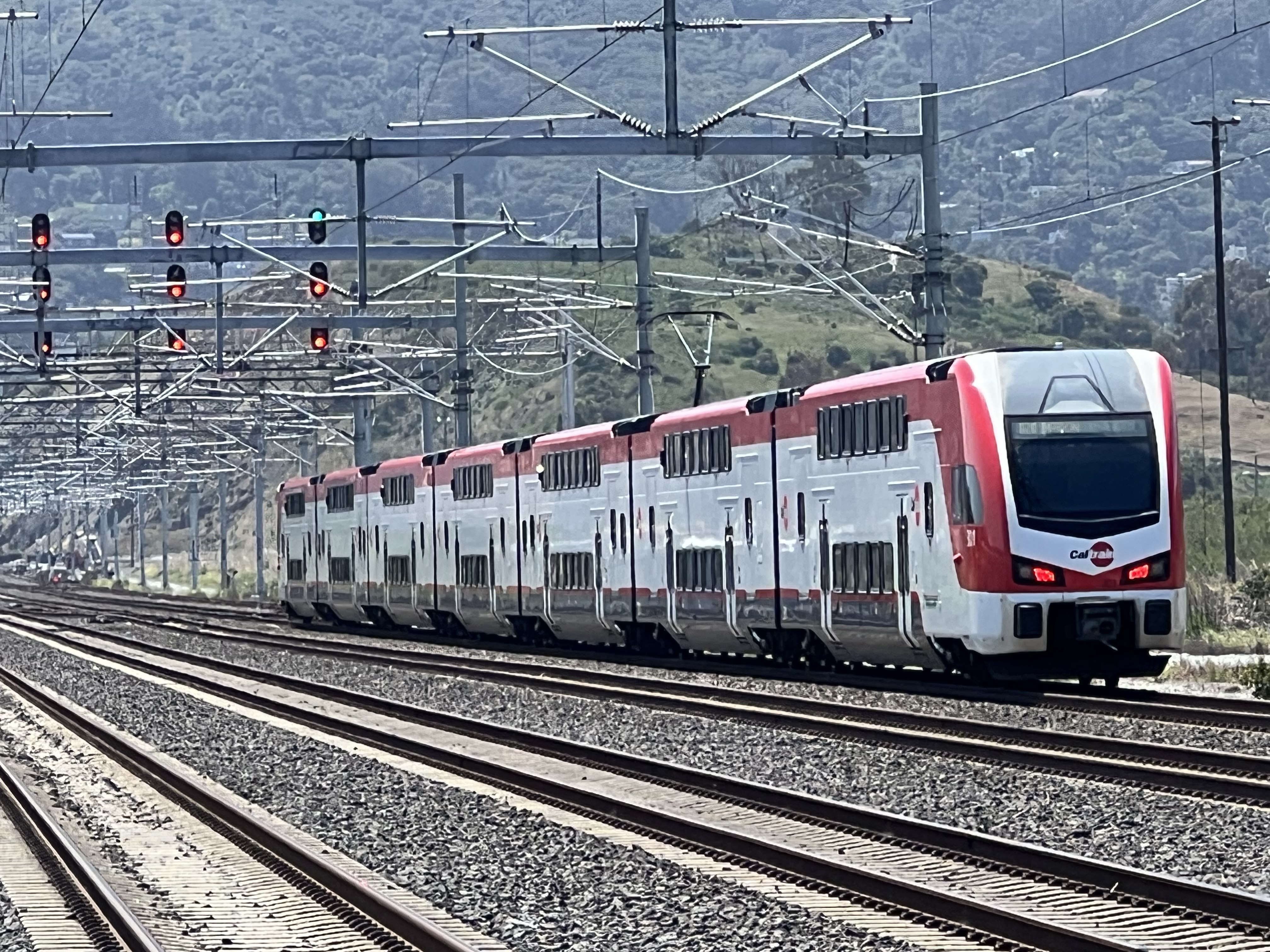
The benefits of the cutoff were: saving more than three miles on the route, reducing the curvature of the line, and flattening the grade. The improvements cut travel time from San Francisco to San Jose by 30 minutes. The cutoff is still in use today, conveying passengers to and from San Francisco on Caltrain.

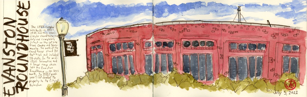
For my Bayshore sketch I took a position on the southbound platform and sketched the Bayshore Station sign in the foreground and the feral field and roundhouse in the background. In the far ground is San Bruno Mountain.

After work I headed up to Brisbane with the intent of sketching the roundhouse from Bayshore Boulevard. The roundhouse is close to the street but the former yard is enclosed in fencing. I was able to find a gap in the eucalyptus trees to get a panoramic sketch (sans graffiti) of Southern Pacific’s Bayshore roundhouse.

The brick shell of the Bayshore Roundhouse.
Image

Sacred Sites the Union Pacific: Wyoming

On my journey from California to Colorado, I had a few historic sights I wanted to sketch along Highway 80 in Wyoming. This is Union Pacific territory, and the route over the Wasatch Mountains from Ogden Utah to Green River is legendary.

The Evanston Roundhouse and the Ames Monument are relics from a different time. The roundhouse was of a time when steam was the prime motive power of the Union Pacific and the monument the Ames brothers at Sherman Summit is no longer near the mainline (the line is now three miles to the south).

The Evanston Roundhouse is notable because it is the last completely intact roundhouse left on the Union Pacific line from Sacramento to Omaha. It had 28 stalls and is 80 feet high.

The roundhouse at Evanston on the left and the powerhouse on the right. The rusted, overgrown tracks in the foreground tells us that this complex has not been used by Union Pacific for a long time. I had to walk a ways back to photograph the whole massive roundhouse.

The roundhouse and yard was build by UP from 1912 to 1914. The roundhouse was part of a 27 acre complex to service steam locomotives. When steam locomotives became more efficient, they did not need to make so many service stops and the yard at Evanston was often bypassed. The Union Pacific deeded the property to the City of Evanston. The roundhouse is now used as a conference center and a meeting place.

Standing before the red brick semicircular roundhouse reminded me of a Plaza de Toros in Spain. Looking at just one part of the structure gives no indication of it’s form. I sketched one side of the roundhouse with the roofline slowing curving around (featured sketch). To see the entirety of the roundhouse, one has to walk back from the roundhouse by at least 100 yards to take it all in.

An intermodal freight passing through Evanston. The two locomotives on point represent the Transcontinental Railroad. The Union Pacific is pointed east towards Cheyenne and behind # 8990 is a former Southern Pacific locomotive (representing the Central Pacific) facing west toward Sacramento.

The next Union Pacific site is to be found off Highway 80 near the town of Buford (population 1). This is a monument to two brothers who were essential in creating the Union Pacific side of the Transcontinental Railroad.

The Ames Monument was built by the Union Pacific and dedicated to the brothers Oakes and Oliver Ames. It marked the highest point on the original Transcontinental Railroad at Sherman Summit at 8,247 feet. Oliver was one of the first presidents of the Union Pacific Railroad (from 1866-1871) and his brother Oakes was a U.S. Representative from Massachusetts. Both brothers, at the request of Lincoln, were put in charge of financing and building the Union Pacific portion of the railroad. Without the contribution of the Ames brothers, the railroad might never have been completed.

The 60 foot pyramid was build in 1880-1882 of granite at the cost of $64,000. On two side are base-relief portraits of each brother. In 1901, Union Pacific rerouted the mainline a few miles to the south.

On my first attempt to sketch the Ames Monument, a thunderstorm rolled in from the west. This monument being 60 feet high and at one of the highest points on the original Transcontinental Railroad, I though it would be wise to head to my car and return in the morning!