Image

Signal Peak and the Southern Pacific Fire Lookout

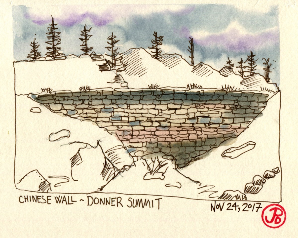
On my latest sketching odyssey I headed to one my favorite locations in California, if not the world: Donner Pass.

Before I set out, I sketched the rail route of the East Slope of Donner Pass, heavily influenced by a map drawn by John Signor (author, artist, and former Southern Pacific employee) in his marvelous book: Donner Pass: Southern Pacific’s Sierra Crossing.

I would be driving parallel to the Central Pacific side of the first Transcontinental Railroad on Highway 80. In 1865 the railroad became Southern Pacific.

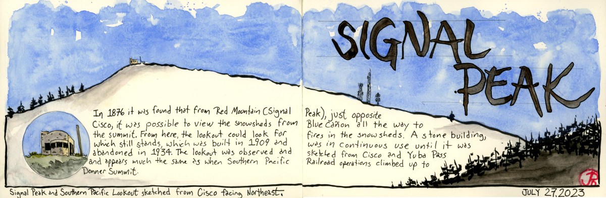
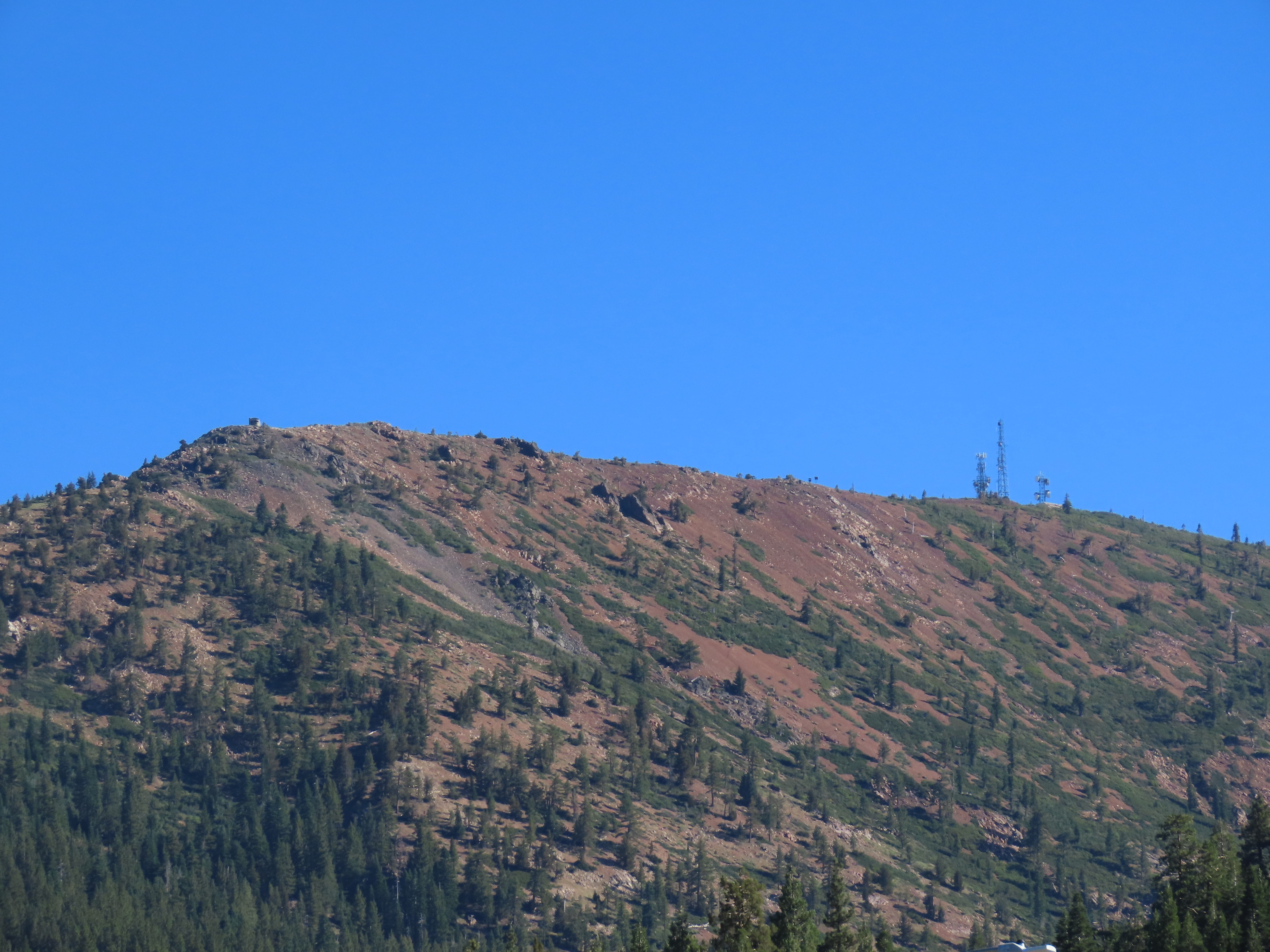
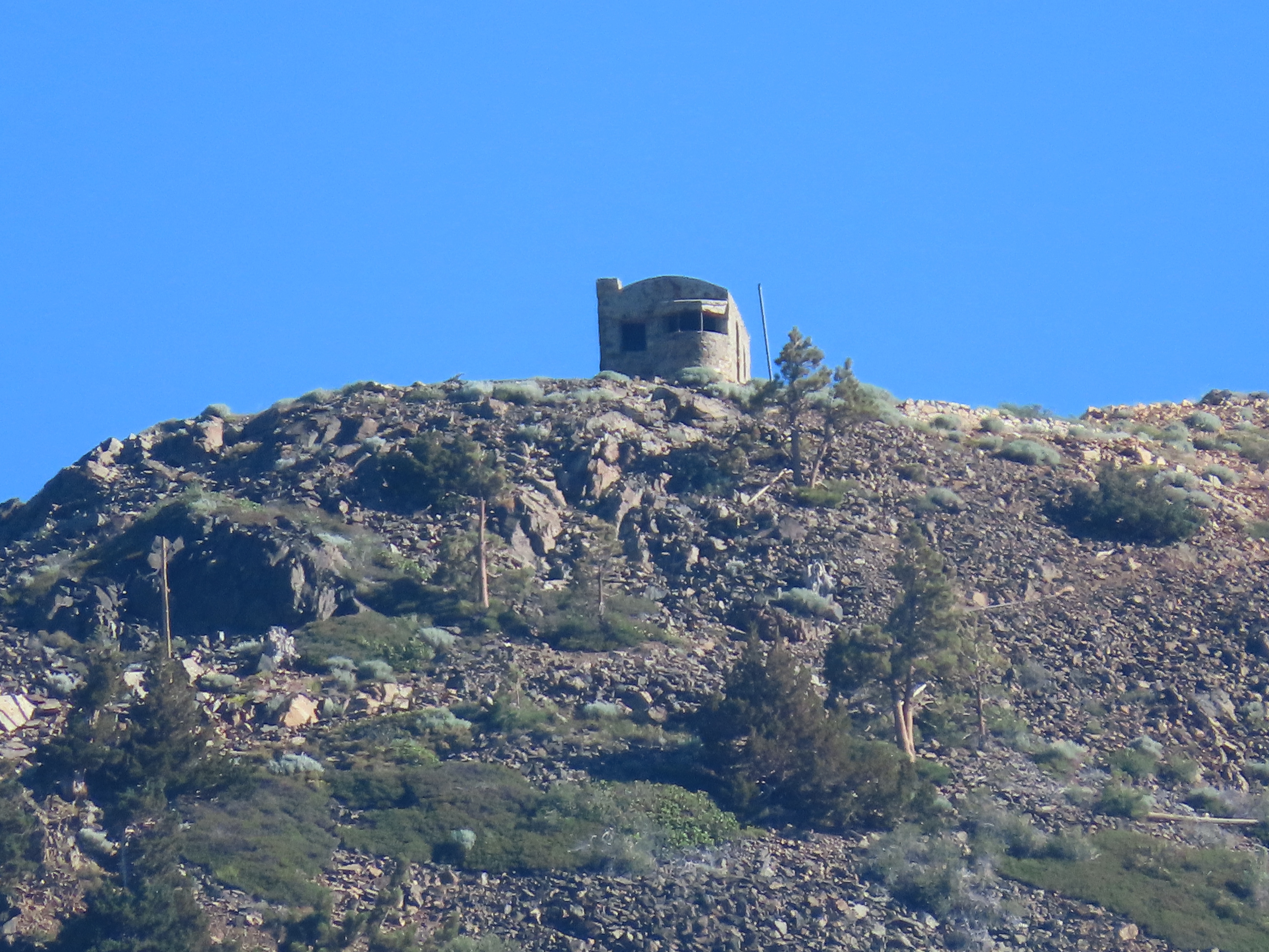
I was looking for a stone structure that was built in 1909 as a fire lookout and I reckoned that Cisco, which is directly across the valley from the building, would be my best position for seeing Southern Pacific’s fire lookout on Red Mountain.

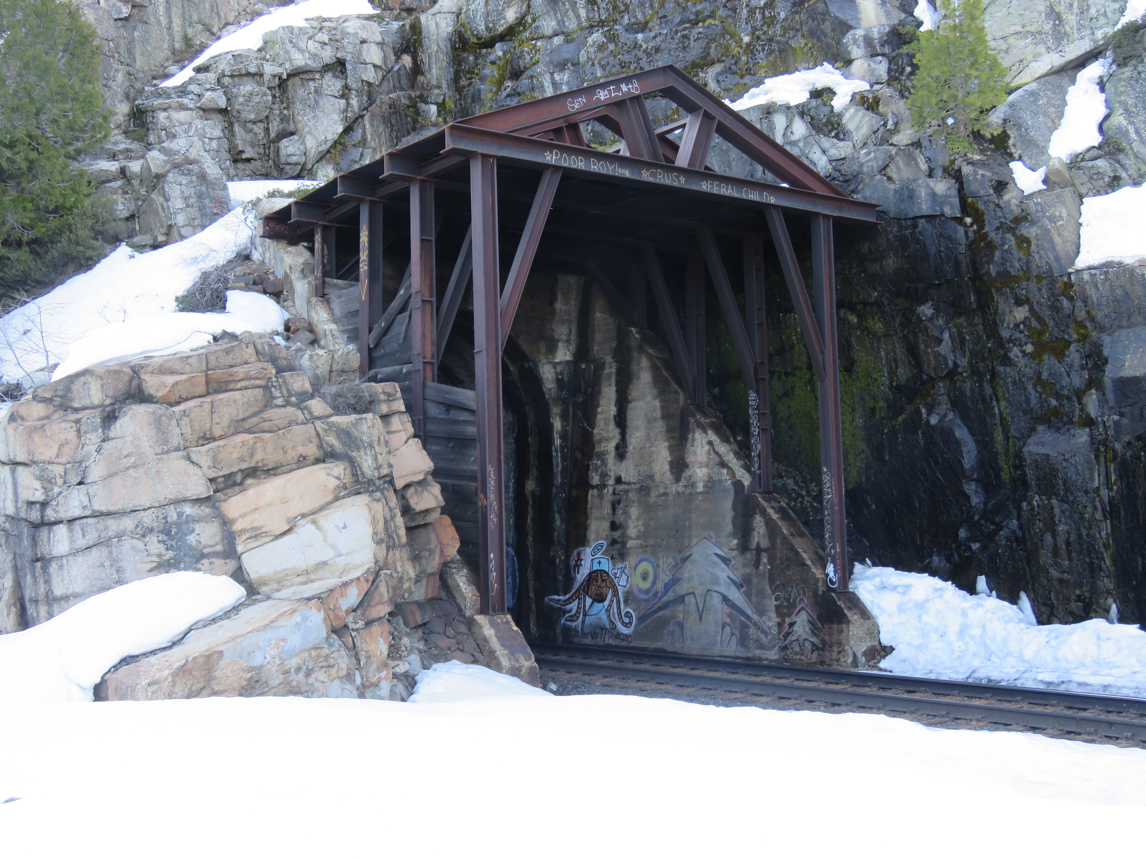
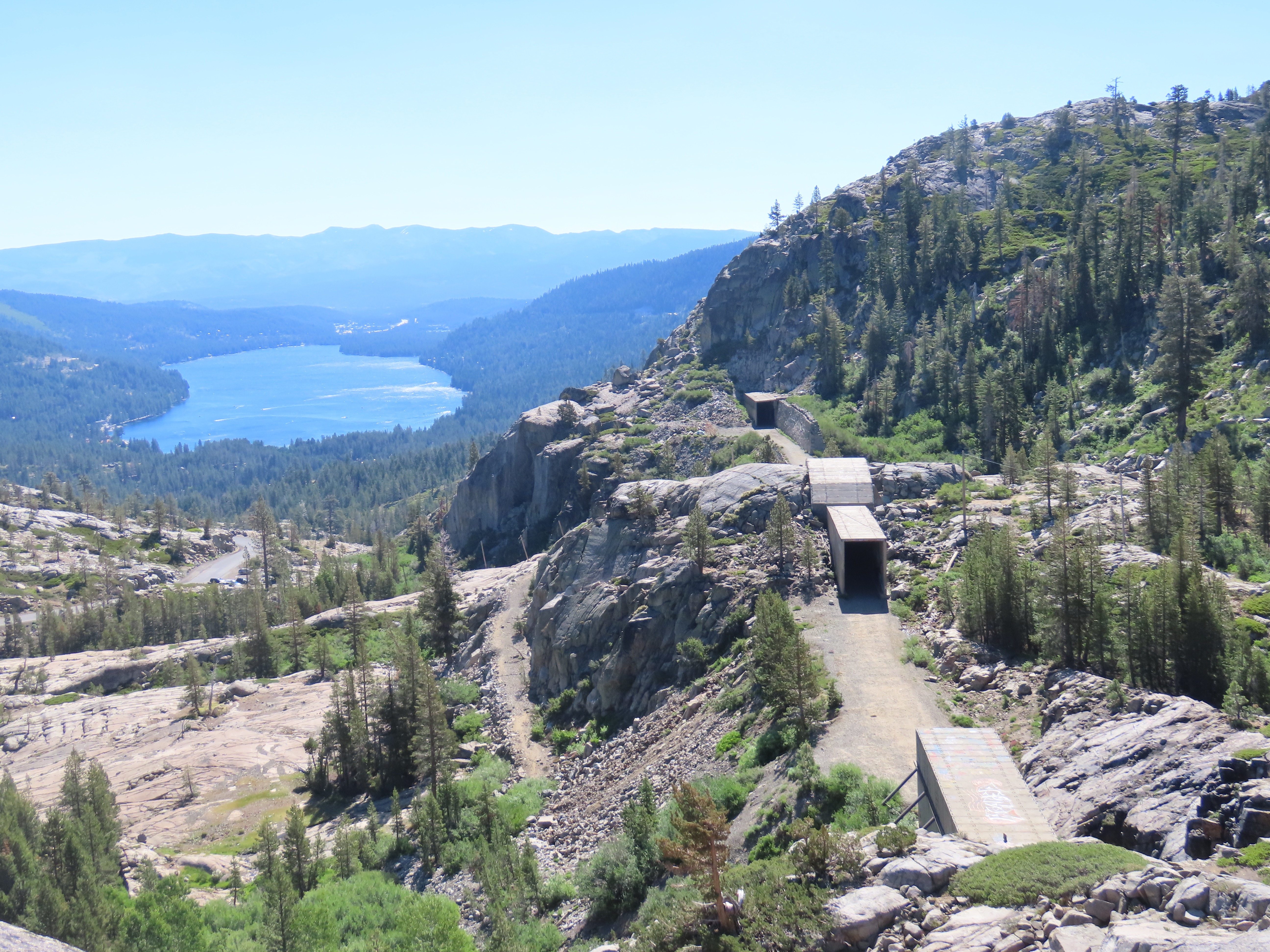
The lookout on Red Mountain was built because, from this vantage point, the rail line from Blue Canon to Donner Summit could be observed. Because 50 miles of the trackage was above 5,000 feet in elevation, snow was a real problem for keeping the line open during the long winters. The solution was to build wooden snowsheds to keep snow off the tracks. Work on the snowsheds began in 1867 and the sheds were completed by 1873. In total, 30 miles of sheds where built.

The view from Donner Summit. On the right is the original rail bed of the Transcontinental Railroad. The east portal of the Summit Tunnel (Tunnel #6) and Tunnel #7 is beyond. The snowsheds are made of concrete, replacing the flammable wooden sheds. In the middle ground is Historic Highway 40 and in the background is Donner Lake.

When you combine wooden snowsheds with wood burning steam locomotives the result can be fire.

Southern Pacific employed fire trains that could be called into action to put out fires in the snowsheds but first someone had to observe the smoke. This is where the fire lookout came into play.

The fire lookout was in continuous use until 1934 when it was abandoned.

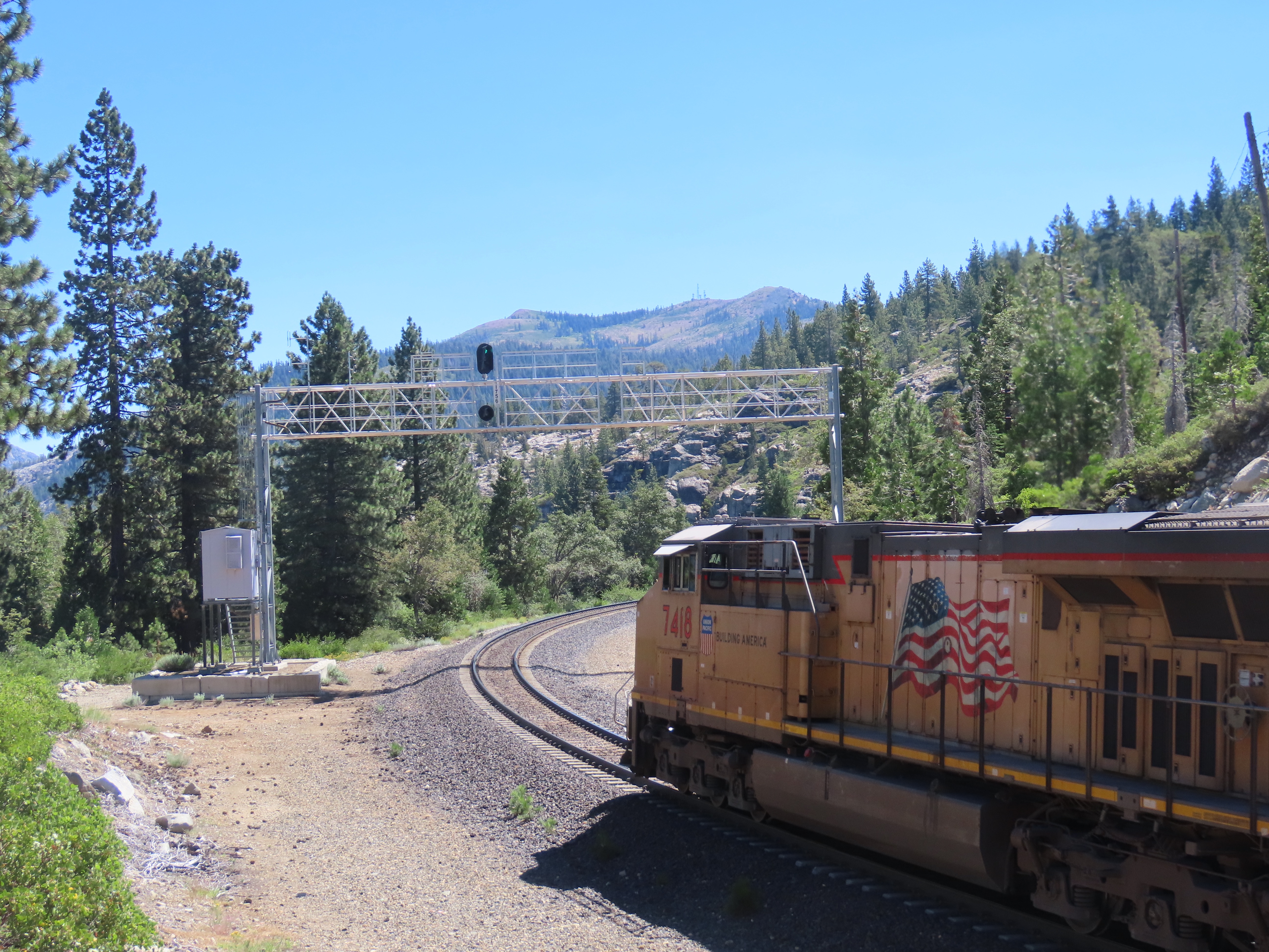
Before I got to Cisco, I pulled off Highway 20, just before it merges into Highway 80 at Yuba Pass. From here I looked down the line and just above the signal gantry was Signal Peak and to the right I spotted the prominent silhouette of the fire lookout.

Yuba Pass with Red Mountain and Signal Peak in the background.

I headed east on 80 for one stop, I took the Cisco exit which just a service station stop. I pulled behind a parked truck and looked to the northeast across the highway.

Behind me, further up the hill was the mainline. In front of me was Red Mountain and Signal Peak. To the right was antennas and towers, to the left was the Southern Pacific fire lookout.

Red Mountain and Signal Peak.

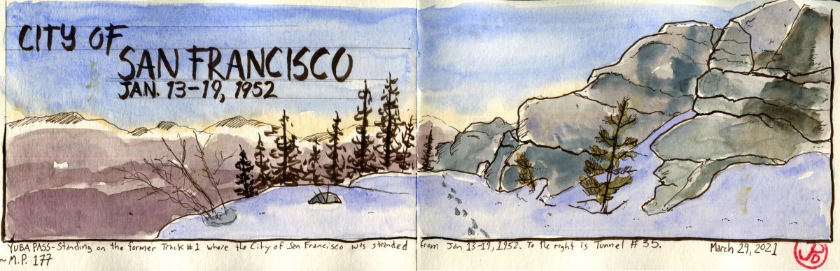
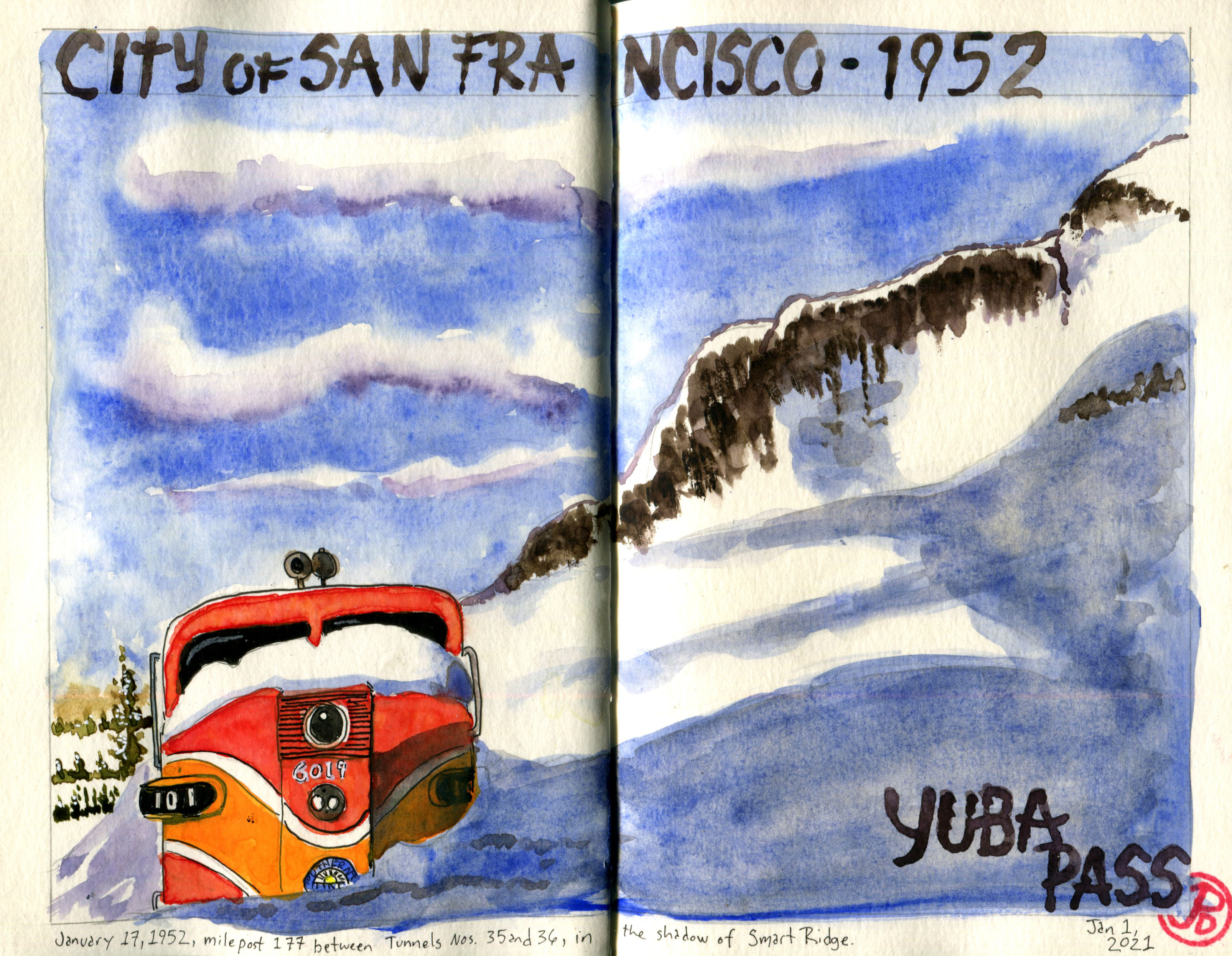
Now it was time for a sketch using my Delta panoramic journal (featured sketch) to capture the peak.

Close up of the Southern Pacific stone lookout built in 1909 and used until 1934.

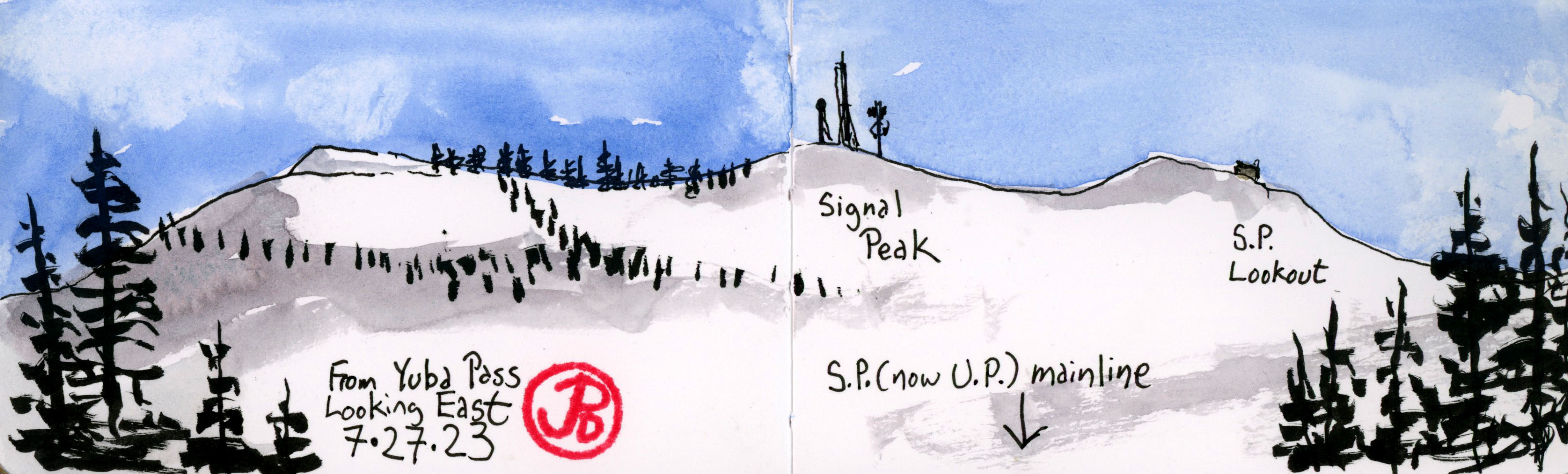
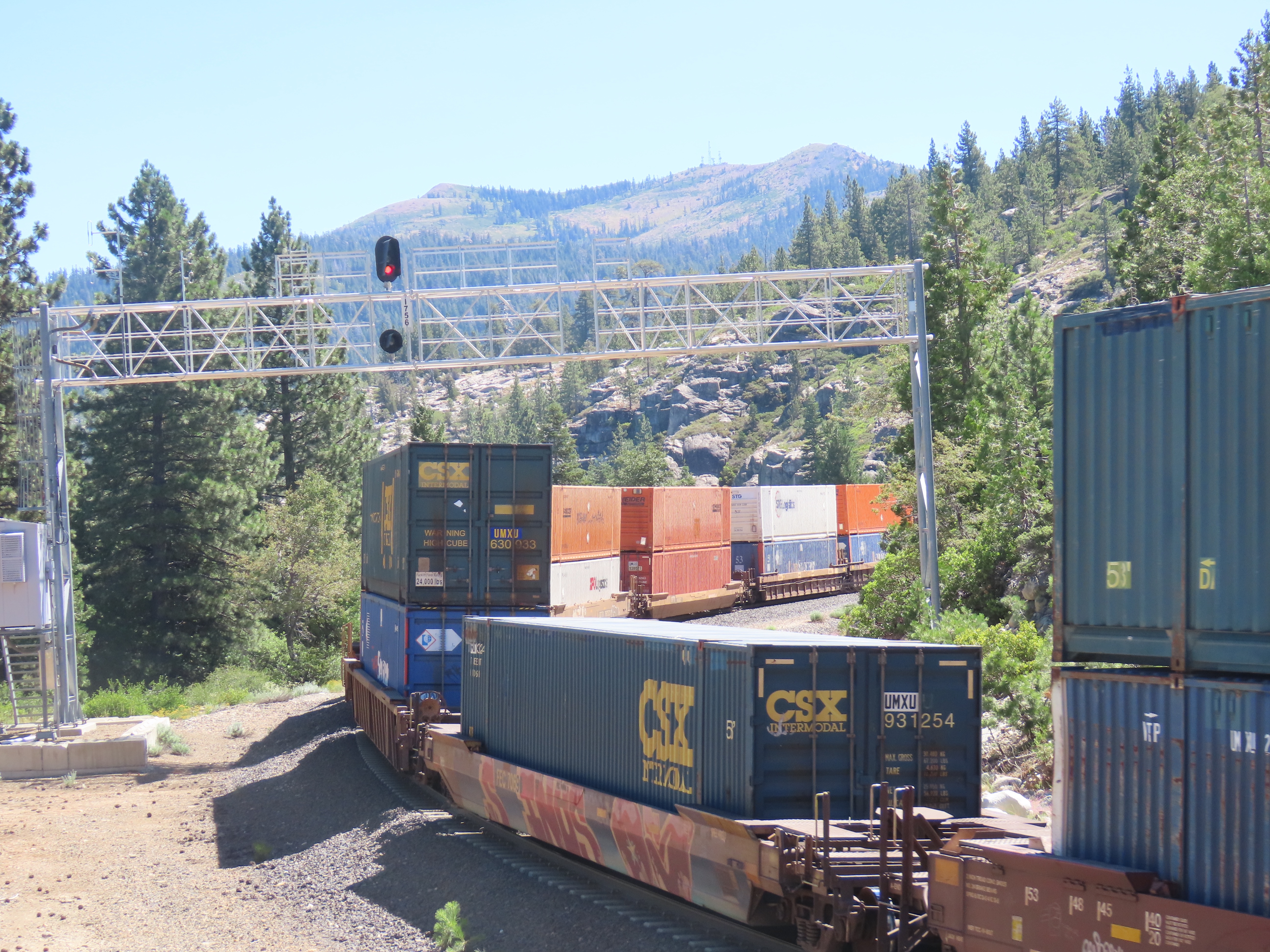
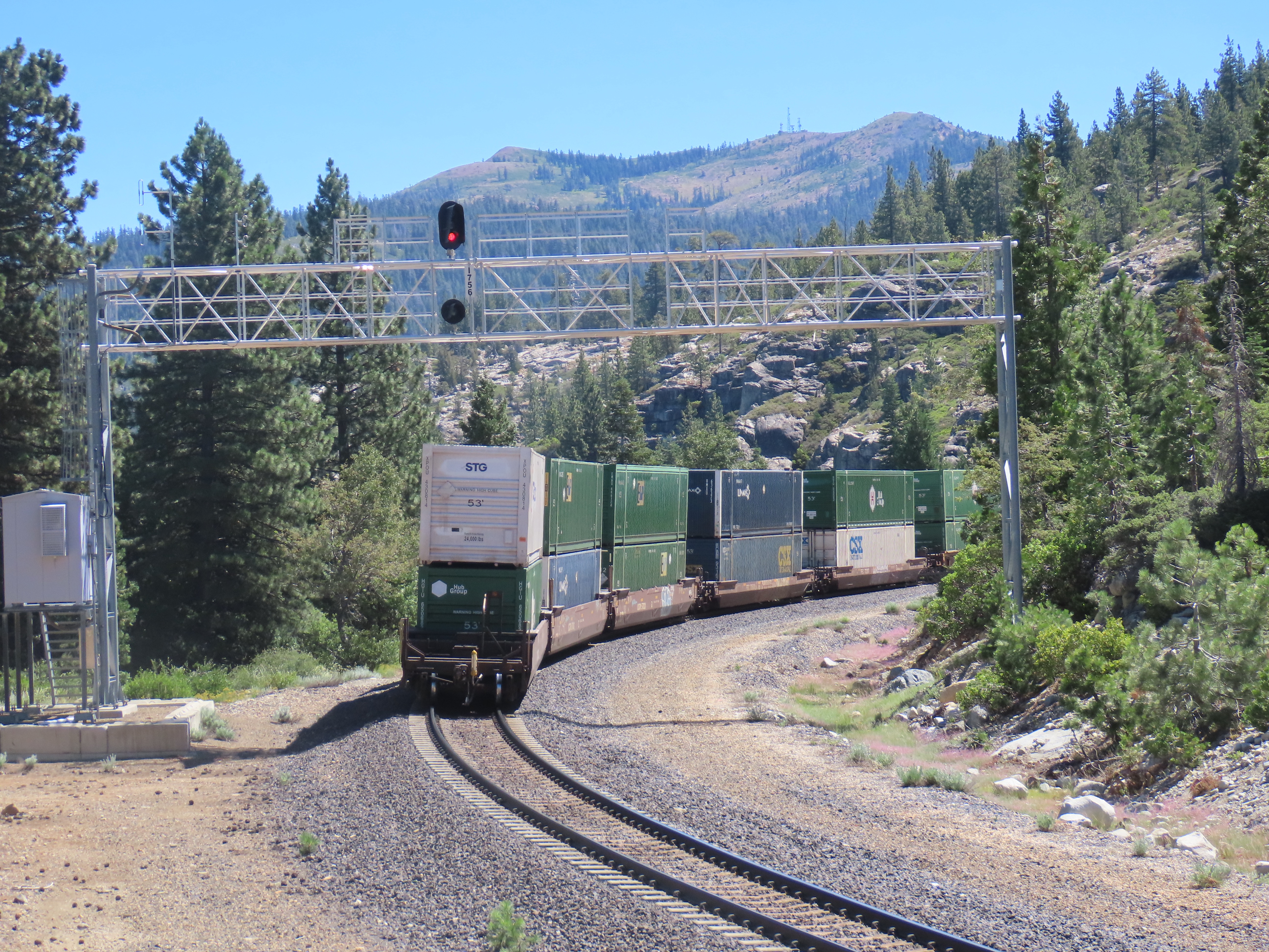
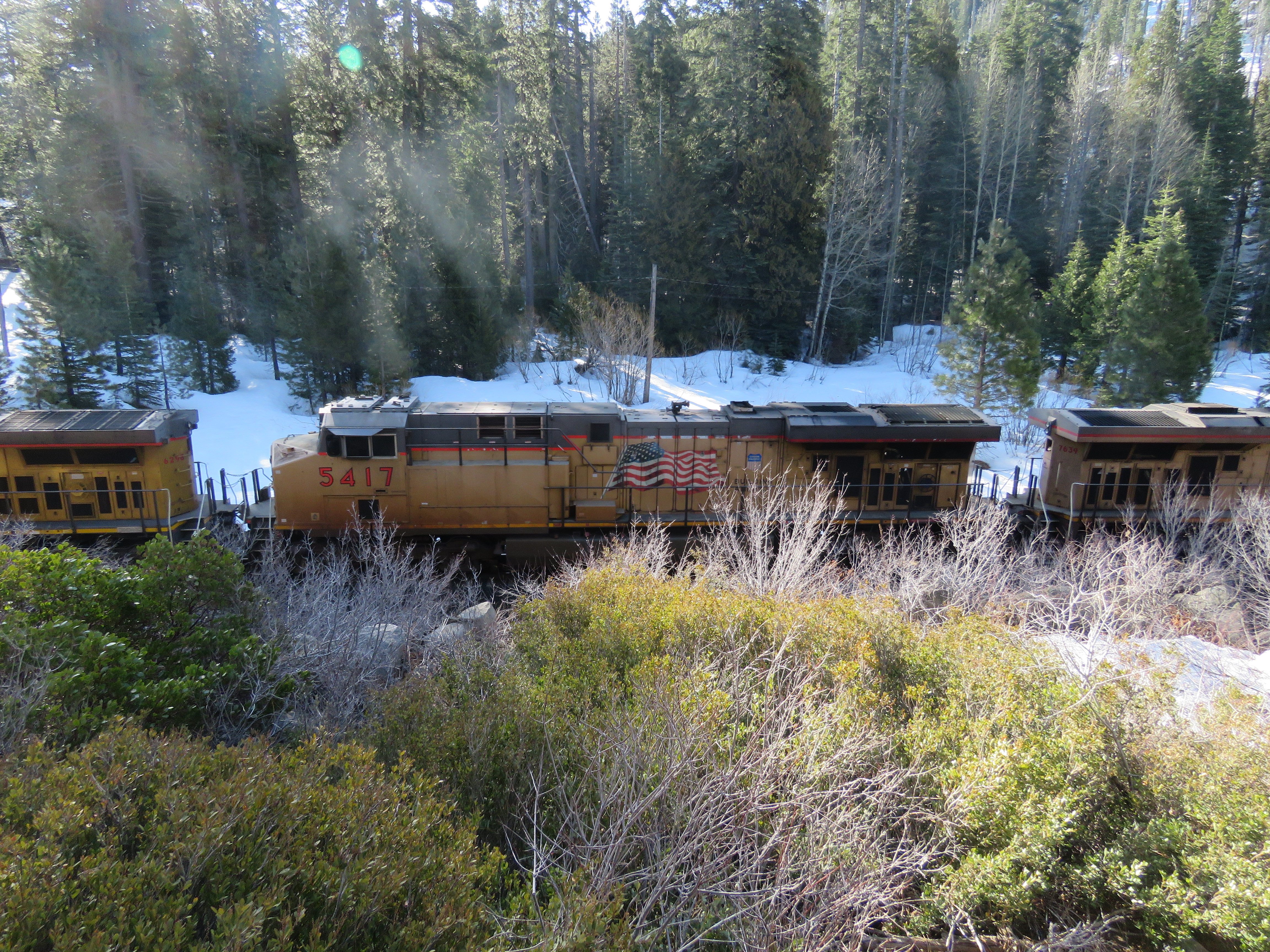
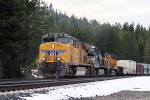
I returned to Yuba Pass to get a sketch of Red Mountain from this perspective. The signal on the gantry was green so an eastbound freight was imminent. Before long I could hear the rumble of a Union Pacific intermodal freight train climbing the grade towards Donner Summit. This consist contained six locomotives and I lost count of how many cars it train contained. (In truth I didn’t attempt to count. Seeing this long freight train mean less truck traffic on America’s highways).

What follows is a series of photographs of the UP freight making the climb to Donner Pass with Signal Peak in the background.

Image

Yuba Pass, M. P. 177

Ever since I had read about the stranding of the City of San Francisco in January 1952, I have wanted to visit the location and do a sketch.

In January of 2021, I did a sketch of the stranded super liner that was based on a historical photo. Since that time I had wondered if the stranding site was accessible or if it was on a part of the line that was far from roads or trails. In January 1952, the whole landscape was snowbound, paralyzing all transportation routes. After some research, I found out that the site was ridiculously accessible because Milepost 177 was a ten minute walk from where Highway 20 joins Highway 80.

As I pulled off Highway 20, I donned my snowboots, an east bound Union Pacific freight passed by with a consist mainly featuring tanker cars. Freight has the right of way over passage service, it is the bread and butter of the contemporary railroad business.

A UP freight climbing towards Tunnel numbers 35 and 36 and off toward Donner Summit.

I wanted to find the exact location that the City of San Francisco became stranded: milepost 177, between Tunnels 35 and 36. But I also wanted to time my visit so I could see and photograph some trains at Yuba Pass. Well I just missed a freight train but my real prize was now running two minutes late and would depart Truckee at 9:39 AM.

This was the passenger service that replaced the City of San Francisco. It is one of the longest, and some would argue, most beautiful, routes on the Amtrak system. This is the California Zephyr. The hike up to Yuba Pass was extra special because on the following day, I would be boarding the eastbound California Zephyr, Train #6, to Denver, Colorado. Nine days later I would be returning on the westbound, Train #5. This was the train I was waiting for.

I hiked along the former grade of Track #1, the route is currently single tracked. The hike was relatively easy because it was along a railroad grade and the snow wasn’t too deep. It took me about ten minutes to reach Tunnel # 35. The current track goes through the tunnel but the former track goes around Smart Ridge. It was in this area that the City of San Francisco became stranded in 1952.

I looked at a few arial reference photos and picked my spot, in the shadow of the rocky ridge. I sketched in the ridge on the right and the trees in the background and far off the spine of a mountain range. For this I used Micron dark sepia pens.

The west entrance of the 738 foot long Tunnel # 35.

I sketched for about 20 minutes and then I walked toward Tunnel #36 to find a good vantage point to photograph the Zephyr and I decided on standing near the eastern entrance of Tunnel #35 so I could photograph the train coming out of Tunnel #36. And then turn westward to capture the Zephyr as it disappeared into Tunnel # 35.

I had no idea when the train would be emerging from the tunnel but I filled my time being serenaded by the beautiful whistle of a mountain chickadee. This is the song of the western mountains. Spring was slowly arriving in the Sierras.

A mountain chickadee singing from the top of a pine. Bird and trains in the Sierra Nevada, I’m in heaven!!

At 10:40, I saw the headlights of the westbound Zephyr.

A first sighting of the California Zephyr coming out of the east portal of the 326 foot long Tunnel #36. In the foreground is the rail bed of the former track #1.
California Zephyr train #5. This train started in Chicago.
The Zephyr heading into Tunnel #35 as it climbs down the valley toward it’s next stop, Colfax. My footsteps are in the foreground.
Image

Birding the West Slope: Blackbird Ponds, Truckee

In Truckee, near the Pioneer Monument on the east shore of Donner Lake, is a series of ponds that are a hidden birding gem of the Sierra Nevada Mountains.

It was such a hidden gem that it took a few attempts just to find access to the ponds. In the end we parked in a Taco Bell parking lot and bushwhacked, forded two creeks (Donner and Cold Creeks), and scrambled up a rocky dyke to finally reach the first pond. A pond I named Beaver Pond because there were many beaver-felled trees on the shore.

We headed up between Beaver Pond and Middle Pond (again these are my own names). The top bird on our wishlist for this birding hotspot was North America’s smallest breeding bird: calliope hummingbird. This can be a tricky bird because of it’s size and fleeting flight.

On Middle Pond, there was a female common merganser and her cadre of ducklings. Their breeding season at elevation is later from the sea level mergansers of the San Lorenzo River.

We weaved through the ponds of Blackbirds Ponds, adding more birds to our checklist. We wandered into a flowery meadow between two ponds. This seemed the best habitat for our main target bird, calliope hummingbird. Three calliopes had been reported a few days before. The meadow was full of low flying swallows, but no sign of North America’s smallest bird.

We chased a calling Cassin’s vireo in the willows when Grasshopper spotted on of North America’s largest flying birds: American white pelican. This pelican has a wingspan that is slightly smaller than our largest flying bird, the California Condor.

American white pelican coming in for a landing.

The pelican came in to land on Pipe Pond. We observed this beautiful bird and it’s mirrored twin and then headed back towards the Taco Bell parking lot.

One the way back, we passed some locals who where taking a walk with their pooch. They told us about a path that led to some other ponds to the south that we had not seen yet where, according to the locals, a few more white pelicans spent the summer.

We thanked them and headed south, toward the main line that climbed up towards Donner Pass. That’s when Grasshopper spotted a hummingbird on a snag! When I turned to look, the bird was gone. We waited and the bird returned to the perch. After some great looks and a few photos, we had checked off the smallest hummingbird in the United States, the calliope hummingbird.

Our main target bird: a male calliope hummingbird.
Image

The China Wall of Donner Pass

The construction of the Central Pacific Railroad from Sacramento over the Sierra Nevada Mountains, would not have been possible without the thousands of Chinese laborers that gave their blood, sweat, and lives to the construction of the railroad. The workers, at their highest number, was 12,000, making the Chinese the largest work force on America at the time.

Many lost their lives to explosions, extreme cold, and avalanches. The Central Pacific Railway never kept records of Chinese fatalities, the true toll will remain a mystery to history.

On the the Old Donner Pass Road (Highway 40), just past the Rainbow Bridge, is the historical marker, “China Wall of the Sierra”. Looking just beyond the marker, a quick scramble up the hill, is the granite wall that holds up the roadbed between Tunnels #7 and 8. I sat on a bench of granite and sketched the wall from below.

The wall, which was built in 1867, was created to fill in a ravine and is 75 feet high. It is a testament to the workers, that after 150 years later the wall is still intact.

The upper China Wall on the right and the entrance to Tunnel #8 looking east along the now abandoned railroad bed.

An eastbound Union Pacific freight train at Norden, near Soda Spring Ski Resort. Around Donner Summit, the mainline has now been double tracked to the south of the original route of the Transcontinental Railroad. This stretch of iron was built by the Central Pacific which later became the Southern Pacific and then the SP merged with the Union Pacific on September 11, 1996.