
“Maine is deceptive. It is the twelfth smallest state, but it has more uninhabited forest-ten million acres-than any other state but Alaska.”
–A Walk in the Woods
Bill Bryson
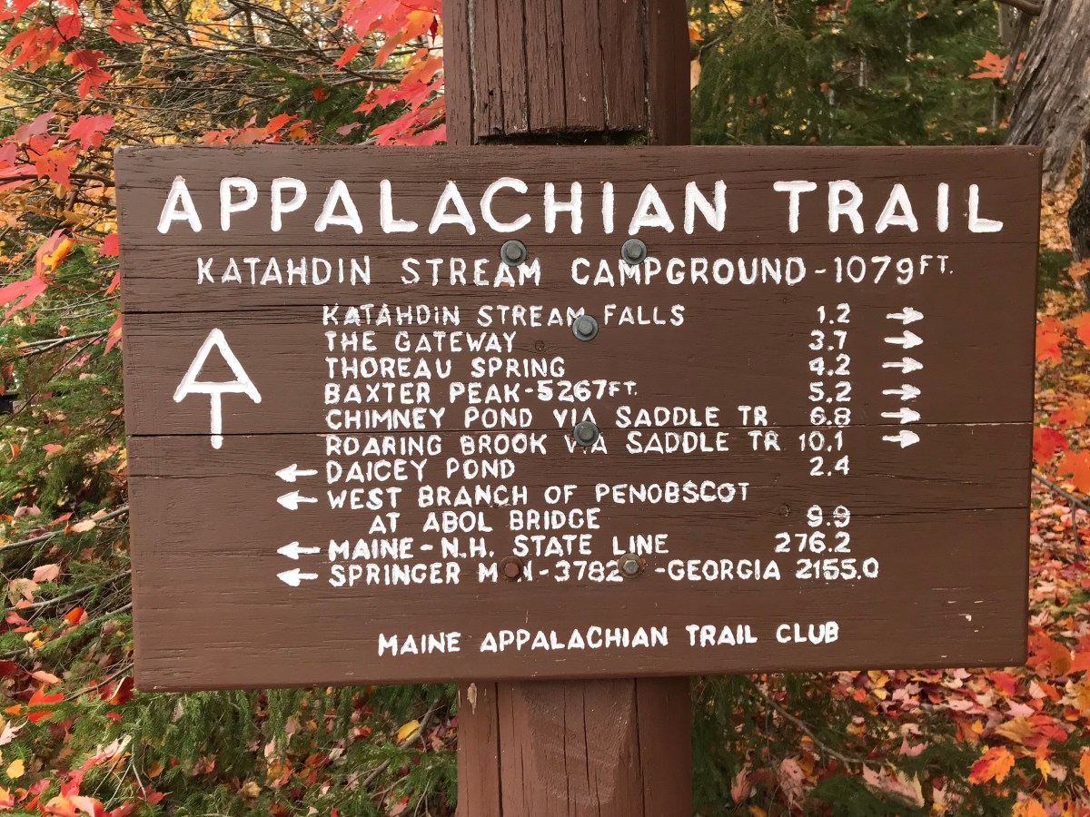
The first time I crossed the Appalachian Trail or the AT as it is also known, I was on the Mt. Washington Railway climbing to the summit. The second time I crossed the Trail, was 5.2 miles from it’s ending on the summit of Mt. Katahdin in Maine’s Baxter State Park.
For the about 400 Thur-hikers, who have hiked the entire 2,200 miles in one season, this is the last part of their long journey ending at Baxter Peak at 5,267 feet. They would have started sometime in the early spring at Springer Mountain in Georgia and passed through 14 states. Through that journey, their elevation gain and loss is the equivalent of ascending and decending Mt. Everest. . . 16 times!
I walked a short way on the AT, found a rock, sat down, and sketched. The sketch I created was a loose, gestural representation of the trail that stretched out into the woods before me. I used my dark sepia brush pen and I sketched quickly. I had to because I felt the first few drops of a passing sprinkle. The weather changes here at Baxter very quickly and I wanted to get the bare bones of my sketch down before the rain.
Now I can say that I have walked about 100 yards of the 2,200 miles of the AT. Well that’s a start anyway.

I’m on the southern end of the AT here in Georgia. I’m no good at sketching, but did the best I could to preserve my daughter’s first AT experience in writing and photo: https://williamwisephoto.com/appalachian-trail-2015.html, if you’re bored. William
LikeLike
William,
Very nice photos. I have always dreamed of hiking and sketching the AT.
John
LikeLiked by 1 person