The world’s smallest gull had recently been spotted in a flock of Bonaparte’s gulls at the San Lorenzo River mouth.
It was a rare west coast gull and the one spotted on May 13, 2022 was only the 5th Santa Cruz County record.
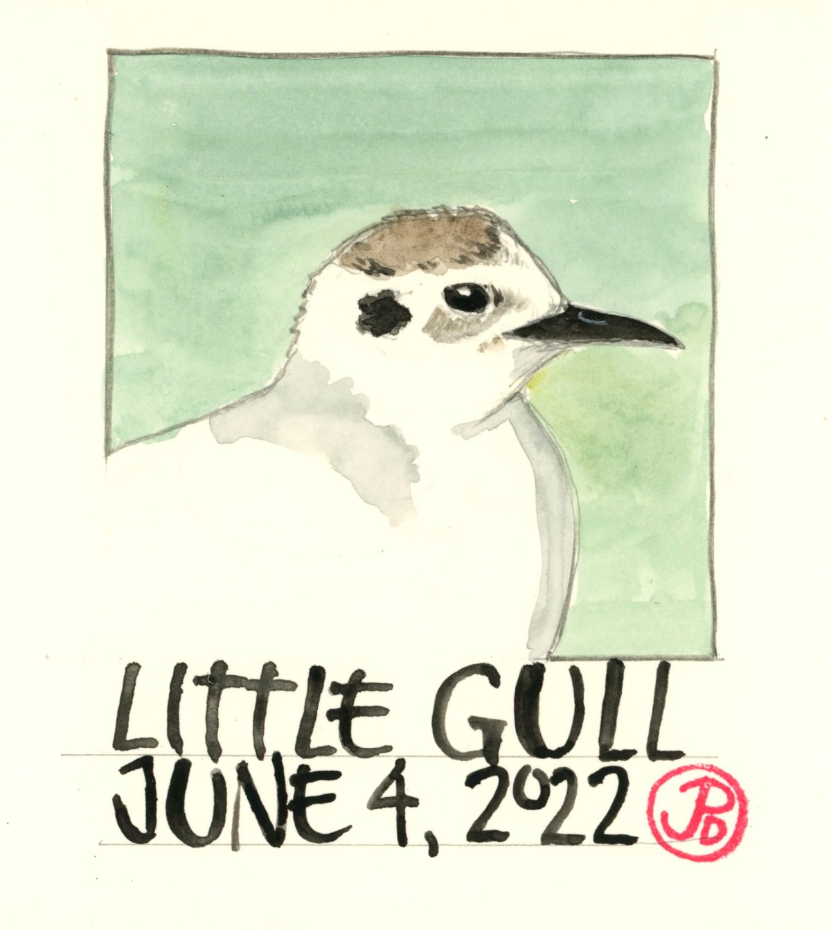
This is the appropriately named little gull (Hydrocoloeus minutus). I had seen this rarity on June 9, 2004 at Pescadero March in San Mateo County but I had not seen the diminutive gull since.
My first attempt to add the little gull to my Santa Cruz County list was foiled by a foot race that closed access to the San Lorenzo River mouth. I would have to try again later. Luckily the gull hung around with the flock of Bonaparte’s gull.
I tried again the following weekend. The flock had moved from the river mouth, up river, just north of the railroad trestle. There were about 75 Bonaparte’s gull, so searching through the flock for a slightly smaller gull showing a brown “M” on it’s wings, proved to be a challenge.
I got fleeting and very unsatisfying looks of the gull as the gull flock burst into the air climbing ever higher into the sky, which made me want to come back another time to try to see the bird again. And to get good reference photos for a sketch. Which is exactly what I did the following Saturday morning.
I returned to the Riverway Trail, which is just north of the train trestle that crosses the San Lorenzo River. The Bonaparte’s gull flock had moved from the river mouth (south of the trestle) further up the river. I imagine the large amount of human traffic and off leash dogs on the main beach may have something to do with the relocation.
There where now just 21 Bonaparte’s gulls left in the flock and they were roosting on the western shore of the river, the same river that flows past my cabin, further up the San Lorenzo Valley. Because there where less gulls, picking out the world’s smallest gull would be much easier. It also helped that there was another birder on the trail, already looking at the little gull!
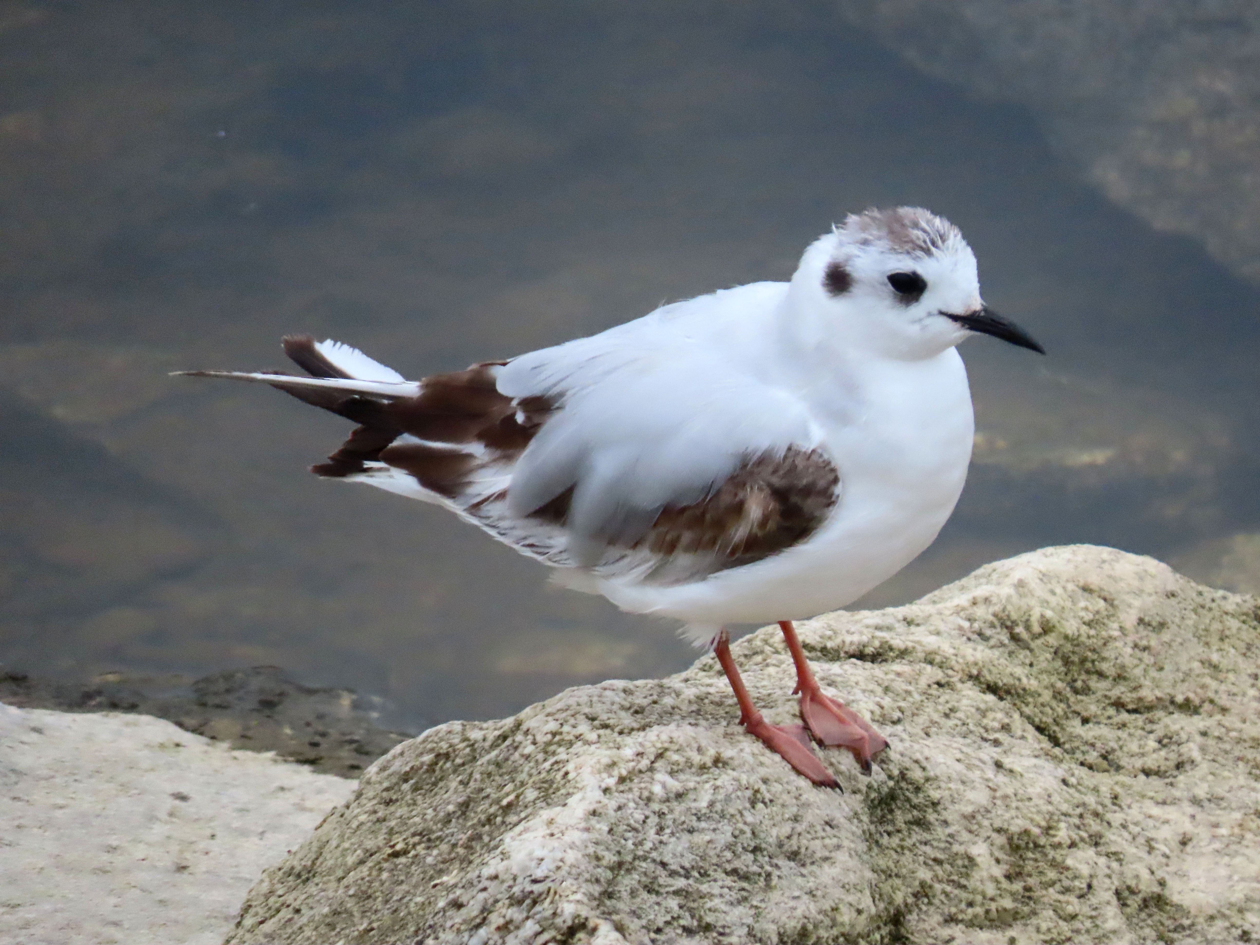
This time the little gull was roosting on a riverside rock 15 feet from the trail! The morning was foggy which was perfect flat, low-contrast light for getting great photographs.
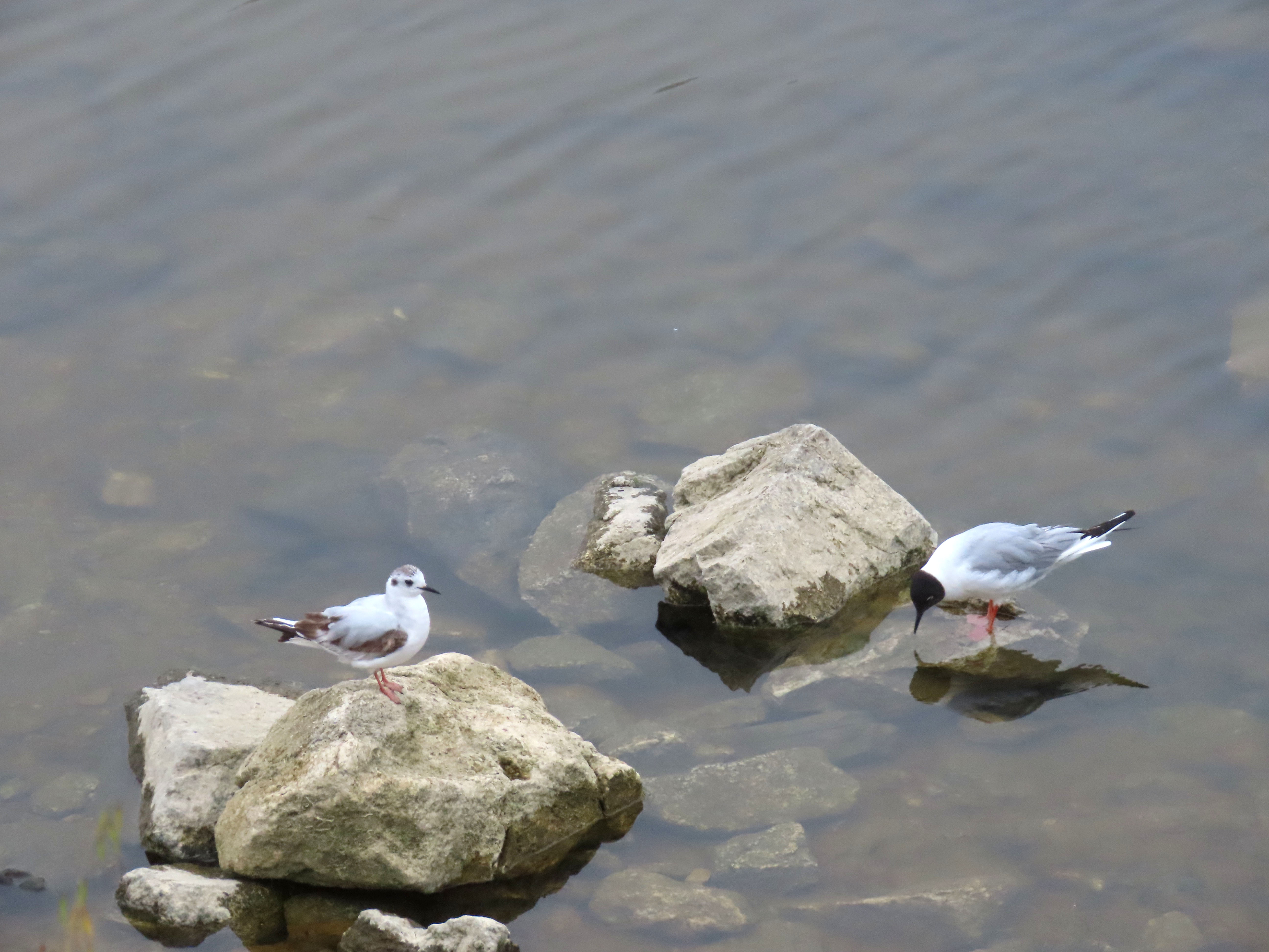
The little gull was also roosting close to the Bonaparte’s, giving me a nice size comparison of the two similar species.
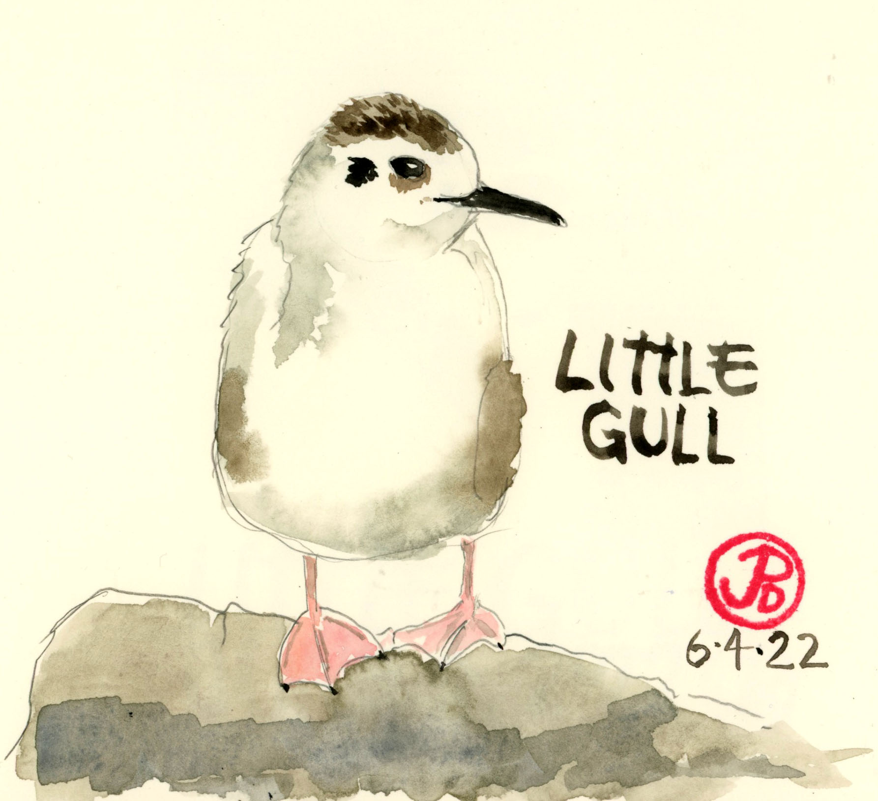
The little gull and the larger adult Bonaparte’s gull on the right.Loose sketch of the little gull based on one of my photographs.
Whenever I’ve seen a booby, it is usually flying away from view or sitting still, like a statue. Of course I’m referring to a bird!
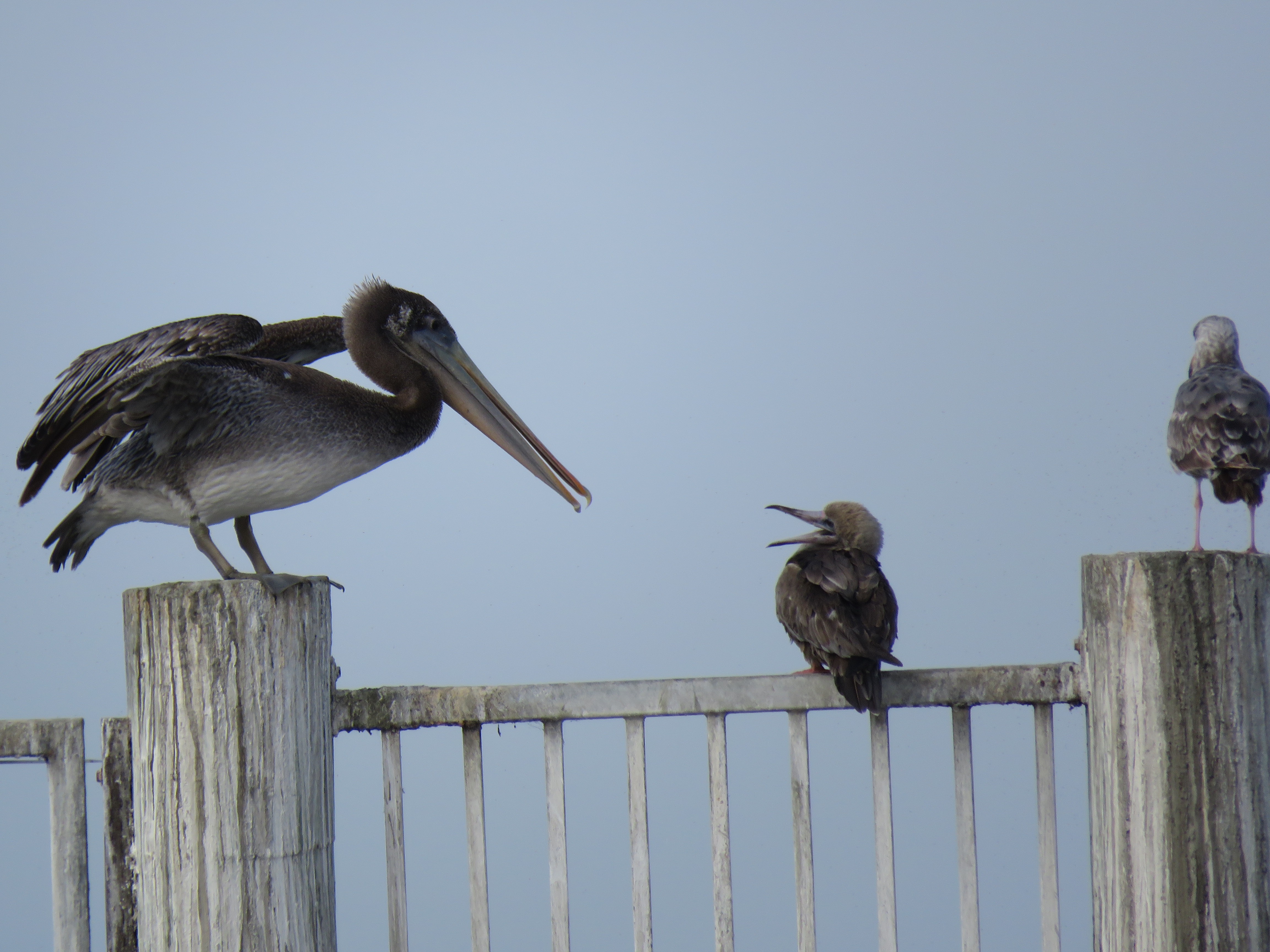
In Santa Cruz County, I have seen a red-footed booby at the Concrete Ship at Seacliff State Beach on November 3, 2018 but I have always wanted to add the more common brown booby but none have stuck around long enough for me to see it.
The red-footed booby at the Concrete Ship being harassed by a juvenile brown pelican.
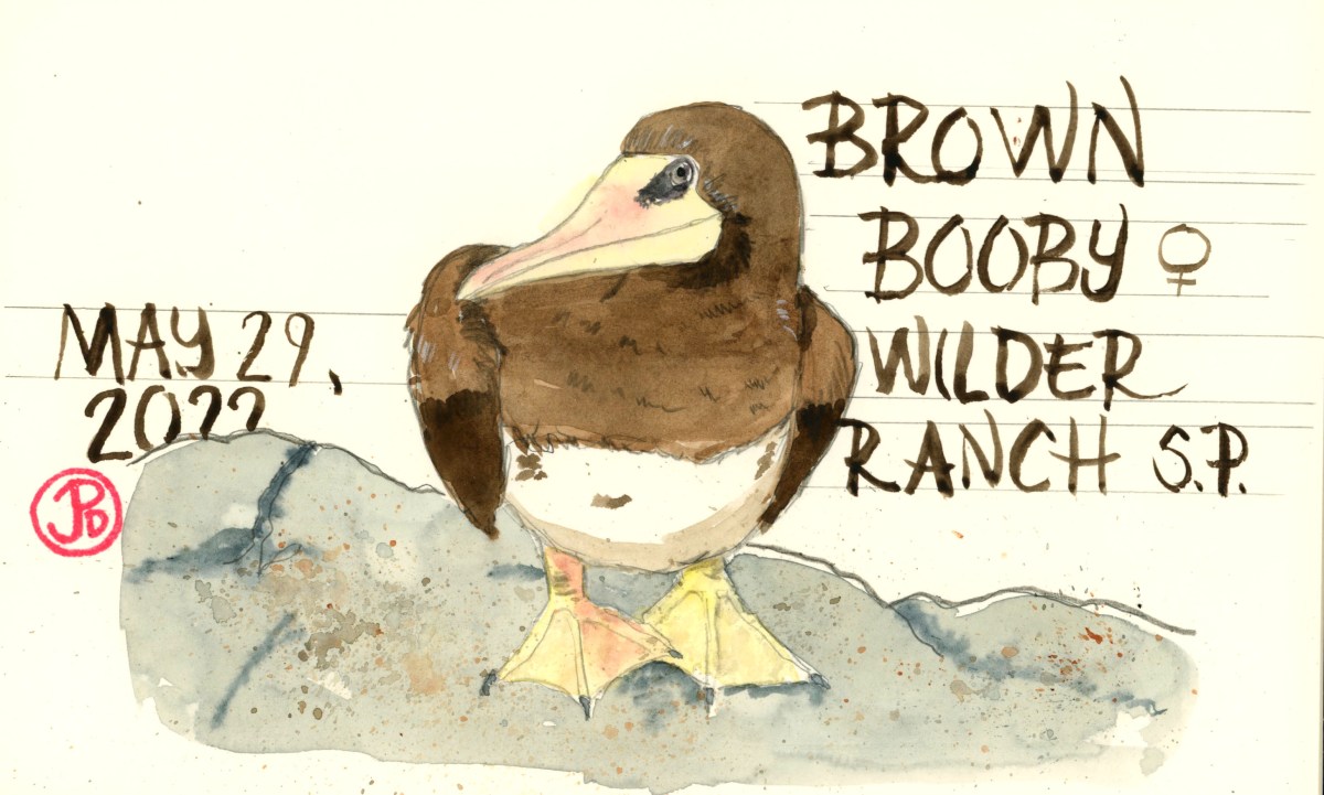
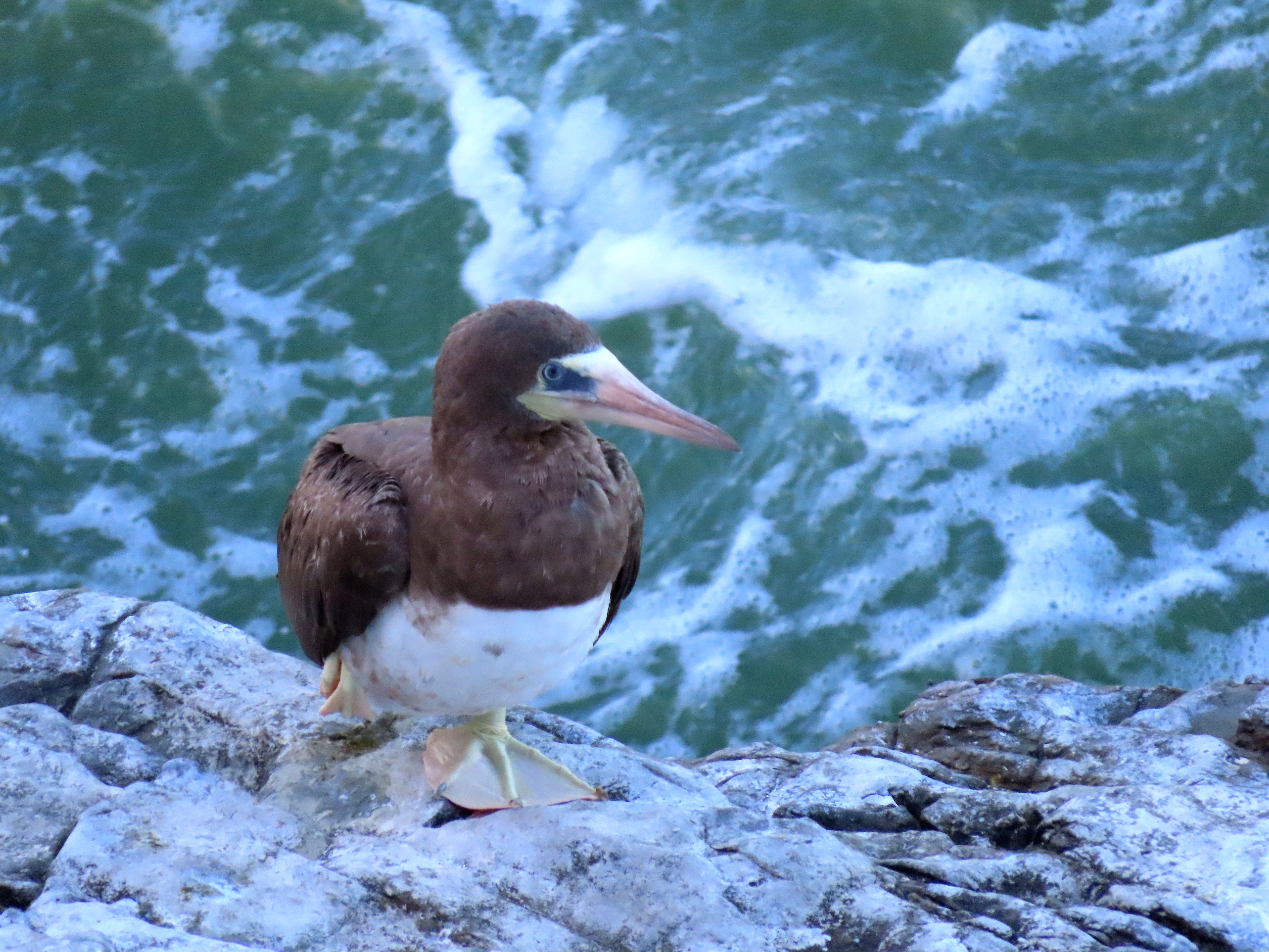
Until an adult female brown booby had been spotted roosting on the cliffs just south of Fern Grotto on the Old Cove Landing Trail at Wilder Ranch State Park. I just hoped she would stick around long enough for me to get a look!
Wilder Ranch State Park is a 7,000 acre State Park that reached from the Santa Cruz County Coastline up to the peak of Ben Lomond Mountain. It is a popular destination for hikers, bikers, birders, nature loafers, and wave watchers.
On Saturday morning I was heading out on one of my favorite hiking/birding trails in the park, the Old Cove Landing Trail. After parking on Highway 1, I headed down a trail and into the historic farm site with contains houses and farm buildings.
It was here, in the and around the buildings, that Lindsey, Stevie, Christine, John, and Mick appeared in the video for “Little Lies”. It is from the album Tango in the Night (1987), which has sold over 15 million copies. “Little Lies” was the highest charting single from the album, reaching number 1. It is still played on 80’s hit radio stations today. Maybe Wilder Ranch had a little to do with it.
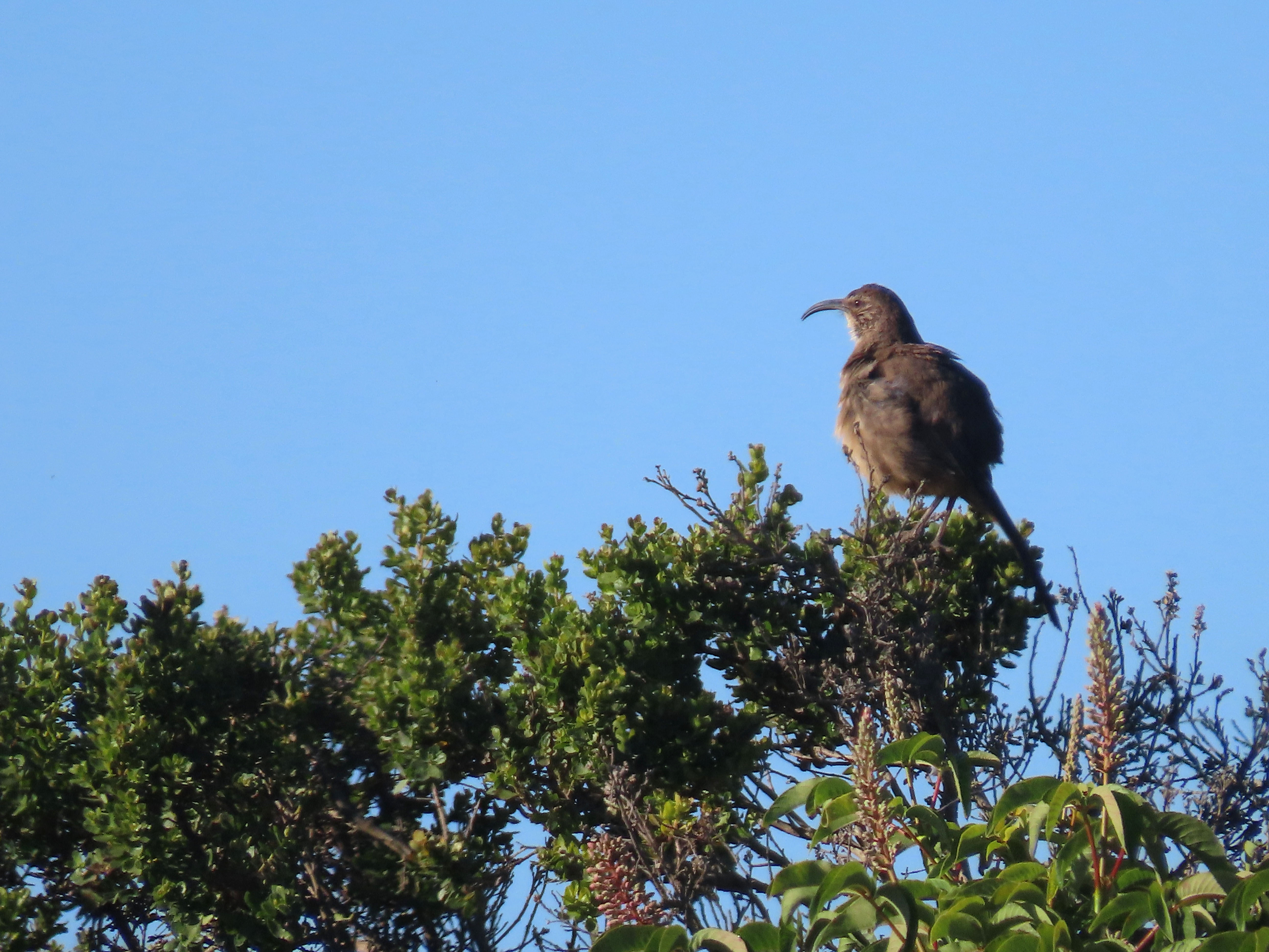
I headed through the farm buildings and I was about to crossed the railroad track to the Old Cove Trail when I spotted a California thrasher at the top of a coyote bush. They are more visible and more vocal at this time of year.
One of the many “California”birds I saw on my quest for the brown booby. The others where California towhee, gull, quail, and scrub-jay.
It is about a mile hike on the Old Cove Landing Trail to get to the place where the bobby had been seen. I arrived at the coastal bluffs just south of Fern Grotto Beach.
In front of me was a long flat rock. I scanned the rock: western gulls, lots of Brandt’s cormorants, a lone black oystercatcher, brown pelicans but no brown booby. It must be out to sea fishing or it was just gone. I had decided to give the bird an hour. So I waited for the brown booby to appear. I scanned the southern horizon looking for a booby flying towards my position. I saw none.
I tried to turn a roosting brown pelican into a brown booby, it’s large bill was tucked into it’s back feathers but the feet color was wrong. No booby.
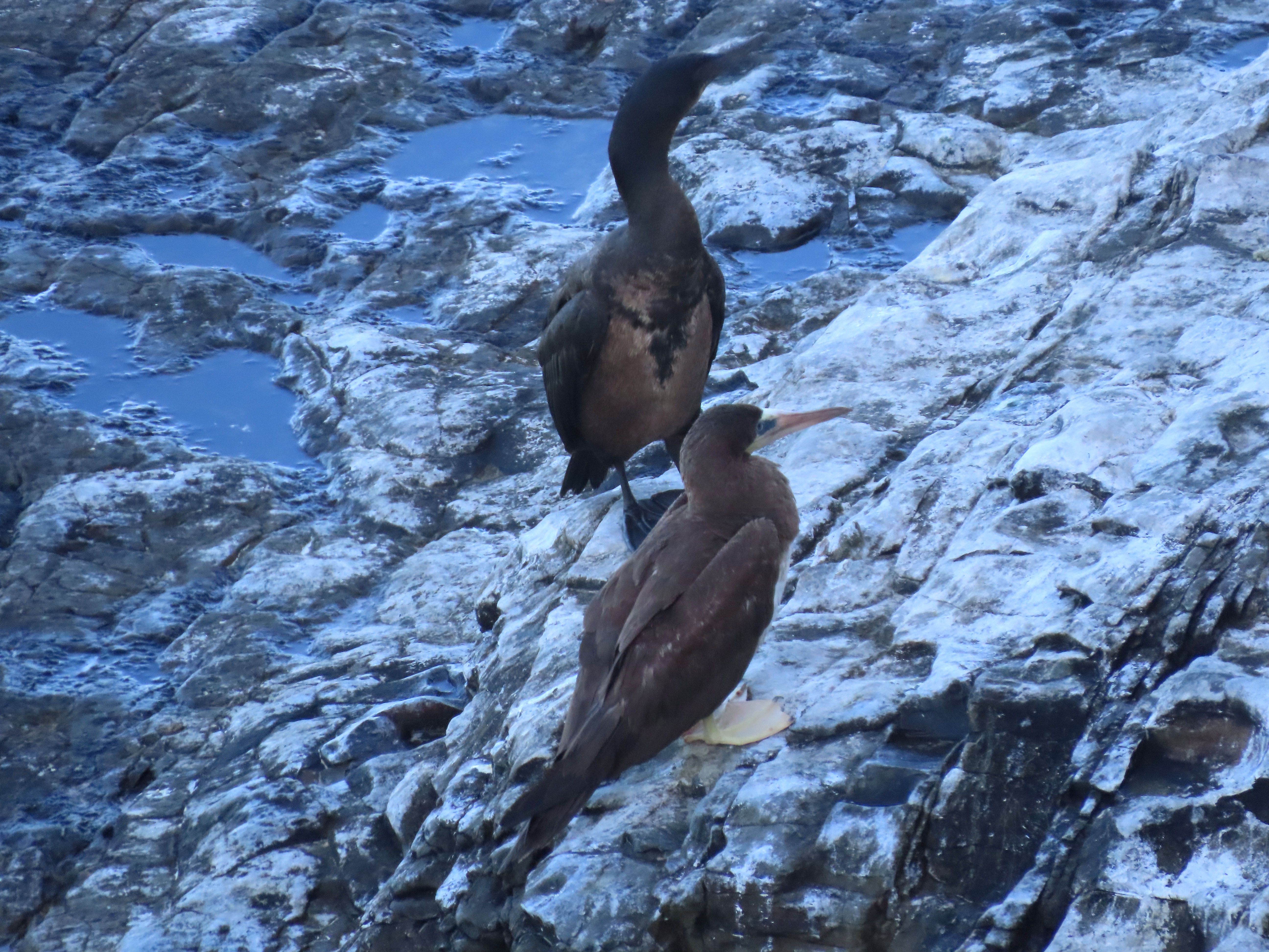
Below me a bird flew into view and landed on the cliff next to a Brandt’s Cormorant. It was the brown booby!! It must have been roosted out of view on the cliff I was standing on.
This is the angle where I first got looks at the brown booby.I moved to a position directly above the booby, without falling over to join it, to get some better photos.
For the two past years, because of Covid, we had to cancel our annual adventure to the gold discovery site in Colma, spending three days and two nights as part of the Gold Rush Program at the Coloma Outdoor Discovery School (CODS). Our school has been going to CODS for the past 25 years and it was tough to see two groups of 4th graders missing out on what is one of the most memorable experiences in elementary school.
As a substitute for Colma, my teaching mate suggested a day trip to Roaring Camp & Big Trees in Felton. In the Santa Cruz Mountains we would walk among giants, pan for gold, and take a steam railroad trip through the redwoods. I thought it was a great idea because, in a sense, it was almost in my backyard.
As I like to say, I rent in the city but I own in the country. My family cabin is in the San Lorenzo Valley between Santa Cruz and Felton. From up the valley I can hear the lonesome whistle of the shay locomotive from my deck. While the steam railway is narrow gauge, the standard gauge branch runs just uphill from my cabin, taking passengers from Felton to the Santa Cruz Boardwalk.
On the Friday morning of our trip our school buses were ten minutes late. Most mapping apps time the trip from San Mateo to Felton to take one hour. In a yellow school bus you have to add 10 to 20 minutes. So when we arrived at Roaring Camp were already behind schedule. Two words in teaching trade that are the most important in this situation are flexibility and patience.
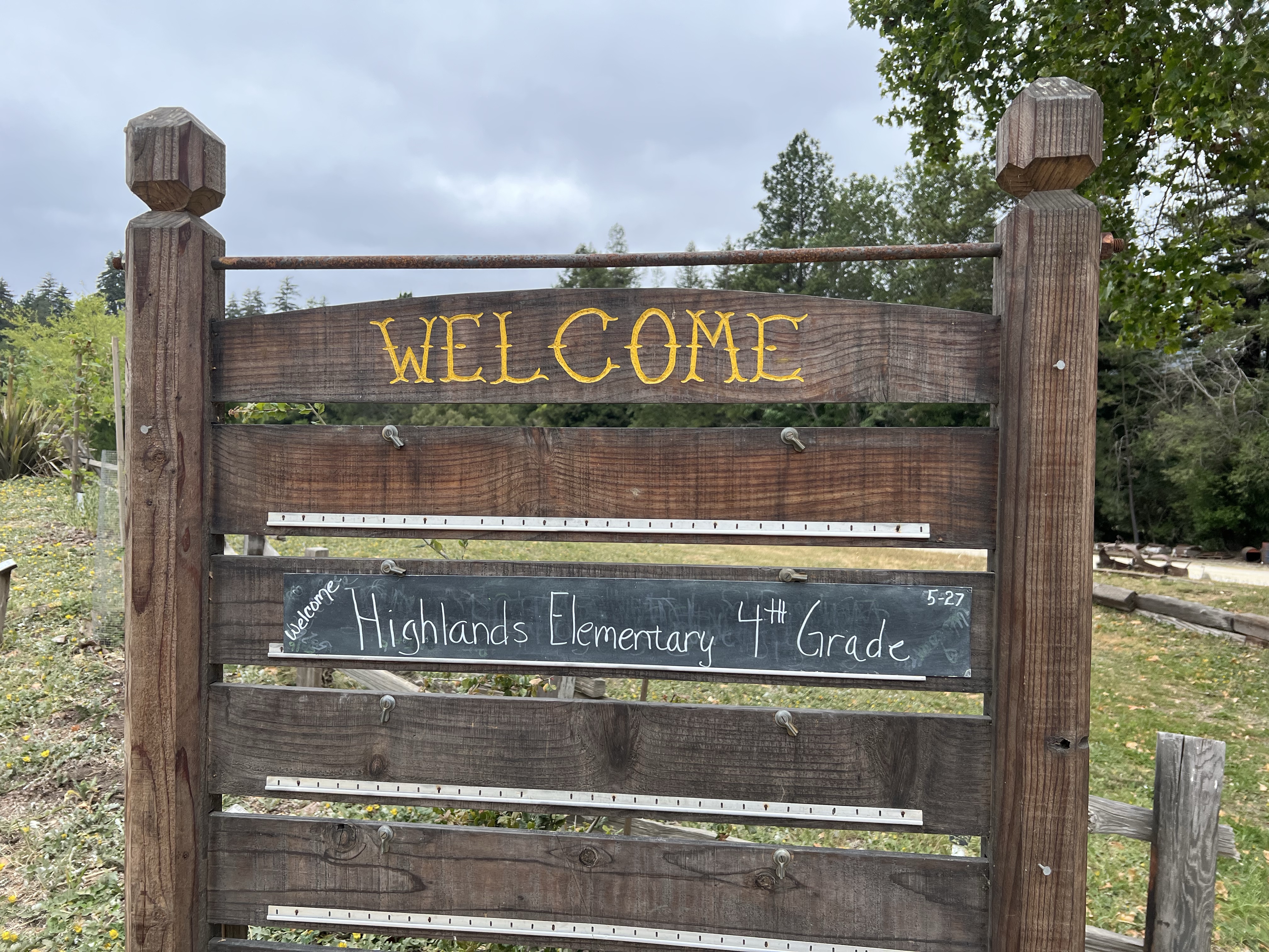
We unloaded our bus (no one lost their breakfast on the journey over the curvaceous Highway 17) and we had a pleasant surprise, just before we crossed the covered bridge on our way to the station.
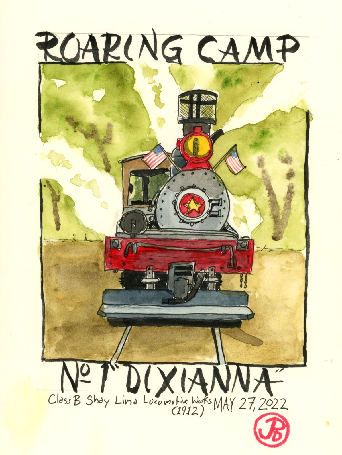
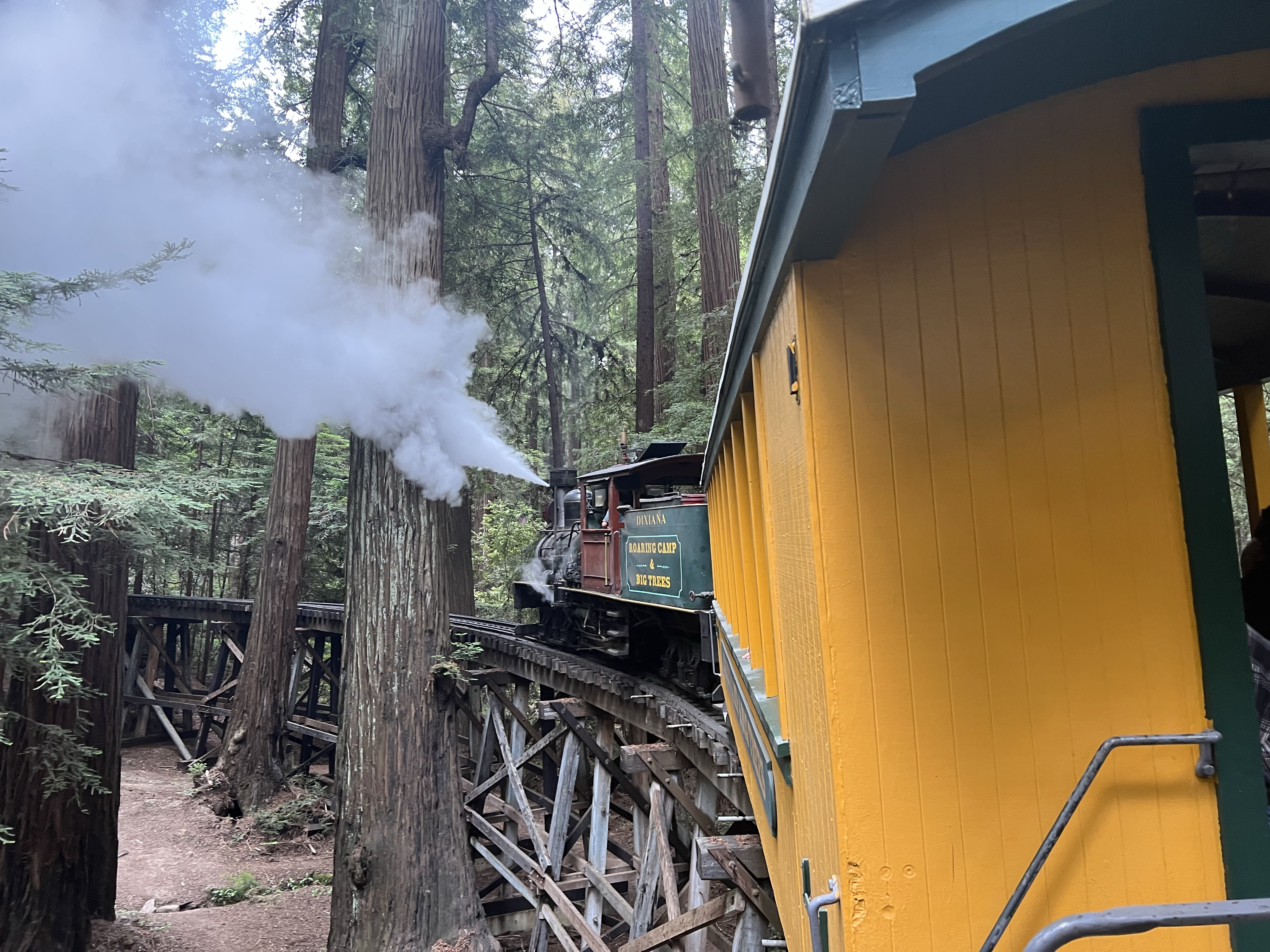
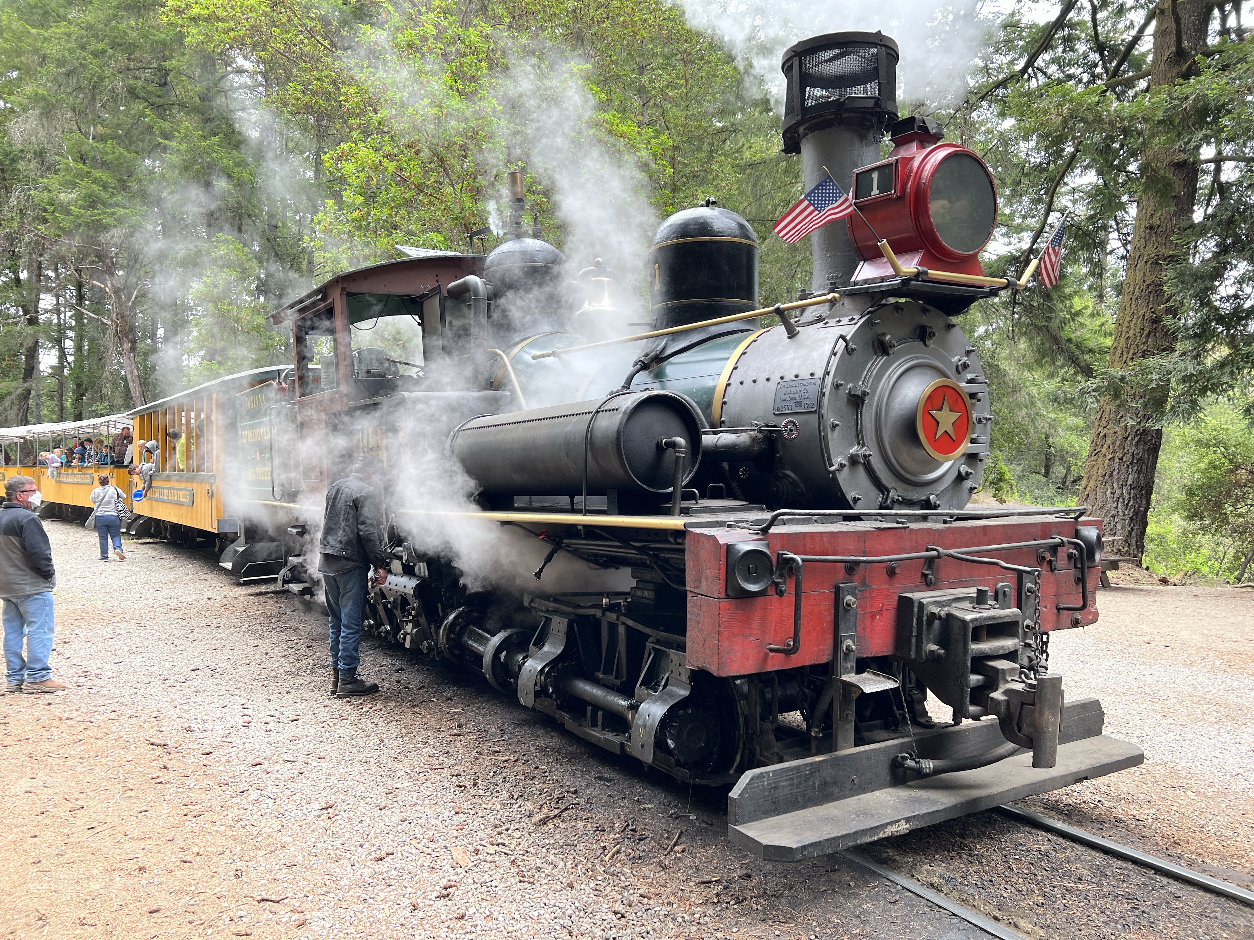
We arrived late, so our planned schedule was already out the window. We had time for a bathroom break before we queued up at the station as the No 1 Shay “Dixiana” backed into the station with her consist of brightly painted yellow and green passengers cars. We had the two cars behind “Dixiana”. We really would have front row seats to the sites, sounds, and smells of a live steam locomotive!
The two truck Class B Shay on point, was built in 1912 at the Lima Locomotive Works. It was originally built for the Alaculsy Lumber Company as a geared narrow gauge logging locomotive capable of climbing grades of 8% (most standard locomotives can handle a 1.5% grade). It served six other railroads before ending up in Dixianna, Virginia (hence the locomotive’s name). It was designated No. 1 because it was the first locomotive acquired by the railroad and she is now the workhorse of Roaring Camp.
The founder of Roaring Camp, Norman Clark, purchased the Shay in 1962 for his vision of a replica logging town with a narrow gauge railway. The Shay was loaded onto a flatcar and then shipped, via mainline rail, to her new home in Felton.
I could feel the excitement of our fourth graders as they found their seats. These tech-savvy ten year olds were about to experience cutting edge technology of the early 20th Century! And we would be pulled up the mountain by a 110 year old steam locomotive.
With two toots of the whistle, our train rumbled into life headed out from the station and past the water tower. Our train turned right into Schoolhouse Curve on it’s way up to Bear Mountain. Our top speed was about five miles an hour. Shays were built for their motive power on steep logging grades not for swift passenger service.
Crossing the horseshoe curve wooden trestle at Indian Creek. This trestle is one of the tightest turning railroad trestles in the United States. At it’s highest point, the train is 35 feet above the ground.
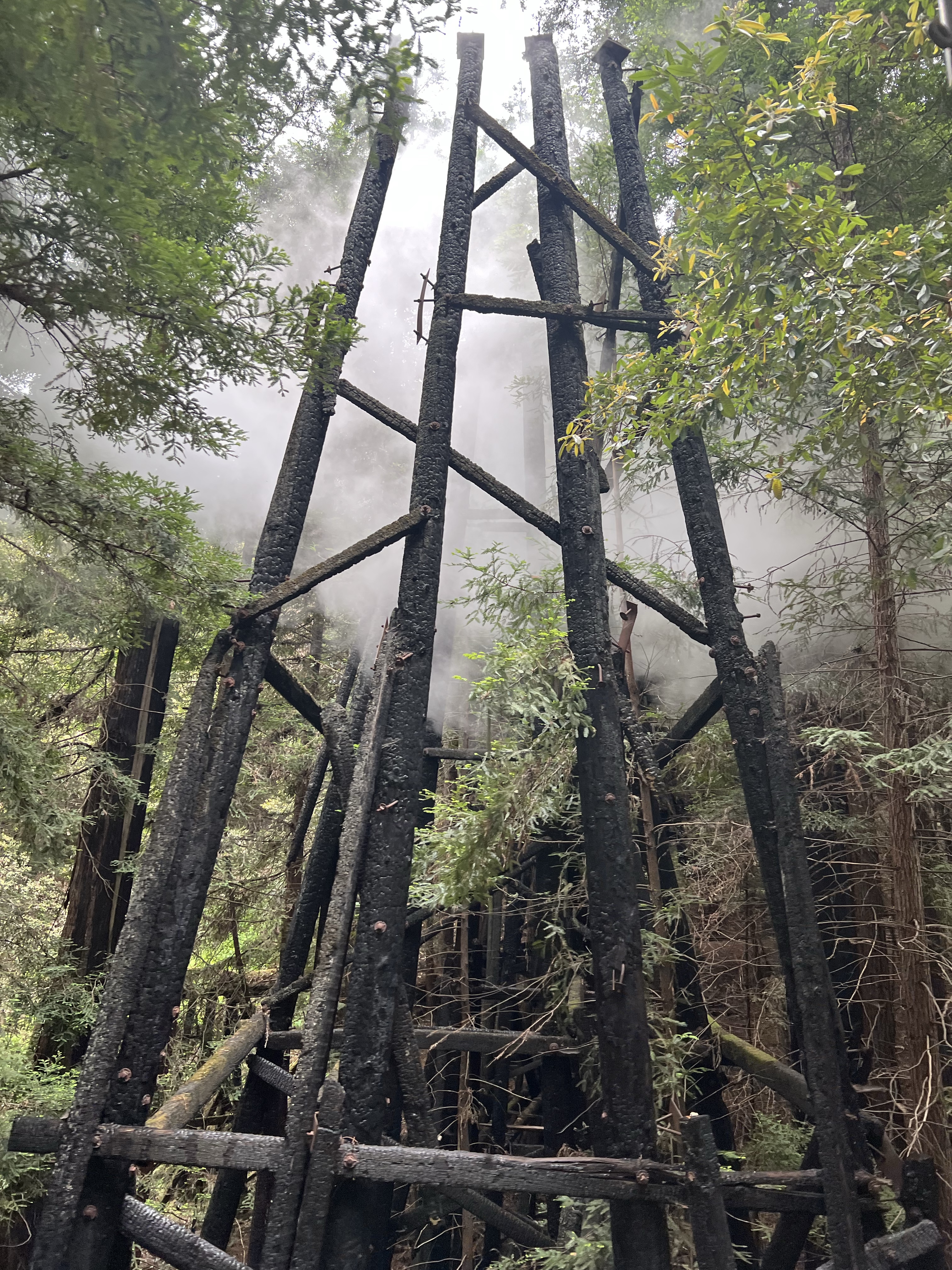
Once we crossed over the Indian Creek Trestle, the No. 1 labored up an 8.5% grade to the burned out trestles at Spring Canyon. The trestles were burnt in a fire on June 27, 1976.
The charred remains of the Spring Canyon Trestle. I love these ghosts of the past. I have no memory of crossing over this trestle, but knowing my father, I must have been on this train as an infant in the early 1970s.
After the trestle burned on July 27, four months later, a switchback was constructed to make up the elevation needed to summit Bear Mountain. On first section of the switchback, the train has to back up meaning that Shay No. 1 is pushing, instead of pulling, her consist up the hill. This section of track is the steepest portion of narrow gauge railroad in the United States. This grade reaches 9.25%!
Dixianna pushed our train up the grade with no problem, after all this is what she was designed to do. On the way up my some of my students caught their first sighting of a banana slug!
We headed up the last leg of the switchback and labored towards the summit of Bear Mountain, which is really more of a hill. Once our train reached the summit and we stopped for about 15 minutes. We kept our students on the train because we didn’t want to leave anyone behind. I detrained and took a few photos on Dixianna, one of which was the reference for the key sketch.
Dixianna at Bear Mountain. The engineer is greasing the moving parts. Stream locomotives are high maintenance.
A toot from the whistle announced that it was time to board the train because we where heading back down the hill to the station.
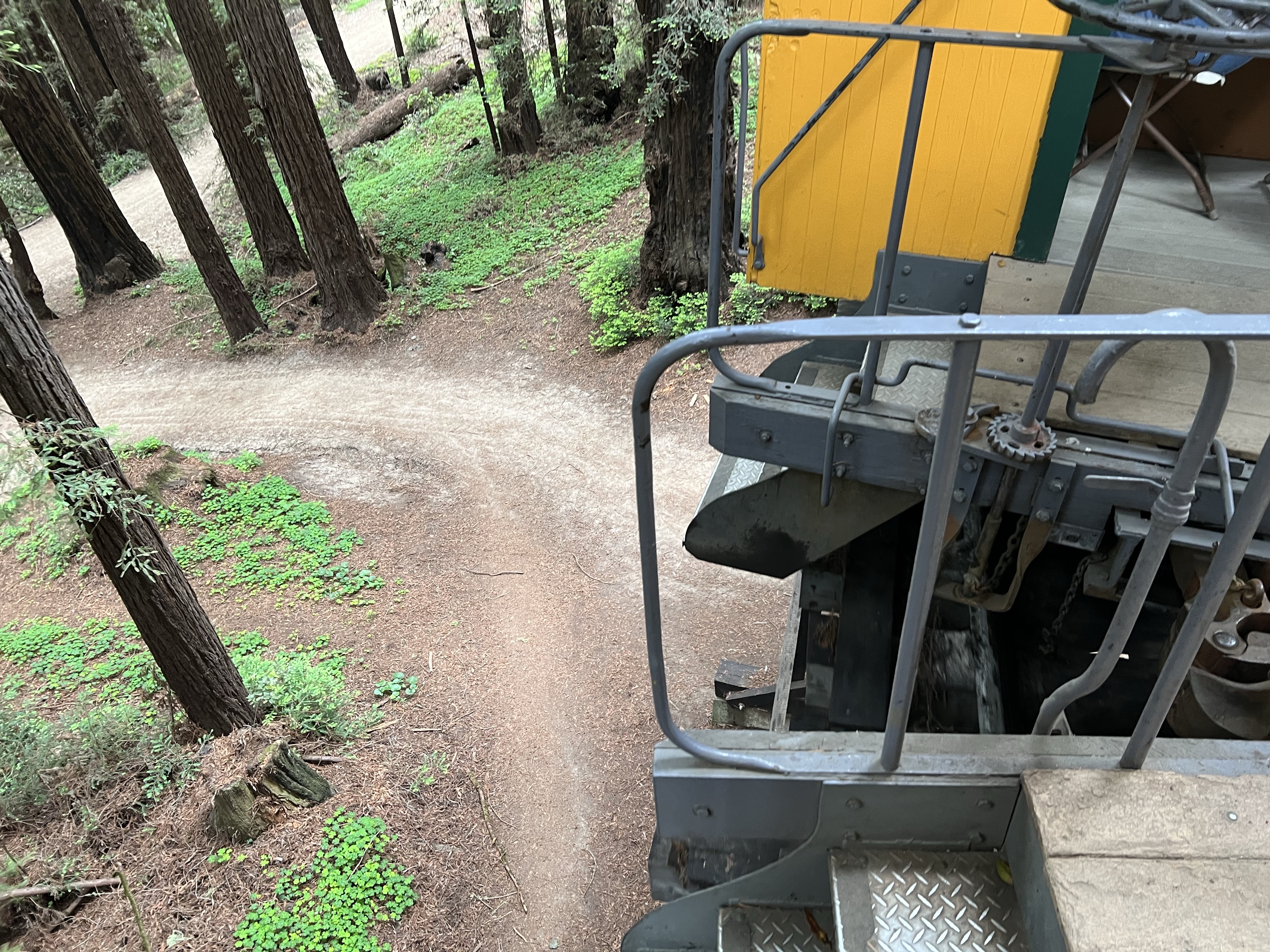
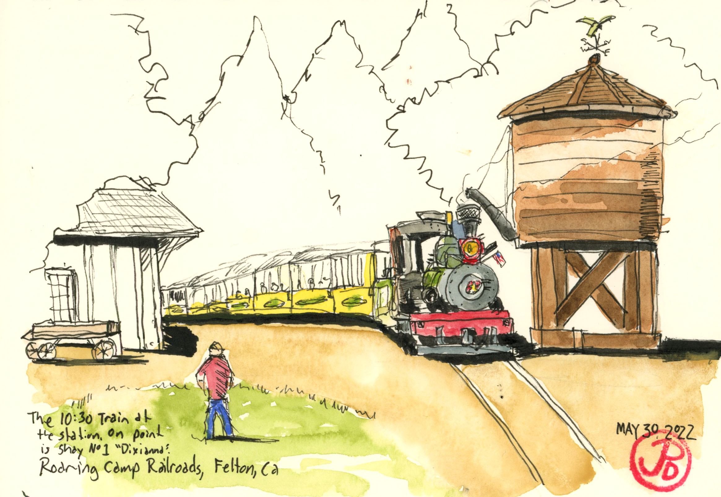
Looking down from 35 feet atop the Indian Creek Trestle on our way back to the station.A Memorial Day field sketch of “Dixianna” waiting to depart of her 10:30 trip to Bear Mountain. She was in the station for about 20 minutes, which gave me enough time to sketch.
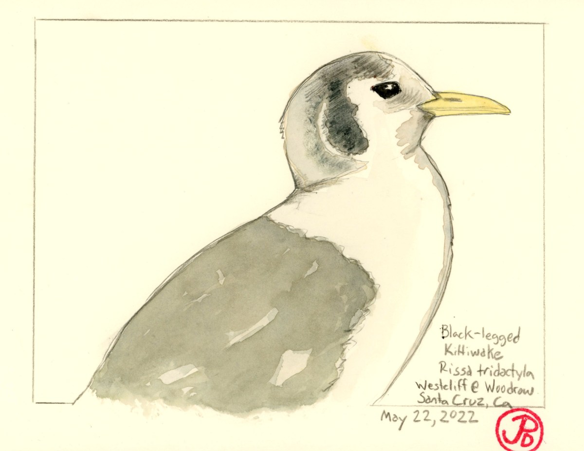
The black-legged kittiwake has been on my Santa Cruz County wish list for sometime. You figure with 29 miles of coastline, this pelagic gull or more correctly, seagull (kittiwakes drink salt water), would be far easier to see in the county. But sadly, it isn’t. The kittiwakes keep to the offshore waters.
The winter is the time to see this gull on the California Coast. Every winter, a few kittiwakes stop for a rest on coastal beaches or cliffs. The county north of Santa Cruz, San Mateo County, can be a good place to see a kittiwake as it rests, bathes, or preens, at gull roosts, usually on a beach where a freshwater creeks flows into the ocean. But every season can be different with many kittiwake sightings on year but some seasons, hardly any.
Perhaps because much of Santa Cruz County’s coastline lies within Monterey Bay and not facing the open ocean, kittiwakes tend to be even scarcer than in counties to the north.
Many times I had searched gull flocks on the northern Santa Cruz coast with no luck. I could not find the smaller gull with the bowlegged walk, wearing black earmuffs with a yellow beak. Waddell Beach, the most northerly beach in the county, has been a good place for large concentrations of roosting gulls. I picked through these flocks in search of a lone kittiwake and had always come up empty.
Now there was another lone adult kittiwake being seen on the rocks at Westcliff Drive and Woodrow. And in the middle of May!
After getting another look at the scissor-tailed flycatcher in Davenport, I headed back to Santa Cruz and walked parts of Westcliff Drive in search of the kittiwake. No luck.
One early morning on the following day, a Sunday, I headed to the San Lorenzo River mouth to look for the recently reported little gull but the whole area was closed off because of a foot race. So I thought I would check Westcliff Drive to see if I could add a county kittiwake. I had missed so many times that I did not have high expectations.
I parked on Columbia Street and I looked east down Westcliff, toward the lighthouse and there was a large feeding flock of gulls, pelicans, and cormorants. I sure hoped the kittiwake was not amongst the hundreds of birds.
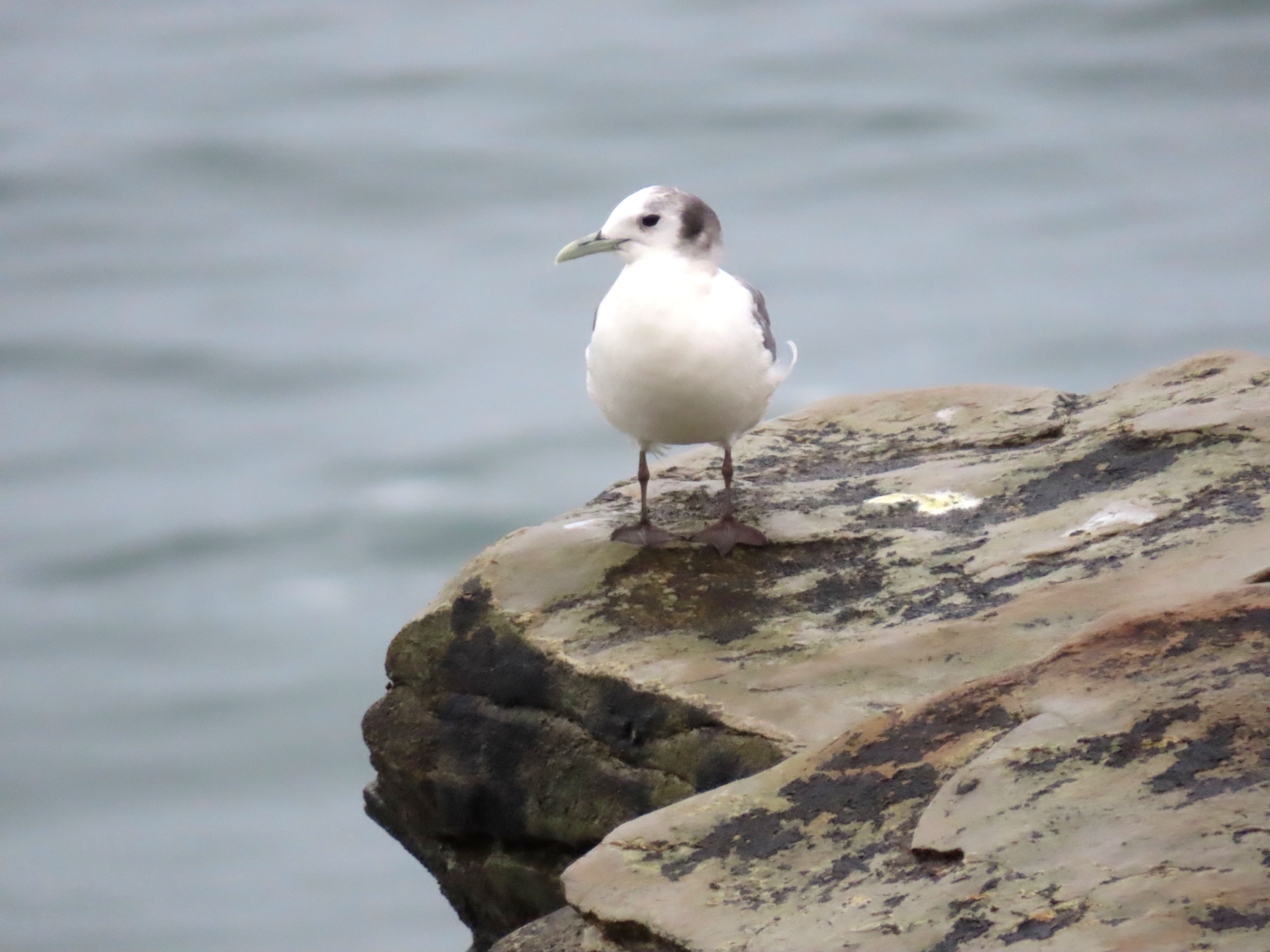
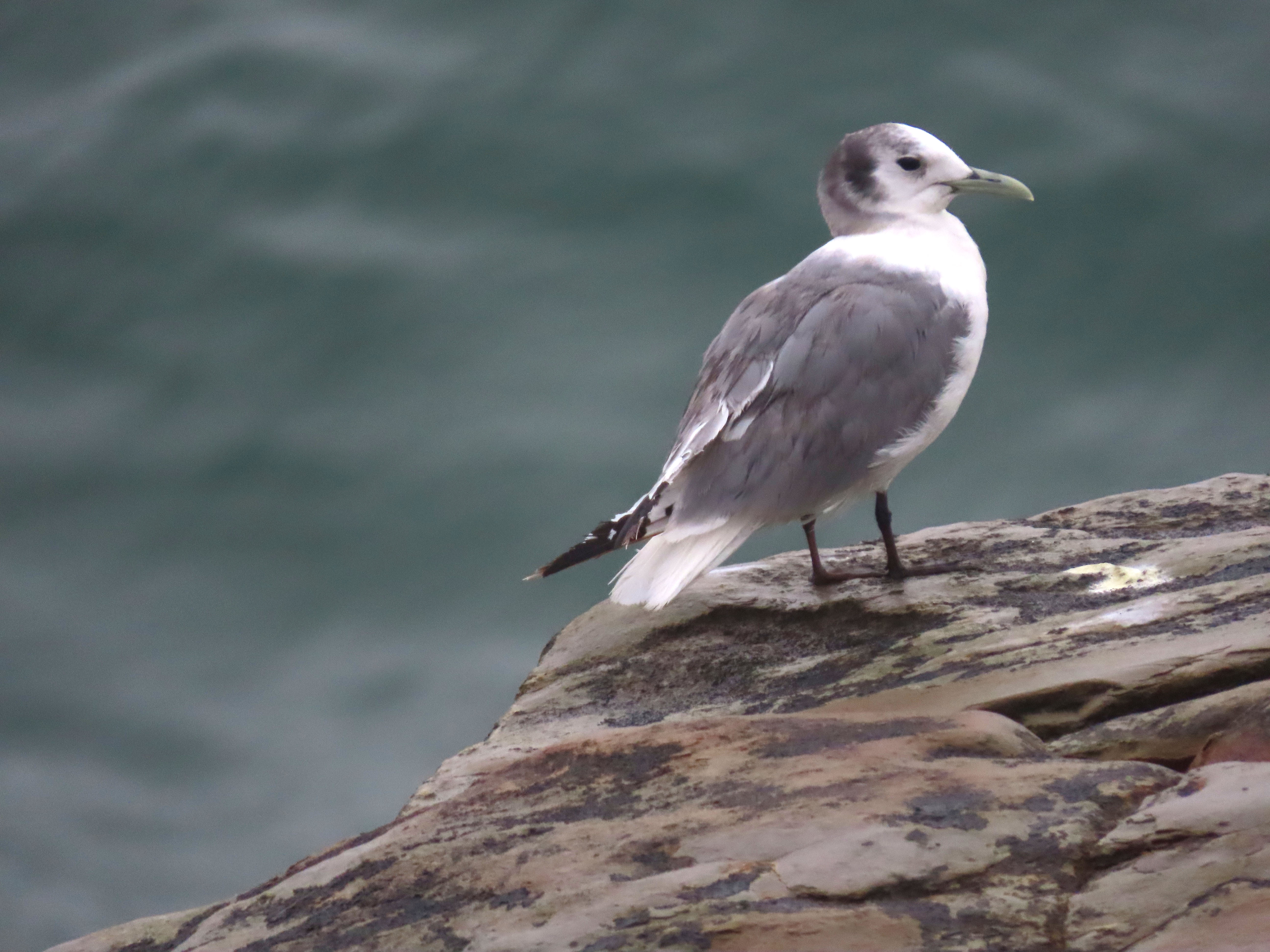
I turned and walked west, towards Woodrow and I soon saw a lone whitish bird perched on the rocks. It was a bit too far to identify conclusively but I had a hunch that this was the kittiwake. I picked up my pace and then stopped to raise my bins. It was most certainly a kittiwake! I was now almost jogging because I wanted to take a few photos before the bird flew.
By the time I was inline with the bird on the cliff, I was about 20 yards away and the kittiwake showed no signs of leaving anytime soon.
I was able to get some great shot of the kittiwake in the even gray morning light. It did not seem threatened by my presence, this was a bird that spent the majority of it’s life at sea after all. It then took to the air, circled around twice and them flew west.
Just then a local birder arrived and I gave him the news that he had just missed the bird. We stood around chatting about attempts to see kittiwakes in the county and he then turned to leave, heading towards his car parked on Woodrow. Just then, the kittiwake returned to the cliff and I called out “Kittiwake!” and the birder returned to confirm it’s existence.
Clearly the “squirrel-proof”, pepper-infused suet is not working. When I restocked four suet cakes into the suet feeder for the first time this season, it didn’t take long for the local gray squirrels to visit the feeder.
The squirrels do have a habit of eating some suet, pausing, as if thinking, “Damn this is hot!” before going back for a second helping. The chickadees, juncos, Steller’s jays, and song sparrows enjoy the spicy suet but it is definitely not squirrel proof!
On the first night that I set out the suet, at about 8:20, I heard an audible thump on the deck.
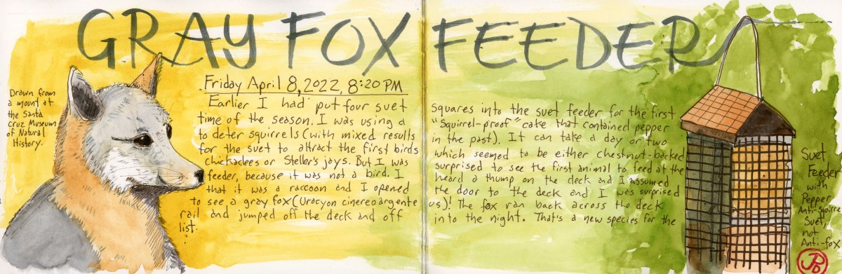
When I went to have a look, I fully expected to see a raccoon, which are infrequent nocturnal visitor to the feeder. But instead I was surprised to see a gray fox, having a nibble at the feeder.
The fox instantly turned around and sprinted across the deck railing and then jumped off the deck and into the night leaving me gobsmacked. What an amazing encounter! This was the first gray fox I had ever seen in the park! And it had come to visit my suet.
The only other gray foxes I had seen in the county were ex-gray foxes lying by the roadside.
This sighting increased my yard mammalian list to five: grey and red squirrel, raccoon, striped skunk, and now gray fox. (I could add mountain lion but a neighbor reported this apex predator passing between my cabin and my neighbors, but I didn’t see it myself.)
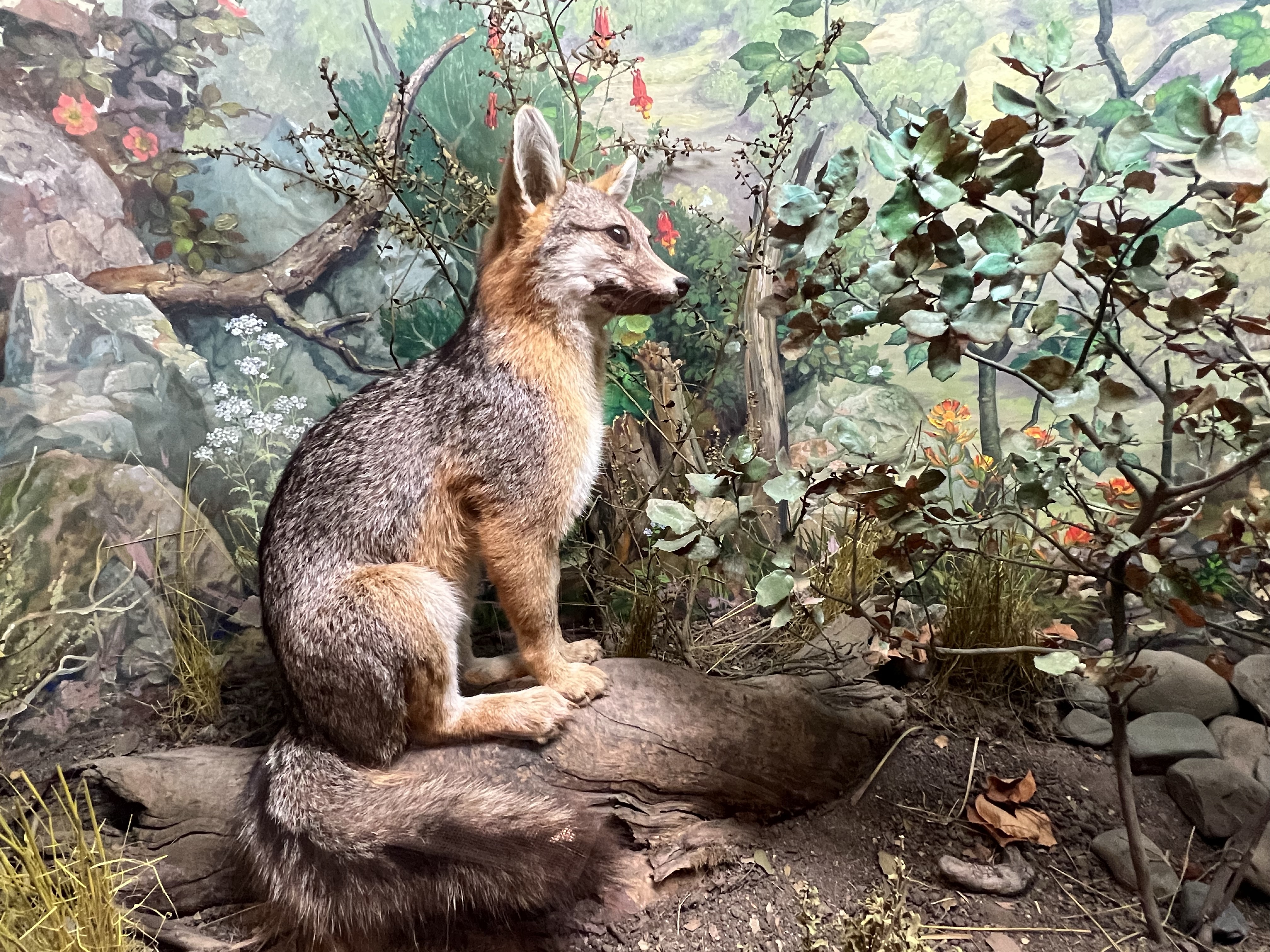
I knew I wanted to do a sketch about the encounter but I wondered how I could do a sketch of a gray fox. I wanted to shy away from copyrighted photographs online , so I chose to sketch an ex-fox, at the Santa Cruz Natural History Museum.
I went to the museum and found the display that included the taxidermy gray fox (Urocyon cinereoargenteus). These mount museums are a sketcher’s delight because you can sketch many reptiles, butterflies, fish, birds and mammals that are not moving. I felt like I was channeling the sprit of John James Audubon.
The gray fox at the Santa Cruz Museum of Natural History.
While Grasshopper and I were birding Mines Road and Del Puerto Canyon, a rare flycatcher for the West Coast was found on a barbed wire fence just north of Cement Plant Road in Davenport. I wasn’t going to able to look for it until the following Friday, that is, if it hung around.
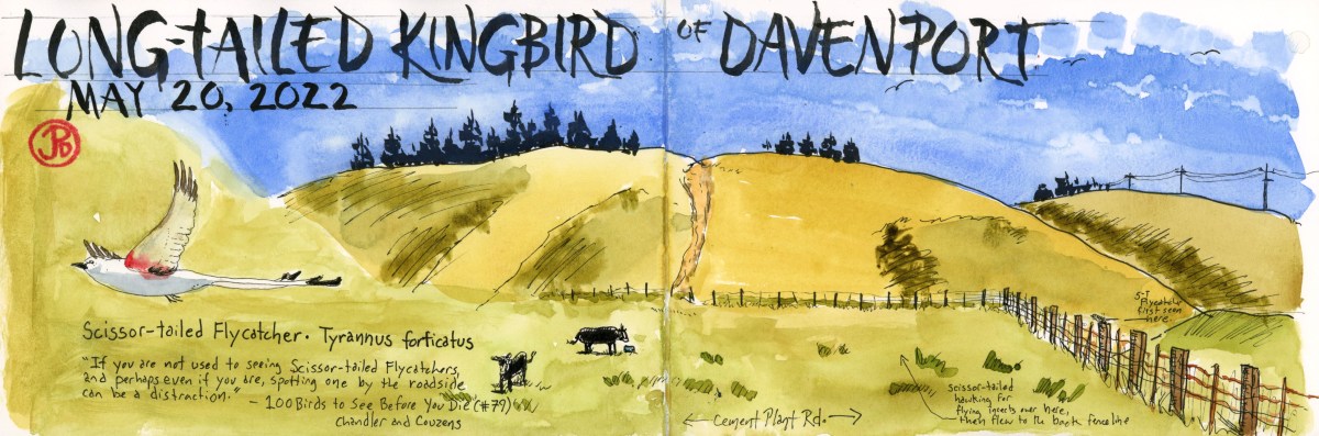
This is arguably one of the most beautiful flycatchers in North America. This is Tyrannus forticatus, the scissor-tailed flycatcher. The flycatcher looks like a kingbird (it is actually related to the western kingbird) with a forked tailed that is twice the length of it’s body. In the book 100 Bird to See Before You Die by David Chandler & Dominic Couzens, the authors rank the scissor- tailed on the list at number 79, ahead of vermillion flycatcher, magnificent frigatebird, angel tern, paradise tanager, tufted puffin, and greater flamingo (all birds I have seen in the wild.)
The adult scissor-tailed was not where it was supposed to be (something all birders love). The bird summers and breeds in the southern middle of the United States, in Texas, Nebraska, eastern Colorado, and western Louisiana. But all this kingbird needs is an open pasture, some cows, lots of hunting perches( like a barbed wire fence), and a sky full of flying insects.
I got off work early because of a buy back day to pay us back for the extra hours of open house and I headed to the coast on Highway 92 and then south on Highway 1 toward Davenport.
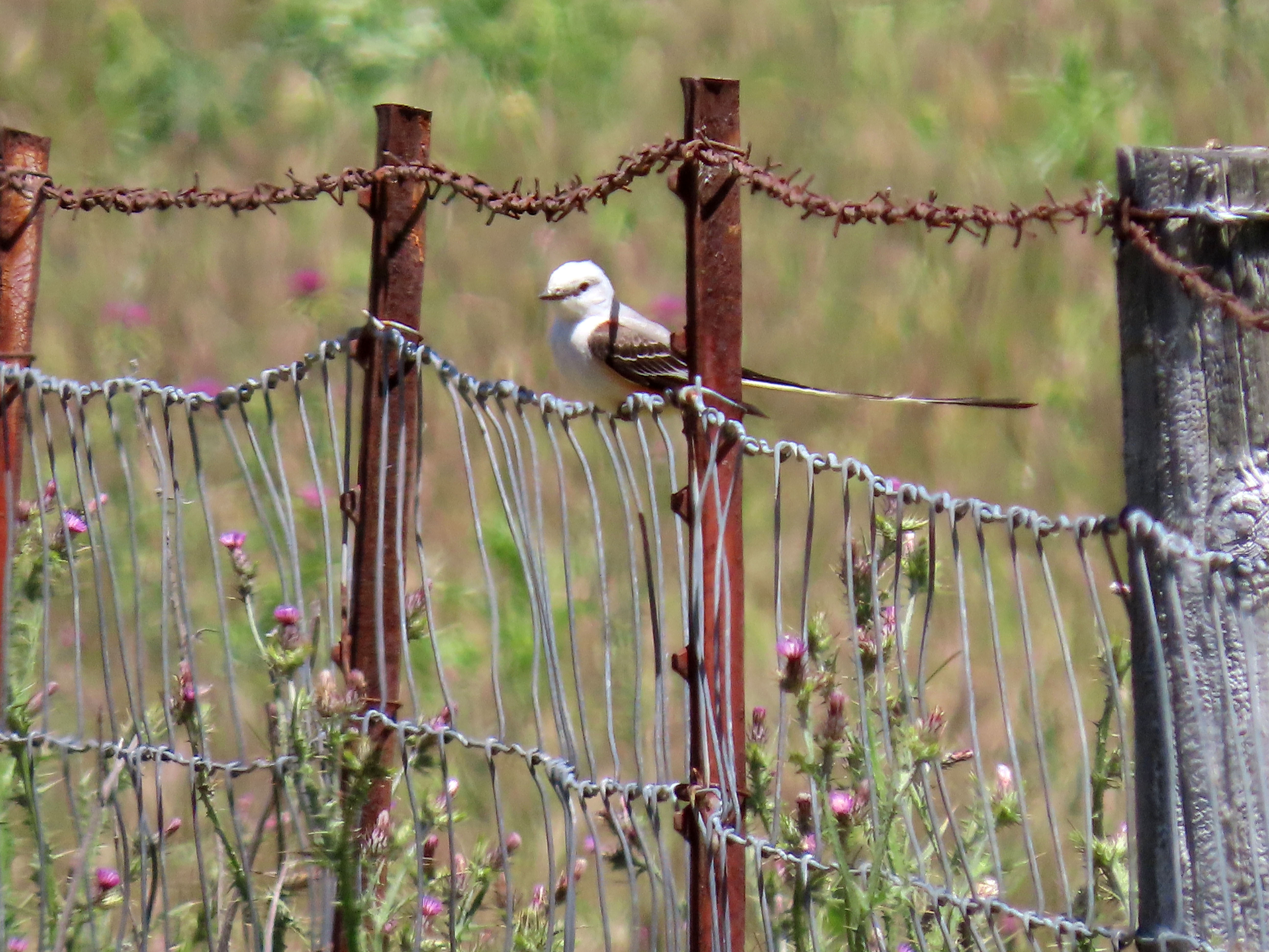
Some birds are extremely hard to add to your life or county list such as rails, wayward warblers, and some thrashers but it is always nice to have a bird handed to you on a plate (a live bird of course!). This was the case with the “Long-tailed Kingbird of Davenport”. As I rolled up, five birders where already peering into the cow pasture along Cement Plant Road. The flycatcher was perched on barbed wire about 30 yards out. This was much closer than it had been seen by others over the past six days!
This is not only a beautiful flycatcher but it is also a pleasure to watch as it is in motion for most of the time, pursuing flying insects from it’s fence perch. It would also fly down to the grass to catch insects on the ground.
This was a wonderful and unexpected Santa Cruz County bird!
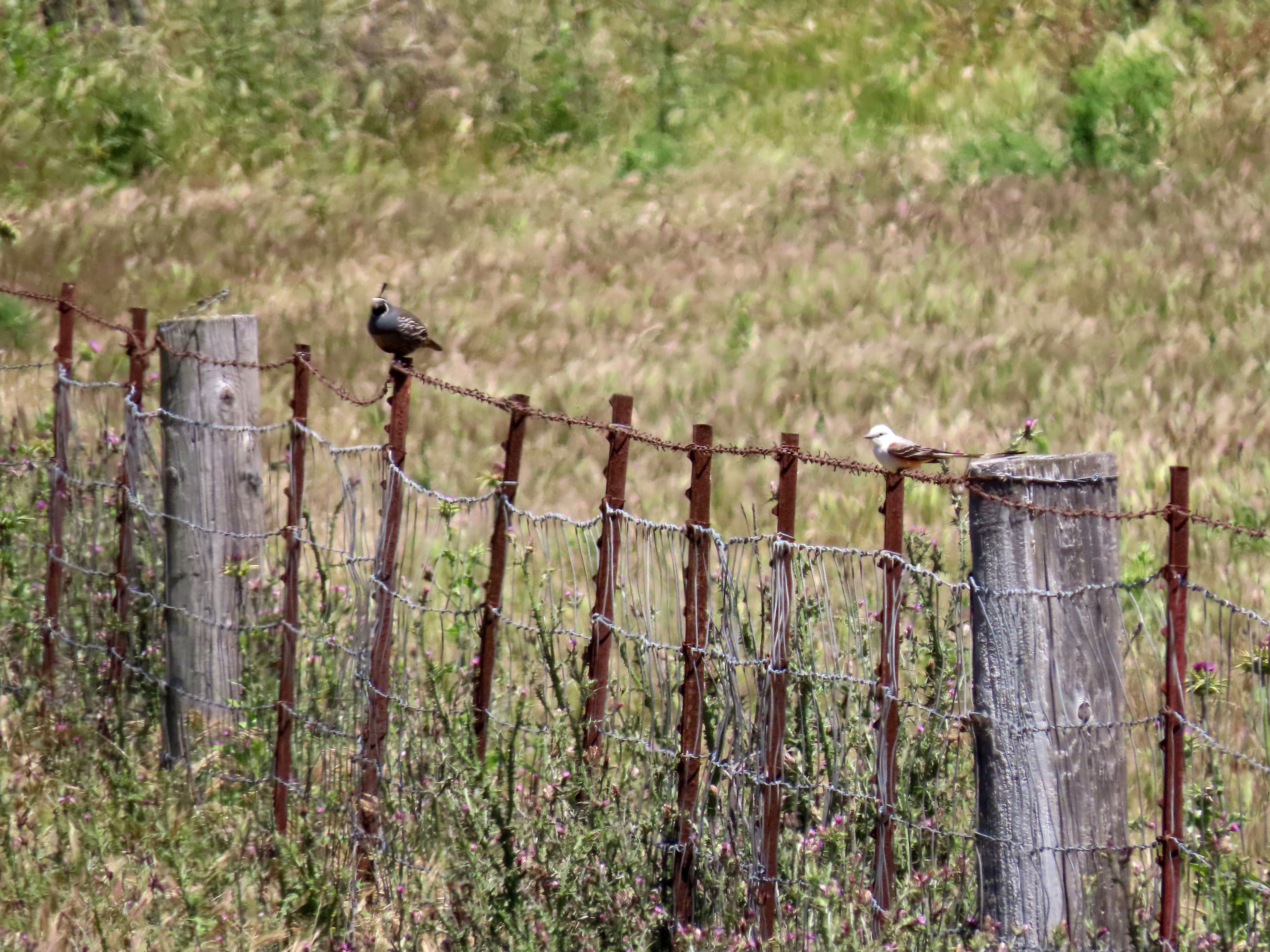
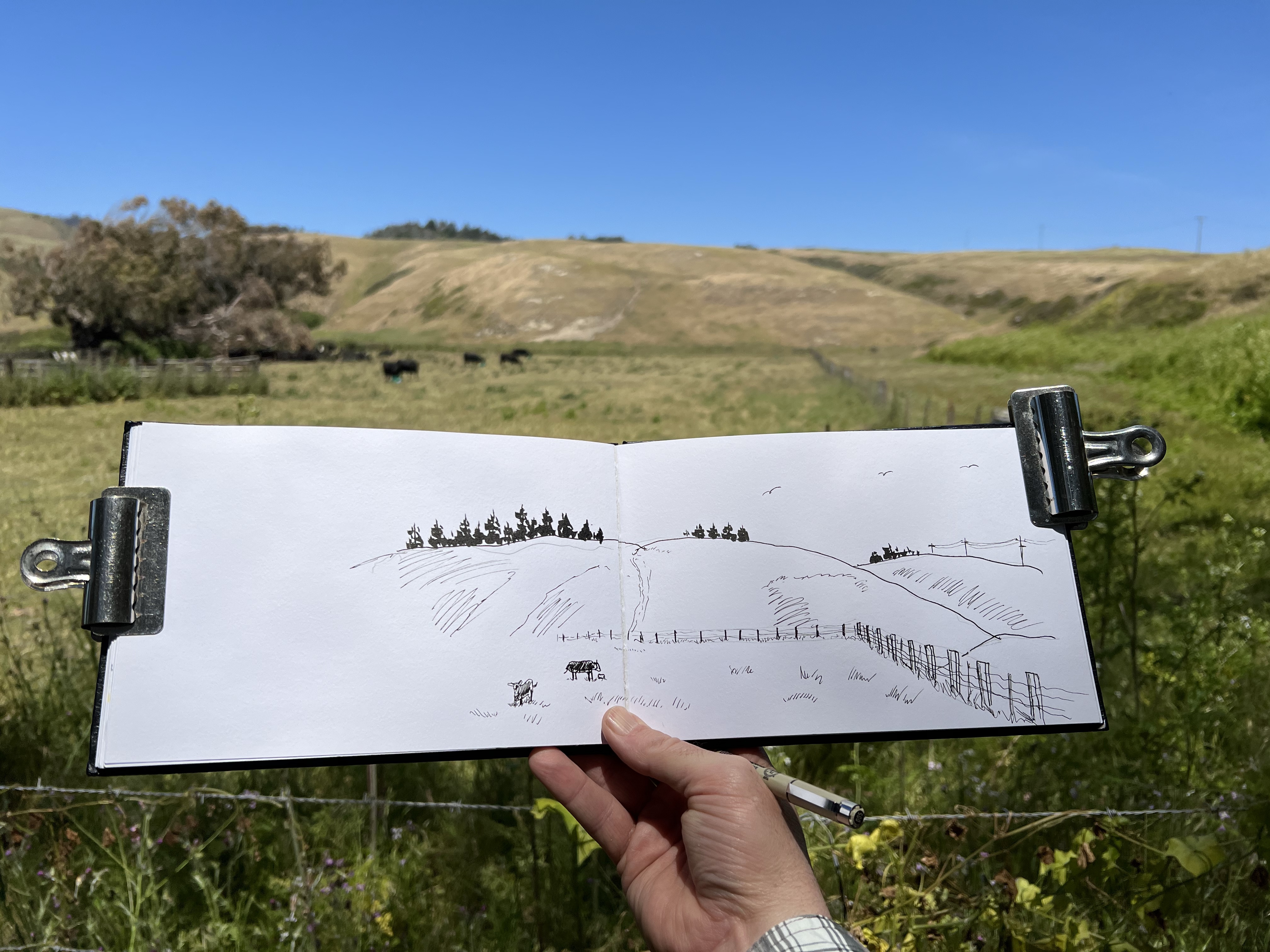
You don’t see this combo everyday: California quail and scissor-tailed flycatcher.The anchor for my sketch was a field sketch of the cow pasture where I first spotted the scissor-tailed flycatcher. Full disclosure: while there were many more cows in the pasture, I only drew two. I try to follow a whole foods, plant-based diet after all! And don’t get me started about cow farts.
There was one airplane that loomed larger than others in my childhood: the Lockheed P-3 Orion, the submarine hunter. I loved this plane more than the supersonic jets like the F-4 Phantom or the F-14 Tomcat.
The four turboprop patrol plane would pass by my bedroom window on it’s final approach the Navy Base, Moffett Field. The roar of the four props where as recognizable to me as the call of the scrub-jays. I could identify the P-3 in flight as readily as a soaring turkey vulture.
I wanted to make another sketch of my past and bolstered by my sketching experience at the Castle Air Museum, I wanted to find an example of a P-3 on static display because sketching large unmoving objects makes sketching a bit easier. Much easier.
After doing a little research and reconnoissance through Google Earth, I found my subject near the control tower for what is now known as Moffett Federal Airfield. It was a P-3 Alpha or P-3A for short. Now it was time to sketch it.
Parts of the former Naval base are now open to the public so on a Saturday morning, Grasshopper and I ventured forth with our sketching bags to put the P-3 Orion into our sketchbooks.
While we were at Moffett we also visited the excellent Moffett Field Historical Society Museum which covers all the stages of this former base, from the USS Macon to NASA.
A P-3 flight simulator in the parking lot of the Moffett Field Historical Society Museum.
After visiting the museum we walked south, past the enormous Hangar 1, to the patrol plane, set up our sketching chairs and began to sketch.
The Lockheed P-3 Orion was an extremely successful marine patrol airplane which made it’s way upon the world’s stage in October 1962 as it buzzed two ships bound for Cuba during the Cuban Missile Crisis. It was designed to be used for marine patrol, reconnaissance, and anti-submarine warfare. The P-3 joins the list of aircraft which includes: Boeing’s B-52 and KC-135, and Lockheed’s C-130 and U-2 which have been in service for over 50 years.
Moffett Field was home to squadrons of P-3s which patrolled the Pacific Coast, on the look out for Russian submarines. In honor of this workhorse, one P-3 was put on public display. This was the plane now sat in front of me as I began to sketch.
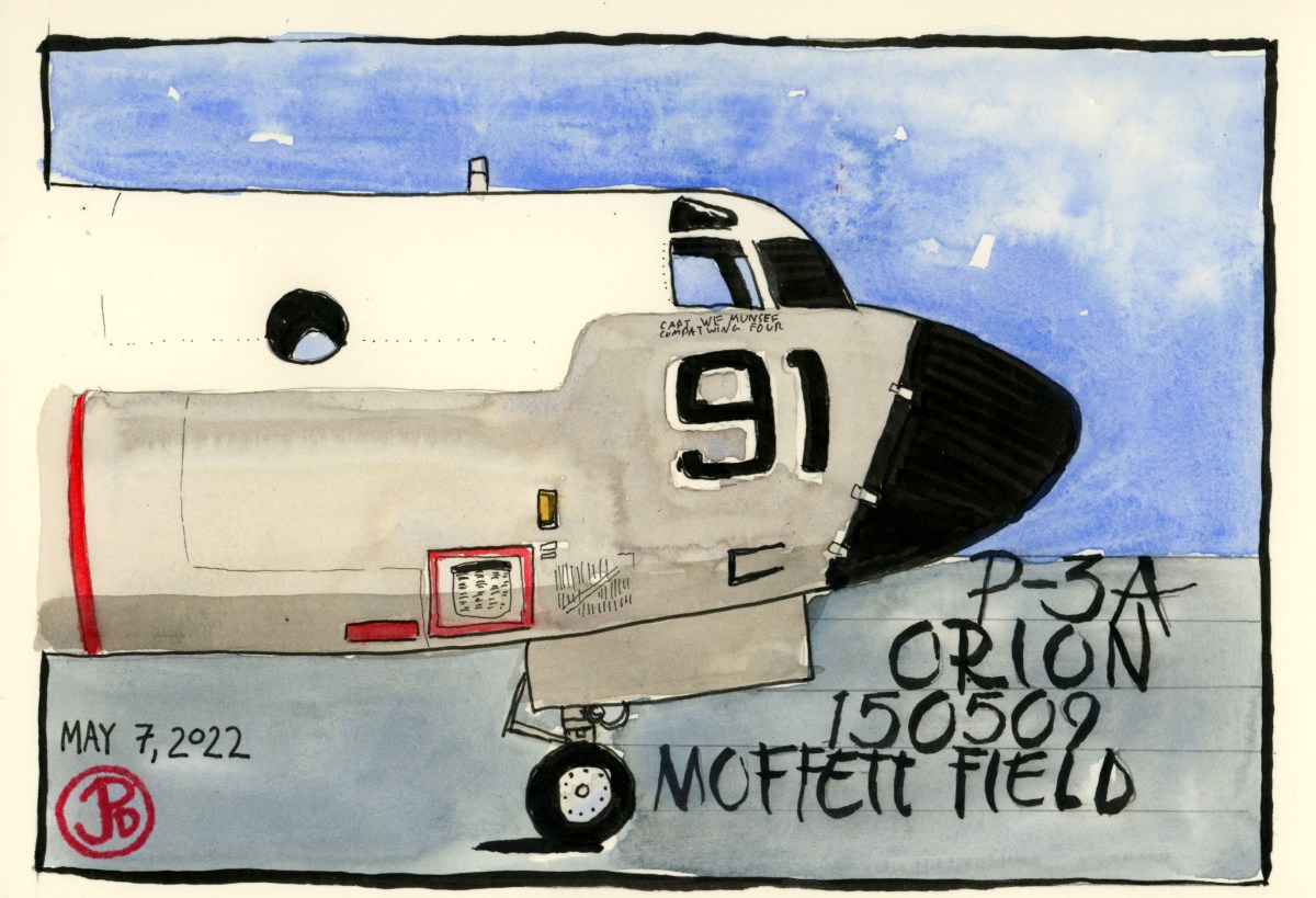
The airplane before me was a P-3A BuNo. 150509. It had a long career serving as a training aircraft and served in many squadrons. She flew 9,914 flying hours and was retired after a 29 year career, where she was the last Alpha in service. This is much more efficient and economical than the Navy’s dirigibles or blimps.
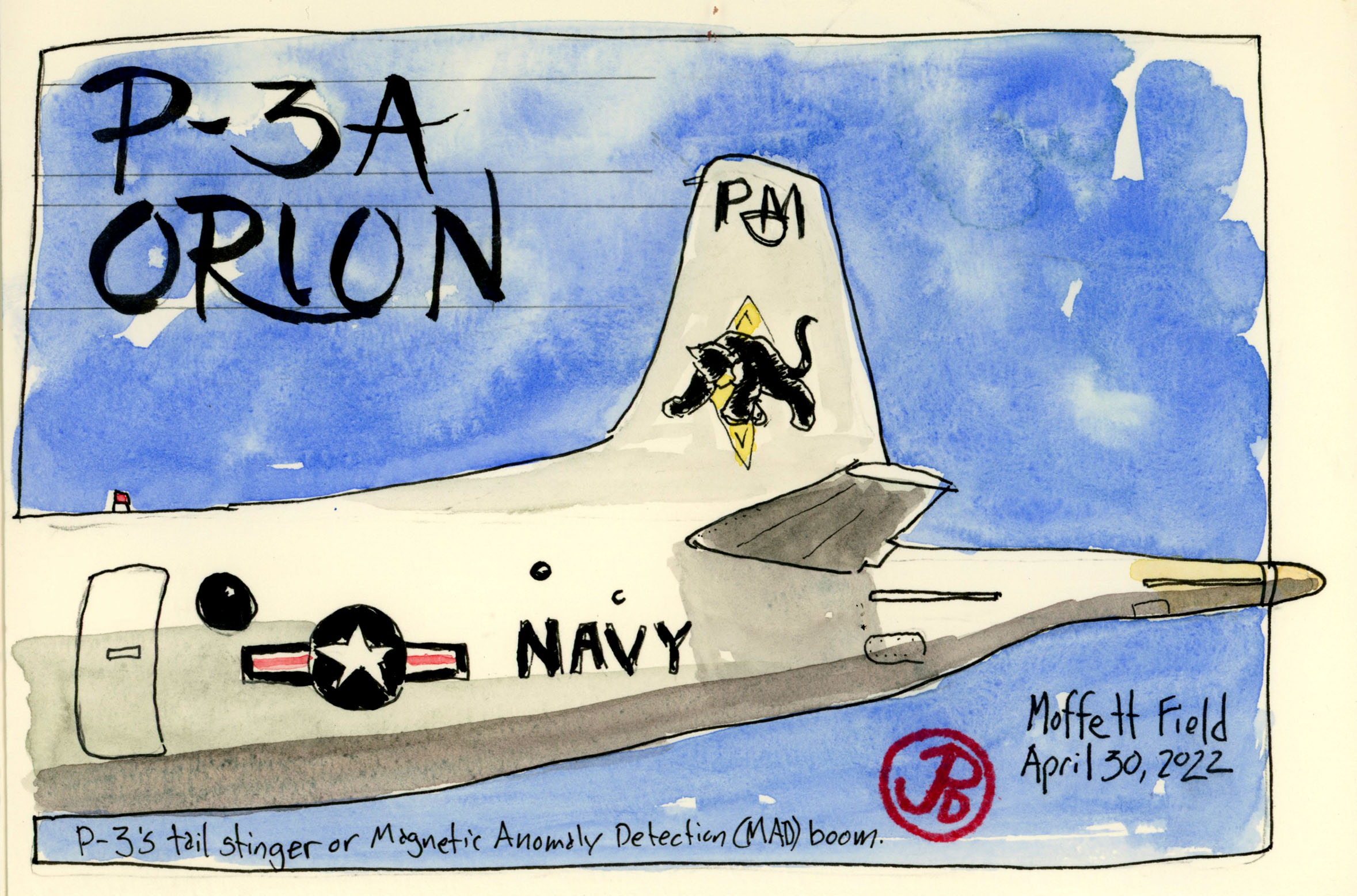
I did three sketches of the P-3A. One head on and two detail sketches of the front and tail of the plane. The distinctive “stinger” tail of the the P-3 houses the Magnetic Anomaly Detection (MAD) boom which detects submarines under the water.
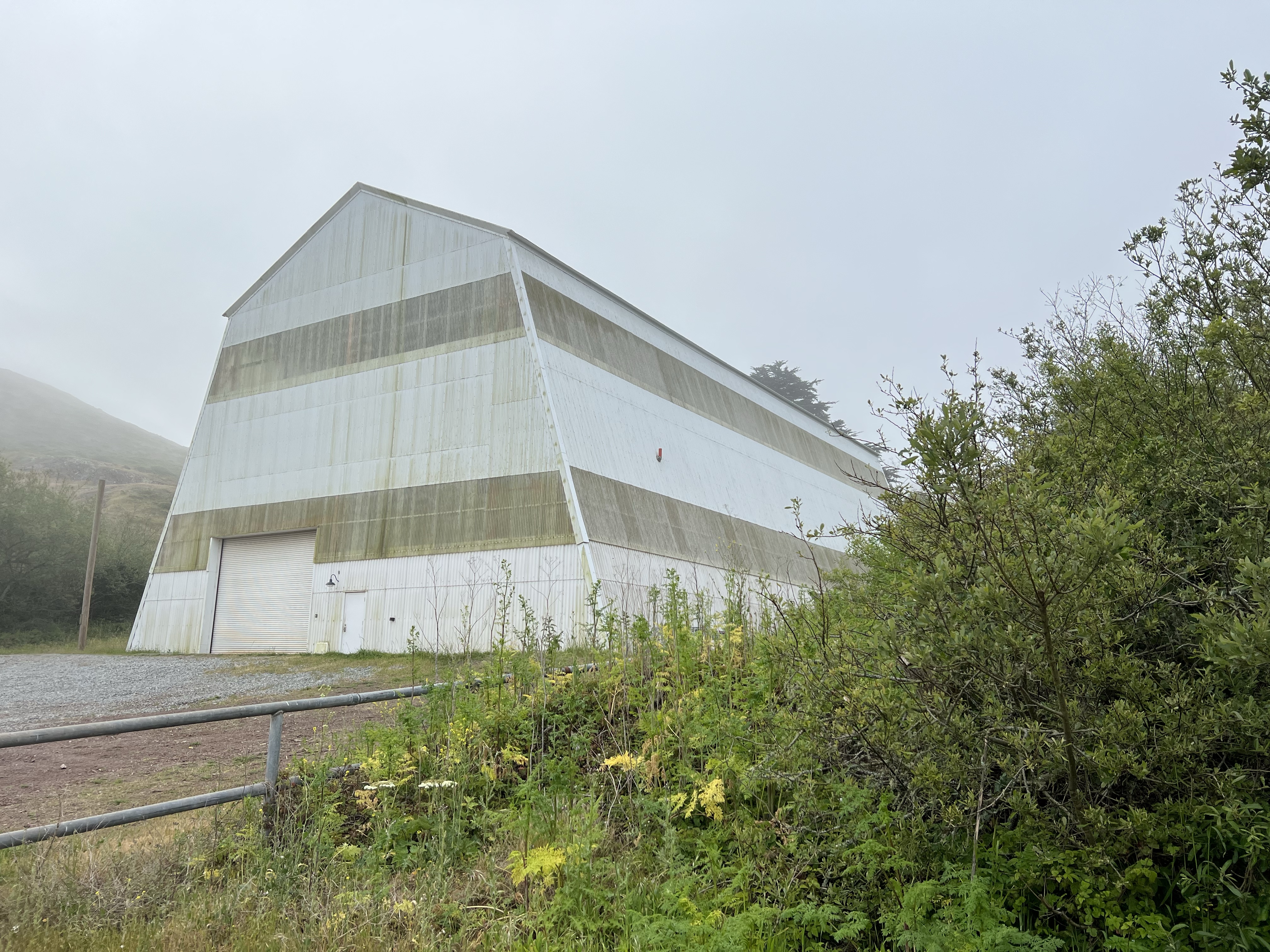
I had driven by it perhaps 30 times during a hawk banding season as a volunteer hawk bander for the Golden Gate Raptor Observatory (GGRO) and I had thought, there’s another military building. This one was big and gray and it reminded me of an oversized barn. This impression made sense because of the horse stables in front of the “barn”.
It turns out that it was a barn of sorts, not for horses but blimps.
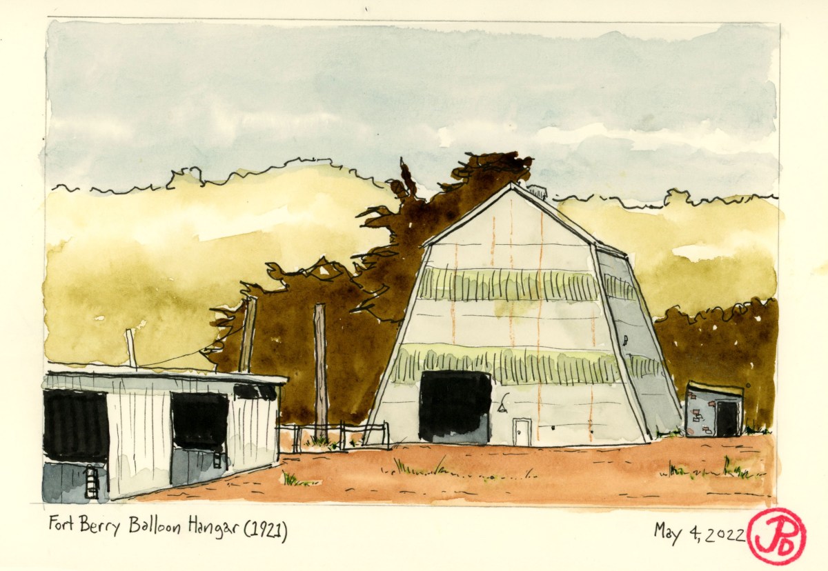
This structure is the Fort Berry Balloon Hangar and it was completed on June 27, 1921 for a cost of $99,893.50. At that time the Army was experimenting with tethered balloons for coastal surveillance. Things didn’t turn out so well because the hangar was built and abandoned in the same year (1921). The military sure knows how to spend money! And taxpayers where left with an oversized gray vehicle shed, which what it is used for today.
This is the only surviving blimp hangar of its type that actually housed army balloons. Now it is used to store tractors and other vehicles, according to the man feeding the horses.
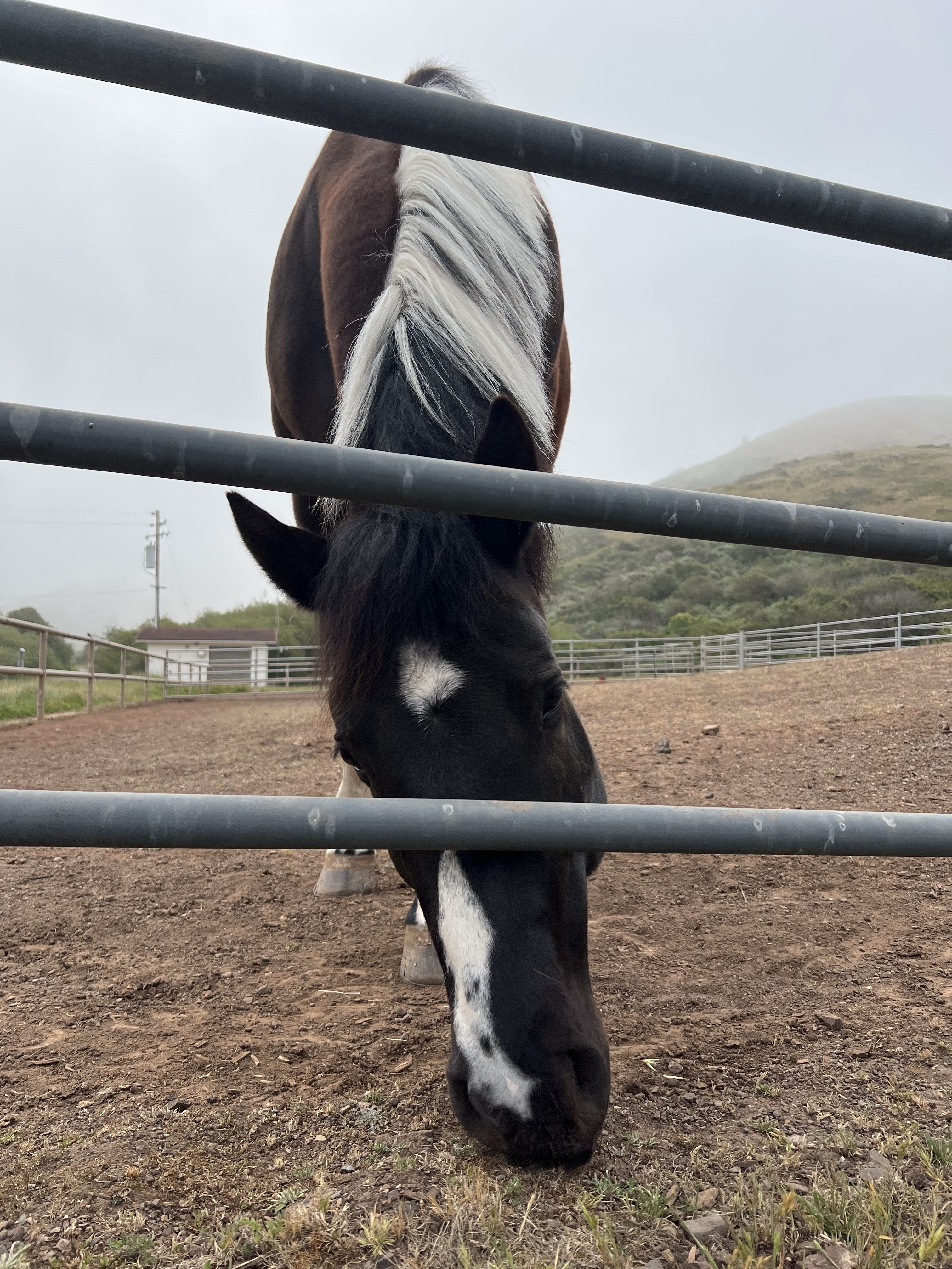
The horses are stabled at the Presidio Riding Club in the buildings that where originally built as vehicle sheds.
In my field sketch I included part of the stable on the foreground. I also used a little sketcher’s license by opening the door in the hangar. Shhh don’t tell!
A friendly horse boarded at the Presidio Riding Club, just in front of the blimp hangar.
While the Coqui frog is lionized in its native Puerto Rico as the unofficial National animal, the diminutive frog is the scourge of the Hawaiian Islands!
There are 16 species of Coqui frogs whose common name is onomatopoeically named for their loud mating calls: “Ko-kee”. This small tree frog is about the size of a penny (15-80 mm). But they have a very big voice.
Their calls can reach 100 decibels. To put that in some context, that’s louder than most power tools, dishwashers, food blenders, or a diesel locomotive from 100 feet away. And their calls are slightly less louder than your average rock concert.
On the Hawaiian Islands this frog is an invasive species. It was unintentionally introduced in the late 1980s through imported nursery plants. The frog competes with native species for food (mainly insects) and they have no natural predators (the Indian mongoose does not climb trees) so in some parts of the islands they have reached levels of 2,000 frogs per acre!
The Coqui frog, along with the common myna, finds itself on the IUCN’s list of the 100 of the World’s Worst invasive Alien Species. While they are harmful to native wildlife, they are they harbingers of many a sleepless night.
On the Kona side I had no problems with Coquis and it wasn’t until I was on the windward side and specifically the town of Hilo where I encountered their dubious reputation.
And they are notorious around the Dolphin Bay Hotel. This Hilo mainstay is a wonderful family run hotel just across the Waikuku River from the historic downtown. The staff are friendly and informative and the rooms are a pleasant throwback to another era (it was built in 1968).
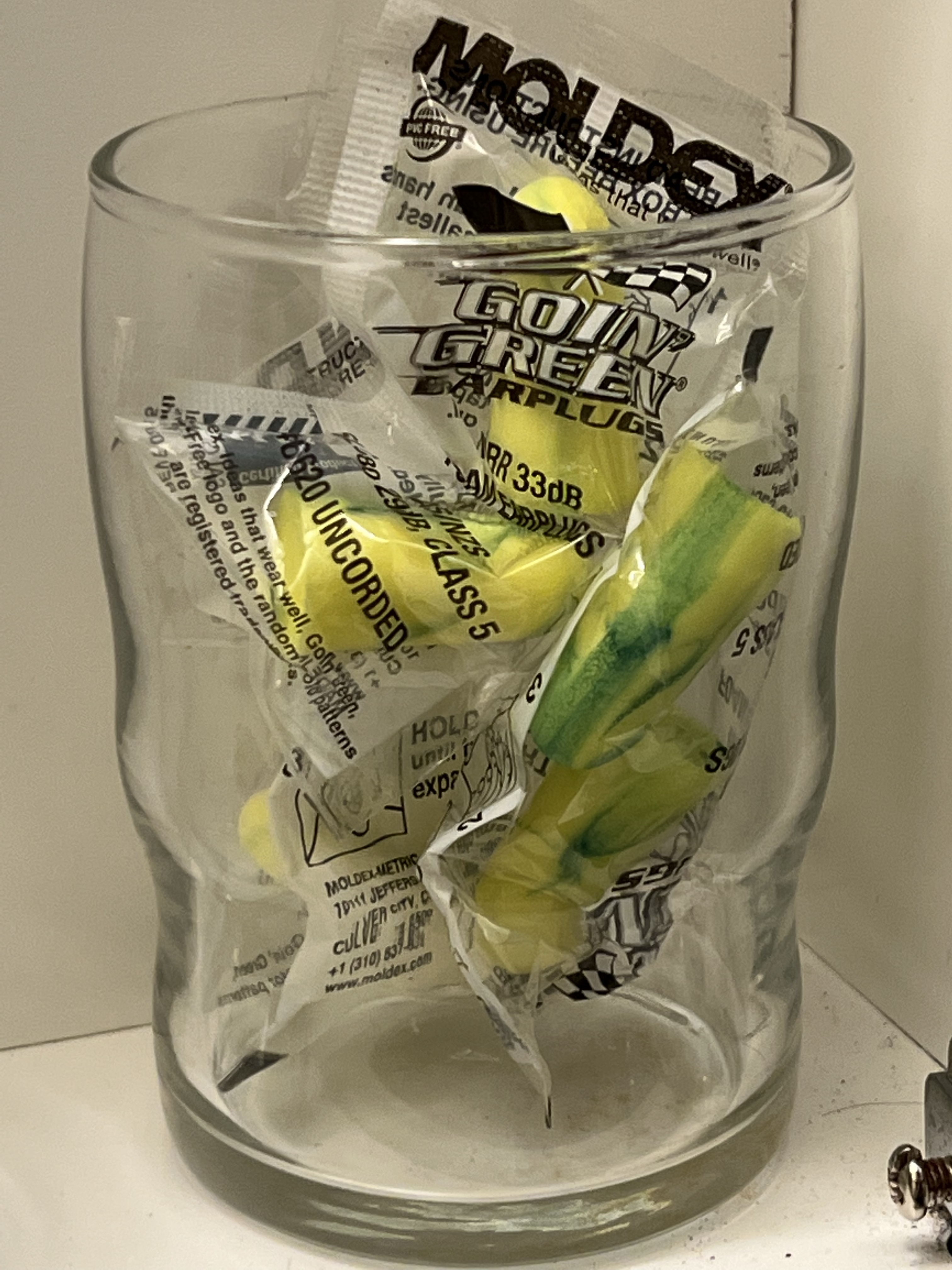
But what is not so pleasant is the incessant chorus of frogs from dusk to dawn. Shutting all the windows and blasting the fan can’t completely cover the frogs! So I used one of the traveler’s best tools: earplugs.
The Dolphin Bay Hotel provides complementary earplugs.
This side of the Big Island averages 130 inches per year. Rain and watercolor field sketching don’t always go hand in hand. So many of the subjects that I wanted to sketch where not going to happen.
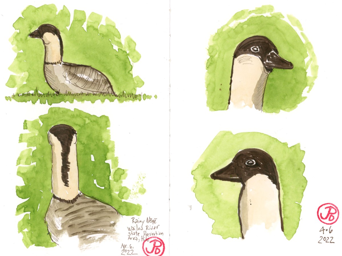
I headed to Wailoa River State Recreation Area to do some field sketching of Hawaii’s state bird, the nene or Hawaiian goose. Geese don’t mind the rain and that they had recently been reported in this park.
When I got there I immediately spotted nene, grazing on grass near the water. Trouble was that water was coming from above, which would make sketching in the open a really task.
I attempted to sketch but the pursuit was given a rain delay. Here, in front of me was a great opportunity to sketch an iconic Hawaiian endemic but the weather was not on my side. I attempted to sketch until the cover of a large tree but raindrops still fell on my sketchbook. So I retreated to my rental car, also know as my sketching blind.
The flock of nene wandered close to the parking lot, grazing on grass so I was able to get a series of sketches in, despite the rain.