Why has it taken me so long to read Truman Capote’s “non-fiction novel” masterpiece In Cold Blood (1965)? I’m not quite sure.
I’ve known about the book and basically knew what it was about but I had never picked it up to read it. Simply a case of “too many books, too little time”.
In Cold Blood is a true crime account of the shocking murders of four members of the Clutter family in their rural Western Kansas farm house.
The killings were a result of a botched robbery by two ex-cons, Dick Hickock and Perry Smith.
Hickok was told by a fellow cell mate, who had worked for Mr. Cutter as a farmhand, that Mr Clutter was a rich man and had a safe in his office full of cash.
This was far from the truth. There was no safe, no huge amounts of cash. Hickock and Smith left the house with a small transistor radio, binoculars, and just $40.
What In Cold Blood does better that most “true crime” accounts is getting into the mind of a murderers and answering the question what makes a man kill another man, in cold blood.
Capote was able to do this by cultivating a friendship with the murderers, especially Perry Smith. This is shown in the film Capote (2005) with a brilliant performance by Phillip Seymour Hoffman as the southern writer.
In Cold Blood was Capote’s last great work. The book took six years to research and write and this prolonged process somehow destroyed him and he was never the same after and never finished another novel.
He became a regular on talk show where he was a true celebrity.
One of the more interesting tunnels on the South Pacific Coast Railroad is Tunnel No. 5 in Zayante.
This is one only two tunnels on the former South Pacific Coast line that is still in use, although not by a railroad.
As the railroad climbed its way up Zayante Creek it came to a granite outcrop that the builders could not go around or over so they had to tunnel through it.
Granite is stable and solid and because of that they did not have to add any interior wooden supports. When completed Tunnel No. 5, at 250 feet, was the second shortest on the line.
The tunnel was active until the Southern Pacific’s abandonment in November of 1940.
The tunnel began it’s current use in 1952 when the Western States Atomic Vault Company bought the tunnel, sealed both ends and used Tunnel No. 5 as a fire-flood-nuclear-proof storage silo, housing records (mainly microfilm and microfiche) for many companies including Disney. The silo officially opened on May 2, 1954.
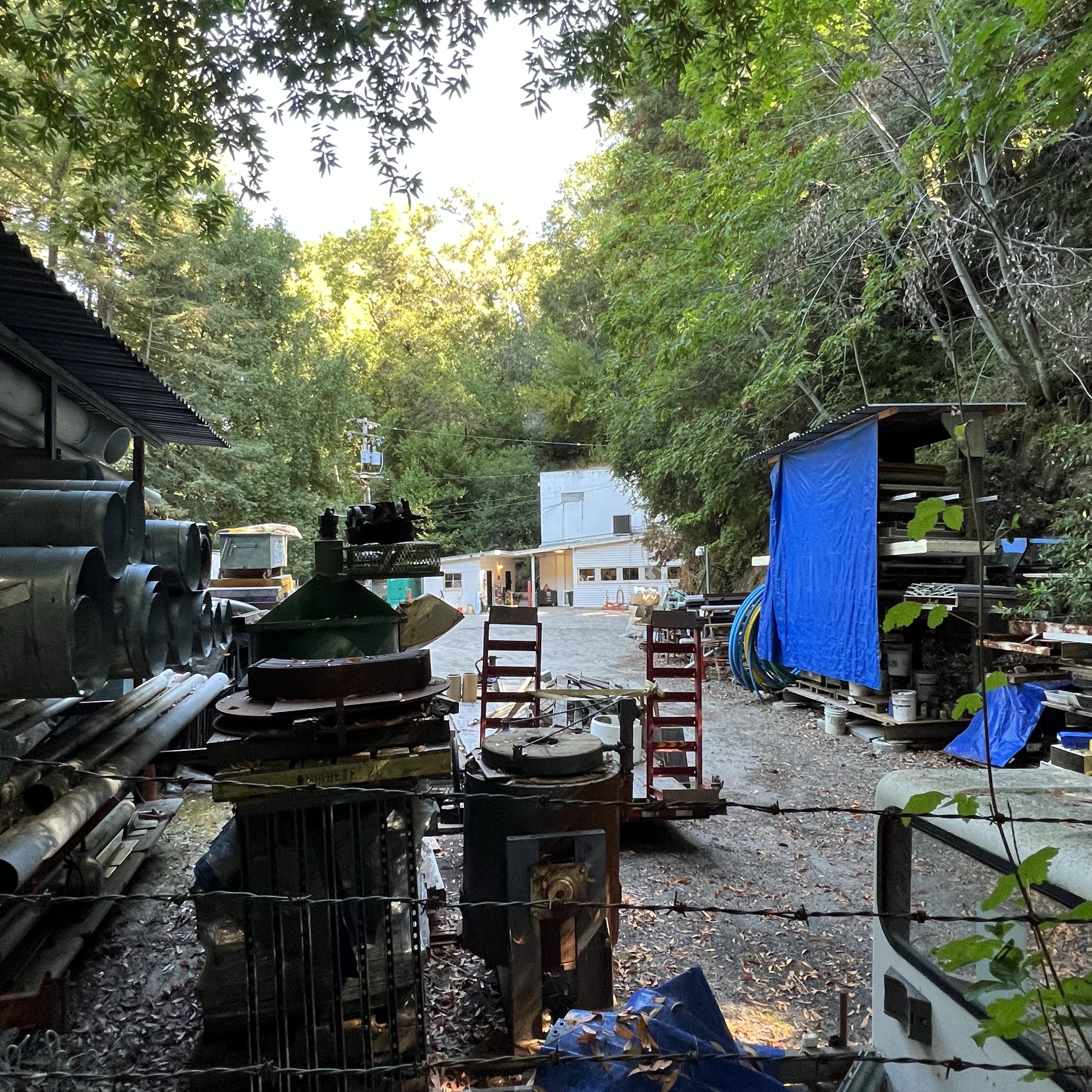
The eastern portal was made the entrance to the facility and a guard shack was built (featured sketch) where a guard was stationed 24/7. We did not see any signs of a guard so we could not ask for a tour. (The facility is currently owned by Iron Mountain).
In times past, the company would allow tours inside the facility and one visitor deemed it the “most interesting dull place in the world”.
One can only guess the nearly 70 year old “secret” files that now reside in the former railroad tunnel known as Tunnel No. 5.
Peeping through the fencing toward the eastern portal of Tunnel No. 5. One of the two windowed buildings appears to be the guard shack. The parking lot now looks like an odd junk sale with junk that no one wants to buy!The former rail bed (sans rails) looking towards Eccles and Felton and Santa Cruz.
On a historic rail sketching adventure, Grasshopper and I headed up into the Santa Cruz Mountains to sketch a portal of one of the longest rail tunnels on the former South Pacific Coast Railroad (later Southern Pacific) route.
This 28 mile route started at Vasona Junction in Los Gatos and climbed over the Santa Cruz Mountains to the beach town of Santa Cruz.
Part of this route still exists as the Big Trees and Pacific Railroad which operates a tourist train from Felton to the Santa Cruz Beach Boardwalk.
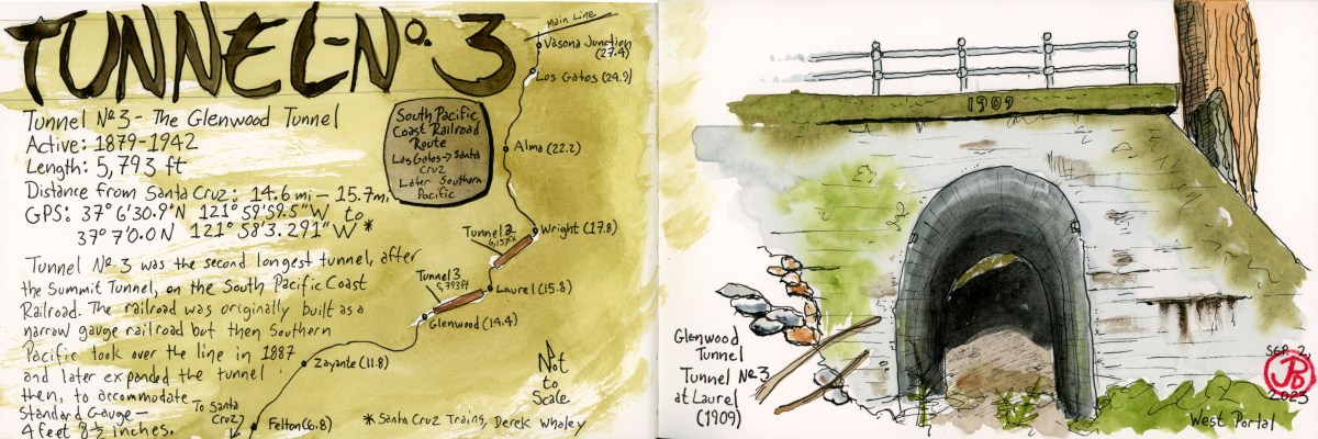
The tunnel we were looking for is the Glenwood Tunnel, also known as Tunnel No. 3. This 5,793 foot tunnel was active from 1879 to 1942. The original tunnel was built for narrow gauge but when Southern Pacific took over the line in 1887, they later converted the line to standard gauge (4 ft 8.5 in).
When the South Pacific Coast Railroad was first planned, then had to figure out how to get the road bed into the San Lorenzo Valley. To do this they had to built two one-mile long tunnels: Tunnel No. 2 (Summit Tunnel) and Tunnel No. 3 (Glenwood Tunnel).
From northbound Highway 17, we took the Laurel exit heading towards the former township of Laurel. We passed a few mountain homes and two bikers laboring up the hill as we headed down towards the former rail-bed.
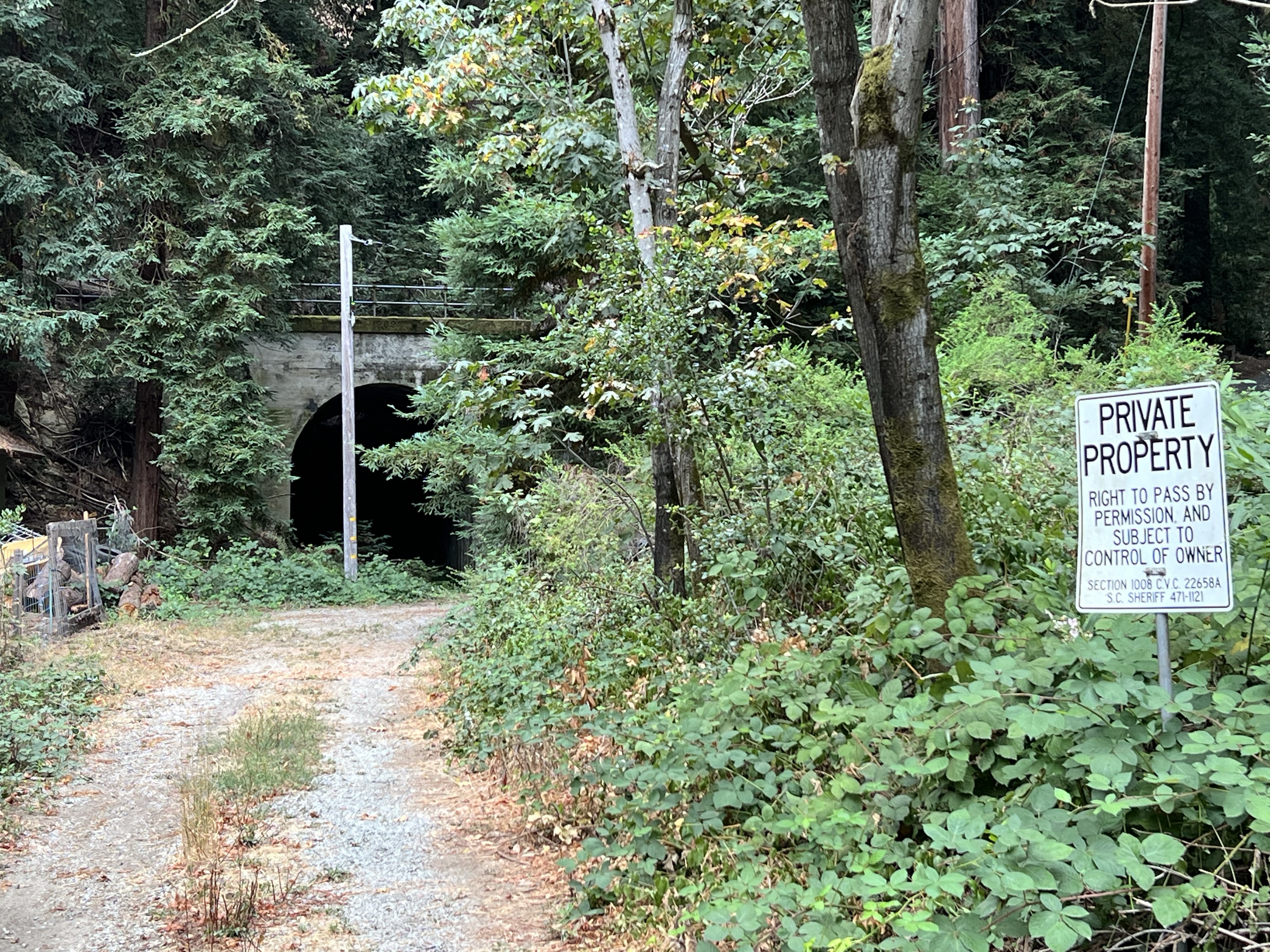
We parked and headed out to a get a better look. The west portal of the Glenwood Tunnel was visible, but parts were obscured by trees and a power pole. The “private property” sign kept us at bay. Was this the best view we would get?
The not-so-great view.
I climbed up a side road, probably also private property, that parallels the rail bed, to get a better sketching vantage point. Even here, the portal was obscured by redwoods but I started a sketch anyway (which, like Tunnel No. 3, I abandoned).
Not being satisfied with the sketch I returned to where Grasshopper was sketching. His only company was a barking dog on the other side of a fence. There was a house just to our left.
A man peeked over the fence with his cup of coffee and said, “You can walk up to the tunnel if you want.”
This was the owner of the house (let’s call him “Bill”) and we had a nice conversation with him about living in the redwoods, winter storms, history, his spring-fed water system, and trains and tunnels.
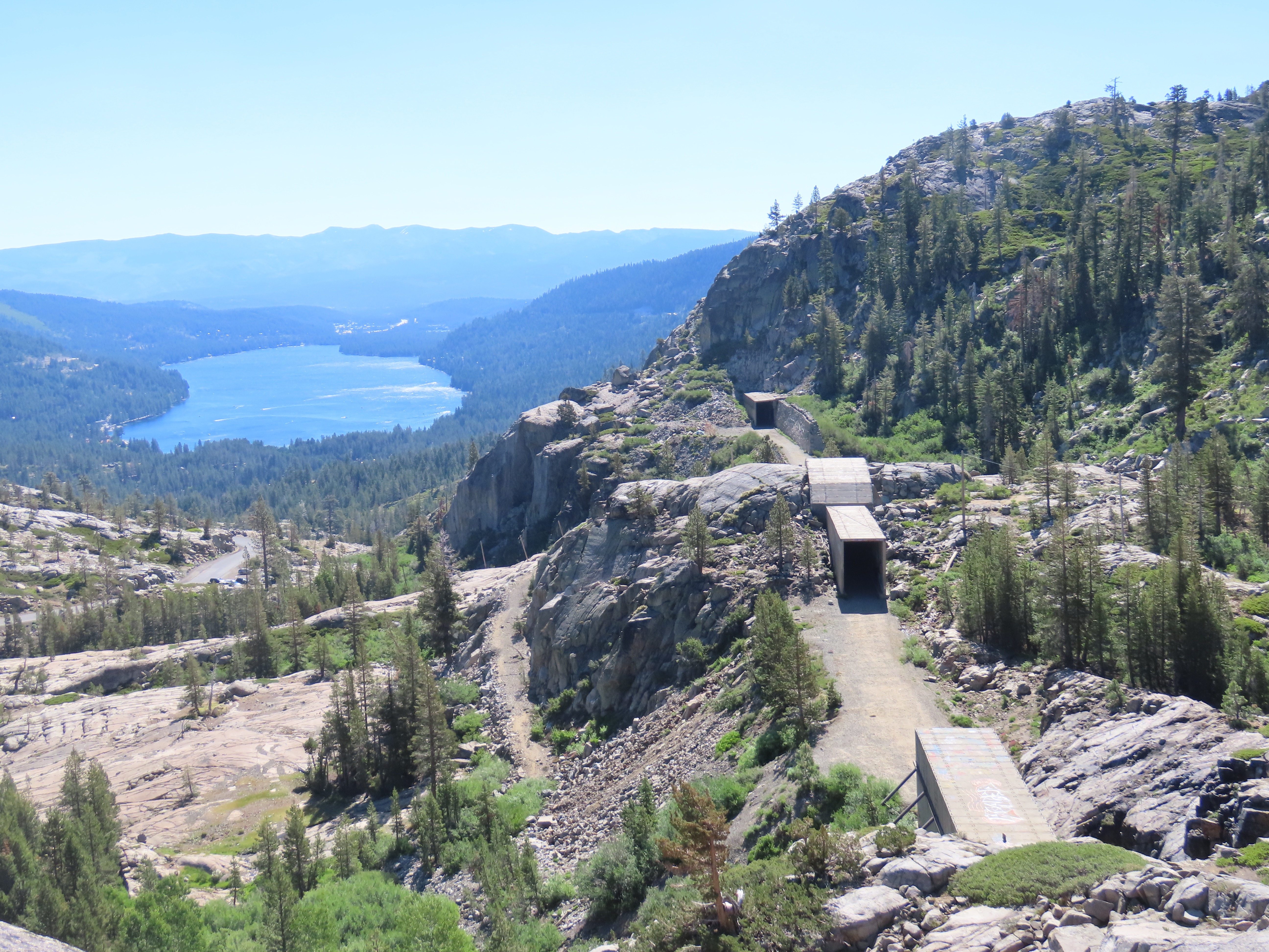
We thanked Bill and walked around the chain that crossed the rail bed and headed towards the western portal of the Glenwood Tunnel. Now this was the way to sketch the tunnel (featured sketch).
Grasshopper sketching the western portal of Tunnel No. 3. Bill’s spring-fed water system can be seen on the right.Corvidsketcher in the western portal of Tunnel No. 3.
We walked into the 1909 concrete portal. The tunnel ended in about 50 feet.
In 1940, winter storms and landslides closed portions of the route permanently. Southern Pacific made the decision to abandon the line. The major tunnels were dynamited at both ends, closing the tunnels for good. The concrete portals are all that still remain.
Now that we firmly had tunnel fever, we had to find the other side of the tunnel, the eastern portal.
Tunnel No. 3 now passes under Highway 17 so you have to cross over the highway to find the other end.
The eastern portal of the Glenwood Tunnel at Glenwood Drive.
The eastern portal of the Glenwood Tunnel is much harder to get to than the western portal. To get a comparable view you would have to scrabble down a steep hillside or trespass through a stable to reach the rail bed which now seems to be a creek bed.
So we had to make due and sketch the portal from the side of Glenwood Drive, which the concrete portal now supports.
On my latest sketching odyssey I headed to one my favorite locations in California, if not the world: Donner Pass.
Before I set out, I sketched the rail route of the East Slope of Donner Pass, heavily influenced by a map drawn by John Signor (author, artist, and former Southern Pacific employee) in his marvelous book: Donner Pass: Southern Pacific’s Sierra Crossing.
I would be driving parallel to the Central Pacific side of the first Transcontinental Railroad on Highway 80. In 1865 the railroad became Southern Pacific.
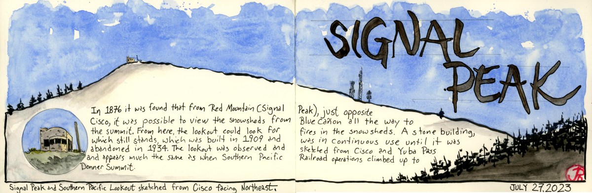
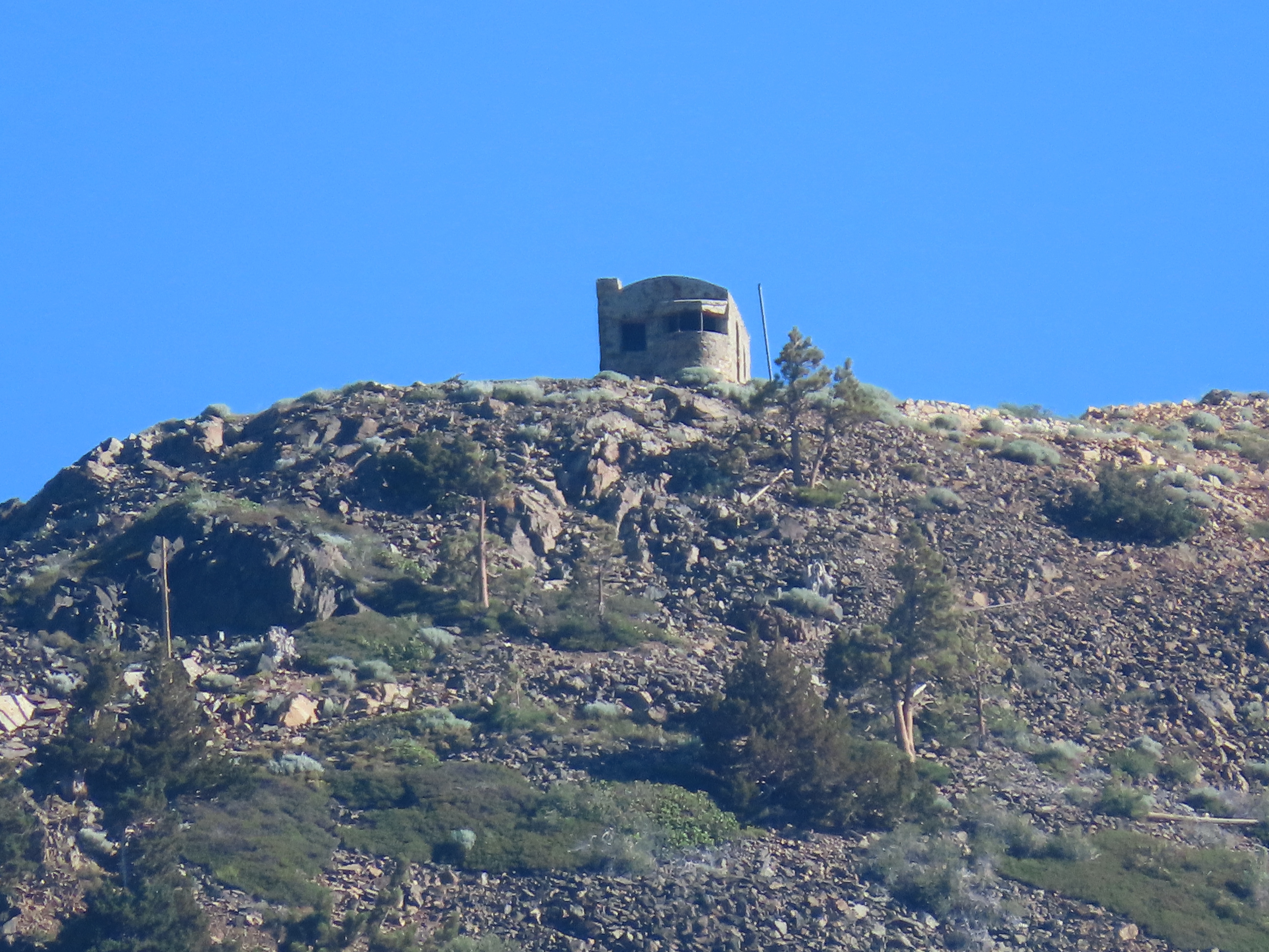
I was looking for a stone structure that was built in 1909 as a fire lookout and I reckoned that Cisco, which is directly across the valley from the building, would be my best position for seeing Southern Pacific’s fire lookout on Red Mountain.
The lookout on Red Mountain was built because, from this vantage point, the rail line from Blue Canon to Donner Summit could be observed. Because 50 miles of the trackage was above 5,000 feet in elevation, snow was a real problem for keeping the line open during the long winters. The solution was to build wooden snowsheds to keep snow off the tracks. Work on the snowsheds began in 1867 and the sheds were completed by 1873. In total, 30 miles of sheds where built.
The view from Donner Summit. On the right is the original rail bed of the Transcontinental Railroad. The east portal of the Summit Tunnel (Tunnel #6) and Tunnel #7 is beyond. The snowsheds are made of concrete, replacing the flammable wooden sheds. In the middle ground is Historic Highway 40 and in the background is Donner Lake.
When you combine wooden snowsheds with wood burning steam locomotives the result can be fire.
Southern Pacific employed fire trains that could be called into action to put out fires in the snowsheds but first someone had to observe the smoke. This is where the fire lookout came into play.
The fire lookout was in continuous use until 1934 when it was abandoned.
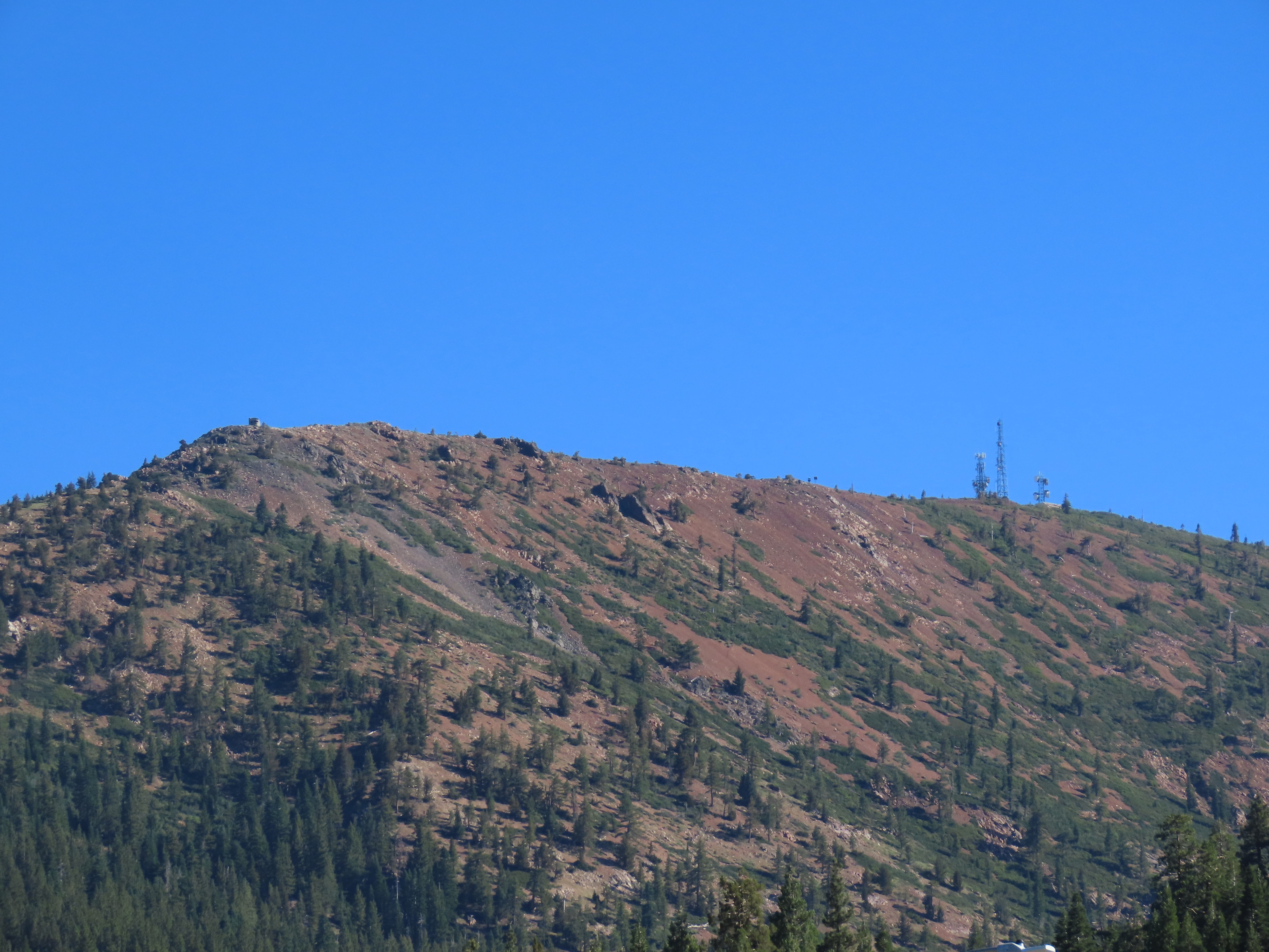
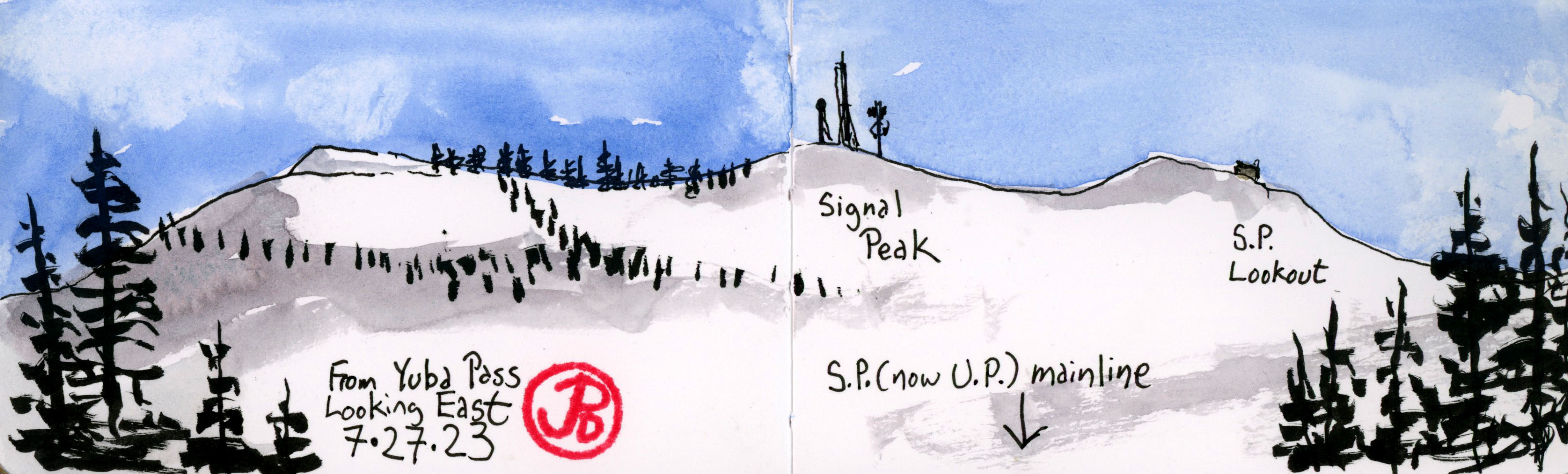
Before I got to Cisco, I pulled off Highway 20, just before it merges into Highway 80 at Yuba Pass. From here I looked down the line and just above the signal gantry was Signal Peak and to the right I spotted the prominent silhouette of the fire lookout.
Yuba Pass with Red Mountain and Signal Peak in the background.
I headed east on 80 for one stop, I took the Cisco exit which just a service station stop. I pulled behind a parked truck and looked to the northeast across the highway.
Behind me, further up the hill was the mainline. In front of me was Red Mountain and Signal Peak. To the right was antennas and towers, to the left was the Southern Pacific fire lookout.
Red Mountain and Signal Peak.
Now it was time for a sketch using my Delta panoramic journal (featured sketch) to capture the peak.
Close up of the Southern Pacific stone lookout built in 1909 and used until 1934.
I returned to Yuba Pass to get a sketch of Red Mountain from this perspective. The signal on the gantry was green so an eastbound freight was imminent. Before long I could hear the rumble of a Union Pacific intermodal freight train climbing the grade towards Donner Summit. This consist contained six locomotives and I lost count of how many cars it train contained. (In truth I didn’t attempt to count. Seeing this long freight train mean less truck traffic on America’s highways).
What follows is a series of photographs of the UP freight making the climb to Donner Pass with Signal Peak in the background.
The big house, the bucket, the calaboose, the cooler, the gray bar hotel, the hoosegow, the joint, the jug, the pen, the pokey, the slammer, and stoney lonesome.
These are all slang for jail.
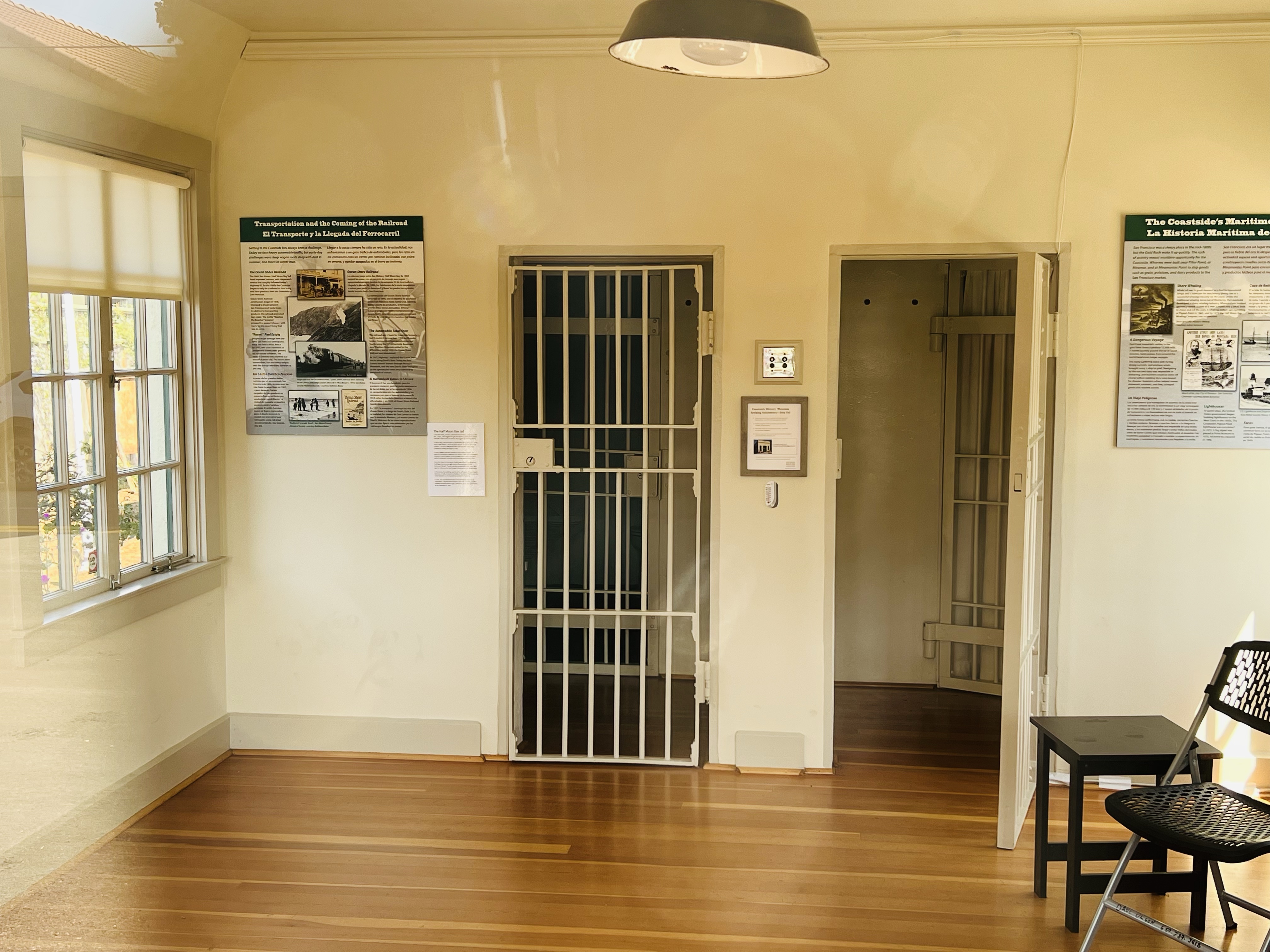
On my way down the coast, I did a Friday afterwork jail sketch in the town of Half Moon Bay.
On a side street that parallels Main is a small building that sits alone. In case anyone wondered what this building was, it reads “JAIL BUILT-1909” in big black letters across the top. (The jail was actually built in 1919.)
This was Half Moon Bay’s small two-cell jail. This isn’t, even with the wildest imagination, the Big House.
The jail is built of reinforced concrete on a concrete foundation, built to keep people in. Not like it’s formerly interned were serious criminals. The cost of the jail was $3,000.
The Half Moon Bay Jail reopened in 2018 as a historical museum. The two cells and constable’s office.
The jail held prisoners until they could be transferred to the county jail in Redwood City. Locals also spent the night here having had too much fun in Half Moon Bay’s saloons.
The jail was used as a jail and sheriff’s office until 1967 where it was little used until it was reopened as a historical museum in 2018. It is the oldest public building in Half Moon Bay.
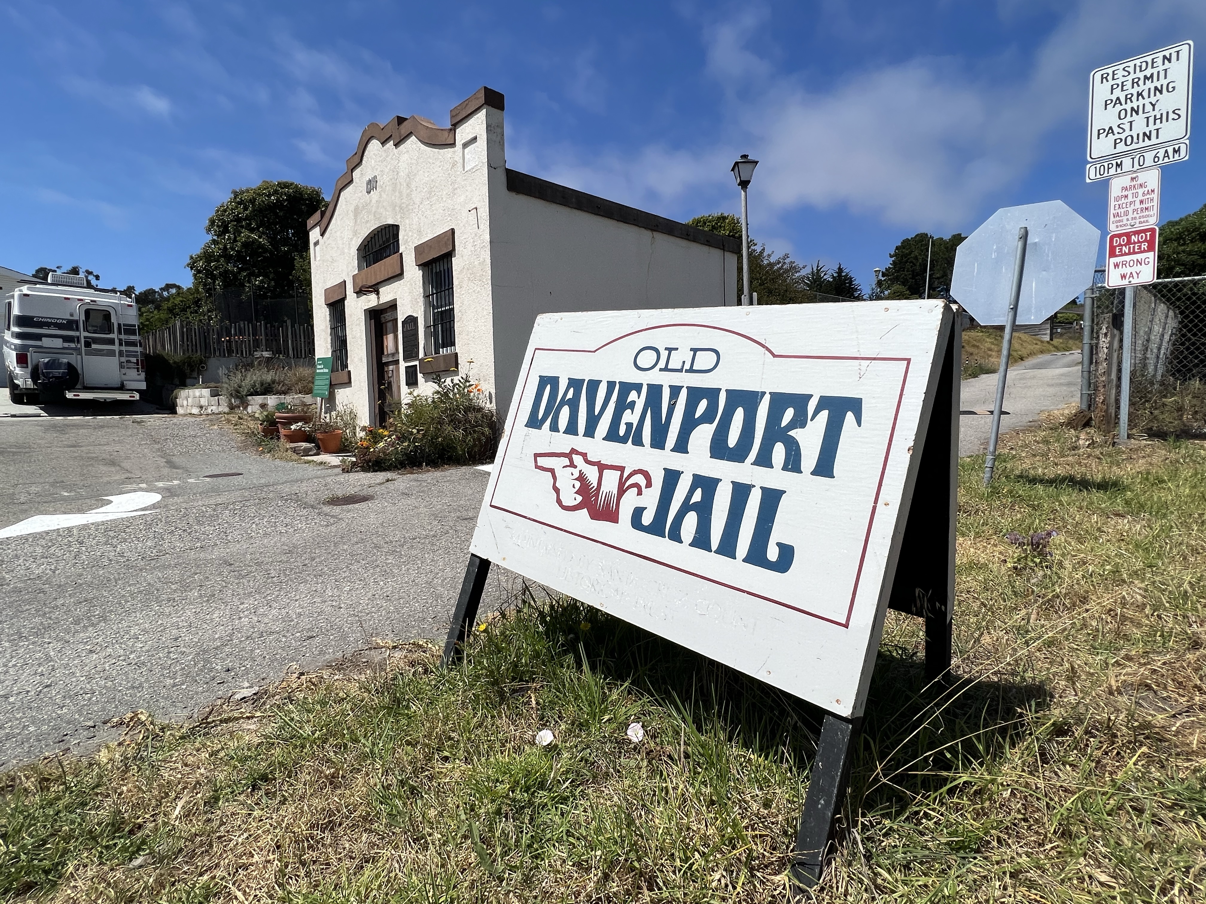
I then headed 45 minutes south on Highway One to the small town of Davenport to sketch their small jail.
This two-cell jail was built in 1914 of Santa Cruz Portland Cement, made at the Davenport Cement Plant. This small jail was built to last and looks solid for a building that is over 100 years old.
The jail housed two horse thieves from San Mateo and like Half Moon Bay, locals that had imbibed a bit too much in Davenports’s saloon.
In 1936, when the new jail on Front Street in Santa Cruz was built, the Davenport clink became redundant.
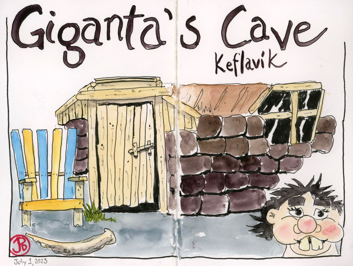
Keflavik is where the international airport is location, about 45 minutes from the capital of Reykjavik.
I had some time to kill before my flight left (a whole day and a half in fact) so I did what I always like to do to pass the time, sketch.
One of the more intriguing sites of Keflavik is a troll’s cave near the harbor. As mentioned in another post, about 50% of Icelanders strongly believe in hidden people such as trolls, elves, and dwarfs.
So I sketched Skessuhelir, Giganta’s Cave. This attraction is a little bit like an amusement park without the rides, games, or food stands. It’s an attraction that defies description. It’s like a roadside attraction without the road. It is more like a harborside attraction really.
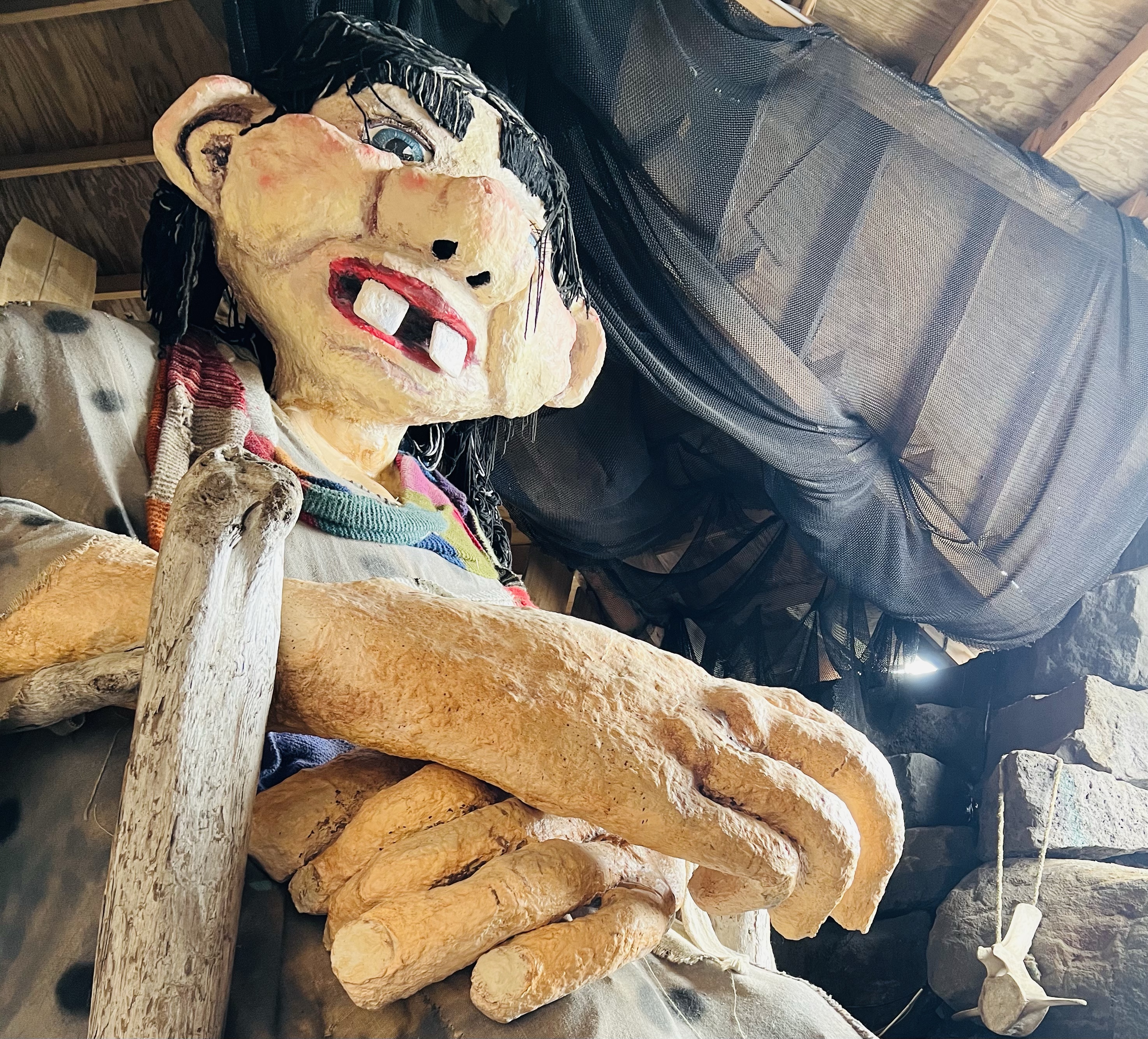
On the way to Giganta’s Cave. Keep you children close. Real close!
Trolls in Iceland function a bit like the bogyman in American culture, “If you don’t eat your broccoli, the troll will come and get you!” or “If you don’t clean up your room the Bogyman is coming for you!” Here was a chance to visit a troll and live to tell the tale.
Inside the cave, everything is oversized, the chair, toothbrush, shoes, and bed. In the darker end of the cave stood what looked like a Christmas tree but instead of being covered in lights and decorations, the troll’s tree was covered in baby’s pacifiers! I liked this Icelandic dark humor.
The troll herself!!The troll seems to be a bit of a celebrity here in Keflavik. There is even a mural dedicated to her.
There was plenty of public art along the jetty and I sketched a bird sculpture of course. The sculpture mirrored the gulls, Arctic terns, and fulmars flying along the jetty.
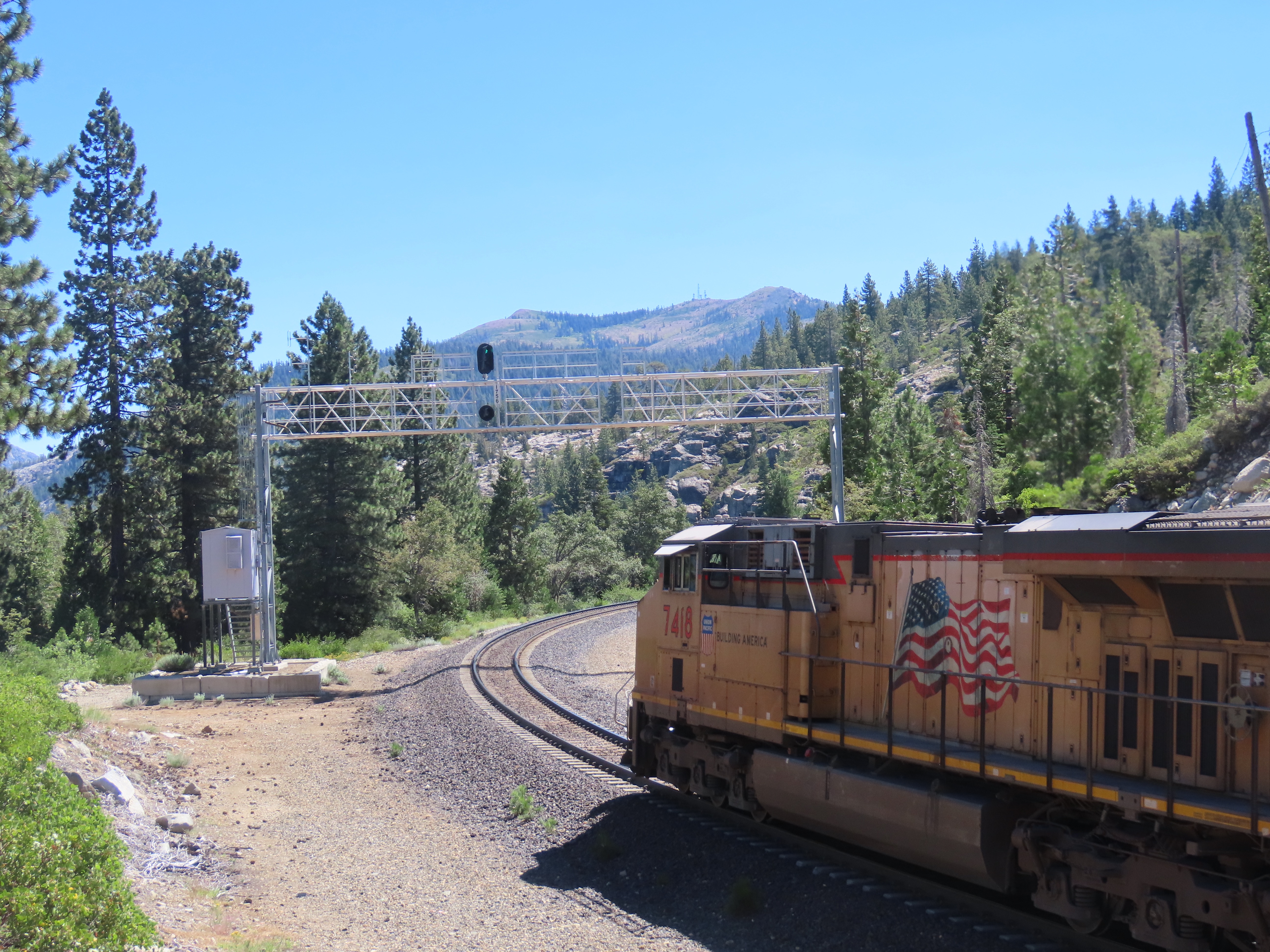
I once chased the California Zephyr Train # 6 from Roseville to Truckee but now I wanted to chase what really makes Union Pacific the big bucks: an intermodal freight train!
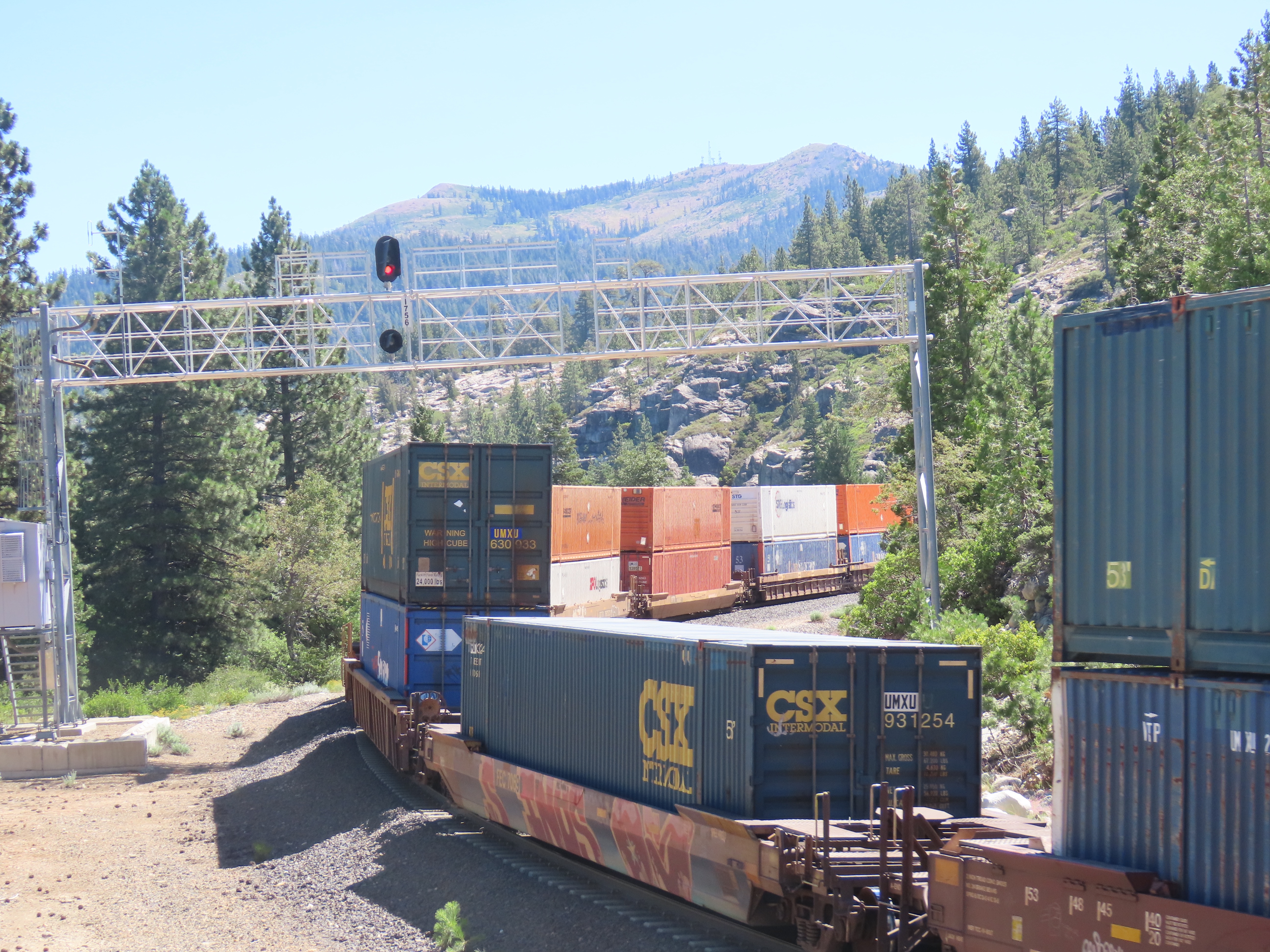
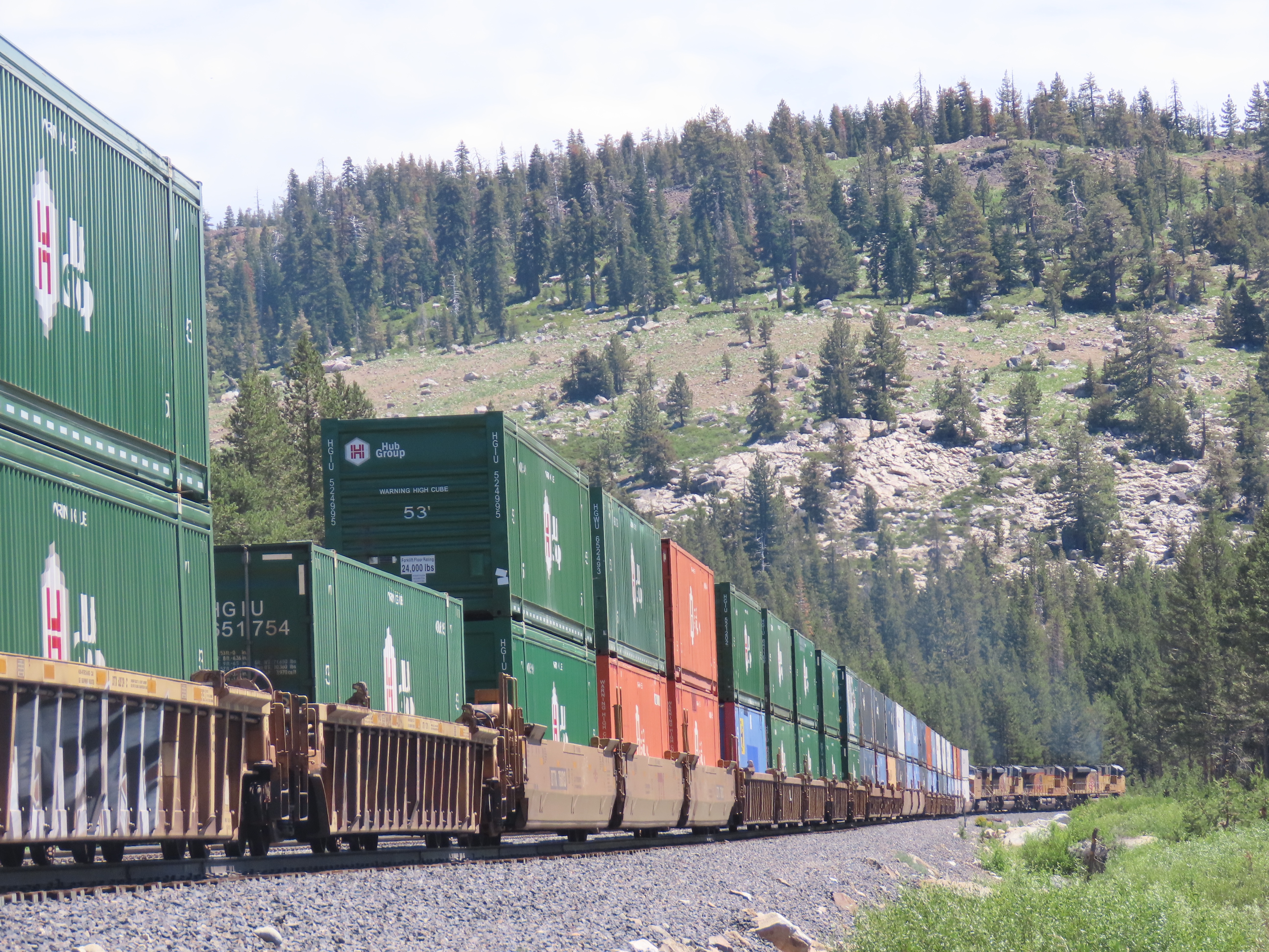
Intermodal is freight that is transported by various forms of transportation: ships, trains, planes, and trucks, for example. Most of the intermodal freight trains across the Sierra Nevada consist of double stacked freight containers, known as Container on Flatcar (COFC), or single truck trailers on flat cars, known as Trailer on Flatcar (TOFC) or piggybacks.
I first caught sight of my freight as it really began it’s climb up the western slope of the Sierra Nevada Mountains at Cape Horn, just out of Colfax. (I had just missed it’s passage through Colfax.)
I attempted to follow the train on Historic Highway 40 with some stretches on the highway that relegated Highway 40 to a little used country road: Interstate Highway 80.
Catching up with the train should not be a problem (even on windy side roads) because the average speed of a freight train climbing up to Donner Summit is between 25 to 30 miles per hour. And sometimes the freight’s speed could be even less.
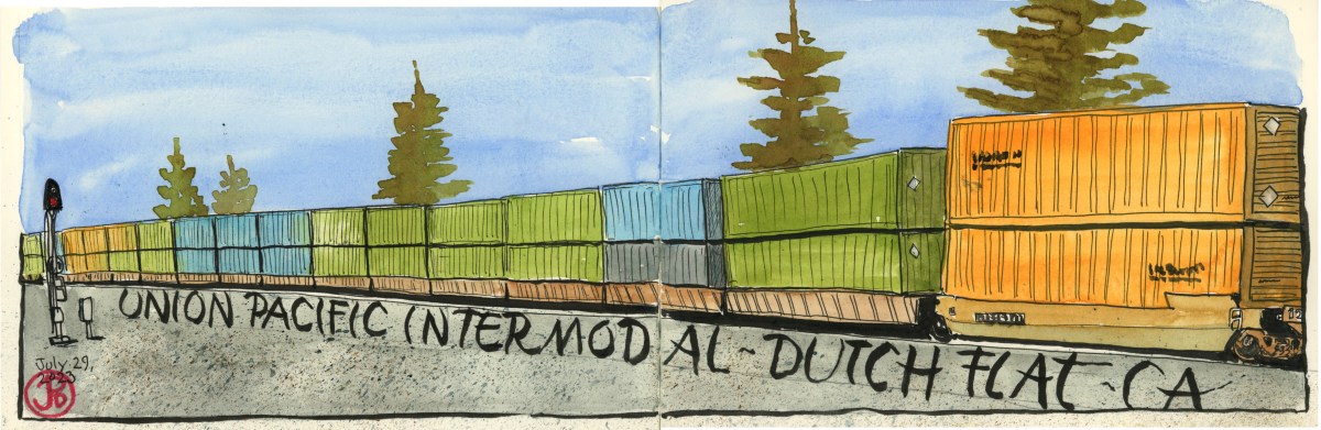
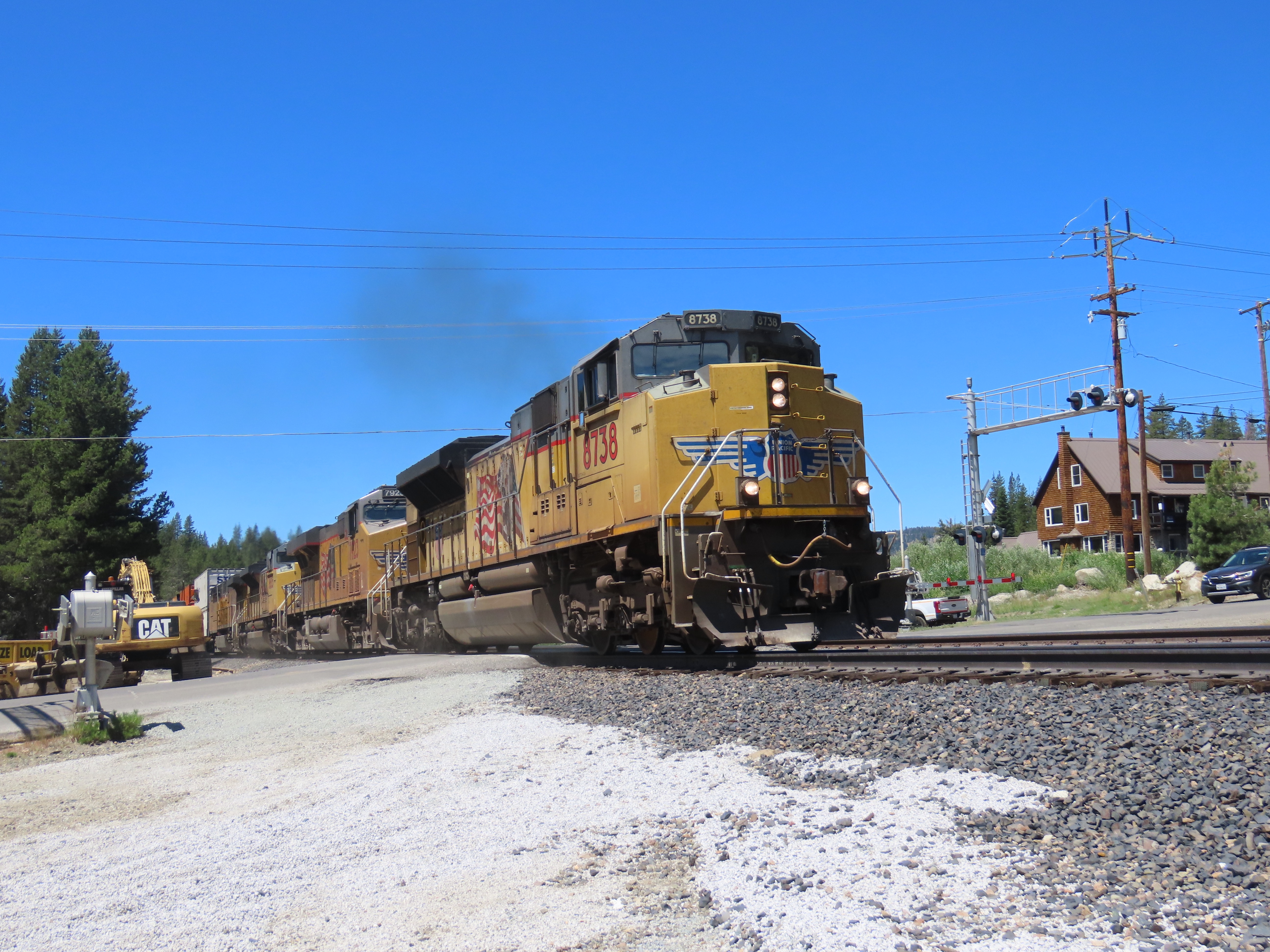
I headed east on a patchwork path of Historic 40, side roads, and Interstate 80. When I thought I was sufficiently ahead of the intermodal, I searched for the mainline. This consisted of picking either side of the road, north or south (at Blue Canon I picked the wrong side), and then driving until I came upon railroad tracks. This I did at the grade crossing at Dutch Flat. The eastbound signal light was green indicating that the train had not passed this point yet.
I picked my vantage point and after about ten minutes I could hear the rumble of the diesel-electric locomotives as they climbed the grade followed by the sounding of the horn, and then the crossing gates were triggered and the safety arms lowered to stop traffic.
The Transcontinental Railroad reached Dutch Flat in June 1866.
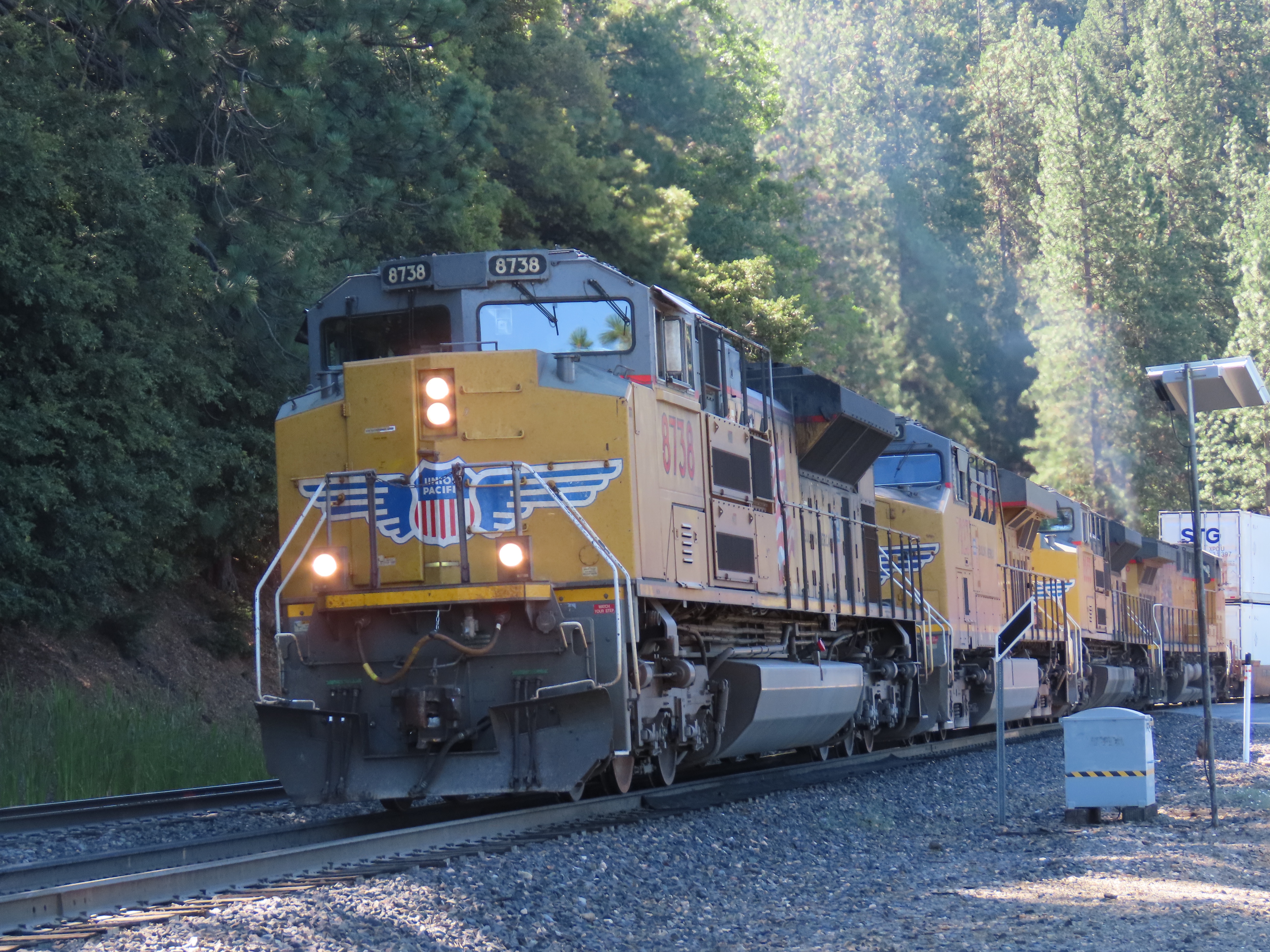
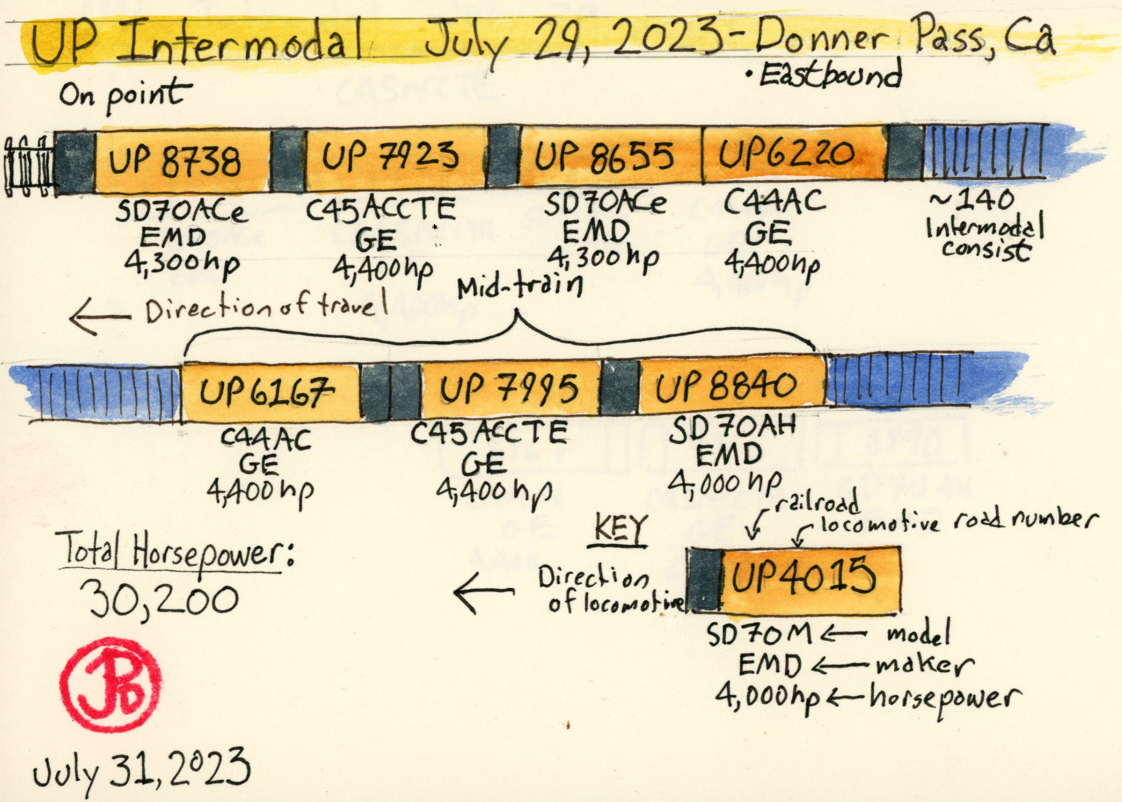
Union Pacific No. 8738 came into view. No. 8738 is an Elctro-Motive Diesel (EMD) SD70ACe. These 408,000 pound locomotives generate 4,300 pounds of horsepower and this consist featured four locomotives on point and three more mid-train. These seven locomotives generate a combined 30,200 pounds of horsepower. They need this power to pull/push the heavy loads up and over Donner Summit.
Just to provide some context, the Southern Pacific locomotive that was designed to tackle the grades and snowsheds of Donner Pass were the cab forwards. The last cab forward built, the AC-12 class No. 4294 (which is preserved ay the California State Railroad Museum in Sacramento) weighed 1,051,000 lbs (locomotive and tender) and the locomotive produced 6,000 pounds of horsepower.
When compared to standard vehicles on Interstate 80, 30,200 horsepower equals about 30 semi trucks or 150 Toyota Camrys.
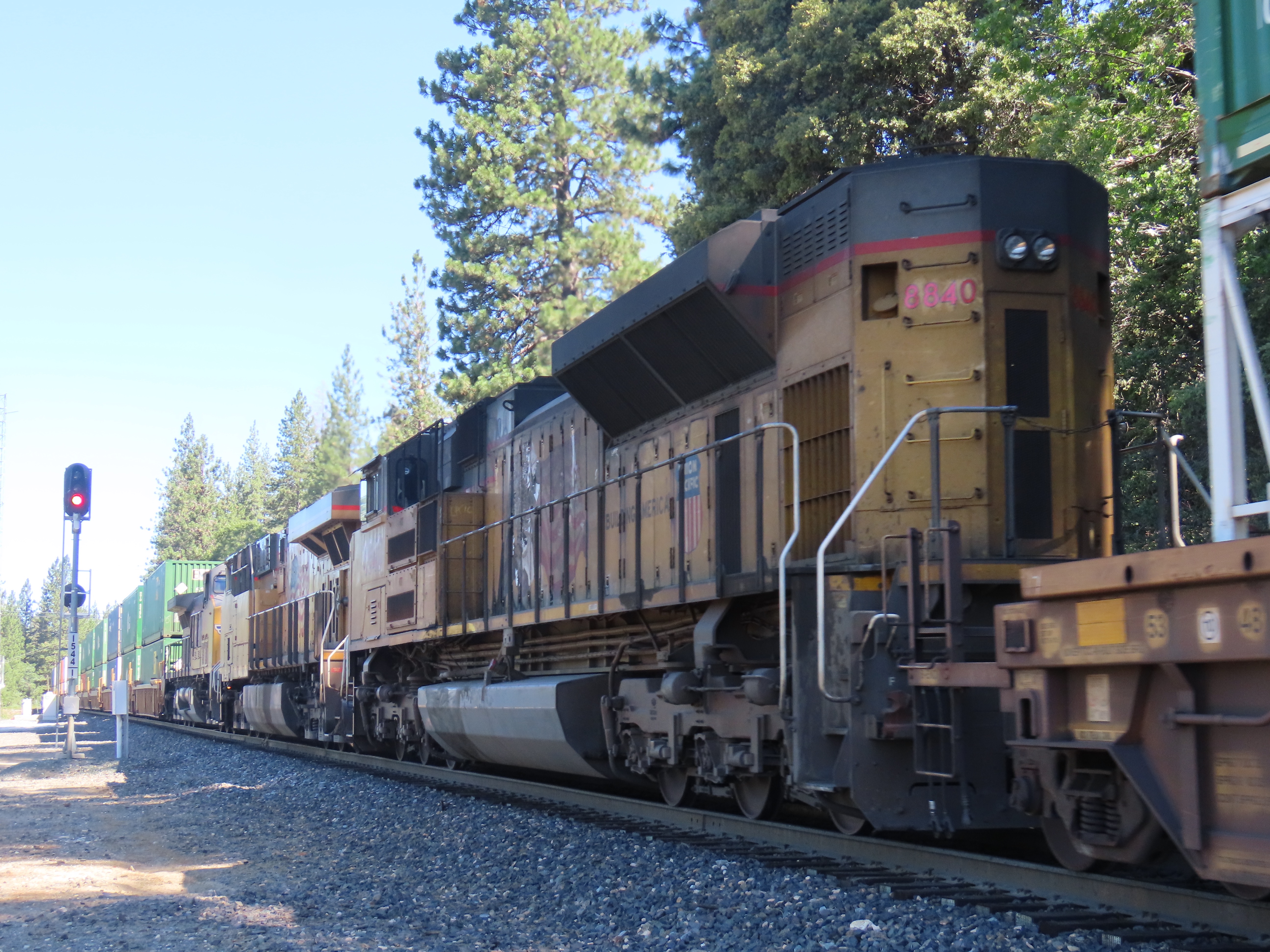
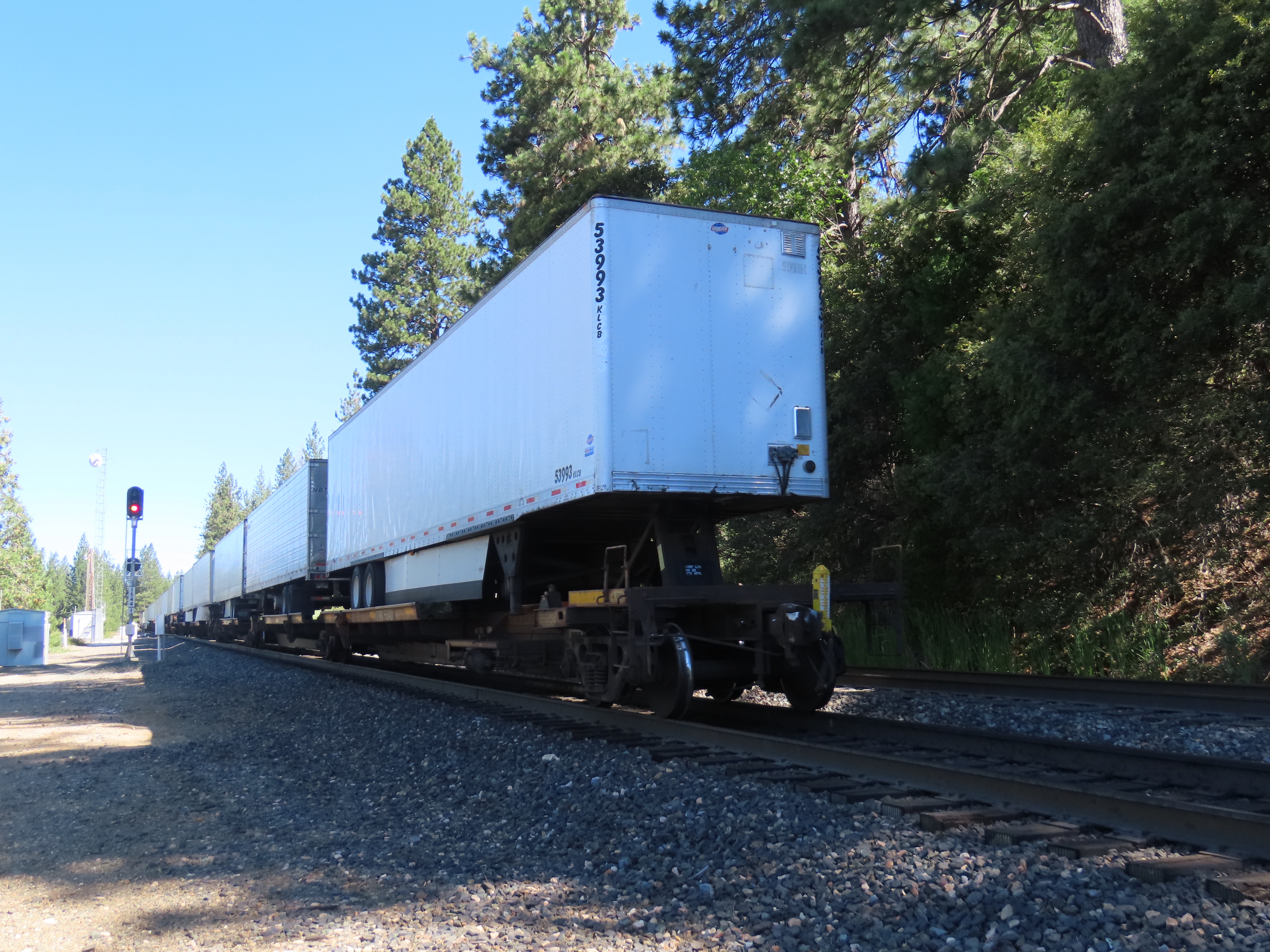
Three helpers to help push and pull the intermodal consist towards Donner Pass. The signal at Dutch Flat is now red, halting any train traffic that should come too close to the tail end of the train.The end of the train consisted of truck trailers on flatcars or piggybacks. This was the end of the train and there was no caboose. Cabooses have not been used on mainlines since the mid-1980s. They have been replaced by a small yellow box known as an End-of Train Device (ETD). This has reduced the crew of freight trains. Now the crew consists of just two people: an engineer and conductor.
Once the train passed I drove down the road into “downtown” Dutch Flat and headed back toward the highway. I came to a grade crossing where the last few cars where just passing. The arm rose and the race was on!
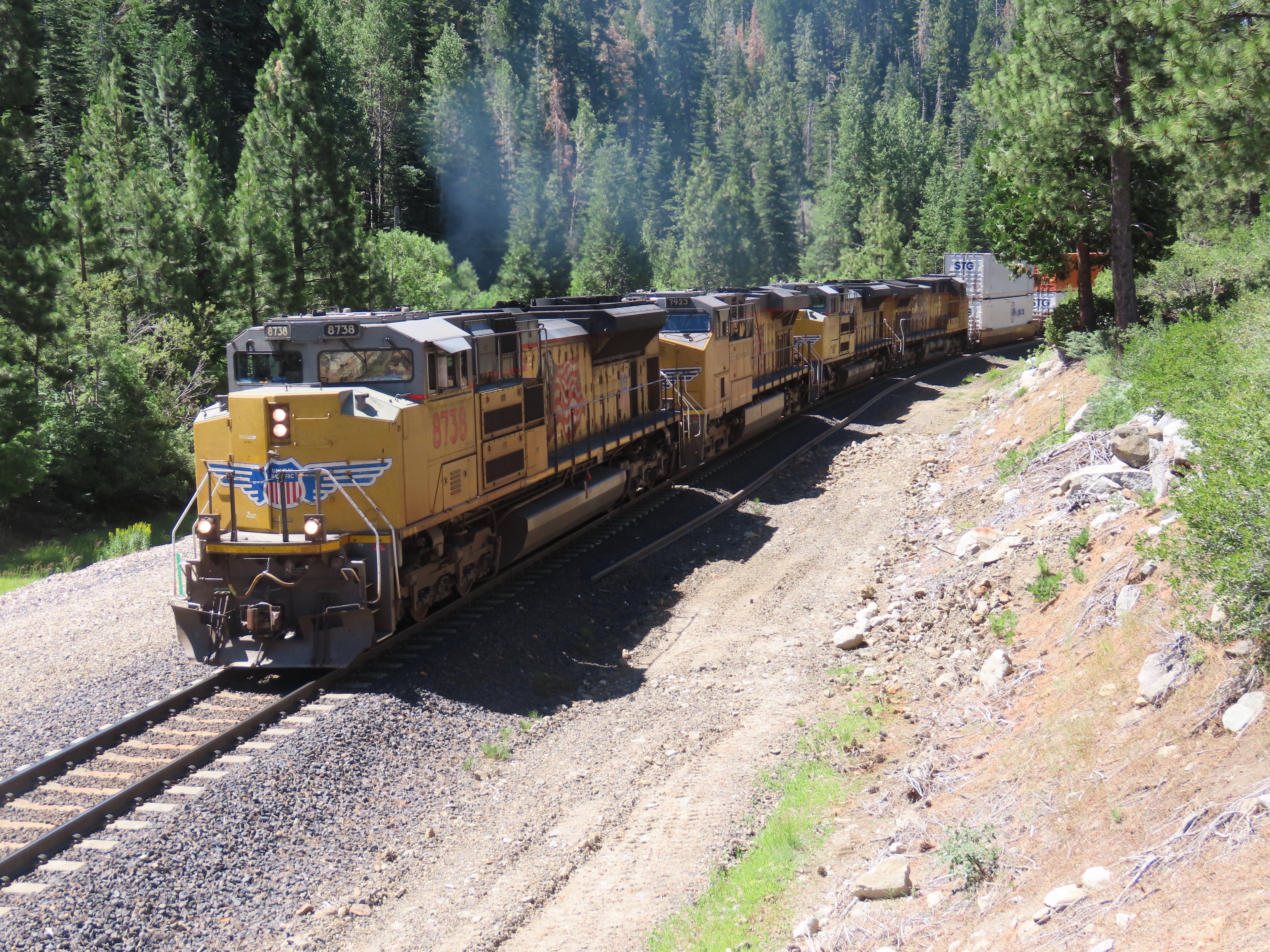
I hit the highway trying to outpace the freight train as well a finding a new point to see the train. I made it to my tried and true spot at Yuba Pass, where Highway 20 merges into 80. I knew I had not missed the train because the signal on the gantry above the rails was green. I must have made really good time because I had to wait almost 30 minutes before I heard the rumble of the diesels laboring on the hill. The intermodal passed and this time I got a wave from the conductor, seated on the left side of the cab. In the days of steam, this would have been the fireman’s position and the conductor would have been riding at the end of the train in a caboose.
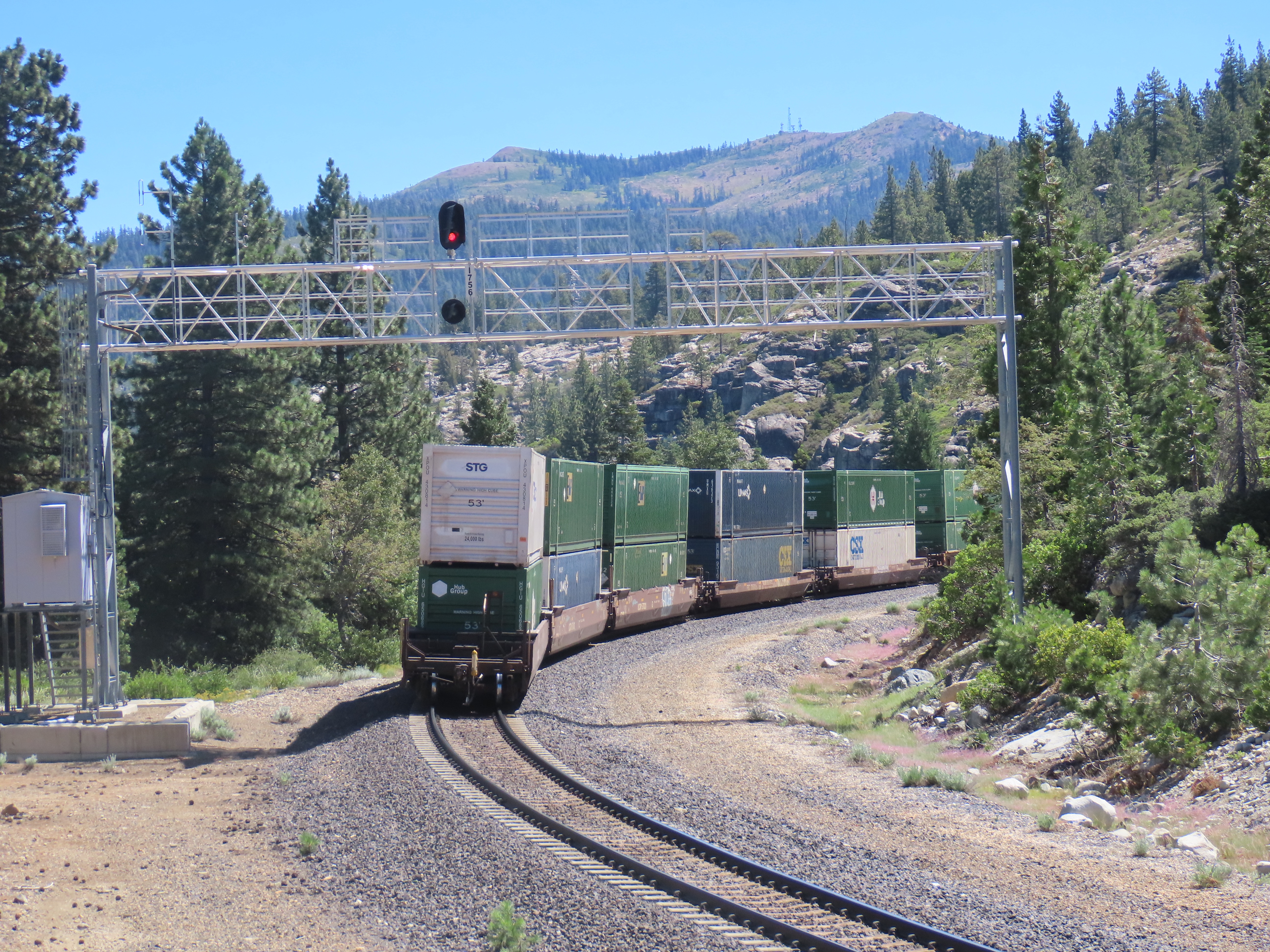
The intermodal heading into Yuba Pass.
The average length of a freight train on a Class I railroad is about 5,400 feet. At Soda Springs I wanted to do a little experiment with the intermodal to see if I could come to an estimation on how many cars where in the consist. This started with timing the train from the grade crossing at Soda Springs. How long would the train take to pass a single point? The answer was four minutes and 54 seconds. That was almost a five minute wait for any motorist at the crossing!
Now for a little railroad mathematics. I estimated that it took about 2 seconds for one car to pass so I divided 294 seconds (5 minutes and 54 seconds) by 2 and got 147 train cars. I then subtracted the number of locomotives (7) and came to an estimation that this freight train consist consisted of 140 cars. An intermodal of this length takes a lot of trailer trucks off the roads. Just how many trucks?
I estimated that about 75% of the train consisted of double stacked Container on Flatcar (COFC) which is 105 cars and the remaining 35 cars were Trailer on Flatcar (TOFC). 2 times 105 is 210, add 210 to 35 and we get 245. So this intermodal freight train removes about 245 trailer trucks from Highway 80. Every motorist motoring to Lake Tahoe or Donner Lake should be thankful these Union Pacific freights that put in the hard work that make life a little easier.
The intermodal at the grade crossing at Soda Springs, almost at the top of it’s climb to Donner Summit.The train with it’s 140 cars, heading towards Donner Summit near Sugar Bowl Ski Resort.
Based on my field photos I was able to get the road numbers of all seven locomotives on the freight train. Using a Union Pacific roster I was able to identify the maker and model of each locomotive and it’s horsepower output. There where three EMD (Electro-Motive Diesel Inc.) and four GE (General Electric) locomotives. I put this information into a locomotive map showing the road number, model, maker, horsepower, and direction of travel for each locomotive. The total horsepower output for all seven locomotives was 30,200 hp.
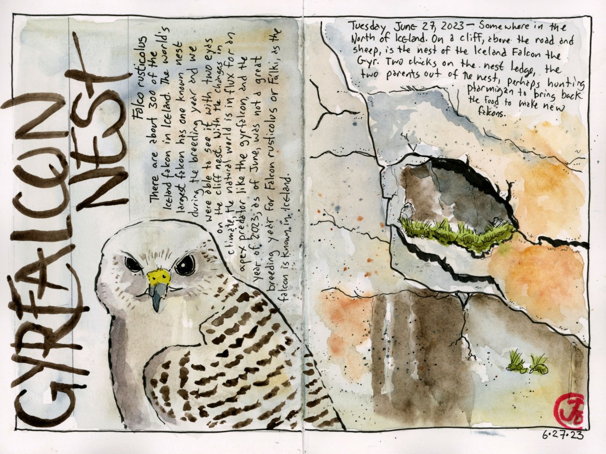
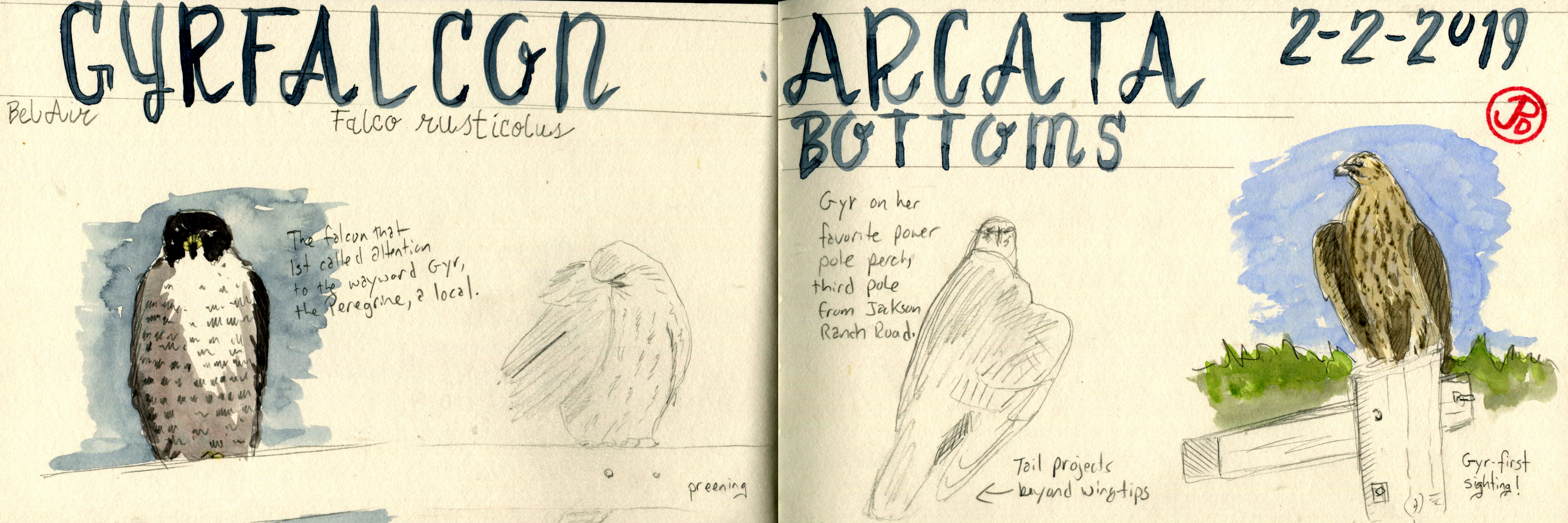
A raptor on my wishlist for Iceland is the Iceland falcon or gyrfalcon, the world’s largest falcon.
I believe that if you wait long enough, birds will come to you. Such was the case with the gyrfalcon.
On February 2, 2019 I saw my first gyr at the Arcata Bottoms in Northern California. What an amazing view of this female gyr that perched on power lines and then hunted coots near the road where we where the lone audience to nature’s sometimes cruel theater! This was one of my best observations of any raptor in the field.
A spread of field sketches about a long sought after lifer, the gyrfalcon.
So gyrfalcon would not be a lifer on my Iceland birding saga but seeing the Iceland falcon in Iceland would be a special experience. But first we had to find one.
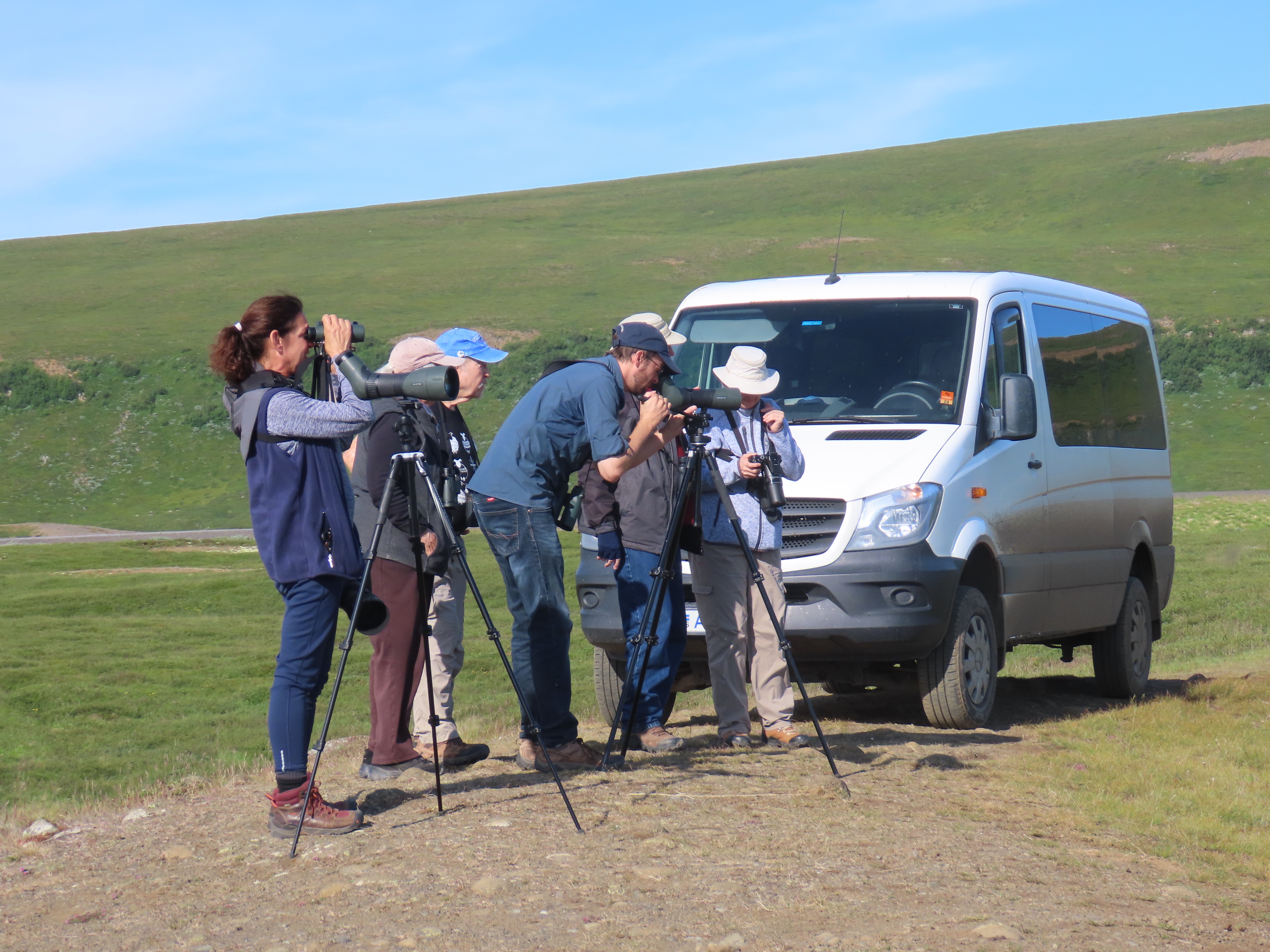
Our guide had staked out a gyrfalcon nest on a cliff with two chicks. Through the scope, we could just pick out the chicks, sitting on either side of the nest but the adults were nowhere to be seen. They were probably off hunting to feed their future falcons.
This nest is believed to be the only active nest in Iceland this breeding season. Whether avian flu is to blame or a crash in prey populations, the reasons are unclear.
Our birding posse enjoying views of the gyrfalcon nest.Ain’t that the truth!
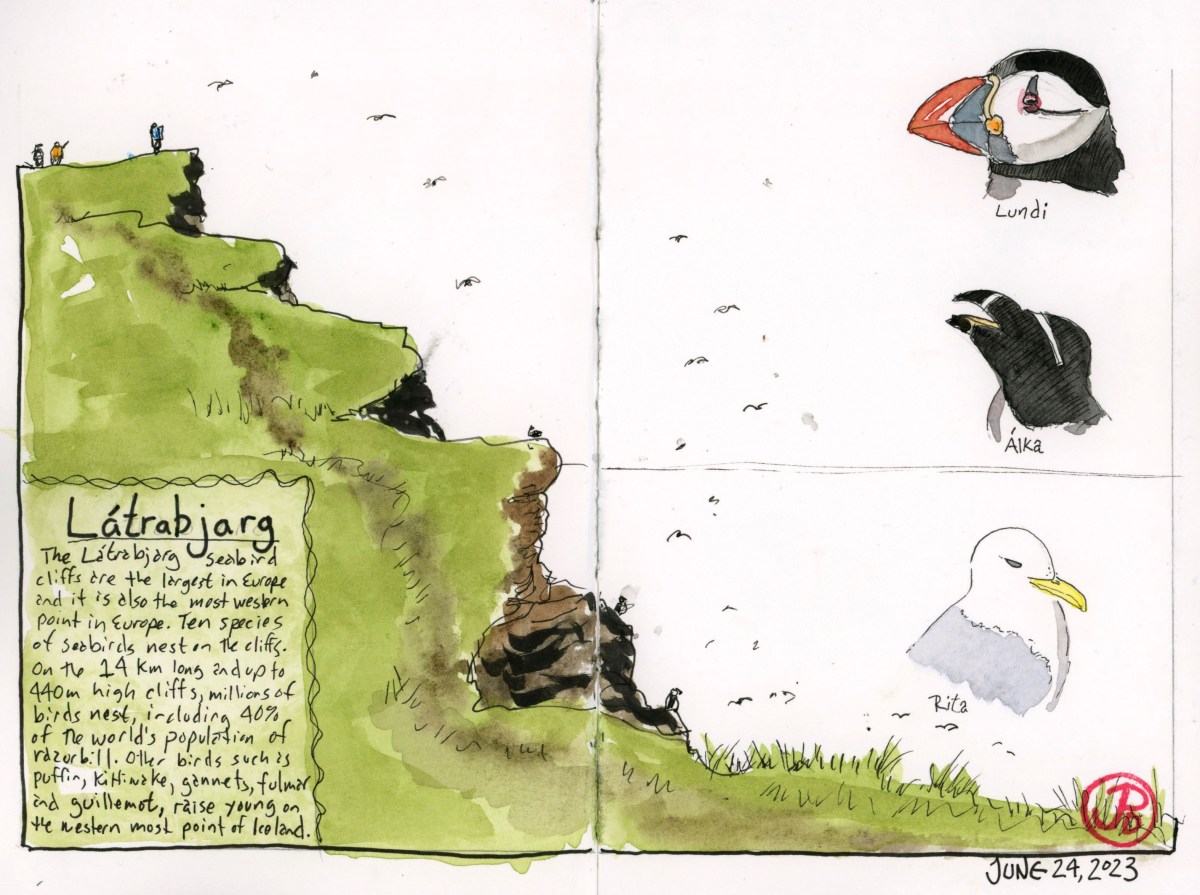
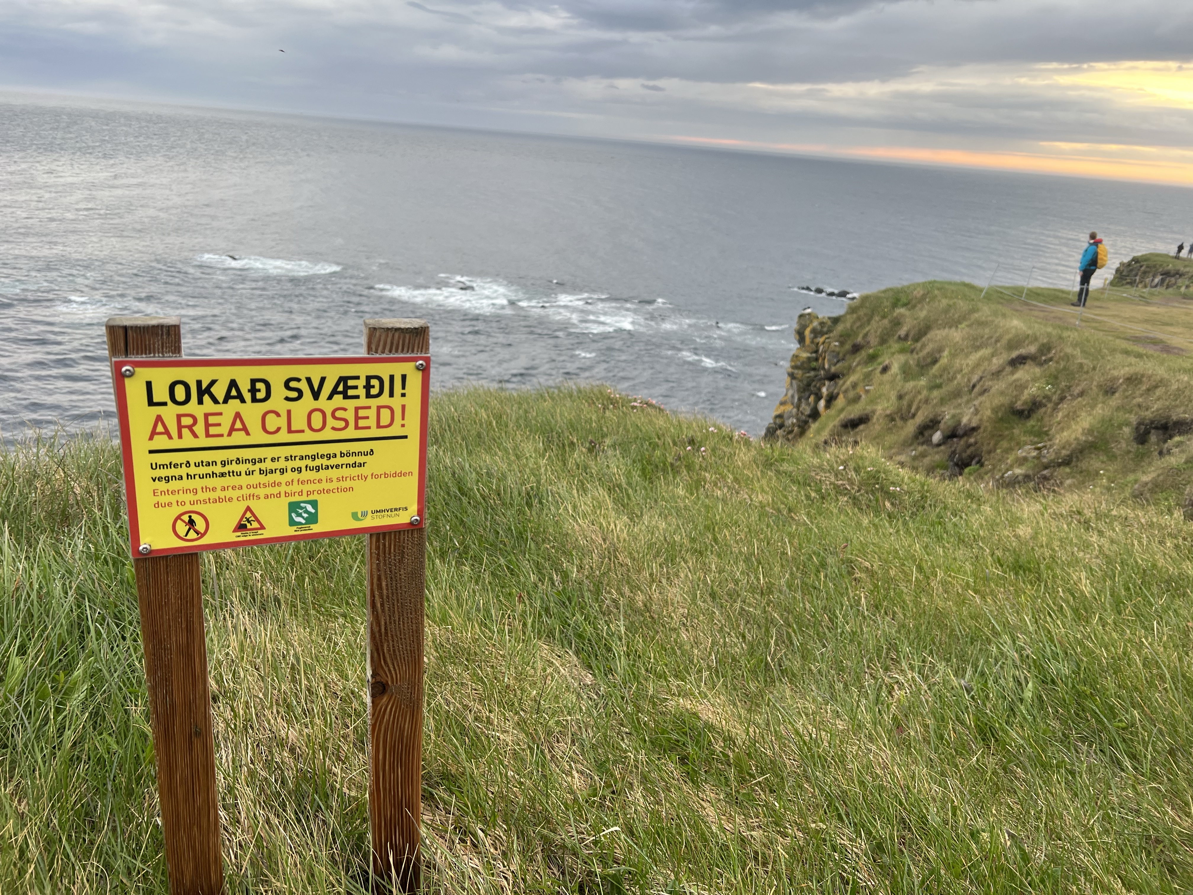
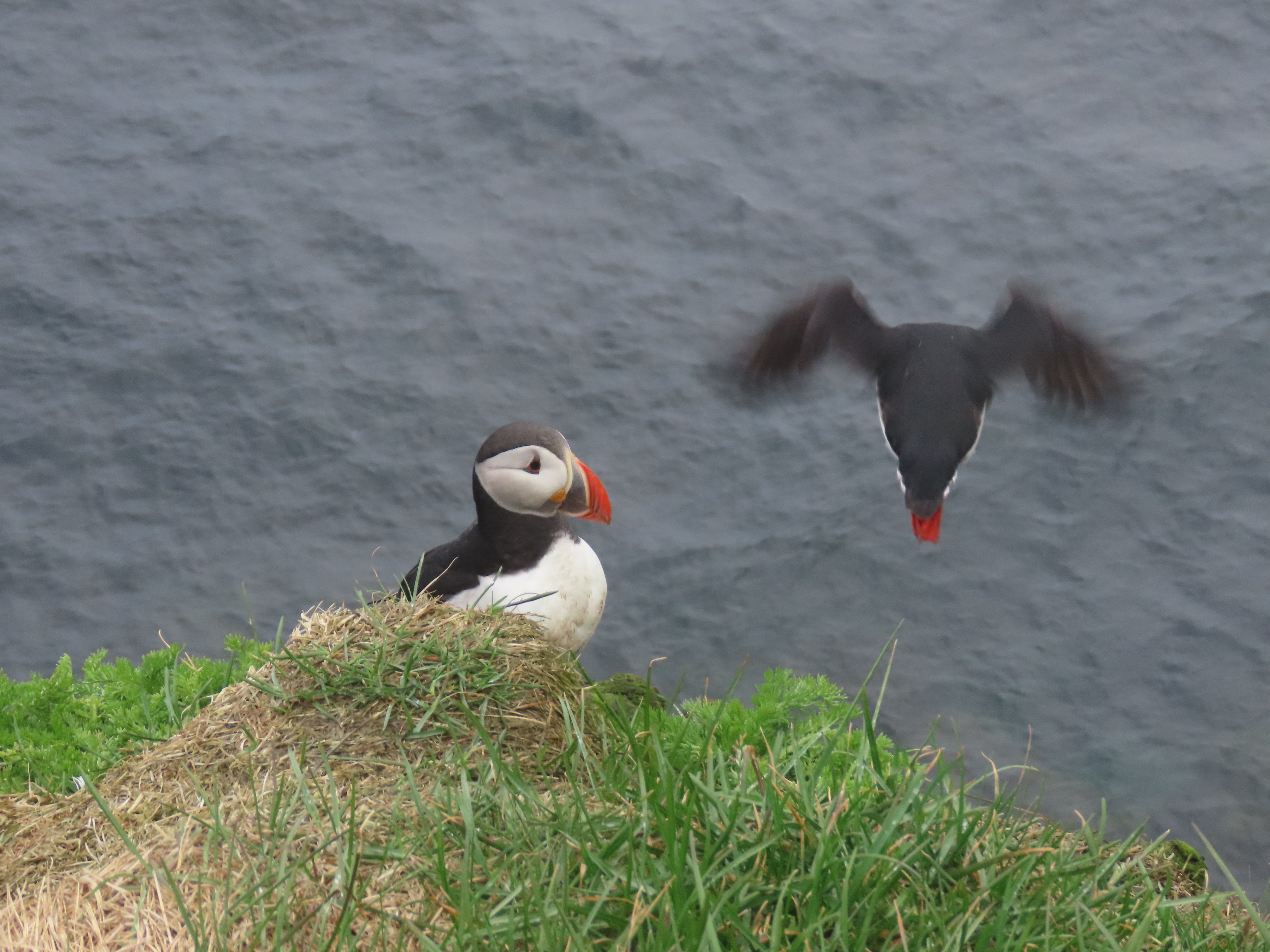
One of the visits that I was really looking forward to on my Icelandic birding trip was to see the seabird colony at Látrabjarg, the most western point in Europe.
In the Land of the Midnight Sun where the sun never truly sets in the summer, the best time to visit the bird colony is in the early evening, when many birds have returned from the sea to their nest burrows after feeding.
Luckily it is easy to get close to puffins without getting too close to the unstable cliffs.
The cliffs at Látrabjarg are the largest sea bird colonies in Europe. Here puffins, razorbills, kittiwakes, murres, guillemots, and fulmars breed. About ten million birds are present here during the summer breeding season but we were only viewing a small portion of the cliffs that spans about eight and a half miles long with a maximum height of 1,400 feet, nearly the height of Chicago’s Sears Tower (1,451 feet).
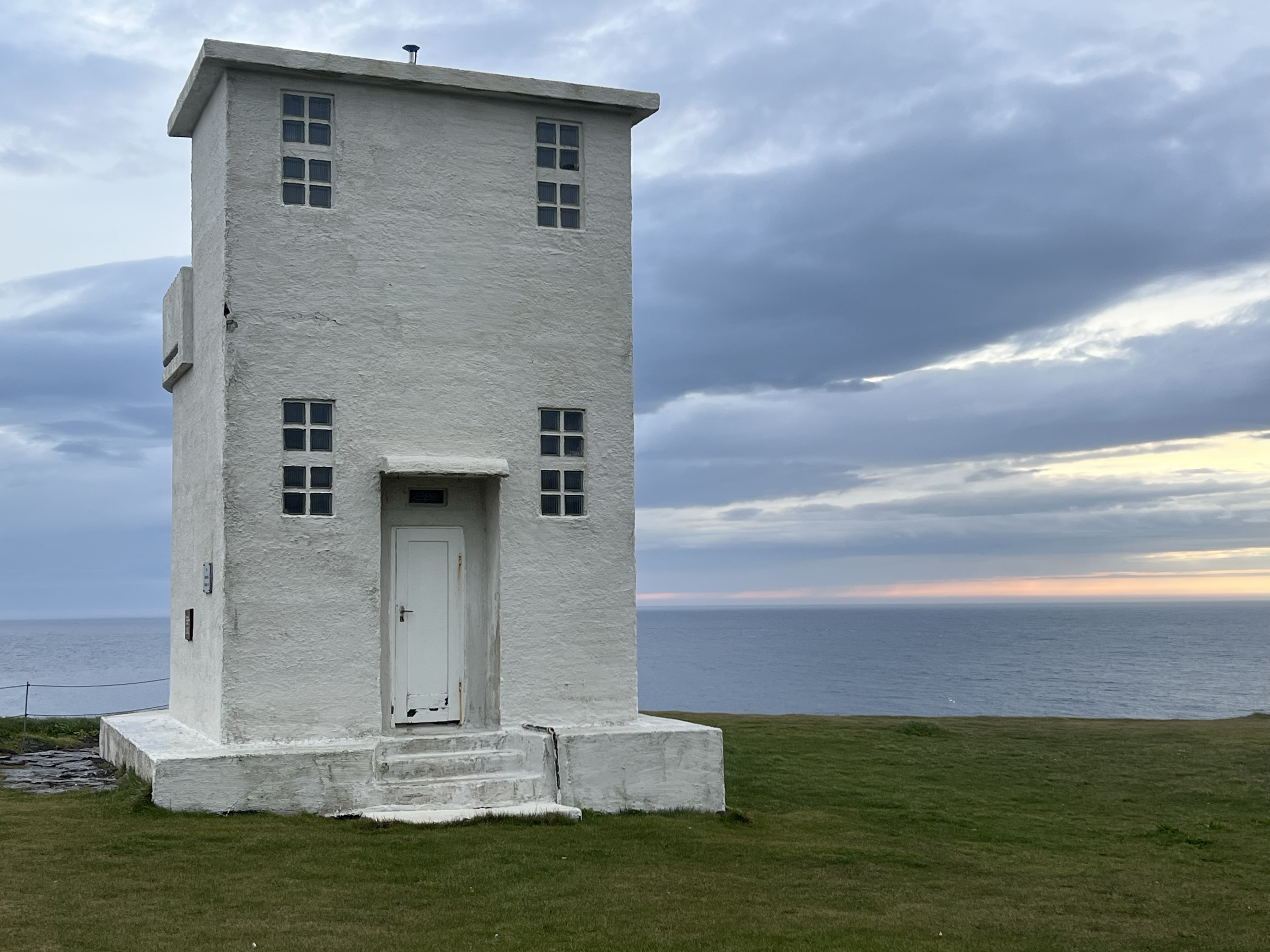
The Látrabjarg Cliffs were high on my sketchlist and I was determined to add this natural wonder into my Iceland sketchbook. The problem: rain was forecast for our evening visit. Now rain (or wetness in general) does not go hand in hand with field sketching, especially when using ink or watercolor. So I had to find shelter to start my sketch.
The westernmost lighthouse in Europe provided a weather break so I could get my initial anchor sketch in (featured sketch). In the finished sketch a few telltale ink smudges bear witness to the drizzly weather on our Látrabjarg visit.
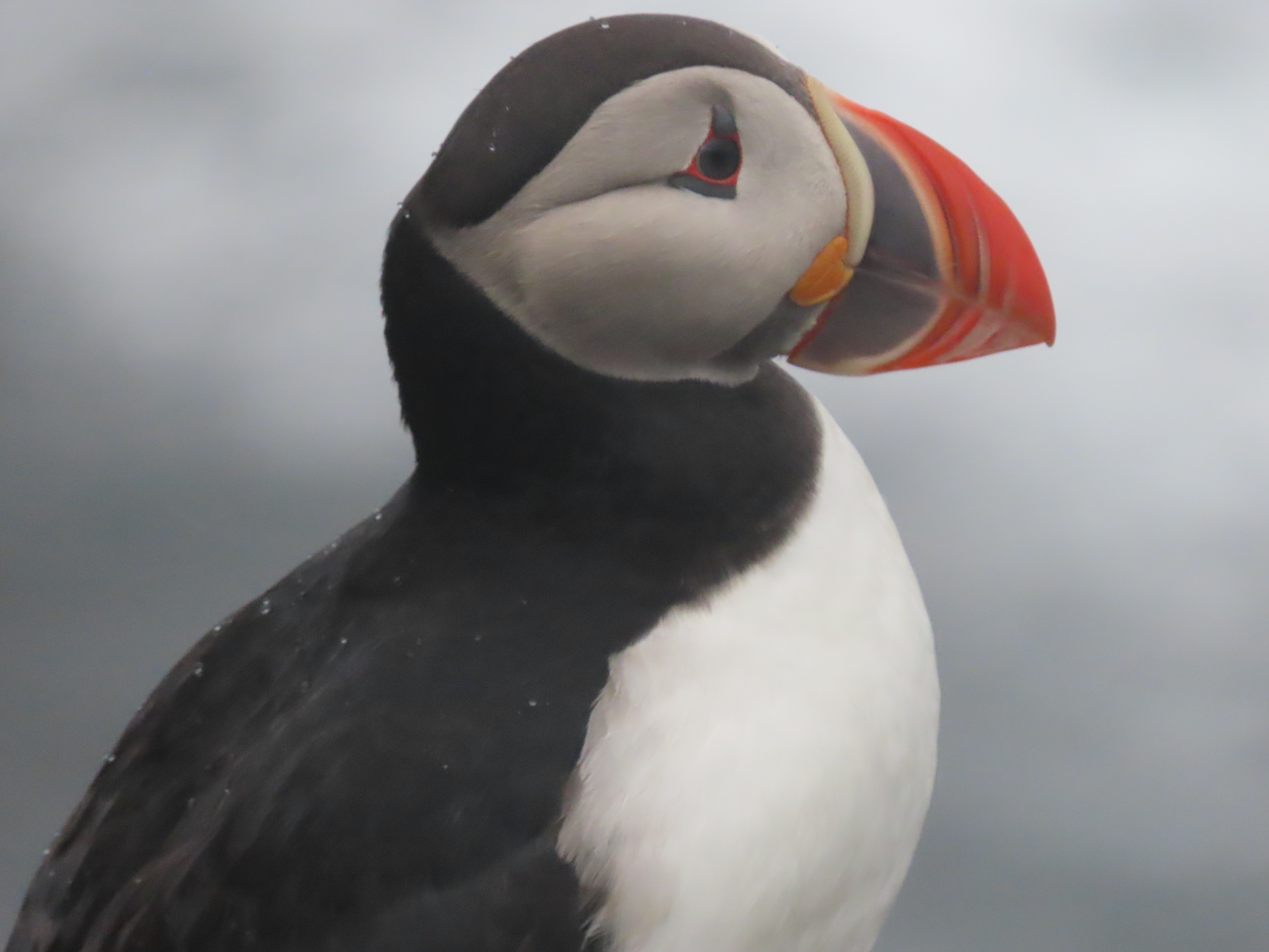
The big draw to visiting these cliffs are the large numbers of seabirds and the close proximity to one of Iceland’s most beloved breeding species: the Atlantic puffin.
You can get close to puffins, very close at the nesting colony. This one was about six feet away.
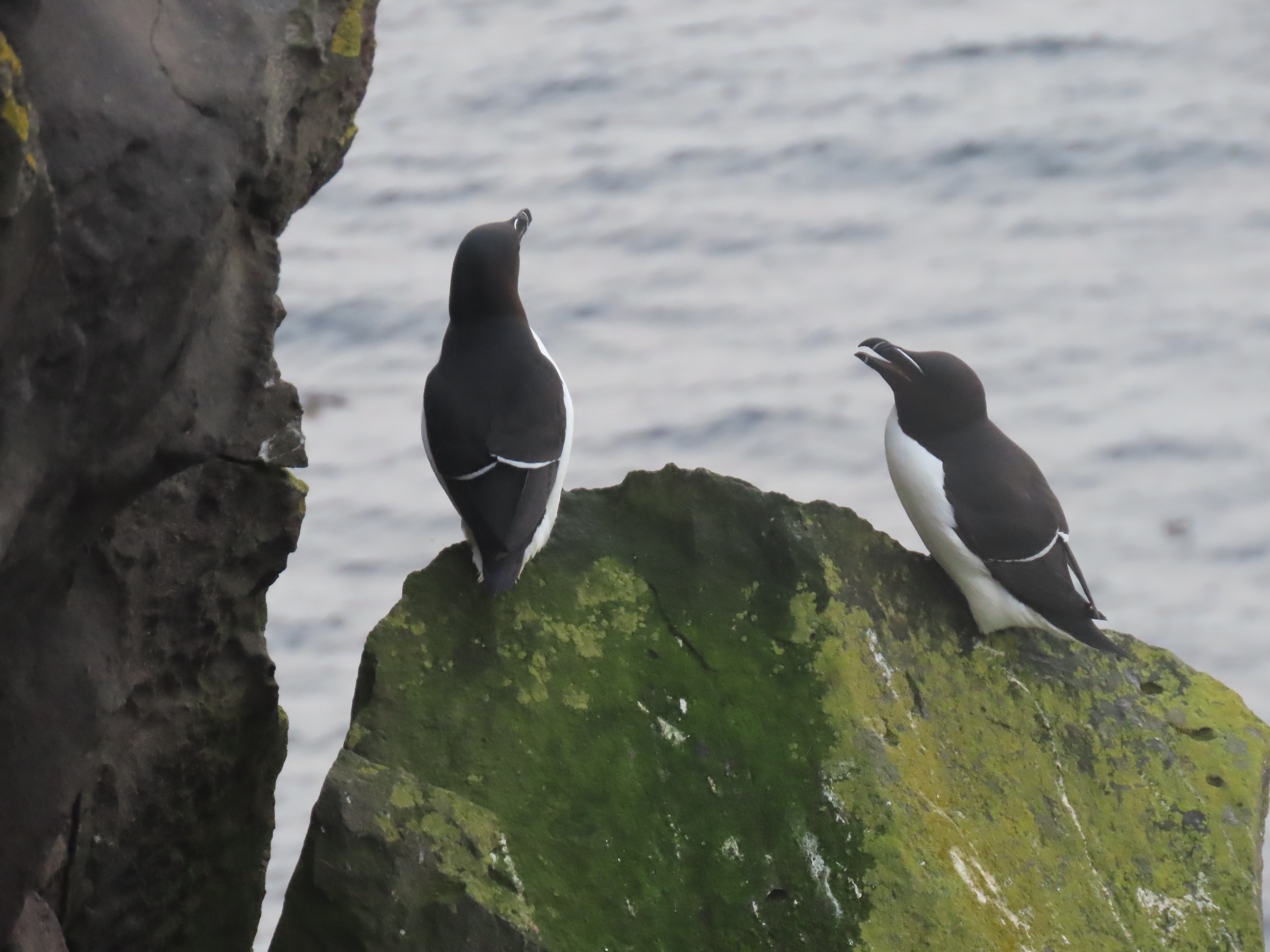
Seabirds nest at different levels of the cliff with puffins occupying the tops of the cliffs, followed by razorbills, and towards the bottom, kittiwakes. This is represented by the vertical portraits of the three species on the right side of the sketch. Seven other species of birds also use the cliff for nesting.
40% of the Razorbill population breeds at the Látrabjarg cliffs.
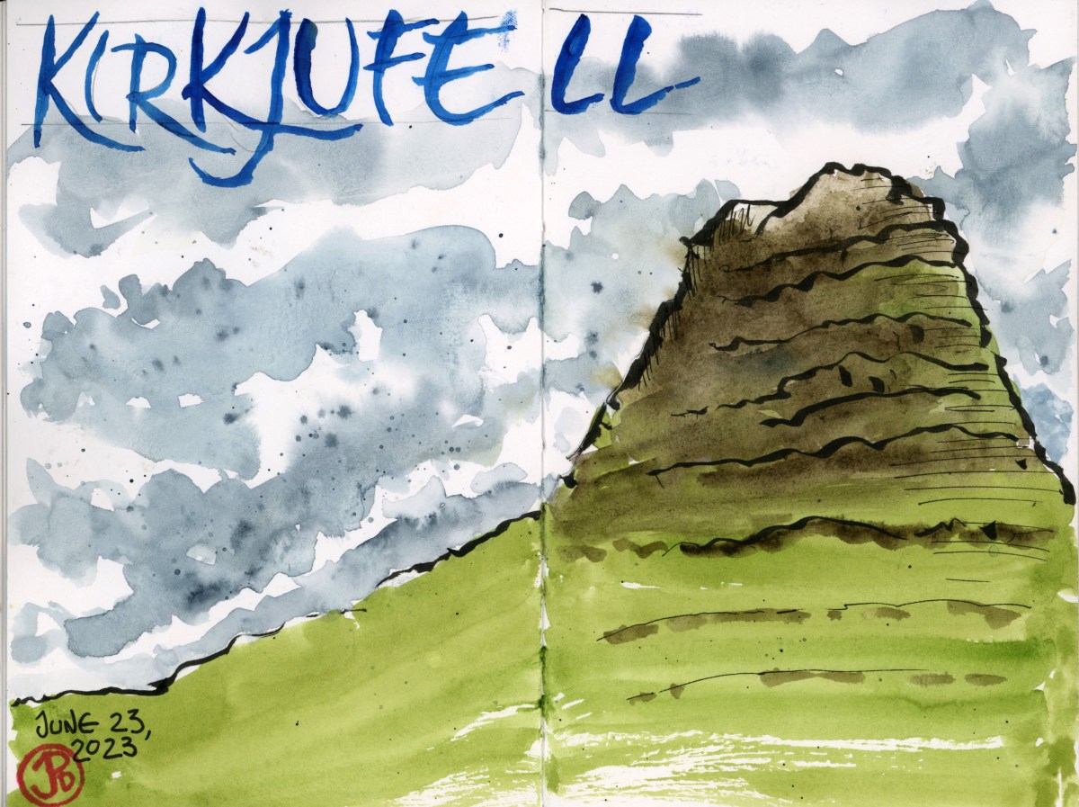
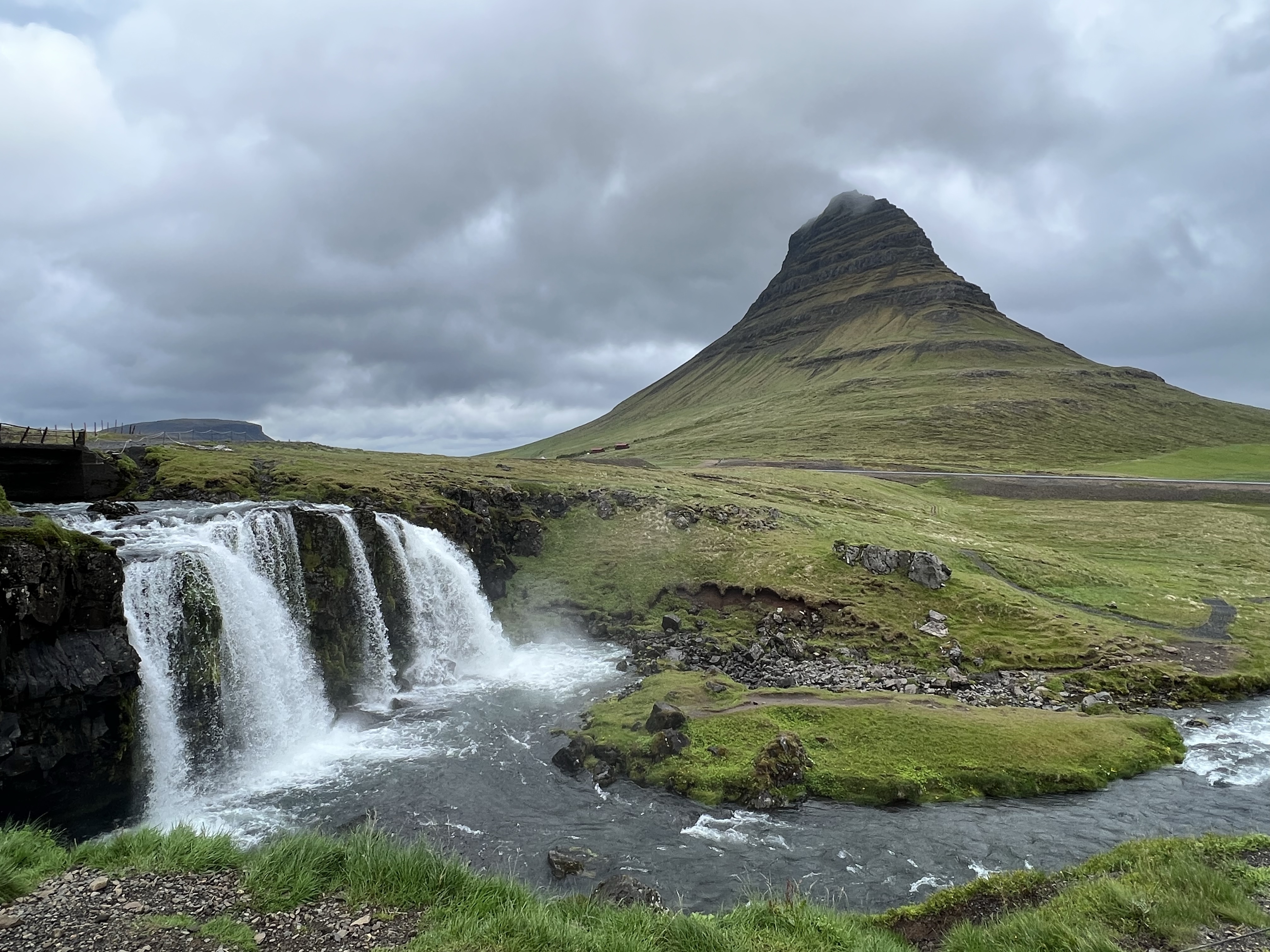
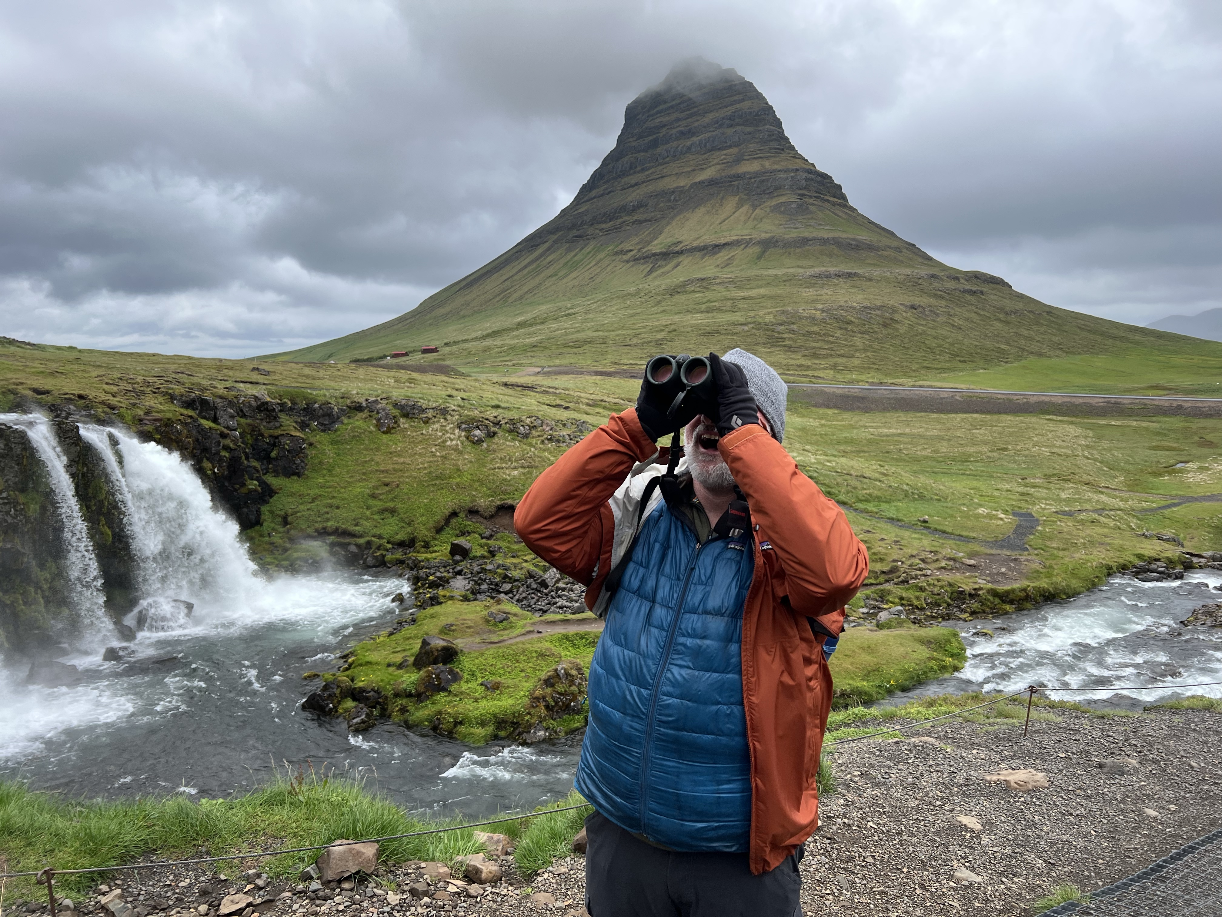
Near our digs in Grundarfjordur is Iceland’s most photographed mountain: Kirkjufell. Which is translated as “Church Mountain” because it’s shape resembles the roofline of a kirk (church).
I have seen this mountain in guide books and on maps, never knowing where in Iceland it was or even what is was called. The mountain was always photographed with the waterfall (Kirkjufellsfoss) in the foreground (Iceland boast over 10,000 waterfalls). The mountain has been used as a filming location in television series such as Game of Thrones.
This scene seems desolate, requiring a long hike or drive to get to.
This was further from the truth as a major road runs between mountain and waterfall and a port, big enough to handle cruise ships, is a quick five minute drive away. As for the long hike, it is three minute ramble from car park along a paved path to the famous vista.
The famous vista of Kirkjufell.
I knew I had to sketch this iconic Icelandic icon and I hoped the weather would be accommodating.
It is said of Icelandic weather, “ If you don’t like the weather, wait five minutes.” It seems you can experience all four seasons in a quarter of an hour.
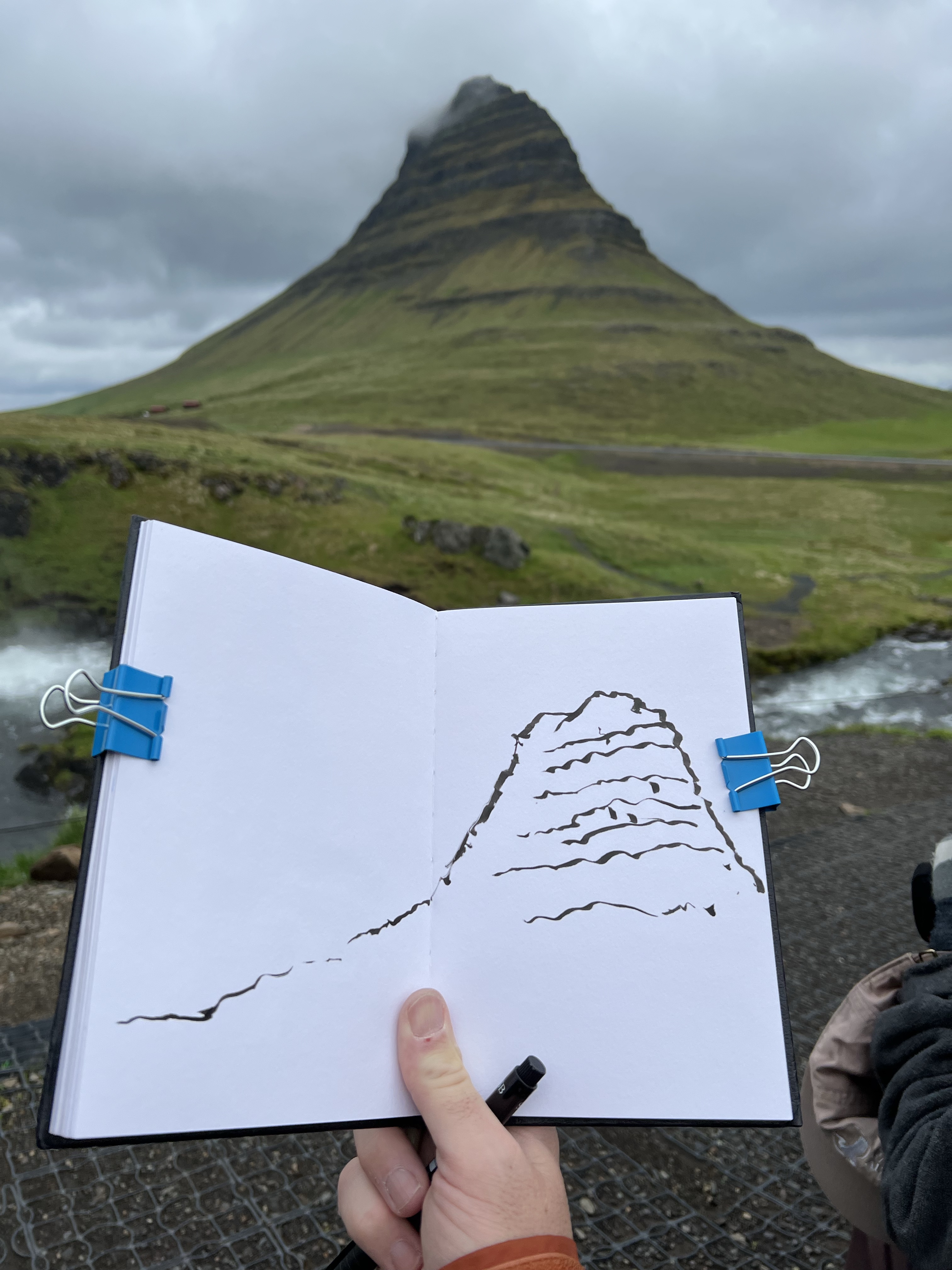
When we arrived there was rain and wind. Icelandic wind seems more intense that other climes. When I stepped out of the van, the rain nearly ripped my raincoat off!! The wind was so intense that it was blowing water from the waterfall upstream and over the foot bridge!
Clips are essential for field sketching in windy and wet Iceland.
But I was determined to get Kirkjufell into my sketchbook, by hook or by crook! Having clips to keep my sketchbook open in heavy winds was a big help. Between periods of precipitation, I sketched the mountain quickly with my brush pen and I was happy with the result despite the inclement weather.
Corvidsketcher birding in Iceland. What’s that? A colony of fulmars.