Image

The Godwit Trifecta

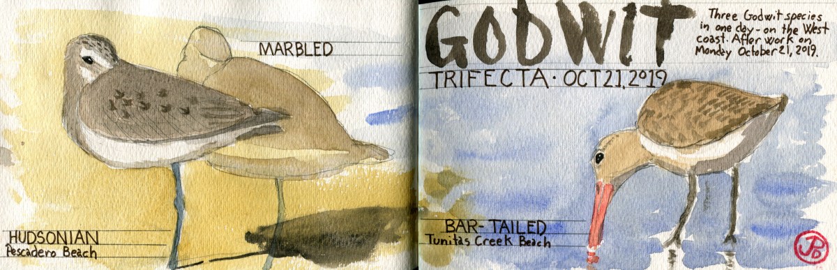
It’s not every day that you see three species of godwit on the west coast in one day. But Monday October 21, 2019 was the day and I was going to try for them after work.

I had seen all three godwits before but not all at the the same place. Marbled godwit is a common bird this time of year on the coast or bay. Hudsonian was rare on the coast. The last time I’d seen one was in Alviso in September of 2003. And I had just seen a bar-tailed godwit in the spring. It’s a common bird, if your in Europe, which I was, but rare in Coastal California. I had picked one up as a lifer in the Ebro Delta in Spain.

My first stop was Pescadero State Beach, where the previous week, all three godwits were present. Now only the Hudsonian and marbled remained. It was just a mater of finding it.

Along the long narrow beach that stretched out to the north I could see nothing but gulls, lots and lots of gulls. What I needed to find was a group of godwits. I couldn’t see any from here so a little leg work was called for. So I took a sandy step off to the north.

After I passed the large gull roost I found what I was looking for, a small group of shorebirds. I could make out a few whimbrels, long-billed curlews, and yes, some marbled godwits. It took all of my effort not to raise my bins to my eyes but I resisted the urge. I needed to get closer and head a little to the west to get the low sun at my back to help me find that one godwit that looked a little different.

IMG_6454

One of these birds does not look like the others.

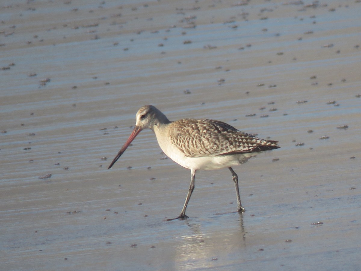
Most of the godwits were roosting, balanced on one leg with bills tucked under their back feather. Once I put bins on the group I immediately saw a smaller, over all gray and not rufous godwit with a dark cap and a defined bold supercilium or eyebrow. I was looking at a Hudsonian godwit for the first time in almost 20 years!

Hudsonia sketch

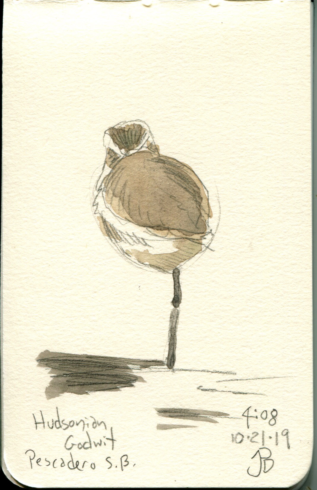
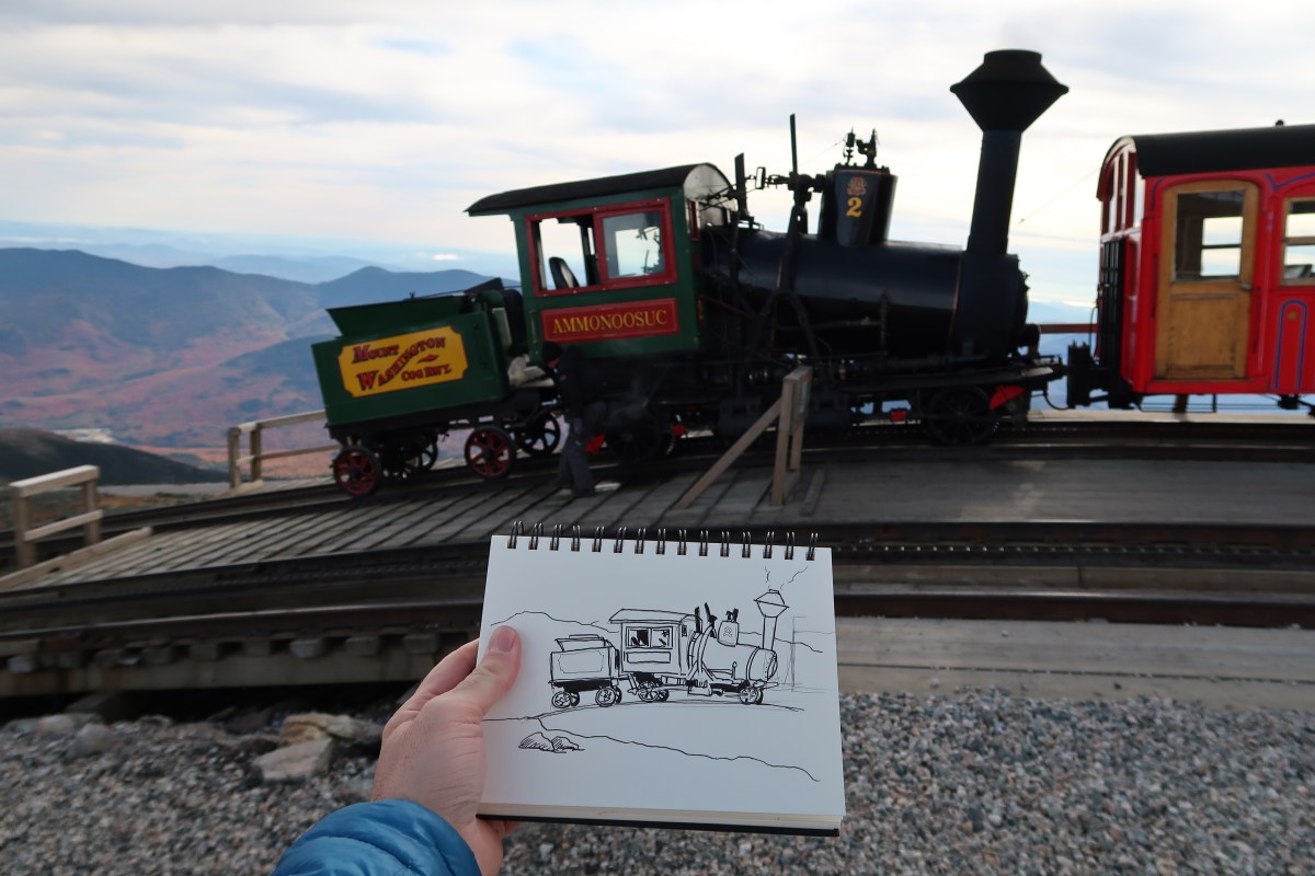
A field sketch of the resting Hudsonian in a Stillman & Birn Delta Series softcover sketchbook.

I guess I would just have to be satisfied with a two Godwit Day when Dickcissel texted me that the bar-tailed godwit had just been refound 10 miles to the north at Tunitas Creek Beach! So I rushed back, as fast as I could with a scope and in sand, to the parking lot.

Off I headed on Highway One and pulled off on Tunitas Creek Road (one of the most haunted roads in the United States) and parked. Then it was down the hill, along the path, up the steep hill, through bramble, along the hedge cave, past the creek and concrete wall to the expanding views of Tunitas Creek Beach.

IMG_6622

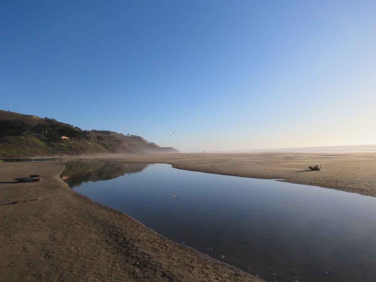
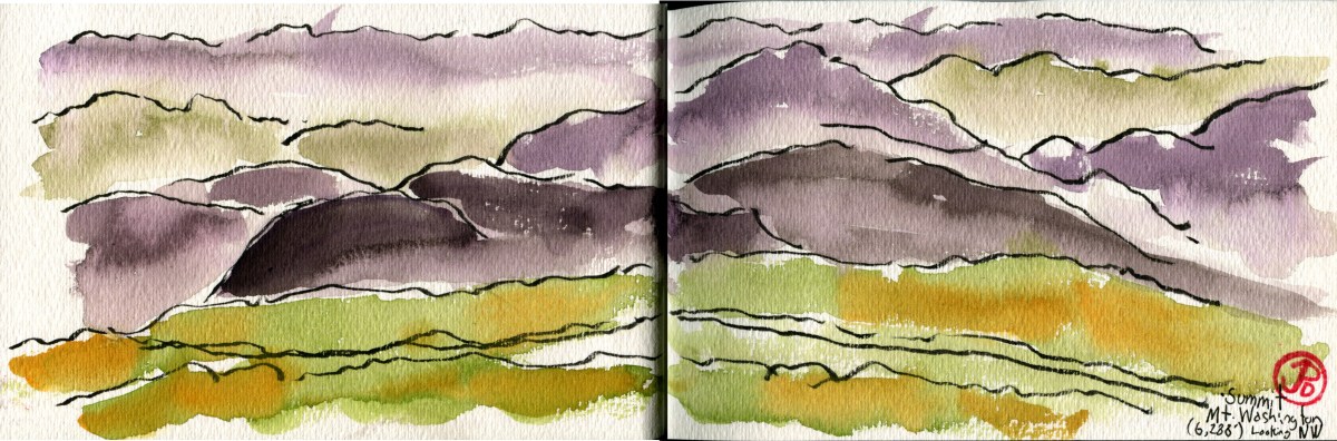
Tunitas Creek and the beach, looking southwest.

I scanned the long and narrow beach from the north and to the south. Nothing but gulls. Déjà vu.

What I needed to find was a group of godwits. I couldn’t see any from here so a little leg work was called for. So I took a sandy step off to the north.

All gulls and no godwits.

I was stopped by some friendly locals with their pooch and they asked what I was looking for. I expanded and they asked if I’d seen the heron by the creek. I told them that I had and that birding is an affliction and I had to find the godwit before I lost light. And off I went to the south. Not sure they understood, it is an affliction after all.

About halfway down the beach I saw the silhouetted forms of shorebirds. I had to head southwest of their position to get the sun at my back to identify them. A group of godwits. I scanned the flock. All marbleds.

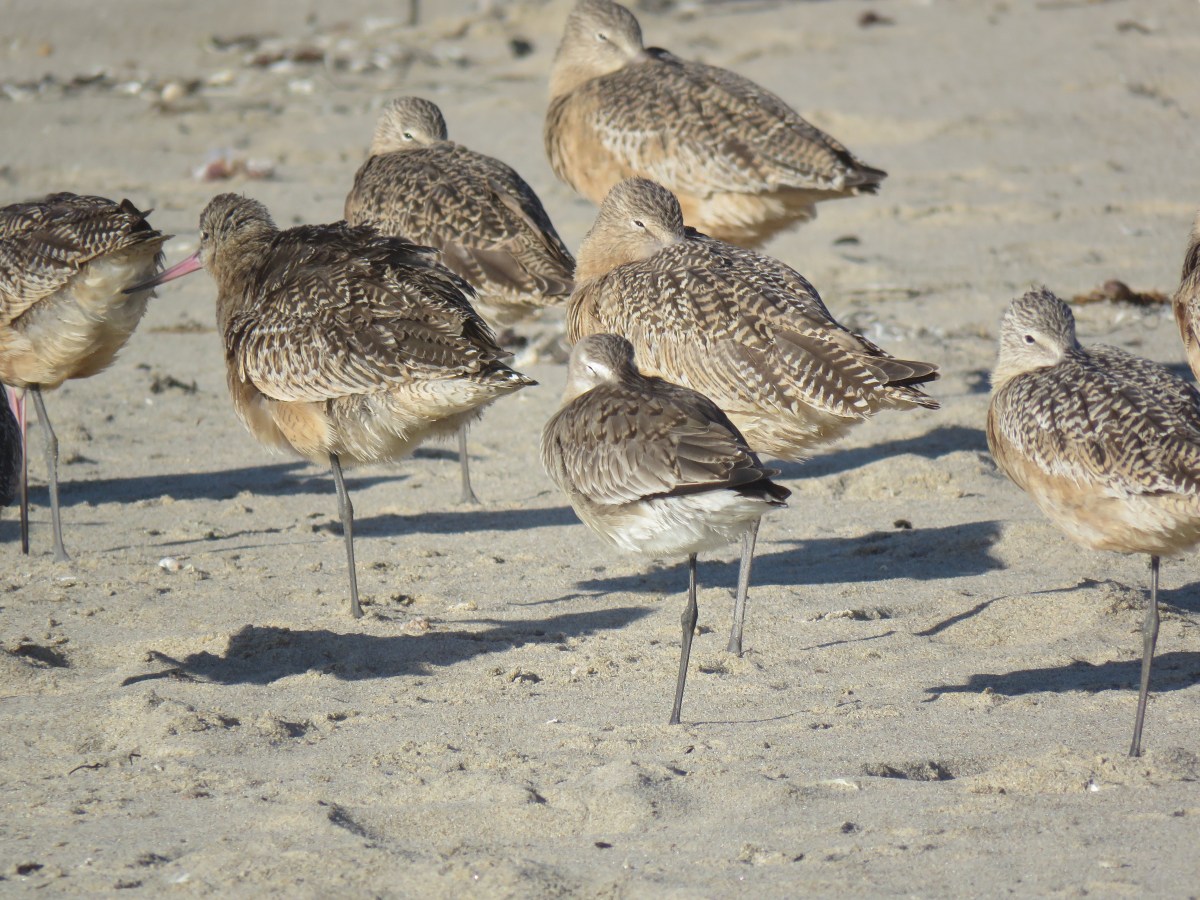
I looked to the south and moved on. In a sandy depression in the beach, I saw the silhouetted forms of shorebirds. I had to head southwest of their position to get the sun at my back to identify them. A group of godwits. I scanned the flock. I found marbled godwits and one bird that looked like no other. A bird foraging with the flock but was a little apart from the rest. Bar-tailed godwit!

IMG_6515

Bar-tailed godwit at Tunitus Creek Beach,

Now after attaining the Godwit Trifecta I could head back north towards home, reveling in a very satisfying Monday afterwork Birding adventure.

I would sleep well tonight!

Image

Mount Washington Cog Railway

There is something about the sound of a steam engine whistle that turns this grown man into a child again. Better yet if the whistle echoes off the walls of a valley, covered in autumnal vestments.

I was waiting with anticipation on the platform as I heard the retort of the steam engine’s whistle down the line, announcing it’s arrival. The engine’s top speed is three miles an hour, so it would take a little while to pull into the station.

IMG_6817

Our brakeman Tommy, waving at the children and adult children as No. 2 Ammonoosuc, pulls into the base station.

The Ammonoosuc was slow but it could do what few other steam engines could do: ascend a grade of over 35% (most steam engines can handle only a grade of 6%). This is because the steam engine, now billowing smoke into the cold fall air, is a cog engine.

No. 2, Ammonoosuc, was pushing her red passage carriage which would push about 70 tourists up the three miles of track to the summit of Mt. Washington, the highest peak in the Northeast, at 6,288 feet. What was really amazing about our engine is that she was built in Manchester, New Hampshire in 1875 and she’s still running strong.

We loaded up and it would take about hour (three miles at a top speed of three miles an hour) to reach the summit. I got a quick sketch in of my carriage view, which caught the attention of a curious toddler.

With a long retort of the whistle we started up and not far from the station, Ammonoosuc was tasked with pushing us up the Spring Hill Grade at 35%. That means that for every 100 feet we travel, we climb 35 feet! But this wasn’t the steepest grade on the line. That was yet to come, just under the summit, at the Jacob’s Ladder Trestle with a grade of 37.41%!

Near the summit was the first of two times that I would be crossing the famed Appalachian Trail or AT. At Mt. Washington, this was the second highest point on the entire 2,200 mile trail. Near the rocky, treeless summit, the AT is marked with stone cairns so hikers will not loose their way in the frequent inclement weather of the summit.

Mt. Washington

My sketch from the summit of Mt. Washington looking southeast, the highest peak in the northeast at 6,288 feet.

Once at the summit we had an hour to take selfies at the summit, take in the view, and sketch (well I was the only one sketching). I did one quick and loose sketch of the incredible view to the southeast in which I almost froze my face off (one must suffer for art) and one sketch of Ammonoosuc as she rested before our descent.

IMG_6874

One our descent, our brakeman, Tommy, was in charge of the wheel breaks of our car so we didn’t run into the engine on the steep grades. We were actually not connected to the engine, she pushed us up and then we glided down and Tommy made sure we didn’t put too much stain on No. 2. She was an old lady after all, just 144 years old this year!

We made it to the calmer weather of the base station where well all unpeeled from our layers, hats, gloves, and scarfs. Looking up I traced the snake trail of the cog line and reflected on the incredible achievement of having this almost impossible railway line built.


Image

Above Golden Pond

I had seen Squam Lake from lake view on my pontoon boat tour and now it was time to see Squam from above.

And the best place to do this was a 40 minute hike up to West Sidewinder Ridge.

From the granite park, you look down as the fir and pine fingers that seem to reach out into the waters of Squam.

Today was a beautiful afternoon and even on a Tuesday, the car park was filled to capacity. By the time I was at the peak, there were groups of people enjoying the views and sunshine.

IMG_6750

I found my little sketcher’s hallow and found a crack in the granite to secure my sling bag. I then started sketching the contours of the lake in my Strathmore panoramic watercolor journal.

Grasshoppers and wasps were my companions and the wasps investigated me until satisfied that I was not a source of food and then left me alone to enjoy my sketch.

IMG_2952

Image

On the “Real” Golden Pond

What would bring a son the Golden State to a small lake in New Hampshire?

It was a film I saw when I was a kid, the three time Academy Award winning On Golden Pond (1981). The real Golden Pond is to be found in New Hampshire’s Lakes Region and it’s real name is Squam Lake. I planned to spend a few days here sketching and nature loafing.

I would be visiting a few of the filming locations and taking a Squam Lake Natural Science Center pontoon boat ride around the lake to take in the natural beauty of the lake in it’s fall foliage.

On our 90 minute ride we visited some of the bays and islands of the serene New Hampshire lake. We hoped to see two of the emblematic species of this region: common loon and bald eagle. We had no luck with the eagle but near Kimball Island, I spotted four loons and our captain took us over for a closer look.

During the filming of On Golden Pond, the cinematographer noted that it was hard to get good shots of loons because they were so shy and would dive out of view when approached (they are known as “divers” in Britain). Since the 40 years since On Golden Pond was filmed, the lake has become more and more popular with more visitors and boats and house on the lake. As a result the loons are used to the presence people being around them and allow close approach.

IMG_6796
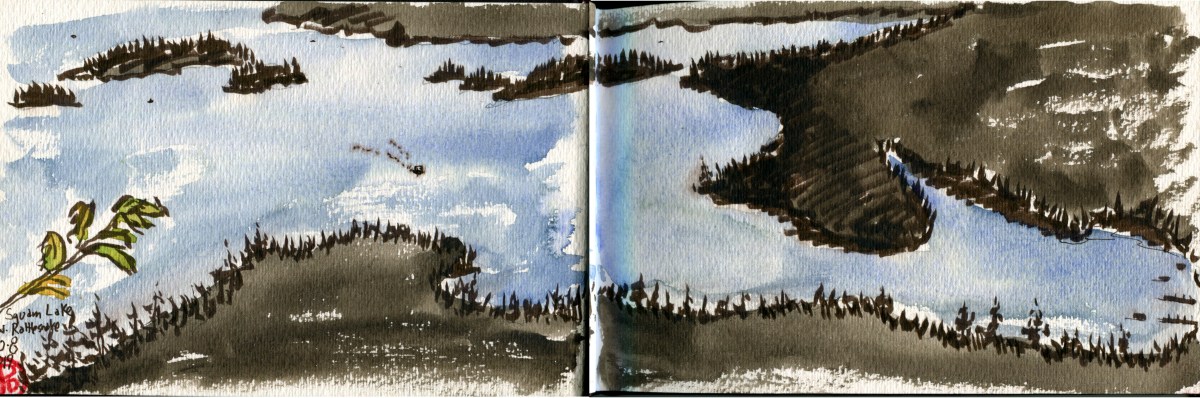
A Nature Center pontoon boat passes by Holderness’ famous dock on it’s way to Squam Lake. Behind the boat is the boathouse that Henry Fonda almost took out as he speed away from the dock in the film.

One of the locations featured in the film is the public boat harbor in Holderness. It is know as the Squam Boat Livery to the locals. It was here where legendary film actors Katherine Hepburn and Henry Fonda, playing Ethel and Norman Thayer, stopped to have their vintage 1951 Chris-Craft wooden boat refueled. The wooden boathouse looks very much the same when they filmed here in 1980. What is notable is the tourist industry that has grown up because of the success of the movie. The restaurant next the the harbor is named “Walter’s Basin” a reference to the trout that almost got away in the film who was named “Walter”. The are inn and bed and breakfasts with the name “Golden Pond” in them.

IMG_3074

I stood on the bridge, right where Katherine Hepburn pulled her car up to get the mailman to help look for Norman Thayer and Billy after their boat accident in “Purgatory Cove”. (If you haven’t seen the film this is all meaningless, so go watch On Golden Pond!)

Purgatory Cove

The scene where the boat accident was filmed was near Kimball Island. (This scene scared me when I watched it as a kid). On our boat tour we passed by the cove and our captain pointed out the two rocks featured in the famous scene.

We left we again found a small raft of loons.

IMG_3076

The second unit shot footage of a car driving through the Lakes Region. Some of this unused footage was featured in the opening sequence of the sitcom Newhart, including the main road in Sandwich.

Image

Carriage Roads and Bridges

A way to avoid the tourists and fall foliage peepers In Acadia National Park is to hit the 57 miles of Carriage Roads that rise and weave throughout the National Park. It was easy to find peace away from the crowded Jordan House area because anything requiring hiking on a slight rise really thins out the masses.

The Carriage Roads where a gift from philanthropist John D. Rockefeller Jr. and were constructed from 1913 to 1940. The roads were designed and built to fit the lay of the land and meant for taking your time and enjoying the journey. These roads were never built for the automobile in mind and to this day you can only travel by foot, tire, or hoof.

IMG_3294

Walking on a Carriage Road in the fall was certainly one of the highlights of my trip.

Rockefeller also financed 16 out of the 17 stone-faced bridges. I was heading out early from Jordan Pond to sketch the oldest bridge on the Carriage Road system: Cobblestone Bridge which was completely in 1917.

Less then a mile on the well marked Carriage Roads, I came to the first bridge ever built in the road system. It is different than most of the other 16 bridges in that it is faced in cobblestone, in an attempt to fit into it’s stream-spanning location. I found a streamside rock on Jordan Creek and started to sketch.

IMG_3217

I loved sketching the textures of this bridge. I also loved sketching in my Stillman & Birn Delta Series watercolor journal. I normally don’t like spiral sketchbooks because of their lack of ruggedness for the trials of travel but this this book held up well.

I headed back to the Jordan Pond area, where a good confluence of Carriage Roads exist, and I hiked out to look at two other bridges. I sketched one of them, the Cliffside Bridge which was completed the year my father was born, 1932. This 230 foot bridge is an arch above a ravine and standing above the arch gives way to a beautiful fall foliage panorama.

Cliffside

I drove to another trailhead and another carriage road system to see and sketch two more bridges. The first bridge I came to was the Hemlock Bridge (1924) and then I came to the appropriately named Waterfall Bridge (1925) because it’s arch frames a forty foot waterfall. This bridge I sketched in my smaller Aquabook.

Waterfall bridge

Waterfall Bridge in my smaller Aquabook.

Image

Phillip Exeter Academy Library

How do you sketch an architectural masterpiece?

Well first I “shake hands” with the building which means walking around the structure, viewing it from all angles and even walking across the street to find which angle speaks to me.

The building, the Phillip Exeter Academy Library in New Hampshire, was certainly speaking to me. It is on the campus of Exeter Academy (founded in 1681) and is the largest secondary school library in the world. And I wanted to find the best angle that would really showcase the architect, Louis I. Kahn’s lines and form but I had one challenge. It was hard to see the Library through the trees. This is part of the on-the-ground-challenges of field sketching, but I was certainly up for the challenge!

IMG_6592

Louis I. Kahn’s great library at dusk, Exeter, New Hampshire. The interior is every more amazing.

I first became aware of Kahn’s work through the documentary 2003 My Architect: A Son’s Journey, made by his illegitimate son, Nathaniel. I had sketched his West Coast masterpiece, the Salk Institute in La Jolla, California and I wanted to find more examples of his work to add to my sketchbooks.

IMG_6583

The best way to understand a piece of architecture is to sketch it. The more you take the time to notice the more you really “see” it. This is really true of any subject but the best part about architecture, unlike animals, they are very obliging subjects, except for the complexity of the lines and the difficulty of perspective.

The following morning I sketched the library one either side of a coffee and oatmeal break. I sketched it from two different angles and in two different styles. My first sketch was a little more detailed following a pencil sketch while the second I was sketching without a net using micro pens (08 and a brush pen) to do a very loose sketch (featured image). I think I like the latter sketch, it is freer and captured the essence of the library better.

I did say that the interior was more incredible that the brick exterior. I know this because I headed into the space and saw the amazing interior. Unfortunately a librarian also saw me and with an air that said to me that she frequently turns away Louis I. Kahn fans. She told me of the few days of the year you could visit the interior, this was, after all, a school in session and said, “The library has because popular recently, too popular.” I thanked her and got fleeting glimpses of the incredible interior before headed out. Far too fleeting for such an amazing and sketchable space which remained unsketched.

Exeter 2

Image

Northeast Fall Foliage

Autumn is a second spring when every leaf is a flower.

-Albert Camus

One of the highlights of going to the northeast in the fall is the autumn colors which the area is rightly famous for. And it looks like I’d be timing it perfectly, as I did some research to find when the peak times would be in Maine, New Hampshire, and Vermont.

To put this all into a sketch, I chose to do it in the form of a map. So with a few reference materials I created a fall foliage map. Included a Albert Camus quote, a compass rose, and a key.

I couldn’t wait  to become one of the “leaf peepers” and paint some of the autumnal scenes in New England. Before flying to Logan, I prepared my paint palette with autumnal colors: burnt sienna, Winsor yellow, olive green, Quinacridone gold, alizarin crimson, cobalt blue, and cadmium orange.

Image

Pre Trip Sketching

“The world is a book, and those who do not travel read only a page.”

-Saint Augustine

One of my favorite parts about travel, aside from the travel itself, is the preplanning and research that happens months and weeks before the date of departure. These preparations creates the palpable excitement that intensifies to the point of lift off.

I am certainly not a planner that wants to know where I’m going to be every minute of the day. I look at it more as planned improvisation. I see it as the framework but I also want to be open to the serendipitous events that can happen when away from home far away. The event you can never plan for but plan to be open to.

One thing that I booked weeks before my autumn trip to New England, was an afternoon whale watching trip out of Bar Harbor, Maine.

EC Pelagic Card

A pre sketch design sketch.

I love whale watching cruises on the West Coast and I have enjoyed seeing humpback, Gray, and blues whale as well as orcas and other dolphins. And I have also enjoyed pelagic birding trips so I was looking forward to Birding on an east coast whaling trip.

You don’t always have a whole lot of time to identify pelagic birds as they pass by so I was going to do a little homework to help me with my fieldwork.

This involves doing a lot of research through field guides and reference books and distilling that knowledge and putting it into a single sketch.

One of the top birds on my East Coast pelagic wish list was great shearwater and I was hoping to see a Manx shearwater too.

Manx shear

Image

Birds of Brazil

At the end of 17 days birding the Cerrado, the southern Amazon Basin, and the Pantanal of Brazil I had added 309 new species to my world lifelist and seen a total of 525 bird species. By the time I boarded the plane in Cuiabá on my way to São Paulo, I had a total of 1,642 world lifers, which is about double the number of species found in the United States.

To reach this number I had to travel. All across the United States from California to Cape May to the Rio Grande Valley in Texas. Two trips to Spain. Then south to the Americas: Costa Rica Panama, Ecuador, and Brazil and over to the western Pacific to Japan.

I had also whiffed on birds all over California and the rest of the United States. I have many birds that might have been.

It is a reminder to stay in the moment and celebrate the bird in front of you. It may me with you a short time or you may get quality time but it never pays to think of the bird that never was.

Image

Bodega Pelagic

“At length did cross an Albatross,

Through the fog it came;

As if it had been a Christian soul,

We hailed it in God’s name.”

The Rime of the Ancient Mariner (1834)

Samuel Taylor Coleridge

We met at 6:30 AM in the dirt parking lot of Bodega Bay Harbor.

A grizzled, sandaled sea dog of a Welshman stepped forward. He was to be our guide over the next ten hours.

He was and is Steve Howell, seabird author (his book Oceanic Birds of the World was in my pack) and expert of the avian world and he would be helping to identify the pelagic life we would be seeing in the Cordell Bank National Marine Sanctuary.

While it seemed nice and calm on the dock, Captain Rick warned us of choppy and windy conditions. And things seem nice enough as we headed out of the harbor but once we hit open waters the New Sea Angler bobbed on the waves like a cork. There was a steady stream of birders heading to the stern to “feed the fish”. Luckily I had a stomach of iron and I never suffered from seasickness. But this trip was going to test my will and my digesting breakfast.

Close to port we saw many nearshore species such as brown pelicans, common murres, cormorants, and California gulls. A little further out we saw our first pelagic species: sooty shearwater. As Steve Howell noted, “They’re called shearwaters because, well, they shear the water.” These dark oceanic birds flew with ease, inches above the rolling water, seemingly cutting the surface.

Even further out, we saw our first whale spout. Off on the horizon, to the port side, I saw a humpback whales breach! This is when a cetacean partially or wholly leaves the water’s surface.

We were seeing a smattering of birds followed by a pelagic barrens of no birds. Captain Rick headed towards an anchovy school where about ten humpbacks were feeding. Soon Pacific white-sided dolphins appeared in the swells besides us. One highlight was a lone humpback that passed under the New Sea Angler and surfaced close to our starboard side. The whale was so close that I could hear the leviathan exhaling!

More shearwaters appeared around us: Buller’s, sooty, and pink-footed. Where the whales are you will find pelagic birds. We were still in relatively shallow waters and we had not yet seen the oceans most iconic species: the albatross. Albatross is a deep water species, rarely seen from land.

When we were out about 25 miles, the winds peaked at 20 knots and we saw our first albatross, easily riding the wind. This was the black -footed albatross and we would see more as we labored above the submarine canyon near Cordell Banks.

Two amazing highlights were just ahead of us, above the canyon’s edge. Two massive whale spouts, one after the other, billowed in the air, just to our starboard. Two bluish-gray whales rolled on the water and then appeared again heading on an easterly course, across the canyon. These whales did not appear black, like the humpbacks but we’re blue like their namesake: blue whale. These are the earth’s largest creatures; the largest creatures that ever have lived on the planet earth.

These two whales had their accompanying mass of pelagic birds but one was a sought after bird for this trip. Mario, one of the spotters, called out, “Laysan!” And every birder within earshot rushed to the bow of the boat, eagerly scanning the pitching waves from a pitching boat. Not an easy task. No albatross.  I moved into position, scanning the waters in front of us. The swell moved towards us revealing the following trough. And there was what looked like a massive western gull. “Laysans on the water in front of the boat!” I exclaimed.

The Laysan sat on the pitching waters, stretching it’s long, narrow wings. The birder density was reaching critical mass on the bow as this was a sought after a lifer as well as a Sonoma County bird. After a quick preen, the albatross stretched out both wings, ran across the waters, and effortlessly lifted off into the air. It headed to the east, presumably to catch up with the blue whales.

Cordell Sketch
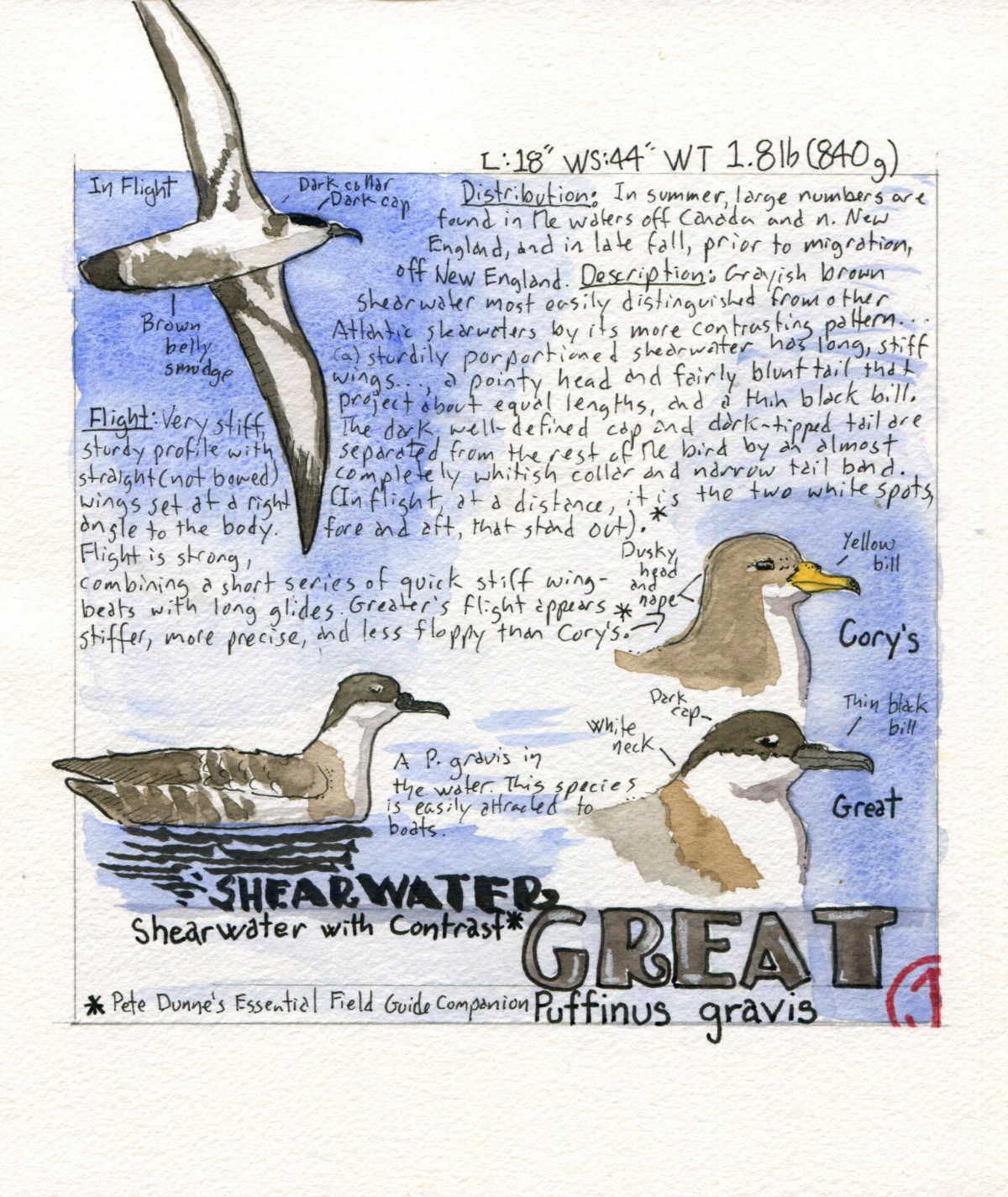
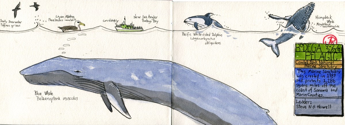
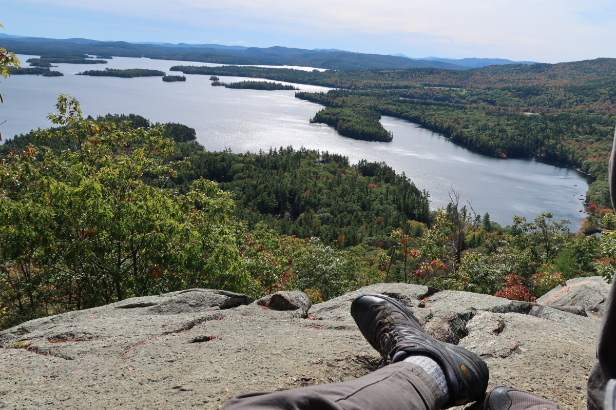
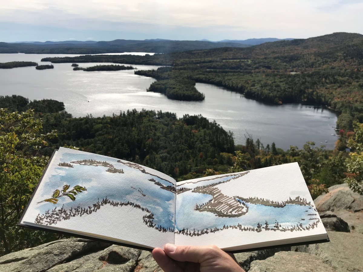
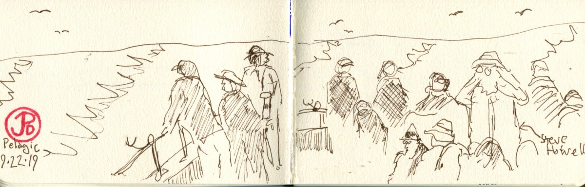
A sketch to pass the time as we headed back to port. I had attempted to sketch earlier but didn’t have my sea legs yet and it came off rather disheveled. Sketching on a moving boat is not as hard as it seems, and I had some experience in the boats of the Amazon and the Pantanal. But Big Blue offers huge challenges for the sketcher of the waters.