I had three target lifers for my Scandinavian summer adventures: barnacle goose, dovekie (little auk), and ivory gull.
The hardest to get was the ivory gull which was only to be found on the pack ice sometimes in the company of polar bears.
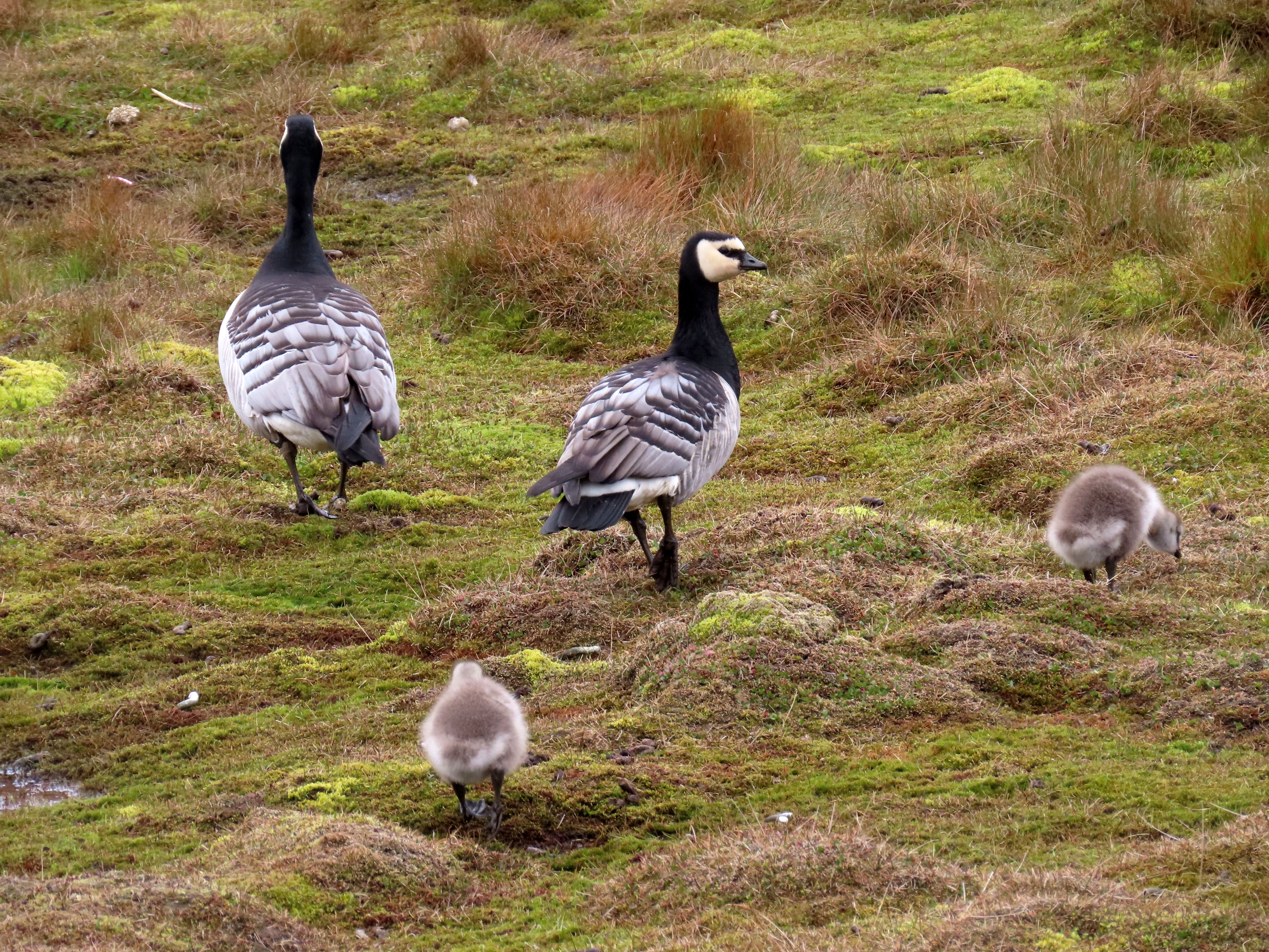
Perhaps the easiest was the barnacle goose and dovekie. I had four geese in the harbor near the Munch Museum in Oslo. I saw many more in Longyearbyen in Svalbard.
Barnacle goose family in Longyearbyen.
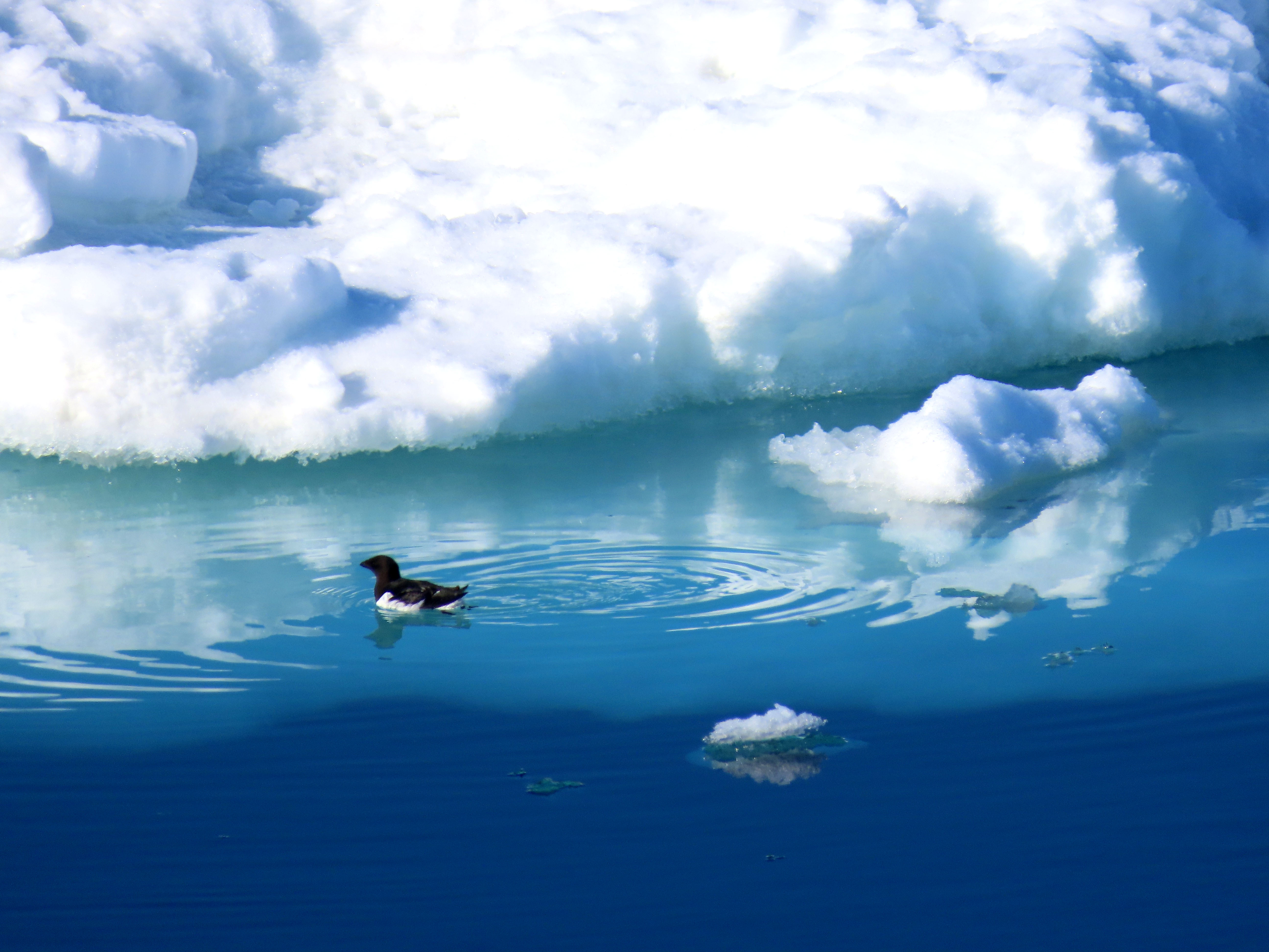
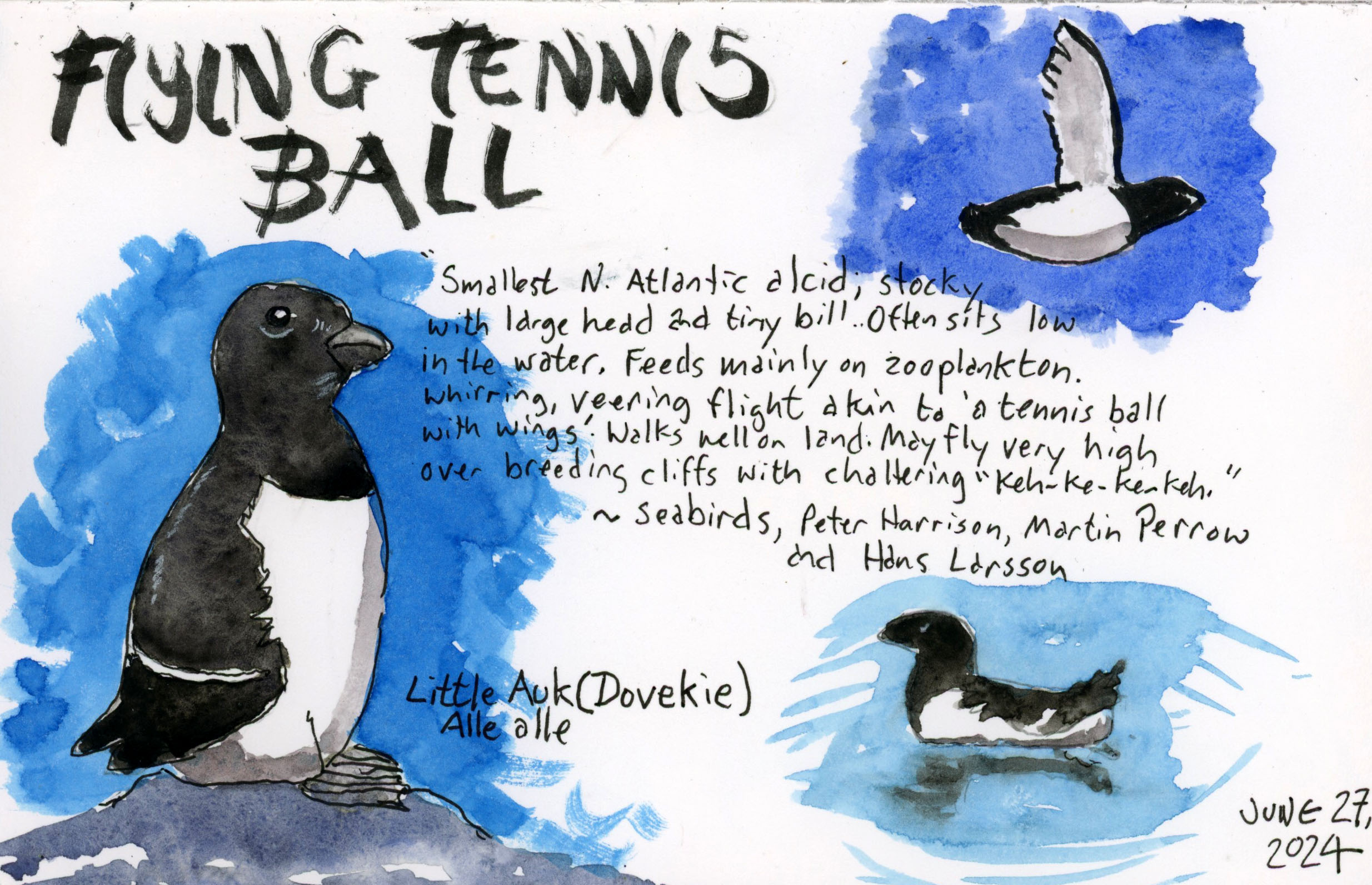
Dovekie or as it’s known in Europe, little auk, was also plentiful around the southern and eastern side of Spitsbergen. I saw many from the decks of the Plancius.
Little auk in its icy summer habitat.
So what’s in a name? Common names vary in different regions and in different languages. For instance Phalaropus fulicariusis known as the red phalarope in North America but on the other side of the Atlantic it is the grey phalarope. Our guide didn’t even know this, falsely claiming that the common name had been changed.
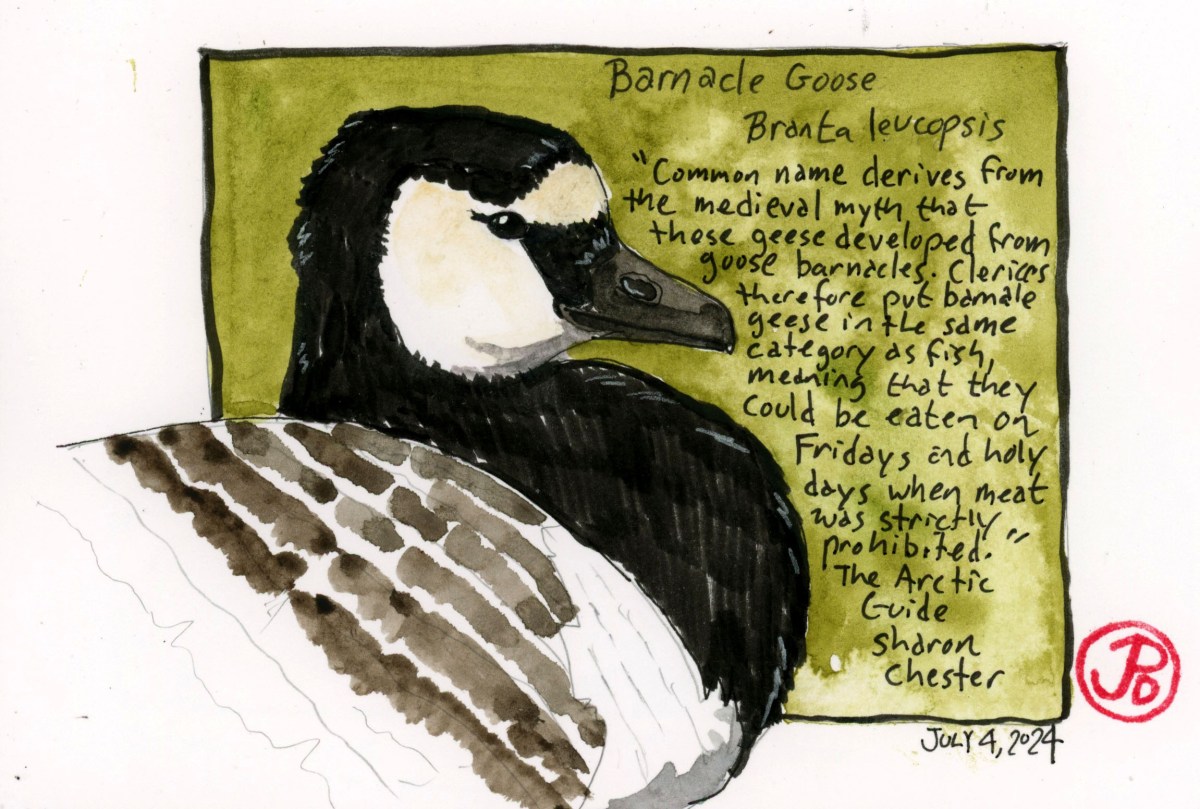
One of the dubious common bird names is barnacle goose. You would think this goose eats barnacles. Nope. The name comes from Medieval times when it was thought that the goose came from goose-necked barnacles. The bird was even considered a fish so it could be eaten on religious holidays such as Lent. Such were the times when folklore trumped scientific learning.
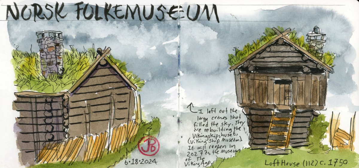
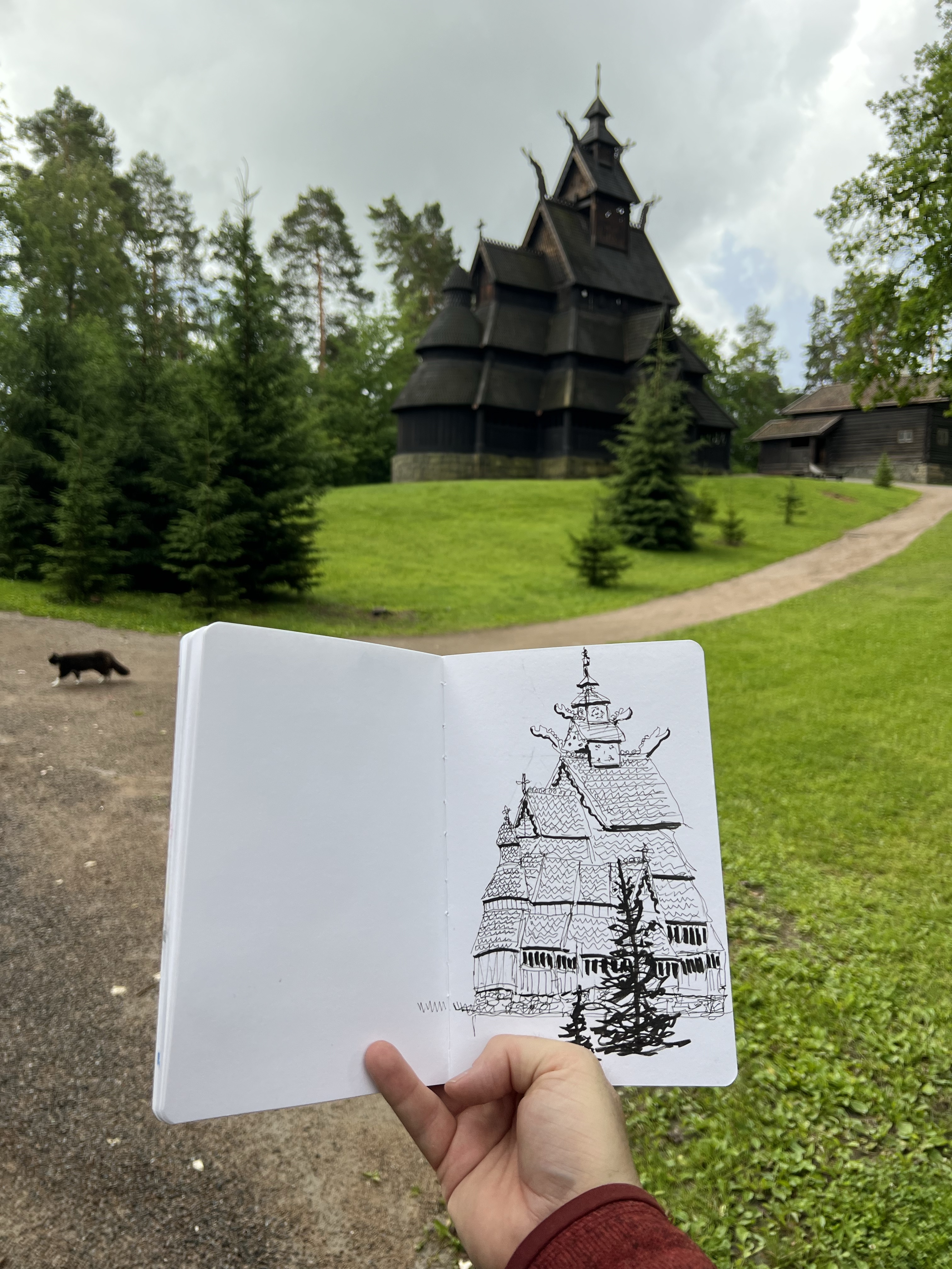
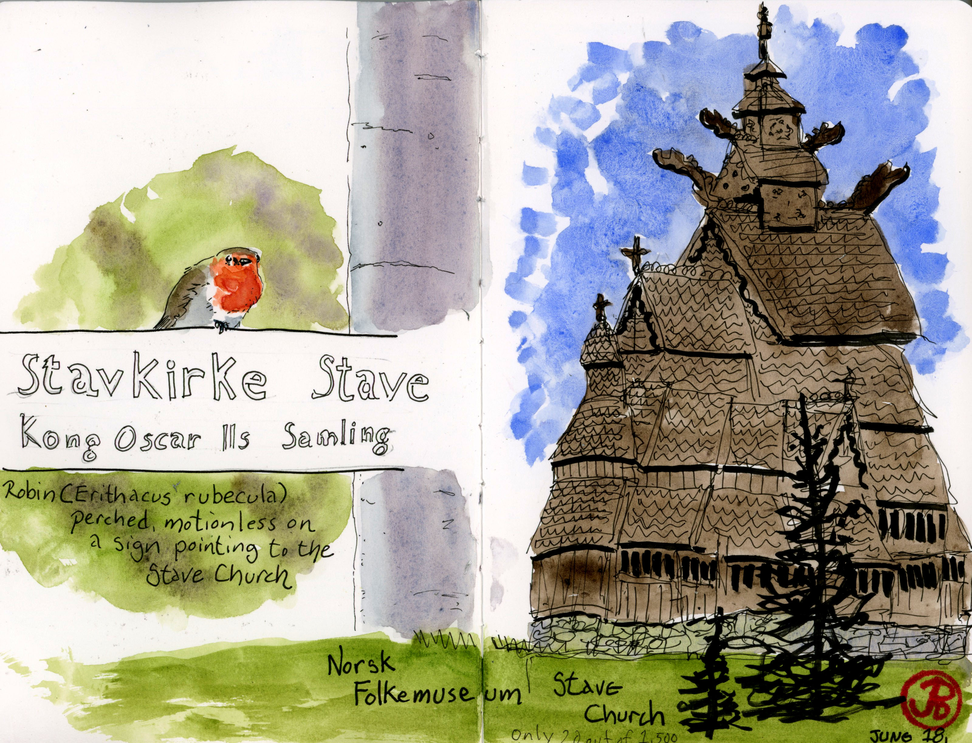
High on my sketch list was the traditional stave church at the Norwegian Folk Museum.
I took the first Bygdoy Ferry to the peninsula to visit this very popular outdoor museum, which is Norway’s largest outdoor museum.
The museum has over 140 buildings from different regions of Norway spanning an impressive span of time.
Once the gates opened at 10, I made my way to the stave church, using the map to navigate the large trail system. The church was so full of detail that I went with a very loose style, not focusing on every single shingle but choosing the form of the church.
Church, sketch, and a photobombing cat.
After my sketch I headed to another section and on the way I passed a robin statue-still on a sign. I was almost fooled into believing that this was a wooden carving until the red breast burst into life and shot off to forage in the underbrush. I add this experience to the other side of my spread.
I found a collection of house farmsteads with a living roof of green so I found a bench and started sketching. My sketch was interrupted by rain so I had to finish my sketch in stages while retreating to a nearby house.
For this sketch, featured sketch, I used a little real-time editing. Behind the buildings, huge cranes reached into the air, shattering the feeling of time travel and firmly placing me back in the 21 Century. The cranes where above the site of the Vikingshipshuset (Viking Ship Museum). This museum has one of the most iconic preserved Viking ships in existence, the Oseburg Ship. The museum was closed in September 2021 for a complete renovation. The new museum will reopen in 2027.
This section of the museum felt like I had travelled forward in time from the last two buildings I sketched. I was traveling from Norway’s rural countryside to more developed towns.
Sounds like I need to make another visit to the Bygdoy Peninsula some time in the future!
Oslo is a city coming into its own as a modern Scandinavian city. The architecture around the city center is modern and I wanted to add this newer side to Oslo to my sketchbook.
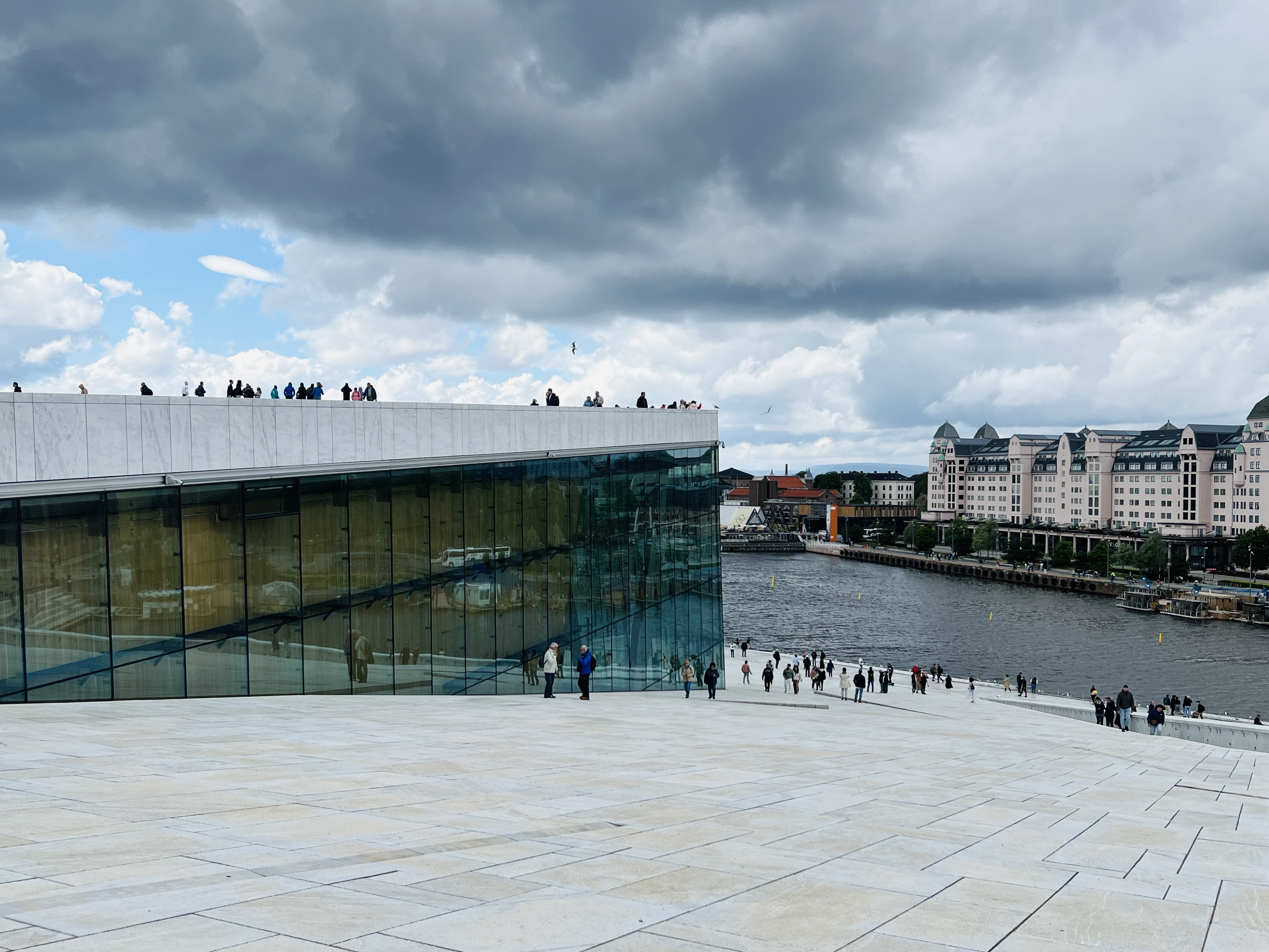
Nothing says modern Oslo more than its glacial Opera House. The innovative design lets you walk up the sloped roof for great views of the cityscape and the fjord.
The architectural glacier that is the Oslo Opera House. You can walk up onto the roof for city views.
Another modern building that made it into my sketchbook is the Munch Museum. This museum is dedicated to the works of Edvard Munch, best known for creating the second most famous painting in the world: The Scream.
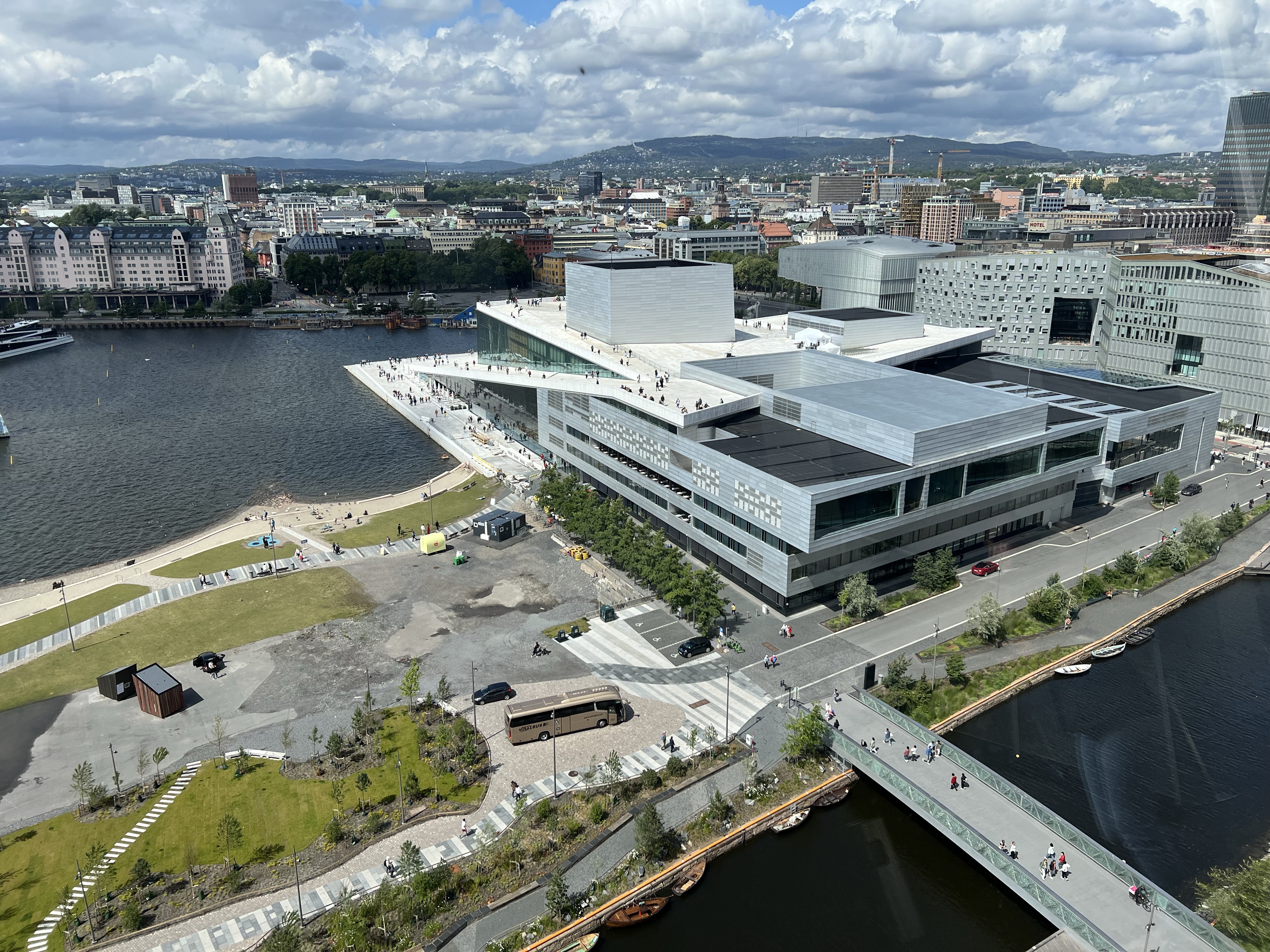
The new Munch Museum was opened in 2021 and the view from the top floor is amazing.
The view from the Munch looking down on the Opera House.
I found a perspective to sketch the museum with a garden and sculpture in the foreground. The 2022 sculpture in title The Mother by Tracey Emin.
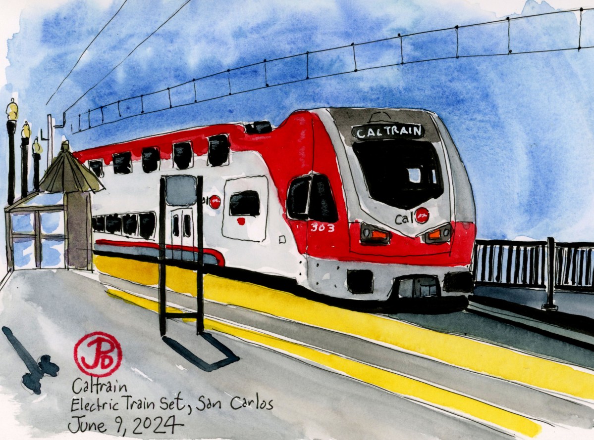
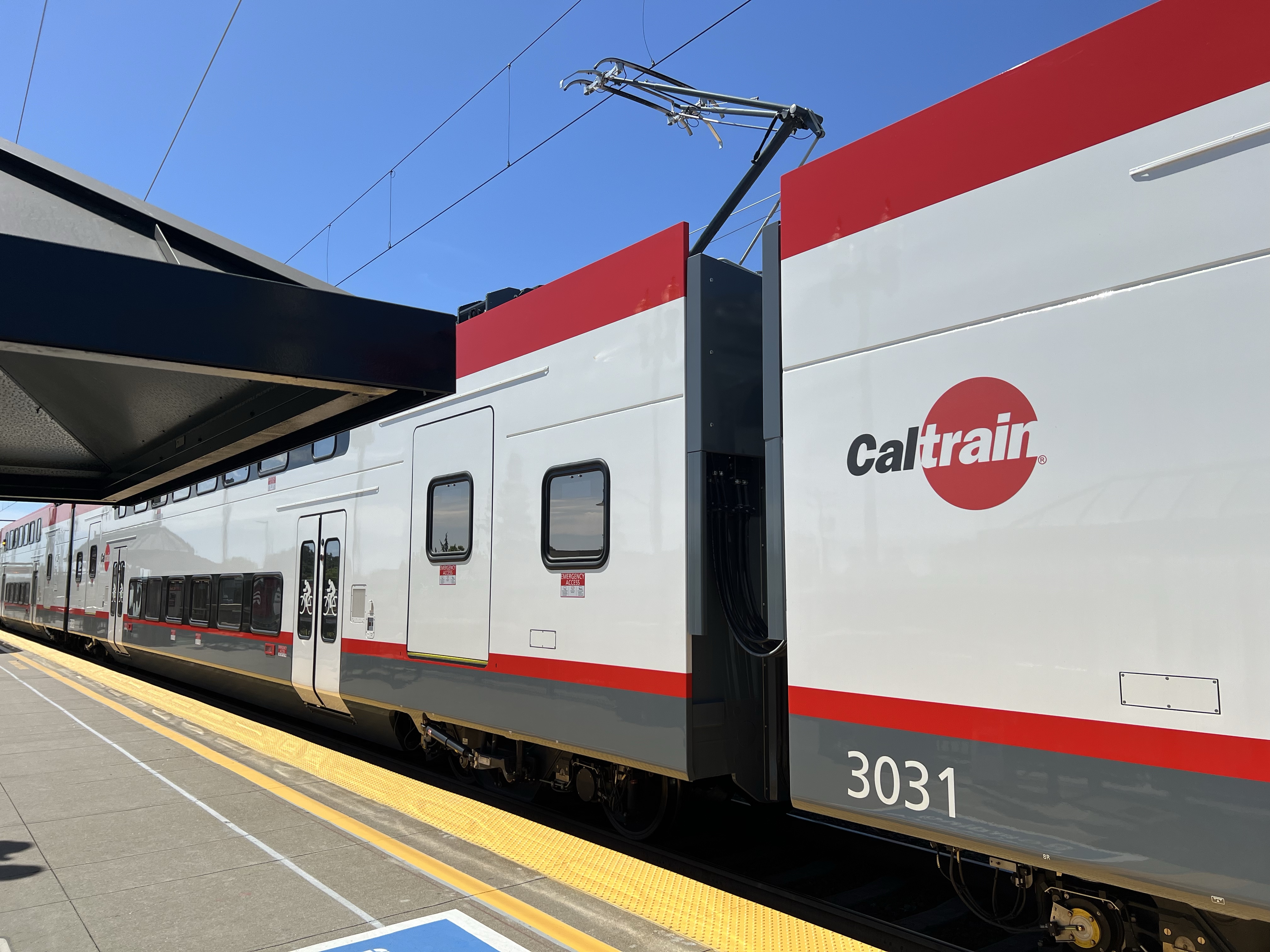
On a recent Saturday morning I had a pleasant surprise as I drove north on El Camino Real at San Carlos. At San Carlos Station was one of the new electric CalTrain sets.
The new trains are built by Stadler, a Swiss-based train manufacturer. The company was founded in 1942 and is headquartered in Bussnang, Switzerland. The company has a factory in Salt Lake City, where Stadler will build 24 train sets for Caltrain.
The train sets are known as BEMUs which stands for battery-equipped electric multiple unit.
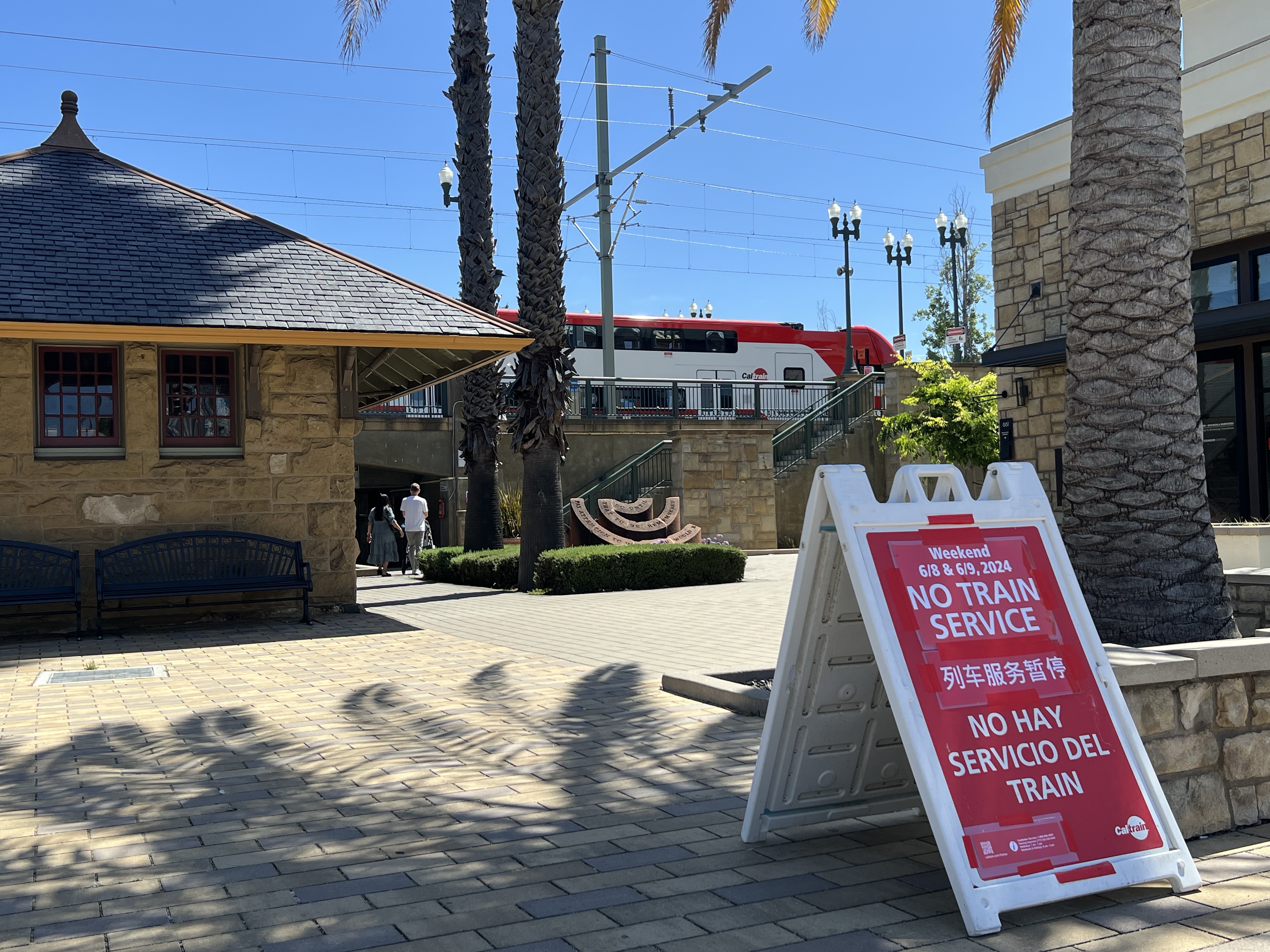
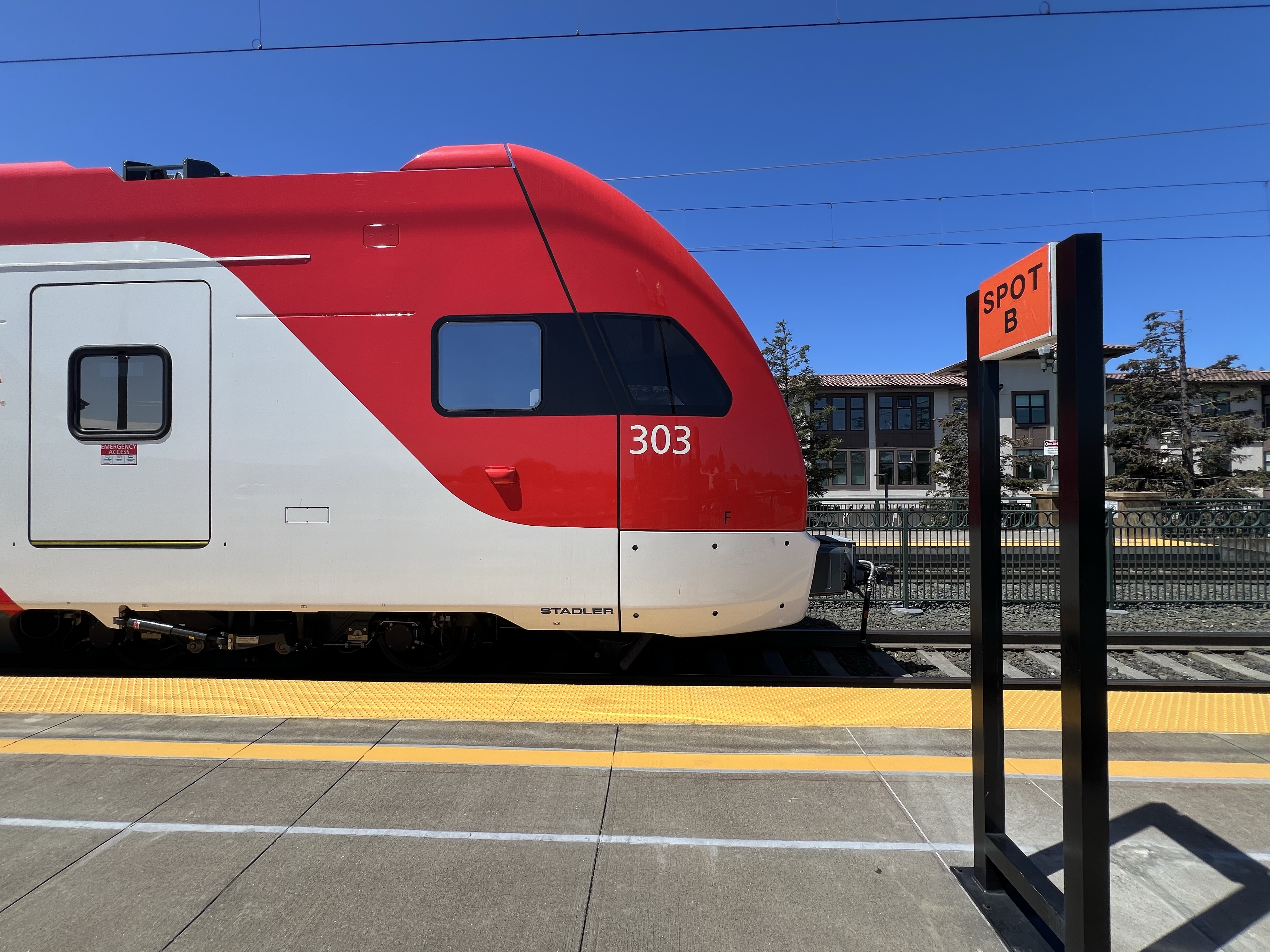
I parked, thinking that the train would surely have left the platform by the time I walked to the station but as I walked down San Carlos Avenue, the train was still stationary at the station.
As I crossed El Camino, a placard stated “No Train Service”. The line was closed all weekend.
The line was closed from San Francisco to San Jose so Caltrain could test eight of the new electric train sets. The electrification of the line started in 2017 and electric trains are scheduled to start running on September 21, 2024.
If you think of some of the most iconic passenger trains in modern rail: Japan’s Shinkansen (“Bullet Train”), France’s TGV, Eurostar, Amtrak’s Acela, Chinese Railways CRH, the Bay Area rail corridor was finally being electrified to catch up with the rest of the world, although it would not come close the top speeds of modern Shinkansen (186 mph).
Three quarters of the world’s passenger service are powered by electricity. About time!
This is what powers the new train sets: the pantograph that delivers power from the wires above to the train set below.Not sure if these new trains sets earn any style points. They look like a large streetcar or tram.
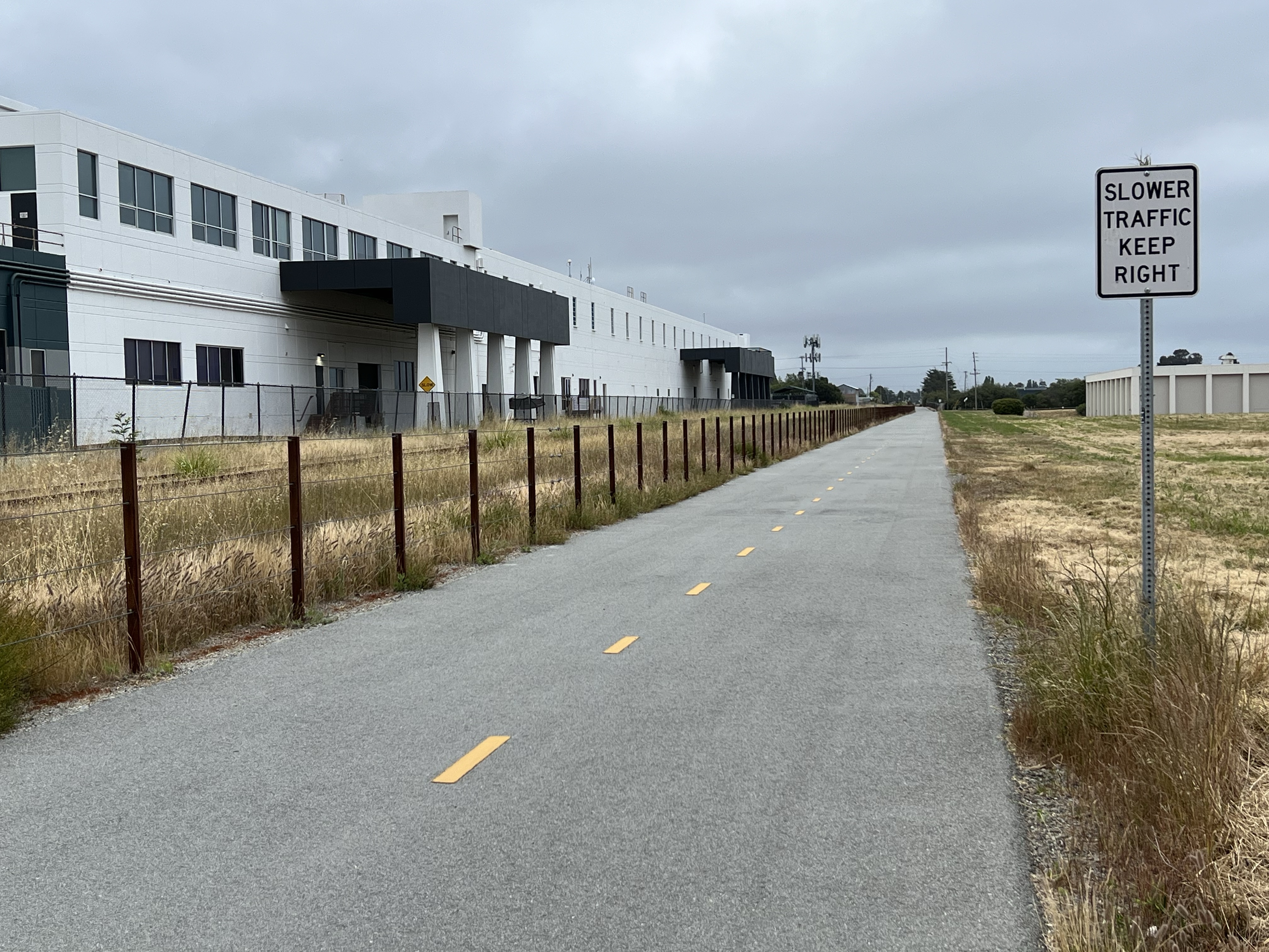
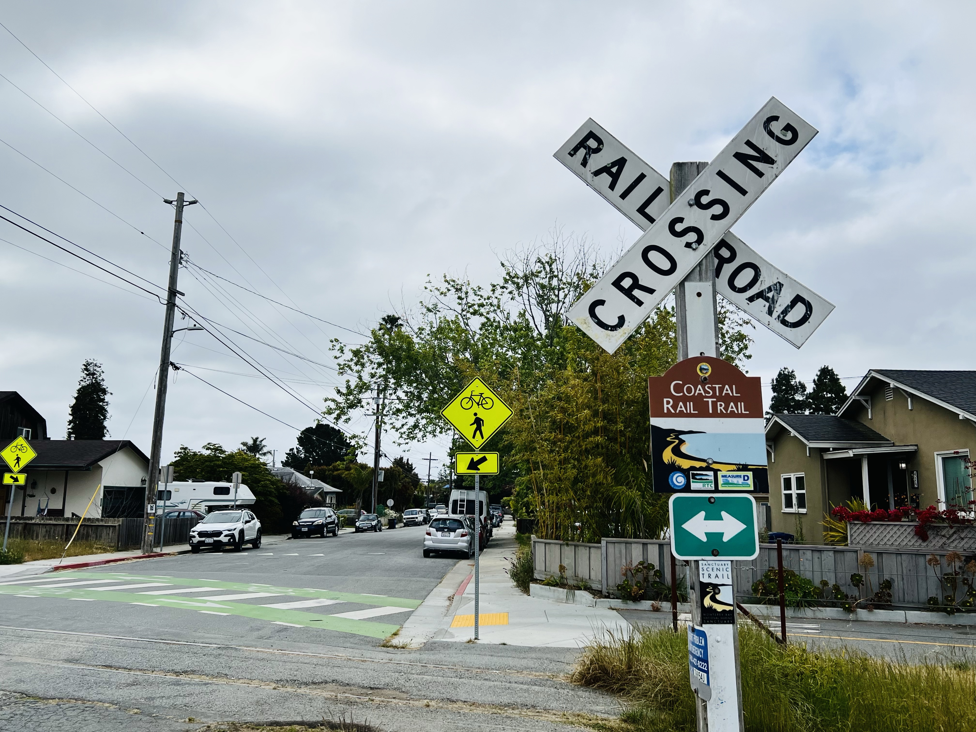
On a gray Saturday morning I decided to explore a recently opened section (opened in December 2020) of the Coastal Rail Trail in Santa Cruz.
The section I was exploring (Segment 7) is between Natural Bridges Drive and Bay Street. The walk takes about 30 minutes and the round trip covers about two miles.
As the name implies, the paved pedestrian trail parallels the former Southern Pacific Davenport branch line from Watsonville to Davenport.
As of the date of writing only two sections of the trail have been opened, one in Watsonville and the section I was walking on in Santa Cruz.
At grade crossings there are pedestrian signals that stops cars so you can cross the street safely. Well that’s the theory anyway. With the trail recently open, pedestrians should still use caution and not assume all vehicles will stop for you.
When the trail is completed, it will cover 32 miles from Davenport to Watsonville. There are also plans to introduce electric rail service using the former Southern Pacific right of way and trackage.
I started where the rail trail ends: Natural Bridges Way.
The Rail Trail passes by the former Wrigley Chewing Gum plant (left). The plant was in operation for more than 40 years and produced 20 million sticks of gum per day. The plant had a rail siding that is still visible today.
In my college days I remember visiting the gum factory with my roommate in an unsuccessful attempt to get a plant tour. The receptionist told us that they didn’t give tours but asked us if we would like some gum! We answered in the affirmative and then opened a drawer full of gum. I went for Big Red while my roommate picked Juicy Fruit.
The trail is level as it parallels the rail grade. Railroad grades normally don’t exceed 2%. The steepest mainline railroad grade is 3.3% on the Raton Pass grade in New Mexico. A railroad grade is expressed as a percentage the grade rises or falls over 100 feet of horizontal distance. So a 2% grade rises and falls two feet over a 100 feet distance. These gentle grades are ideal for walking and biking.
I passed by the New Leaf Market at Fair Ave, often my first stop when I head into town, as the trail and line turns slightly to the left skirting the Westside Circles neighborhood.
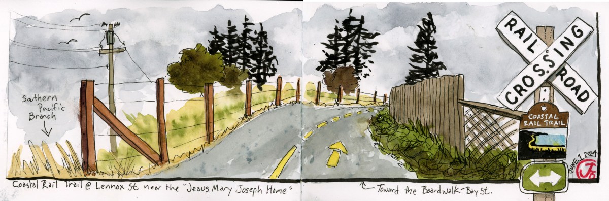
I came upon a scenic curve in the trail at Lennox Street as the rails and trail curve off to the right as it nears Bay Street. I pulled my sketchbook out of my bag and started sketching the view (featured sketch).
On the right of the spread I sketched the grade crossing sign at Dufour Street with Coastal Rail Trail sign below the crossbuck.
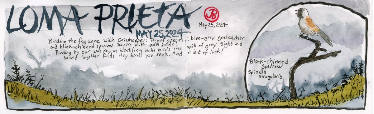
Early on a Saturday morning, Grasshopper and I headed up on winding Summit Road. Our birding destination the Bay Area birding hotspot: Loma Prieta and the “Saddles”.
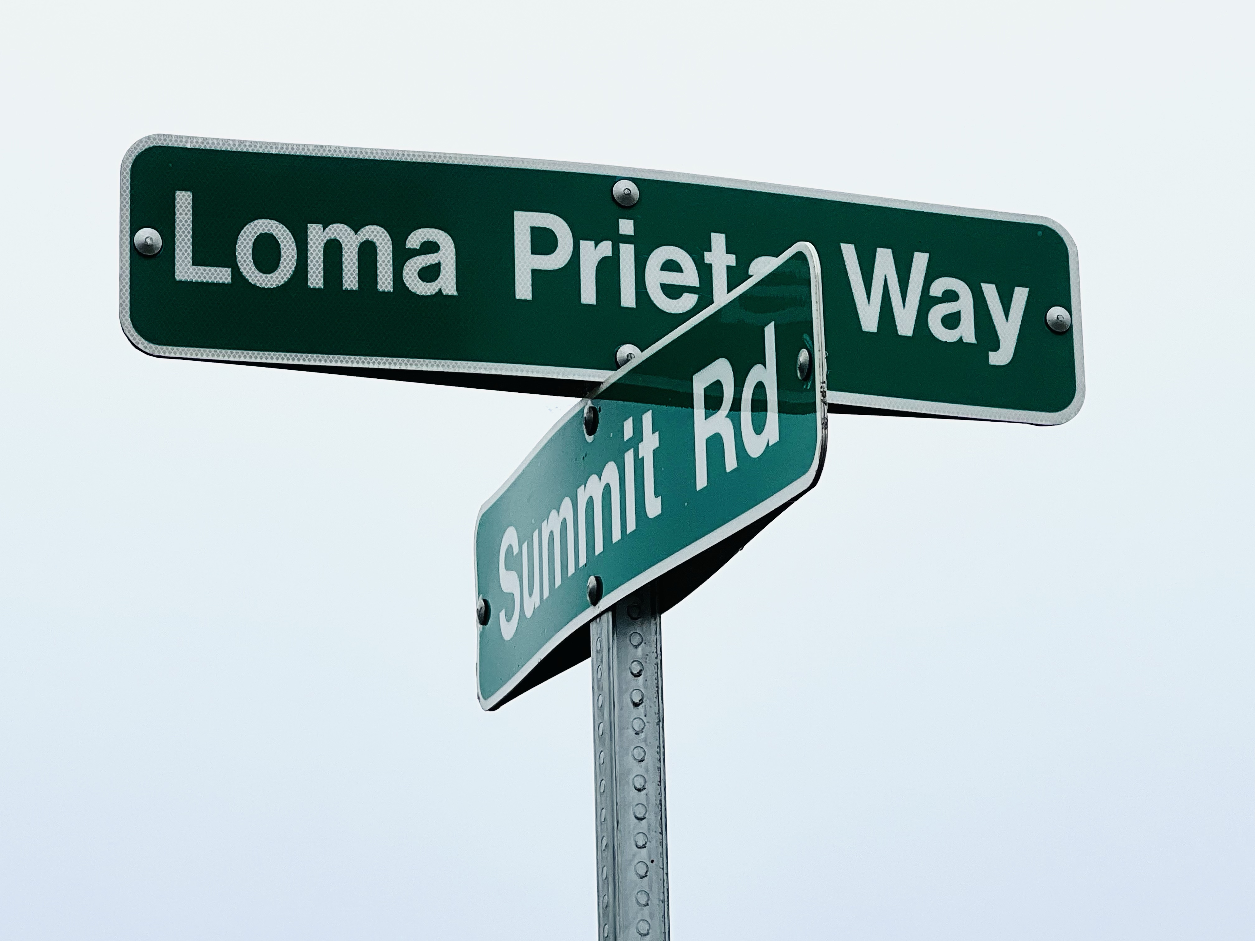
About 10 miles in from Highway 17 the road devolves into a pock-marked rural ramble as it threads its way over the spine of the summit, defining the line between Santa Cruz and Santa Clara Counties. Near the junction with Loma Prieta Way the asphalt ends entirely and the graded dirt begins.
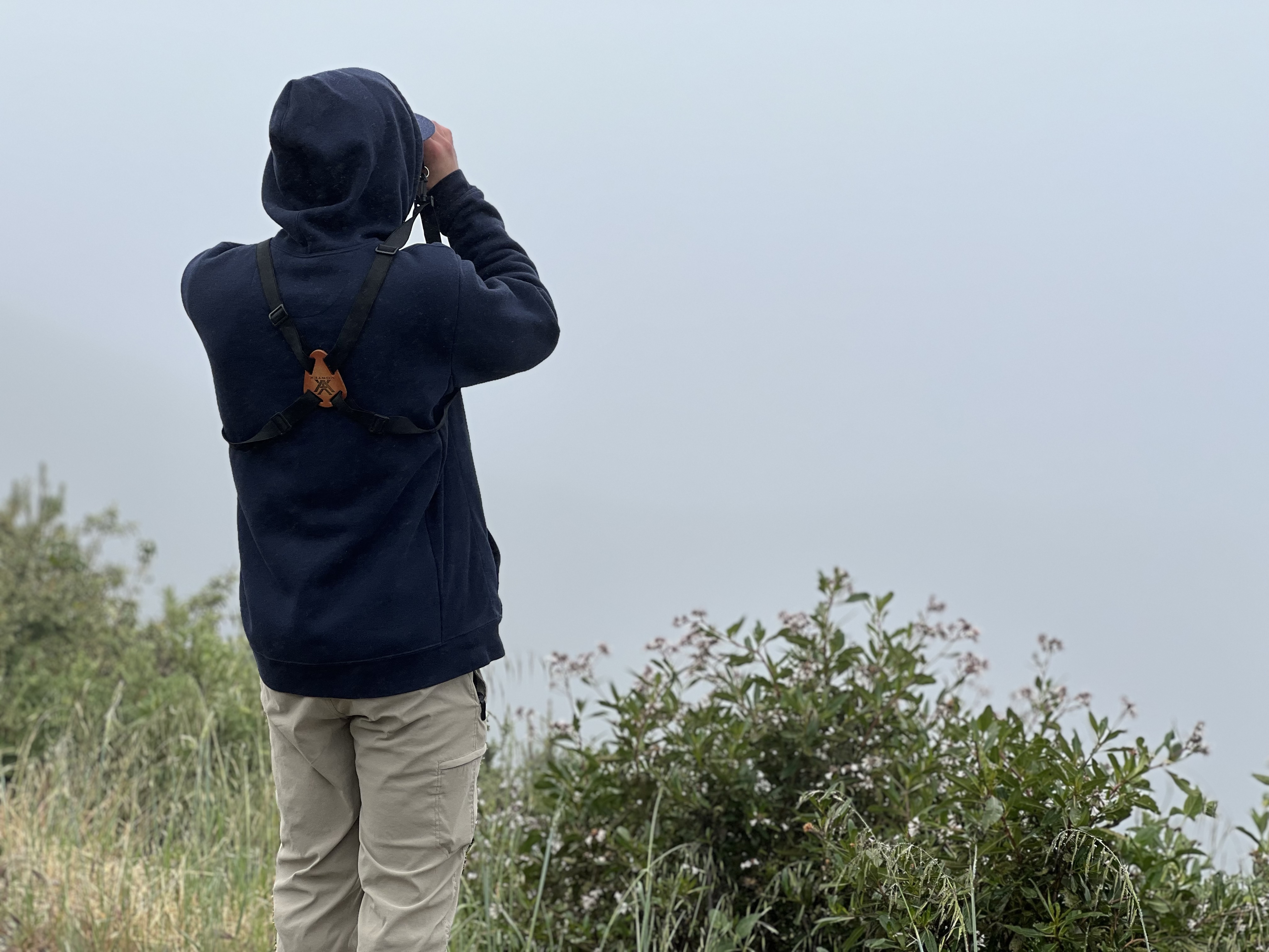
We parked in the dirt lot, light drizzle covering the windshield. This didn’t look like great birding weather. Wet, windy, with limited visibility. Would be able to pick out a blue-gray gnatcatcher or a black-chinned sparrow in these conditions? Both would be lifers for Grasshopper. And it was my goal to get him life birds number 321 and 322.
Grasshopper looking at water droplets.
We got out of the car, geared up, and surveyed the wall of grey to the west. I had a feeling we would be birding by ear, something Grasshopper can always get better at.
We headed down Loma Prieta Way stopping and listening as we went. Wrentits, spotted towhees, a far off California quail but none of our target birds, so we walked on. Luckily the damp, windy weather did not stop the birds from their spring songs.
After we were about a quarter of a mile down from the parking lot I heard something different, a cat-like mewing on the upslope. This was not the fooler Bewick’s wren (who had almost fooled me a few yards back) but one of our target birds!
Now we needed to get eyes on it. The younger eyes of Grasshopper found it out on a tree branch: blue-gray gnatcatcher!
After getting so-so looks of the energetic gnatcatcher, we headed a little further down and I first heard our second target bird far up the hill. An accelerated bouncing ball of a song.
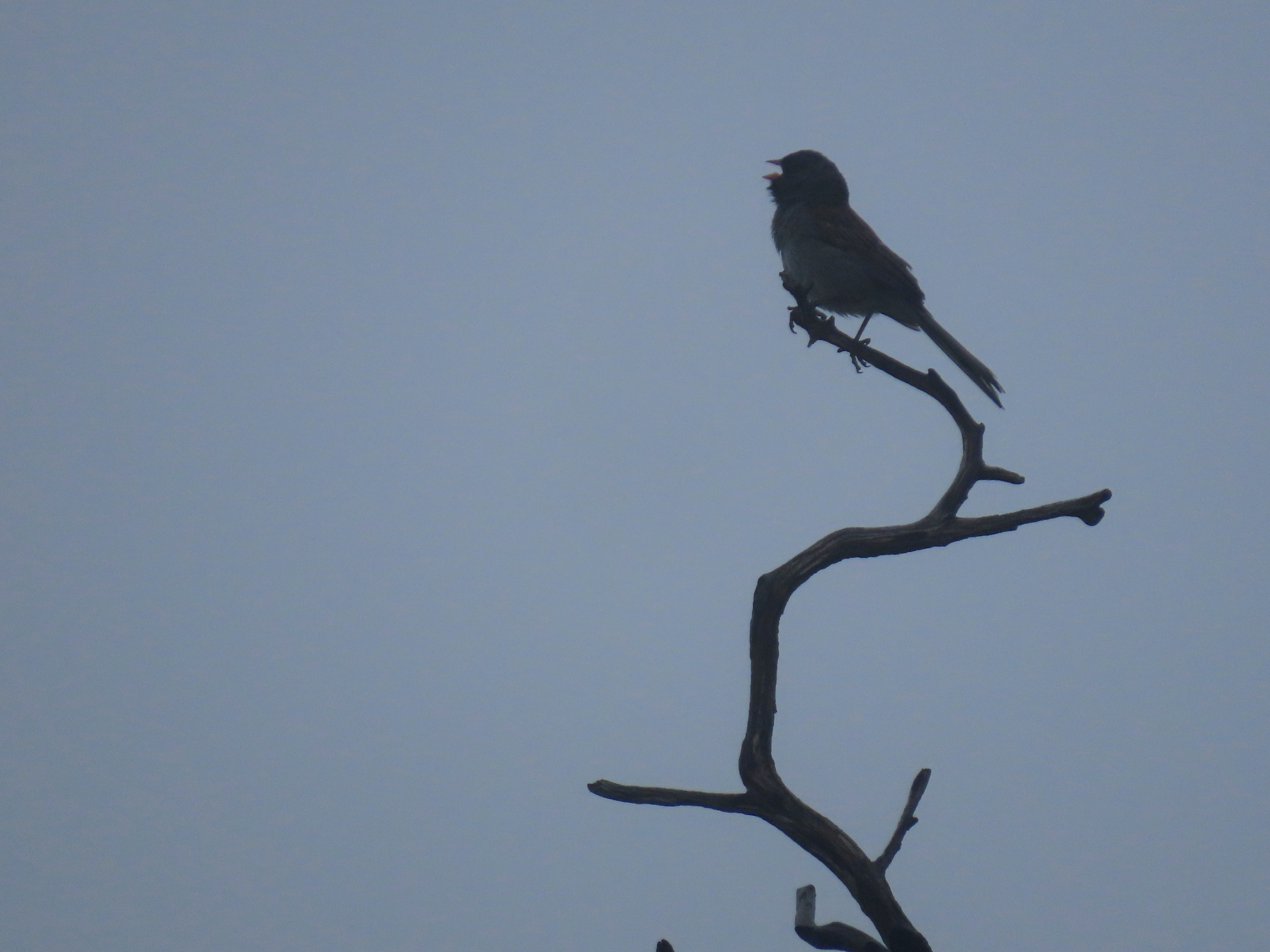
I willed the bird down by saying a little prayer to the Birding Gods and soon enough the sparrow flew over the road and landed downslope on a charred snag. Our binos swung up and we enjoyed prolonged views of a singing male black-chinned sparrow!
The foggy silhouette of one of our main targets: the black-chinned sparrow singing on a burnt snag. The black-chinned is an early adopter of burnt out areas.
Lifer number two for Grasshopper!
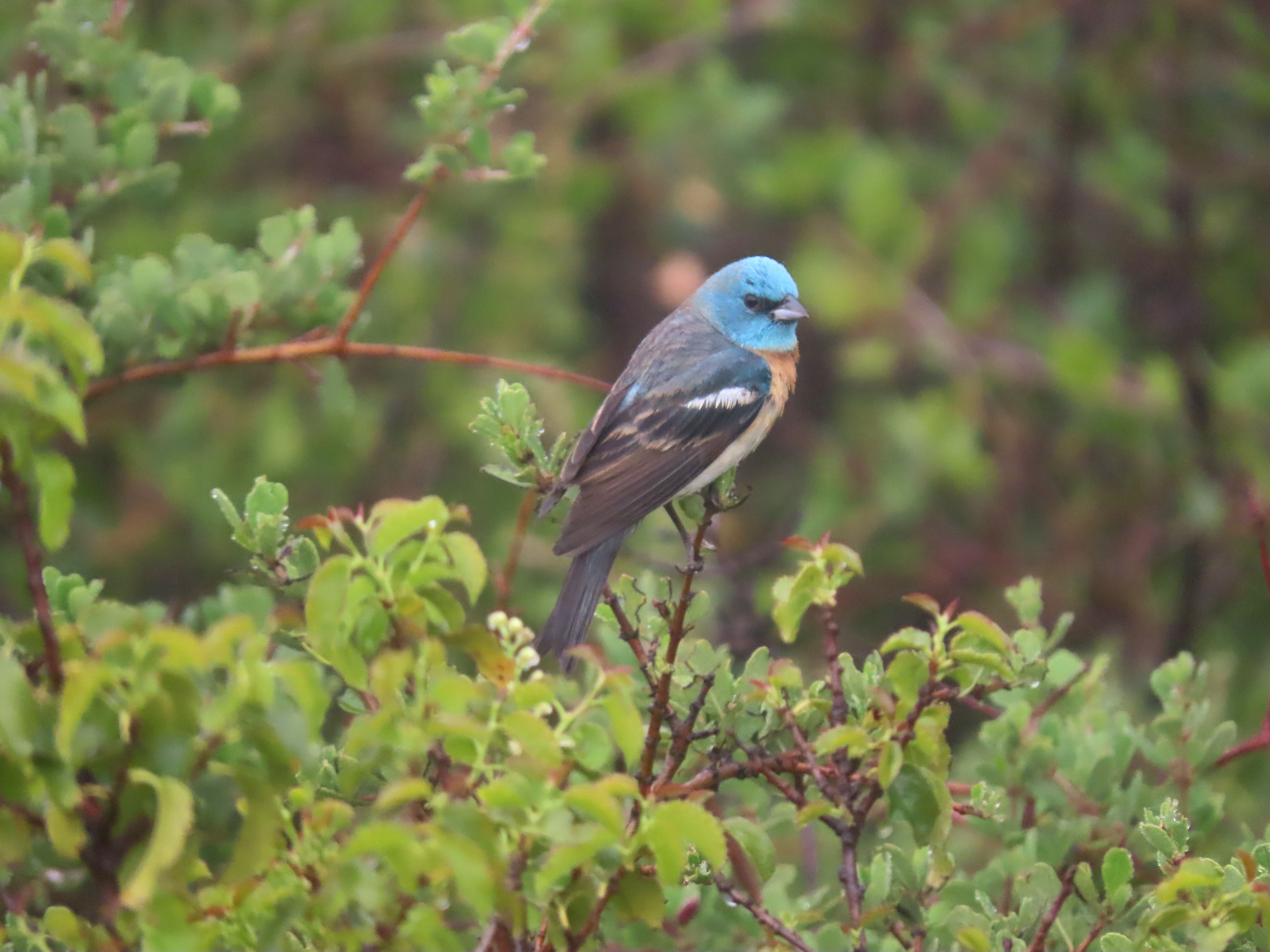
By this time we were coated with dizzily dampness and we headed back up to the parking lot. On the way up Grasshopper saw birds flying below the road. It was a pair of lazuli buntings! This is not a lifer for me or Grasshopper, but it has been a while since I have seen or heard this neotropic migrant.
A stunning male lazuli bunting. I never get tired of seeing and hearing this bird.
This is why birding remains a passion for me. I’m still excited to see and hear birds that I have seen many times before but the excitement remains.
Previously I had written about aviation history above the skies of Aptos on the Monterey Bay. The man who designed the glider was a Professor John L. Montgomery.
Montgomery had a long history of flight development in California. He is overshadowed by aviation developments in Europe and on the East Coast. And his accomplishments are eclipsed by the Wright Brothers, who must have had a better PR man.
There are a few reasons for this. Montgomery had trouble securing patients for his flight inventions and being far away on the west coast and far from the national media in New York and Boston meant that his exploits didn’t get the same coverage as the Wrights. Even though he flew a glider 20 years before the famous Wright Brothers.
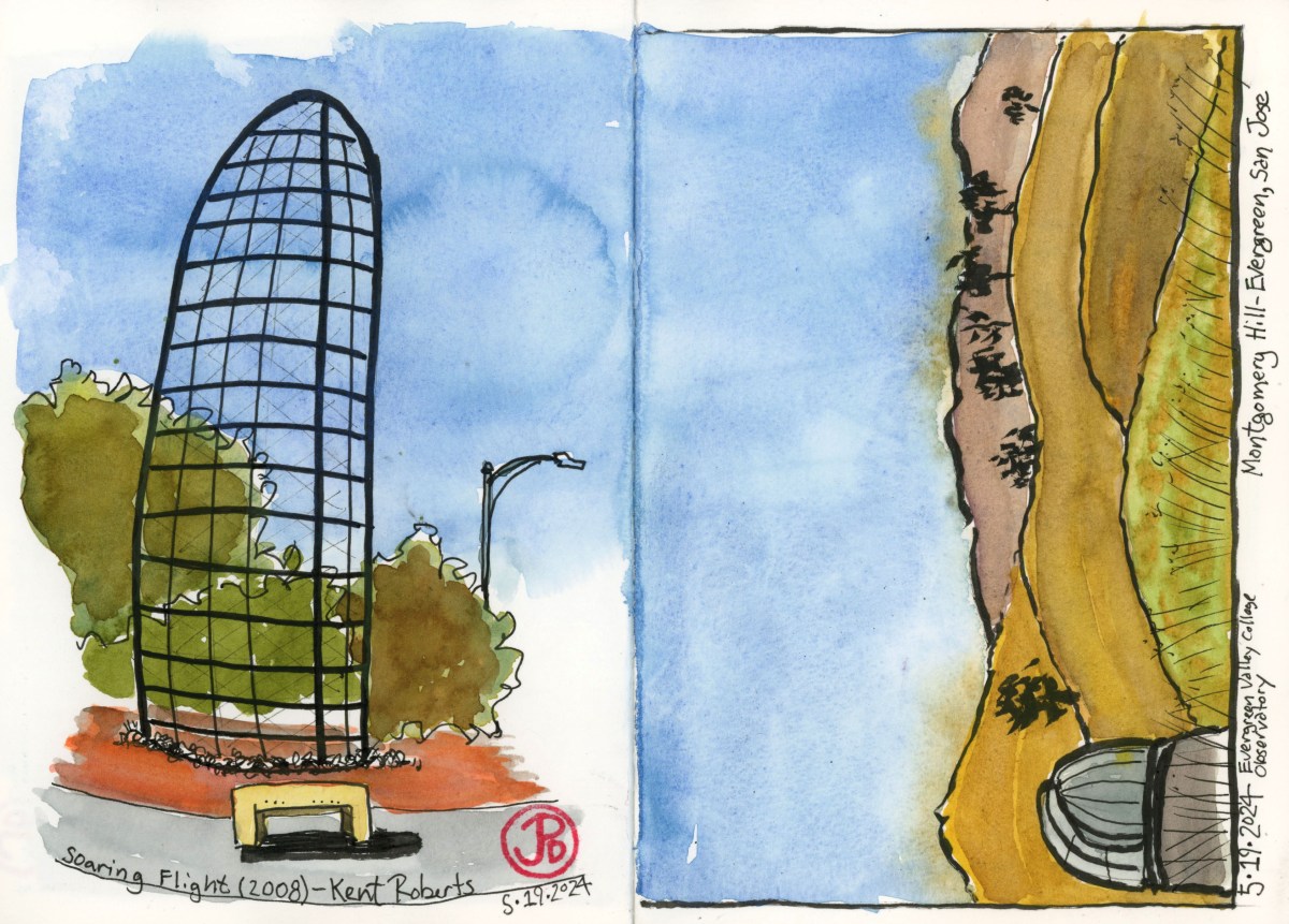
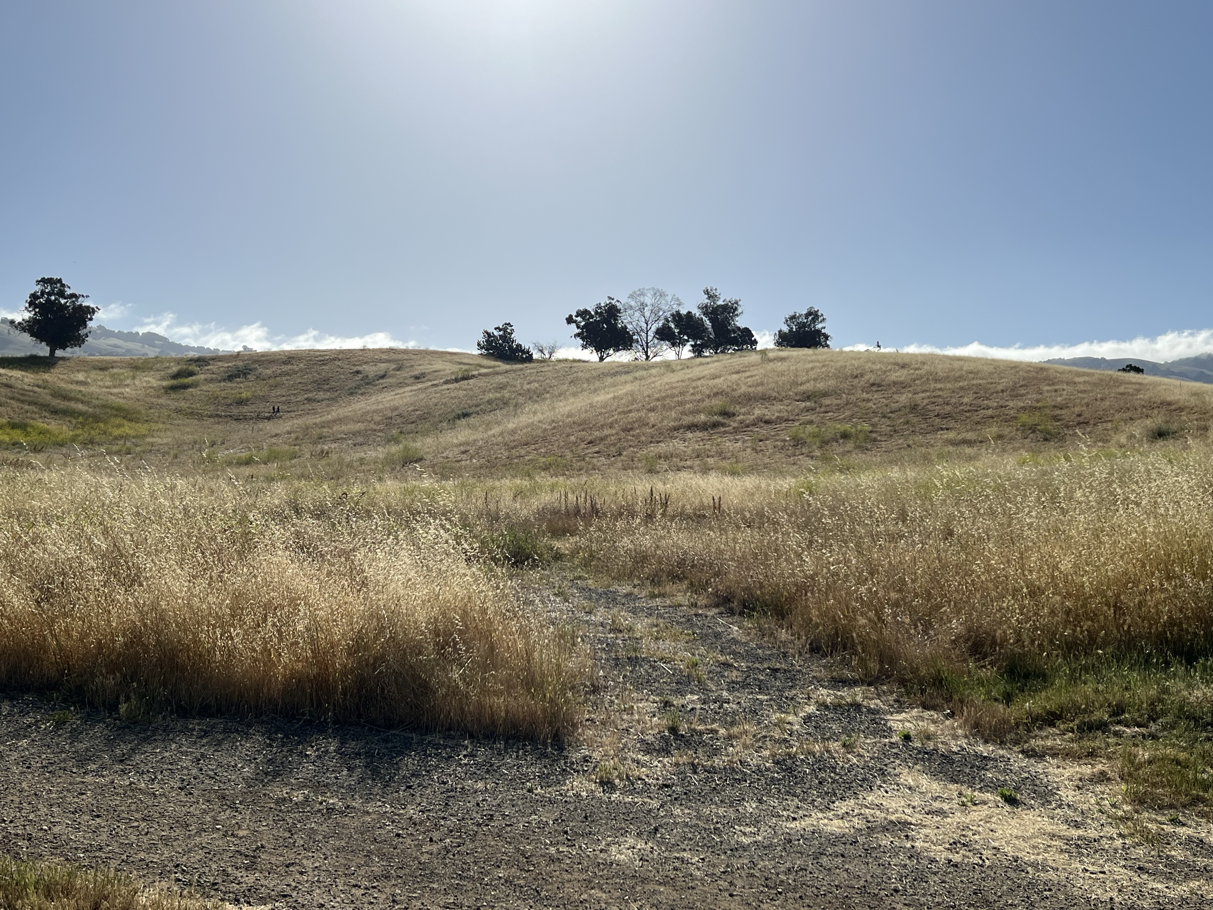
I wanted to visit and sketch the hillside where be flew his last glider. This is in the Evergreen neighborhood of East San Jose. The hillside is now named Montgomery Hill in his honor and is behind present day, Evergreen Valley College.
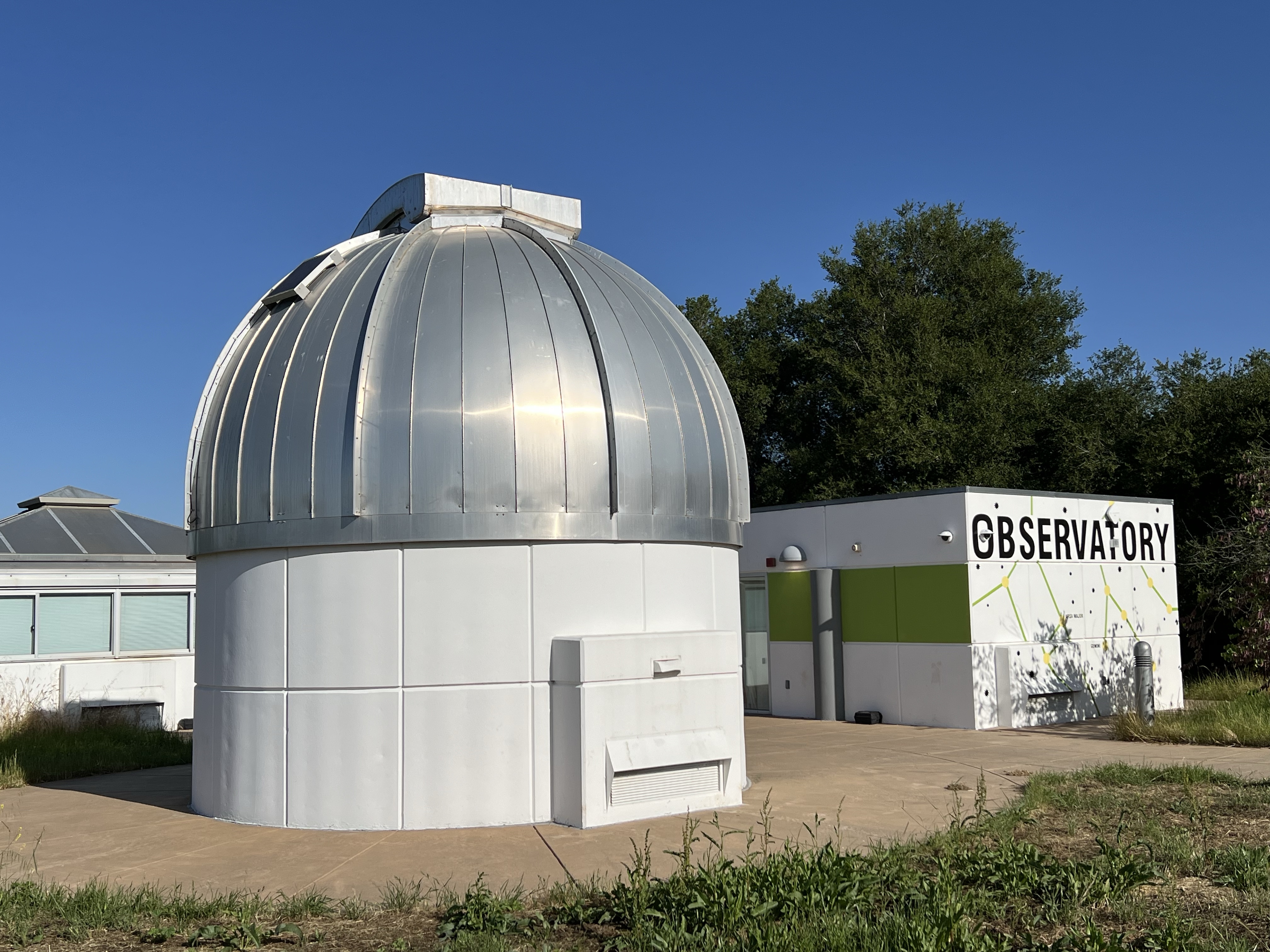
I arrived at the collage early on Sunday morning, free parking! My plan was to walk up to the observatory and sketch Montgomery Hill.
The Observatory at Evergreen Valley College.
I positioned myself so I could sketch the dome of the observatory in the foreground and the hill that stretched off into the distance (featured sketch right).
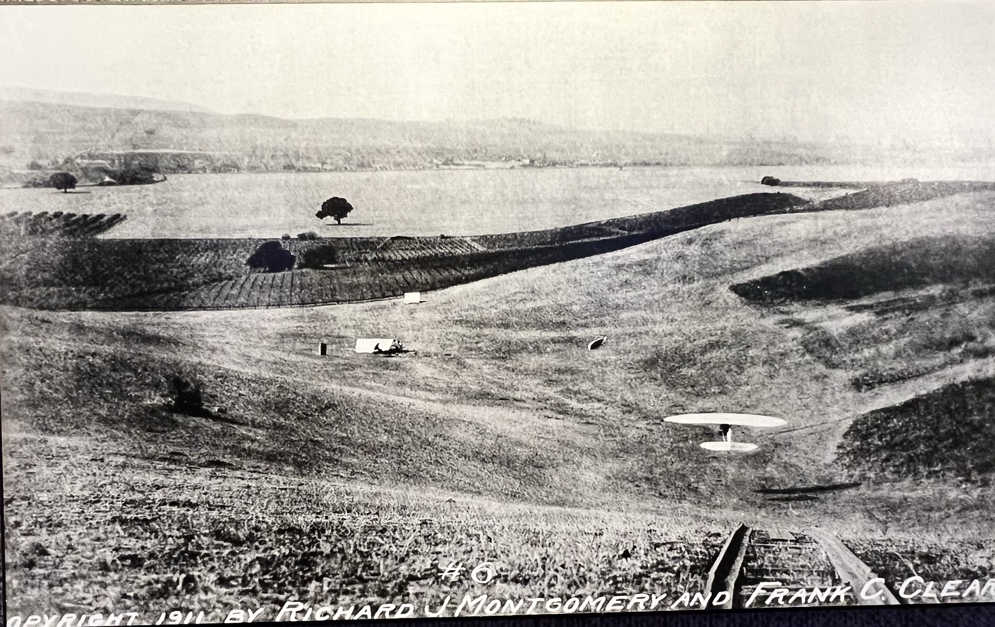
The hill before me was where Montgomery did many test flights with the glider her designed. The glider was named after this area: Evergreen.
A 1911 photograph of Montgomery flying the Evergreen, shortly before his death. The location is now called Montgomery Hill.
In was on this hill on October 31, 1911, that Professor Montgomery crashed his glider Evergreen, and died of his injuries. He was 53 years old.
Montgomery Hill, the sight of Montgomery’s last flight.
John J. Montgomery is starting to get the recognition in aviation history that he so rightly deserves. In the Evergreen neighborhood at the intersection of San Felipe and Yerba Buena, there is a 30 foot wing that stretches up to the sky (featured sketch).
This Public art is titled “Soaring Flight” (2008) by artist Kent Roberts.
On an interesting side note, sculptor Kent Roberts (1947-2019) was a Bay Area artist. Before attending the San Francisco Art Institute, he served as an officer in the US Navy aboard an aircraft carrier. The ship’s name: the USS Kitty Hawk.
For eight years I have been part of my school’s ultimate overnight field trip to Coloma.
Coloma is the epicenter of California’s Gold Rush. It was in the tailrace of Sutter’s Mill, on January 24, 1848, that James Marshall “discovered” gold.
And the world rushed in to California, changing the state, country, and the world forever!
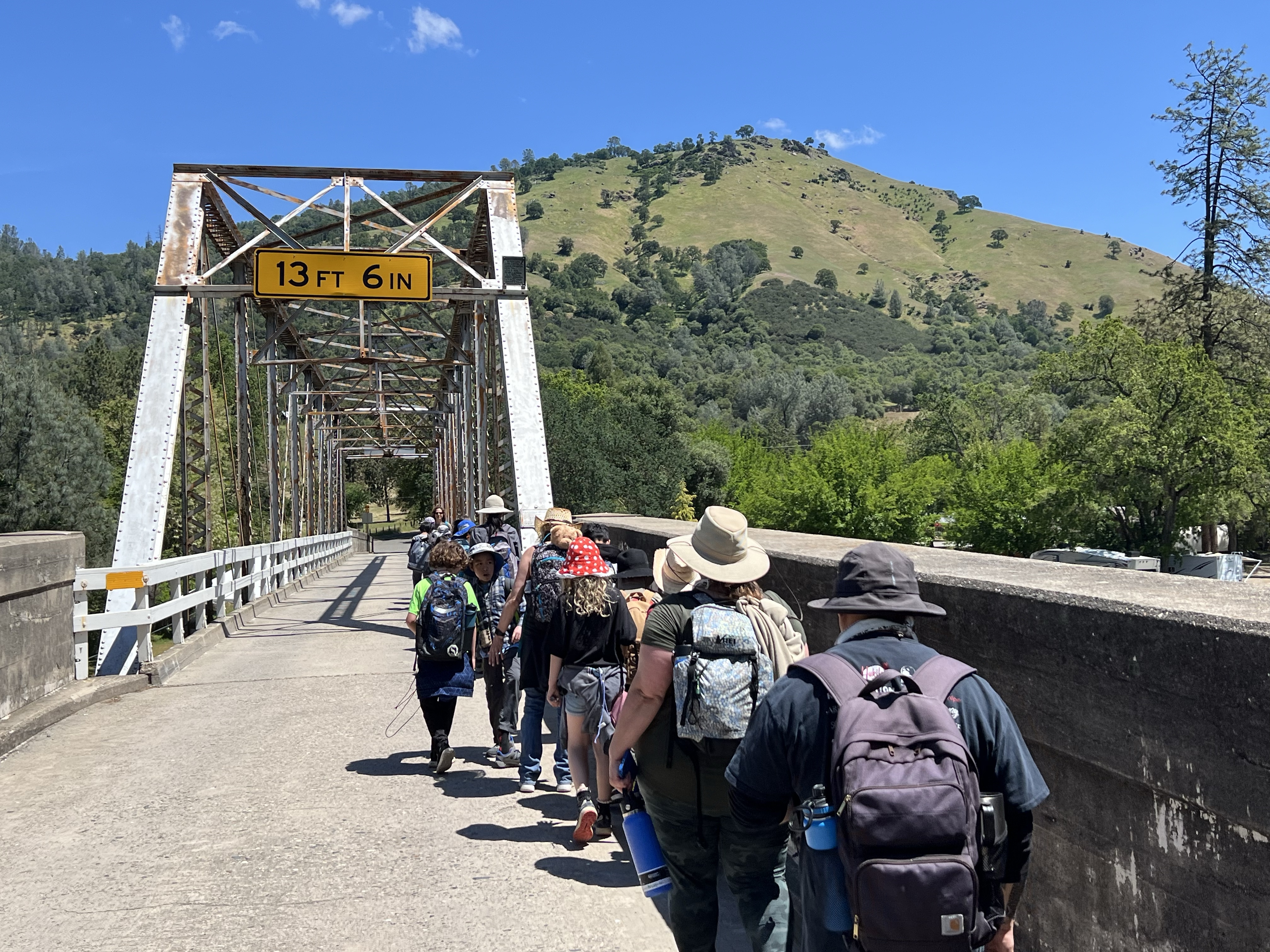
So in early May, two coaches carried 66 fourth graders, 18 parent chaperones, and three teachers on the three hour journey to the Gold Country!
This overnight trip is a lot of work. The paperwork, medical forms, medications, student group spreadsheets, and unexpected last minute changes make this trip a bit stressful.
But once we are on our way and we see our student’s journey from a Greenhorn to becoming a Sourdough miner, in the end I realize that creating one of their best elementary school memories, is really worth the blood, sweat, and fears.
Our Gold Rush town heading back to camp with Mt. Murphy in the background.
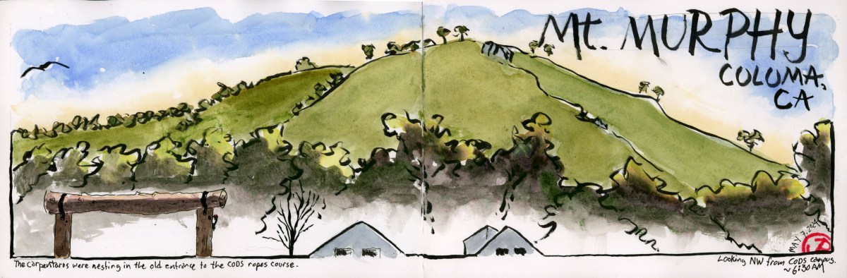
In the Gold County I’m an early riser and one way I get centered and prepare for a day full with students is to do an early morning sketch (featured sketch). A morning meditation.
This time I turned my sketchbook to the northeast toward the tallest peak around: Mount Murphy (elevation 1,932 feet).
I wanted to include the wooden gate that was once the entrance to the ropes course but is now the site of an acorn woodpecker nesting hole.
A female acorn woodpecker perched on the gate. The nest hole is on a vertical support off to the right.
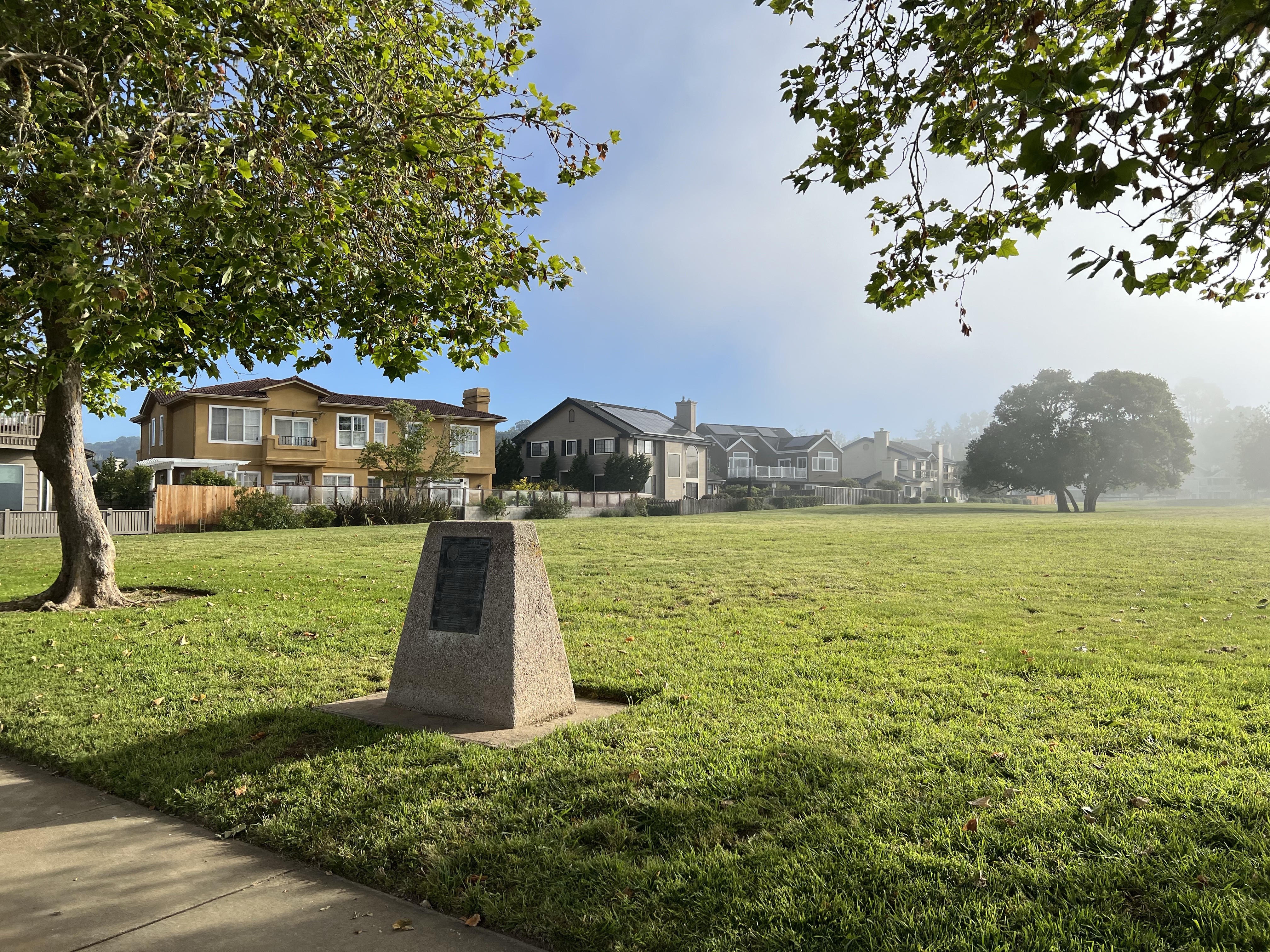
Down a cul-de-sac in a part of residential Aptos I have never explored before there is a monument to aviation at the edge of a green field.
This is what these hidden monuments are for, to reminds us of the anonymous people who have loved, lived, and lost who had come before us. The ones, on whose shoulders we stand, that have changed the world in ways we don’t understand or acknowledge.
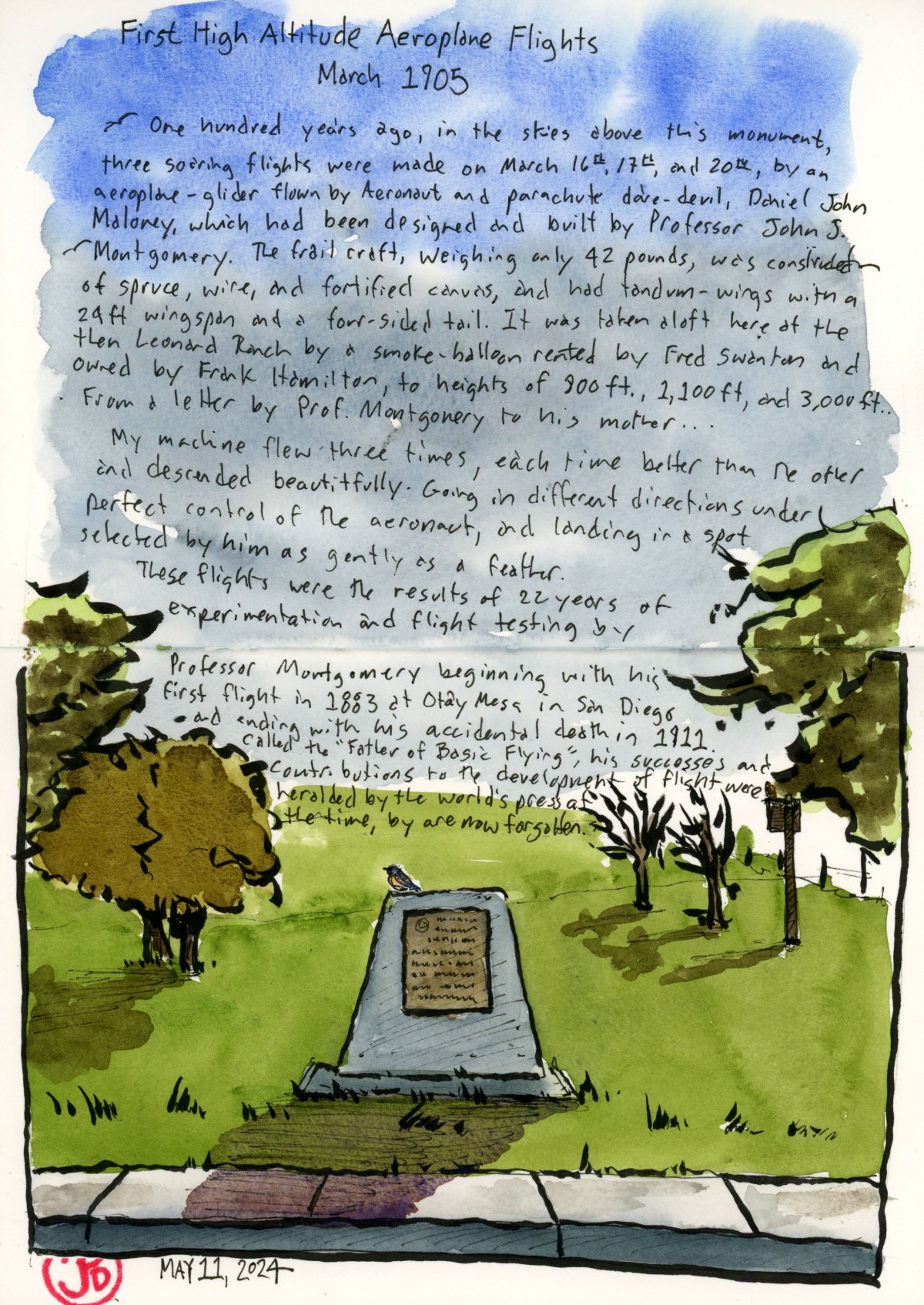
The plaque on the monument reads:
One hundred years ago, in the skies above this monument, three soaring flights were made on March 16th, 17th, and 20th, by an aeroplane- glider flown by Aeronaut and parachute dare- devil, Daniel John Maloney, which had been designed and built by Professor John. J. Montgomery.
The frail craft, weighing only 42 pounds, was constructed of spruce, wire, and fortified canvas, and had tandem-wings with a 24 ft. wingspan and a four sided tail. It was taken aloft here at the then Leonard Ranch by a smoke-balloon rented by Fred Swanton and owned by Frank Hamilton, to heights of 800 ft., 1,100 ft., and 3,000 feet. The longest flight lasted over 18 minutes and covered over 2 miles…From a letter by Prof. Montgomery to his mother…
My machine flew three times, each time better than the other and descended beautifully. Going in different directions under perfect control of the aeronaut, and landing in a spot selected by him as gently as a feather.
These flights were the result of 22 years of experimentations and flight testing by Professor Montgomery, beginning with his first glider flight in 1883 at Otay Mesa in San Diego and ending with his accidental death in 1911. Called the “Father of Basic Flying”, his successes and contributions to the development of flight were heralded by the world’s press at the time, but are now largely forgotten.
The plaque was erected in 2005 by E Clampus Vitus El Viceroy Marques de Branciforte Chapter 1797, E Clampus Vitus Capitulus Redivivus Yerba Buena #1, Hiller Aviation Museum San Carlos Ca,. Aptos Chamber of Commerce and Museum Capitola/Aptos Rotary.
Now the monument serves as a perch for western bluebirds and the green field is used by a murder of crows for foraging. Off to the right is an owl box that a pair of red-shouldered hawks use as a hunting perch.
119 years ago, a frail, 42 pound glider soared above this field. Now it has been returned to the true masters of flight: the gulls, corvids, and hawks that effortlessly glide above.
But if you look further above you will see the great grand children of Montgomery’s passions: the modern passenger jet on final approach to SFO and SJO.
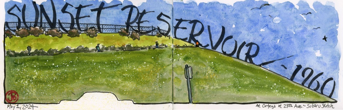
I live a hop, slip but not even a jump from San Francisco’s largest reservoir: Sunset Reservoir.
This terminal reservoir was completed in 1960 and has an impressive capacity of 270 acres. To put this into context the sides of the reservoir are four blocks north and south and two blocks east and west. The surface area is 11 acres.
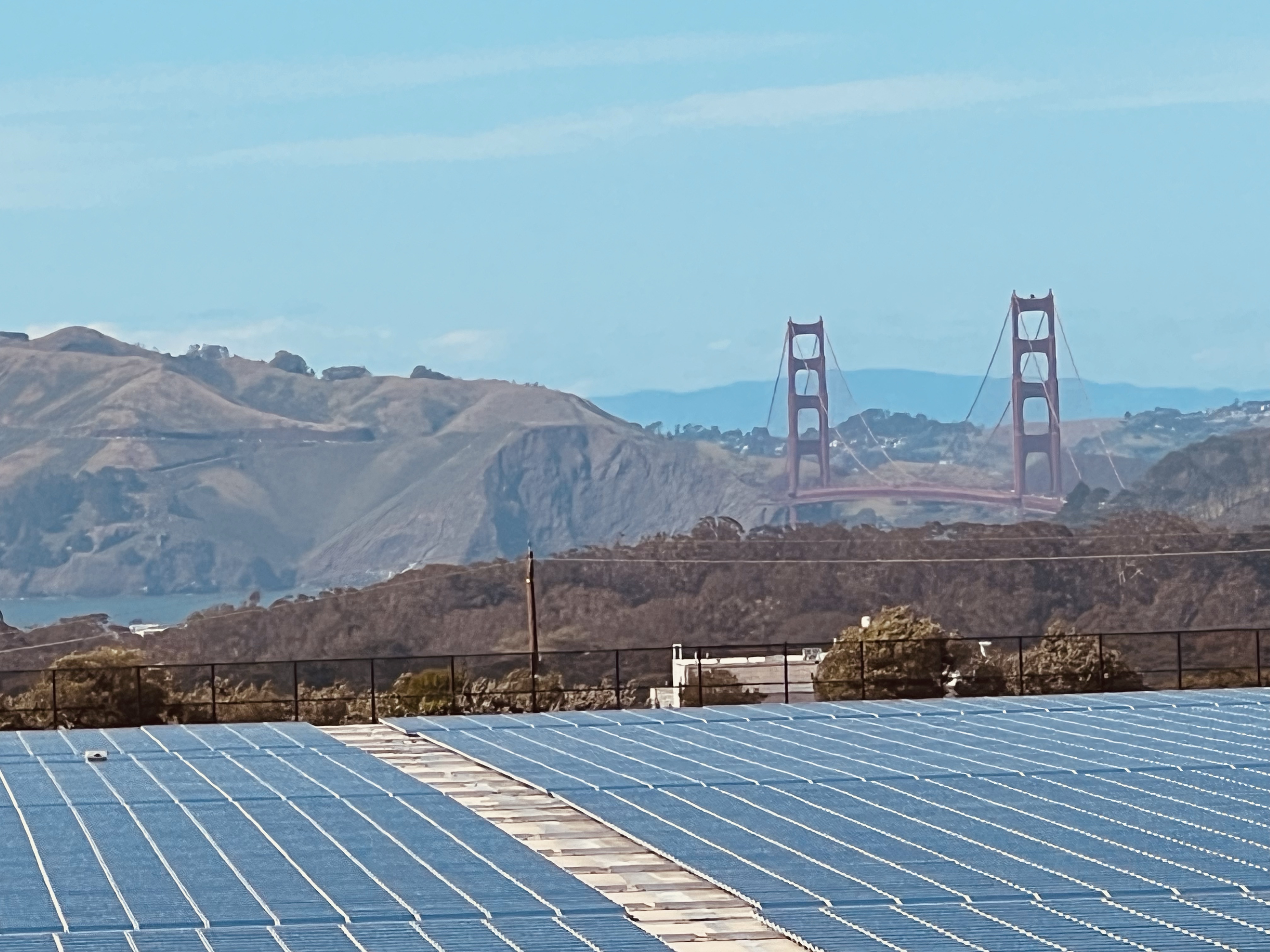
The reservoir is covered and fenced off. Over half of the reservoir is blanketed in 25,000 solar panels. The Sunset Reservoir Solar Project started in December 2010 and has tripled San Francisco’s solar generation capacity.
The irony is that the Sunset is the foggiest part of the city.
Some of the 25,000 solar panels of Sunset Reservoir.
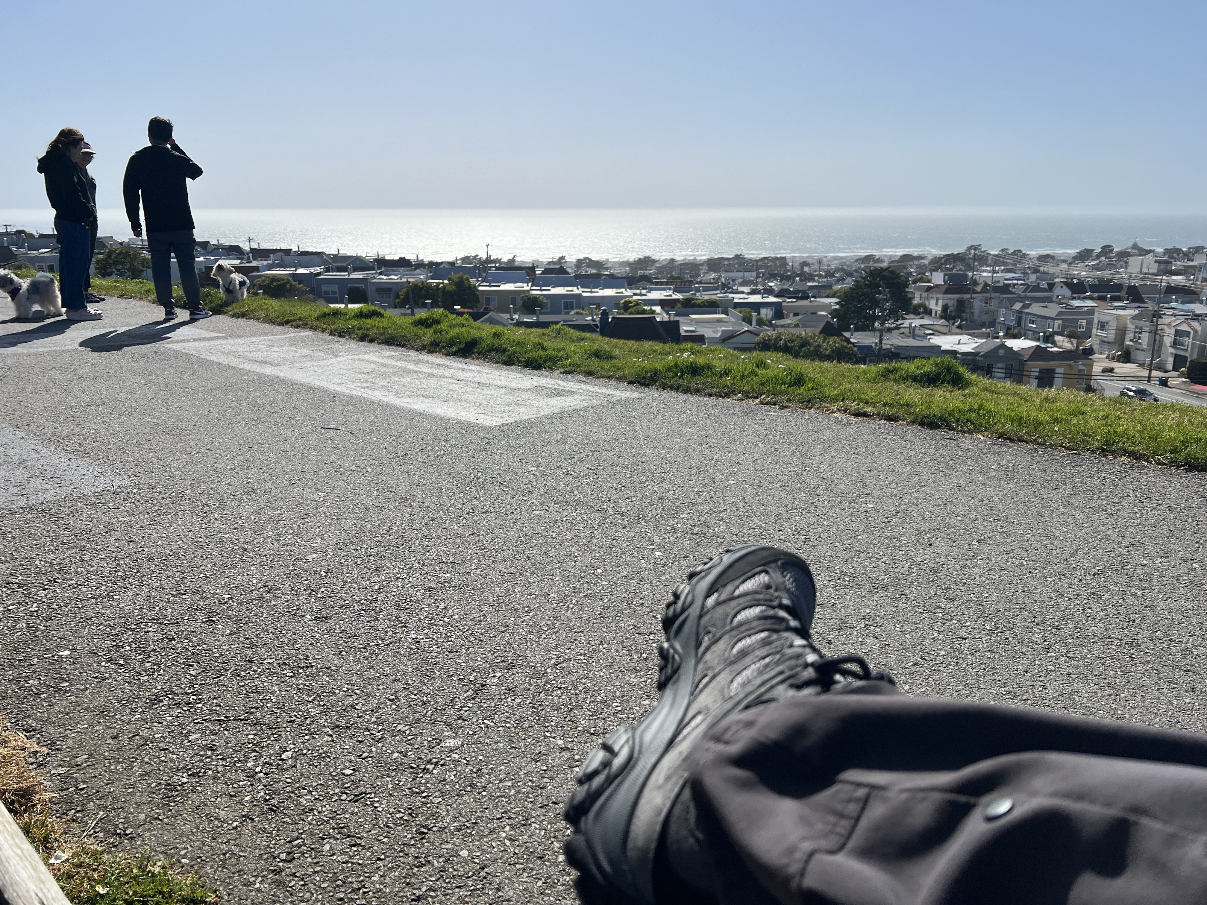
While the reservoir itself is not a sight to behold, the northwest corner (featured sketch) affords some of the best views in the Sunset. Along the embankment are walking paths and at the northwest corner are a line of benches.
The bench-view to the north. I can almost see the Farallons. These paths are popular with dog walkers.
Here you can look out to the west towards the Pacific Ocean and on a clear day, you can see the Farallon Islands perched on the horizon like a large, gray battleship.
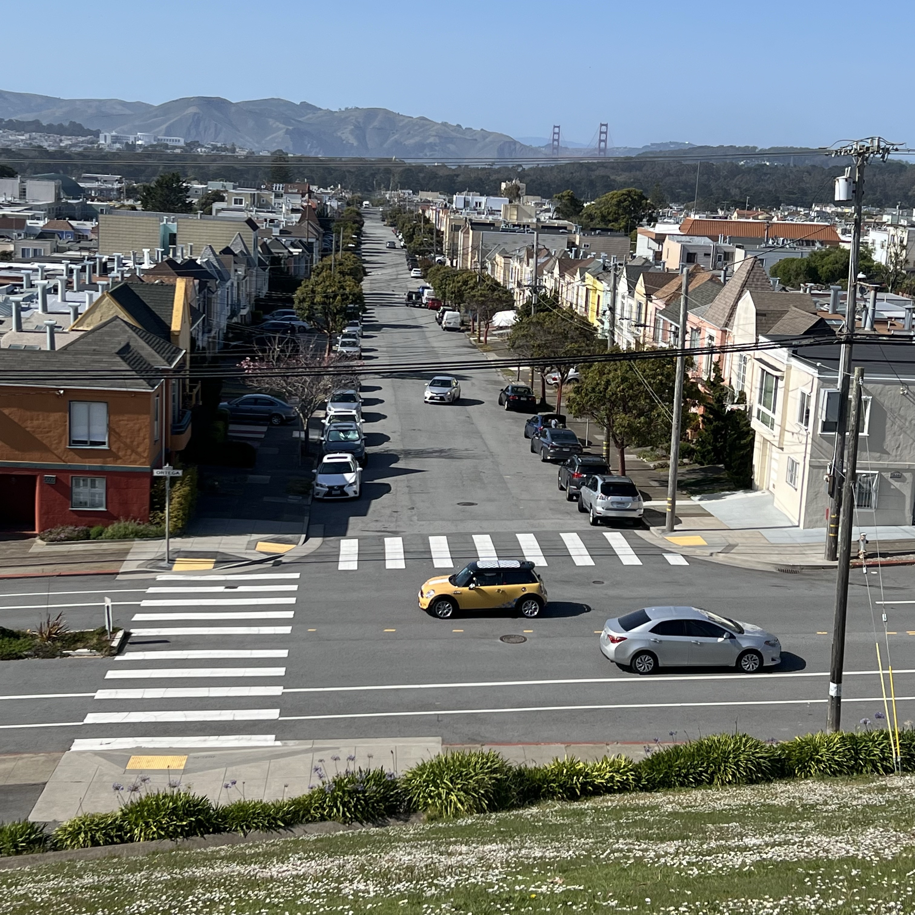
The views to the north as just as stunning taking in Golden Gate Park, the Richmond District, the Golden Gate Bridge, Marin Headlands, and Mt. Tam. On really clear days you can see outer Pt. Reyes.
Looking north down 27th Avenue towards the Golden Gate from one of the walking paths.