For Steve.
Veterans Day, November 11, 2020
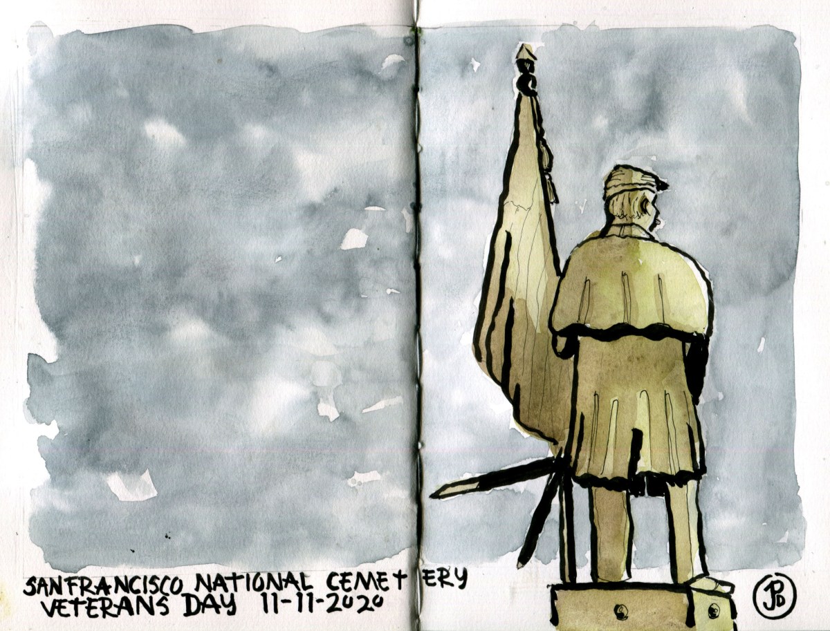
For Steve.

One benefit of sheltering in pace and the global pandemic is that it has forced me to walk around my neighborhood (for sanity’s sake).
When you get out in the neighborhood you start to notice details you haven’t seen before. You noticed the little details of houses that before seemed all the same. Details are the route newly noticed.
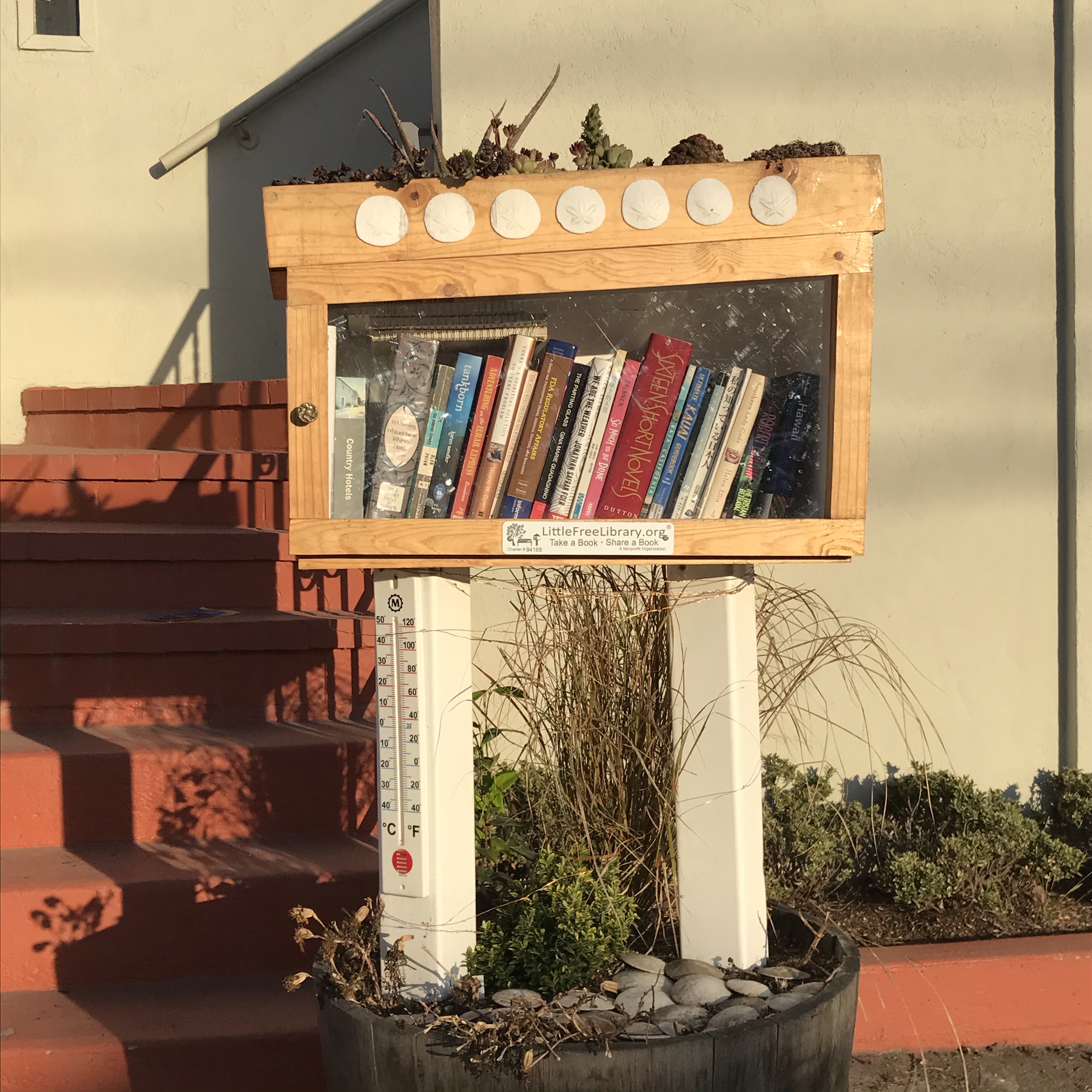
One thing that I have noticed on my walks of San Francisco’s Outer Sunset District is the proliferation of little boxes on wooden poles. These are the little libraries.
The box on top of the pole contains one or two selves lined with books. These boxes are used to take a book or leave a book and they are all free. It seems odd in a city there is actually something free! Well not exactly free. I donated three books:
The Road to Little Dribbling by Bill Bryson (Good but not as good as Notes From a Small Island.)
The Lost City of the Monkey God by Douglas Preston
The Devil’s Highway by Luis Alberto Urrea
The nonprofit company behind these boxes is Little Free Library, a Wisconsin based company that inspired 100,000 boxes (and counting) in 100 countries (and counting).
People can either build their own library of have one pre-made. Once it is installed, usually in the front yard, facing the sidewalk, the library is registered and added to a map so reading in the community know where to find a Little Free Library.


O Mary I have not wrote you half the trouble we have had but I have Wrote you enough to let you know what trouble is. . . Don’t let this letter dishearten anybody never take no cutoffs and hurry along as fast as you can.
-Virginia Reed, letter to her cousin Mary Keyes, May 16, 1847
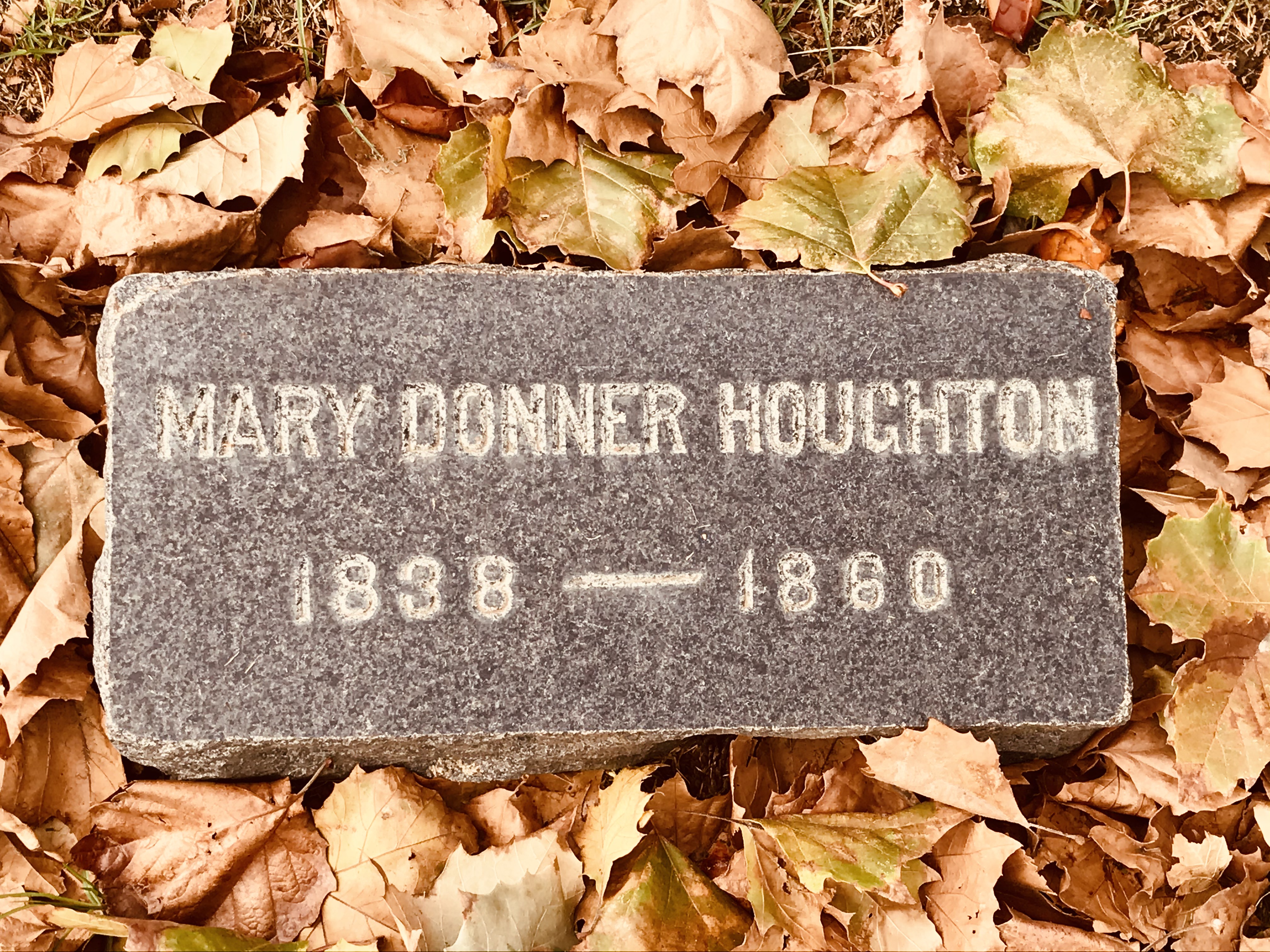
Once the survivors of the Donner Party made it out of the Sierra Nevada Mountains, they dispersed into the state of California.
One can barely imagine how the horrors of their experience in the Sierra Nevada Mountains stayed with them as then conducted their lives, starting businesses, had families, lived their lives, and died far away from the mountains, settling in to the coastal region of the Golden State.
I headed down to the county of my birth, Santa Clara County, to visit California’s oldest secular cemetery, founded before the Gold Rush in 1847. This is Oak Hill Funeral Home and Memorial Park, southeast of downtown San Jose.
This is the final resting place for ten survivors of the Donner Party. About 20% of the 48 survivors are buried here.
The year 1847 was an important one for the Donner Party. This is the year that the survivors, in five groups, made it out of the jaws of death from the campsites on Donner Lake and Alder Creek to the salvation of the Central Valley at Johnson’s Ranch and then on to Sutter’s Fort.
Near the core of the old cemetery is the plot of the Reed and Lewis families in Section D which is now named the “Pioneer” section. Here lies the patriarch of the family James F. Reed and his wife Margaret.
James Reed was one of the leaders of the party and if it hadn’t been for the moment of rage that caused the death of a teamster, stabbed to death by Reed and his subsequent banishment from the party on October 6, 1846, the group might have gone done in history as the Reed Party.
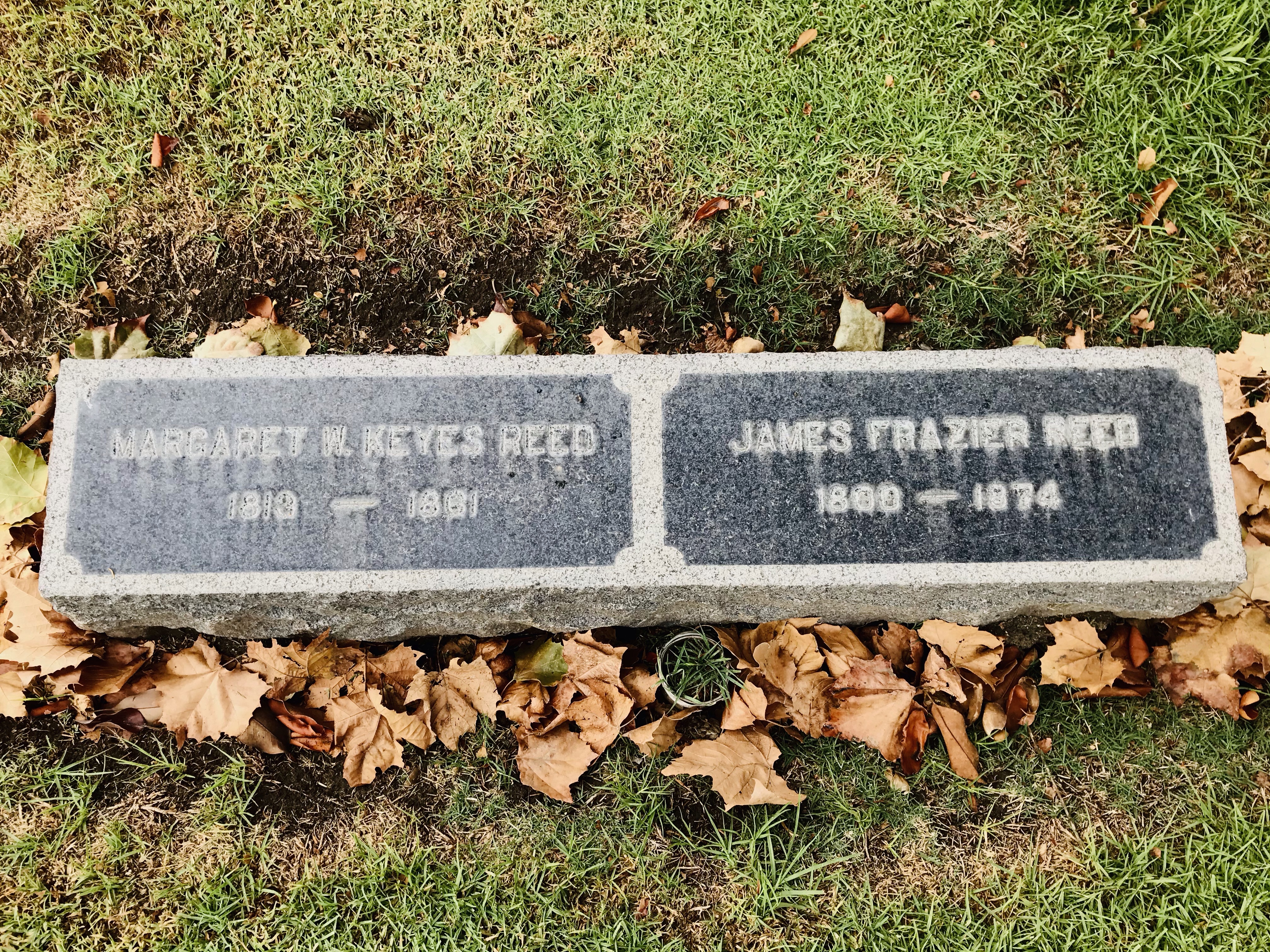
The Reed and the Donner families are like a tale of two clans with two different outcomes from their ordeal in the winter of 1846-47. All of the members of the Reed family survived while the Donner family suffered the most out of any family group. All four adults and four children perished.

After visiting the graves of the Reeds and Donners I crossed the street into Section C looking for the grave of another Donner Party survivor. I looked at my map and his grave was marked as Historical Points of Interest Number 2.
Who knew finding a grave could to so difficult (I was really about to find out a little later in the morning)? There are 15,000 souls interred here, so it could be like finding the proverbial needle in the haystack. I wanted to find the grave of William Henry Eddy, the “leader” of the third attempt to escape from Donner Lake to get help from Sutter’s Fort. This party of 15 was later called “The Forlorn Hope”.
On December 16, 1846 the Forlorn Hope set out from Truckee Lake (now named Donner Lake) and headed toward the summit (now named Donner Summit). The party started off as 15 and when they made it to Johnson’s Ranch there were just seven of them alive. Willian Eddy was one of two male surviors.
After an exhausted search I finally found Eddy’s unique gate, which was almost eclipsed by a larger headstone. Eddy’s grave is unique because it consists of a rock and a round, coin-like relief portrait of Eddy. A small plaque under the portrait reads: “HE LED THE FORLORN HOPE OF THE DONNER PARTY. DEDICATED MEMORIAL DAY 1949 BY THE ANCIENT & HONORABLE ORDER OF E CLAMPUS VITUS”.
I set up my sketching stool and put down the line work of Eddy’s grave. I then added some watercolor.

I had one more Donner Party grave to find and this one proved to be the most elusive. This is the grave of Virginia Reed, James Reed’s oldest stepdaughter (she was Margaret Reed’s daughter from her first marriage). She was 13 in 1846. She was at the dedication of the Pioneer Monument with her stepsister and she had written a recollection of her experience as a member of the Donner Party and had written the very well known and often quoted letter that is quoted at the top of the blog.
I had the location of her grave: Section D, Block 26, Lot 2, Grave 2. I thought this would be easy as I walked up the road. There was a buddhist funeral ceremony going on in Section B. The chimes that rang out and the chanting reminding me that this was still very much an active cemetery.
Section D had a lot of newer graves that were opulent and ostentatious, unlike the simple markers I had seen of the members of the Donner Party. I searched Section D until it turned into Section N. Then I checked my map and headed back toward Section D. In the middle of this section five guys in lawn chairs seemed to be having a tailgate party. This was very much an active and alive cemetery.
I retraced my steps again with no luck. I must have looked lost as I wandered with frustrated intent, map in hand, that I attracted a groundskeeper who pulled up in his truck and asked if I needed help.
I told him I was looking for Section D, Block 26, Lot 2, Grave 2. Her name was Virginia Reed Murphy. He told me it was back the other way near the corner. He would drive around and meet me there.
I guess he assumed I was a member of the family looking for a great great great grandmother. I walked with intent back the way I came, the chimes and chants to my left and turned right on Observatory Avenue. The groundskeeper had just pulled up in his work truck.
He pointed to a plot. To the left was a humble marker for Murphy and to the right was a fallen headstone. In between was green grass. Virginia Reed’s grave was nowhere to be seen. My search had ended in a dead end (pun intended).
“Sometimes the markers get covered up,” the groundskeeper remarked as he headed to the truck and returned with a shovel! He started poking around with the tip of the spade and he he hit upon resistance. “Here it is.” And he dug in. I advised, half jokingly, not to dig too deep.

What followed was one of those moments of miracle and wonder. A moment that is stranger that fiction.
Under five to six inches of sod and grass emerged a marker. Through the thin layers of dirt I could read the markers simple inscription: VIRGINIA REED MURPHY.

No one was here to care for her grave. All her children and grandchildren were long gone and buried. But then came along a fourth grade teacher with a passion for California history.
Here was my small gift to those who cared to look for the grave of a Donner Party survivor. Her grave must have been covered up for years and I wondered about those who had searched in vain for Virginia Reed’s grave, eventually giving up. Now, as if a historical treasure had been unearthed, as indeed it had, it was here again to be seen; To help along what Patty Reed started, that the struggles and tragedies but also the resilience and successes of the Donner Party be remembered for all generations.

What can you buy for ten dollars?
A used book. Lunch at a fast food joint. A six pack (of root beer), Coffee and a bagel. Maybe a movie ticket. A pair of socks. Some laundry detergent. A used CD or DVD.
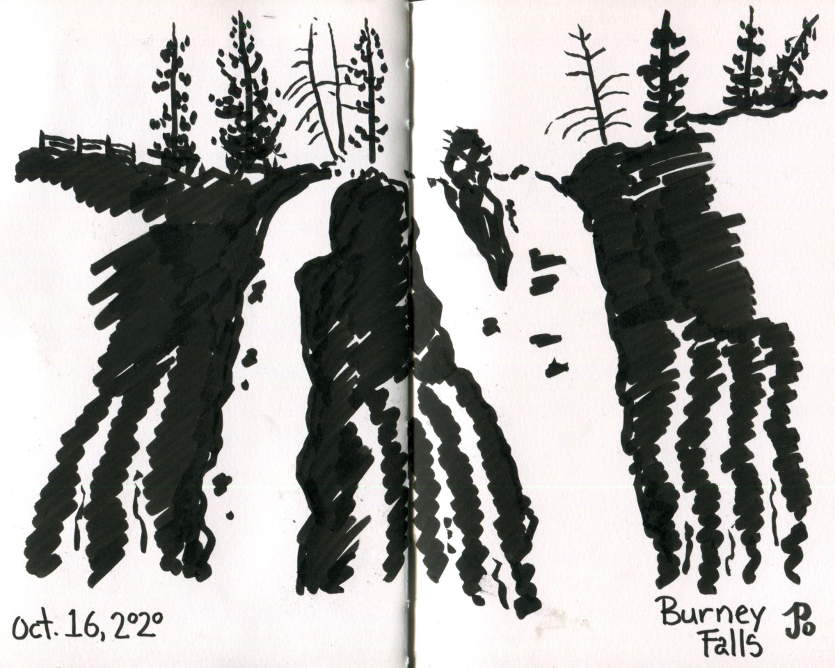
Ten bucks can also pay for your admission to one of the most incredible waterfalls in the United States. This falls is not the highest or largest falls in California but you perhaps it is the most beautiful.
This is the 129 foot Burney Falls.
After I visited and sketched the cinematic Lake Britton Railroad Bridge I returned on Highway 89 and on an impulse, I turned right into McArthur-Burney Falls State Park. When I found out that the “hike” to the falls was only a quarter mile, I happily paid my ten bucks and proceeded to the parking lot! (I was not so concerned about the length of the hike but about timing because I was going to meet my mom and Steve for dinner in Penn Valley).
There were a lot of cars in the parking lot and once I opened my car door I could her the roar of the falls. The paved trail down to the falls is a switch back and as you head down to water level, you are given different views of the falls like a giant amphitheater.
Waters seemed to be appearing everywhere along the basalt rock face almost transporting you back to some tropical waterfall on Kauai. But the cooler temps brought me right back to Northern California in October!
The reason the water is pouring through the rock like an extremely leak dam is that the falls are fed by an underground springs. Burney Falls has a regular flow of 379 million litres a day.
I ambled off the popular path, found a boulder as a seat, and sketched the falls with a brush pen.

President Theodore Roosevelt was so amazing at the sight of Burney Falls he proclaimed it “the Eighth Wonder of the World”.

On my last day in Lassen, I headed north through the National Park to sketch a cinematic railroad bridge. This bridge is called the Lake Britton Bridge and spans a finger of Lake Britton near Burney, California.
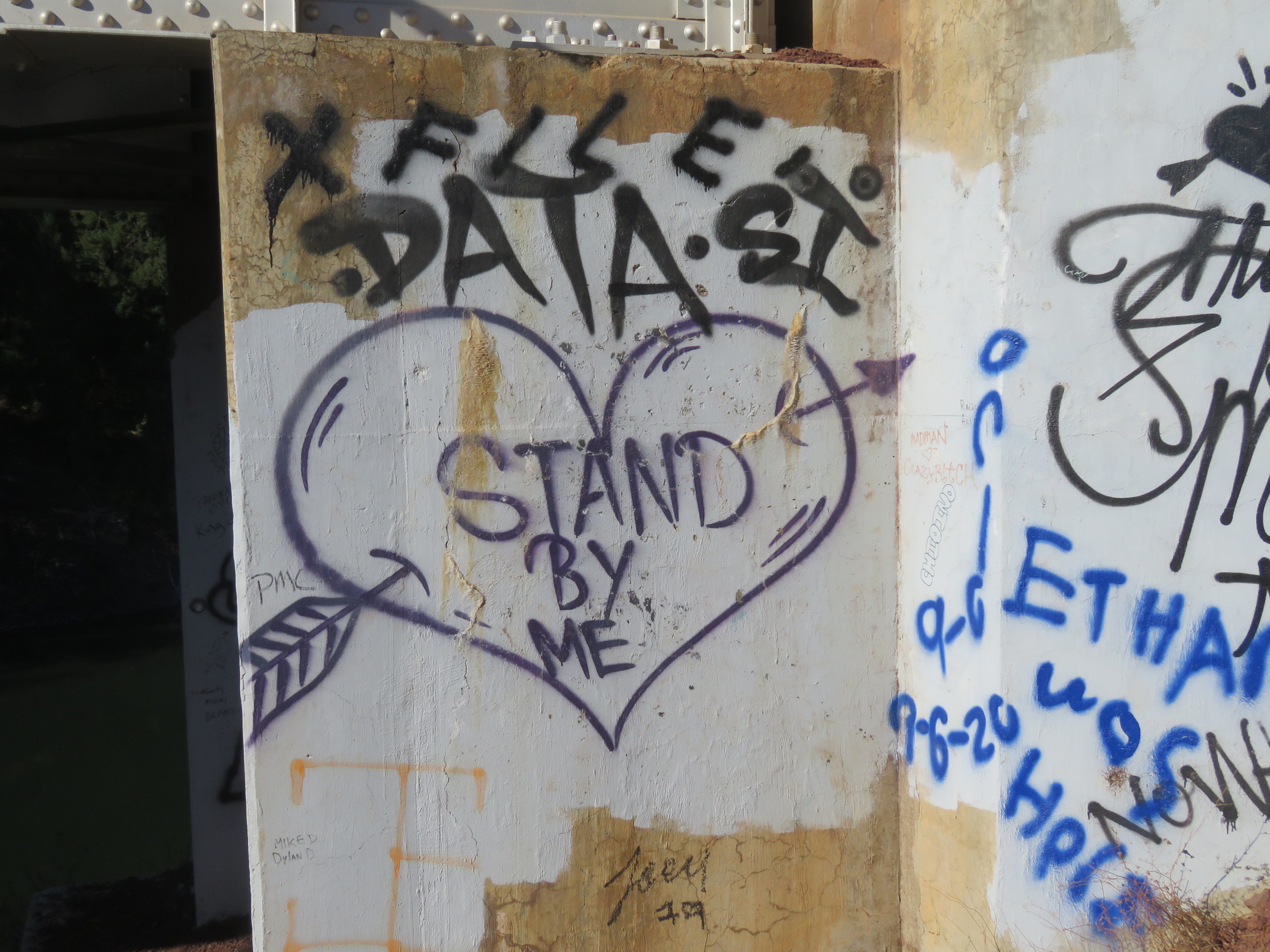
This bridge is featured in one of the most famous scenes in the 1986 film Stand By Me, directed by Rob Reiner (of All in the Family and Spinal Tap fame). Stand by Me was the third film he directed and was based on the Stephen King novella “The Body”. Reiner has also stated that Stand By Me is his favorite film. (I’m going with This is Spinal Tap.)
The plot is a “coming of age” story about four boys that go on an adventure along a railroad to look for a dead body (this is a Stephen King story after all). It featured young actors Wil Wheaton, River Phoenix, Corey Feldman, Jerry O’Connell (in his acting debut), and Kiefer Sutherland.
The bridge was built in 1955 on the McCloud River Railroad, primarily a logging railroad. The steel bridge is 450 feet long and is about 75 feet above the waters of Lake Britton. The bridge has now been stripped of rails and is no long in use. This part of the Burney branch was operational until 2005.

The bridge plays a prominent role in one of the most famous sequences of the film. It was one of the few sequences, according to Reiner, that was actually storyboarded.
In the scene, the four boys come to the edge of the bridge. And they wonder when the next train is coming. They contemplate taking another route that will take much longer but will be safer. (Safer never works in cinema). Two of the boys, Chris Chambers and Teddy Duchamp, start across the bridge. The two other boys, Gordie Lachance and Vern Tessio are reluctant to start across. Well I bet you can guess where this is going.
Gordie nervously looks down the rails. No train. He stoops and places his hand on the rail, he feels no vibrations. He stands up and slowly makes his way across the bridge. Vern is crawling on his hands and knees.
Gordie again stoops to feel the rail, gripping it tightly. He looks down the bridge and sees steam exhaust billowing above the trees. He stands and in slow motion, exclaims the famous line, “TRAIN!!!!”
And you will just have to watch the movie to see if they survived the ultimate train dodge.
I pulled off Highway 89, just after crossing Lake Britton, on a dirt road heading down toward the Dusty Campground. To my right was the red dirt graded roadbed that was the former McCloud River Railroad right-away. I parked on the former railroad and headed out to the bridge.
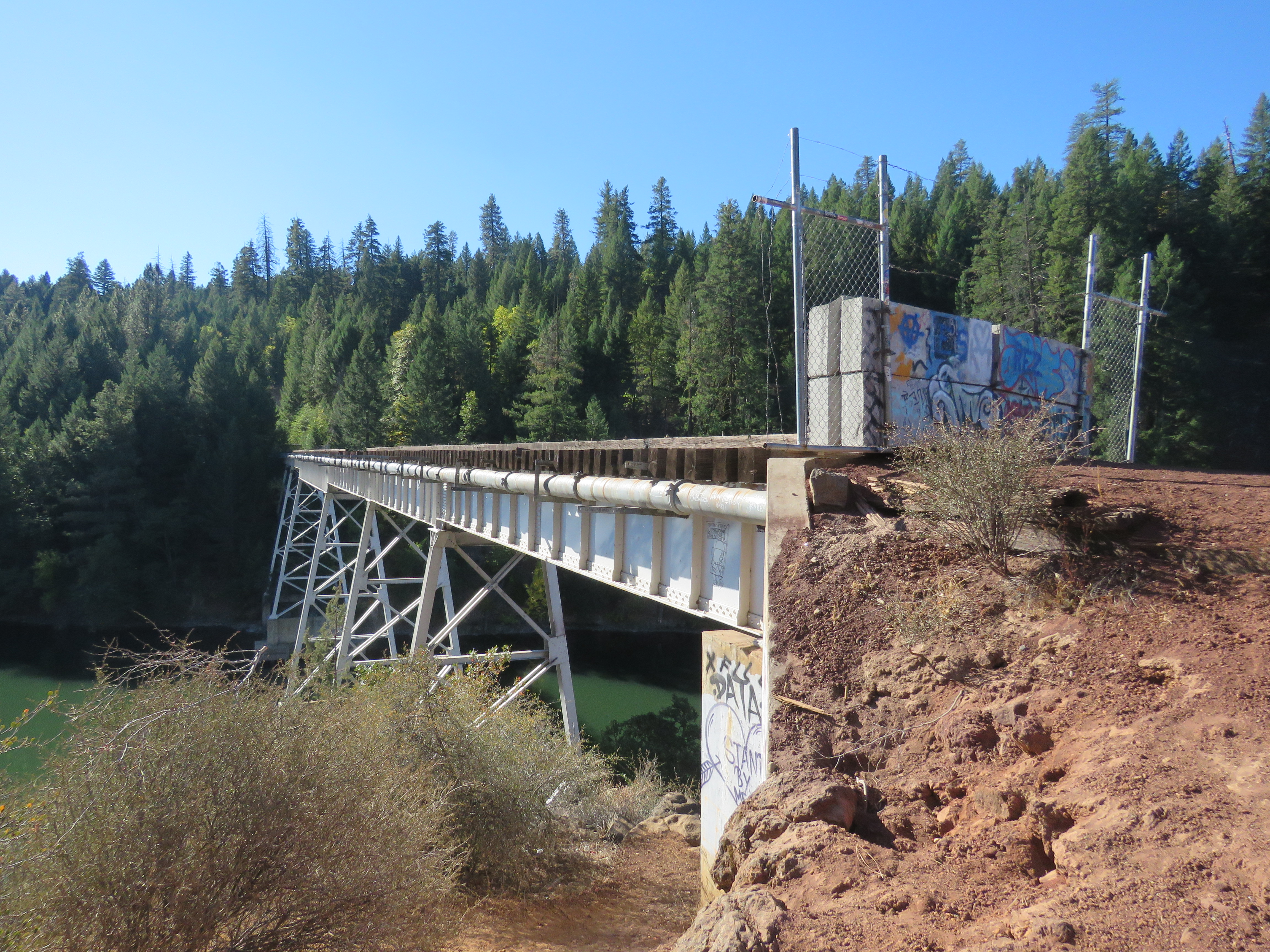
I picked my spot, right near the camera position in Stand By Me and I started to sketch. It was a beautiful day and the scene before was wonderful to add to my sketchbook.
Coda:
August 2, 2016 8:50 AM
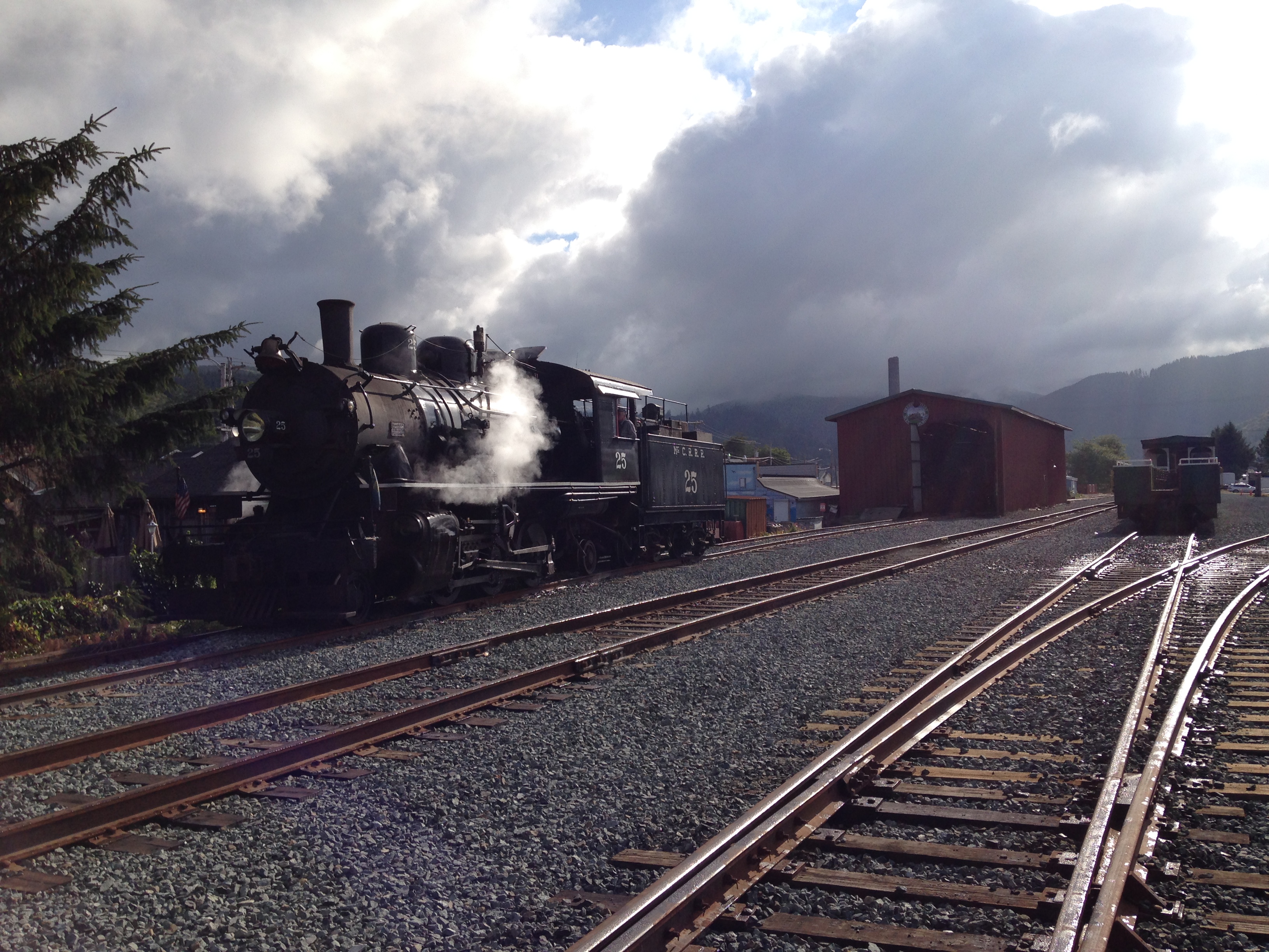
On an Oregon coastal drive on Highway 101 from Astoria to Florence, I came to the small town of Garibaldi (Population 779). To my surprise, this coastal town was home to a tourist railway, the Oregon Coast Scenic Railroad.
It was in the morning and I was exciting to see an engine under steam, getting ready for the day. I took a few pictures of the 2-6-2 “Prairie” Type steam locomotive as is got ready to meet it’s consist of passenger cars for it’s days work.
It was only when I looked back at these images that I realized that this steam locomotive, the former McCloud River Railroad No. 25, was the same locomotive featured in the famous Stand By Me scene filmed at the Lake Britton Bridge.
This well know locomotive was brought in an out of service over the years and headed up many railfan excursions. One such exclusion was in 1955, to celebration the opening of the Burney line. Number 25 was on point of the Golden Spike excursion from McCloud to Burney. We could surmise that No. 25 was the first steam locomotive to cross the Lake Britton Bridge.
No. 25 was sold and in 2011 she was moved from McLoud, Ca to Tillamook, Or. She is currently running on the Oregon Coast Scenic Railroad in Garibaldi.
To think that this minor piece of cinema history, built in 1925, had not been scraped or put on static display in some park but was still a living and breathing locomotive that pulls a trainloads of passengers up the coast of Oregon really puts a smile on my face.


My base camp for my time in Lassen was Cabin Number 4 at the Mill Creek Resort.
The resort is located 12 miles south of the Lassen Volcanic National Park southern entrance. It was 25 miles from gas and groceries in the metropolis of Chester.
The resort was first opened in 1936 and featured a store, gas station, and a post office. The current resort has nine cabins, eight RV sights, and 17 tent campsites. The twelve acres includes a stretch of Mill Creek.
After almost six months of distance leaning one thing that really appealed to me about Cabin 4: no WiFi! I was more that ready to get away from screens and start to enjoy the rustic.
No more work email, useless YouTube videos, political ads, or any ads. Just a view from the front porch, a book, and my watercolor journal and sketching kit.

The true test came on Wednesday evening when word came that PG&E was going to be shutting off the power because of high winds for three day. It was about to get really rustic!
One Wednesday I was in the middle of reading the poem “Traveling through the Dark” by William Stafford when the power went out at 7:35 PM. This was uncanny, irony of the highest order!
I turned on my headland and finished the poem which ends:
I thought hard for us all—my only swerving—,
then pushed her over the edge into the river.

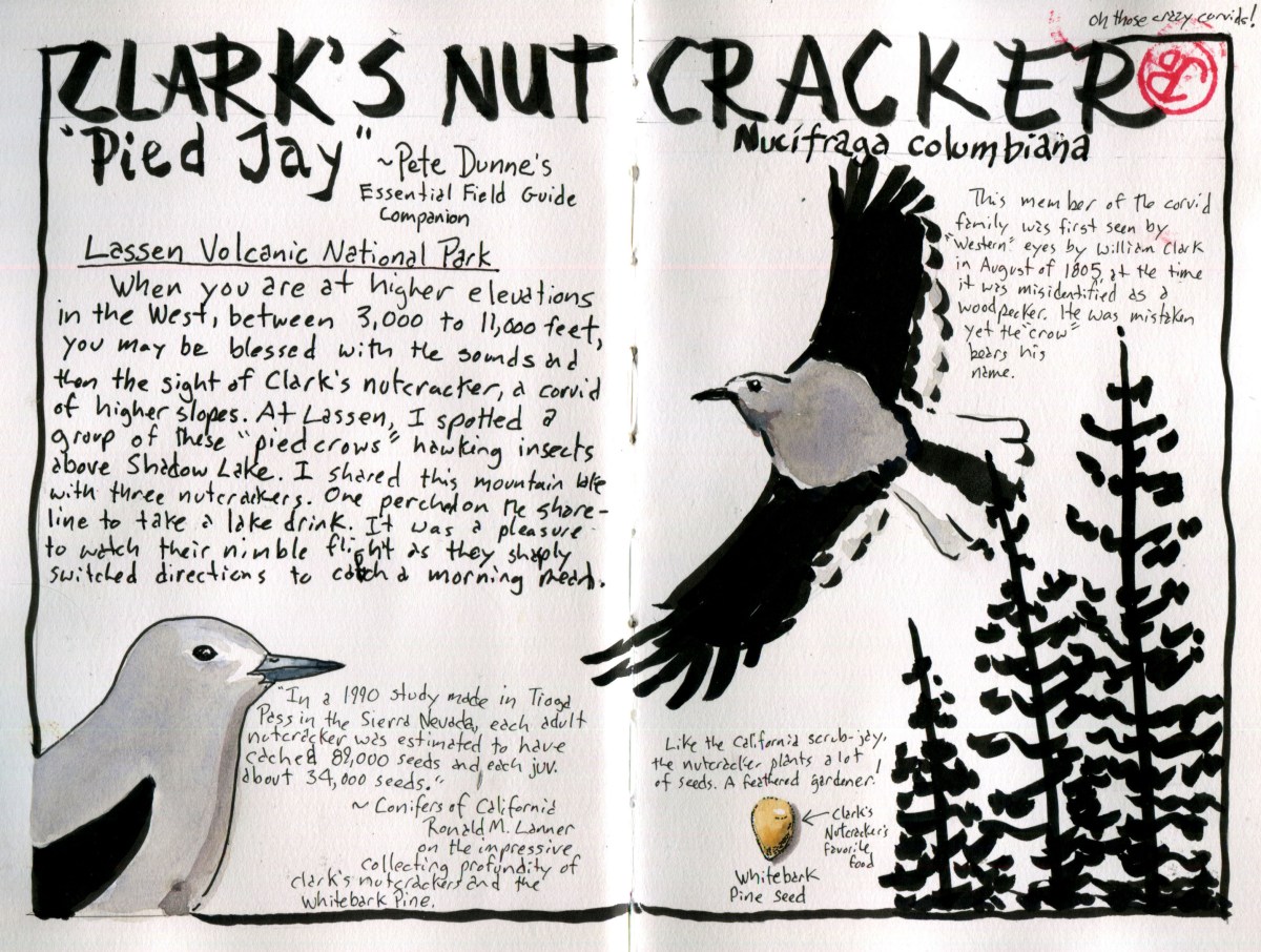
Being a birder, I always keep an eye out for birds, even when hiking, and not birding, is my primary aim. One might argue that a birder really never stops birding. I like to select a bird species as “Bird of the Trip”. This could be an iconic species or it could be a common species showing interesting behavior. The Clark’s nutcracker hits both of these targets.
The Corvids (not Covid) were well represented at Lassen. Common ravens patrolled the Lassen Volcanic National Park Highway, Steller’s Jay were seen at most locations. While I do love seeing these species, I can see them from the deck of my cabin in Santa Cruz. One Corvid encounter was a nice surprise, a family group of Canada jays (formally gray jay) forging on the ground near the Lassen Trail monument. The Canada Jay is a species that I do not see very often because they only occur in far Northern California.
The Clark’s nutcracker is an interesting bird for many reasons. When it was first seen by western eyes during the Lewis and Clark expedition in August 1805, William Clark first described a bird as a woodpecker. He wrote in his journal on August 22 1805:
I saw to day [a] Bird of the woodpecker kind which fed on Pine burs it’s Bill and tale white the wings black every other part.
It is odd that this Corvid, now bears the name of a man who misidentified the nutcracker. This bird is more a cracker of nuts than a pecker of wood!
This hearty corvid is found in the western United States, Clark’s first sighting was in present day Idaho and the bird is found at high altitude from 3,000 to 11,000 feet in elevation. I always keep an ear and eye open when I’m at altitude in the west. I usually hear them before I see them.
This was the case as I heading up the trail to Bumpass Hell on my first hike in Lassen. Off to my right, over a deep ravine, I heard the raucous call of the Clark’s nutcracker. A pair of these pied crows crossed over the trail and alighted on a rocky cliff. They stayed in sight for a few minutes and then crested the rise and dropped over the hill.
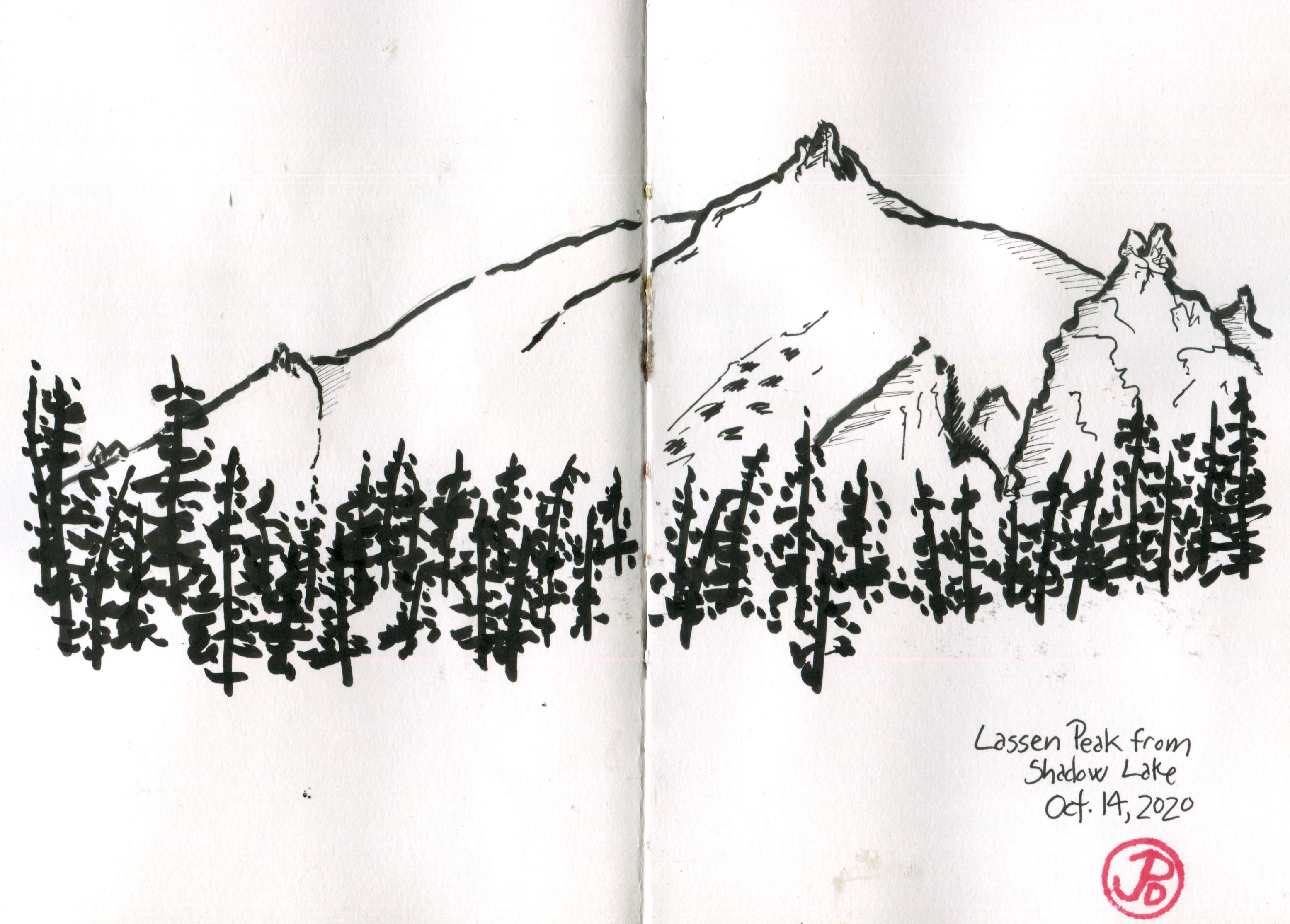
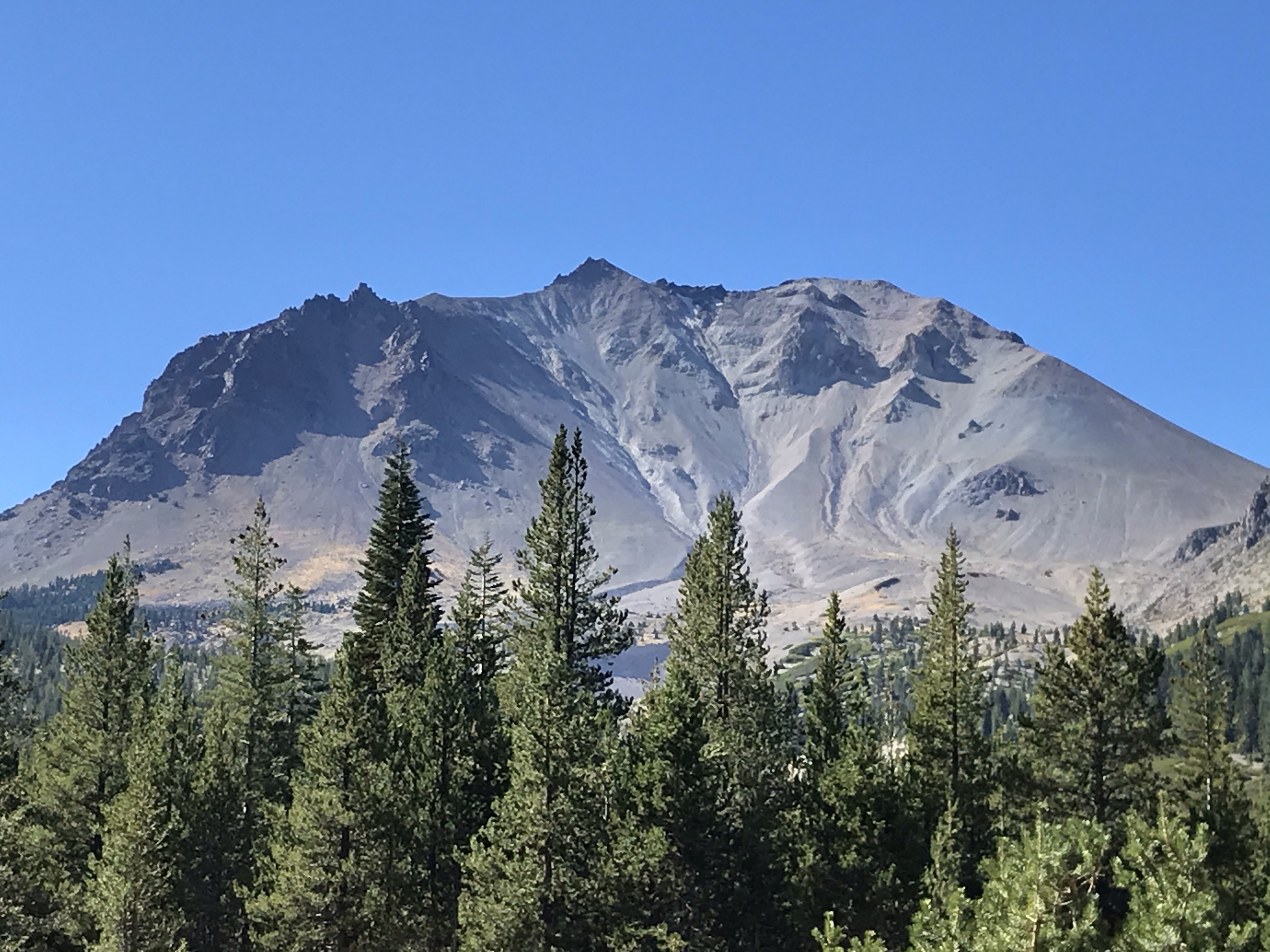
On another day I hiked out to Terrace and Shadow Lakes. I sat on the shore of Shadow Lake to have lunch. From the lake I had a great view of Lassen Peak and it’s twin reflection in the calm, still waters.
After six months of shelter in place and distance-learning, the solitude and stillness of Shadow Lake was exactly what I needed. No technology, no screens, just pen and paper and a perspective to recreate. I sketched the peak of Lassen.
Soon the silence was broken and up the the way, I heard the call of Clark’s “woodpecker”. I was captivated as I watched a pair of Clark’s nutcrackers hawking over the lake, catching insects in their dark bills. I was astonished by the liquidity of their flight as they quickly changed course to catch an insect.
One nutcracker flew down to a short conifer near me. It looked around and then flew down to the shoreline and took a quick drink. The nutcracker repeated itself two more times before returning to hawking insects.
The work ethic of this bird should be then envy of any fourth grader (and everyone else). In a study conducted in Tioga Pass (east of Yosemite Valley) an adult nutcracker was estimated to cache 89,000 pine seeds and a juvenile buried 34,000 seeds. They prefer the seeds of white bark pines, which are very high in calories. Like the California scrub-jay, the nutcracker is a feathered gardener.

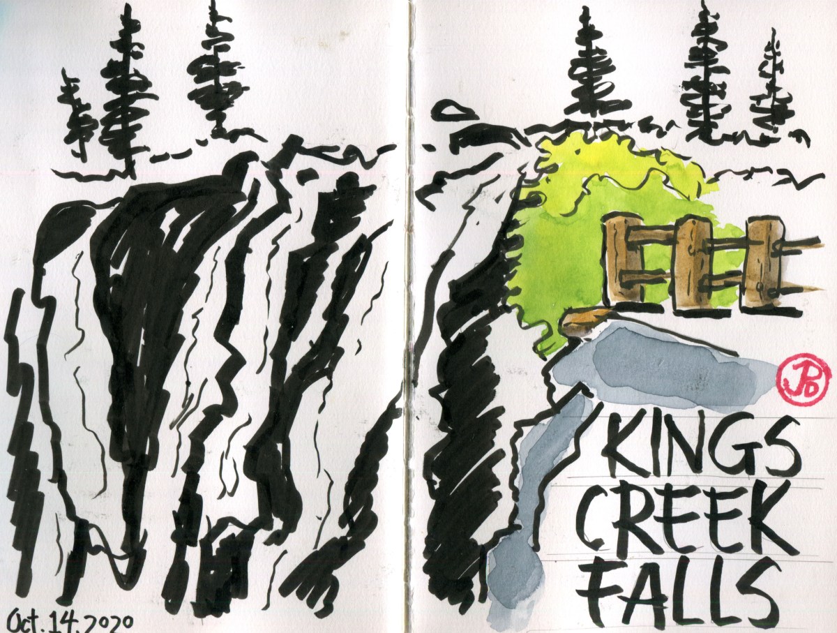
When I pulled into the parking area of the trailhead of Kings Creek Falls at 8:30 AM, there were no other cars there.
One hiking guide listed this hike, in usage, as “heavy” but on this October Wednesday, I had the trail and the falls, all to myself.
The idiom, “the early bird gets the worm” is true for a reason. While others are sleeping in, having an extra pancake, or puttering around with gear, I was on the road by 7:40 AM. Nothing ruins an experience with nature than hordes of people. Yosemite Valley in June, for instance.
The weather was brisk in the early morning hours but the skies clear as I passed through the lovely golden meadows, bisected by Kings Creek. I was heading downstream, towards the 50 foot drop of the Kings Creek Falls.

I once heard that the difference between a creek and a brook is that you can jump a brook, without getting your feet wet. If I were to jump Kings Creek, even with a lively run up, I would land near the middle, with my boots fully immersed in creek. Kings Creek definitely was a creek verging on the edge of being river.
As I hiked, I shed a layer and sweat was beginning to line my brow. The morning was warming up and I came to a trail junction. The trail to the right was a steep and narrow rocky staircase which was oneway. The trail to the left was the trail that left the creek but eventually return to the water course and led to the recently installed King Creek Falls Overlook.
I could hear the roar of the waterfall before I saw it. In 2015, improvements were made to the Overlook area. I assume the building of a fence (featured in the sketch to the right) was to allow visitors to safely get a view of the falls without falling over the edge!
I picked my spot and started to sketch the falls. I kept the sketch loose, it is a sketch after all. I like to work in pen brush, leaving the white of the paper as the water and using the darkness of the pen brush to fill in the shadows and define forms.
During the whole sketch, I had the overlook to myself. When I finished I walked downstream to get a lower perspective of the falls. These falls were certainly impressive but later in my trip I would see some of the most amazing falls in the state of California. (I’m not talking about Yosemite Falls).
Now it was time for one of the surprisingly rewarding parts of the hike, the return journey along the Kings Creek Cascades on a steep and narrow stone stairway.

It was an invigorating climb, with many places of wonderment and rest. The narrow canyon was filled with the sound of water rushing over rock.
On my return I encountered a trickle of people, heading for whence I came. They had finished their pancakes and their gear was now in order. The more people I passed on the way out, the more I appreciated my one-on-one time with one of Lassen’s most popular sites: Kings Creek Falls.

The magma in Lassen is still there; visibly in the form of rocks and boulders scattered around the park. But molten magma still exists below the surface.
The magma is the same that fueled the eruption of Lassen, just over 100 years ago. In places, the magma hyper-warms the ground water and rises to the surface through hydrothermal features, reaching temperatures of 200°F. In this sense, parts of Lassen resembles our first National Park: Yellowstone.
The most well-known hydrothermal feature in Lassen and also the most popular is Bumpass Hell. This is a must do hike for a Lassen visit which explains its popularity.

I headed out early on a Tuesday morning and I had the trail almost to myself. There was one couple that was just ahead of me. If I would have left later in the morning or in the afternoon I probably would have not have been able to find a parking spot in the trailhead parking lot. Even in October!
The hike is a moderate 3 mile, out and back hike with great views of the south of peaks such as Brokeoff Mountain.
Once you crest a rise, you seem to be in a different universe. Bumpass Hell is a visceral experience. Sight: the steam rising into the morning sunlight and the intense earthy colors surrounding you. Smell: the rotten egg stench of sulfur, and sound: the bubbly cauldron burbble of intense heat erupting to the surface. We are definitely not in Kansas anymore!

Another location that is a release valve of Lassen’s subterranean heat is in a under-visited area of this under-visited National Park, located in the Warner Valley.
To get there you must drive east to the rural metropolis of Chester (compared to the blip of Mineral [population 292]). From Chester (population 2,116) you head north back into the National Park on a road that, at first, is nicely paved and then gets a bit rutty before becoming completely unpaved for the final three miles.
I was finally at the Warner Valley trailhead at the campground, which was now closed for the season.
The most exciting thing about this trailhead is that it joins up with a part of the Pacific Crest Trail. The PCT is 2,650 miles long, reaching from the Mexican border to the Canadian border. This hike passes through the states of California, Oregon, and Washington. A through hiker would take about five months to complete the trail. It’s midpoint lines close to the metropolis of Chester. The midpoint is also the meeting place of the Cascade and the Sierra Nevada Mountain ranges.
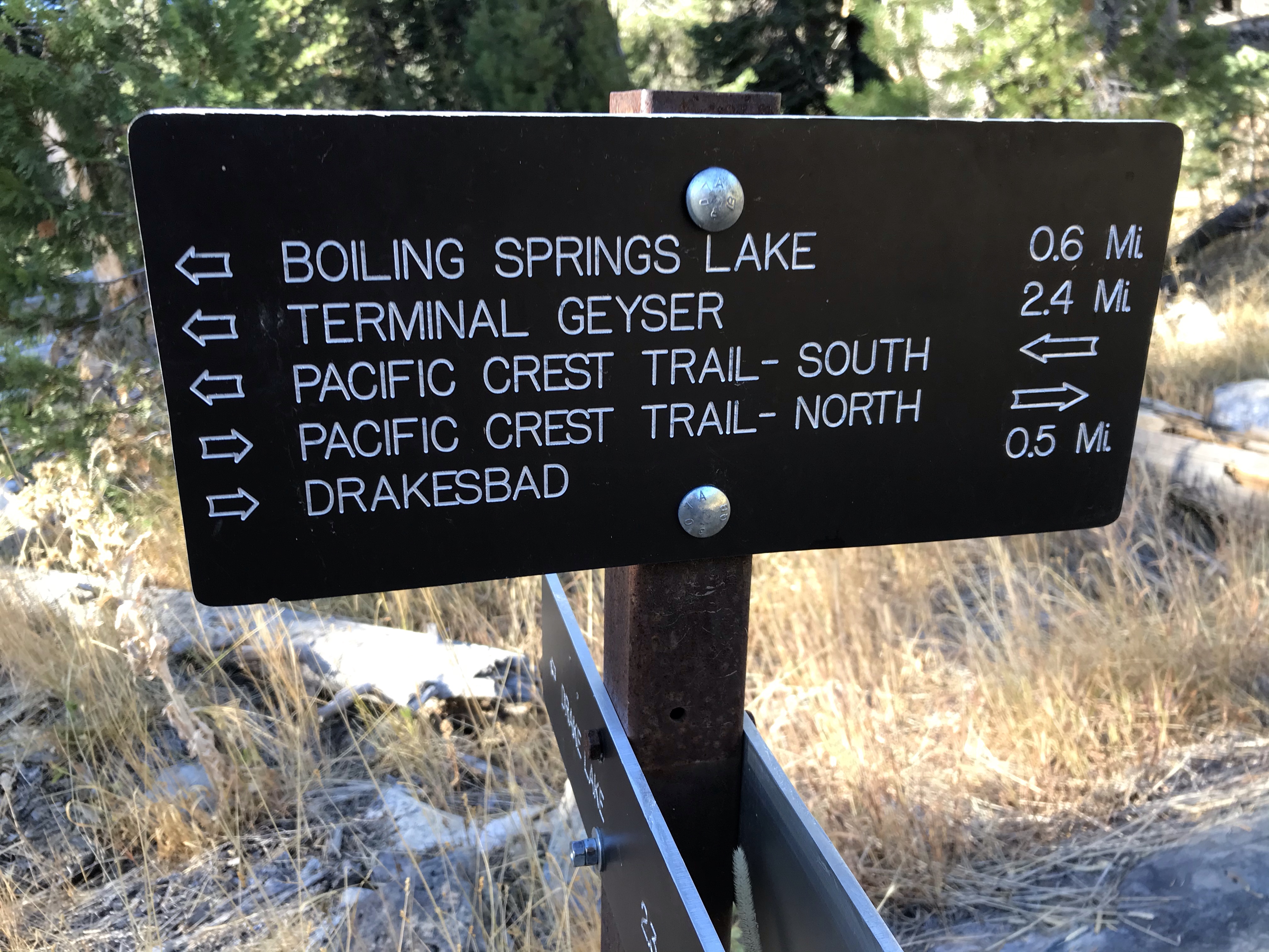
So now I can say that I hiked the PCT, well a very small part of it anyway, from the trailhead to another one of Lassen’s exciting hydrothermal features: Boiling Springs Lake. This is an apt name for this clay colored lake that, in places, resembles a witches cauldron.
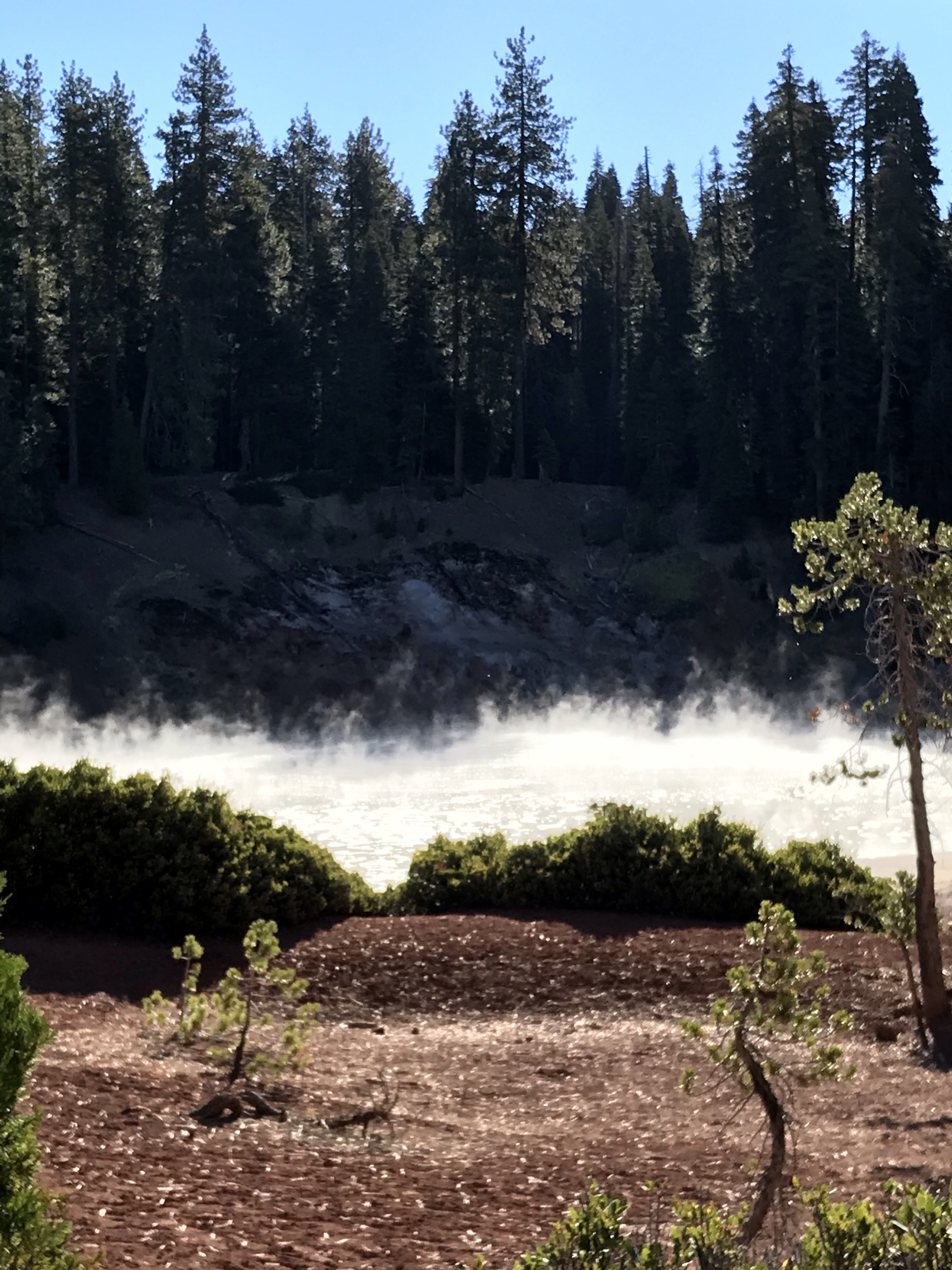
As I approached the lake, steam rose up into the morning sun and as I got closer, but not too close, I started to hear the bubbling of the mud and smell the tell tale smell of sulfur.
I hike halfway around the lake to a rise on the far side of the lake. From my position I had Boiling Springs Lake in the foreground and Lassen Peak in the background. And I did what any sketcher do, I sketched!

Lassen was the final National Park in California that I needed to visit in order to visit al the National Parks in my home state. It always seemed less well known and remote than other parks in the state, with the exception of Channel Islands National Park because you have to take a one hour boat ride to get there. California has the most National Parks in the Union with nine.
Lassen Volcanic is an apt name for this National Park because volcanos and Lassen Peak dominate the landscape of this northeastern part of California.

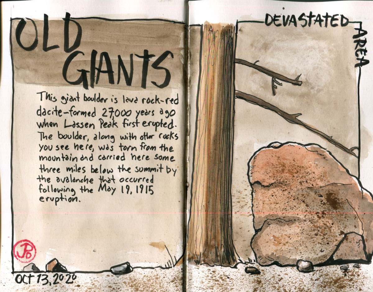
This 106,000 acre park features all four types of volcanos and Lassen Peak represents the last volcano to erupt in California. Even through that was just over one hundred years ago, that eruption, or more accurately, eruptions, left its mark all over the landscape. This is easily seen in the part of the park northeast of Lassen Peak called the Devastated Area.
The short interpretive trail features giant boulders that had travelled over three miles to find their angle of repose after an avalanche on May 19, 1915. Some of the massive boulders are estimated to have travelled at over one hundred miles an hours on their journey from the summit.
Lassen was active between 1914 and 1917 but it’s largest eruption occurred on May 22, 1915 when a massive eruption sent gas and ash 30,000 feet into the air. The eruption could be seen 50 miles away to the west in Anderson. The flows headed down the Lost and Hat Creek waterways, destroying everything in it’s path. This is now the area called the Devastated Area. The trees and vegetation has grown back but the large volcanic boulders tell of a turbulent time.
I picked a spot on the ground near the trail and sketched a large reddish dacite boulder formed about 27,000 years ago. Reading about this boulder’s journey helped understand these erratic rocks. It’s reddish hue reflected the origins of it’s birth, the reds I was seeing at the peak of Lassen.
