Image

Clark’s Nutcracker

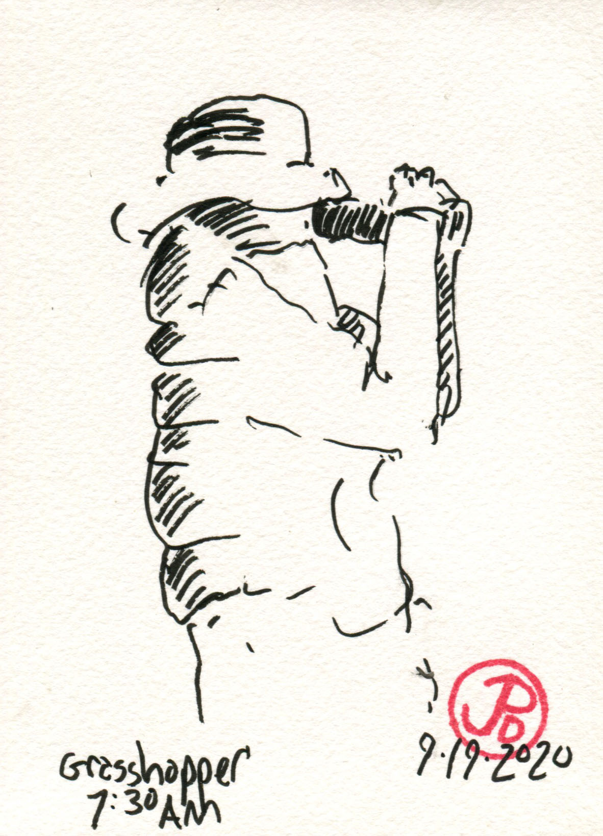
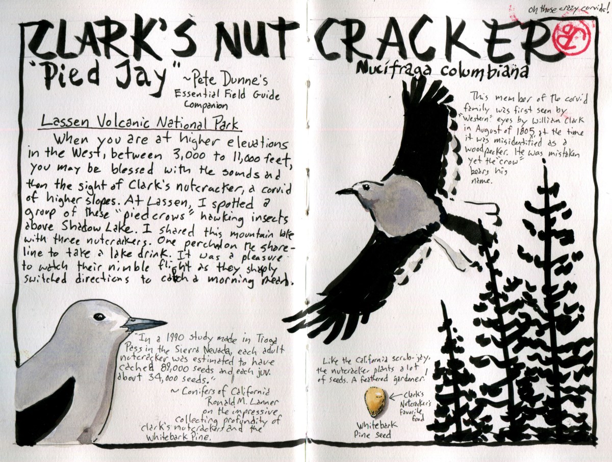
Being a birder, I always keep an eye out for birds, even when hiking, and not birding, is my primary aim. One might argue that a birder really never stops birding. I like to select a bird species as “Bird of the Trip”. This could be an iconic species or it could be a common species showing interesting behavior. The Clark’s nutcracker hits both of these targets.

The Corvids (not Covid) were well represented at Lassen. Common ravens patrolled the Lassen Volcanic National Park Highway, Steller’s Jay were seen at most locations. While I do love seeing these species, I can see them from the deck of my cabin in Santa Cruz. One Corvid encounter was a nice surprise, a family group of Canada jays (formally gray jay) forging on the ground near the Lassen Trail monument. The Canada Jay is a species that I do not see very often because they only occur in far Northern California.

The Clark’s nutcracker is an interesting bird for many reasons. When it was first seen by western eyes during the Lewis and Clark expedition in August 1805, William Clark first described a bird as a woodpecker. He wrote in his journal on August 22 1805:

I saw to day [a] Bird of the woodpecker kind which fed on Pine burs it’s Bill and tale white the wings black every other part.

It is odd that this Corvid, now bears the name of a man who misidentified the nutcracker. This bird is more a cracker of nuts than a pecker of wood!

This hearty corvid is found in the western United States, Clark’s first sighting was in present day Idaho and the bird is found at high altitude from 3,000 to 11,000 feet in elevation. I always keep an ear and eye open when I’m at altitude in the west. I usually hear them before I see them.

This was the case as I heading up the trail to Bumpass Hell on my first hike in Lassen. Off to my right, over a deep ravine, I heard the raucous call of the Clark’s nutcracker. A pair of these pied crows crossed over the trail and alighted on a rocky cliff. They stayed in sight for a few minutes and then crested the rise and dropped over the hill.

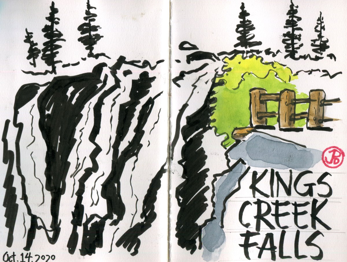
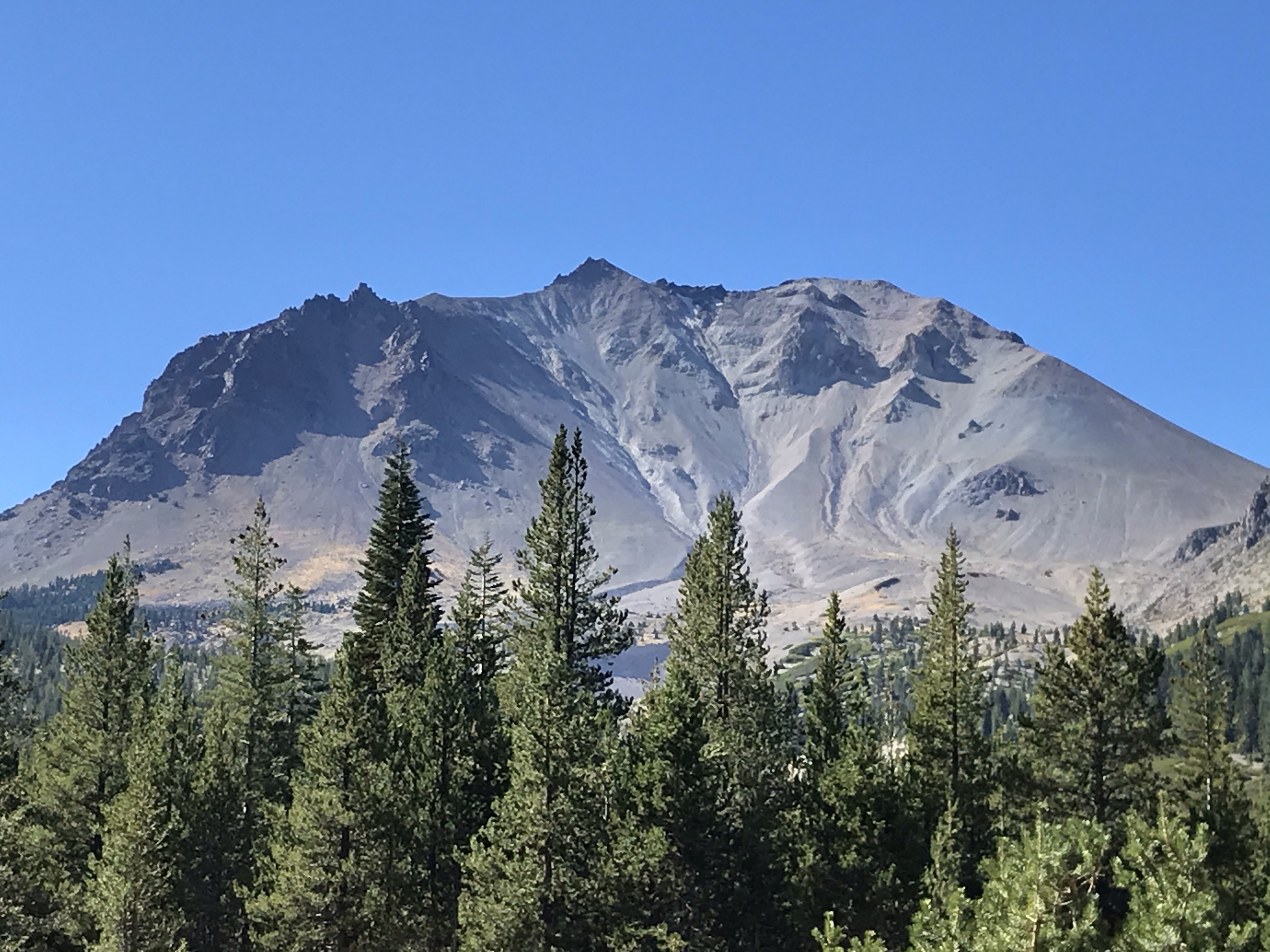
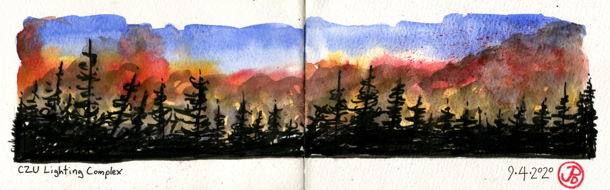
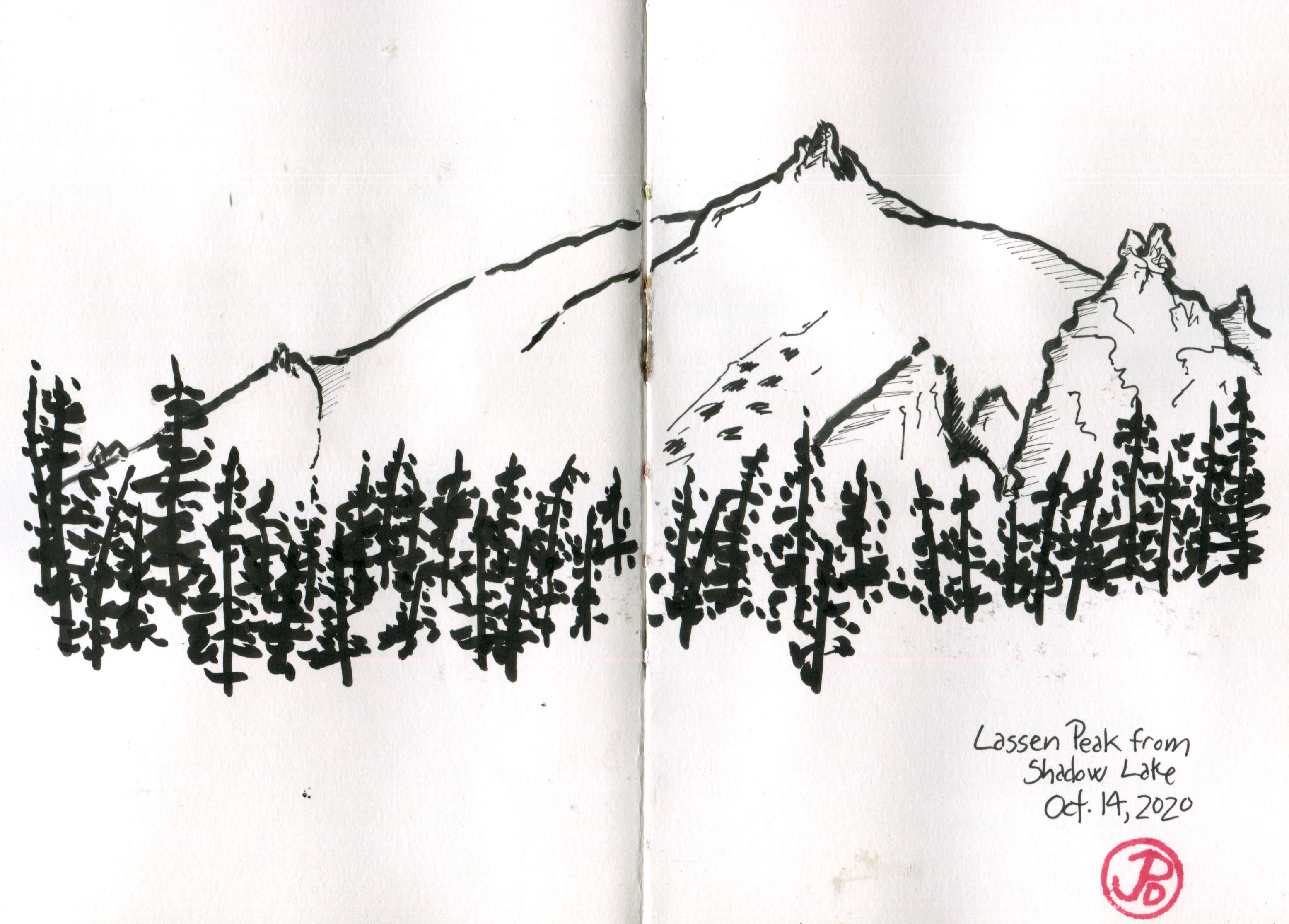
On another day I hiked out to Terrace and Shadow Lakes. I sat on the shore of Shadow Lake to have lunch. From the lake I had a great view of Lassen Peak and it’s twin reflection in the calm, still waters.

After six months of shelter in place and distance-learning, the solitude and stillness of Shadow Lake was exactly what I needed. No technology, no screens, just pen and paper and a perspective to recreate. I sketched the peak of Lassen.

A sketch of Lassen Peak I did while relaxing at Shadow Lake. I thought of adding watercolor but I just left the ink work. Most of this sketch in done with a brush pen.

Soon the silence was broken and up the the way, I heard the call of Clark’s “woodpecker”. I was captivated as I watched a pair of Clark’s nutcrackers hawking over the lake, catching insects in their dark bills. I was astonished by the liquidity of their flight as they quickly changed course to catch an insect.

One nutcracker flew down to a short conifer near me. It looked around and then flew down to the shoreline and took a quick drink. The nutcracker repeated itself two more times before returning to hawking insects.

The work ethic of this bird should be then envy of any fourth grader (and everyone else). In a study conducted in Tioga Pass (east of Yosemite Valley) an adult nutcracker was estimated to cache 89,000 pine seeds and a juvenile buried 34,000 seeds. They prefer the seeds of white bark pines, which are very high in calories. Like the California scrub-jay, the nutcracker is a feathered gardener.

A quick nutcracker sketch in the visitor’s book of Cabin No. 4 at the Mill Creek Reseort.
Image

Kings Creek Falls

When I pulled into the parking area of the trailhead of Kings Creek Falls at 8:30 AM, there were no other cars there.

One hiking guide listed this hike, in usage, as “heavy” but on this October Wednesday, I had the trail and the falls, all to myself.

The idiom, “the early bird gets the worm” is true for a reason. While others are sleeping in, having an extra pancake, or puttering around with gear, I was on the road by 7:40 AM. Nothing ruins an experience with nature than hordes of people. Yosemite Valley in June, for instance.

The weather was brisk in the early morning hours but the skies clear as I passed through the lovely golden meadows, bisected by Kings Creek. I was heading downstream, towards the 50 foot drop of the Kings Creek Falls.

I once heard that the difference between a creek and a brook is that you can jump a brook, without getting your feet wet. If I were to jump Kings Creek, even with a lively run up, I would land near the middle, with my boots fully immersed in creek. Kings Creek definitely was a creek verging on the edge of being river.

As I hiked, I shed a layer and sweat was beginning to line my brow. The morning was warming up and I came to a trail junction. The trail to the right was a steep and narrow rocky staircase which was oneway. The trail to the left was the trail that left the creek but eventually return to the water course and led to the recently installed King Creek Falls Overlook.

I could hear the roar of the waterfall before I saw it. In 2015, improvements were made to the Overlook area. I assume the building of a fence (featured in the sketch to the right) was to allow visitors to safely get a view of the falls without falling over the edge!

I picked my spot and started to sketch the falls. I kept the sketch loose, it is a sketch after all. I like to work in pen brush, leaving the white of the paper as the water and using the darkness of the pen brush to fill in the shadows and define forms.

During the whole sketch, I had the overlook to myself. When I finished I walked downstream to get a lower perspective of the falls. These falls were certainly impressive but later in my trip I would see some of the most amazing falls in the state of California. (I’m not talking about Yosemite Falls).

Now it was time for one of the surprisingly rewarding parts of the hike, the return journey along the Kings Creek Cascades on a steep and narrow stone stairway.

A view of from the return journey on the stone staircase.

It was an invigorating climb, with many places of wonderment and rest. The narrow canyon was filled with the sound of water rushing over rock.

On my return I encountered a trickle of people, heading for whence I came. They had finished their pancakes and their gear was now in order. The more people I passed on the way out, the more I appreciated my one-on-one time with one of Lassen’s most popular sites: Kings Creek Falls.

Image

Lassen’s Hydrothermal Features

The magma in Lassen is still there; visibly in the form of rocks and boulders scattered around the park. But molten magma still exists below the surface.

The magma is the same that fueled the eruption of Lassen, just over 100 years ago. In places, the magma hyper-warms the ground water and rises to the surface through hydrothermal features, reaching temperatures of 200°F. In this sense, parts of Lassen resembles our first National Park: Yellowstone.

The most well-known hydrothermal feature in Lassen and also the most popular is Bumpass Hell. This is a must do hike for a Lassen visit which explains its popularity.

The Bumpass Hell Boardwalk. And not a soul in sight!

I headed out early on a Tuesday morning and I had the trail almost to myself. There was one couple that was just ahead of me. If I would have left later in the morning or in the afternoon I probably would have not have been able to find a parking spot in the trailhead parking lot. Even in October!

The hike is a moderate 3 mile, out and back hike with great views of the south of peaks such as Brokeoff Mountain.

Once you crest a rise, you seem to be in a different universe. Bumpass Hell is a visceral experience. Sight: the steam rising into the morning sunlight and the intense earthy colors surrounding you. Smell: the rotten egg stench of sulfur, and sound: the bubbly cauldron burbble of intense heat erupting to the surface. We are definitely not in Kansas anymore!

Another location that is a release valve of Lassen’s subterranean heat is in a under-visited area of this under-visited National Park, located in the Warner Valley.

To get there you must drive east to the rural metropolis of Chester (compared to the blip of Mineral [population 292]). From Chester (population 2,116) you head north back into the National Park on a road that, at first, is nicely paved and then gets a bit rutty before becoming completely unpaved for the final three miles.

I was finally at the Warner Valley trailhead at the campground, which was now closed for the season.

The most exciting thing about this trailhead is that it joins up with a part of the Pacific Crest Trail. The PCT is 2,650 miles long, reaching from the Mexican border to the Canadian border. This hike passes through the states of California, Oregon, and Washington. A through hiker would take about five months to complete the trail. It’s midpoint lines close to the metropolis of Chester. The midpoint is also the meeting place of the Cascade and the Sierra Nevada Mountain ranges.

Near the midpoint if the Pacific Crest Trail.

So now I can say that I hiked the PCT, well a very small part of it anyway, from the trailhead to another one of Lassen’s exciting hydrothermal features: Boiling Springs Lake. This is an apt name for this clay colored lake that, in places, resembles a witches cauldron.

Smoke on the water at Boiling Springs Lake.

As I approached the lake, steam rose up into the morning sun and as I got closer, but not too close, I started to hear the bubbling of the mud and smell the tell tale smell of sulfur.

I hike halfway around the lake to a rise on the far side of the lake. From my position I had Boiling Springs Lake in the foreground and Lassen Peak in the background. And I did what any sketcher do, I sketched!

Image

Lassen Volcanic National Park

Lassen was the final National Park in California that I needed to visit in order to visit al the National Parks in my home state. It always seemed less well known and remote than other parks in the state, with the exception of Channel Islands National Park because you have to take a one hour boat ride to get there. California has the most National Parks in the Union with nine.

Lassen Volcanic is an apt name for this National Park because volcanos and Lassen Peak dominate the landscape of this northeastern part of California.

A pre-trip sketch of the four types of volcanos and their examples, found in Lassen Volcanic National Park: Cinder Cone (Cinder Cone) Composite (Brokeoff Mountain), Shield (Prospect Peak), and Plug Dome (Lassen Peak). Lassen Peak is the largest example of a Plug Dome volcano in the world.

This 106,000 acre park features all four types of volcanos and Lassen Peak represents the last volcano to erupt in California. Even through that was just over one hundred years ago, that eruption, or more accurately, eruptions, left its mark all over the landscape. This is easily seen in the part of the park northeast of Lassen Peak called the Devastated Area.

The view of Lassen Peak from the Devastated Area.

The short interpretive trail features giant boulders that had travelled over three miles to find their angle of repose after an avalanche on May 19, 1915. Some of the massive boulders are estimated to have travelled at over one hundred miles an hours on their journey from the summit.

Lassen was active between 1914 and 1917 but it’s largest eruption occurred on May 22, 1915 when a massive eruption sent gas and ash 30,000 feet into the air. The eruption could be seen 50 miles away to the west in Anderson. The flows headed down the Lost and Hat Creek waterways, destroying everything in it’s path. This is now the area called the Devastated Area. The trees and vegetation has grown back but the large volcanic boulders tell of a turbulent time.

I picked a spot on the ground near the trail and sketched a large reddish dacite boulder formed about 27,000 years ago. Reading about this boulder’s journey helped understand these erratic rocks. It’s reddish hue reflected the origins of it’s birth, the reds I was seeing at the peak of Lassen.

Image

Ishi

Monday October 12, 2020

On this Indigenous People’s Day I visited a historical marker to one of the most well known indigenous person in California.

I remember the stories my grandma told me of the man in a suit that she would see in the local corner grocery store in the the inner Sunset neighborhood in San Francisco. He was different but covered in the threads of the times. Although she had seen him as a child, the story she told me in her later years showed what an impression that experience had made on her.

This was the man named “Ishi”, the last surviving member of the Yahi People. And I was going to the point of his intersection with the modern western world.

How did he come to live in San Francisco? It began on an August evening at about 7:30 in eastern Oroville.

On August 29, 1911, Ishi collided with he western world when he was captured near Charles Ward’s Slaughterhouse (note the irony) in Oroville, California. He was captured and put into the Oroville jail (supposedly for his own protection) when the first photograph of him was taken of.

Ishi’s people, the Yahi, had been diminished by attacks by other native tribes and by white settlers who came to California to seek their fortunes in the Gold Rush. His small family group died out and he wandered down from the foothills, tired and dehydrated, to look for food when he was captured.

Ishi at the Oroville jail.

In September, Ishi made his way to San Francisco where he stayed at the University of California Museum of Anthropology at Parnassus and was studied by an anthropologist named Alfred Kroeber. Kroeber learned from Ishi about his culture and language (no living person spoke his language). His voice was recorded as he talked, sang, and told stories.

One favorite story is about the time that Ishi was riding in a car through Golden Gate Park and he made the driver stop the car as he spotted California quail by the side of the road, a bird Ishi would have been very familiar with. Today, there is only one quail remaining in Golden Gate Park, a lone male, which local birders have named “Ishi”.

Ishi’s contact with the modern world proved to be his downfall. He was often sick with western diseases. He died on March 25, 1916 of tuberculosis.

The area where Ishi was found is now a quiet residential neighborhood on a quiet street. The slaughterhouse in gone and the area has been built up with residential, single family houses. The calls of the northern flicker, California quail, and the acorn woodpecker may be the only things recognizable from 1911. At least to Ishi.

Now there is a historical marker, the genesis behind it’s creation was a high school teacher and his son, who wondered why there was not a historical marker about the last of the Yahi: Ishi. And because of their efforts, there now is California Registered Historical Landmark No. 809.

Looking at this marker now, I reflect on our complicated interactions with the native people of California. It is often a tragic story but also with bits of light and wonder. Like the time a little girl saw the man from Parnassus in the local store. A story she would tell, many, many years later to her grandson.

Image

Lassen Volcanic N. P.

Before most trips I like to create a map of my travels in my journal to help me get the lay of the land. For my fall break I decided to keep it local and visit one of California’s least visited National Parks: Lassen Volcanic National Park. This remains the last National Park in California that I have yet to visit.

This National Park gets about 500,000 annual visitors compared to Yosemite’s 4.4 million. It can be hard to find solitude among the masses at Yosemite, which is California’s most visited National Park. So I was looking forward to the solitude I would find on the trails, lakes, and meadows at Lassen during the fall.

Volcanoes dominate the landscape, history, and name of Lassen Volcanic National Park. The volcano in question is the last volcano to erupt in California and only the second volcano (the other is Oregon’s Mount St. Helens) in the Continental United States to erupt in the 20th century. This of course is Lassen Peak.

This is a sketch taken from a famous Benjamin Loomis photograph of Lassen eruption in 1914. This is also the first sketch in my Stillman & Birn Zeta Series watercolor journal. I love breaking in a new journal and I hope to fill it’s pages with Lassen sketches.

The first major eruption of Lassen occurred on May 22, 1915 and ash was spewed high in the air drifting as far east as 280 miles. Lassen continued to be active until 1921. In August of 1916, Lassen became a National Park and Lassen became a sleeping giant.

The landscape around Lassen still show signs of the last eruption in the early years of the 20th century. I can’t wait to sketch this volcanic history.

Image

Monterey Bay Classic Pelagic

The first time I remember going out on a boat on Monterey Bay I was in high school. That year (1988, I think), numbers of blue whales were being attracted by krill into the nutrient-rich bay.

My dad and I took a whale watch boat out of Monterey’s Old Fisherman’s Wharf and it was the first time I set eyes on the world’s largest animal. I was able to take a few pictures of the whale’s blue-gray mass. Later, I told my biology teacher that I had seen blue whales in Monterey Bay. He didn’t believe me, but I showed him pictures to prove it!

In the ensuring 30 years, I have been on a few Monterey Bay pelagic birding and whale trips. But it had been a while so, when I saw that Alvaro’s Adventures was taking a trip to the bountiful Monterey Bay, I signed up.

I love Monterey because of it’s place in California’s history. The American flag was first raised in Monterey. Our state constitution was written (in English and Spanish) at Colton Hall, a short walk from Monterey Wharf.

What I don’t love about Monterey is it’s wharf. This is full of tourist junk shops and cheesy nautical themed restaurants but it’s saving grace is to be found at the end of the wharf: the companies that lead nature tours (mainly for whales) out into the Monterey Bay Sanctuary.

The orca sign at the dock to Monterey Bay Whale Watch and our masked-leader below, Alvaro. I had seen a pod of orca in the bay a few years ago. I wouldn’t mind seeing the world’s largest dolphin again.

I found myself here at a quarter to seven at a wharf that was slowly coming to life, which would be a jarring contrast on our return later that afternoon when hordes filled the wharf, having not got the note about social distancing.

A few pelagic birders were milling about. You could always tell them apart, they had on birding hats, often displaying some national or international birding destination. They usually had optics around their neck and were nibbling on ginger snaps or cookies and thumbing through bird guides. Some where even checking out the local western gulls and pelicans.

Today our boat was manned (this doesn’t sound right) by two women. She was a large boat, the 70 foot Sea Wolf II and was made, not for fishing, but whale watching, a perfect vessel for pelagic birding! Of course the real Sea Wolf of the seas is the orca aka the killer whale.

There was plenty of leg room on the Sea Wolf II. The red tape on the rail was placed six feet apart to encourage social distancing. One of these lines of perspective is straight. My money is on the horizon. The Sea Wolf had lots of places to stand or sit with clear views of Big Blue.

We boarded and before long where heading out into Monterey Bay. The swells were high and I enjoyed riding the rhythms of the sea like a nautical bucking bronco, a raucous sea horse! A few members of birders joined the Feeding-the Fish Club. Luckily, touch wood, I have never been a member of this club.

The reason Monterey Bay is a legendary location for pelagic life is the marine canyon, the Monterey Submarine Canyon, that bisects the bay. This canyon starts just to the west of Moss Landing. The canyon, at certain places, is a mile in depth and is the deepest submarine canyon on the west coast; a Grand Canyon of the Pacific. This canyon produces nutrient-ruch waters that attracts cetaceans (from blue whales to orca) and pelagic birds. This also means that you do not have to travel too far out to see pelagic species.

Today we headed south to search the waters off the coast of Big Sur. I told Alvaro that I would be checking the skies for California condor! (there is a nerdy bird joke in there.) The pelagic birding in the bay had not been as prolific in recent weeks, possibly because of water temps, so Alvaro directed the crew of the Sea Wolf to head south. And it turned out to be a good decision.

Within 30 minutes of leaving port, we had our first pelagic species, a lone sooty shearwater. This trip was dominated by the presence of pink-footed shearwaters. Alvaro noted that “weirdo” shearwaters (aka rare) associate with pink-footed and not sooty shearwaters. I could only hope for a Manx!

A little further out, we were upon a pod of Risso’s dolphins. These gray dolphins have dorsal fins that resemble female orcas. Our captain called attention to one individual Risso’s, an albino, named by whale watchers as “Casper”.

Risso’s dolphin. These dolphin don’t seem to enjoy bowriding like the gregarious Pacific white-sided dolphin. But a great dolphin to see nonetheless.

Further south we encountered sweet spots with many shearwaters, a smattering of ashy storm-petrels, and some south polar skuas. One skua was being chased by a Heerman’s gull, oh how the tables had turned. In this general direction we saw our first, of about ten, black-footed albatross. We added two species of jaegers to our list.

I spent most of my time in the stern of the boat. It it usually is less crowded, less wet, and less turbulent in the back. Once we headed back north again, I migrated to the bow of the Sea Wolf. Here is was important to keep at least three points of balance and attempt to hold binoculars to your eyes. At times, I wore my binos like a dense necklace and scanned the waters with the naked eye. This is a wide angle lens approach to pelagic birding. This approach has payoffs.

I spotted a chocolaty shearwater crossing our bow from right to left. “Shearwater”, I called out. Alvaro, who was standing to my left, got bins on it and proclaimed, “Flesh-footed!” It really does pay off to stand next to someone who knows more than you do. It always makes you look better. This was the only flesh-footed shearwater we saw on the trip and only the second one I had ever seen.

Something similar happened a dozen miles later when I spotted a grouping of four birds. It looked like two phalaropes bookended by two California gulls. One of the spotters identified the two birds as red phalaropes. The seas, swells, and light can play tricks on the birder, even the most seasoned pelagic birder. As we came closer the birds were not phalaropes but the smaller Napoleon’s gull. They showed their dark bills and ear muffs. These small gulls were a pleasant pelagic surprise. I have never seen this gull in open ocean but on terra firma.

It was surprising to see a few passerines so far out at sea. The closest these birds might come to water was a bird bath. An American pipit strafed the boat and then later a golden-crowned sparrow crossed our stern. We also spotted an unidentified sparrow that was laboring, inches above the waters. It was flying towards us. Some passerines hitch rides back to port but this sparrow did not look long for this world. It most likely had gotten lost flying over the bay and this shortcut can prove deadly. We soon lost sight of the sparrow, it disappear behind the swells.

We soon made a course to the west as we headed back to port. Here we saw more inshore species like common murre, Brandt’s cormorant, and brown pelican. The latter species it’s truly one the of the iconic inshore west-coast species. Brought close to extinction by the pesticide DDT, they now flourish in the Pacific. A line of pelicans approached from our port side. Such a common species here, now, but is there no other bird in flight, over the seas that is more soothing to soul and meditative, than a line brown pelicans?

To me, there never has been, nor will there ever be a species that says “Monterey Bay” than the brown pelican.

Image

Pioneer Canyon Pelagic

For months, Grasshopper Sparrow has been dreaming of going on a pelagic to see some of the iconic west coast species: shearwaters, storm-petrels, and the mighty black-footed albatross! And finally the morning came for a September Alvaro’s Adventures pelagic trip to the continental self from Pillar Point Harbor.

A loose sketch of a budding birder checking out the birds on the breakwater as we head out of Pillar Point Harbor.

We arrived at the harbor half an hour before the meeting time of 6:30 AM. I felt like a child on Christmas Eve, I was excited and I rarely sleep well before a pelagic. Pelagic trips are so exciting because you never know what you’re going to see.

This pelagic produced some avian highlights but on this trip the cetaceans really shined.

A loose pen brush sketch from the stern of the Huli Cat. Not an easy thing to do with the rolling and rocking of the boat in open sea. That’s why it’s loose!

As we headed out into the foggy bay we saw many rafts of common murres. It took a while to see a sooty shearwater and our first was a lone individual, strange for such a gregarious species. As we headed further out we saw more sootys and then our first pink-footed shearwater. A bird misinterpreted by an elderly woman on the trip as a “pink” shearwater, the flamingo of the sea. We came upon small rafts of red-necked phalaropes. Then we saw our first storm-petrel, an ashy.

We were all anticipating the first appearance of an albatross. Once the depth went from 200 feet dropping down to 1,000 and more, we knew we had passed over the continental shelf and were over Pioneer Canyon. This is where pelagic life really intensifies. These were the waters of the albatross. But we didn’t see any of these monarchs of the open seas (well not yet, anyway).

We where not over the submarine canyon long before we were surrounded by dolphins, hundreds of them. Pacific white-sided dolphins same toward the Huli Cat, riding our bow wake and jumping in our stern wake. Mixed in with this large pod were the northern right-whale dolphin, it’s finless back can be easily confused with sea lions. The large pod seemed to seek out our boat and many dolphins where fully breaching out of the water! Their playfulness in water reminded me of ravens in the air.

We next encountered a pair of humpback whales. As we cruised along the continental shelf we came to our best whale sighting of the day. Two blue whales that we kept pace with for about 10 minutes. This is the largest animal to have ever lived on planet earth and it is always amazing to see this leviathan of the Oceans. In fact, there were two of three other blue whales in the area, their tall, straight blow gave away their positions. The two whales would pause on the surface, perhaps resting before diving down, showing their massive fluke as they searched the nutrient rich waters for krill.

The mighty blue whale. We saw their flukes as they dived down.

Later, to our starboard, a young humpback whale entertained us by breaching (jumping) out of the water. We were able to watch about ten breaches from this playful whale.

We came to a group of gulls and shearwaters on the water, perhaps feeding on the remainder of a sea lion meal when Alvaro yelled out the word we were yearning to hear, “Albatross!” A lone black-footed albatross passed us on our port side, giving us great views of it’s effortless flight. We later saw one other albatross but this pelagic was marked by the presence of some amazing cetaceans.

And Grasshopper also got some great lifers, both pelagic birds and marine mammals!

Image

The Skies of Mars

But Oh! as to embrace me she inclin’d,
I wak’d, she fled, and day brought back my night.

—John Milton, Sonnet 23

The morning skies of Wednesday September 9, 2020 where an odd orange hue. This dawning day looked like a sepia colored night from a Film Noir based in the foggy, hilly streets of the City By the Bay (think: Out of the Past).

The sun was shrouded by a high, smoky fog. The street lights were on, motorists had their headlights bright, and the birds where silenced by the false-night.

There are currently 28 major wildfires burning in California that have consumed over 2.5 million acres. The smoke from these fires lay thickly in our upper atmosphere, above the coast marine layer (fog) creating the sun’s orange-tinged light.

Many forecasts predicted temperature highs to be in the 90s but the smoke blocked out so much sunlight that many areas in the Bay Area could only muster temps in the 60s.

The only bird that broke the silence was the local California scrub-jay. All other life seemed silent and shrouded in a apocalyptic nightmare!

This photo was taken at 11:30 AM, you could not drive in the gloom without your headlights on!
Looking north down 27th Avenue. The Golden Gate Bridge is out there somewhere!
Image

California Wildfires: CZU Lighting Complex

In the early morning hours of Sunday August 16, 2020, I was awoken by the low thud of thunder. A few minutes later, white light temporarily illuminated my bedroom. A summer thunder and lighting storm! This was a rare occurrence on the California coast.

I lept out of bed and headed to the deck in the same spirit that John Muir climbed up a Doug-fir to experience a windstorm! In this case my survival instinct prevented me from climbing to the top of the tallest tree in an electrical storm. Instead I stood in the open doorway.

I looked upriver and another flash of lighting silhouetted the sloping tree-line and then a clap of thunder filled the darkness. I heard the first drop of rain hit the deck and I reached my hand out from the doorway to feel the life-giving rain. It rained for a very short time, this was a dry thunderstorm.

I stood in the threshold of the back door until that survival instinct willed me to close the door and return to bed. Of course I couldn’t sleep in all the climatic excitement. The center of the storm cell was now moving over my cabin. One clap of thunder was so close that it rattled my bedside lamp.

The whole storm lasted for about 30 to 45 minutes. At that time, little did I know, that this storm sparked wildfires that would create more damage in Santa Cruz County than the 1989 Loma Prieta Earthquake.

I finally drifted off to sleep and when I awoke and looked out across the deck to clear blue skies, I knew the day was going to be warm, extremely warm.

That day I chose to drive over Highway 9 through the San Lorenzo Valley. I rarely drove this route but I had many memories of the area including the town of Boulder Creek, where I worked at a coffee shop just after college. This highway would be a fire line in upcoming weeks. Over 900 structures would be destroyed to the west of Highway 9.

Monday August 17, was the first day of school and it proved to be one of the oddest first days in my teaching career because I was not greeting my students at the classroom doorway but online in my digital “classroom”. Well that was the plan until I got to school and found out that the power was out and PG&E later looked at a power pole on campus that had been struck by lighting (part of the same storm system that started the fire in the Santa Cruz Mountains) and destroyed a transformer. Power would not be restored until two days.

As the news came that a series of forest fires (a complex) was growing into one big wildfire, I kept an eye on Cal Fire’s updates on the contagion. At the same time trying to be present for my students who were no doubt anxious and nervous with the first week’s jitters, especially so because we where all in isolation and we where only seeing a facsimile of ourselves on a screen.

I was also planning for a digital Back to School Night on Thursday and I knew there would be many questions about Distance Learning and I surly did not have all the answers. I ended the presentation by sharing the poem I had written last April about how we were all like pioneers on the Oregon Trail. There would be many hardships but with perseverance and hard work, we would get there.

Back to School Night went better than I had expected and it was very odd not to see my parents and greet then in person. Half and hour later, at 7 PM I received work that a mandatory evacuation order was in place for Paradise Park and my family cabin was in danger of being consumed by the CZU Lighting Complex fire!

At the time of writing the fire that was named the CZU Lighting Complex had burned for 19 days and have consumed over 86,000 acres across San Mateo and Santa Cruz Counties. As of the morning of September 5, the fire is 61% contained.

Cal Fire were able to create fire lines to protect the UC Santa Cruz campus, Santa Cruz, Scott’s Valley, and Paradise Park. The evacuation order was lifted after seven days and residents were able to return to their homes. I headed back to my cabin, a week later, almost 20 days since I had left.

The first thing I noticed was the smoky air and when I looked down the ground was covered in fine white ash, like a light dusting of snow that hadn’t melted away yet. Then I headed to my deck and I heard the rumble of a Cal Fire Huey helicopter with an empty water bucket trading behind.

I looked down and that’s when I noticed the leaves. They were bay laurel leave but they were drained of color and were a charred sepia. How far from the fire storm had these leaves travelled to land on my deck? This evidence of fire was somehow more “real” than the smoky air or the Cal Fire helicopters passing back and forth.

A burnt bay laurel leaf on my front steps.

The suet feeding on the deck was empty and the trees around the cabin were eerily empty of birds. I wondered some animals, like the humans of the community, had fled to less smokey quarters.

I replenished the water in the bird bath and I added some suet to the feeder. Slowly, life was returning. The first bird to visit the feeder was a chestnut-backed chickadee. Life was beginning to return to “normal”.