Image

M*A*S*H, Malibu Creek State Park, Part 1

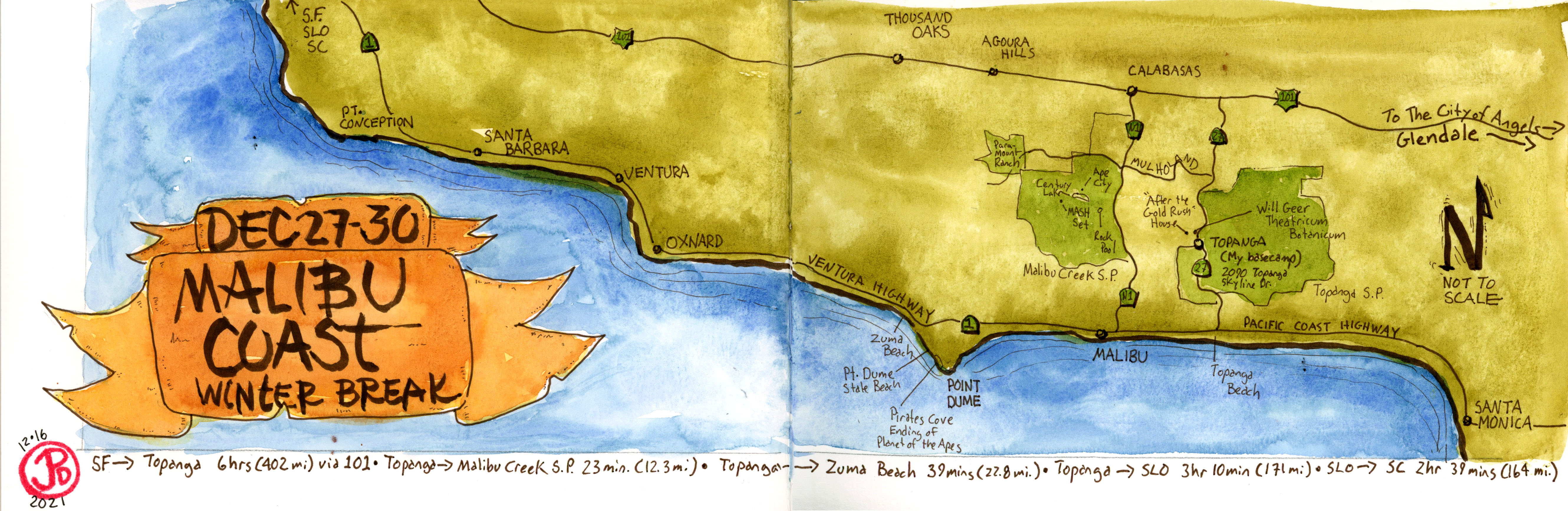
I headed out early from my Topanga Canyon digs on a 23 minutes drive to Malibu Creek State Park.

I would be hiking just over two miles (2.37 miles to be exact), on a fireroad called Crags Road, to the location set for the popular television series M*A*S*H (1972-1983). This state park was once the filming backlot for 20th Century Fox and many other tv shows and films where also filmed here, including the original Planet of the Apes. More on that film in a later post.

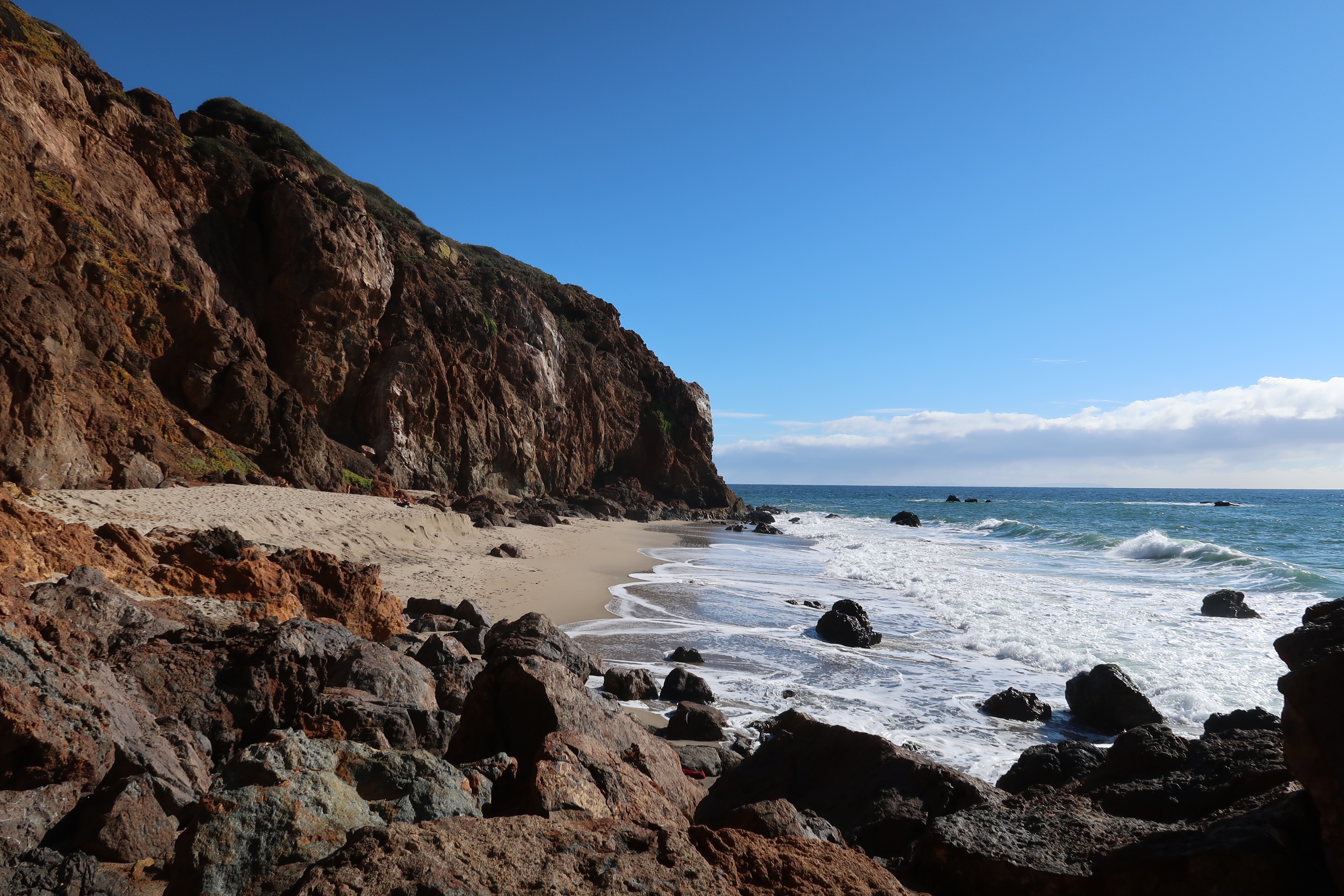
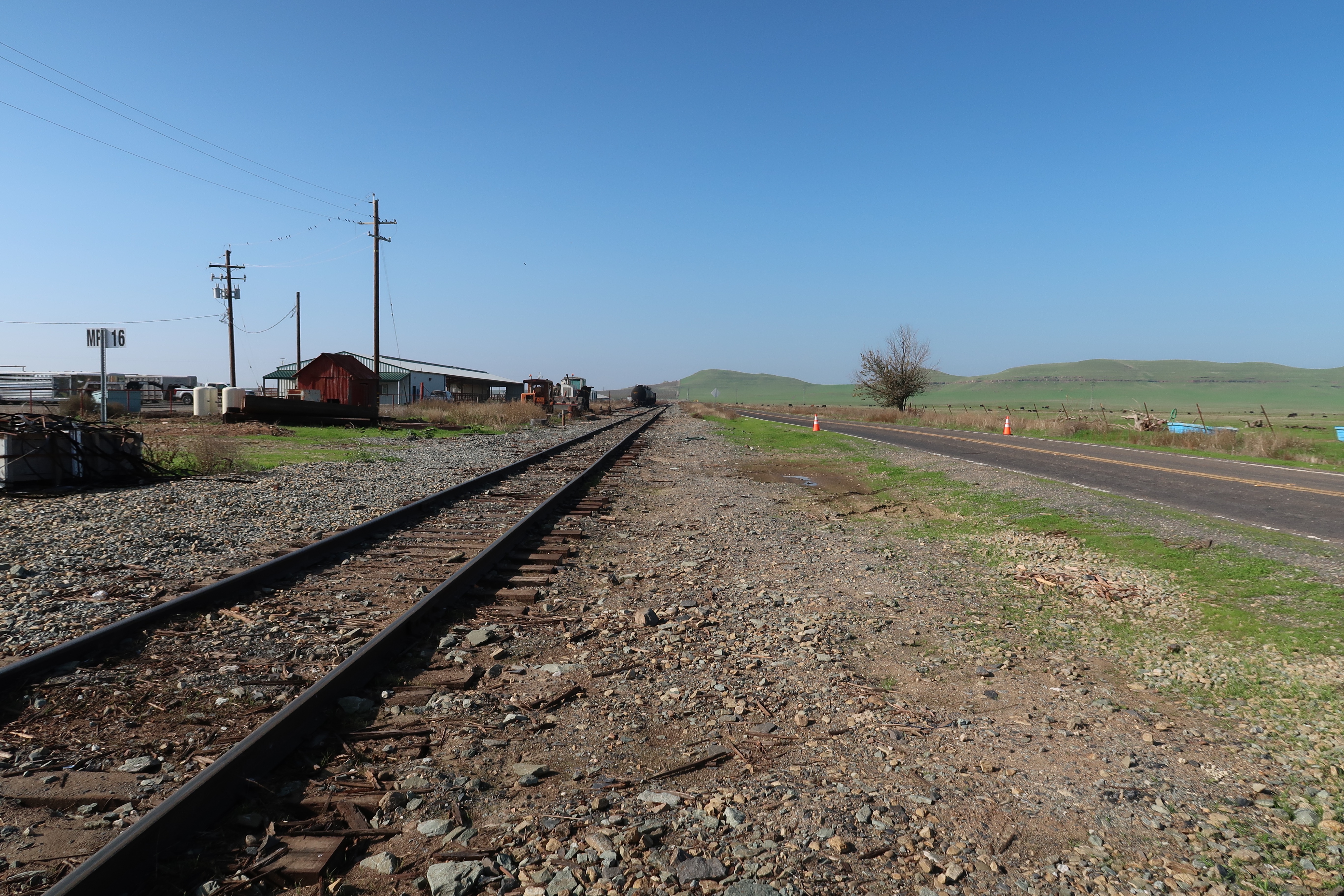
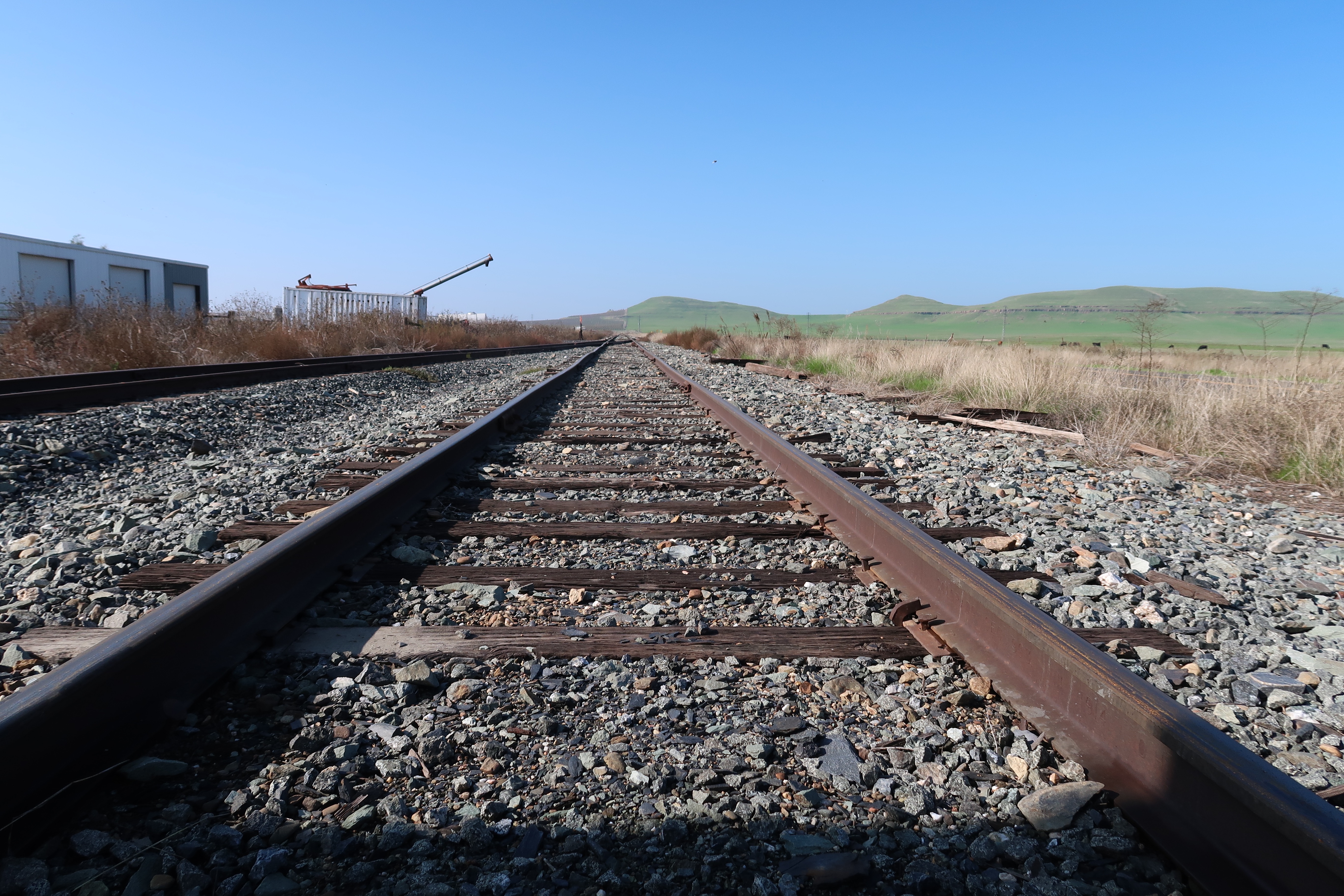
The level trail, which paralleled the rain-swollen Malibu Creek, was muddy from the rain over the past few days. Mist hung below the beautiful mountainous peaks of the Goat Buttes. The buttes are part of the Santa Monica Mountains, the only mountain range in California that runs west to east. I felt I was already in the “Korean” landscape of M*A*S*H. This landscape looked very familiar.

After I passed the side trail to Rock Pool, Crags Road began to climb upward in a muddy assent. The trail briefly leveled out and I headed down towards the former location of Ape City, built in the late 1960s for the sci-fi classic Planet of the Apes. But more about that in another post.

The fireroad now narrowed as it continued to parallel Malibu Creek. At this point I had not encountered a single person on my hike. I hoped that I would have the M*A*S*H site all to myself! The early bird, indeed gets the worm!

The beautiful long shadows of winter sun. On Crags Road less than 0.8 mile from the M*A*S*H site. But first I had to cross the creek.

I followed the sign to the creek crossing only to find a wooden staircase the led into the waters of Malibu Creek! The creek was impassable here, unless I was willing to swim. I looked upstream and I could just make out a makeshift “bridge” constructed of logs and tree limbs. Perhaps “constructed” is too much of word to describe the crossing but I had to chance it to get to the M*A*S*H site, which was on the opposite side of the creek.

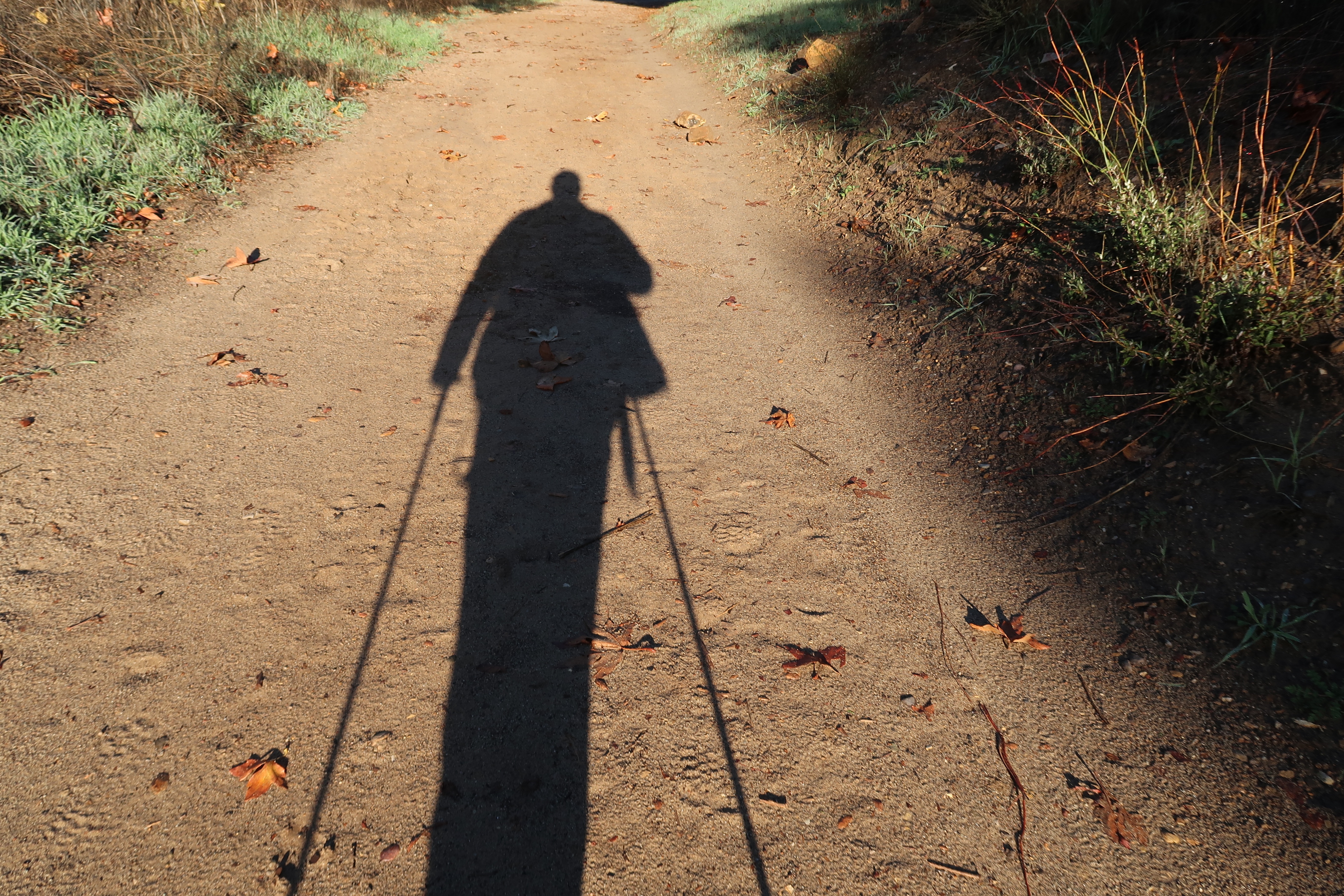
I started across the “bridge”, carefully choosing each footfall on wobbly and far too thin sticks and logs. Here having trekking poles helped afford two more points of balance during the crossing. One pole slipped off a log and I attempted to put the pole down on the bottom of the creek, only to find that it was so deep that my pole was suspended in midwater. I made it to the opposite bank without becoming fully or partial immersion. I made sure my journals were safely stowed in a dry bag.

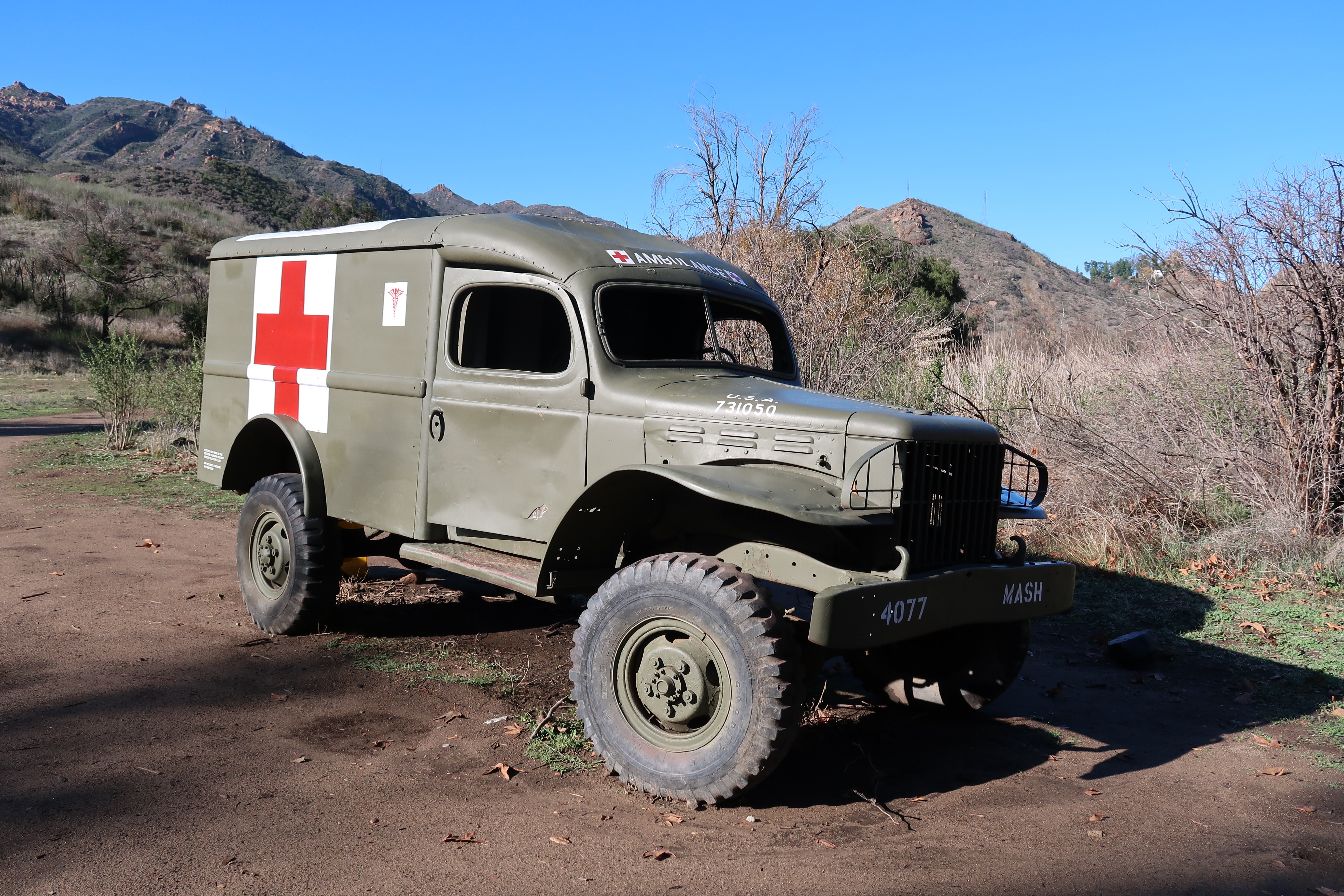
I now bushwacked to find the trail, which at this point did not resemble a fireroad but a single track trail. I was now very close, perhaps 0.5 of a mile and I was waiting, with childlike anticipation, for my first glimpse of the filming site. As I rounded a corner, I saw a Korean War era ambulance by the side of the trail. This marked the edge of the filming set.

This is a restored Dodge WC54 ambulance, which, despite what other have stated online, was not actually used during the filming of M*A*S*H. When you come up this vehicle, you know you about to enter the set.

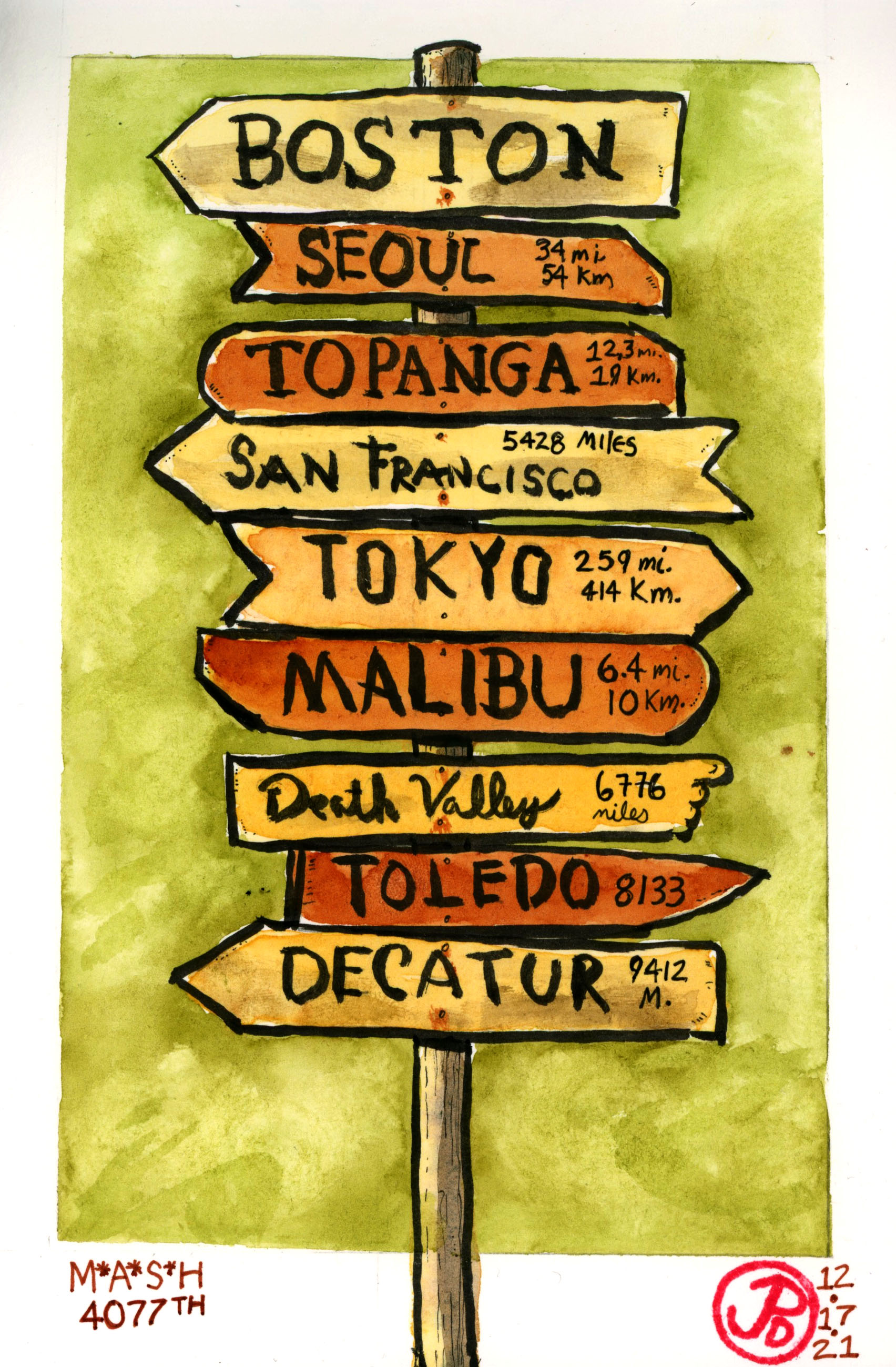
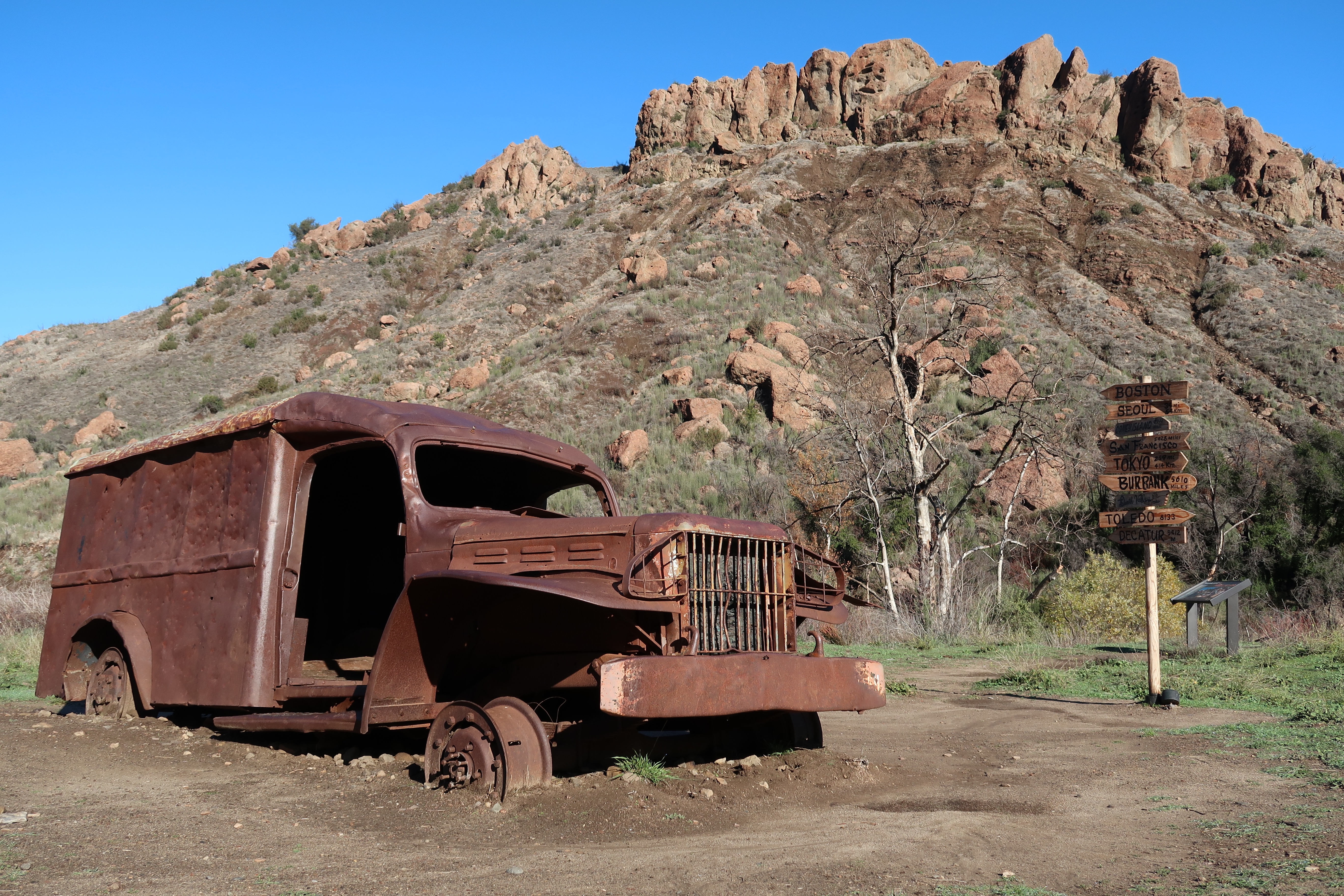
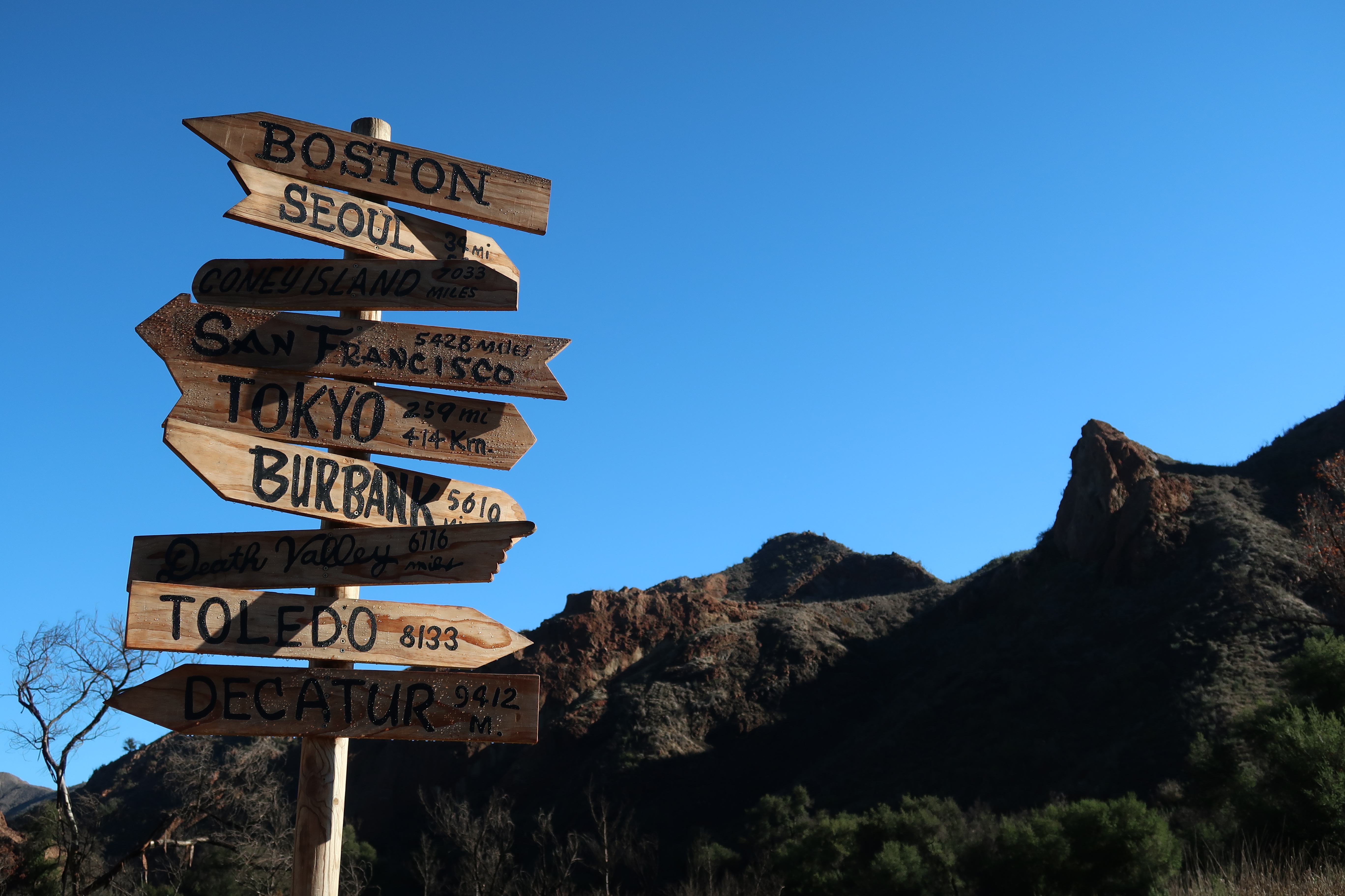
I briefly scanned the site, which included three interruptive signs, two burnt out vehicles (a jeep and an ambulance) from the series, picnic benches, and a replica of the iconic signpost that was placed just outside of The Swamp. But before I explored the site properly, I headed up to the helipad to do some sketching. And yes, I had the site to myself, in beautiful clear winter weather!

This burnt out ambulance was used in the series. An ambulance similar to this is featured in the opening credits. A brush fire burnt the set during the final episode in 1983 and the fire was written into the script.
The replica signpost with the distinctive outline of the Goat Buttes.

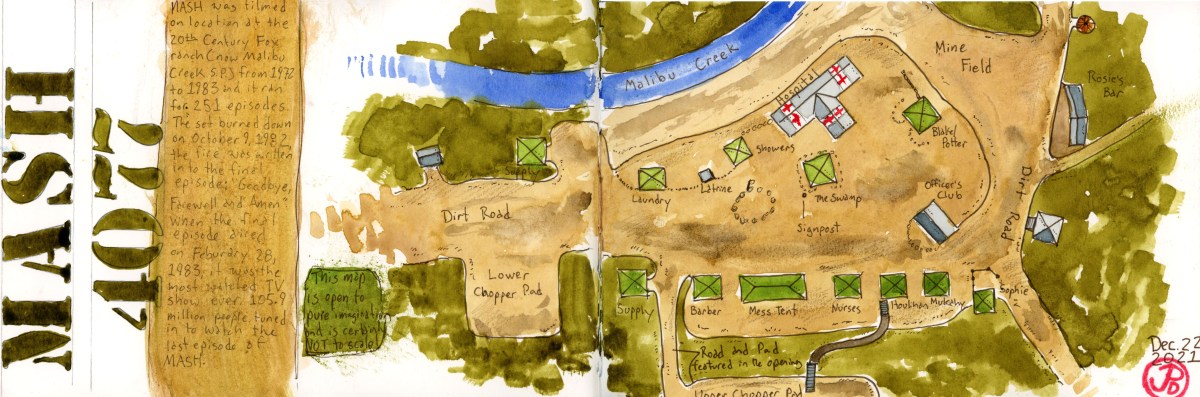
The featured sketch is a map of the M*A*S*H site. I drew this before I head down to Malibu and it helped orient me when I was visiting the location for the first time.

Image

Planet of the Apes, Pt. Dume, Part 2

After my visit to Malibu Creek State Park, I headed south on Malibu Canyon Road and then turned west on the Pacific Coast Highway to the filming location of one of the best and perhaps most shocking endings of any film.

This is Point Dume State Beach and a little cove, named Pirate’s Cove, hidden away from the main beach by rocks that reached out into the Pacific. To get there, you had to time the tides (low tide is best) and then scrabble up and over some rocks to get to the secluded beach.

When I got down to Pirate’s Cove, I almost had the beach to myself, except for an amorous couple at the other end of the beach. I picked a location that was close to the camera position in the final scene of Planet of the Apes and I began to sketch in the forms with my dark sepia brush pen. It was a glorious day after a heavy downpour the day before and is relished the sun and the view before me.

Warning: what follows is a description of the ending of Planet of the Apes (1968) and it will spoil the surprise ending of the film so if you have not seen this film, please stop reading and watch Planet of the Apes (1968) ASAP!

The last scene of Planet of the Apes was filmed at this little cove and the true reveal is shocking, even to this day. Taylor looks up and sees the ruined, half buried Statue of Liberty and realizes that he has been on planet Earth the whole time. Earth has become dominated by apes. The final shot was accomplished by shooting in the real location and adding a matte painting of the ruined Statue of Liberty.

A view of Pirate’s Cove from the cliffs above.

On the other side of the cove, at the southeastern end of Pt. Dume State Beach, the epic scene, just before the final shot, where the camera pans to the left, from a high angle. In the foreground view comes the torch and then the pointed crown of the Statue of Liberty. These where scale mock ups and where filmed from a 70 foot scaffolding built for the film. It was on this stretch of beach where Charlton Heston utters the famous final lines of Planet of the Apes, “They blew it up! God, damn you! Dawn you all to hell!”

This is approximately the angle seen in the film as the camera pans across the mock up of the Statue of Liberty. And this is where Heston spoke the final lines in the film. Maybe right where the lady in a light blue shirt is walking.

This final scene can be viewed on so many levels and this is one reason that this film is seen as a classic of the science fiction genre to this day. What does this ending say about the state of the United States or the world in 1968? What does it say about the plight of freedom, liberty, and democracy today? Like all great films, Planet of the Apes does not simply serve up easy answers but like any great work of art, it is thought provoking and lets the viewer decide for themselves, what the film, and it’s ending, ultimately means.

The final shot of Planet of the Apes.

Point Dume Beach was also used in one other Apes Film: Escape From the Planet of the Apes (1971). The wonderful beginning of the film was filmed here. A spacecraft is just offshore and the military stages at the beach to attempt a rescue of the astronauts. The general order the spacecraft open and he salutes and then falls into silence. The three astronauts have every appearance of being human, until they take off their helmets!

Image

Sketching, Trackside

Colfax, California is on the original Transcontinental Railroad. At Colfax, the climb of the western flank of the Sierra Nevada Mountains begins in earnest. The town started as a railroad construction camp and then was renamed by Governor Stanford to honor Vice President Schuyler Colfax who visited to check the progress on the western side of the Transcontinental Railroad.

What is special about Colfax is that it is one of the few places on the California Zephyr’s 51 hour and 20 minute route where trains 5 (westbound) and 6 (eastbound), pass within minutes of each other. That is, if the Zephyr is running on time, which is not too often. In California, the AMTRAK passenger service runs on Union Pacific rail and freight always has right of way. It pays the bills after all.

Both Zephyrs where scheduled to be at Colfax within a few minutes of each other at about 12:30 PM. At about 12:15, people with their suitcases began to arrive at the platform. I love the romance of train travel. The farewells at the station as one prepares for a rail journey, often to see far off friends and family over the Christmas Holiday.

12:30 came and went and no Zephyr.

Both Trains 5 and 6 were late. This is AMTRAK after all, a passenger service not known for it’s punctuality. The Chicago-bound, Train #6 was running about 30 minutes late. It had left Emeryville in the morning at 7:21 AM.

The California Zephyr eastbound Train #6 arriving at Colfax, about 30 minutes late. This train’s final destination is Chicago.

Train #6 pulled into Colfax station at 12:59 PM. I had positioned myself on the east side of the grade crossing at Grass Valley Street. The Zephyr had an eight car consist with a baggage car and seven passenger cars and was pulled by two locomotives. The train was too long for the station platform so when the Zephyr stops at the station, it stops traffic on Grass Valley Street. I had no way of knowing which car would be stopped at the grade crossing. It lent a bit of improvisation and serendipity to the sketch. And I would only have a short time to sketch the scene because the Zephyr would be in the station for about three minutes as passenger boarded or disembarked.

The train slowed to a stop and the baggage car came into sketch-view. I would be sketching this car. Great, there are less windows on the baggage car! I quickly sketched in the form of the car and then worked inward to add details. I had all the information I needed in about two minutes of sketch-time (you do lose sense of time when sketching). I would later add a few more details and paint.

Train number 6 headed out of Colfax toward Cape Hope and the summit of the Sierra Nevada Mountains at Donner Pass and then on to Reno, Salt Lake City, Denver, and eventually Chicago. I checked the status of the westbound train train number 5. It was running an hour and a half late. In about 10 minutes I found out the reason why.

Coming down from the summit was a UP freight wearing a dusting of snow on it’s pilot as it headed down towards the Bay Area. The five locomotives (four on point and another at the end) where hauling a long container consist that keeps a lot of trucks off our highways. The Zephyr was running behind this train which explains why it was running an hour and a half late.

I didn’t wait for the westbound Zephyr, I had already gotten my sketch in the book!

The train town of Colfax is a “No Train Horn” town.
Image

Suicide is Painless, It Brings on Many Changes

The hugely popular television series MASH, had it’s initial run from 1972 to 1983, spanning the first eleven years or so of my life.

The series became a backdrop or soundtrack to my life. While my family did not watch the show religiously, I knew the theme song (“Suicide is Painless”), the iconography, and characters of the show. Today, it seems like somewhere, around the world, one of the 256 episodes of MASH is being aired somewhere as a rerun.

The dramatic/comic series follows the doctors, nurses, soldiers, and patients of the MASH (Mobile Army Service Hospital) Unit number 4077 during the Korean War. Often in conflict are the civilian doctors (Hawkeye Pierce, Trapper John, and later B. J. Hunicutt) with the enlisted officers of the unit. The popular series ran for 11 years while the Korean War lasted for just three.

On my winter break, I planned to head to the southland to do some field sketching of one of the most iconic locations using during the MASH movie and the television series. This was the former 20th Century Fox backlot used from many films (Planet of the Apes) and television series (MASH) which is now Malibu Creek State Park.

Of course I started my planning with a map. In this case, a map of the Malibu Coast covering Topanga, Malibu, Zuma Beach. and Malibu Creek State Park.

I often like to do some sketches before I leave on a trip to put my mind’s eye into the location. The featured sketch is based on a screen shot of the pilot episode of MASH, the television series showing the iconic opening as Radar looks on as two helicopter fly towards the helipad with wounded soldiers. The second sketch is of the famous MASH signpost. This was based on a photo of a replica of the sign. The original signpost is in the Smithsonian in Washington DC. I used a little artist license as I changed two of the locations to reflect the real location of the set: Malibu and Topanga (where I would be staying).

Image

Snowman Print 2021

This year’s linocut print is very topical and reflects the strange times we’re living in.

It took me a couple sketches to get the right image that I was willing to carve and then print. There is a bit of improvisation in the carving process but you really need to preplan the finished image only you have to think backwards.

My final sketch where I zeroed in on the design, which didn’t change much from this sketch.Okay there is one less button in the carved block. You will notice that the final print, the image is reversed.

In the end I’m satisfied with the final prints and they speak to the post Covid times. While Christmas is an escape from reality, we should never fully forget what has happened in the past few years and this image is a reminder.

Carving the block. I went over the lines in a back marker so it makes carving out the image a little bit easier. I made a few mistakes in the carving but now, like Japanese pottery, they become part of the final product.
Here is the finished block with my makeshift registration jig. The jig lines up the paper so the print appears in the same place on every printing. Now it only needed to be charged with black ink and pressed into paper.
This print was one of those “happy accidents”. The paper shifted slightly during printing and created a unique image that is almost impossible to duplicate. I love it’s expressiveness. I gave this print to my best friend.
Image

The Prairie and the Neotropic

I have often said that birding is a type of madness. Even more so if it’s a county bird you’re after because this is a species that I have seen many times before but not in Santa Cruz County!

I had missed out on the wintering prairie falcon on the southern edge of Santa Cruz County near Riverside Road. I returned, for the third time, to see a sandy falcon with dark wingpits. I pulled off Riverside Road to scan the pastures, like I’d done three times before. The morning was sunny and clear with blue skies. It was very chilly with the temps hovering in the mid 30s. My hands where numb and for the life of me I couldn’t find my second glove. But what warmed me, was the large hawk circling above the pasture in beautiful morning light. It was the overwintering ferruginous hawk.

But there was no prairie falcon in the air or on any fenceposts so I moved east down the road towards the county line.

In the field, on almost every fence post, where turkey vultures, warming themselves in the morning sun. A lone red-tailed hawk was on a post. Further north, near the base of the hills, was a growing kettle of turkey vultures, rising in the air.

With the naked eye, I could see a bird circling with the vultures. It was much, much lighter compared to the vulture’s black livery. I raised my binoculars and here was my county bird: prairie falcon (Falco mexicanus)! The falcon stooped on a vulture below it, practice hunting I suppose. The falcon continued to circle with the vultures and then peeling off in powered flight as it headed towards the hills to the northwest.

Fence sitting turkey vultures in beautiful morning light.

With the prairie falcon in the bag it was now time to look for the extremely rare visitor that was first seen at Pinto Lake two days before. It was spotted again yesterday after some local birders rented a boat to head out into the lake (hopefully I wouldn’t have to rent a boat to add this bird to my county list). There was a report that the bird had been seen in the middle finger of Pinto Lake in the mid morning. At Pinto Lake, there where a hundred double-crested cormorants at any given time. This could be an exhausting search.

I arrived at the middle finger of Pinto Lake at about noon. I spotted one double-crested cormorant and not the southern visitor so I walked out to the point to scan the main body of the lake. There were a lot of gulls on the water but very few cormorants.

I headed back along the western edge of the finger. There were a few ducks, three hooded mergansers, and more coots but no cormorants. Just when I was about to end my search and head back to my car, three cormorants flew past me heading north up the finger. One of the cormorants stood out. It was much smaller and darker than the the double-crested cormorants it flew besides. The birds moved out of view but I had no doubt that they landed on the water.

I ran down the trail to an opening in the vegetation (birding is a kind of madness after all). There were the three cormorants on the water. One was much smaller and I noticed other details such as the white “V” that framed the base of the beak and the white “sideburns” of it’s breeding plumes. This was the neotropic cormorant (Phalacrocorax brasilianus)! A very rare county bird! In fact this was the first time that a neotropic cormorant had been seen in Santa Cruz County!

The cormorants stayed in view for about five minutes before taking to the air and flying back toward the open lake. I had been lucky with my brief encounter with a Santa Cruz County rarity.

One of these cormorants is not like the others.
Image

Wintering Raptors

The winter in California, is the time of raptors.

Prairie falcon, merlin, rough-legged, and ferruginous hawk, bald eagle. These are exciting times to get out in the field, when raptors have replaced the neotropical migrants, who have headed south.

On a Saturday morning I headed east of Watsonville on the eastern edge of Santa Cruz County on Riverside Drive (Highway 129). Here was habitat like no other in Santa Cruz County, open rolling hills and pastureland. This was habitat like San Benito County, which was really just a mile down the highway. This was the perfect habitat for wintering raptors.

Recently a prairie falcon and a ferruginous hawk had been seen in the area. These are both birds that I look forward to seeing at this time of year. And a prairie falcon would be a county bird for me.

I pulled off Riverside Road at a dirt pullout. Across the road was perfect winter raptor territory. In the foreground was green pastureland with plenty of hunting perches and in the background where the green rolling hills, the realm of golden eagles. It is this view that is the featured field sketch.

To my left I saw some motion against the hillside. I put bins on the raptor and it was one of the prizes I had been looking for, our largest hawk: Buteo regalus! The hawk circled above the ground and then stooped down, landing of the ground. It returned to the air, a minute later, empty taloned. The ferruginous hawk crossed the road and flew above me, paralleling a line of eucalyptus trees. The hawk moved east and out of view.

I moved on down the road and a falcon being pursued by crows crossed the road in front of me. It could be the prairie falcon but I didn’t get a great look at the raptor. I tried to relocate the possible prairie but like most falcons they can be just seem to be passing through, very quickly. This was not enough to tick this bird off on my Santa Cruz County list.

A digitscope of the wintering ferruginous hawk and a Say’ phoebe. This is from a return visit to Riverside Road on Sunday morning.
It must be winter in the Bay Area. Here is a perched ferruginous hawk, our largest hawk, in Princeton near the Half Moon Bay Airport.

Image

St. Josephs Church, Tuolumne, Ca

High Noon starts with a wedding. The town’s retiring Marshal, Will Kane (Gary Cooper) gets married to a Quaker (Grace Kelly), not in the town’s church but in the Justice of the Peace’s office, next door to his own.

But a church does play a part in High Noon. Hardleyville’s church is in reality St. Joseph’s Church in Tuolumne, about 15 miles east of the county seat of Sonora.

The exterior of the church is used for two shots in the film, one, when the three gunmen ride into town on their way to the railroad depot and the second shot is of Marshal Kane walking towards the church to seek assistance from the congregation in defending the town.

I headed to the small town of Tuolumne to sketch the unique looking Catholic Church. It was a clear and cool fall morning and I sketched the church from the warmth of the front seat of my car from approximately the same angle from the film. Like the shot from the film, I cropped off the top of the tower. I’m not sure if this was a statement by director Fred Zinnemann or cinematographer Floyd Crosby or just a a practical way to frame the shot.

The church was built in 1908 and was a Catholic Church until 2008 where it became a Catholic “Mission”.

I like the humor in this sign. High Noon indeed.
Image

Tracking Down an Iconic Shot: Warnerville

There is one shot that is used to create tension in the seminal western High Noon (1952).

The iconic shot looks down the rails towards low hills in what is supposed to be Hadleyville, New Mexico. This shot is used seven times at slightly different heights but is shot from the same position, looking west down the rails. Below is an example from the film:

A still from High Noon looking west down the rails of the Sierra Railroad.

In reality the scene was shot on the Sierra Railroad at Milepost 16 in Warnerville, California. It was here that film crew built the Hardleyville Depot set, which is now gone. There was once a water tower which was featured in the film and this is maybe why they chose this location for the set. The water tower, which was a mainstay in the era of steam, is now gone but the concrete foundation and a small building still remain from the time High Noon was filmed here in September of 1951.

The concrete foundation is all that is left of the water tower at Warnerville. The small red building in the background still stands after 70 years. This shot is looking northeast.
Warnerville looking west toward where the noontime train would be arriving. In the foreground, to the right of the rails, was the location of the Hadleyville Train Depot set. The little red building on the left of the tracks still exists.

Warnerville is not really a town. It consists of a few farms and houses, a grade crossing, and a railroad siding. While it would be great if there was an interpretive sign pointing out the cinematic significance of this location but alas, there is none.

This still from High Noon shows the approaching noontime train, in this case the Screen Queen Sierra No. 3. The water tower and the small building that still exists are to the left of the line. The low hills in the background looks very much the same.
A still from High Noon of Sierra No. 3 pulling into the Hadeyville Depot set at Warnerville.

In the film Nigh Noon, three rough looking gunman arrive at the train station to await the arrival of the noontime train (hence the name High Noon). They are waiting for Frank Miller, who recently has been released from prison. He is coming back to exact revenge on the marshal (Gary Cooper) who put him away.

Among the three gunman, who gaze down the track expecting the noon train, is an actor making his screen debut. He does not speak a single word in High Noon, although he blows a few bars on the harmonica. This actor is Lee Van Cleef. He is best known as the “Bad” in Sergio Leone’s “The Good, the Bad, and the Ugly” (1968).

I arrived at the intersection of Warnerville and Crabtree Road at the Sierra Railroad grade crossing. It was 70 years ago that this location was used in High Noon. The area is a bit different from that time but it is very much the same in other ways. The line of hills had not changed much, except for an almond grove creeping up one of the hillsides (I chose not to add it to my featured sketch, sketcher’s license after all.)

I stood in between the two rails and sketched the approximate position of cinematographer Floyd Crosby’s camera. The rails looked a bit rusted enough so I was not expecting a westbound freight anytime soon. But I still checked my back from time to time because the Sierra Railroad is still an active branch line.

My only companion was a black cow grazing on grass across the road. She raised her head in between foraging and peered, without judgment, at Corvidsketcher.

Well how do you really judge the judgement of a cow after all?

A shoutout goes out to Jeff and Sarah of History Hunters for letting me know about this forgotten filming location. Thank you! Their youtube channel can be found at: http://www.youtube.com/jbenziggy

Here is a photo of my sketching position. If you compare the movie sill from the top of the post, you will notice that the distant hills look very much the same today.
Image

The Sierra Railroad: The Movie Railroad

So many films have been filmed on the Sierra Railroad that it is known as the “Movie Railroad”.

The railroad originated as a branch line connecting the Central Valley, where the mainline is located, to the Gold Country to the east. The construction of the railroad started in 1897 at the Southern Pacific Depot at the town of Oakdale. Seven months later the line reached Jamestown, 41 miles away. In 1899, the line was extended to Sonora, the county seat, and by the turn of the century, the line ran further east to Tuolumne.

The former Southern Pacific Depot at Oakdale. This is where the railroad started. The building now houses the Cowboy Museum.

The town of Jamestown was where the Sierra Railroad established its headquarters and it’s maintenance shops. This part of the railroad now exists and is preserved as Railtown 1897 State Historic Park. The roundhouse still stands and it houses three historic steam locomotives that still are operable today. The star of the roundhouse is Sierra No. 3, a 2-6-0 Mogul type locomotive that is considered to be the most photographed locomotive in the world. She was built in 1891 in Patterson, New Jersey. This locomotive has a look that appealed to Hollywood and heyday of westerns. No. 3 appeared in over 100 films and television shows over the years including My Little Chickadee, High Noon, Bound For Glory, Little House on the Prairie, Petticoat Junction, Back to the Future III, and Unforgiven.

Three movie stars in their stalls at the Jamestown roundhouse. Number 28 and 34 where featured in Hal Ashby’s film Bound For Glory. No. 28 is the only steam locomotive in service and now heads the seasonal “Polar Express”. The sound of the Polar Express in the movie of the same name where recorded from Sierra No. 28.

The Sierra Railroad and No. 3 have appeared in three movies that where nominated for Best Picture: High Noon (1952), Bound For Glory (1976), and Unforgiven (1992). Clint Eastwood’s Unforgiven won Best Picture, Best Director (Eastwood), Best Supporting Actor (Gene Hackman), and Best Editing (Joel Cox).

A sketch of Sierra No. 3 from July 30, 2015.
On my visit to the Jamestown Roundhouse, No. 3, the Screen Queen was in the process of of having her boiler repaired and was in a few pieces.
The Sierra Railroad shops and yard in Oakdale. The yard was used as a filming location for Hal Ashby’s biopic of Woody Guthrie, Bound For Glory. The railroad is still in operation today a runs a few freight trains per week.