The hugely popular television series MASH, had it’s initial run from 1972 to 1983, spanning the first eleven years or so of my life.
The series became a backdrop or soundtrack to my life. While my family did not watch the show religiously, I knew the theme song (“Suicide is Painless”), the iconography, and characters of the show. Today, it seems like somewhere, around the world, one of the 256 episodes of MASH is being aired somewhere as a rerun.
The dramatic/comic series follows the doctors, nurses, soldiers, and patients of the MASH (Mobile Army Service Hospital) Unit number 4077 during the Korean War. Often in conflict are the civilian doctors (Hawkeye Pierce, Trapper John, and later B. J. Hunicutt) with the enlisted officers of the unit. The popular series ran for 11 years while the Korean War lasted for just three.
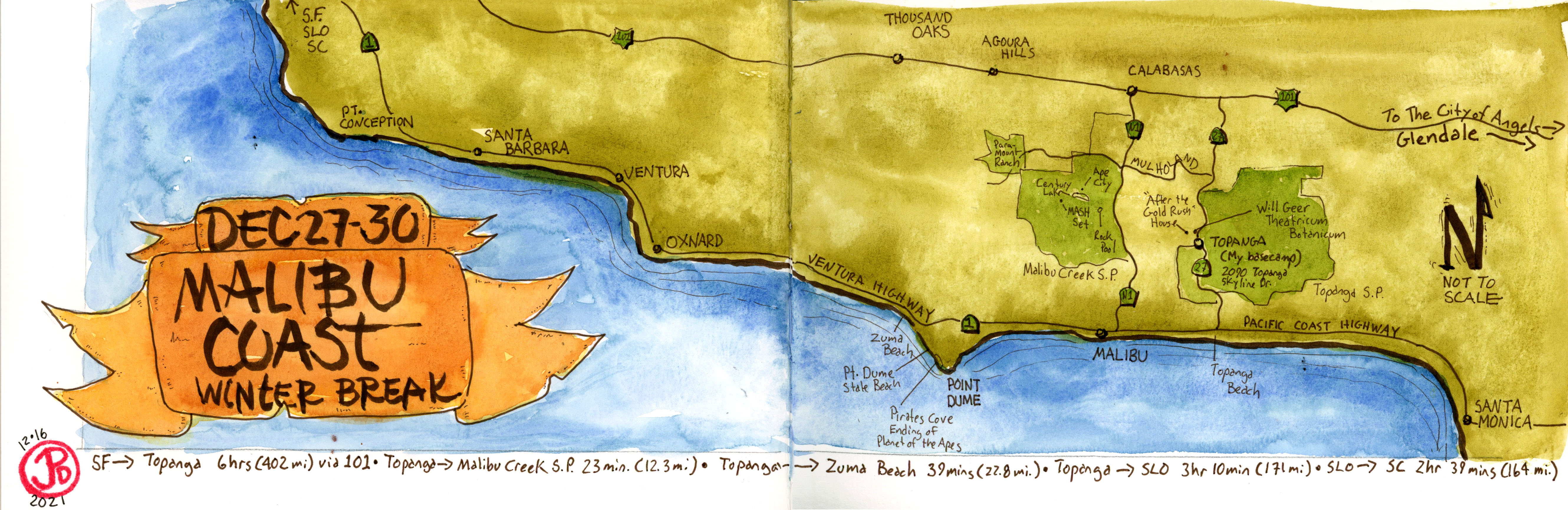
On my winter break, I planned to head to the southland to do some field sketching of one of the most iconic locations using during the MASH movie and the television series. This was the former 20th Century Fox backlot used from many films (Planet of the Apes) and television series (MASH) which is now Malibu Creek State Park.
Of course I started my planning with a map. In this case, a map of the Malibu Coast covering Topanga, Malibu, Zuma Beach. and Malibu Creek State Park.
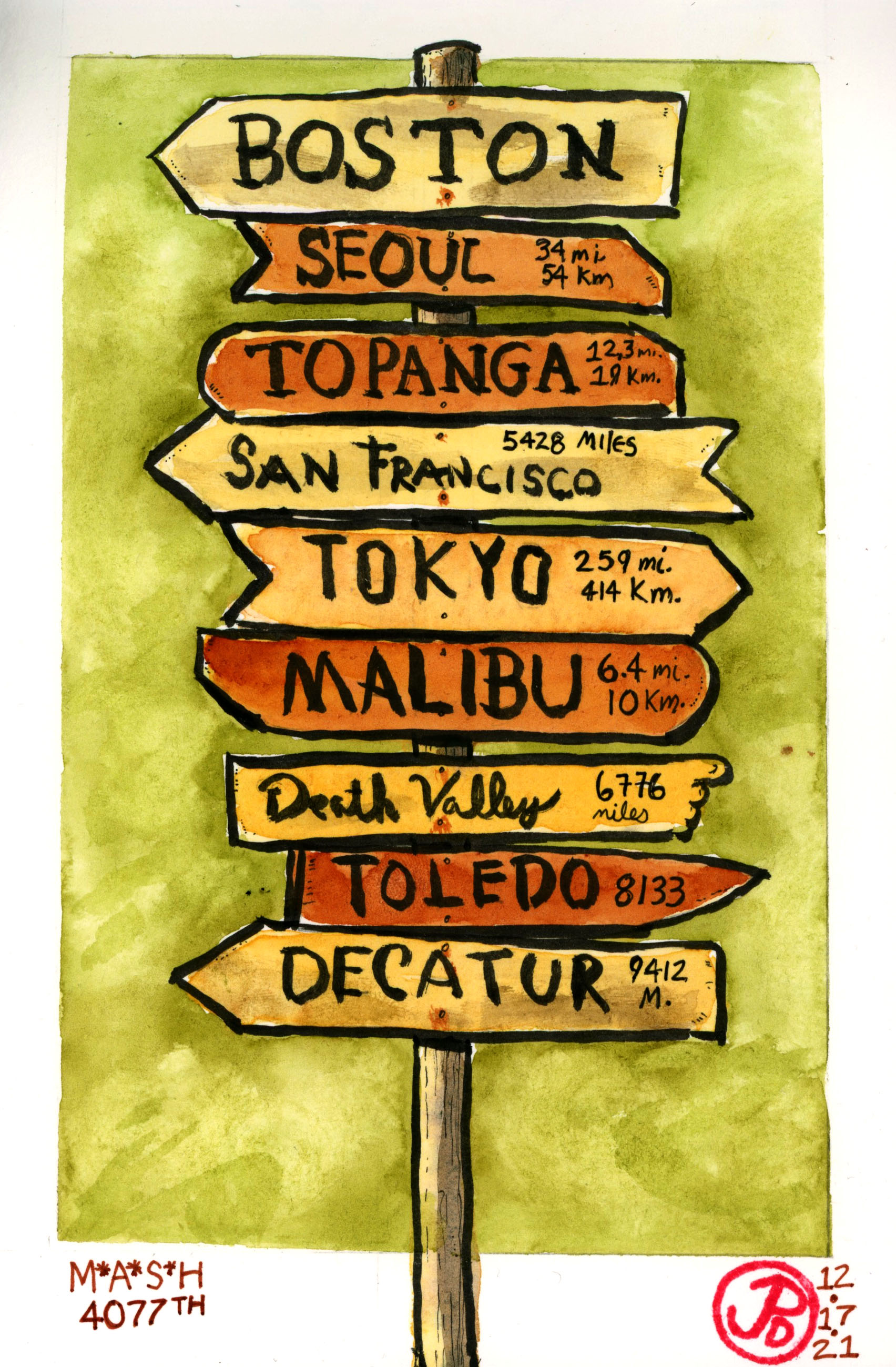
I often like to do some sketches before I leave on a trip to put my mind’s eye into the location. The featured sketch is based on a screen shot of the pilot episode of MASH, the television series showing the iconic opening as Radar looks on as two helicopter fly towards the helipad with wounded soldiers. The second sketch is of the famous MASH signpost. This was based on a photo of a replica of the sign. The original signpost is in the Smithsonian in Washington DC. I used a little artist license as I changed two of the locations to reflect the real location of the set: Malibu and Topanga (where I would be staying).
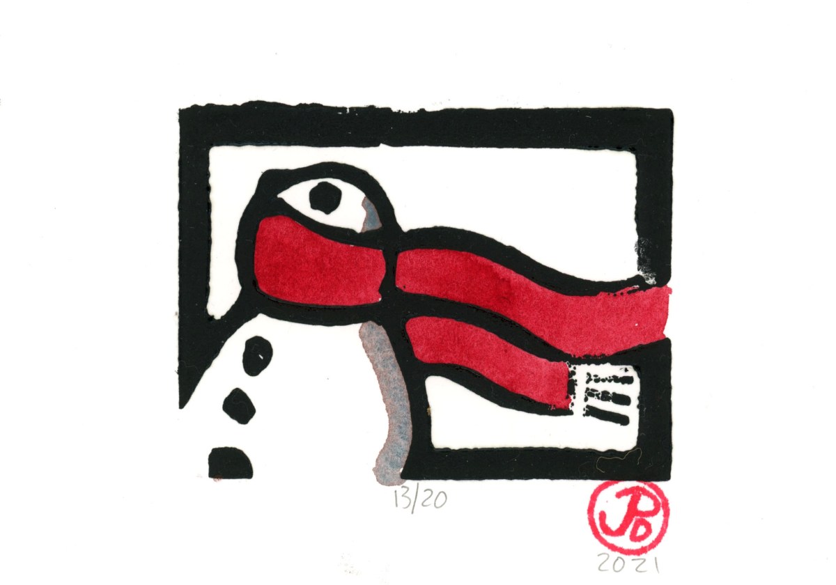
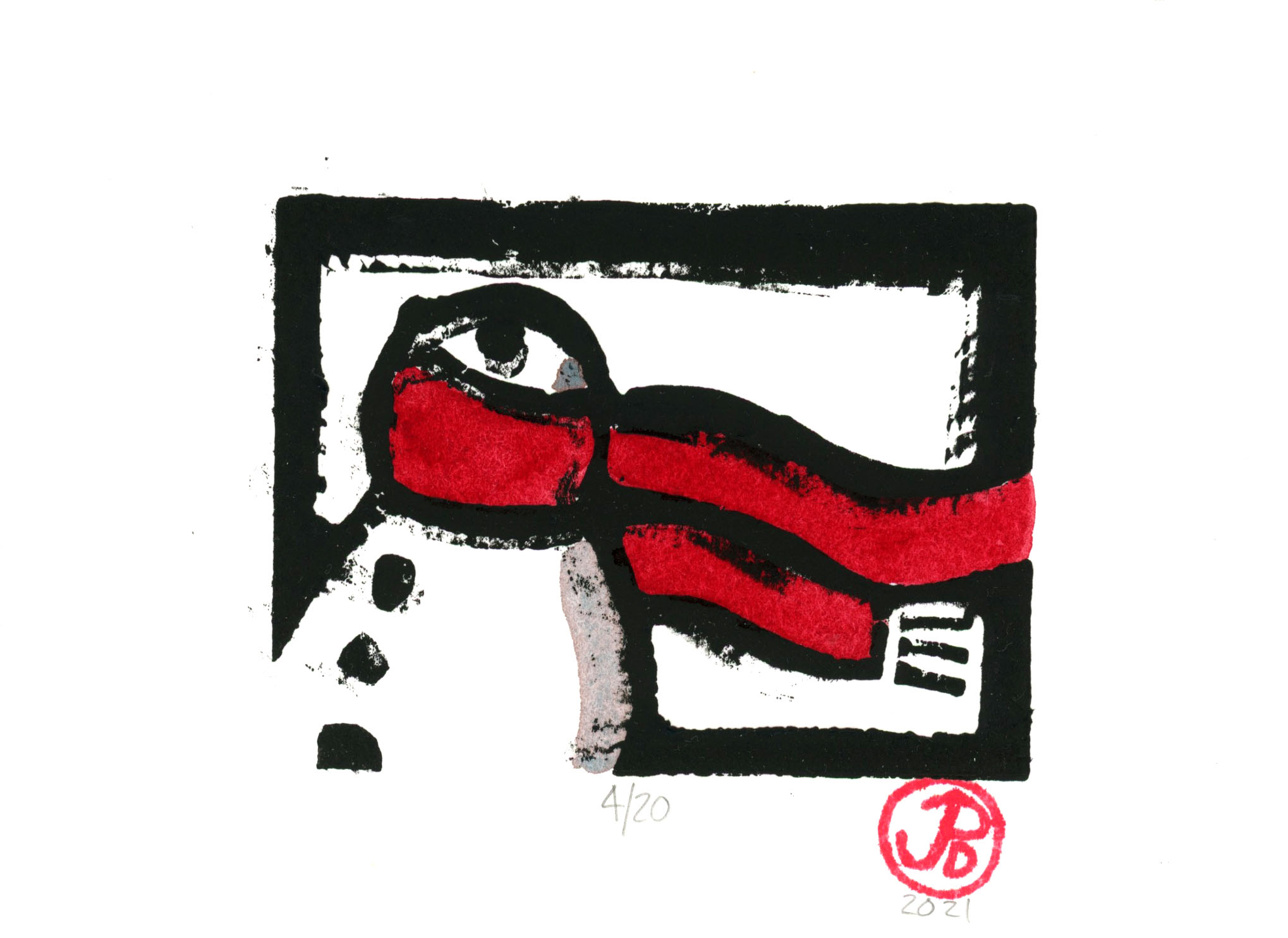
This year’s linocut print is very topical and reflects the strange times we’re living in.
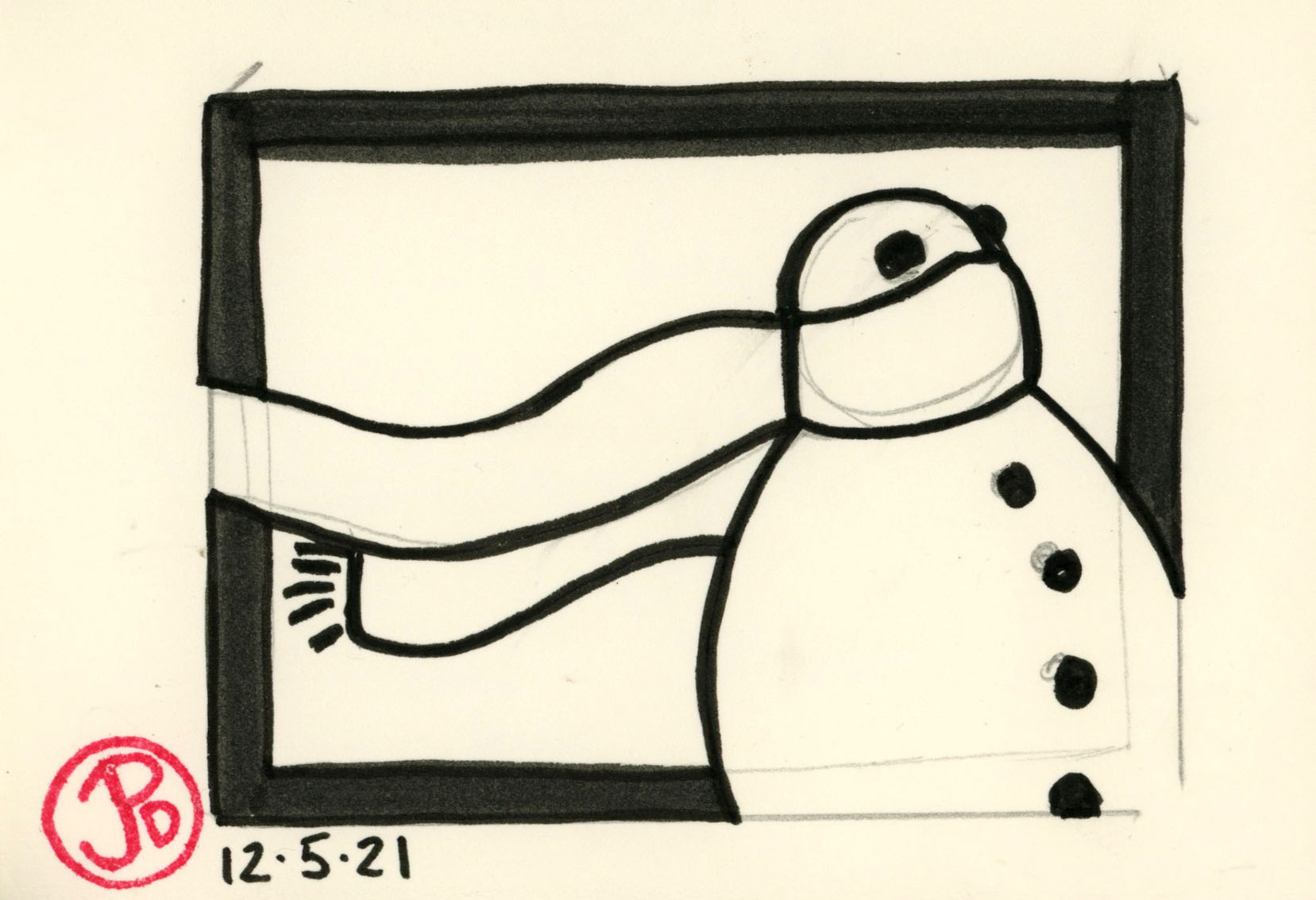
It took me a couple sketches to get the right image that I was willing to carve and then print. There is a bit of improvisation in the carving process but you really need to preplan the finished image only you have to think backwards.
My final sketch where I zeroed in on the design, which didn’t change much from this sketch.Okay there is one less button in the carved block. You will notice that the final print, the image is reversed.
In the end I’m satisfied with the final prints and they speak to the post Covid times. While Christmas is an escape from reality, we should never fully forget what has happened in the past few years and this image is a reminder.
Carving the block. I went over the lines in a back marker so it makes carving out the image a little bit easier. I made a few mistakes in the carving but now, like Japanese pottery, they become part of the final product.Here is the finished block with my makeshift registration jig. The jig lines up the paper so the print appears in the same place on every printing. Now it only needed to be charged with black ink and pressed into paper.This print was one of those “happy accidents”. The paper shifted slightly during printing and created a unique image that is almost impossible to duplicate. I love it’s expressiveness. I gave this print to my best friend.
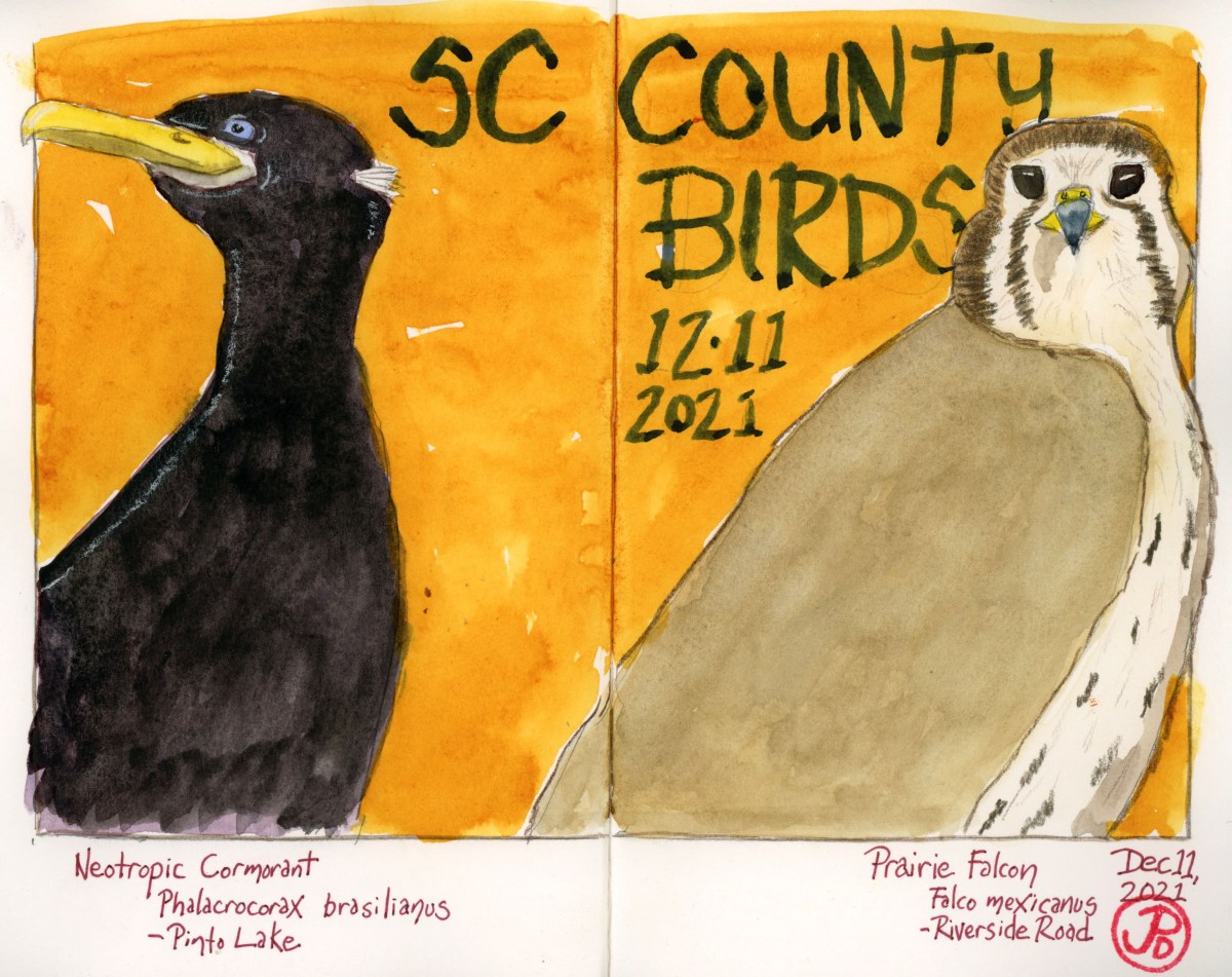
I have often said that birding is a type of madness. Even more so if it’s a county bird you’re after because this is a species that I have seen many times before but not in Santa Cruz County!
I had missed out on the wintering prairie falcon on the southern edge of Santa Cruz County near Riverside Road. I returned, for the third time, to see a sandy falcon with dark wingpits. I pulled off Riverside Road to scan the pastures, like I’d done three times before. The morning was sunny and clear with blue skies. It was very chilly with the temps hovering in the mid 30s. My hands where numb and for the life of me I couldn’t find my second glove. But what warmed me, was the large hawk circling above the pasture in beautiful morning light. It was the overwintering ferruginous hawk.
But there was no prairie falcon in the air or on any fenceposts so I moved east down the road towards the county line.
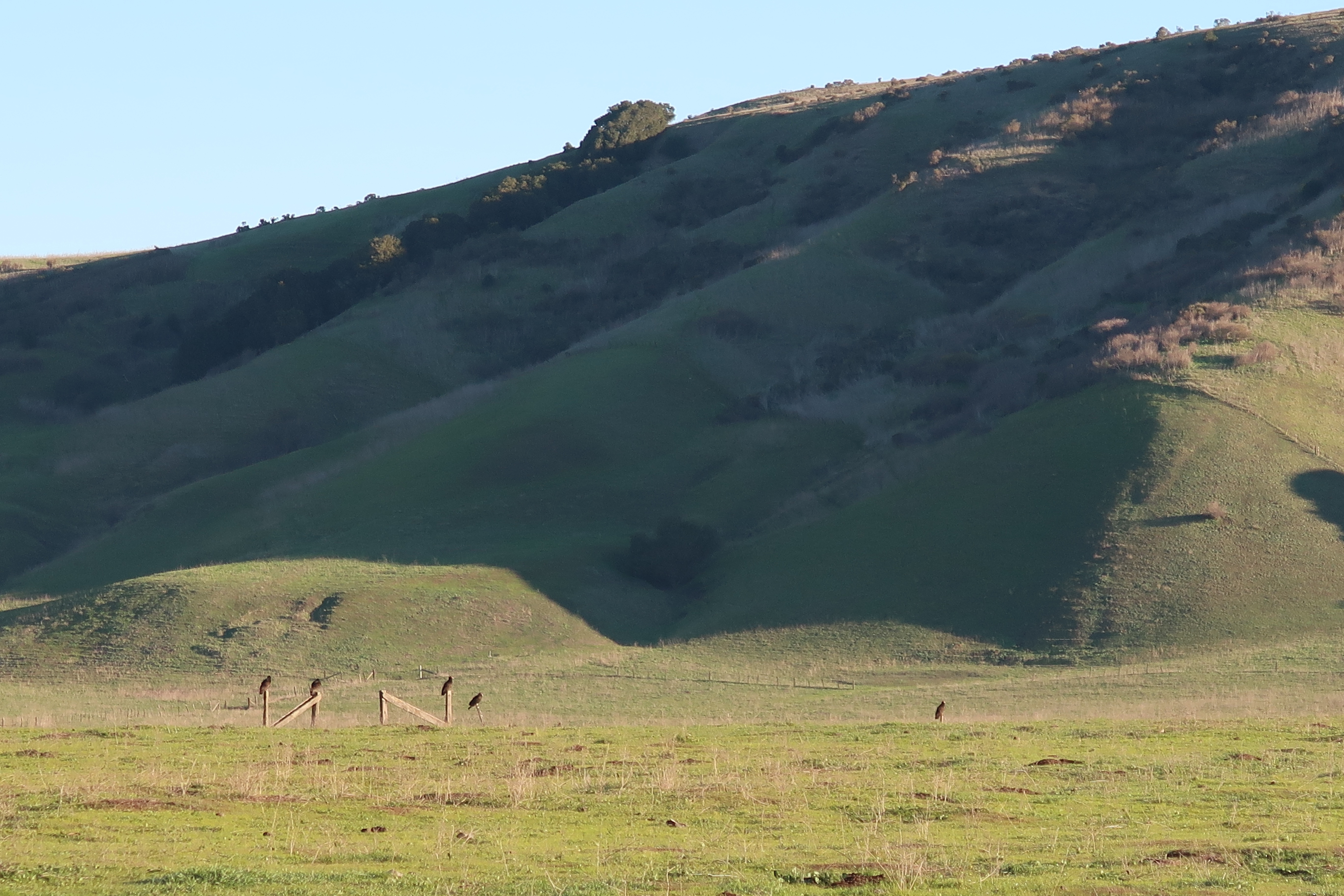
In the field, on almost every fence post, where turkey vultures, warming themselves in the morning sun. A lone red-tailed hawk was on a post. Further north, near the base of the hills, was a growing kettle of turkey vultures, rising in the air.
With the naked eye, I could see a bird circling with the vultures. It was much, much lighter compared to the vulture’s black livery. I raised my binoculars and here was my county bird: prairie falcon (Falco mexicanus)! The falcon stooped on a vulture below it, practice hunting I suppose. The falcon continued to circle with the vultures and then peeling off in powered flight as it headed towards the hills to the northwest.
Fence sitting turkey vultures in beautiful morning light.
With the prairie falcon in the bag it was now time to look for the extremely rare visitor that was first seen at Pinto Lake two days before. It was spotted again yesterday after some local birders rented a boat to head out into the lake (hopefully I wouldn’t have to rent a boat to add this bird to my county list). There was a report that the bird had been seen in the middle finger of Pinto Lake in the mid morning. At Pinto Lake, there where a hundred double-crested cormorants at any given time. This could be an exhausting search.
I arrived at the middle finger of Pinto Lake at about noon. I spotted one double-crested cormorant and not the southern visitor so I walked out to the point to scan the main body of the lake. There were a lot of gulls on the water but very few cormorants.
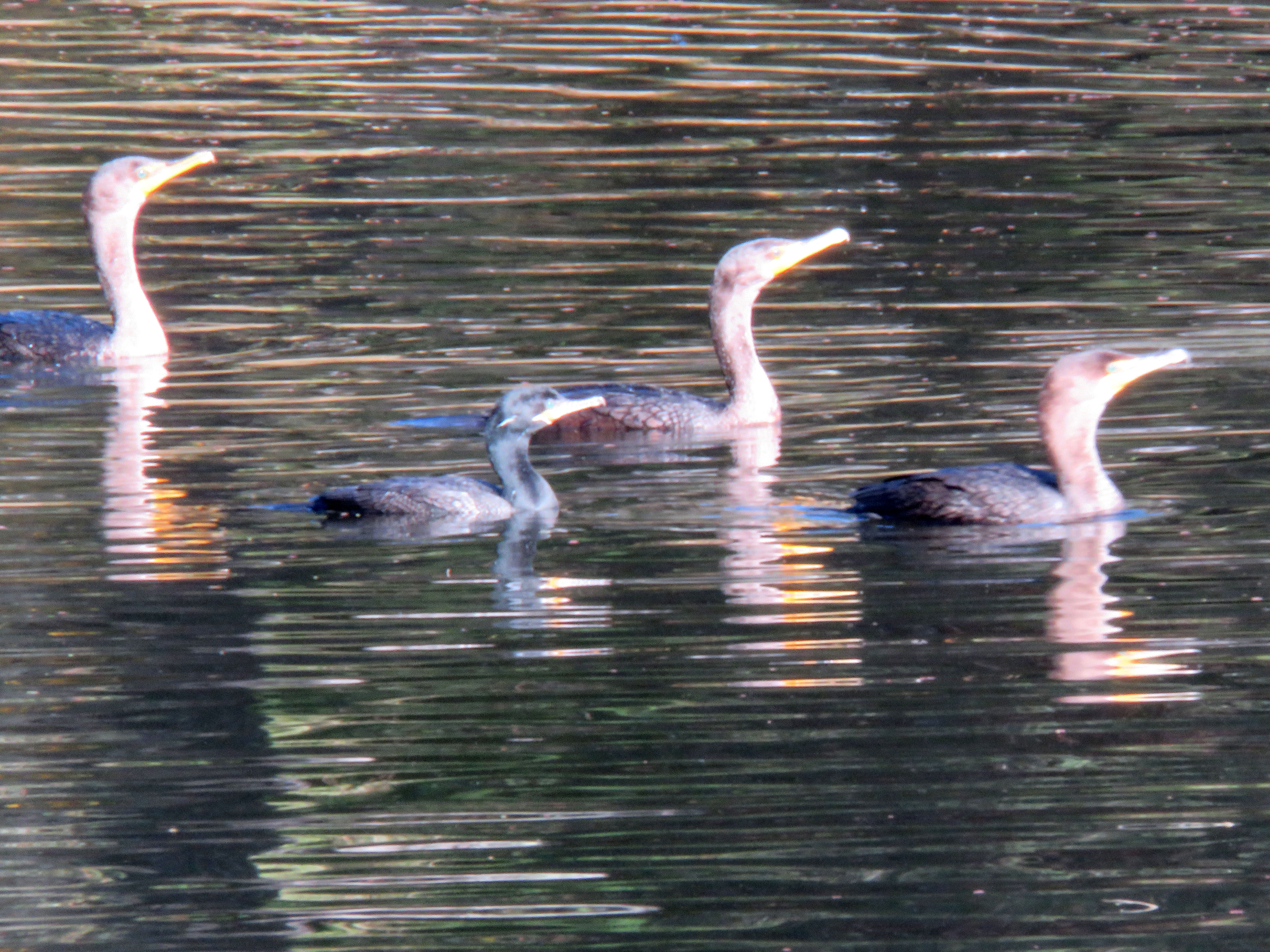
I headed back along the western edge of the finger. There were a few ducks, three hooded mergansers, and more coots but no cormorants. Just when I was about to end my search and head back to my car, three cormorants flew past me heading north up the finger. One of the cormorants stood out. It was much smaller and darker than the the double-crested cormorants it flew besides. The birds moved out of view but I had no doubt that they landed on the water.
I ran down the trail to an opening in the vegetation (birding is a kind of madness after all). There were the three cormorants on the water. One was much smaller and I noticed other details such as the white “V” that framed the base of the beak and the white “sideburns” of it’s breeding plumes. This was the neotropic cormorant (Phalacrocorax brasilianus)! A very rare county bird! In fact this was the first time that a neotropic cormorant had been seen in Santa Cruz County!
The cormorants stayed in view for about five minutes before taking to the air and flying back toward the open lake. I had been lucky with my brief encounter with a Santa Cruz County rarity.
Prairie falcon, merlin, rough-legged, and ferruginous hawk, bald eagle. These are exciting times to get out in the field, when raptors have replaced the neotropical migrants, who have headed south.
On a Saturday morning I headed east of Watsonville on the eastern edge of Santa Cruz County on Riverside Drive (Highway 129). Here was habitat like no other in Santa Cruz County, open rolling hills and pastureland. This was habitat like San Benito County, which was really just a mile down the highway. This was the perfect habitat for wintering raptors.
Recently a prairie falcon and a ferruginous hawk had been seen in the area. These are both birds that I look forward to seeing at this time of year. And a prairie falcon would be a county bird for me.
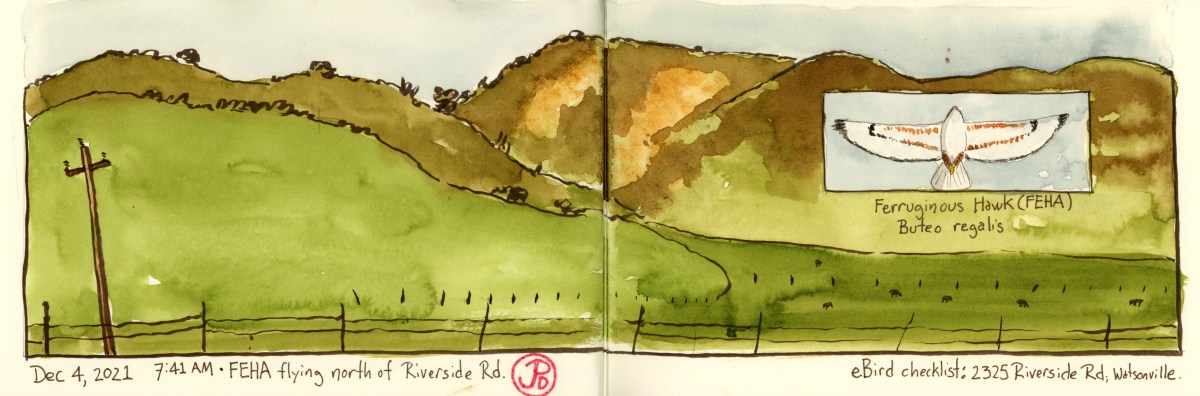
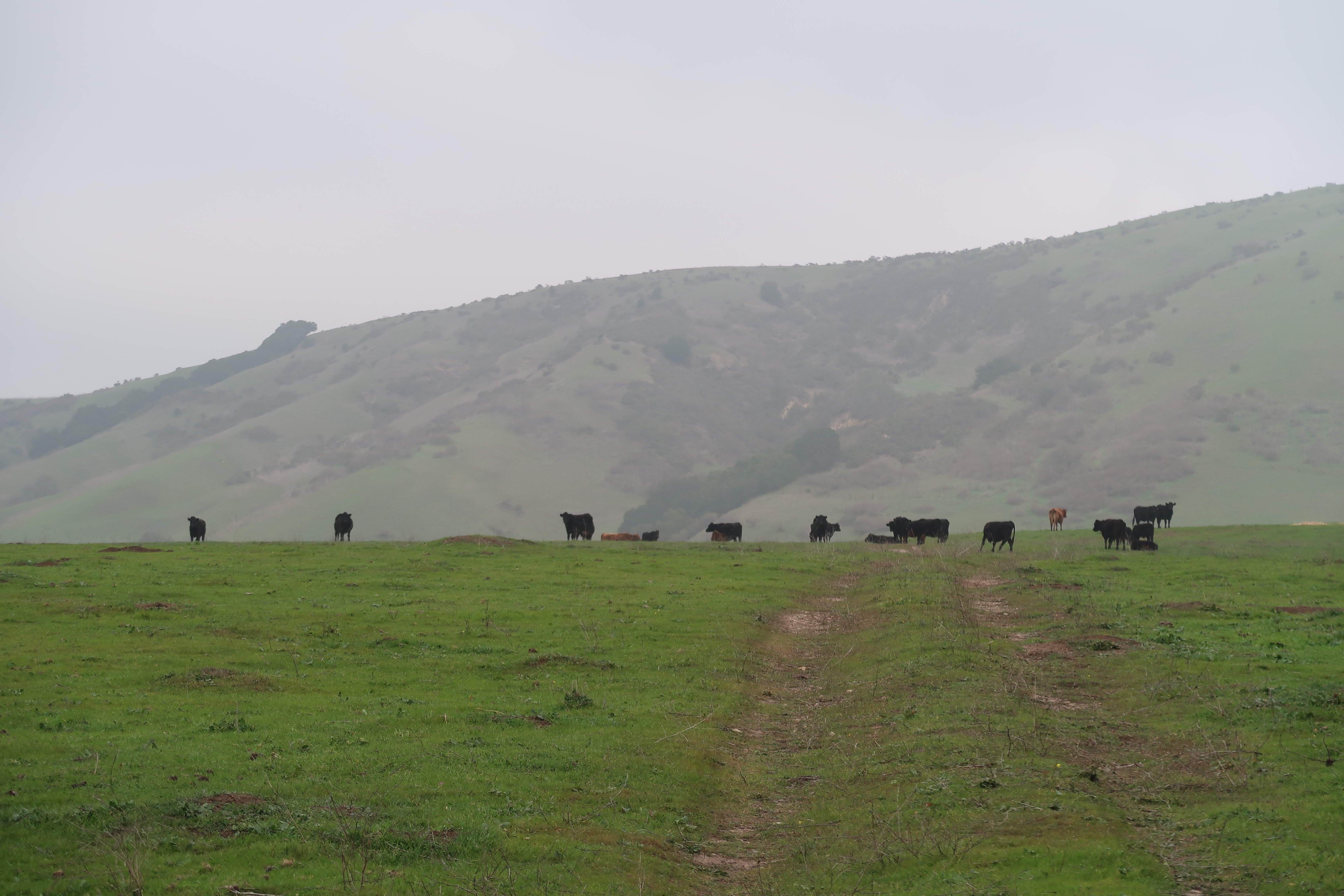
I pulled off Riverside Road at a dirt pullout. Across the road was perfect winter raptor territory. In the foreground was green pastureland with plenty of hunting perches and in the background where the green rolling hills, the realm of golden eagles. It is this view that is the featured field sketch.
To my left I saw some motion against the hillside. I put bins on the raptor and it was one of the prizes I had been looking for, our largest hawk: Buteo regalus! The hawk circled above the ground and then stooped down, landing of the ground. It returned to the air, a minute later, empty taloned. The ferruginous hawk crossed the road and flew above me, paralleling a line of eucalyptus trees. The hawk moved east and out of view.
I moved on down the road and a falcon being pursued by crows crossed the road in front of me. It could be the prairie falcon but I didn’t get a great look at the raptor. I tried to relocate the possible prairie but like most falcons they can be just seem to be passing through, very quickly. This was not enough to tick this bird off on my Santa Cruz County list.
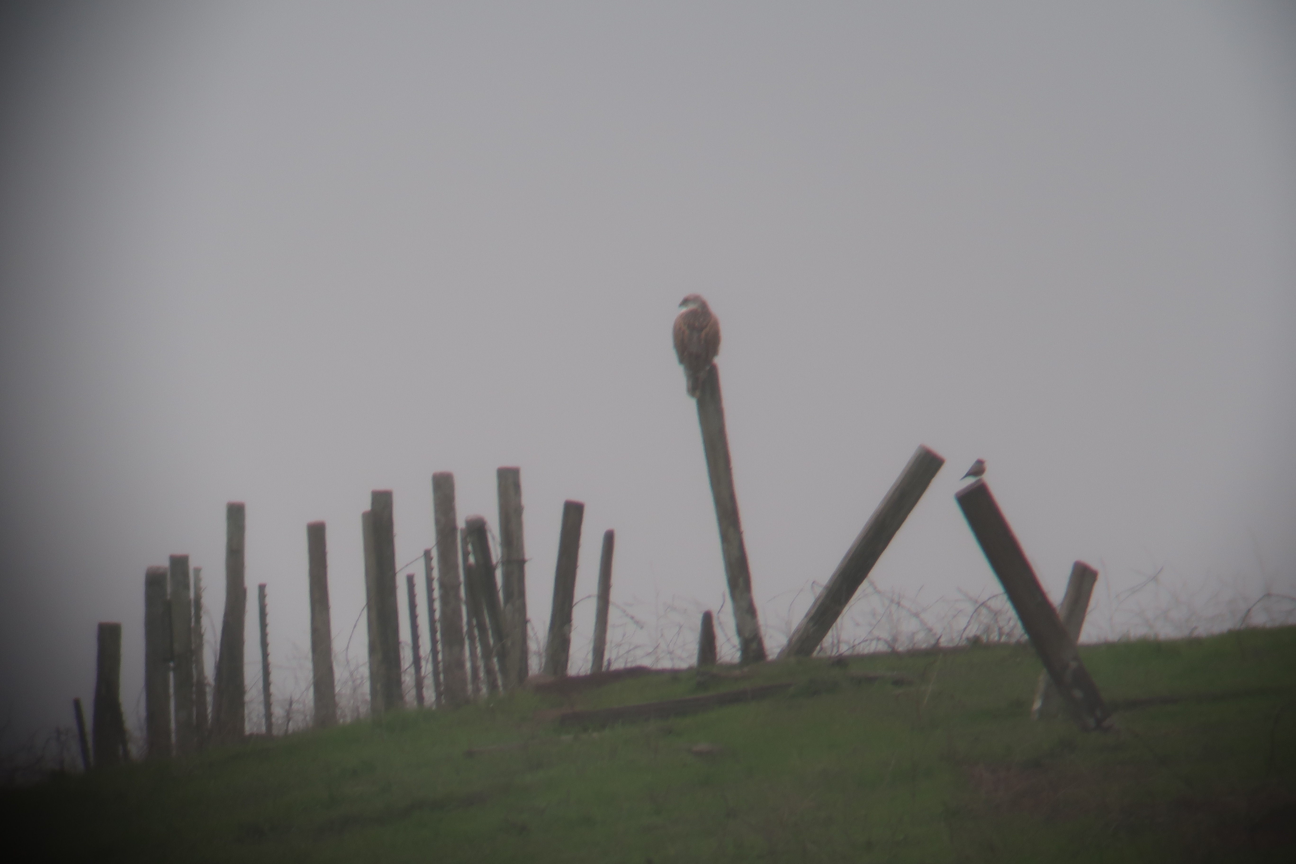
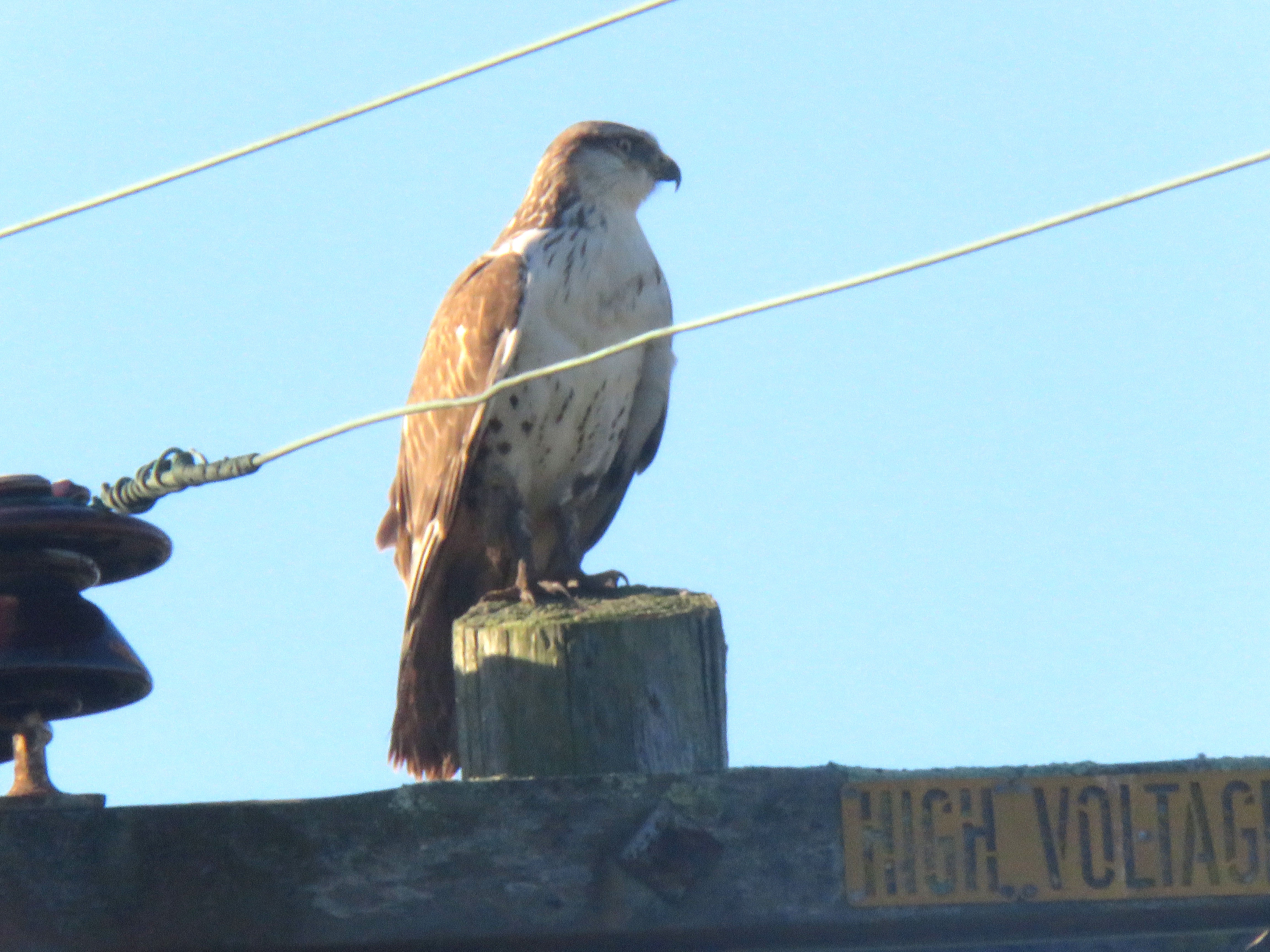
A digitscope of the wintering ferruginous hawk and a Say’ phoebe. This is from a return visit to Riverside Road on Sunday morning. It must be winter in the Bay Area. Here is a perched ferruginous hawk, our largest hawk, in Princeton near the Half Moon Bay Airport.
High Noon starts with a wedding. The town’s retiring Marshal, Will Kane (Gary Cooper) gets married to a Quaker (Grace Kelly), not in the town’s church but in the Justice of the Peace’s office, next door to his own.
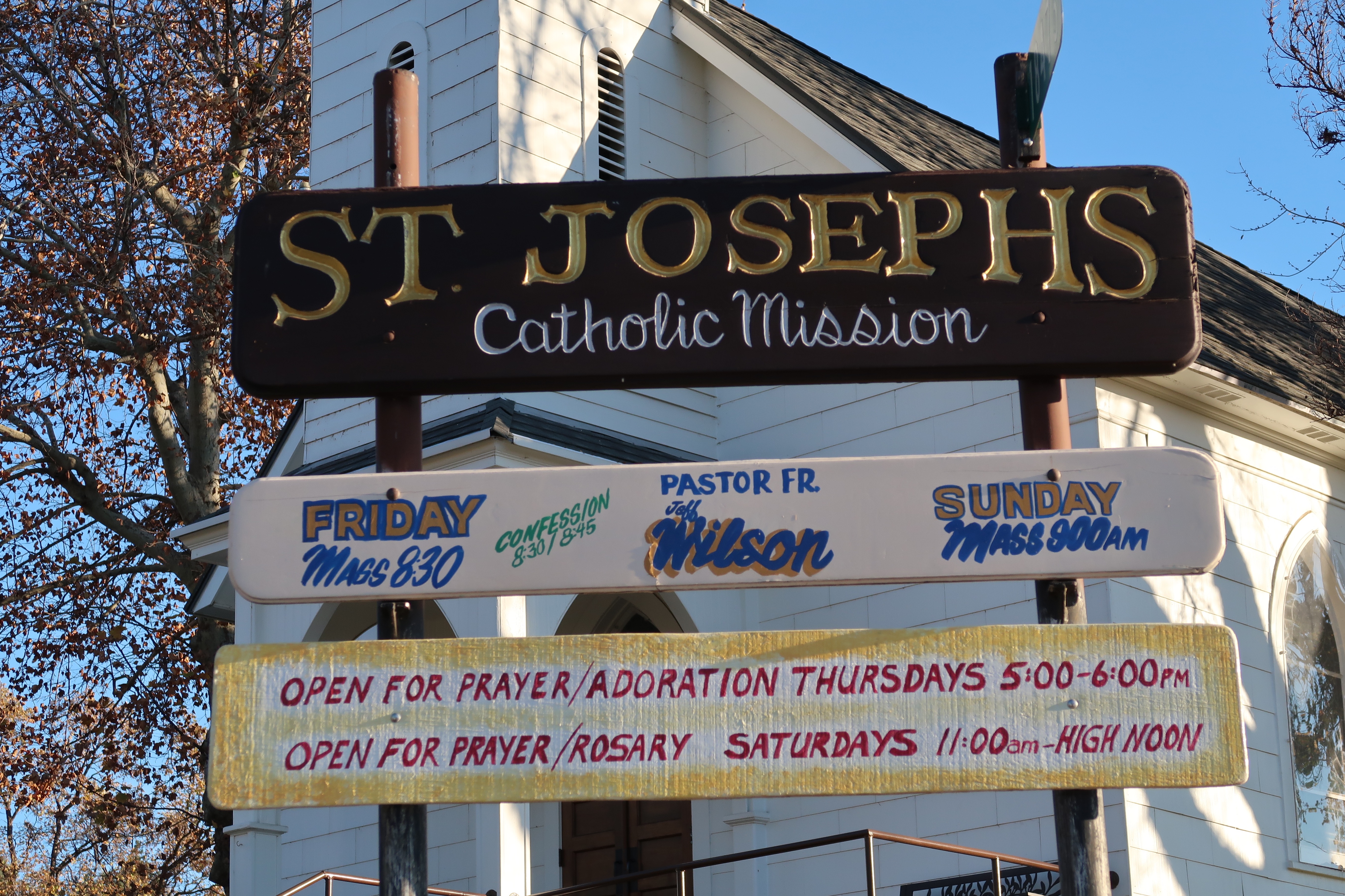
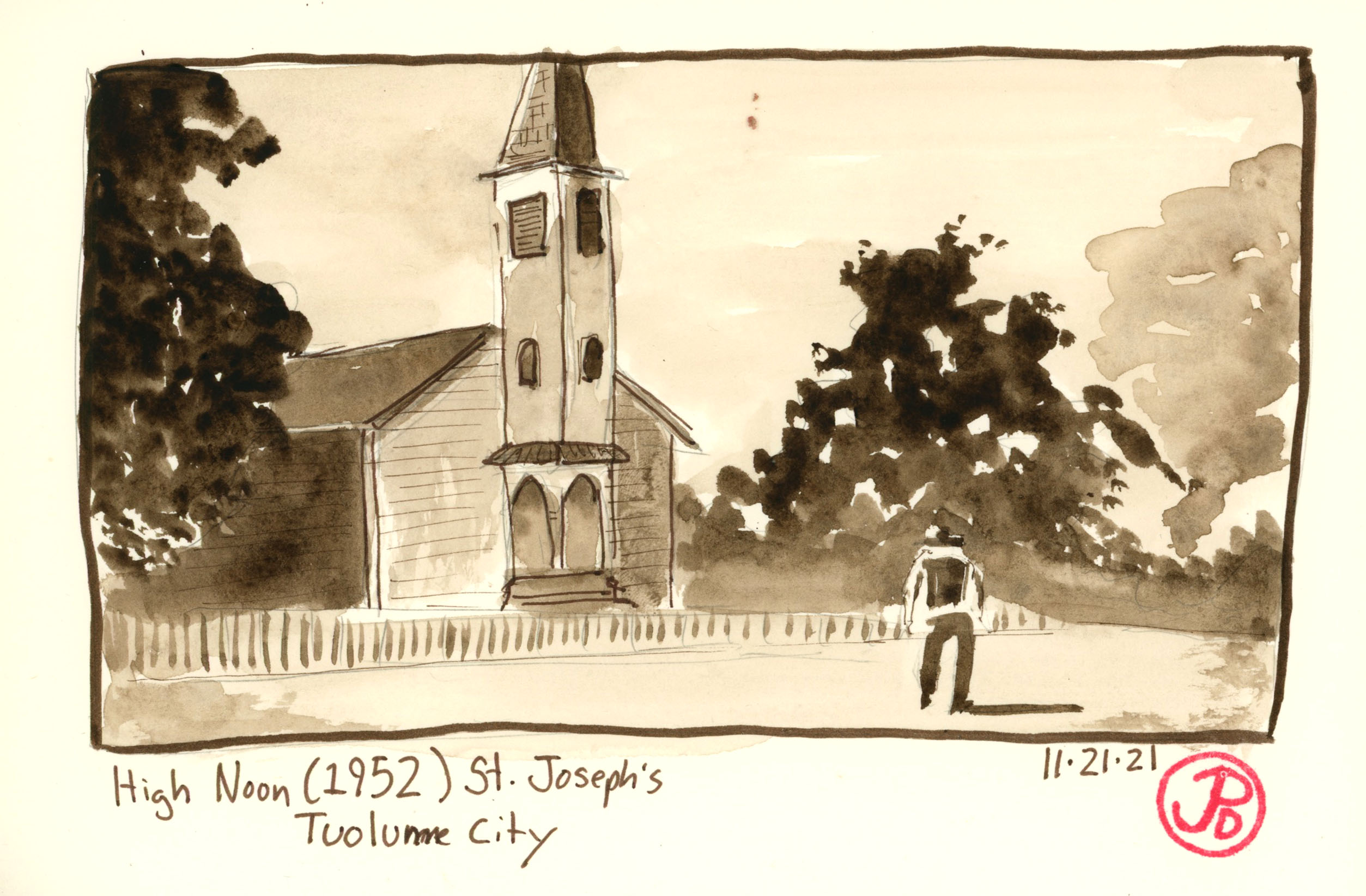
But a church does play a part in High Noon. Hardleyville’s church is in reality St. Joseph’s Church in Tuolumne, about 15 miles east of the county seat of Sonora.
The exterior of the church is used for two shots in the film, one, when the three gunmen ride into town on their way to the railroad depot and the second shot is of Marshal Kane walking towards the church to seek assistance from the congregation in defending the town.
I headed to the small town of Tuolumne to sketch the unique looking Catholic Church. It was a clear and cool fall morning and I sketched the church from the warmth of the front seat of my car from approximately the same angle from the film. Like the shot from the film, I cropped off the top of the tower. I’m not sure if this was a statement by director Fred Zinnemann or cinematographer Floyd Crosby or just a a practical way to frame the shot.
The church was built in 1908 and was a Catholic Church until 2008 where it became a Catholic “Mission”.
There is one shot that is used to create tension in the seminal western High Noon (1952).
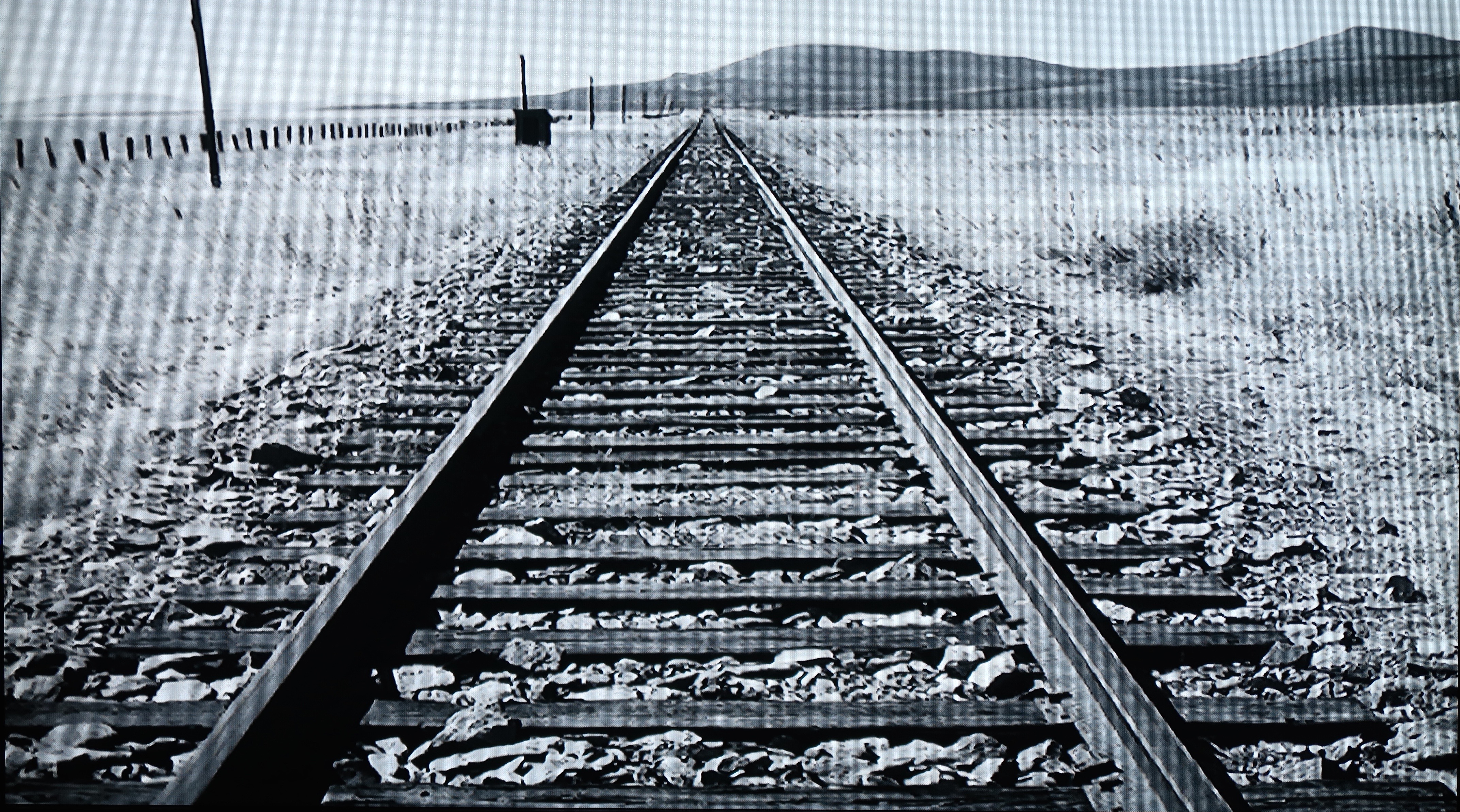
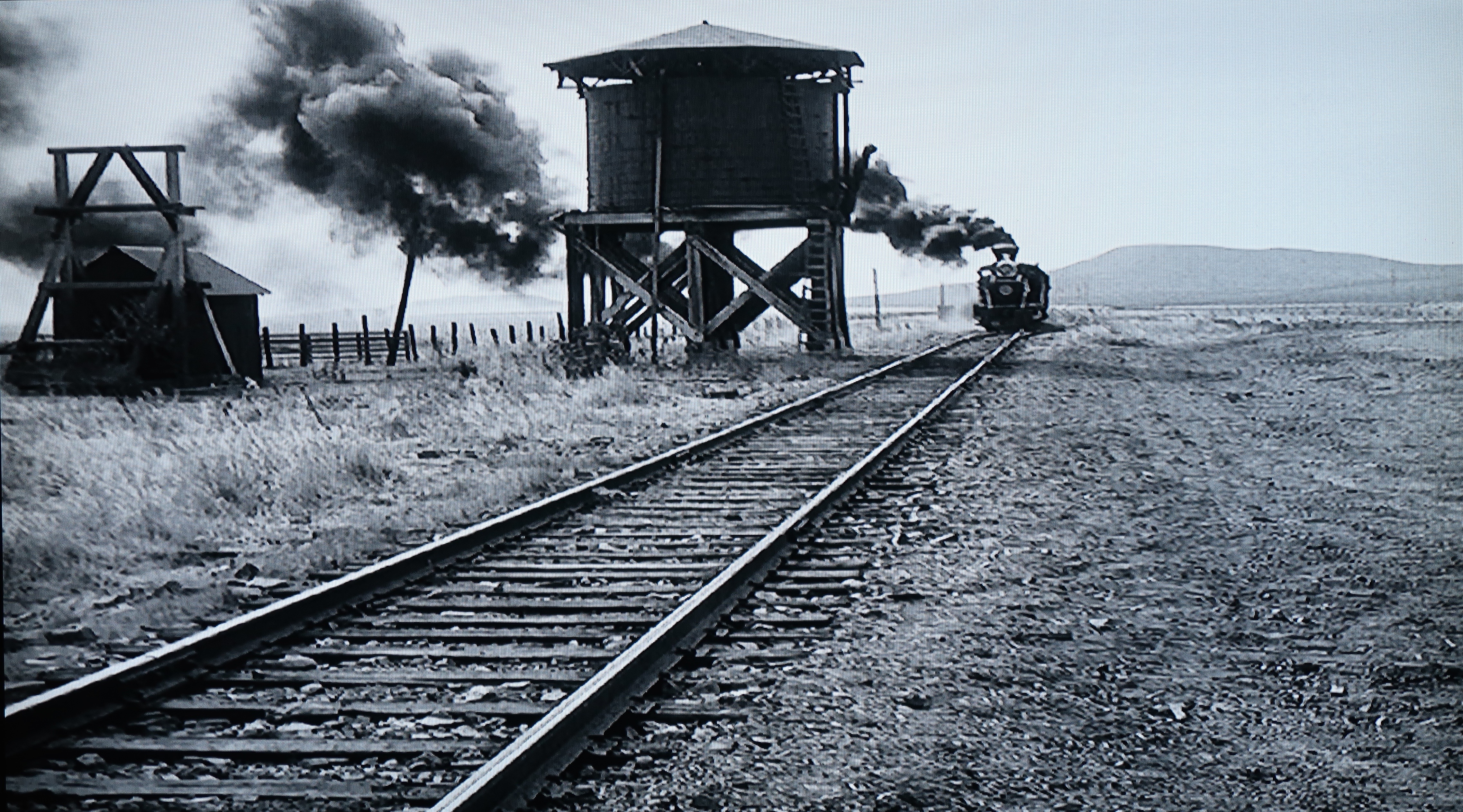
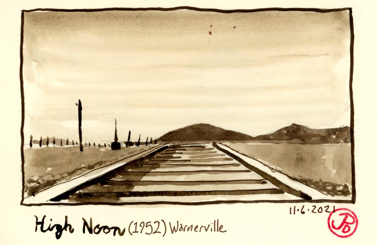
The iconic shot looks down the rails towards low hills in what is supposed to be Hadleyville, New Mexico. This shot is used seven times at slightly different heights but is shot from the same position, looking west down the rails. Below is an example from the film:
A still from High Noon looking west down the rails of the Sierra Railroad.
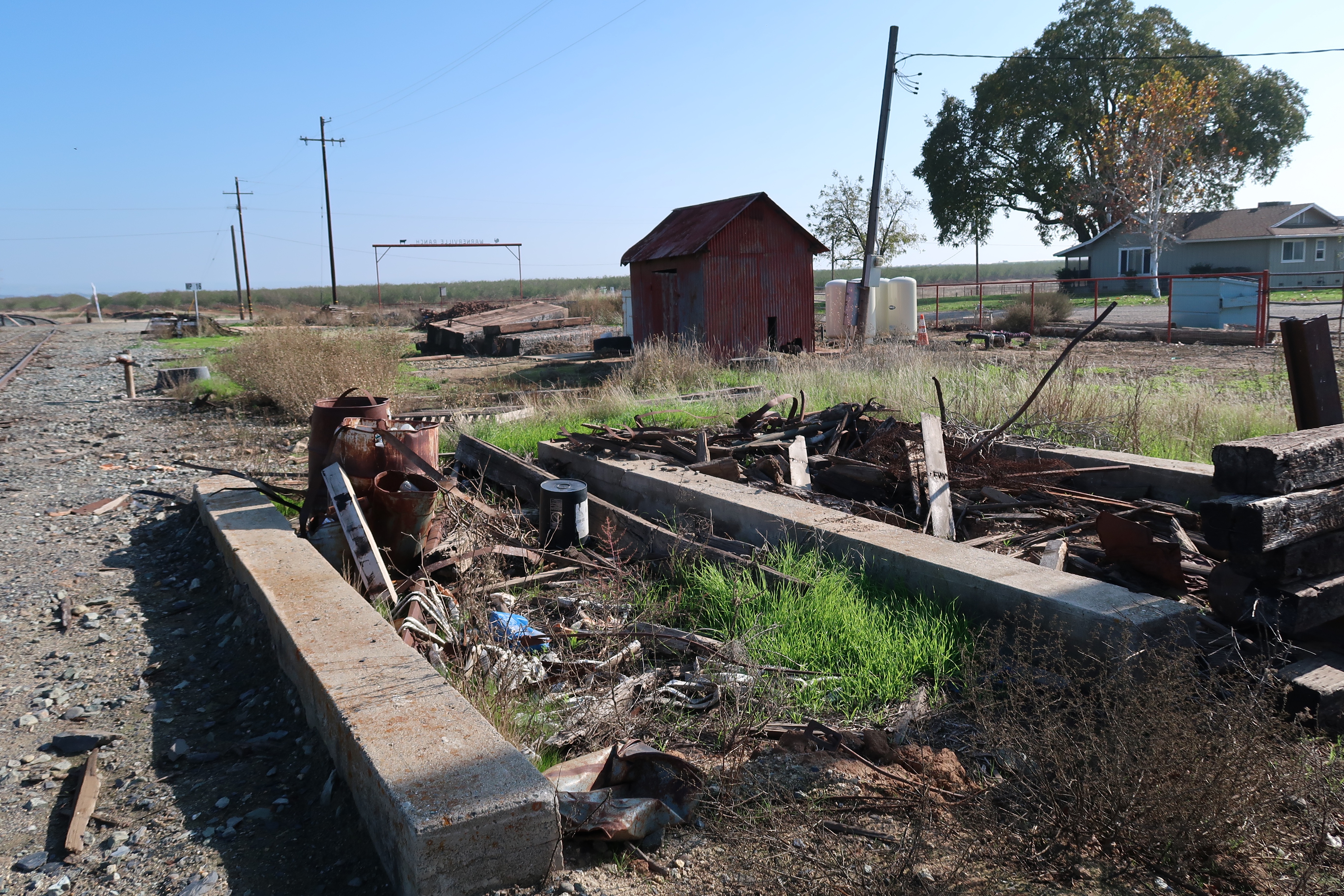
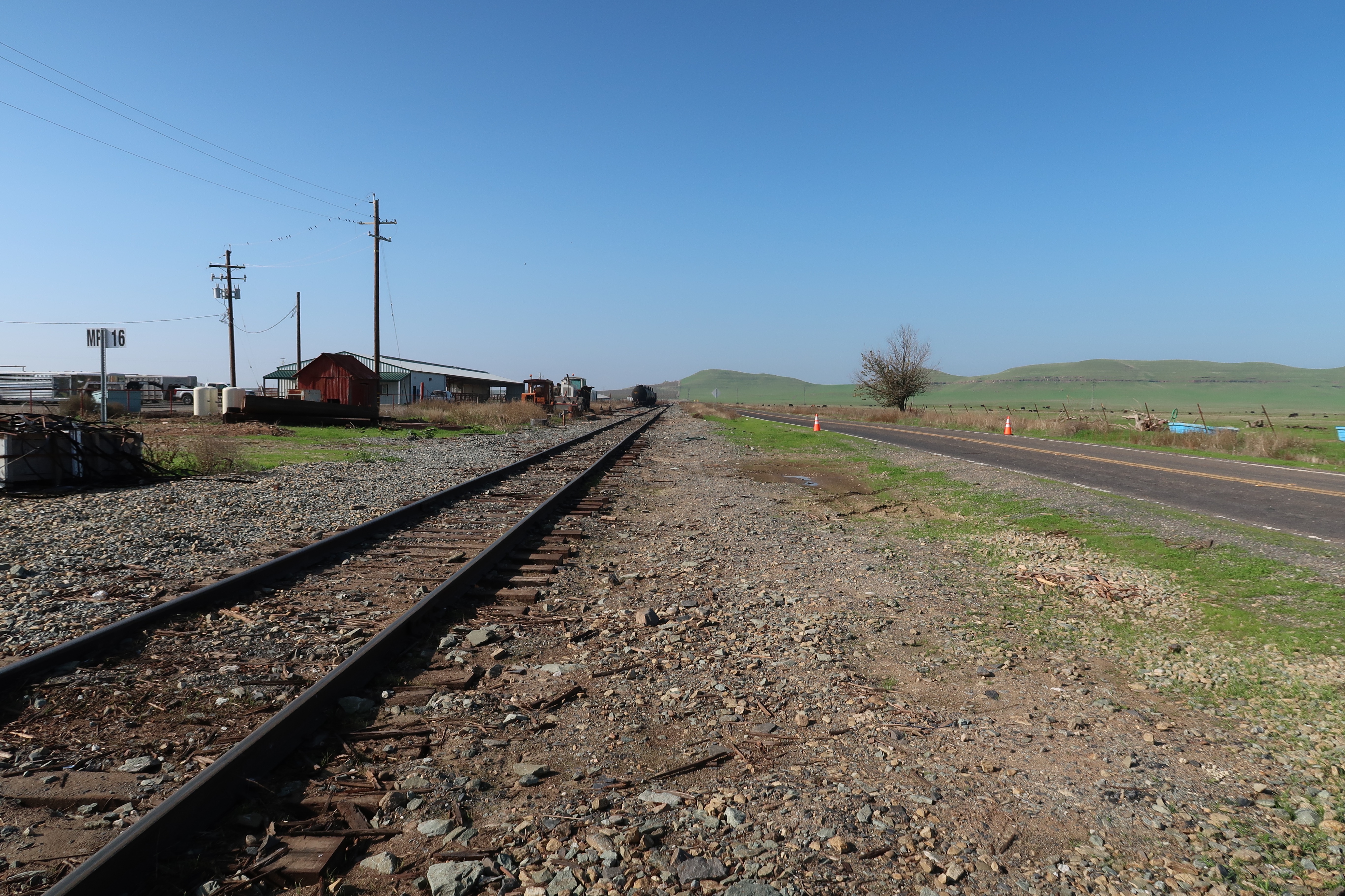
In reality the scene was shot on the Sierra Railroad at Milepost 16 in Warnerville, California. It was here that film crew built the Hardleyville Depot set, which is now gone. There was once a water tower which was featured in the film and this is maybe why they chose this location for the set. The water tower, which was a mainstay in the era of steam, is now gone but the concrete foundation and a small building still remain from the time High Noon was filmed here in September of 1951.
The concrete foundation is all that is left of the water tower at Warnerville. The small red building in the background still stands after 70 years. This shot is looking northeast.Warnerville looking west toward where the noontime train would be arriving. In the foreground, to the right of the rails, was the location of the Hadleyville Train Depot set. The little red building on the left of the tracks still exists.
Warnerville is not really a town. It consists of a few farms and houses, a grade crossing, and a railroad siding. While it would be great if there was an interpretive sign pointing out the cinematic significance of this location but alas, there is none.
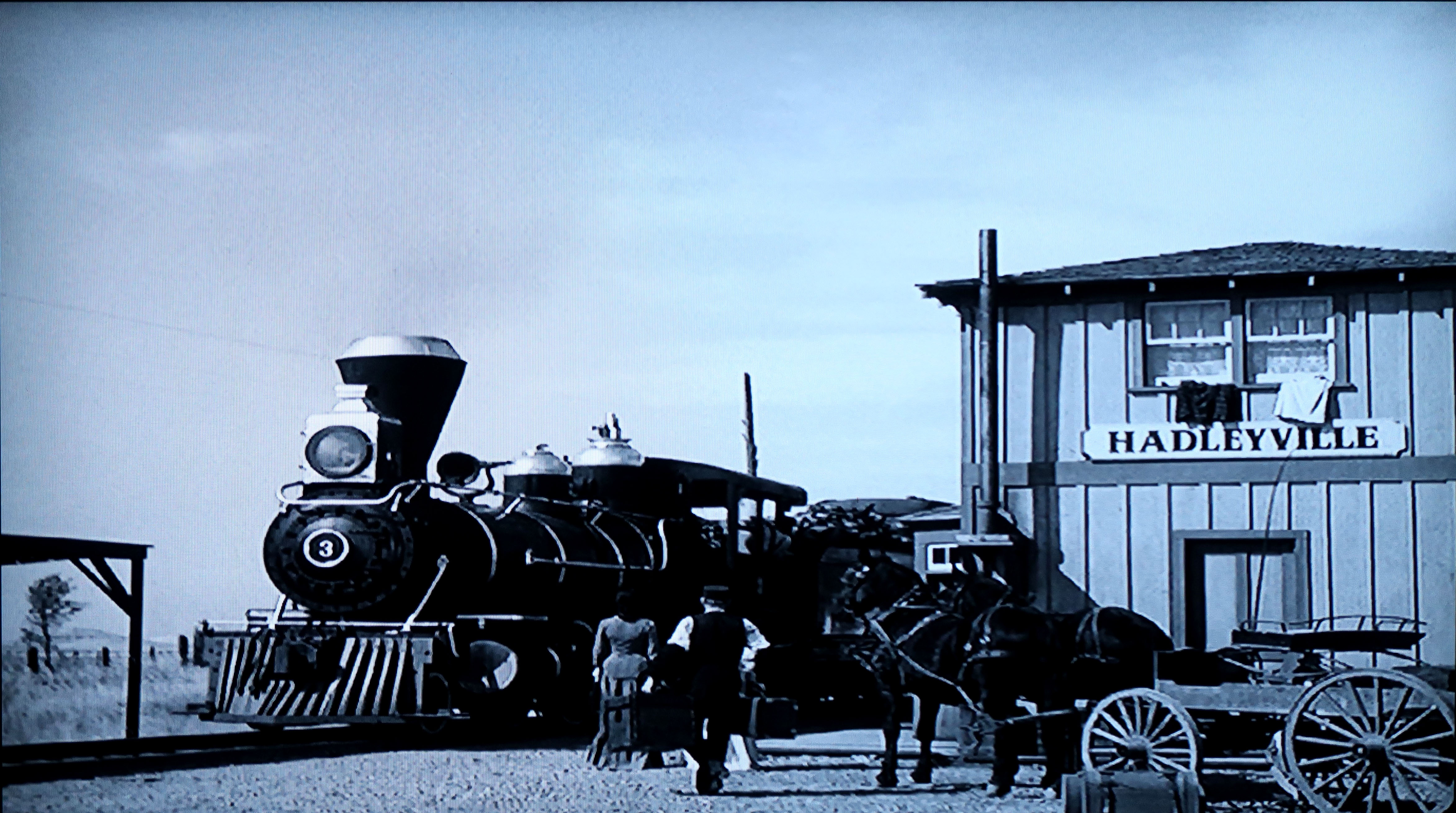
This still from High Noon shows the approaching noontime train, in this case the Screen Queen Sierra No. 3. The water tower and the small building that still exists are to the left of the line. The low hills in the background looks very much the same.A still from High Noon of Sierra No. 3 pulling into the Hadeyville Depot set at Warnerville.
In the film Nigh Noon, three rough looking gunman arrive at the train station to await the arrival of the noontime train (hence the name High Noon). They are waiting for Frank Miller, who recently has been released from prison. He is coming back to exact revenge on the marshal (Gary Cooper) who put him away.
Among the three gunman, who gaze down the track expecting the noon train, is an actor making his screen debut. He does not speak a single word in High Noon, although he blows a few bars on the harmonica. This actor is Lee Van Cleef. He is best known as the “Bad” in Sergio Leone’s “The Good, the Bad, and the Ugly” (1968).
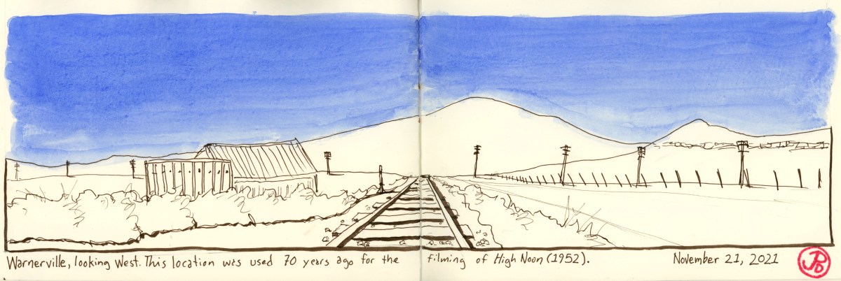
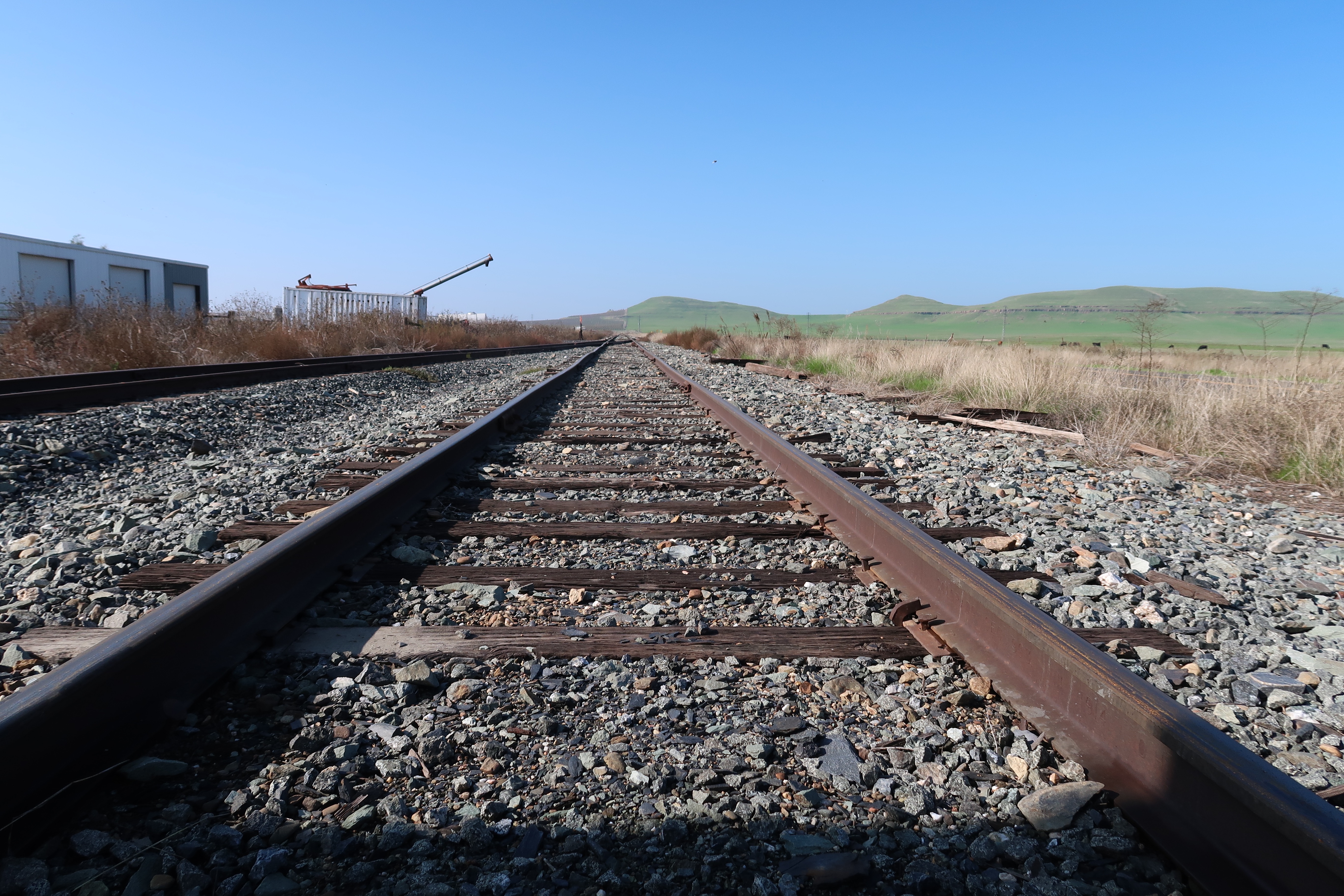
I arrived at the intersection of Warnerville and Crabtree Road at the Sierra Railroad grade crossing. It was 70 years ago that this location was used in High Noon. The area is a bit different from that time but it is very much the same in other ways. The line of hills had not changed much, except for an almond grove creeping up one of the hillsides (I chose not to add it to my featured sketch, sketcher’s license after all.)
I stood in between the two rails and sketched the approximate position of cinematographer Floyd Crosby’s camera. The rails looked a bit rusted enough so I was not expecting a westbound freight anytime soon. But I still checked my back from time to time because the Sierra Railroad is still an active branch line.
My only companion was a black cow grazing on grass across the road. She raised her head in between foraging and peered, without judgment, at Corvidsketcher.
Well how do you really judge the judgement of a cow after all?
A shoutout goes out to Jeff and Sarah of History Hunters for letting me know about this forgotten filming location. Thank you! Their youtube channel can be found at: http://www.youtube.com/jbenziggy
Here is a photo of my sketching position. If you compare the movie sill from the top of the post, you will notice that the distant hills look very much the same today.
So many films have been filmed on the Sierra Railroad that it is known as the “Movie Railroad”.
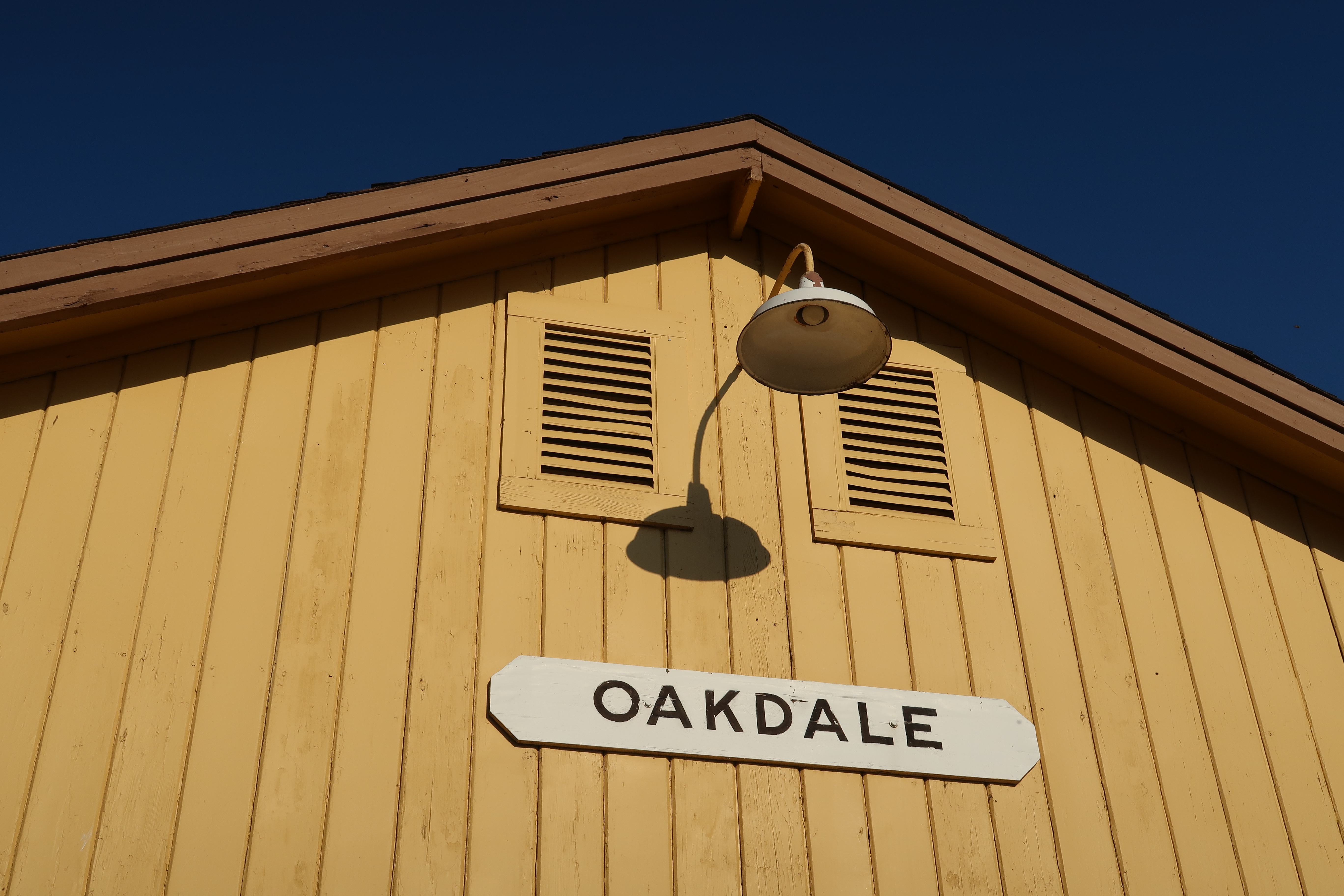
The railroad originated as a branch line connecting the Central Valley, where the mainline is located, to the Gold Country to the east. The construction of the railroad started in 1897 at the Southern Pacific Depot at the town of Oakdale. Seven months later the line reached Jamestown, 41 miles away. In 1899, the line was extended to Sonora, the county seat, and by the turn of the century, the line ran further east to Tuolumne.
The former Southern Pacific Depot at Oakdale. This is where the railroad started. The building now houses the Cowboy Museum.
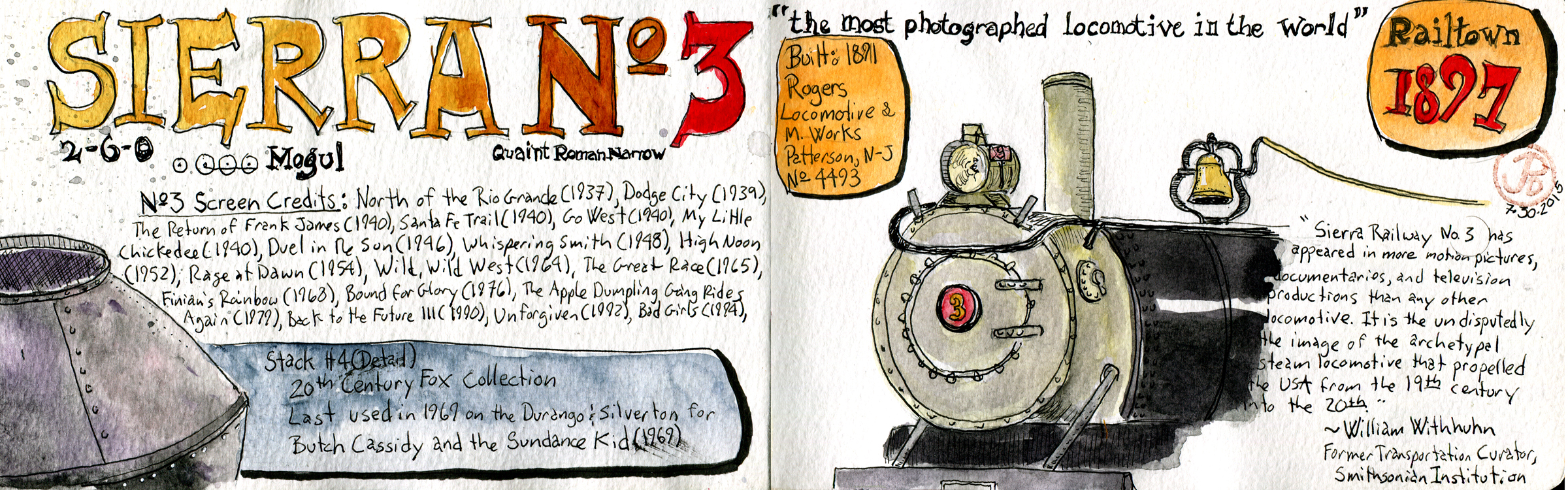
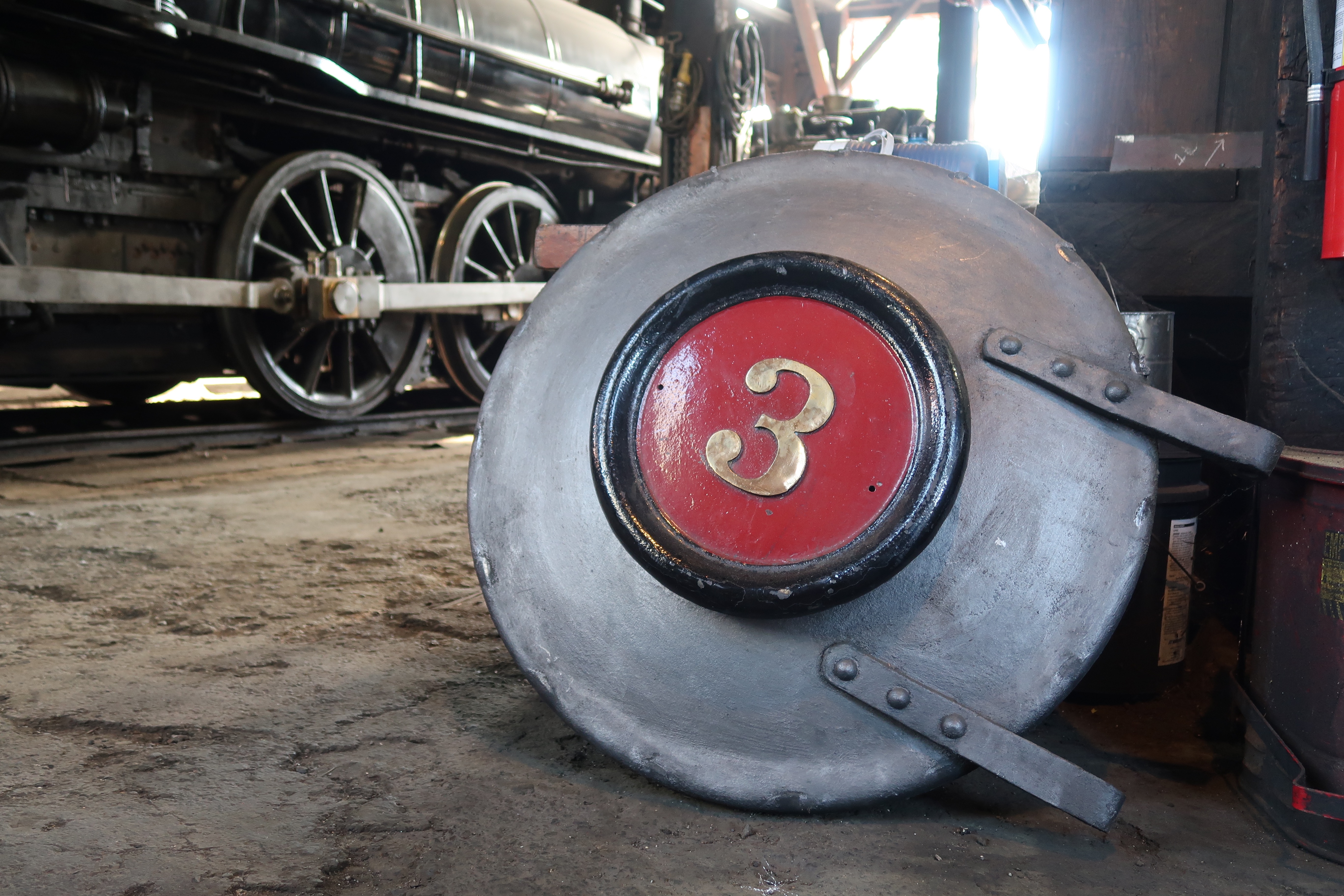
The town of Jamestown was where the Sierra Railroad established its headquarters and it’s maintenance shops. This part of the railroad now exists and is preserved as Railtown 1897 State Historic Park. The roundhouse still stands and it houses three historic steam locomotives that still are operable today. The star of the roundhouse is Sierra No. 3, a 2-6-0 Mogul type locomotive that is considered to be the most photographed locomotive in the world. She was built in 1891 in Patterson, New Jersey. This locomotive has a look that appealed to Hollywood and heyday of westerns. No. 3 appeared in over 100 films and television shows over the years including My Little Chickadee, High Noon, Bound For Glory, Little House on the Prairie, Petticoat Junction, Back to the Future III, and Unforgiven.
Three movie stars in their stalls at the Jamestown roundhouse. Number 28 and 34 where featured in Hal Ashby’s film Bound For Glory. No. 28 is the only steam locomotive in service and now heads the seasonal “Polar Express”. The sound of the Polar Express in the movie of the same name where recorded from Sierra No. 28.
The Sierra Railroad and No. 3 have appeared in three movies that where nominated for Best Picture: High Noon (1952), Bound For Glory (1976), and Unforgiven (1992). Clint Eastwood’s Unforgiven won Best Picture, Best Director (Eastwood), Best Supporting Actor (Gene Hackman), and Best Editing (Joel Cox).
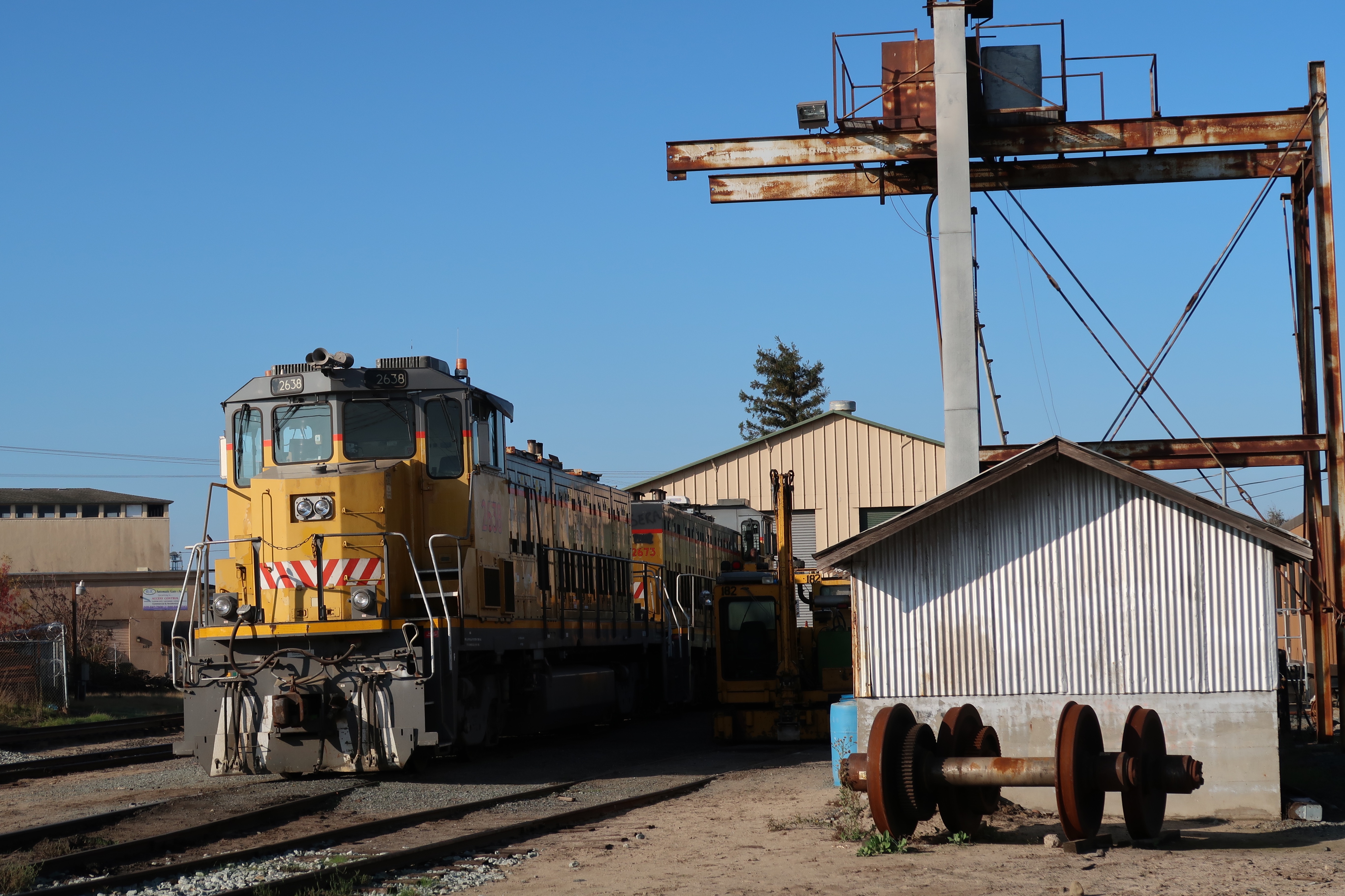
A sketch of Sierra No. 3 from July 30, 2015.On my visit to the Jamestown Roundhouse, No. 3, the Screen Queen was in the process of of having her boiler repaired and was in a few pieces.The Sierra Railroad shops and yard in Oakdale. The yard was used as a filming location for Hal Ashby’s biopic of Woody Guthrie, Bound For Glory. The railroad is still in operation today a runs a few freight trains per week.
I had planned to visit the memorial to United Flight 93 but like visiting the Civil War Battlefield sites, it is so easy to turn away. And I almost did.
But I knew I had to face and embrace it head on, even though it would be intense. If there was any doubt, it came with a chance meeting as I waited to board my flight to Reagan National from SFO.
I saw a family from my school who were about to board a flight at the gate next to mine. I had taught both son and daughter but it it wasn’t for this reason. Their mother was a flight attendant for United Airlines. This was the final push I needed for me to make the two hour and 20 minute drive from Gettysburg to the Flight 93 National Memorial near Shanksville, PA.
I left Gettysburg early and most US 30, the Lincoln Highway, was covered in thick ground fog. I hoped that the fog would clear by the time the I reached the Memorial.
After crossing over the Allegheny Mountains I headed down into another valley which was clear of fog to reveal a beautiful fall day with clear blue skies. Much like that day, 20 years ago, that was clear and beautiful, when four flights lifted off from the East Coast. It was September 11, 2001.
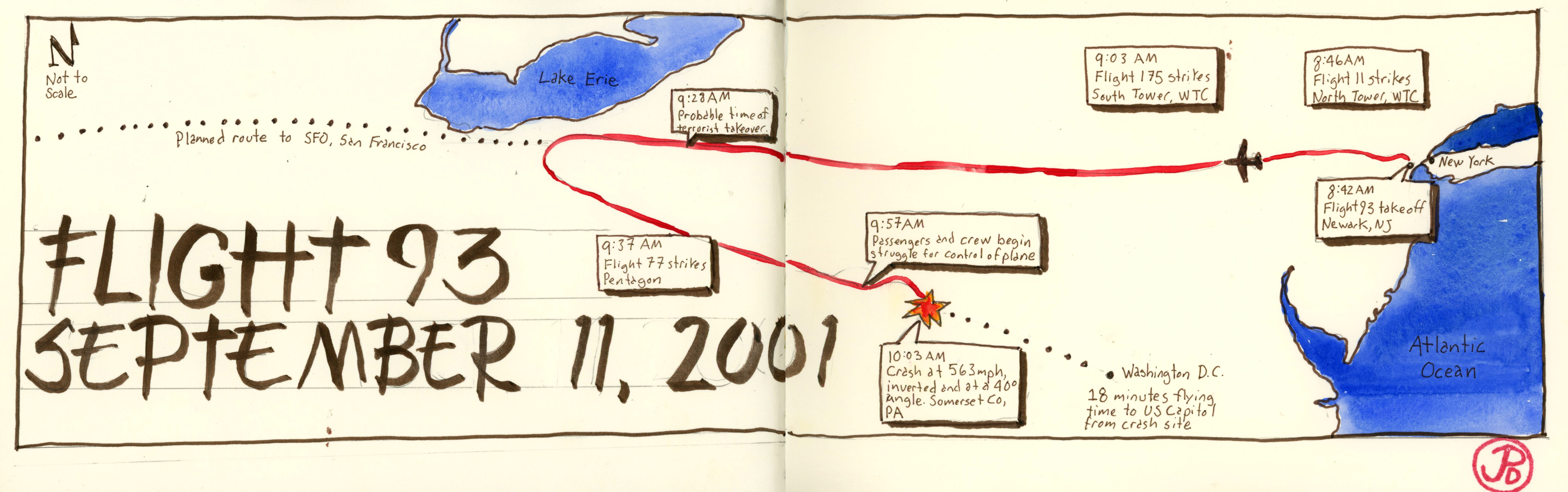
Flight 93 was scheduled to depart from Newark, New Jersey to SFO (San Francisco International Airport). The flight was delayed by about 40 minutes because of heavy air traffic. This delay would have important consequences in the near future. Flight 93 took off at 8:42 AM.
Here is a timeline of what followed:
At 8:46 AM, American Airlines Flight 11 strikes the North Tower of the World Trade Center in New York City.
At 9:03 AM, United Airlines Flight 175 strikes the South Tower of the World Trade Center.
At about 9:28 AM, four hijackers take control of United Airlines Flight 93. The flight is diverted from it’s flightpath to San Francisco and turned around on a southeasterly course towards Washington DC.
At 9:37 AM, American Airlines Flight 77 strikes the Pentagon in Virginia.
At this point the passengers of United 93 make phone calls from the flight and find out that two planes have struck the Twin Towers. They now know that Flight 93 is part of this plot. What we know about the final minutes of Flight 93 comes from the black box recording (the other black boxes from the other flights where never recovered) and the calls made by passengers from the flight.
At 9:57 AM the passengers and crew fight to take control of the Flight 93.
At 10:03 AM Flight 93 strikes the ground, at 563 mph, inverted, and at a 40 degree angle in a field in Somerset County, Pa.
The flight was was just 18 minutes from Washington DC. Out of the four hijacked flights on September 11, Flight 93 was the only flight that did not reach it’s intended target. This is a testament to the will power and bravery of it’s crew and passengers.
This sketch traces the tragic flightpath of United Flight 93 on September 11, 2001.
I turned off the Lincoln Highway and drove to the Flight 93 Memorial Visitor’s Center. Here they had recordings from the flight, an animation of the flight’s last minutes, pieces of the plane and other debris, and memorabilia from the original makeshift memorial.
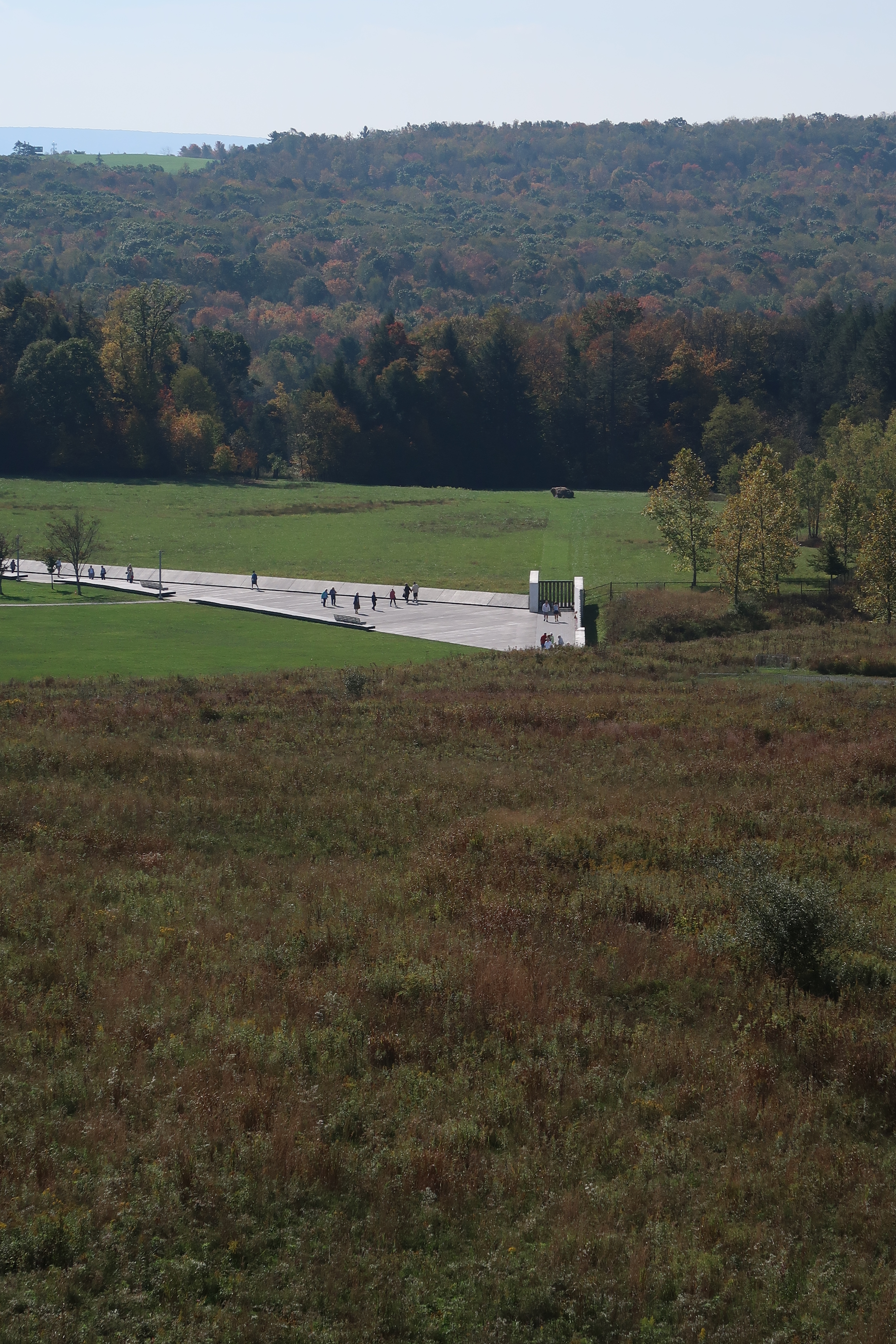
This photo is taken from the observation deck at the visitor’s center. It is looking towards the flight path of Flight 93. Memorial Plaza is in the mid-distance and the large rock in the field, marks the impact site of the flight.
The visitor’s center was starting to fill up so I headed down the hill to Memorial Plaza and the Wall of Names. The last remains of the passengers and crew of the fight rest in this debris field that is walled off. At the time this was one of the FBI’s largest crime scenes.
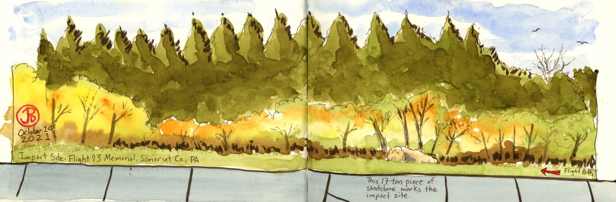
When I arrived, I had the memorial to myself so I picked a bench to sketch the hemlock trees and field, including the 17 ton piece of sandstone rock that marks the impact point of the plane (featured sketch). It’s hard to believe what happened here, 20 years ago. Now it was peaceful with bird songs filling the clear blue skies.
This is the final resting place of the passengers of Flight 93. Family members are allowed access to the debris field and they have left personal memorials on the sandstone rock. Visitors, such as myself, can view the area from a walkway that surrounds the debris field and ends at Memorial Plaza and the Wall of Names.
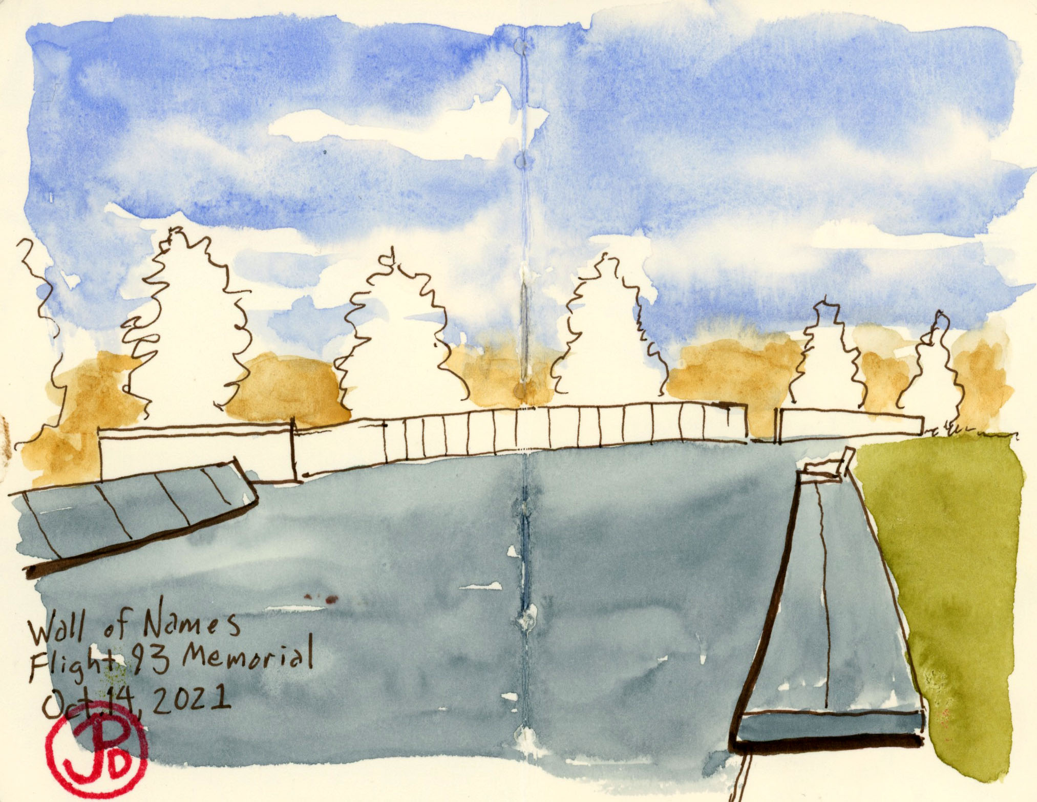
This is a field sketch looking towards the Wall of Names, remembering the 40 people who died in the Pennsylvanian field to the left of this scene.The Wall of Names lists all the passengers and crew of Flight 93. The wall is aligned with the flightpath of Flight 93.
One other reason for visiting the Flight 93 National Memorial was to compare this memorial the hundreds I had been seeing on the battlefields of Antietam and Gettysburg. How did they honor the fallen, more that 100 years ago and how do honor those who have died today?
Civil War battlefields are full of statues that honor individuals, mostly generals. The individual is placed on a pedestal, literally, over the collective. Most common soldiers who died in the Civil War remain anonymous.
By contrast, the Wall of Names emphasizes the collective over the individual. No name stands out over any other. This seems very fitting for what happened at about 9:57 AM on Flight 93 on September 11, 2001.
High Noon often finds itself on the list of the Top Ten Westerns ever made.
The American Film Institute ranks High Noon as 33rd on it’s list of the 100 Greatest American Films of All Time. This is the highest western ranked on the list.
Everything came together with this film: story, direction, casting, acting, pacing, music, cinematography, and it’s allegorical meaning to it’s contemporary time.
What also made High Noon a great film are it’s filming locations. High Noon was not a western of vast vistas, filmed in the photogenic Monument Valley. The skies are not filled with dramatic cumulus clouds but rather clear, formless skies. This is a stark and gritty looking western thanks to the film’s cinematographer Floyd Crosby (father of musician David Crosby).
Most of the film was filmed on the backlot western set of Movie Ranch in Burbank, California that filled in for the fictional New Mexico town of Hadleyville. What I was most interested in was the real California locations used for the film. Most of these locations are in the Gold Country near the town of Sonora.
Sonora was to be my base camp as I explore some of the High Noon filming locations in the area, such as Warnerville, Columbia and Tuolumne City. I would be staying in the historic Sonora Inn, the preferred hotel for the many film crews and actors while filming westerns in the area. During the heyday of Hollywood westerns, the Sonora Inn had a dark room in the basement so the day’s filming could be developed. The Sonora Inn is also Clint Eastwood’s choice of lodging when filming in the area while making films such as Pale Rider (1985) and Unforgiven (1992).
Before I headed east to the foothills of the Sierra Nevada Mountains, also known as the Gold Country, I watched High Noon again and I took photos stills from the movie. I then did sketches from a few of the scenes that featured the locations around the town of Sonora. The railroad and the impending noontime train play a major part in the film. High Noon was shot and edited in real time, meaning that the time taking place in the story is synced with the real time of the film.
One shot looks down the rails towards a line of low hills (featured sketch). This shot, or ones very similar to it, appear in the film several times as a reminder of what the noon time train is bringing to the town of Hadleyville. The what is Frank Miller, a pardoned criminal that Marshal Will Kane (Gary Cooper) sent to the jail and he is coming to exact his revenge on the town’s Marshal and the town of Hadleyville.
Kane tries to round up a posse of townspeople to help him defend the town. His request for help falls on deaf ears. In one scene, he walks to the church to get help from the congregation. The real church is St. Joseph’s Church in Tuolumne City, about 15 minutes east of Sonora.
Like the requests to other townsfolk, he finds no help from the church’s congregation. Kane will have to defend the town, which turned it’s back on it’s Marshal, all by himself.
The subtext of this film was very contemporary indeed. High Noon was written as an allegory about the blacklist in Hollywood and those who stood by and just let it happen. The writer, Carl Foreman, was eventually blacklisted because he would not name names to the House Un-American Activities Committee as the red scare enveloped Hollywood and the nation.
Nigh Noon went on to win four Academy Awards including Best Editing and Best Actor for Gary Cooper.
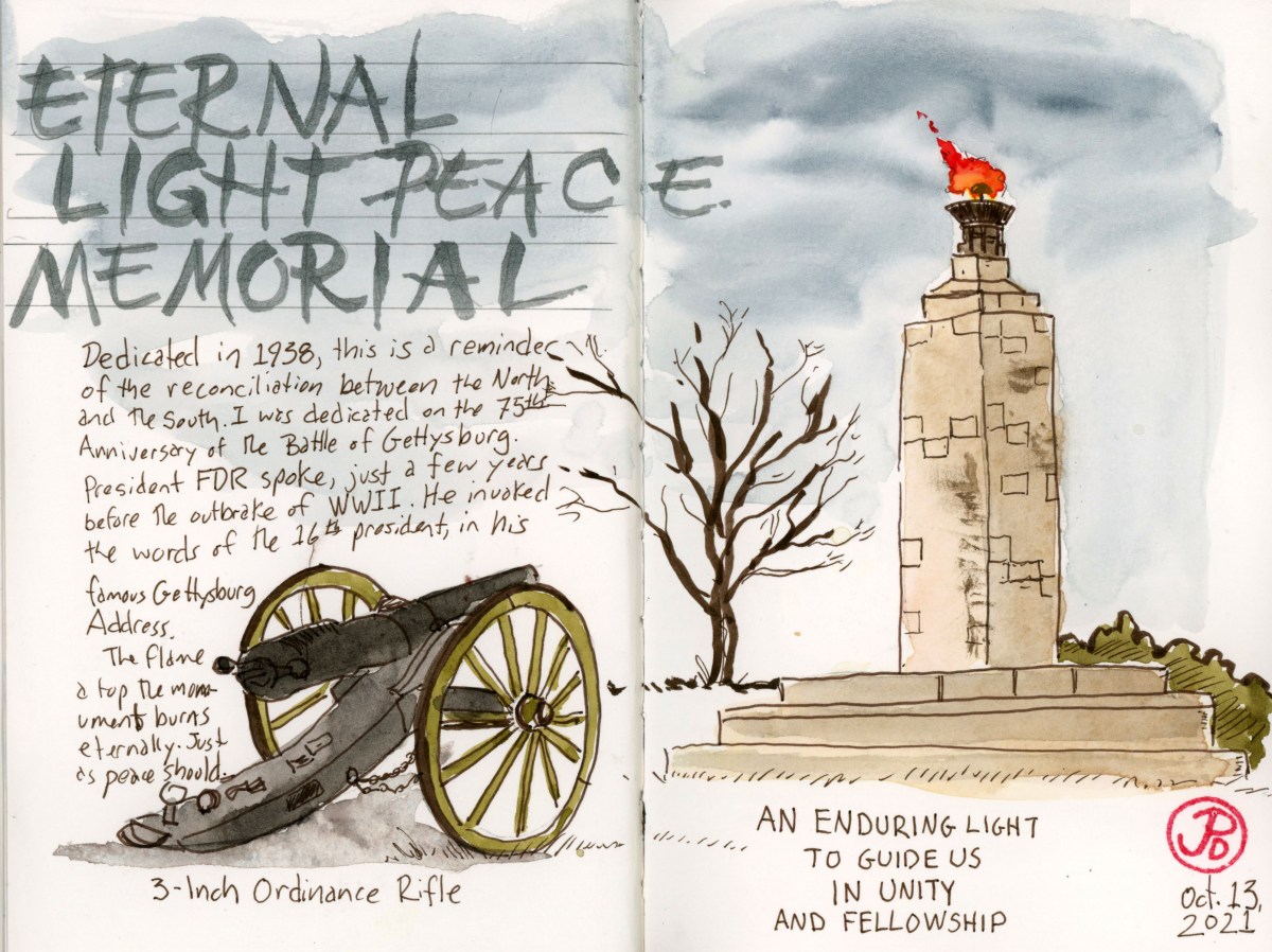
One of my favorite sketches from Gettysburg is of the Eternal Light Peace Memorial, atop Oak Hill, near the place where fighting first started in Gettysburg on July 1.
I like this sketch for two reasons. First because I think it captures what I wanted to sketch in the first place and second, because I like what this monument represents: the coming together of North and South to create a mutual and strong statement about peace. During the 50th Anniversary of the Battle of Gettysburg in 1913, Civil War veterans from the north and the south agreed that there should be monument to the reconciliation of the the two sides. I would take another 25 year to see the completion of the monument.
Despite the Great Depression, funds where raised both from states of the north and south to construct the monument. The shaft is made of Maine granite and Alabama limestone (reminiscent of the fighting on Little Round Top). The 47 and a half foot shaft is crowned by a bronze urn that contains a flame that burns 24 hours a day and 365 days a year. It is said that this eternal flame was the inspiration for flame that burns continuously at President John F. Kennedy’s grave at Arlington National Cemetery.
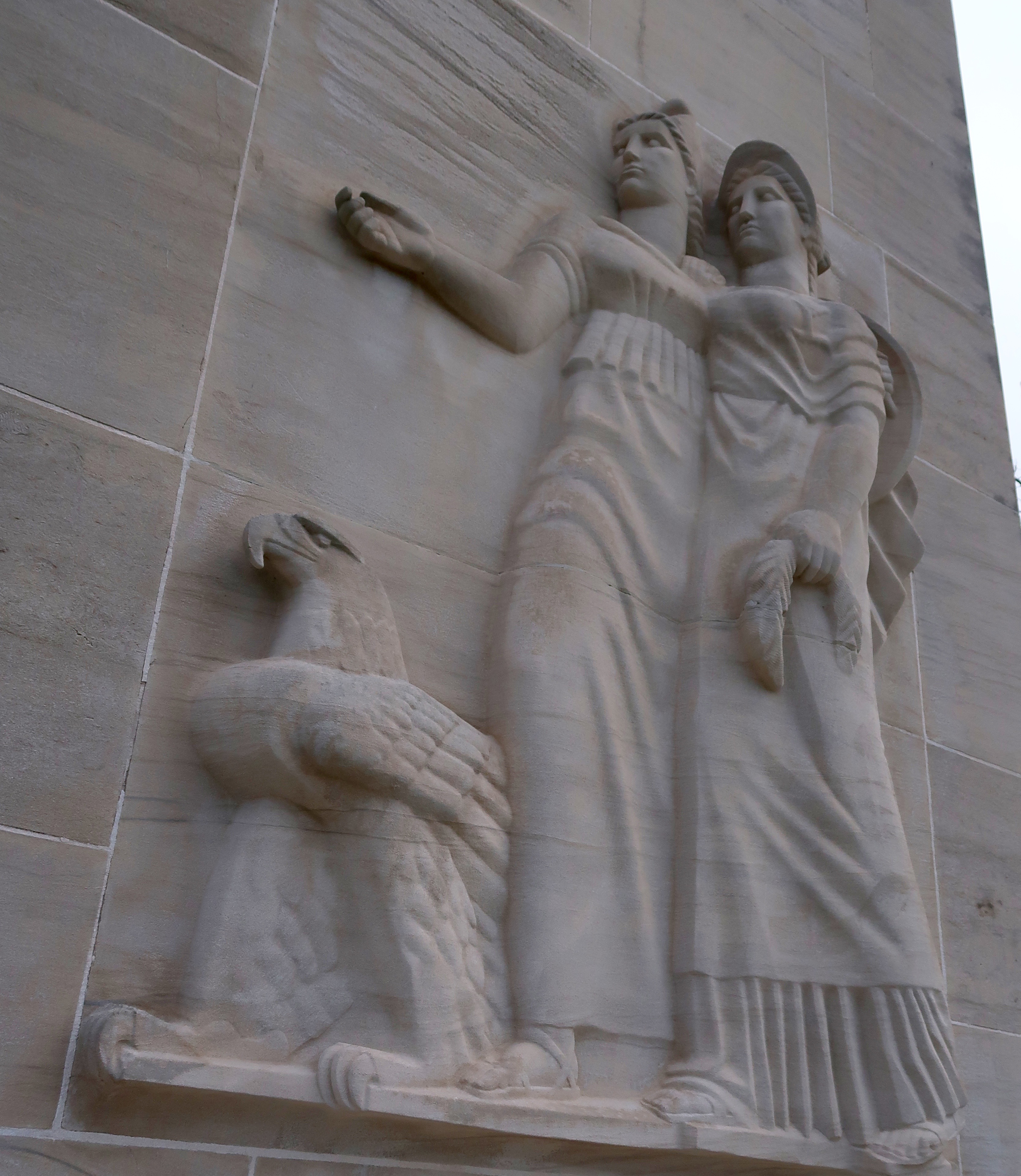
The base-relief sculptures of two woman that fronts the monument, represents peace and goodwill and the eagle represents the nation.
The monument was dedicated on the 75th Anniversary of the battle on July 3rd, 1938. The key note speaker was President Franklin D. Roosevelt. 250,000 people attended the dedication including 1,800 Civil War veterans, all of them in their 90’s or older. This was the last major reunion of Civil War veterans to ever take place.
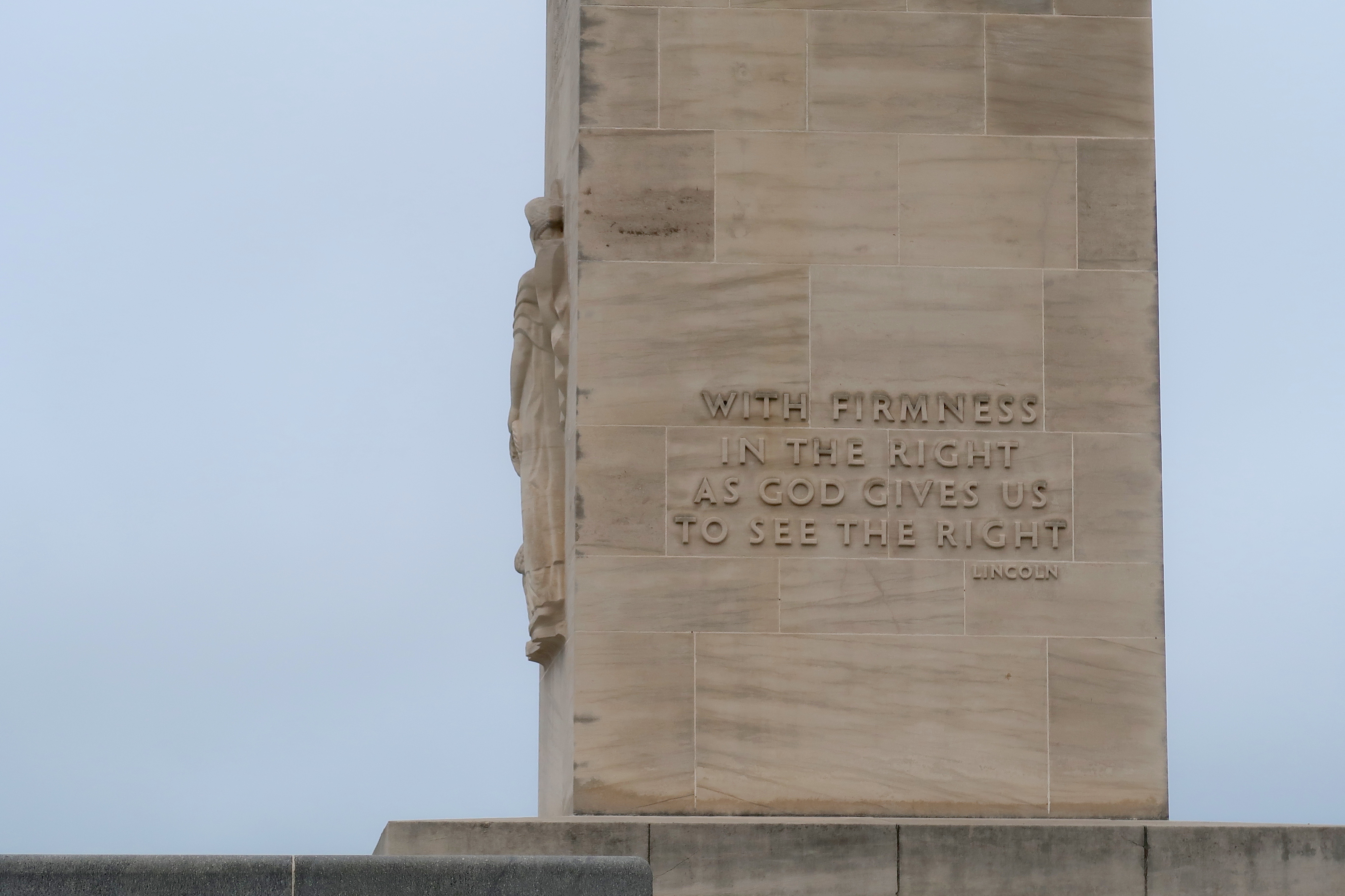
The words of Lincoln are all over the Battlefield of Gettysburg. These are on the side of the Eternal Light Peace Memorial.
I think all the members of congress should visit this monument to peace. The drive from Washington DC is an hour and a half but the journey would be worth their while. Here they would look at and contiplate meaning of this monument to peace, reconciliation, and working for the greater good of the country. This is why it was built, by both North and South and today’s politicians owe it to them and the future of the country to work together.
In my sketch, I added the cannon in the foreground, pointing up toward the monument. Perhaps this was an unconscious message that peace and reconciliation is always under threat. Before January 6, this might seem like an extreme statement but it now seems a possible reality.
This nation will hopefully have only one Civil War.