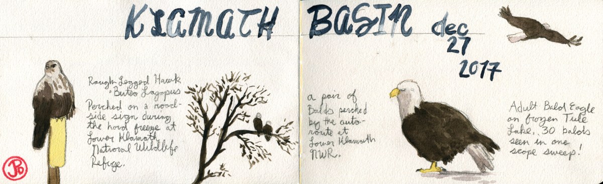
Why would anyone drive to the California-Oregon Border with daytime highs perching precariously in the low 30’s and drive on a muddy road in the middle of no where with visibility down to 50 yards? The answer is simple: Winter raptors!
I started my trip at Lower Klamath National Wildlife Refuge. President Teddy Roosevelt established this refuge in 1908, becoming our Nation’s first waterfowl refuge. The Refuge was designated a National Historic Landmark in 1965. The refuge contains 50,912.68 acres, which straddles the border of Oregon and California.
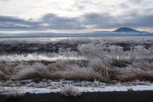
The winter raptorland that is the Lower Klamath Wildlife Refuge. Looking south east from the auto route.
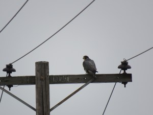
One the first day I arrived the visibility was down to 50 yards, making raptor spotting very difficult. My scope would remain in the truck, I didn’t need a closeup view of wintry gray. Luckily there were a few raptors perched by the roadside of the auto route. None was more wintery than the raptor with leg warmers: rough-legged hawk. This Arctic breeder winters in Northern California and I was lucky to encounter one perched on a road sign, which allowed a close approach in my moveable blind.
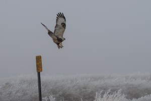
Buteo lagopus vacating a roadside sign showing two identifying field marks: feathered legs and a carpal patch. Note the “wonderful” visibility in the background.
The really star of this raptor wonderland is our National symbol, the bald eagle. The Klamath Basin holds the largest winter concentration of bald eagles in the Lower 48. Winter counts can be between 500 to 1,000 individuals. Their peak numbers were still a few months away in late February to early March, a time that coincides with the northern migration of waterfowl.
All of us in the United States are familiar with this bird, indeed it must be the most recognizable bird to all North Americans (yes I also mean youth, dear Canadians). It is on our stamps, posters, trucks, mudflaps, flags, paintings, sculptures, etc. But to see one, let alone a convocation of eagles, is a life experience that all Americans should have. That also includes you, Central and South!
On the first day, full of chilling ground fog, I saw five eagles. But what a difference a day would make.
After a nighttime roost in Oregon at Klamath Falls, I parted the curtains to find the dense ground fog had flown. I changed plans and headed back to the Klamath Basin.
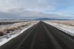
On my second day, the roads and vistas were clear. Perfect for winter raptor spotting. And I had many.
This day can be summed up with one location: Tule Lake. A binocular search made it clear that I needed to set up my scope for a closer look across the frozen surface of Tule Lake. In one 180 degree scan, from the north to the south, I counted 30 bald eagles!
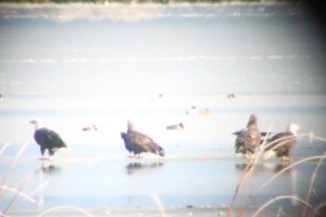
Not the best photo, but this digiscope photo confirms the most bald eagles seen in one view: four!
Here is the total raptor count for both Lower Klamath NWR and Tule Lake on the morning of December 27:
50 Bald Eagle
33 Red-tail Hawk
14 Northern Harrier
7 American Kestrel
3 Rough-legged Hawk
1 Peregrine Falcon
1 Cooper’s Hawk (being harassed by a kestrel)
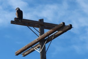
An adult bald keeping watch at Tule Lake, Klamath Basin.
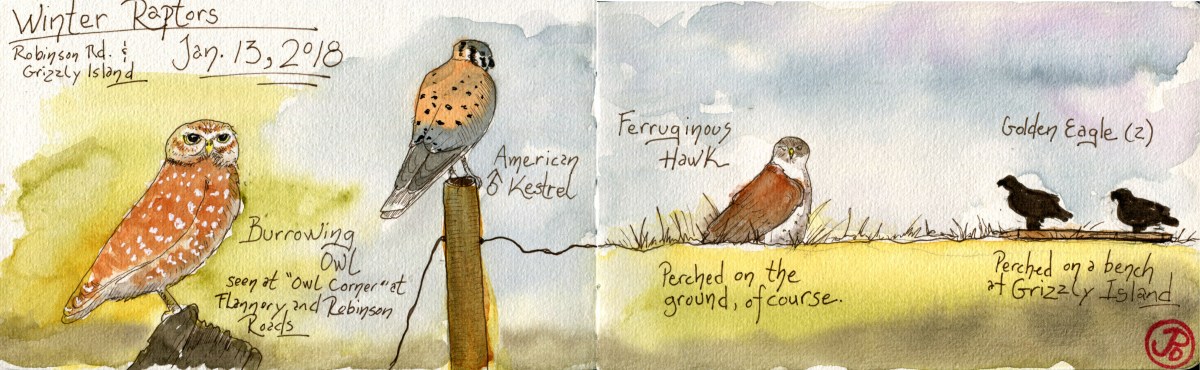
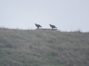
 Burrowing owl is always a welcome sight at this intersection and this trip, again, proved to be fruitful.
 A typical view of our largest buteo hawk from Robinson Road. Perched on the ground.The zoom on my Canon Powershot SX60 was able to bring this far off raptor, a little closer for a diagnostic view of this wintering hawk.