There are three prominent red buildings I wanted to sketch in Tuolumne County in the towns of Sonora and Jamestown.
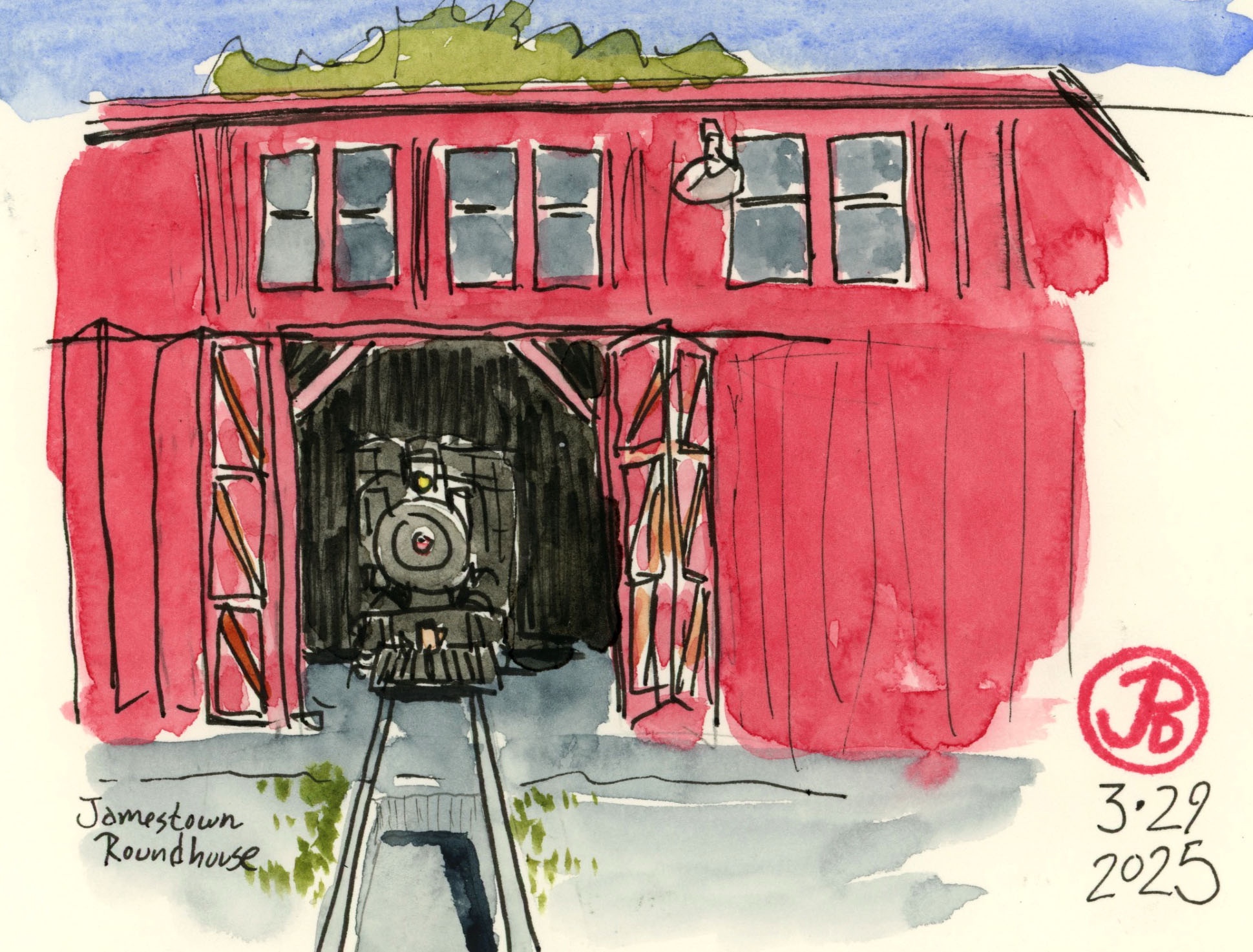
My first stop was Jamestown and Railtown 1897 State Historic Park.
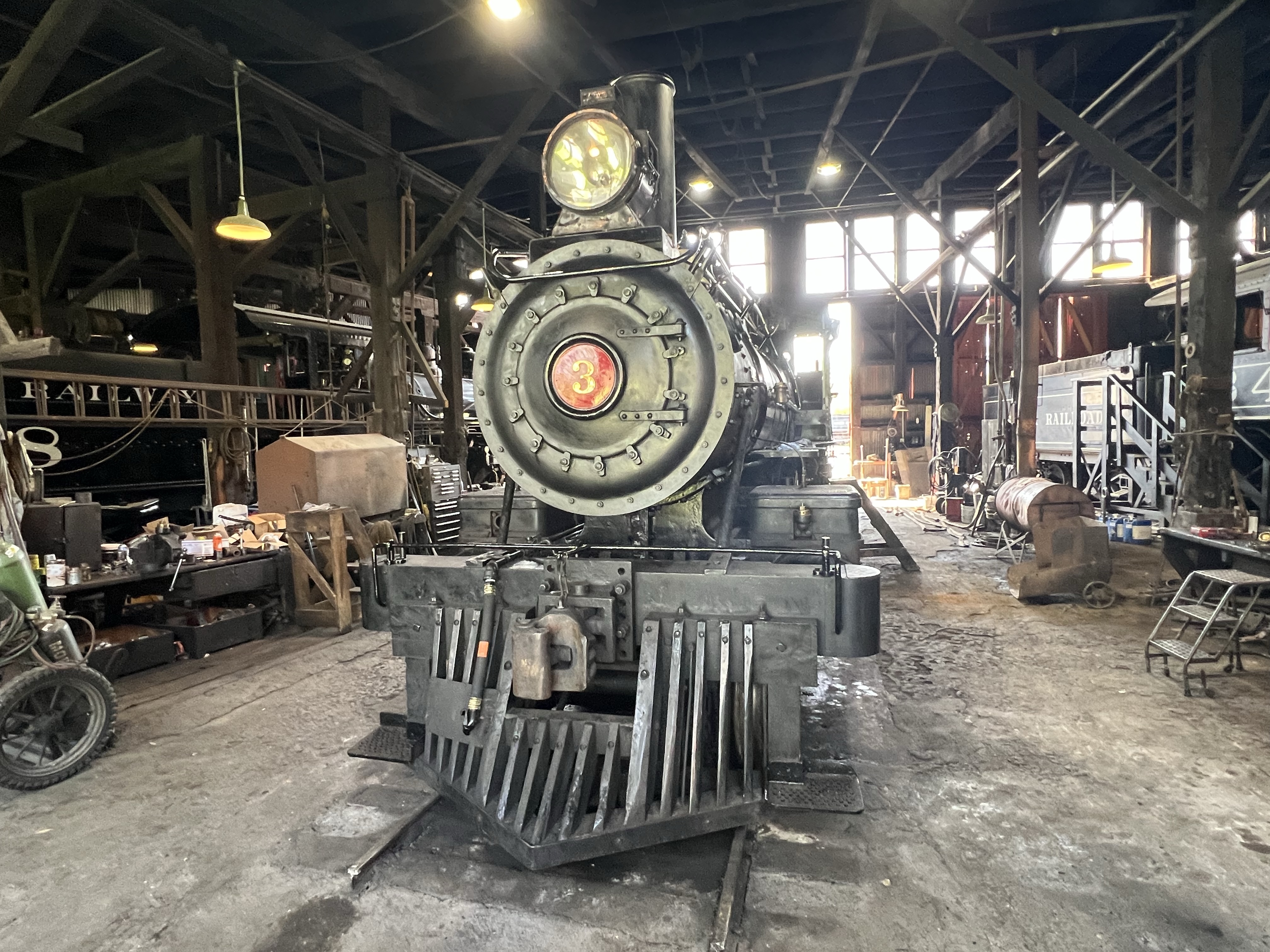
The State Park includes the freight depot and the roundhouse and turntable of the Sierra Railroad. Housed inside the roundhouse are four of the railroad’s steam locomotives.
One or two of the locomotives are still active and operate on weekends in the summer months. None is more famous than Sierra No. 3.
Three of my favorite No. 3 films are: High Noon, Man of the West, and Unforgiven.
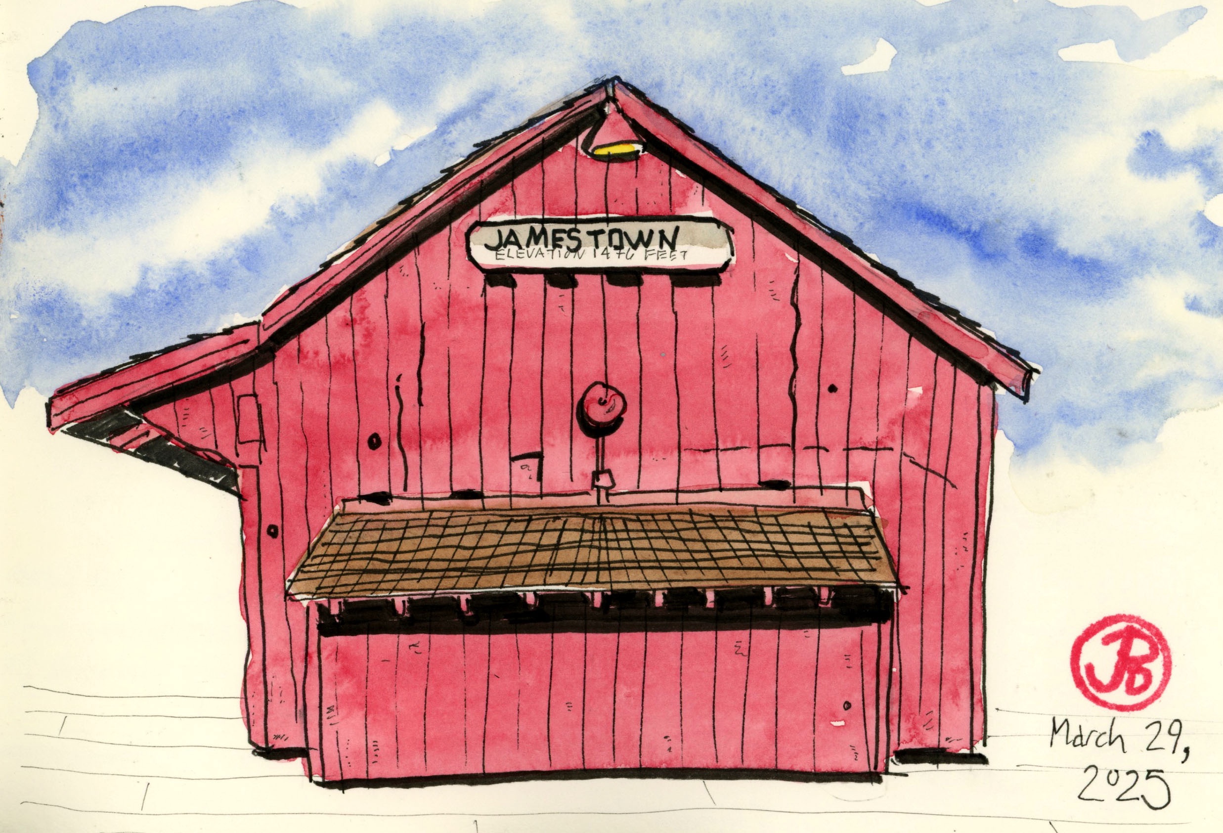
After sketching the roundhouse, I sketched the freight depot, which is now the visitors center and gift shop. This building was featured at the beginning of Anthony Mann’s Man of the West (1958). This is one of Gary Cooper’s last westerns and the last featuring Sierra No. 3 in a Cooper film. Their most famous film was the classic High Noon (although they never appeared in the same scene).
The freight depot. The passenger depot burned down on Thanksgiving Day 1978.
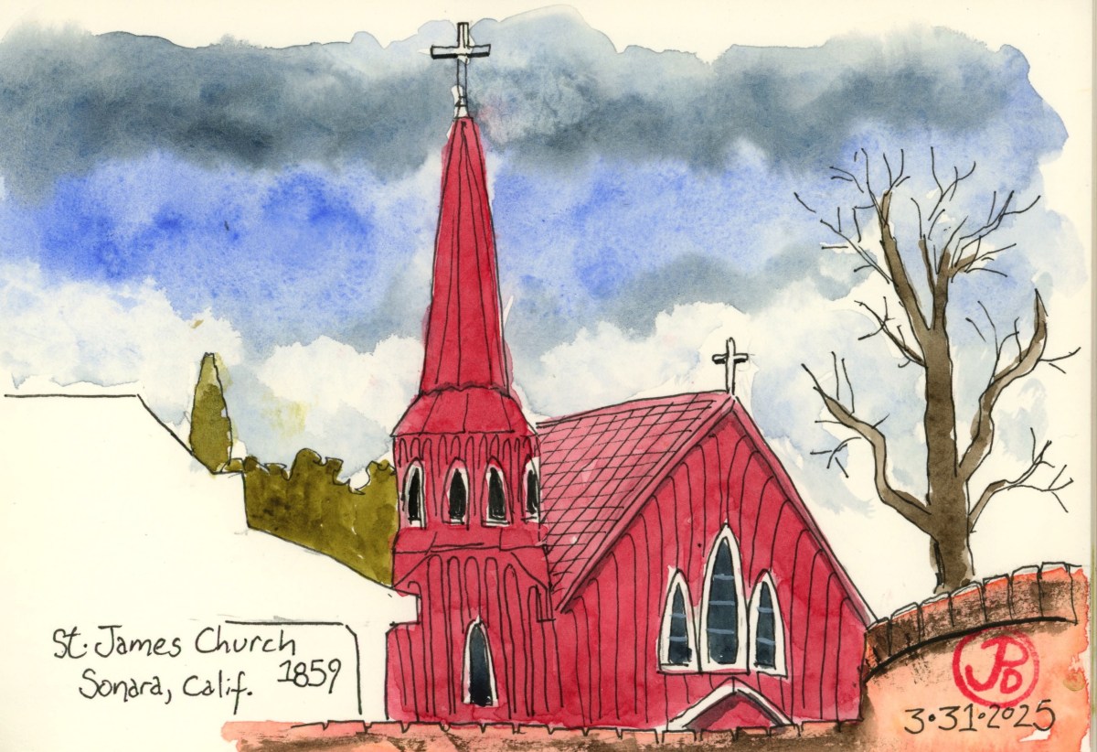
A few days later, I wanted to sketch one of the most photographed churches in the entire Gold Country, which is to be found in the town of Sonora.
This is St. James’ Episcopal Church (1859) also known as The Red Church. The church is build of redwood in a Carpenter Gothic style.
Getting a good sketching perspective was tough because number one, it was raining outside and I needed to do a car sketch yet I couldn’t find parking with an unobstructed view of the church looking up Highway 49. So I found a great perspective from the second story of the parking structure, looking down on the church (featured sketch).
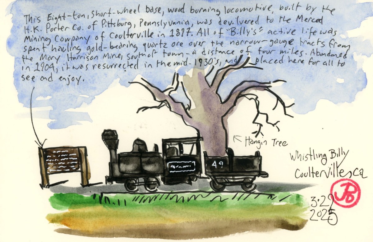
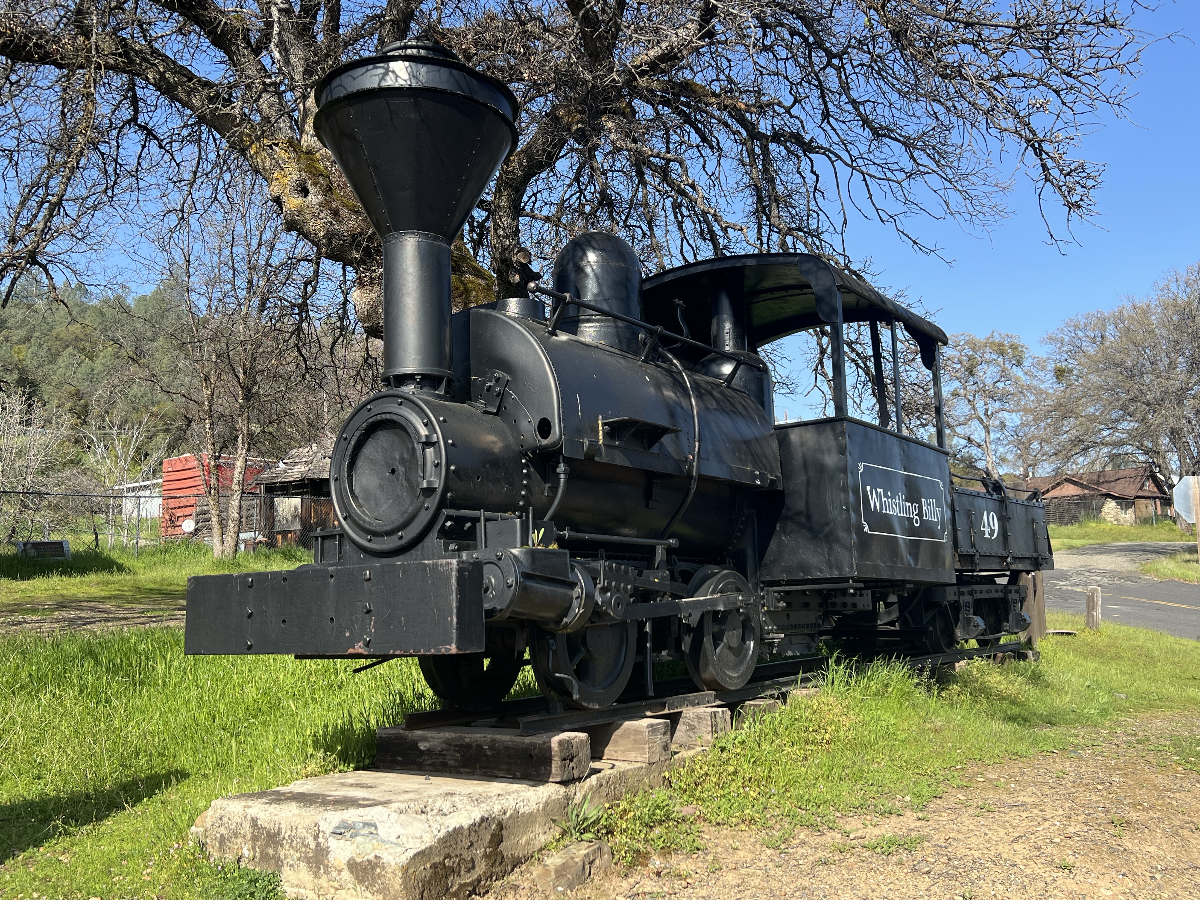
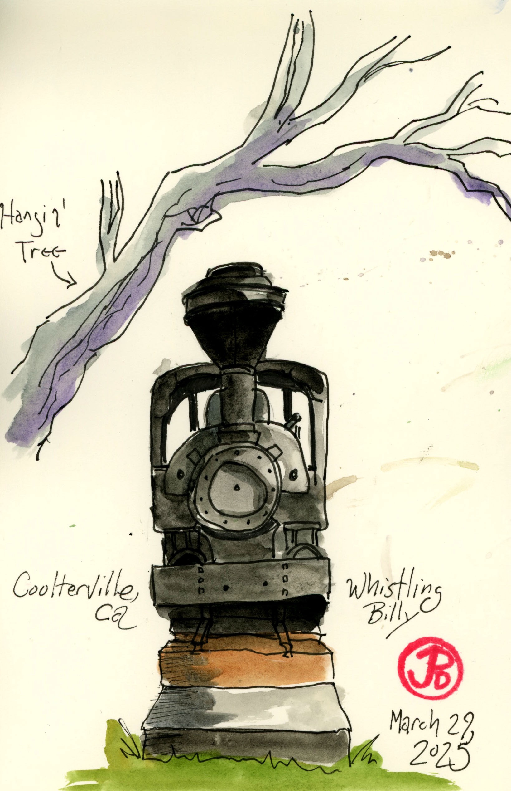
On my Spring Break Gold Country sketch list was an eight ton wood burning narrow gauge steam locomotive that was shipped around the Horn and delivered to Coulterville in 1887.
The locomotive operated on a four mile line hauling car loads of gold quartz ore from the Mary Harrison Mine just south of Coulterville to a stamp mill. Billy was abandoned in 1904 but was later refurbished and put on static display in the 1930s, where it remains today.
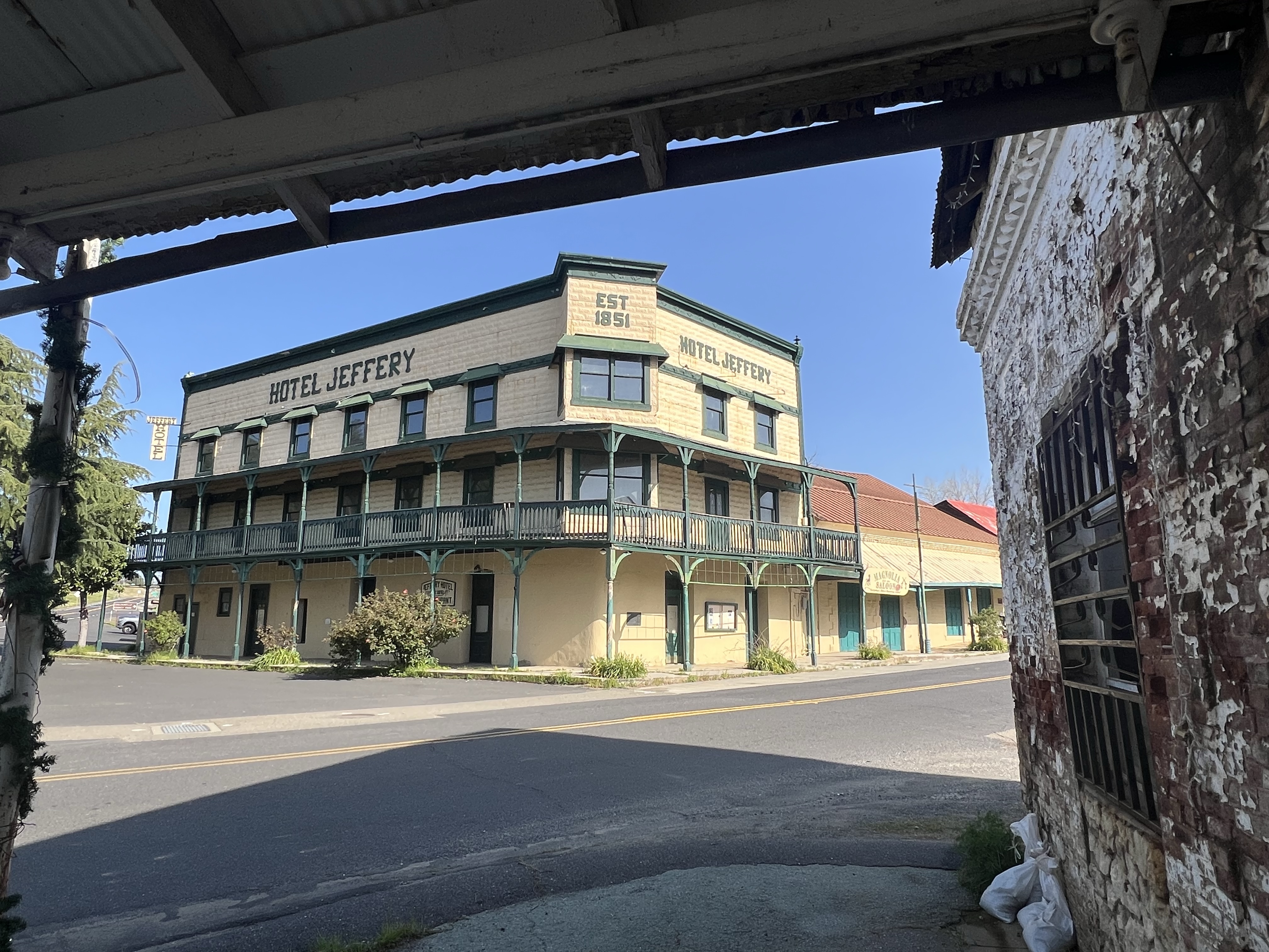
This is the pride and joy of Coulterville. Whistling Billy is displayed across Highway 49 from the Hotel Jeffery under the shade of the town’s hanging tree.
The Hotel Jeffery. While the building still stands the business is closed. Notable lodgers include: President Theodore Roosevelt (on his way to tour Yosemite), John Muir, and Mark Twain. Like most historic hotels in the Gold Country, this one is supposedly haunted.Whistling Billy in beautiful Gold Country Spring sunshine.
I did two sketches of the diminutive locomotive each featuring the hanging tree.
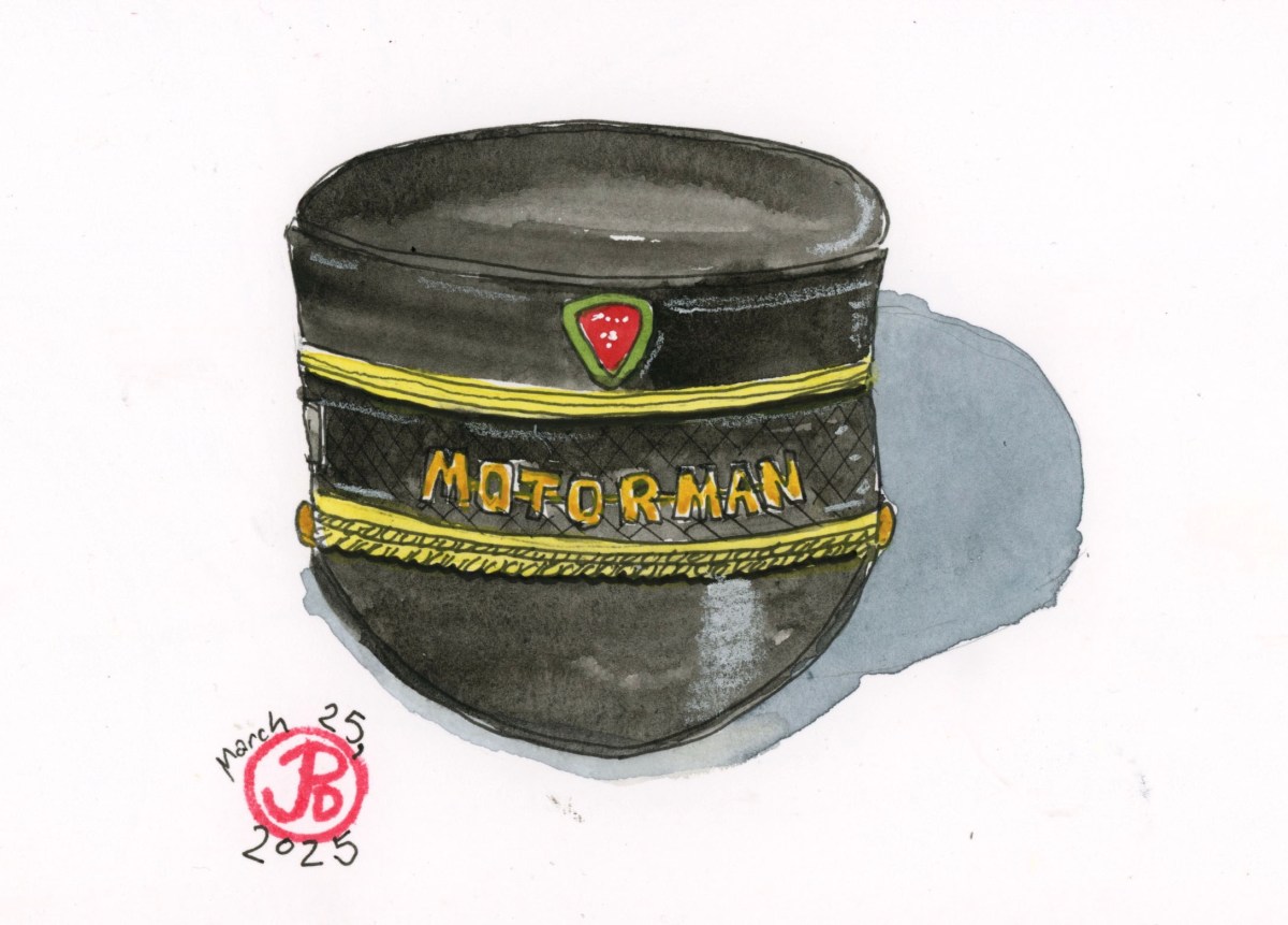
He left us almost 10 years ago. I chose to sketch one of my favorite objects I have: his Motorman’s hat.
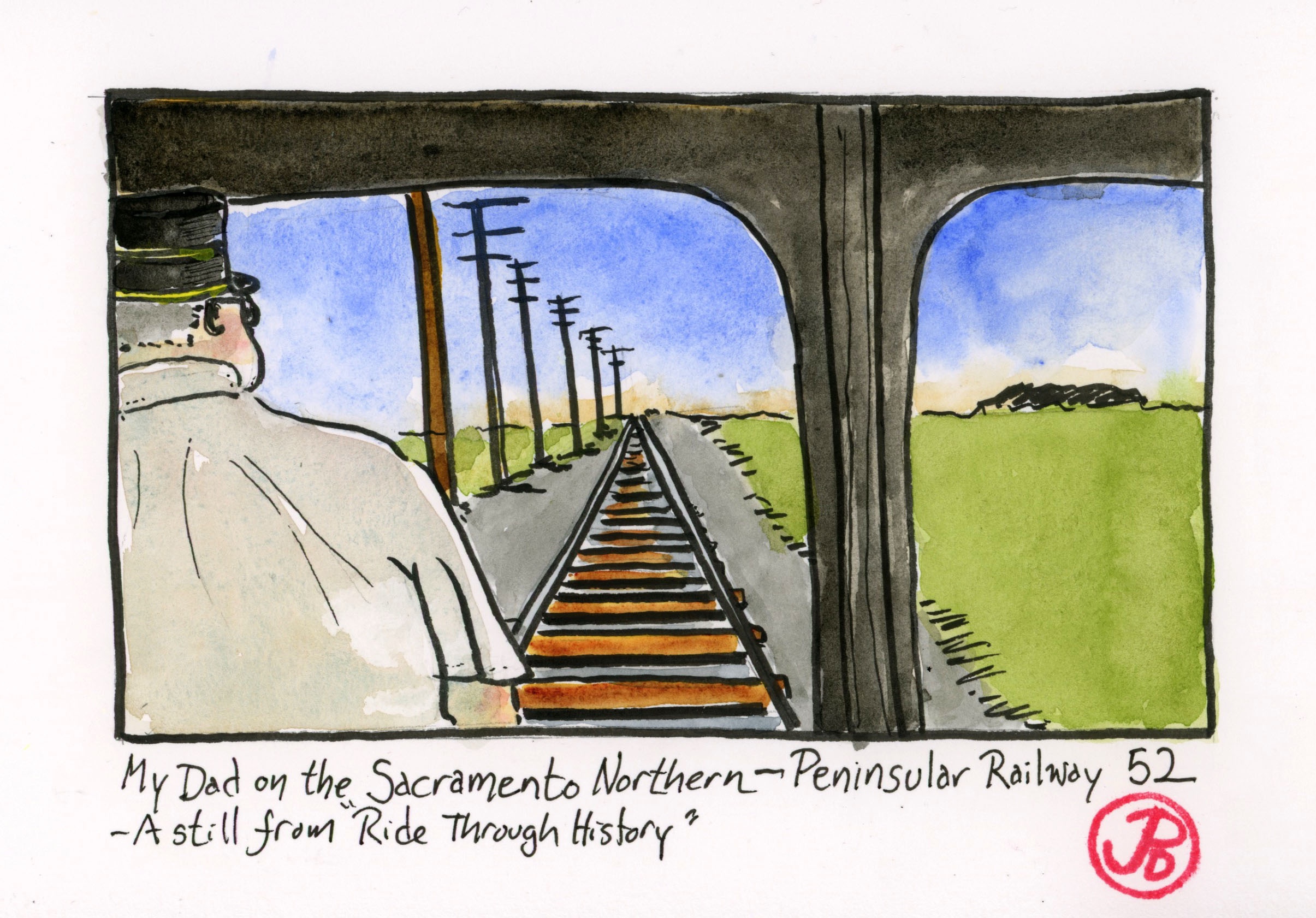
On a recent visit to the Western Railway Museum, where my dad was a volunteer motorman, I bought a copy of a dvd about the museum called “Ride Through History”.
The dvd is narrated by rail enthusiast and Bay Area Radio Hall of Famer Fred Krock and follows Peninsular Railway No. 52 as it rides around the museum and on to the former Sacramento Northern tracks.
Car 52 rides out to the end of the line at Bird’s Landing Road (about six miles) and then changes ends to head back to the museum.
As the car heads back, there is an over the shoulder shot of the motorman and the rails ahead that reach out to the horizon. The man in the foreground is my dad!
There is a special feeling of joy and sadness upon seeing my father doing something he loved but also the finality of his passing.
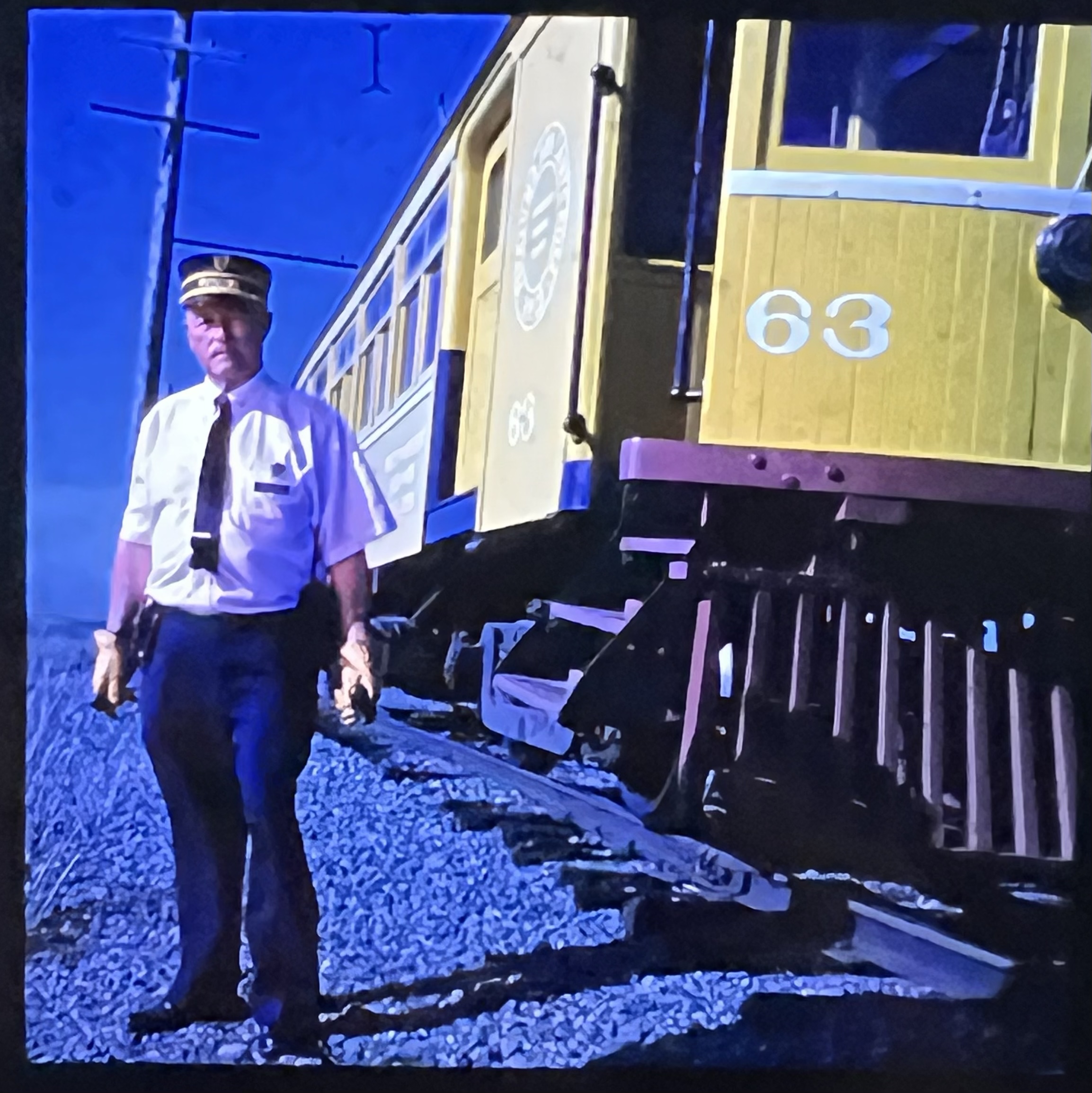
A photo I took of my dad, the streetcar motorman.
In remembrance, I sketched his hat and a still from the dvd.
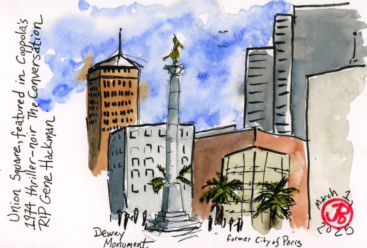
With the news of the passing of actor Gene Hackman, I thought I would sketch some locations from the film where he played one of his favorite roles: Harry Caul in Francis Ford Coppola’s The Conversation (1974).
The majority of the film was filmed on location in San Francisco. The conversation of the title takes place in Union Square.
The plot revolves around a surveillance expert (Hackman), who is hired to record a conversation between a man and a woman in busy Union Square. We later learn his eyes and ears have been deceiving him. No spoiler alert here, see the film for yourself!
I took the N Judah downtown and got off at the Powell Street Station. I walked past the lengthy cable car queue on Powell and headed towards Union Square.
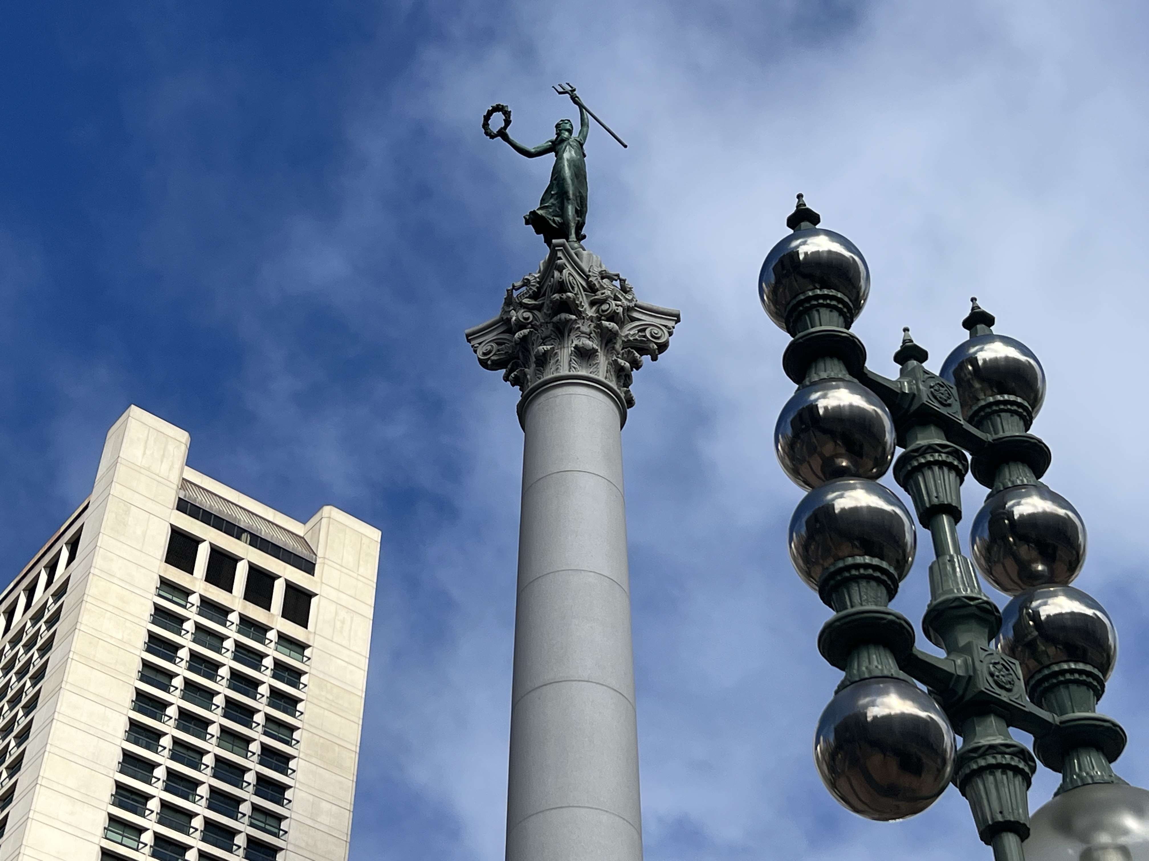
The statue of Nike is the center point of Union Square.
I found a corner of the square to sketch the focal point: the Dewey Monument, which is topped by the Greek goddess Nike, the Goddess of Victory, commemorating Admiral Dewey’s victory at the Battle of Manila Bay in the Philippines.
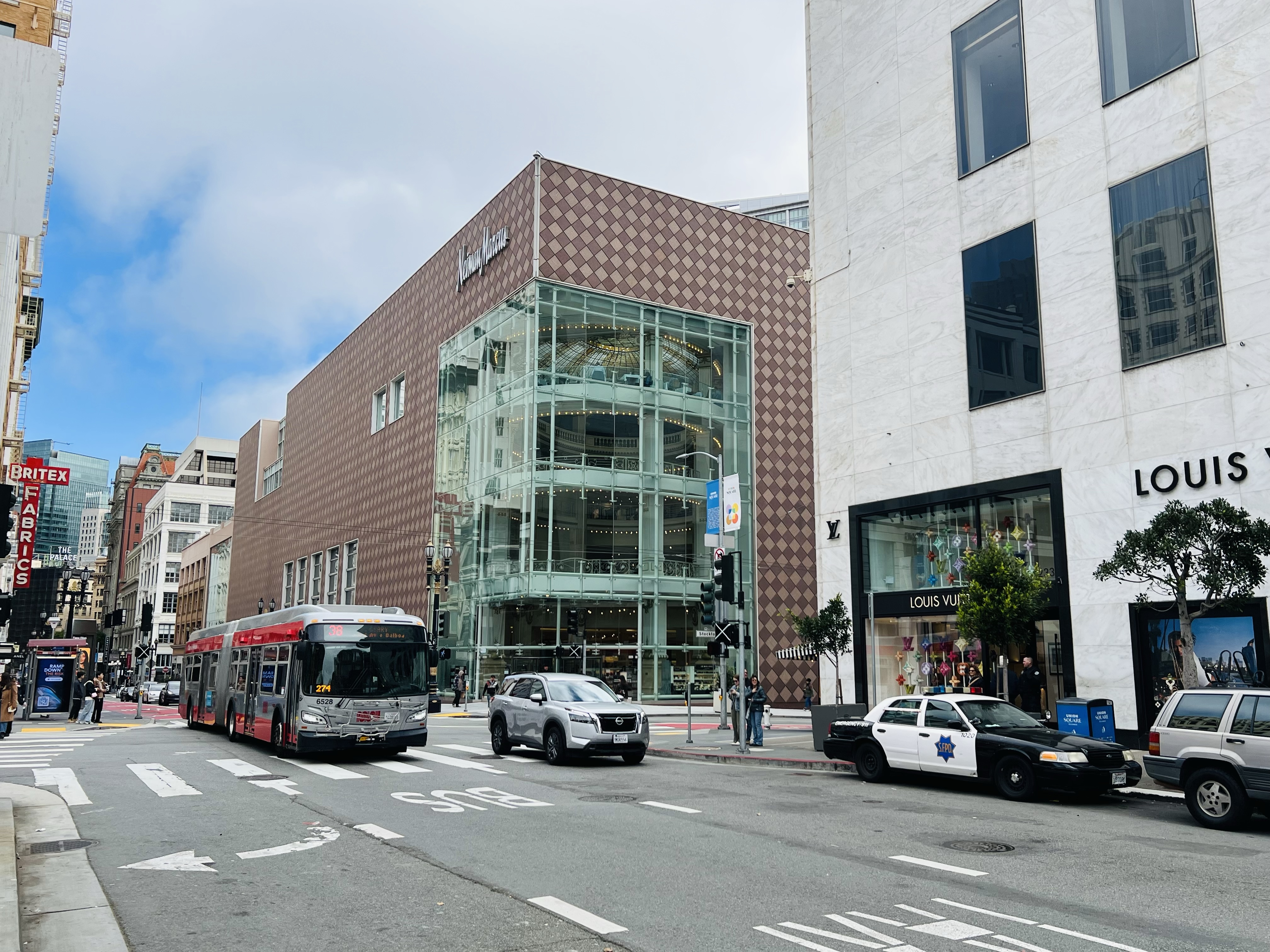
In the background of the sketch (featured sketch) is the former City of Paris department store (now Neiman Marcus), which features at the beginning of the film.
At the time of filming in 1972-73, Neiman Marcus was the City of Paris department store. Harry Caul’s surveillance van was parked where the police car is.
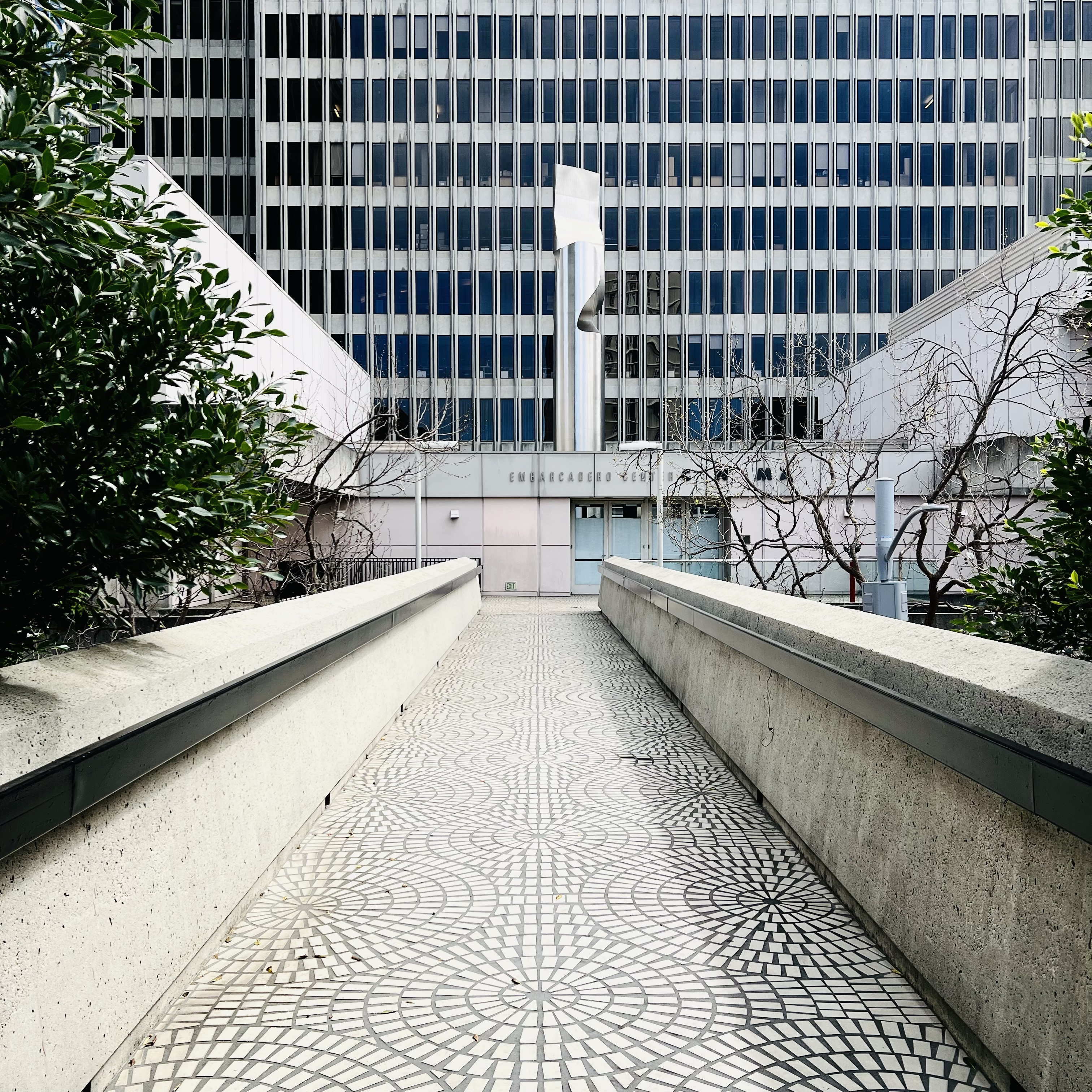
Another San Francisco location that is featured in The Conversation is the Embarcadero One complex. The site was developed in 1971 and was brand new when filming began. The complex is the location of Hackman’s client, the President, portrayed by Robert Duval. His assistant is played by a young Harrison Ford.
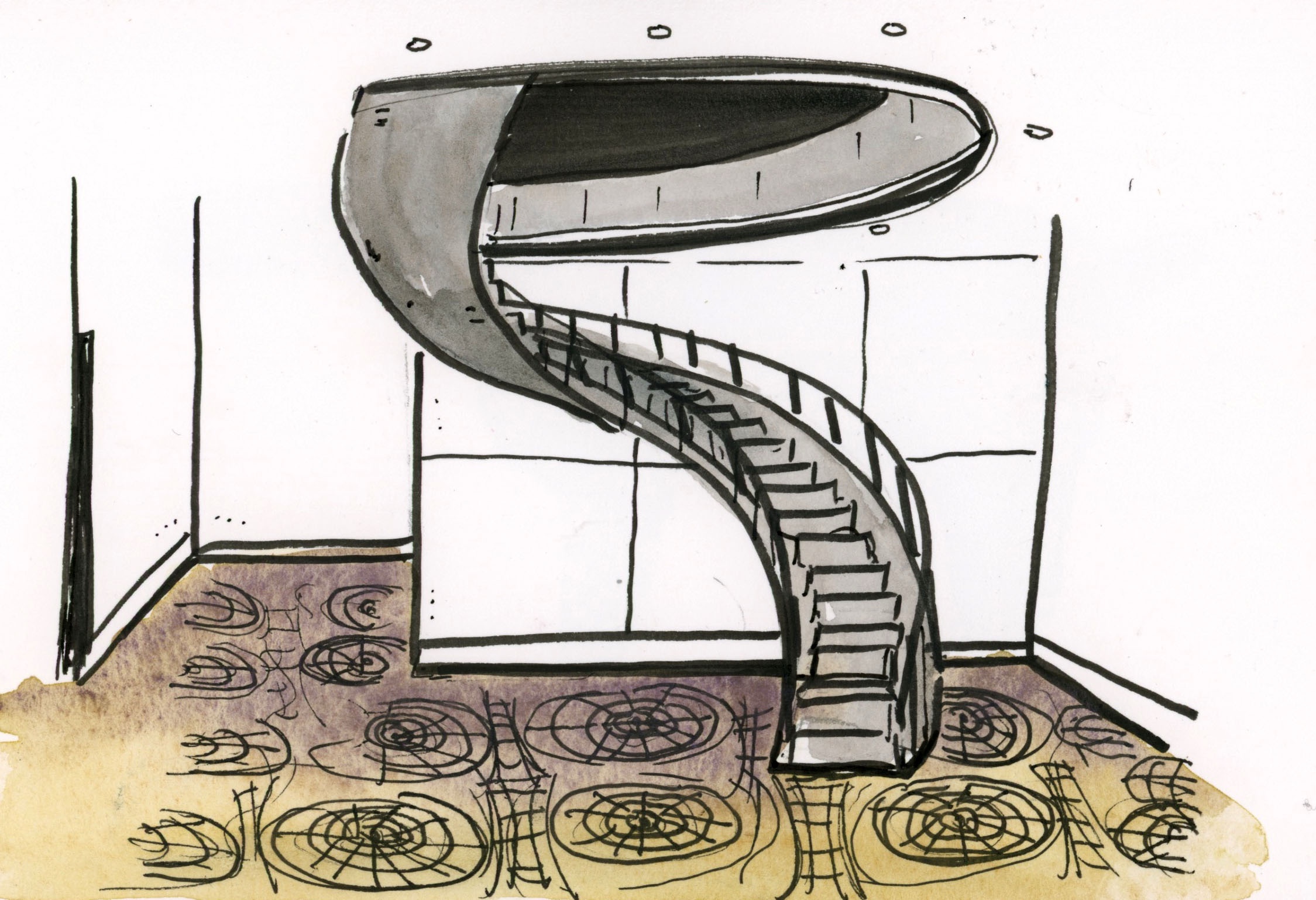
The walkway leading to Embarcadero One was featured twice as Hackman’s character goes to see the Director. The sculpture, Two Columns With Wedge (1971) was only a few years old when filming took place here. The now closed cinema in front of the sculpture was not there at the time of filming. A field sketch of one of the iconic spiral staircases of Embarcadero Center. One of these staircases was featured prominently in The Conversation.After being paid by the President, Hackman walks right to left in front of One Maritime Plaza, which is across the street from One Embarcadero Center. The location looks much the same as it did in the early 1970s.
Walking in the footsteps that the actor Gene Hackman took in one of his seminal lead roles, is my way of honoring a talented performer that had recently left us as well as creating a fitting sketcher’s eulogy.
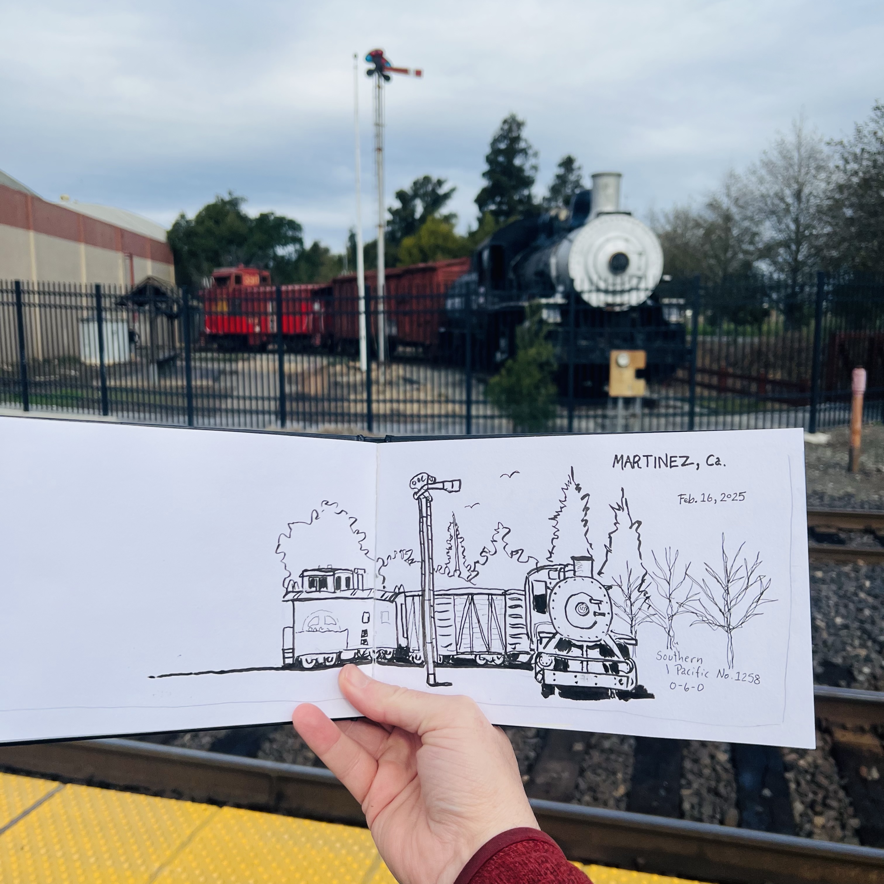
I arrived a few hours early in Martinez before meeting my friend for lunch. I wanted to do some sketching around the Martinez AMTRAK Station.
The train station in Martinez is a busy place. While I was sketching, three Capital Corridor trains passed through.
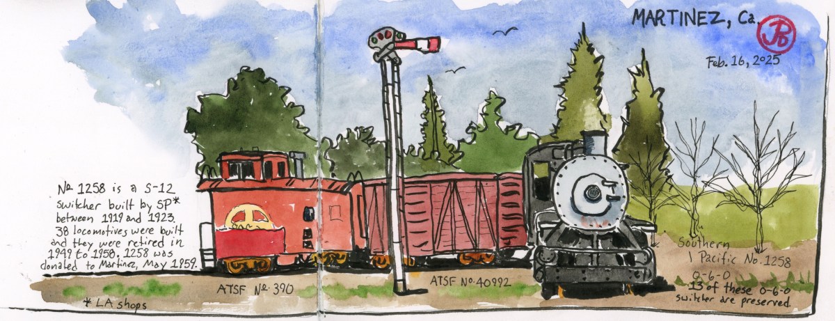
On my last visit I wanted to sketch the Southern Pacific locomotive, with its odd consist of Santa Fe cars, on static display across from the station but I didn’t get around to it. I wanted to add it to a spread on my next visit (featured sketch).
Southern Pacific No. 1258 is an S-12 switcher steam locomotive built at the SP shops in Los Angeles. 38 locomotives where built in this class and there are 13 0-6-0 SP switchers preserved, more than any type of Southern Pacific locomotive built.
Switchers are not sexy nor classy like the GS locomotives. There epitomize function over form. The real workhorses of the Southern Pacific freight yards.
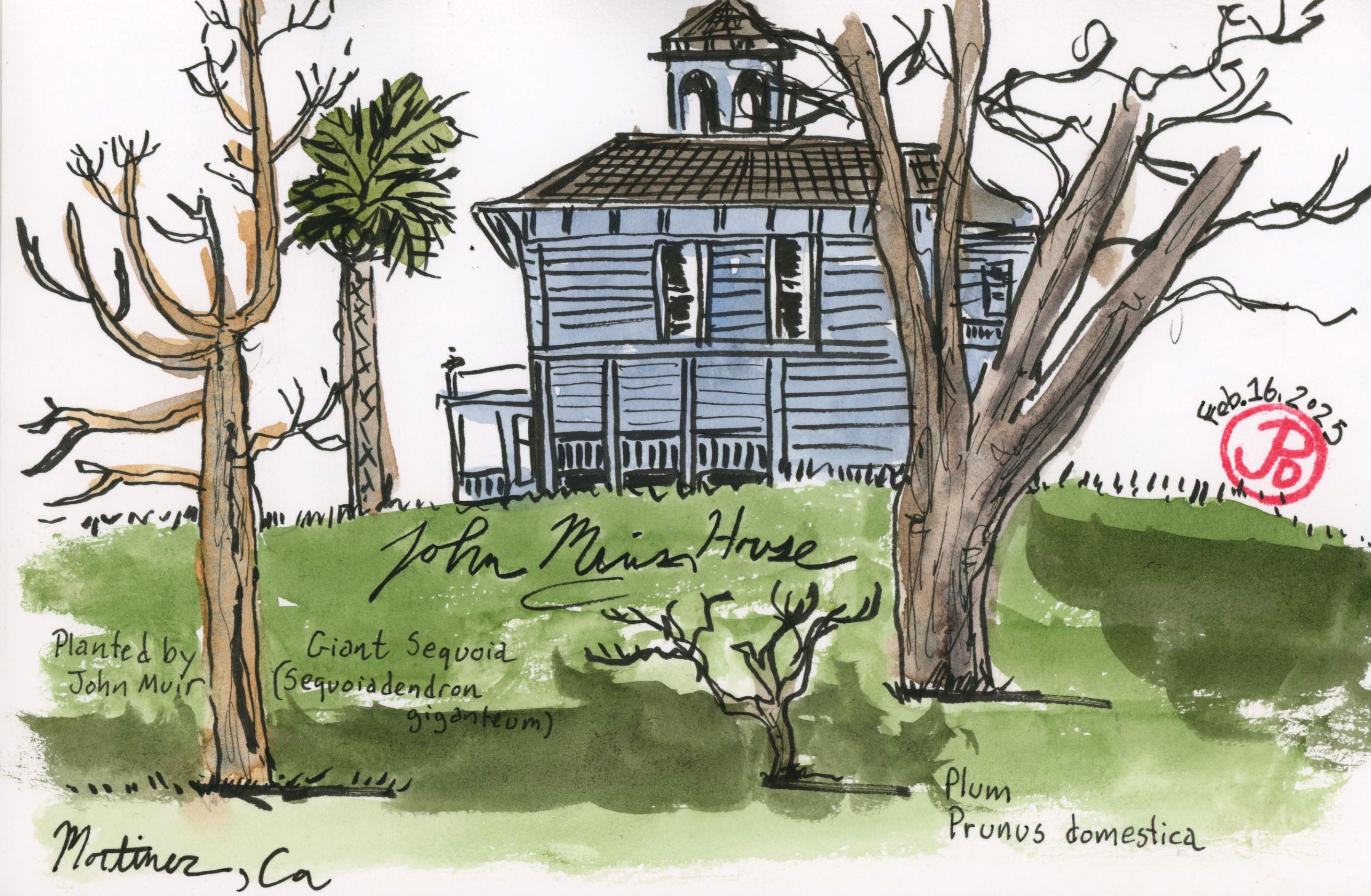
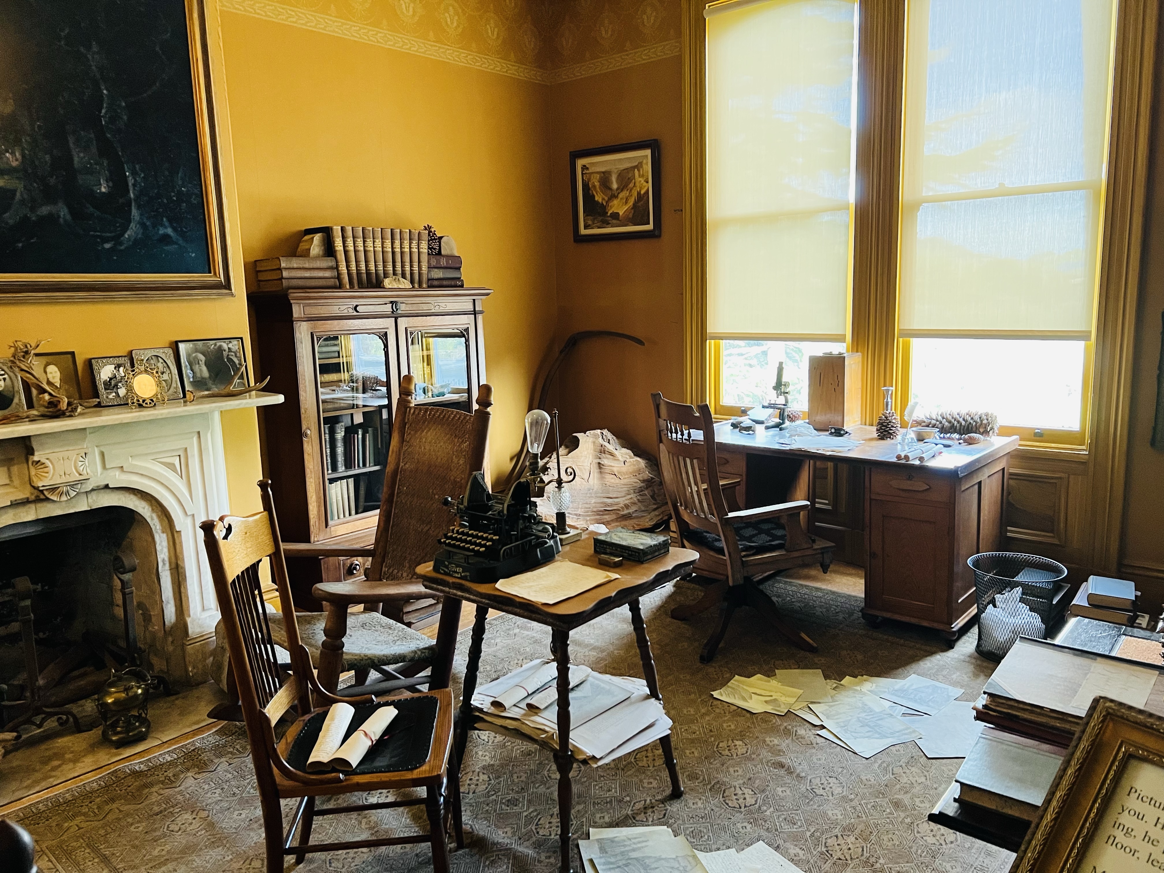
After sketching 1258, I headed to the other side of town to sketch the house of Martinez’s most famous resident.
This resident is the writer and naturalist John Muir. He lived here among the fruit orchards with his wife and family.
Muir married into the Strentzel family in 1880. The Strentzels had been farming the land, mainly fruit ranching, since the 1850s. Muir lived here, except when he was off traveling, from 1880 until his death in 1914.
I knew I wanted to do a sketch of the 1882 Italianate house but I needed to find the right perspective.
The touchstone for my sketch was the not-so-giant sequoia that Muir planted years ago. The tree has failed to live up to its name in the Martinez climate.
My Muir-sequoia-bench sketch.
I found a bench with the sequoia in the foreground and the Muir House in the background up the hill.
My favorite room in the Muir House. Muir’s “scribble den”.
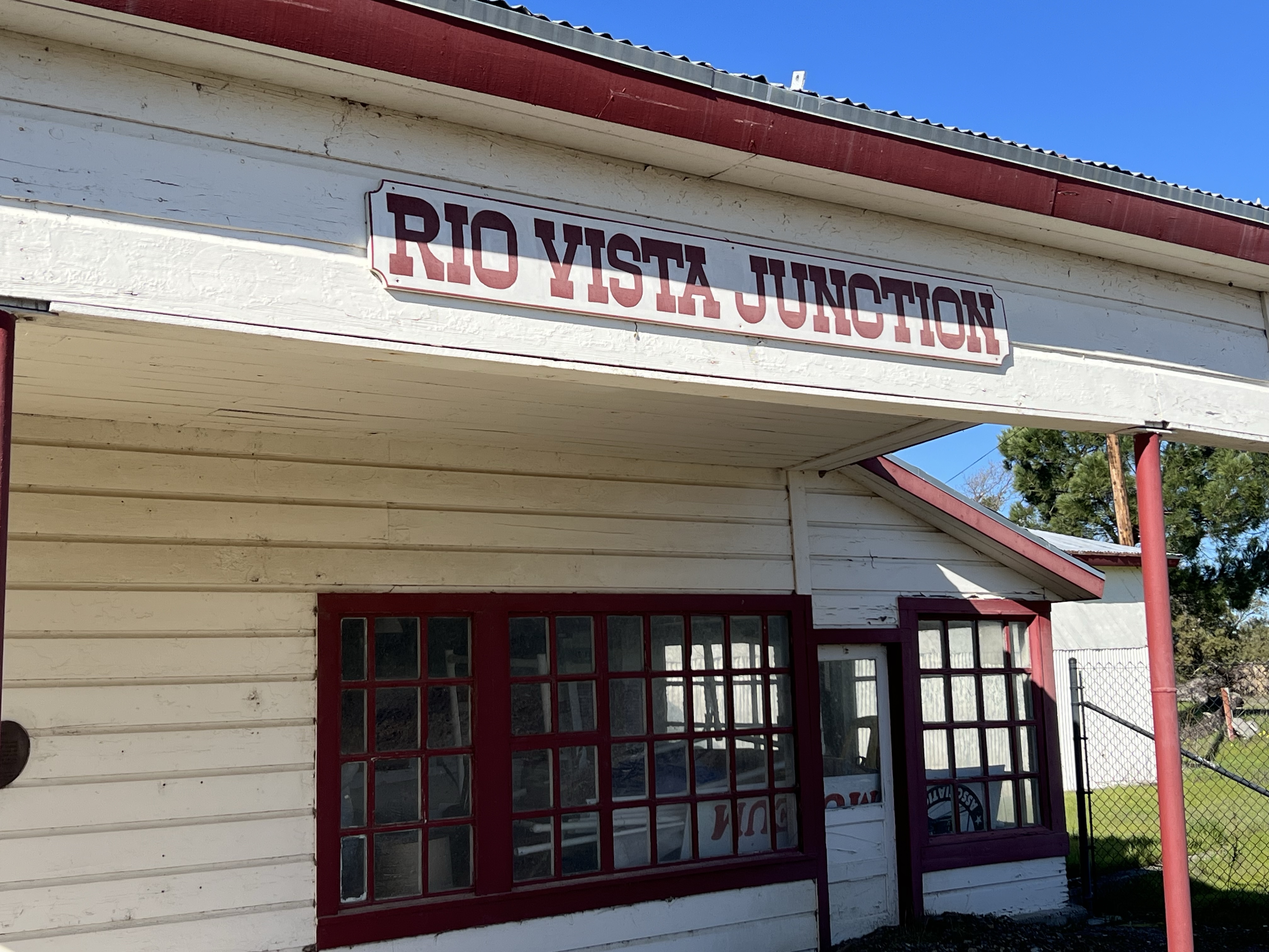
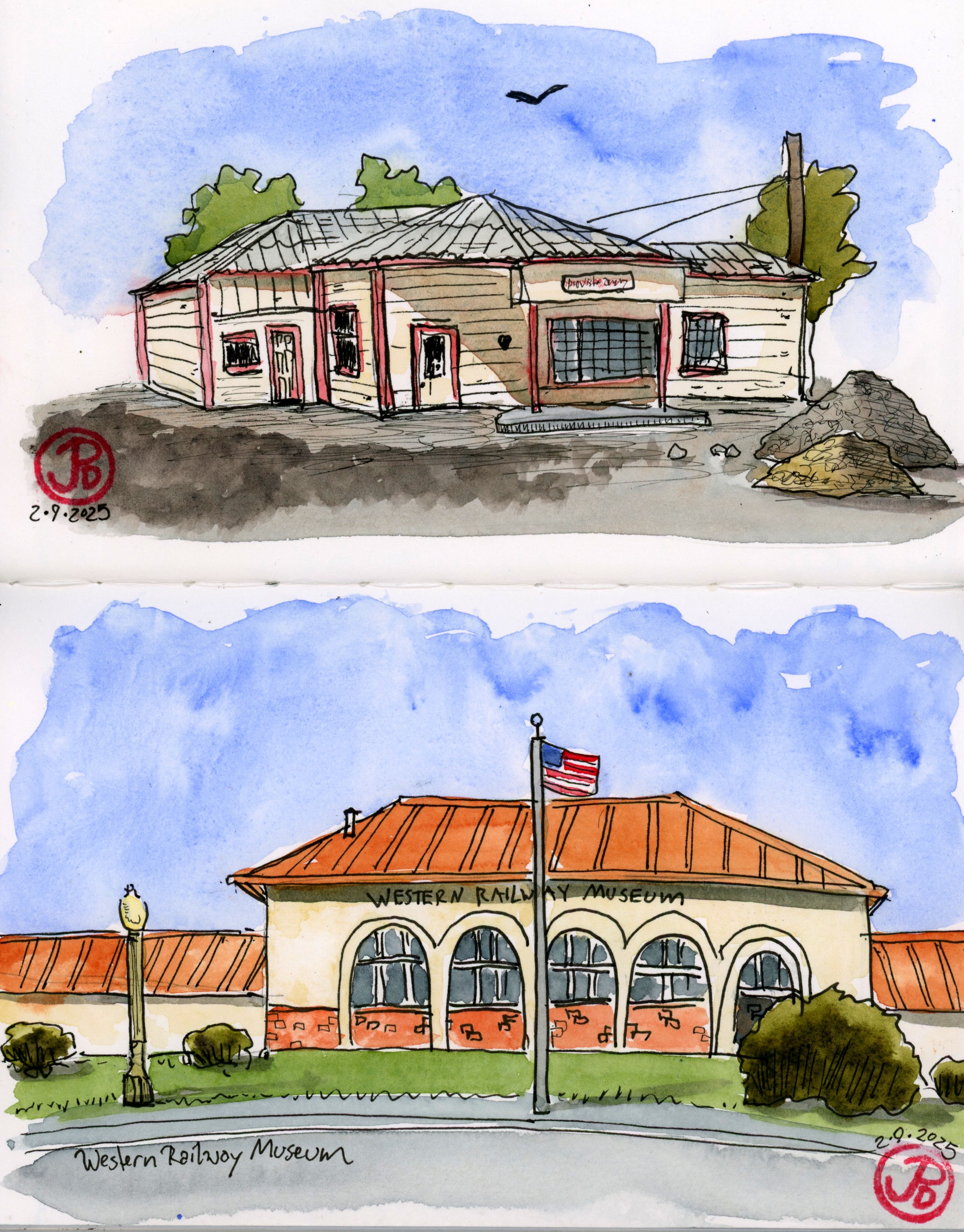
I have memories that stretch back over 40 years of visiting Rio Vista Junction as a child, now called the Western Railway Museum.
The museum was not as polished and a little more threadbare back then. Lot of passion for trains and streetcars but perhaps without the funds.
My father grew up as an only child in San Francisco during the age of steam, streetcars, and streamlined buses.
Dad spent much of his youthful free time riding the streetcars into the dunes before the Sunset District was developed. He told me that the operators, always Irish, would let my father take the controls while the operator ate his lunch. Such scenes are unthinkable now in the age of lawsuits, codification, and over parenting.
When I was growing up, my dad shared his passion for transit. And the active rolling stock of the museum of Rio Vista was one of my classrooms.
And when I return to the Western Railway Museum, I feel my dad’s presence.
It’s not hard to find evidence of my father at the Western Railway Museum. Just inside the front door, his name is listed as a primary donor.
The old visitors center and gift shop has been replaced by a grand building reminiscent of a train depot that has a gift shop, displays, a cafe, and a research library. The new visitors center was dedicated in 2001.
When I visited the research library, there were many cardboard boxes with my father’s name on it. He was quite the collector. I was told that so far, 12,000 items from my father’s collection had been catalogued.
Both centers are still in existence and I sketched both as a contrast to the growth of the museum.
The former visitors center and service station.
The old visitor center is close to Highway 12 and the Sacramento Northern mainline and was formerly a service station. I assume this is where passengers caught buses to Rio Vista to the east.
And it seems gasoline was not the only service offered at the station. An E Clampus Vitus plaque near the front entrance reads, “Here between 1942 and 1948, the painted ladies serviced the needs of our men from Travis AFB. Closed by order of an unsympathetic sheriff.”
The old and the new, sketched in one spread.
The museum was founded as the California Railway Museum in 1960 on property at Rio Vista Junction by the rails of the Sacramento Northern Railway (the museum purchased 22 miles of the Sacramento Northern in the mid-1990s.)
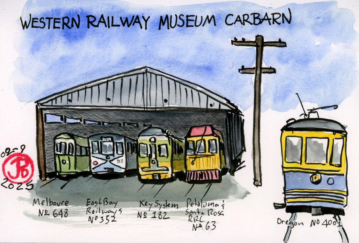
After sketching the two visitors centers from two different eras, I sketched the old carbarn.
The cars facing out (left to right) are a Melbourne car No. 648, East Bay Street Railways No. 352, Key System No. 182, and Petaluma and Santa Rosa No. 63. In the foreground to the right is Portland Traction Company No. 4001. 4001 was waiting for passengers to board.
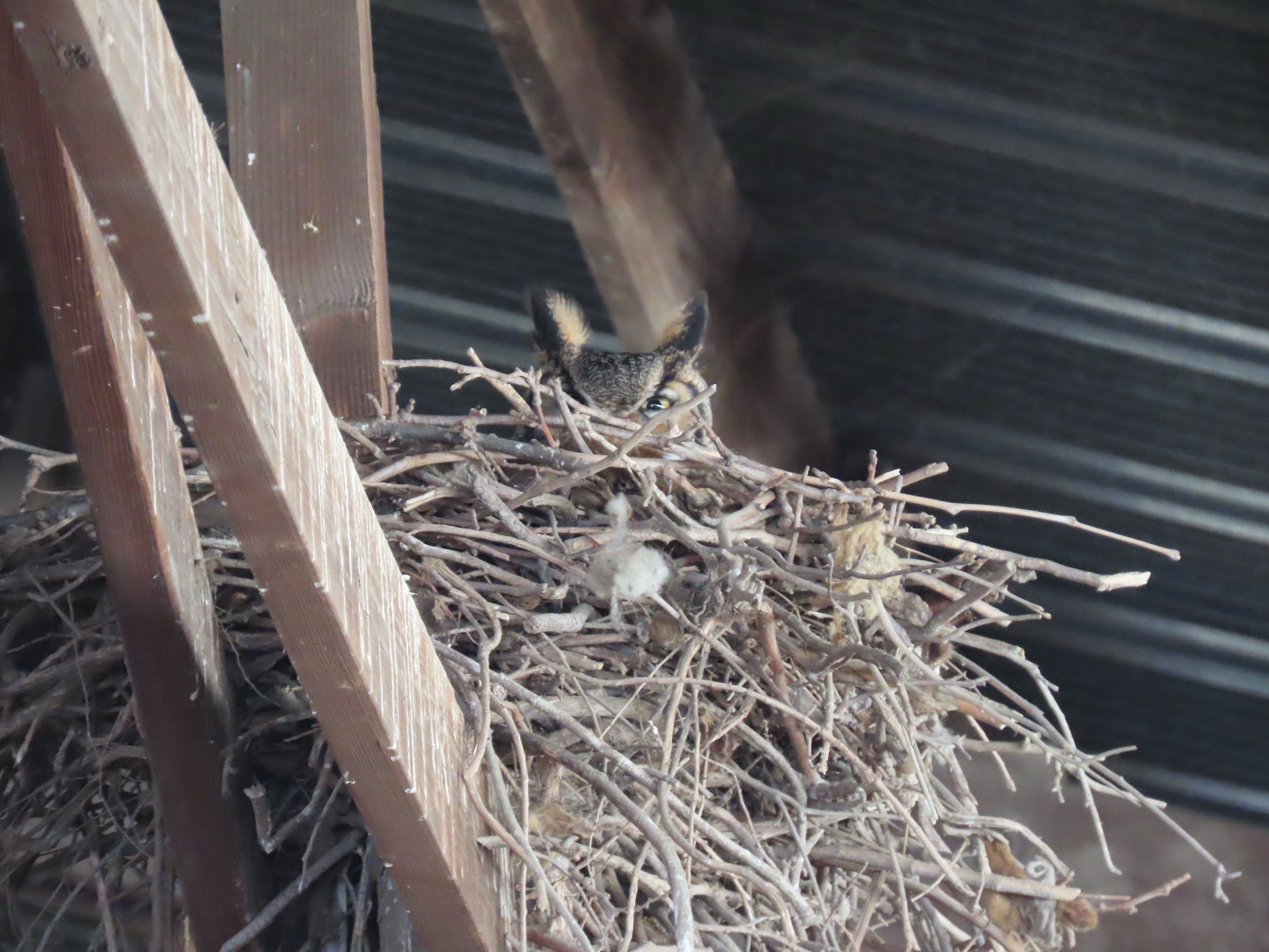
There was one other surprise in the open air carbarn. Earlier I had seen a great horned owl fly from the barn and head to the eucalyptus grove in the picnic area. While I was walking inside the barn I had noticed a very messy nest, it looked like ravens. As I walked near the nest I realized I was being watched.
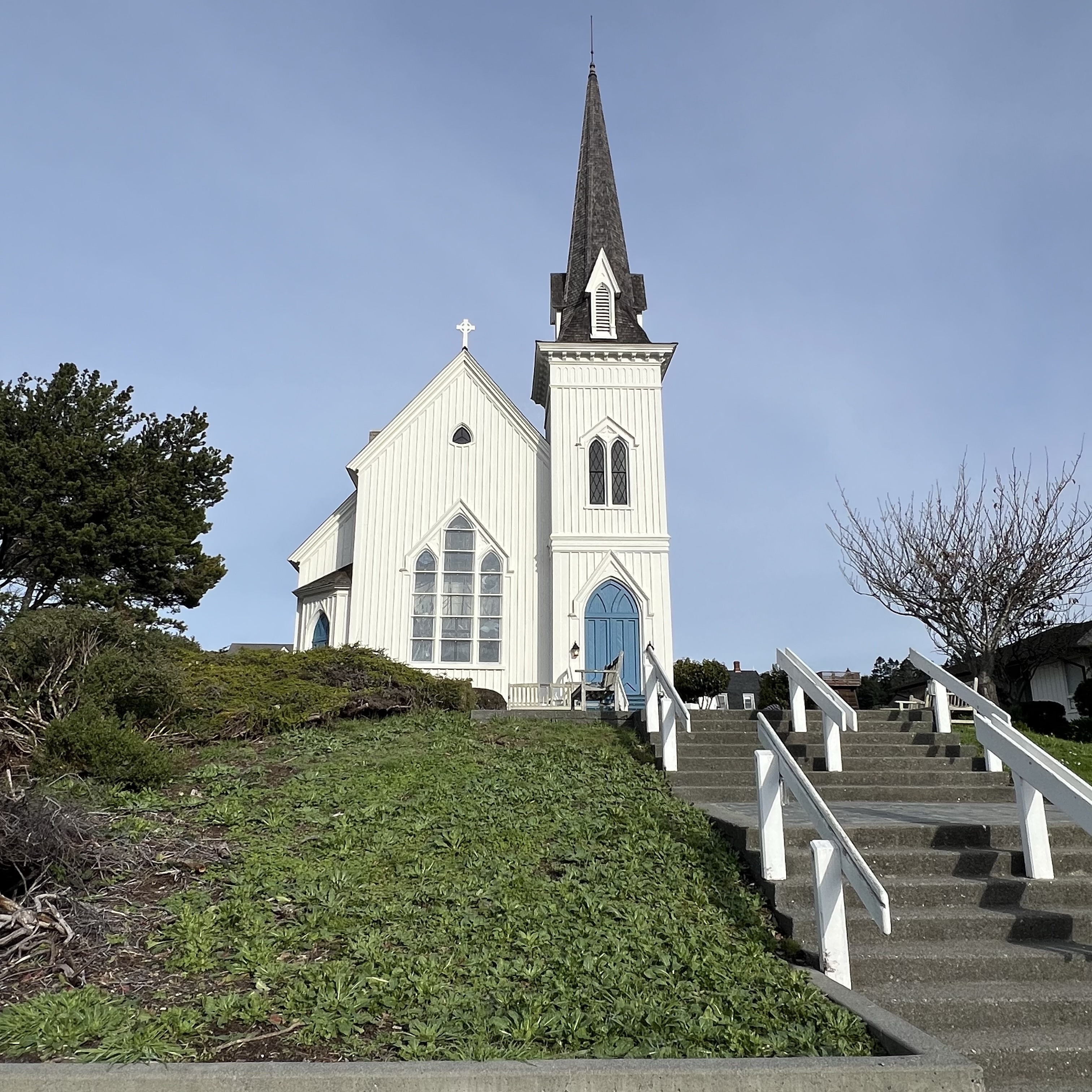
The town of Mendocino has two California Registered Historical Landmarks, both are houses of worship.
I had already sketched the Temple of Kwan Tai on a previous visit and now I wanted to sketch the Mendocino Presbyterian Church.
I sketched the church from my curbside sketching blind and when I finished I walked over to get a closer look at the California State Historic Landmark Plaque.
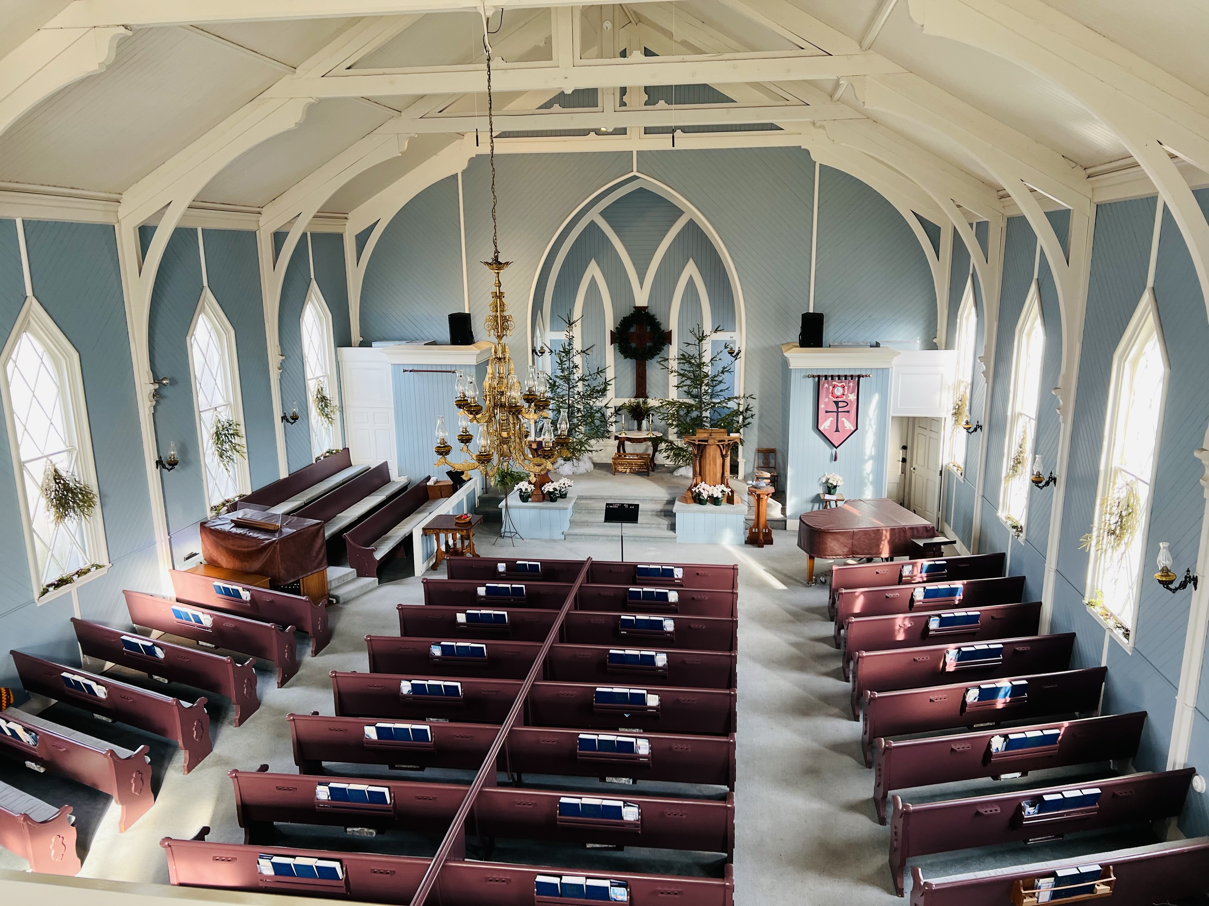
The church was dedicated in 1868 and is the oldest church in continual use in California. As I was reading the plaque a kindly local asked if I wanted to have a look inside.
I replied in the affirmative and the kindly church lady put her dog indoor and returned with the key.
She gave me a brief tour and told me if I was brave (I was) that I could climb the ladder in the choir loft to see the chalk signatures of past pastors and church members on the inside of the bell tower (which I did).
She also said that I could ring the bell, so I grabbed the pull and did.
The church is built of the local wood, the wood that put Mendocino on the map: coast redwood.
There is one art museum and one art exhibition from my youth that is at the fore of my memory.
I was in third grade when I visited San Francisco’s de Young Museum and the King Tutankhamen exhibit.
In 1979, the King Tut exhibit was a huge deal in the Bay Area. It seemed everyone had King Tut fever and wanted to see the treasures of his exhumed tomb.
The exhibit featured 55 objects including Tut’s golden death mask and sarcophagus. I have memories of marveling at the superb death mask.
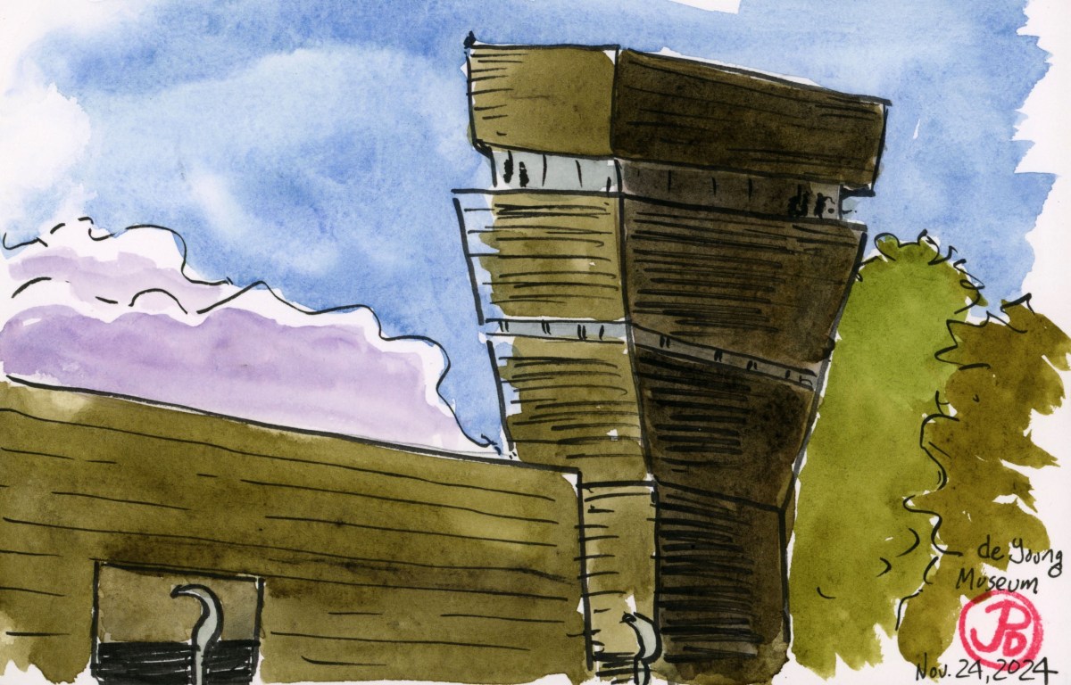
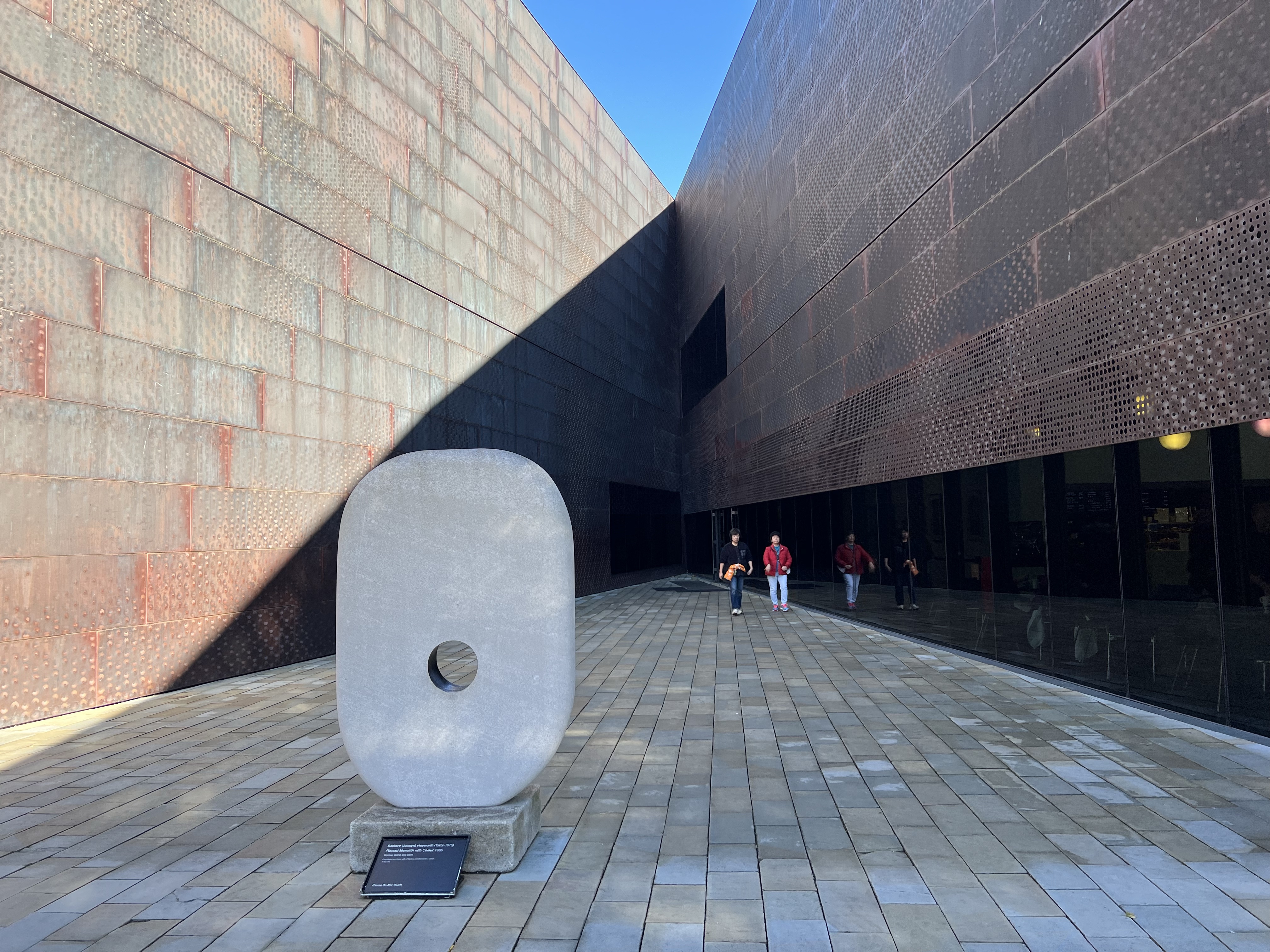
The museum was founded in 1895. It moved to its present site in Golden Gate Park in 1919.
The building was damaged in the 1989 Loma Prieta Earthquake and was demolished. The museum was rebuilt in its current form in 2005.
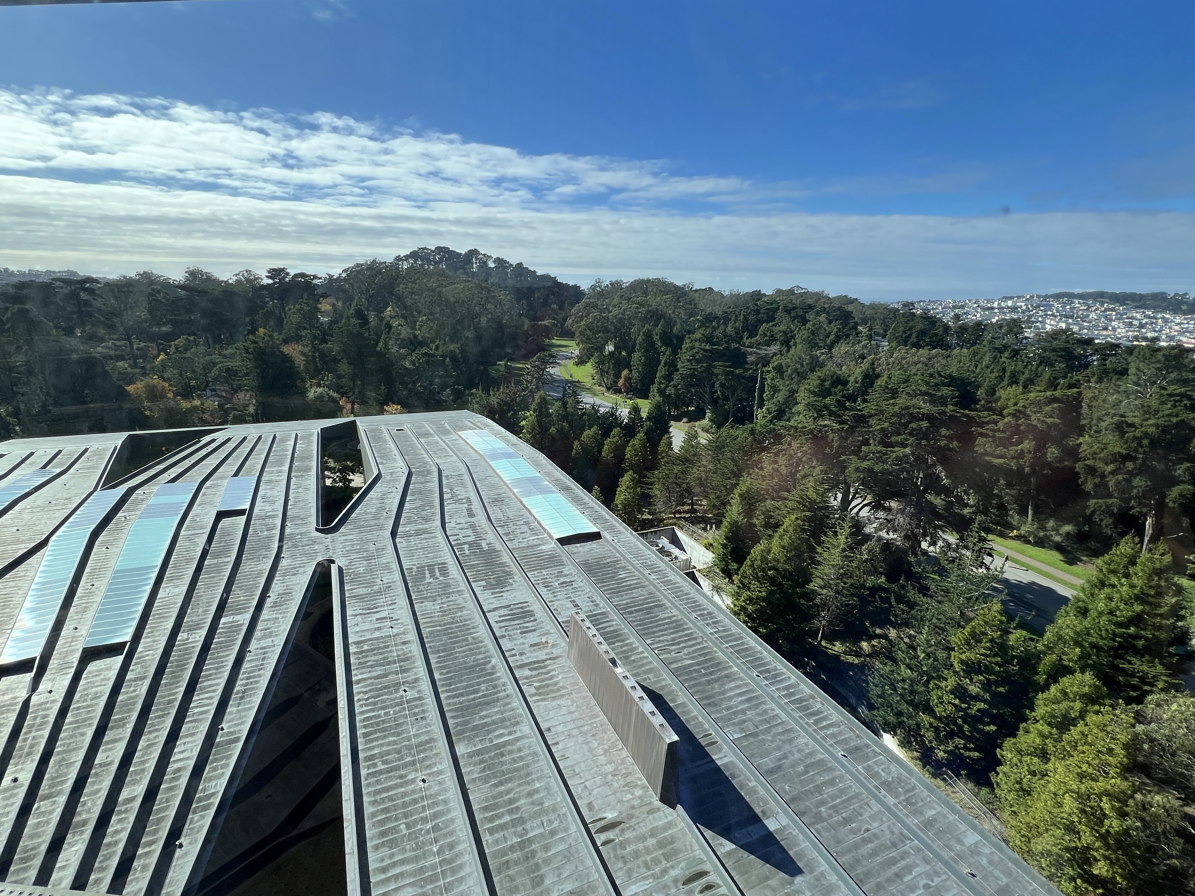
Looking west from the tower with the galleries of the de Young.
I admit that I wasn’t a fan of the new building. But the view from the top is amazing. The building is slowly growing on me.
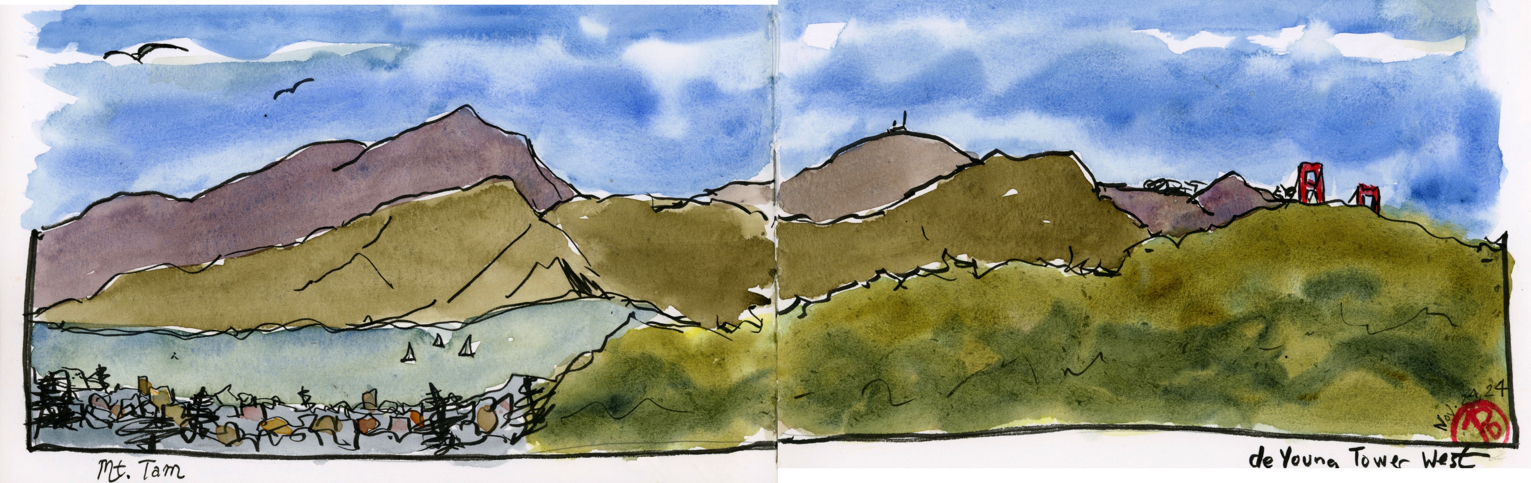
On a recent visit I did a western facing sketch from the top of the de Young tower of the Golden Gate and the Marin Headlands (below).
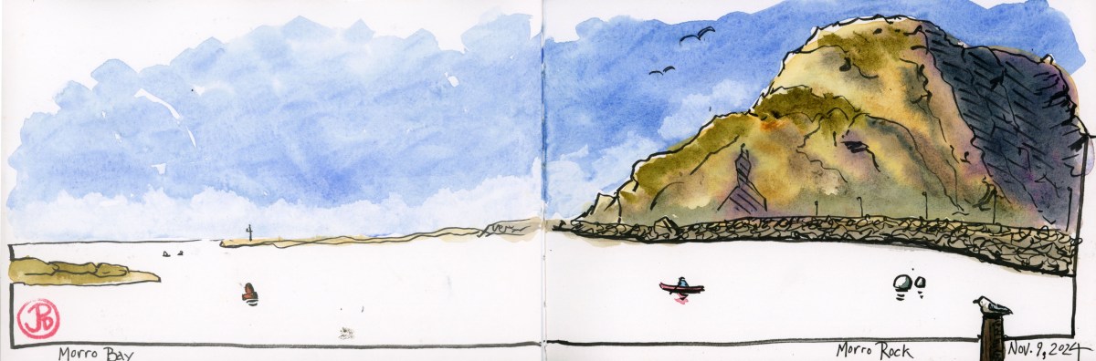
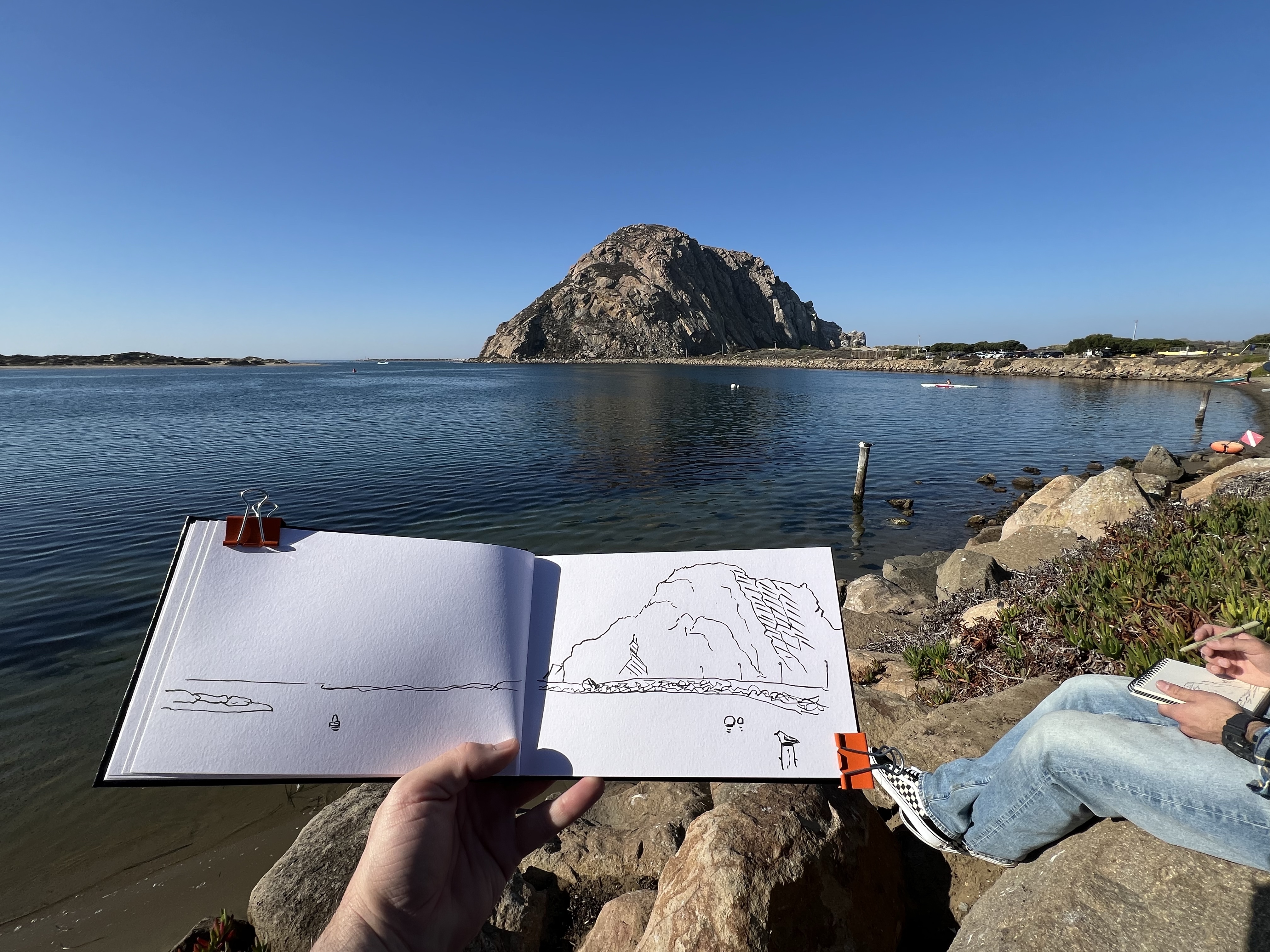
On a SLO Saturday morning with a breakfast at the Copper Cafe at the Madonna Inn (celebrity sighting: Steve Perry), Grasshopper and I headed out west past the Men’s Colony to do some birding-hiking-sketching at Morro Rock.
The 581 foot tall Morro Rock is a volcanic plug on California’s coast. A volcanic plug is the extinct neck of a volcano. It is a prominent landform that is a beacon for wildlife. The extinct volcano formed about 23 million years ago.
We birded around the rock. Avian highlights included white-throated swift, Bewick’s wren with common loons on Morro Bay and willets, black oystercatchers, and brown pelicans on the breakwater.
Around the base of the rock were “No Climbing” signs because Morro Rock is a peregrine falcon reserve. On our visit there were no signs of peregrine falcons.
Sketching Morro Rock with Grasshopper.
We left the trailhead and found a sketching perspective with Morro Bay in the foreground and found a sketching boulder to sketch from (featured sketch).
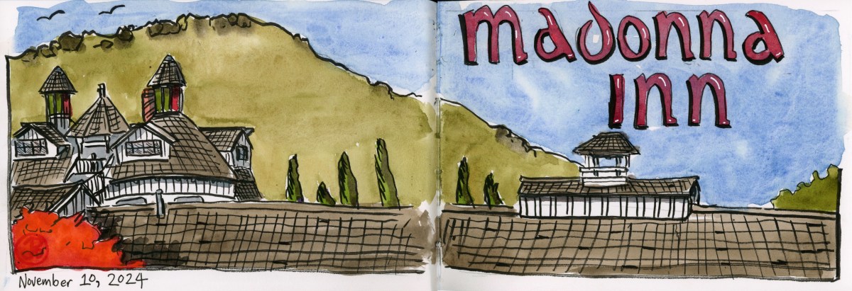
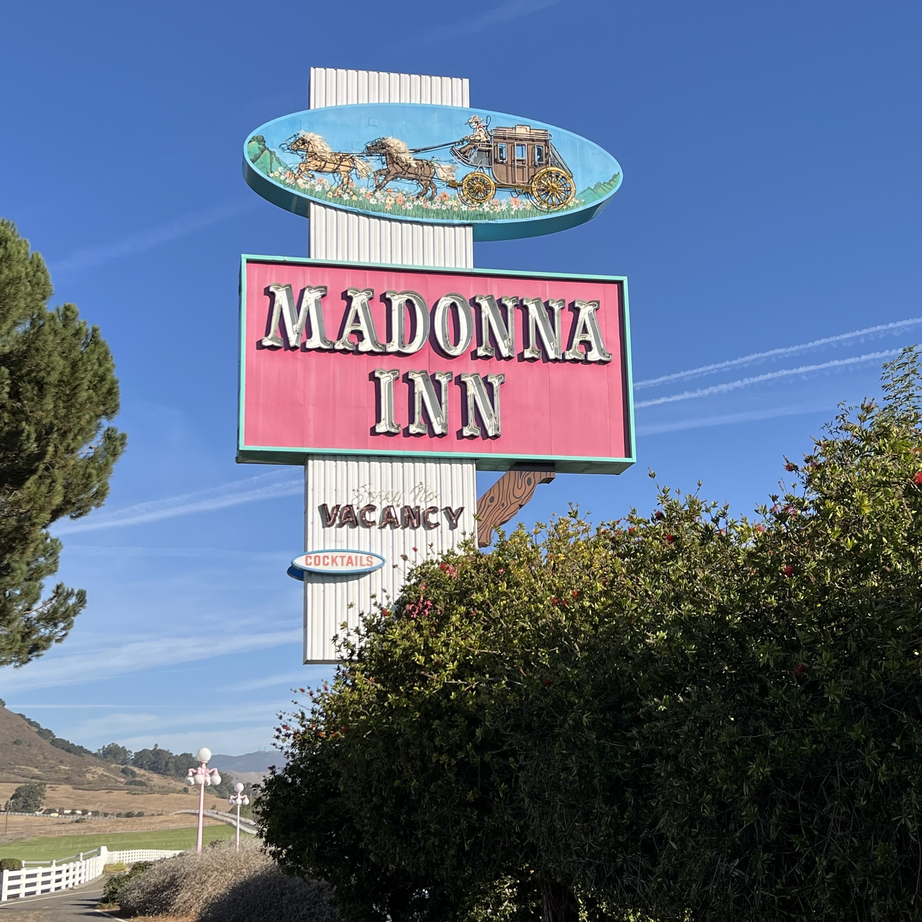
A friend’s 50th Shindig in San Luis Obispo provided me the opportunity to stay at the historic Madonna Inn for the first time.
The roadside hotel was opened in 1958 and has grown to the sprawling compound that it is today featuring five buildings on its 1,500 acre site.
The Madonna Inn sign calling visitors in from Highway 101. San Luis Obispo lies between San Francisco and Los Angeles.
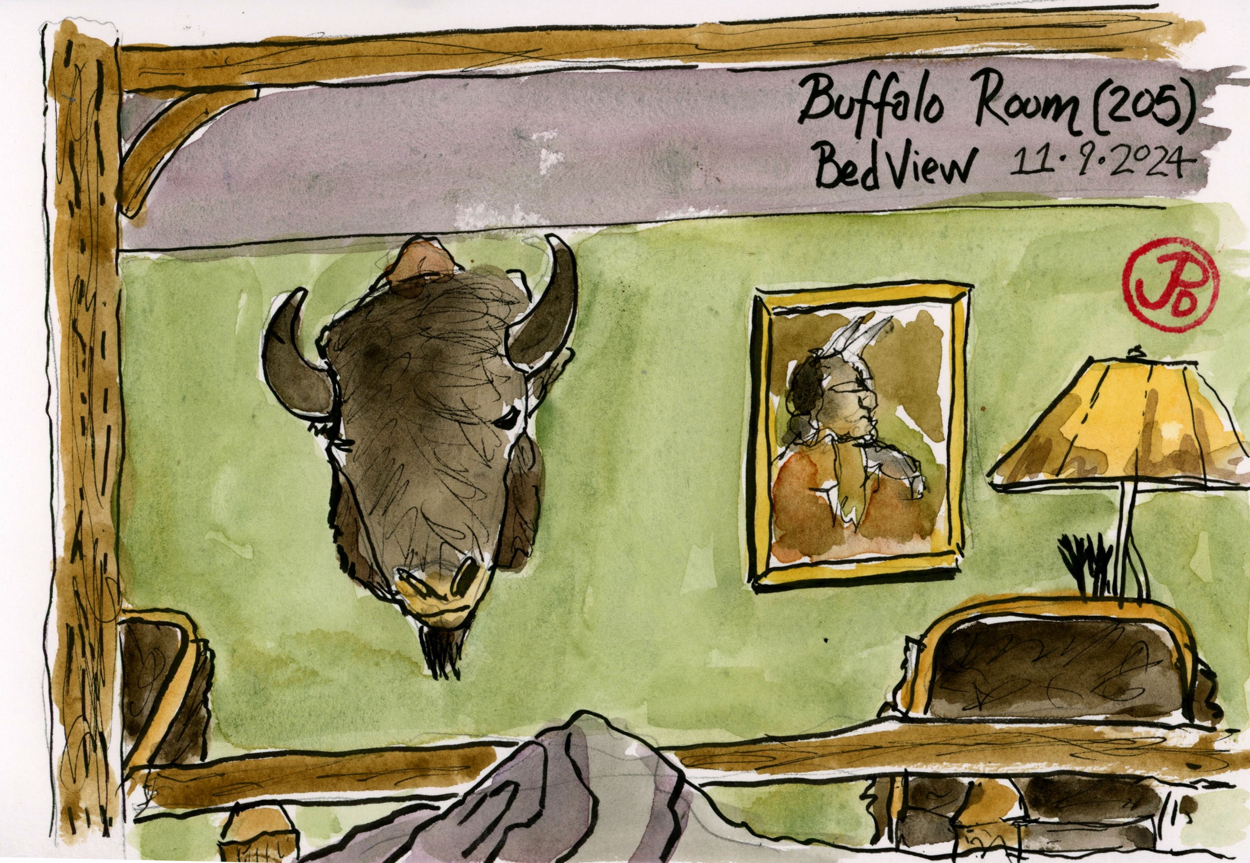
The hotel is known for its oddball decor, its hot pink accents, western murals, and 110 themed rooms.
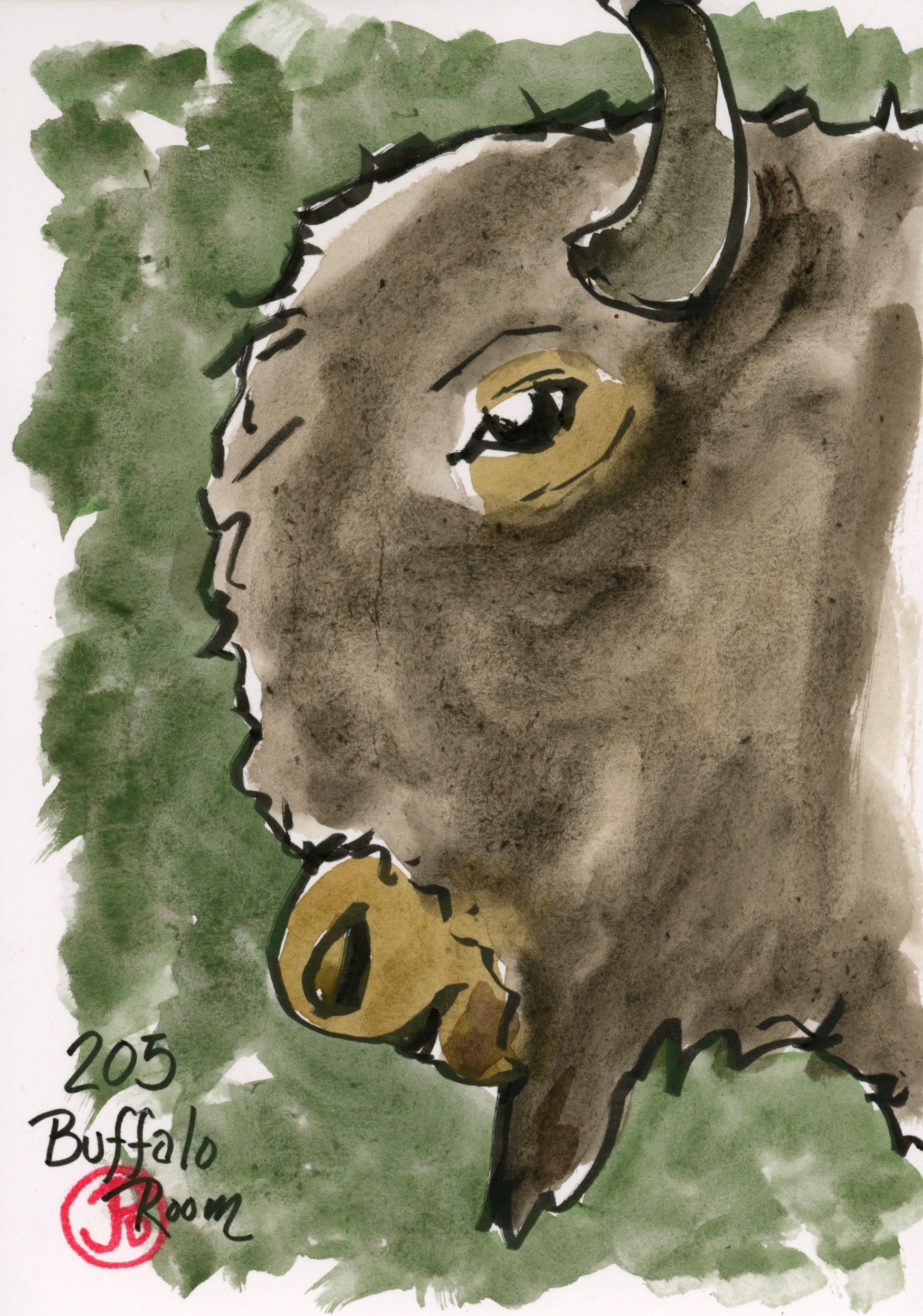
I was staying in room 205, the Buffalo Room. The room has western/Native American themed accents, a rustic wooden four poster bed, and a huge American bison head hanging on the wall. This was sketcher’s paradise.
I just hoped the bison head didn’t give me nightmares!
A bed sketch from room 205. Buffalo head detail. It seems to be looking at you no matter where you stand in the room.