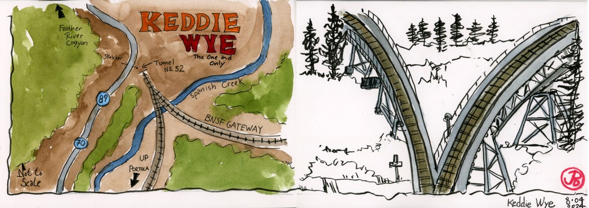
I arrived a few hours early in Martinez before meeting my friend for lunch. I wanted to do some sketching around the Martinez AMTRAK Station.

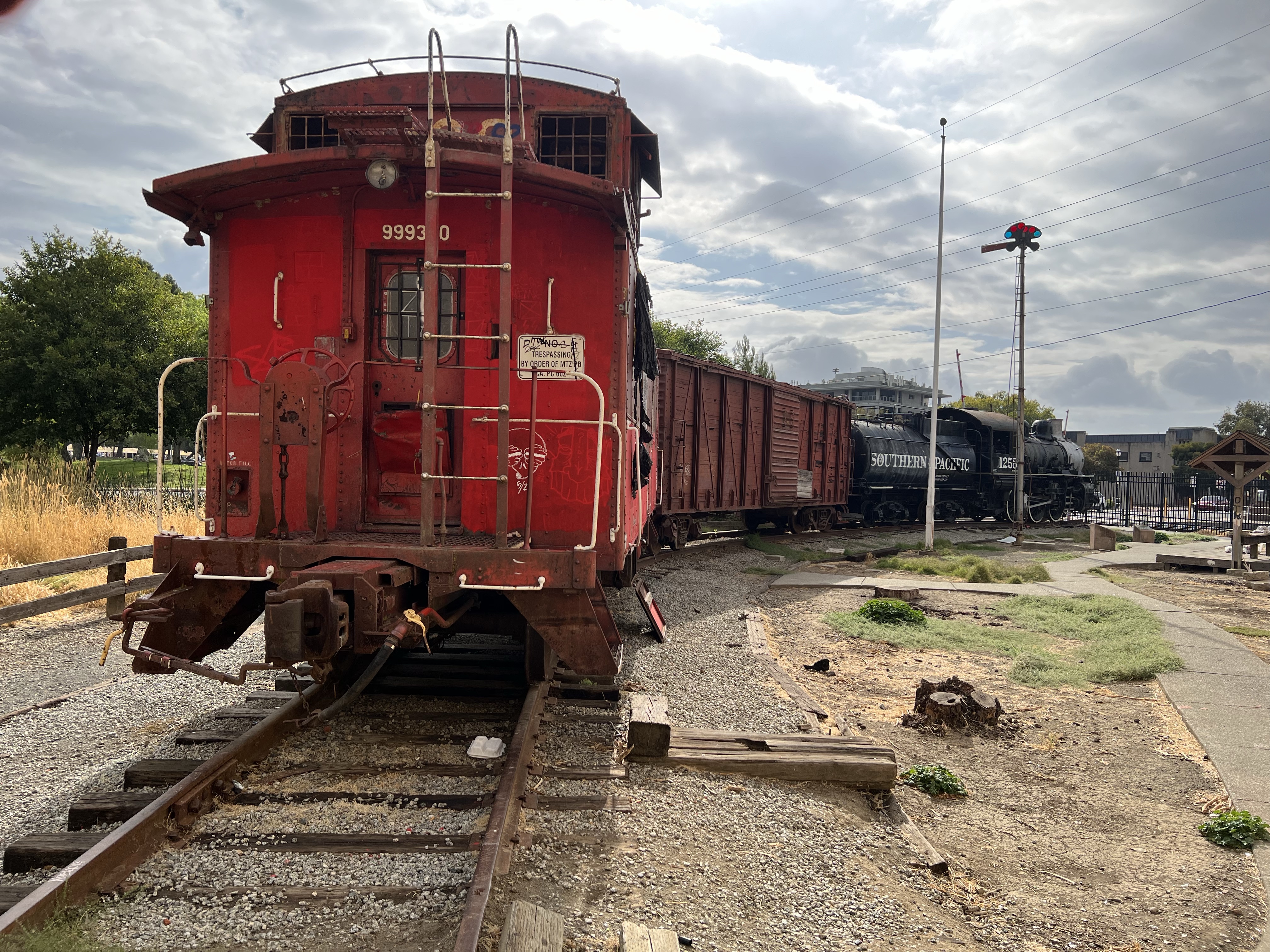
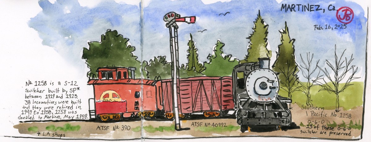
On my last visit I wanted to sketch the Southern Pacific locomotive, with its odd consist of Santa Fe cars, on static display across from the station but I didn’t get around to it. I wanted to add it to a spread on my next visit (featured sketch).
Southern Pacific No. 1258 is an S-12 switcher steam locomotive built at the SP shops in Los Angeles. 38 locomotives where built in this class and there are 13 0-6-0 SP switchers preserved, more than any type of Southern Pacific locomotive built.
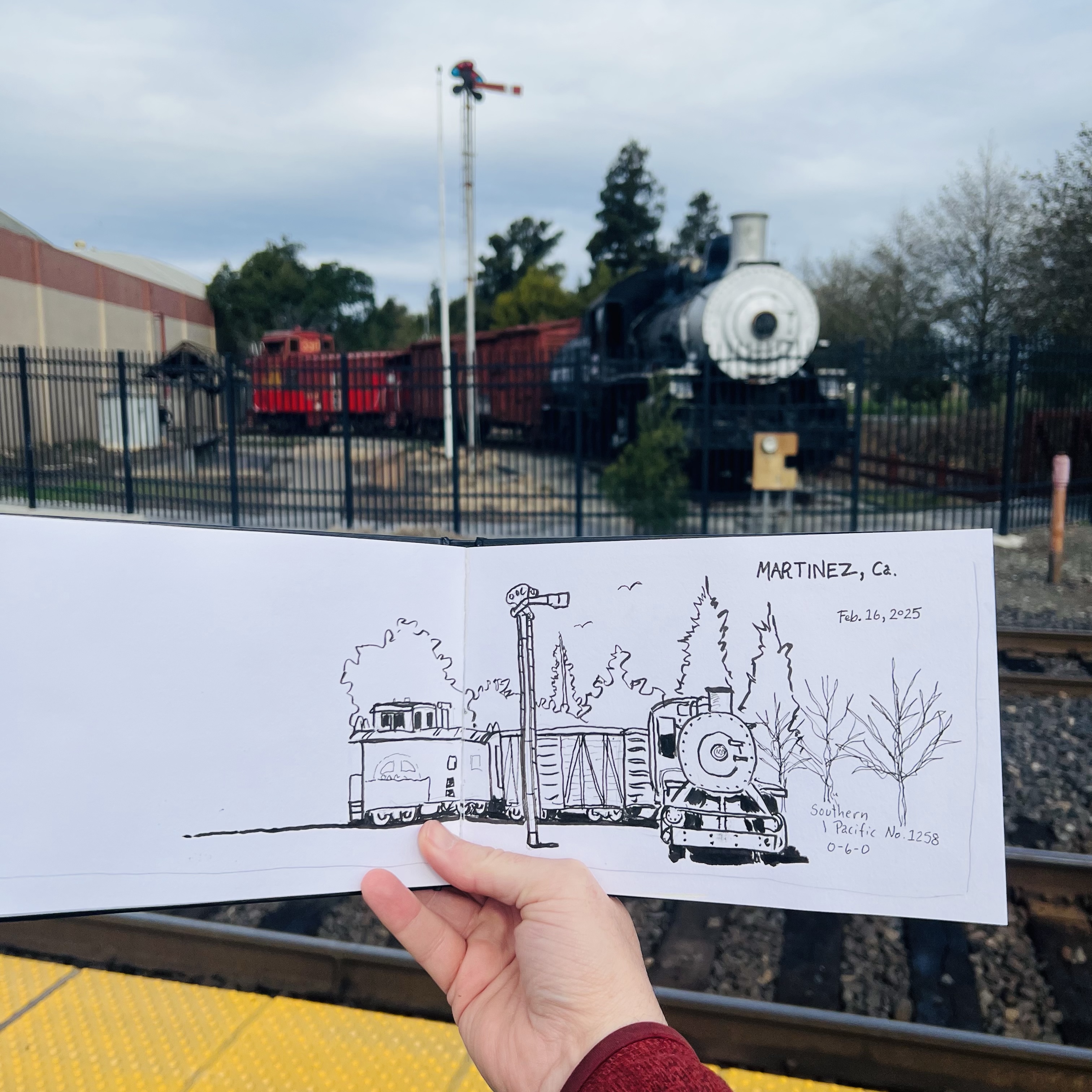
Switchers are not sexy nor classy like the GS locomotives. There epitomize function over form. The real workhorses of the Southern Pacific freight yards.
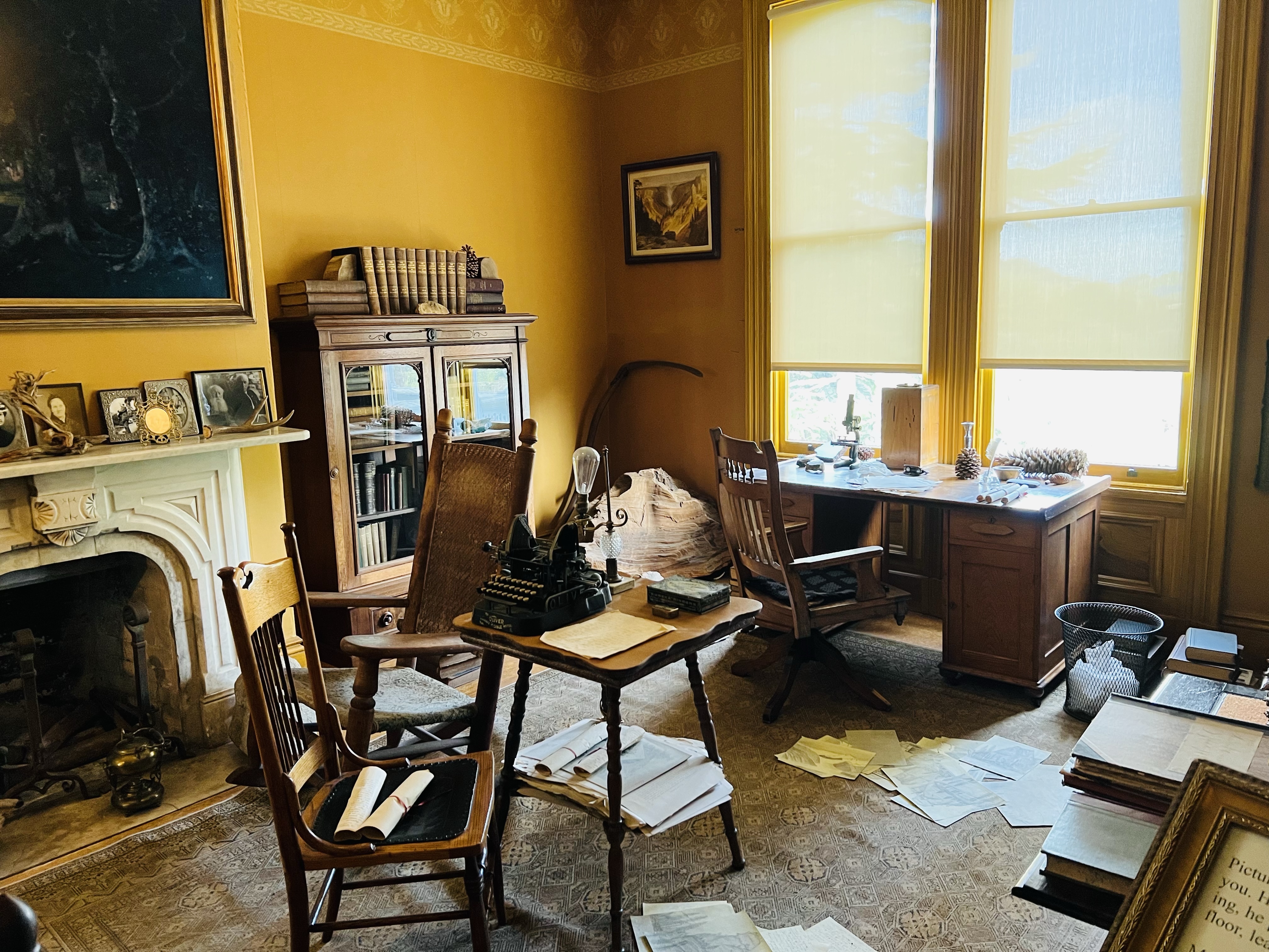
After sketching 1258, I headed to the other side of town to sketch the house of Martinez’s most famous resident.
This resident is the writer and naturalist John Muir. He lived here among the fruit orchards with his wife and family.
Muir married into the Strentzel family in 1880. The Strentzels had been farming the land, mainly fruit ranching, since the 1850s. Muir lived here, except when he was off traveling, from 1880 until his death in 1914.
I knew I wanted to do a sketch of the 1882 Italianate house but I needed to find the right perspective.
The touchstone for my sketch was the not-so-giant sequoia that Muir planted years ago. The tree has failed to live up to its name in the Martinez climate.
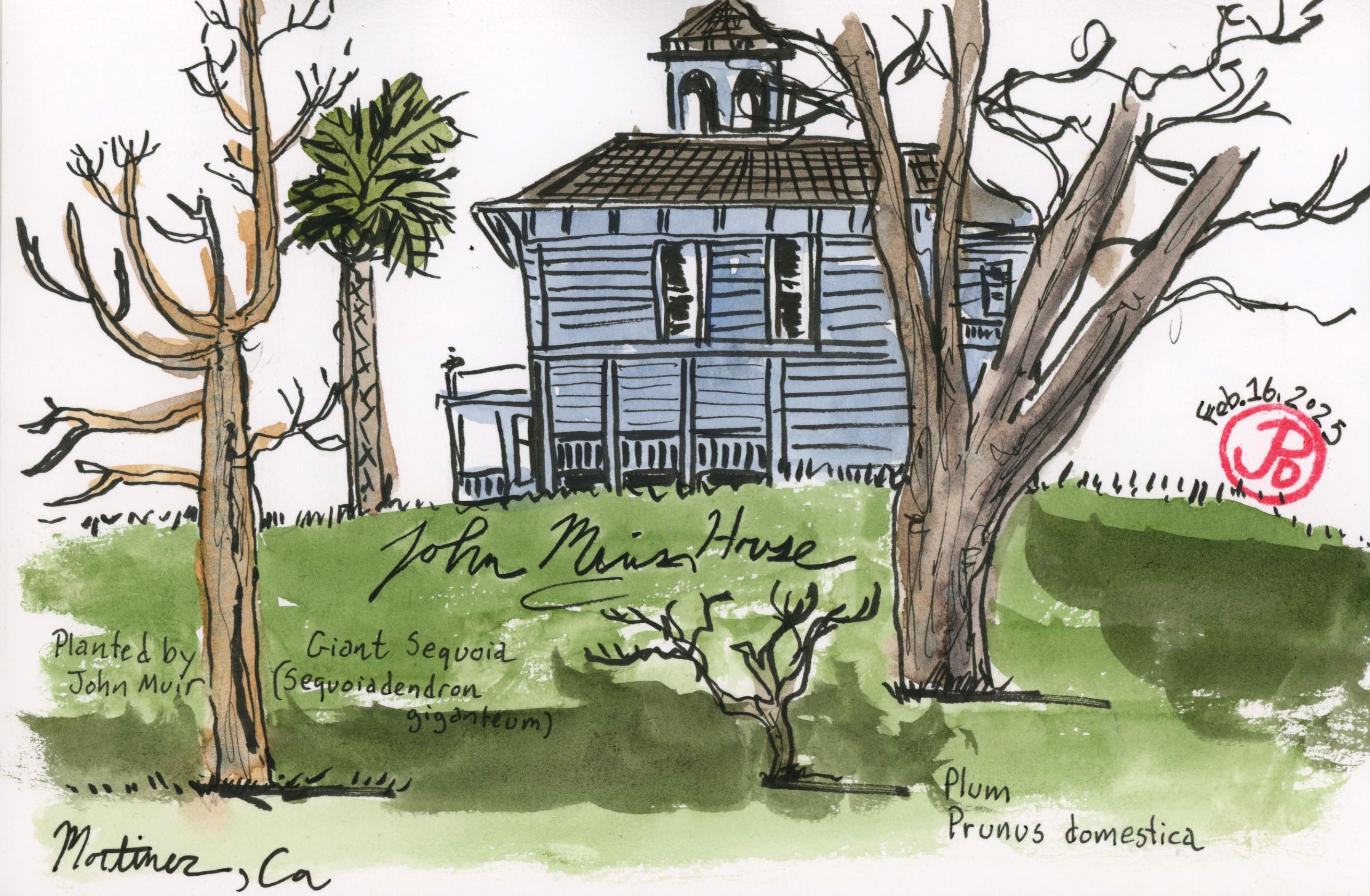
I found a bench with the sequoia in the foreground and the Muir House in the background up the hill.