Just north of the Victorian town of Ferndale is the small Humboldt County town of Lotleta (population 783).
The name of the town is shrouded in a bit of mystery but the name is supposedly the Wiyot word for “pleasant place at the end of the tide water” or according to Wikipedia, “Go f___ yourself “ or “Let’s have intercourse”. So many varied derivations! Take your pick.
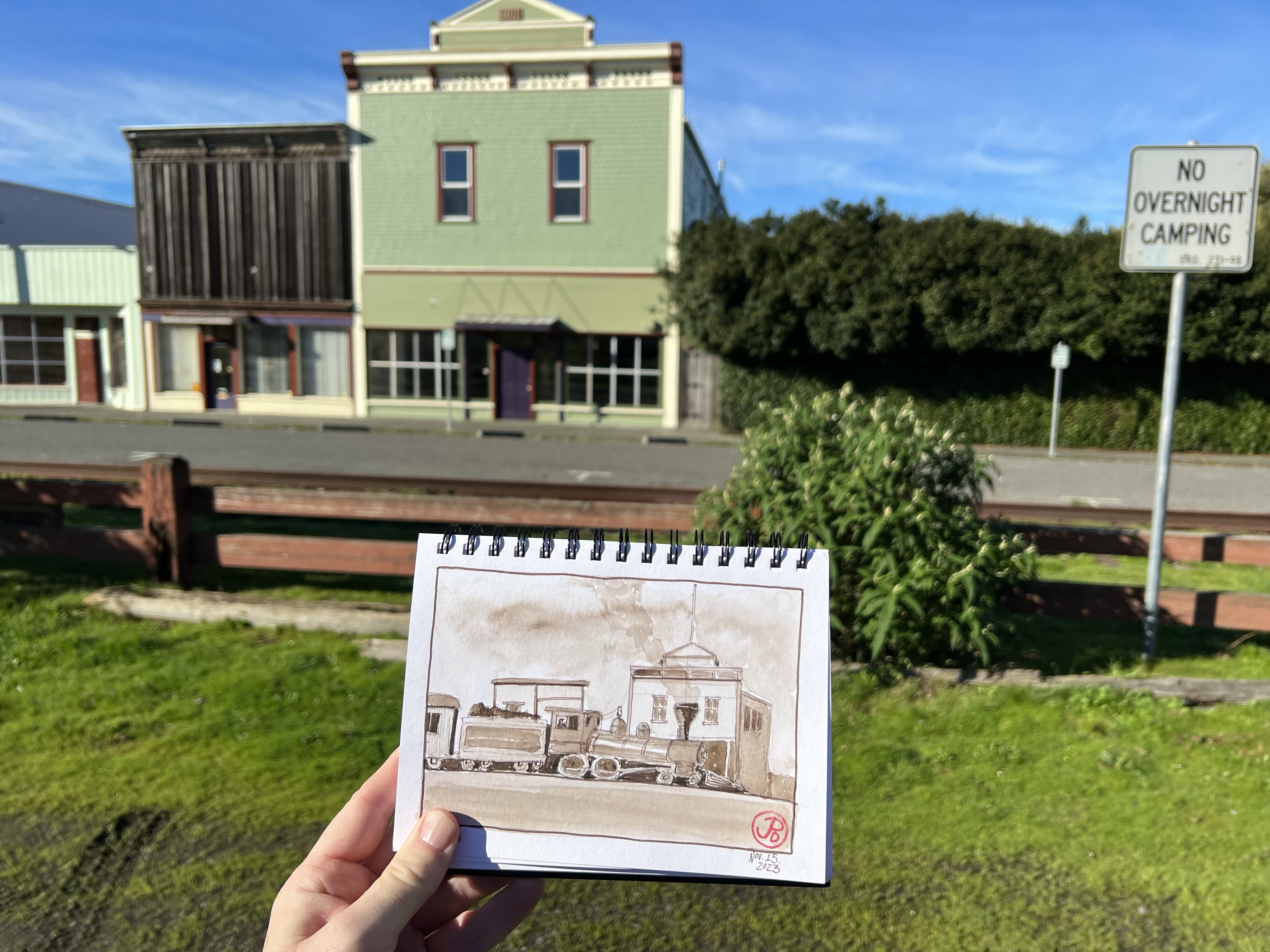
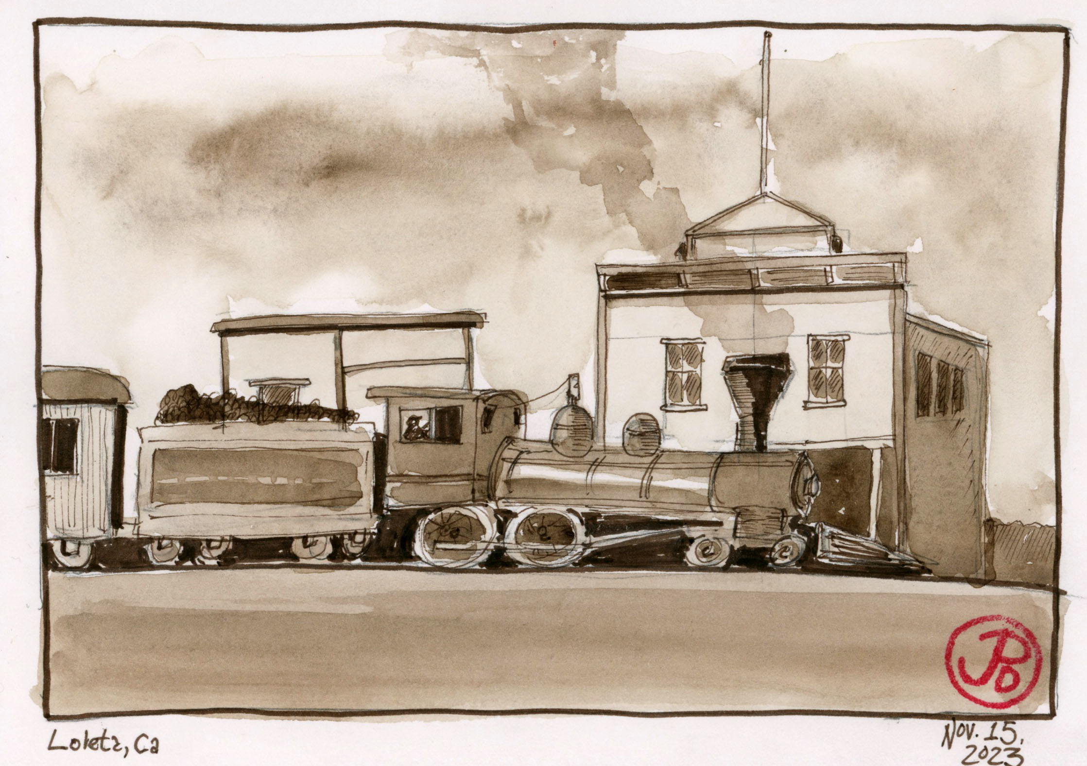
A pre-trip sketch from a vintage photograph. Parts of Loleta have changed very little over the ages.
Through the center of town runs the rusted rails of the Northwestern Pacific Railroad (NWP). Dairy was a very big in this part of Northern Californian economy and this area supplied San Francisco with dairy products. The railroad played a big part in transporting dairy to markets south.
There is a “hiking trail”, much overgrown, along the rails to the abandoned Loleta Tunnel (Tunnel No. 40). I was about to set off on an adventure!
I think this is where the hiking trail begins to the Loleta Tunnel (hard to tell from the sign). In the background is the NWP line. At the grade crossing, the sign reads, “ TRACKS OUT OF SERVICE”.
I set out on the hiking “trail”or the “ING RAIL” which was following the route north of the Northwestern Pacific right of way. In many places the rails were swallowed up in mud or vegetation or both. The Loleta Tunnel was about a mile from “downtown” Loleta. Near the tunnel was a washed out trestle over a small ravine, leaving the NWP rail suspended in midair. Perhaps this is a just metaphor for the hopes of restoring rail to this part of California.
The suspended trestle.
I did not attempt to cross the trestle (or lack of a trestle) but a path had been worn down one side of the ravine and up the other. From here is was a short but muddy slog to the south portal of the Loleta Tunnel.
The Loleta Tunnel runs under Highway 101. This is the much decorated south portal.
Before I headed up to Loleta I did two historic sepia sketches based on period photographs when steam locomotives rumbled through the small town (featured sketch). Parts of Loleta are very recognizable to this day.
Just south of Willits on an unassuming county road is Ridgewood Ranch.
First established as a ranch in the 1850s, the ranch was given the name Ridgewood Ranch by its second owner, Rench Angle in 1859. Angle increased the size of the ranch by buying up surrounding land for $3.25 an acre.
The next owner of note, and the reason for my visit, was multimillionaire Charles S. Howard, who bought the ranch in 1919.
Howard came to San Francisco with 21 cents in his pocket. He worked his way up to become one of Buick’s best salesmen of all time. He ran many Buick dealerships in the west at the rise of the age of the automobile.
On the streets of San Francisco, cars began to replace horses as the motive power of the day. This is ironic because of a purchase he made in August of 1936 for the sum of $8,000.
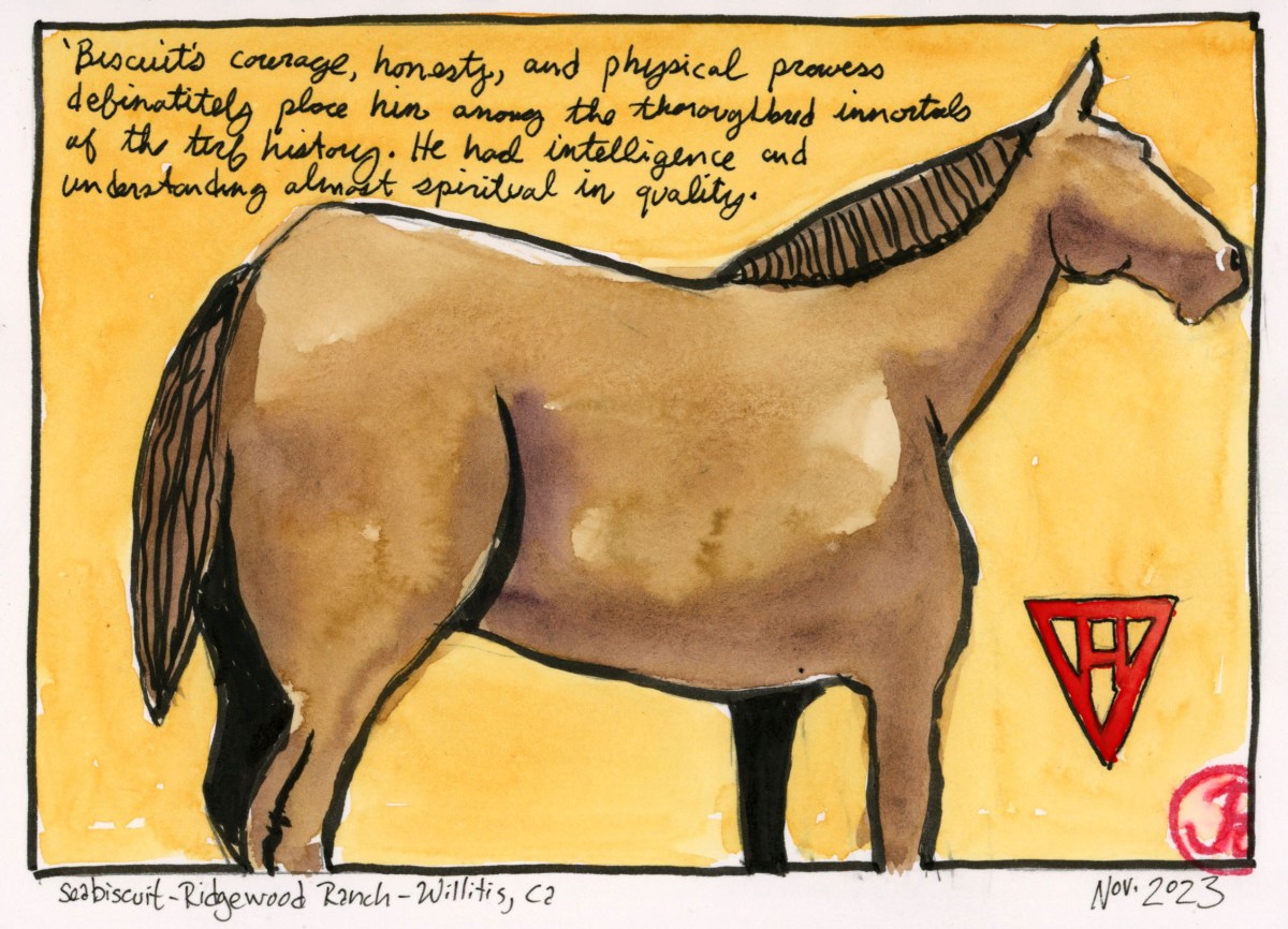
This was the famous thoroughbred Seabiscuit which won many races in the 1930s, lifting a nation in the depths of the Great Depression. He was voted American Horse of the Year in 1938.
The all-time money winner was retired from racing in 1940. Seabiscuit spent the last years of this retired life here at Ridgewood Ranch. He died May 17, 1947 from a probable cardiac arrest.
Seabiscuit is buried near an oak tree at Ridgewood Ranch. Only the Howard family knows the exact location. Seabiscuit’s final resting place is a closely guarded secret.
Schellville is not really a town, just an intersection of a two lane highway and a country road in incorporated Sonoma County. But this is a very important railroad junction.
This is the last bastion of the once great Northwestern Pacific Railroad (NWP).
Schellville was an important rail junction on the NWP and there is a two mile rail yard south of the former train station.
The Schellville Depot has seen better days, just like the rest of the former Northwestern Pacific system. Now it is used for storage.
This was NWP’s only outlet to the greater Southern Pacific rail network. All passenger and freight traffic from Eureka in Humboldt County south to Willits, Santa Rosa, Petaluma and San Rafael in Marin County, had to pass through Schellville.
At one point, post World War II, 11,000 cars a month passed through the junction at Schellville. Many cars went on, under Southern Pacific steam, to the division point at Roseville.
Over the years, declining passenger and freight service, landslides, and the severe winter floods of 1964, sent NWP on a downward decline. The railroad was operated by Southern Pacific and once SP merged with Union Pacific in the mid-1990s, NWP changed hands many times, holding on to it’s diminished existence.
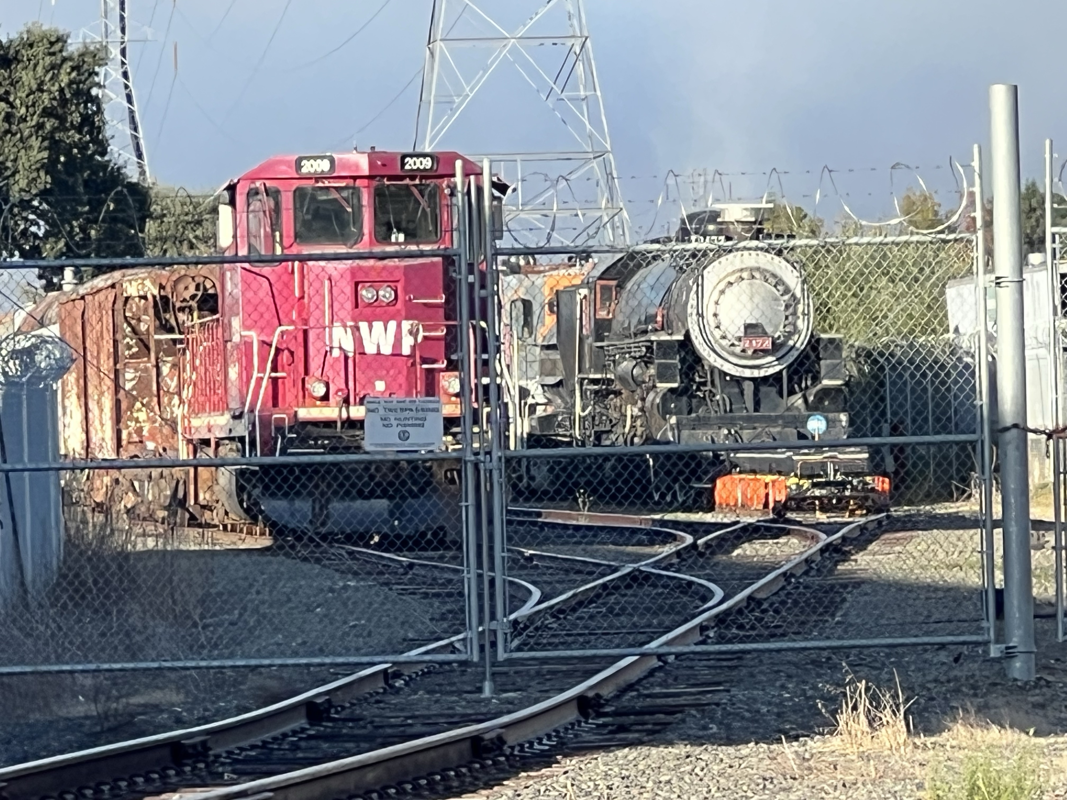
It seemed that the entire fleet of four locomotives where fenced in near the station. This motley collection were painted in the livery of other railroads.
NWP No. 1501 painted in the Southern Pacific “bloody nose” livery.
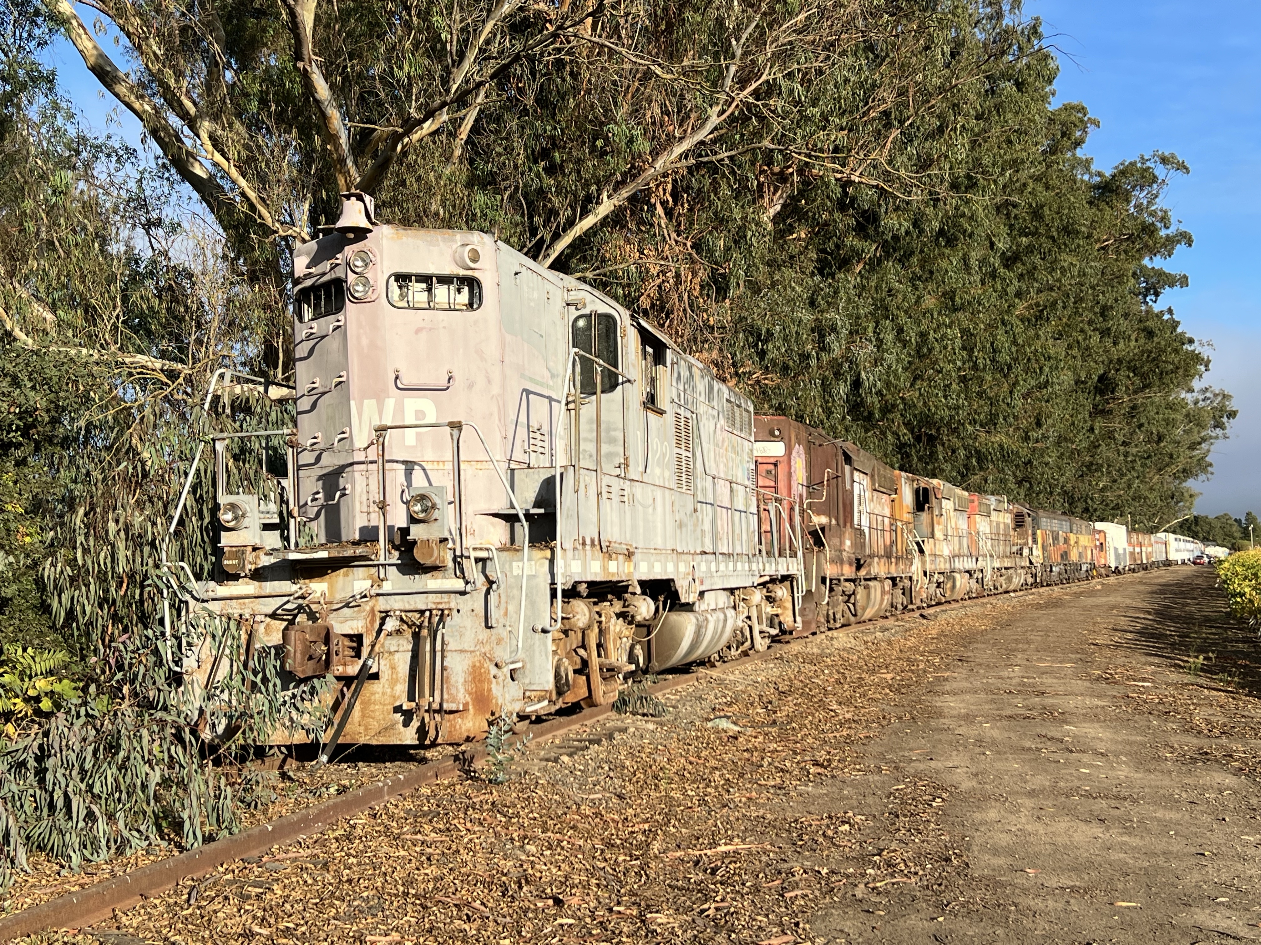
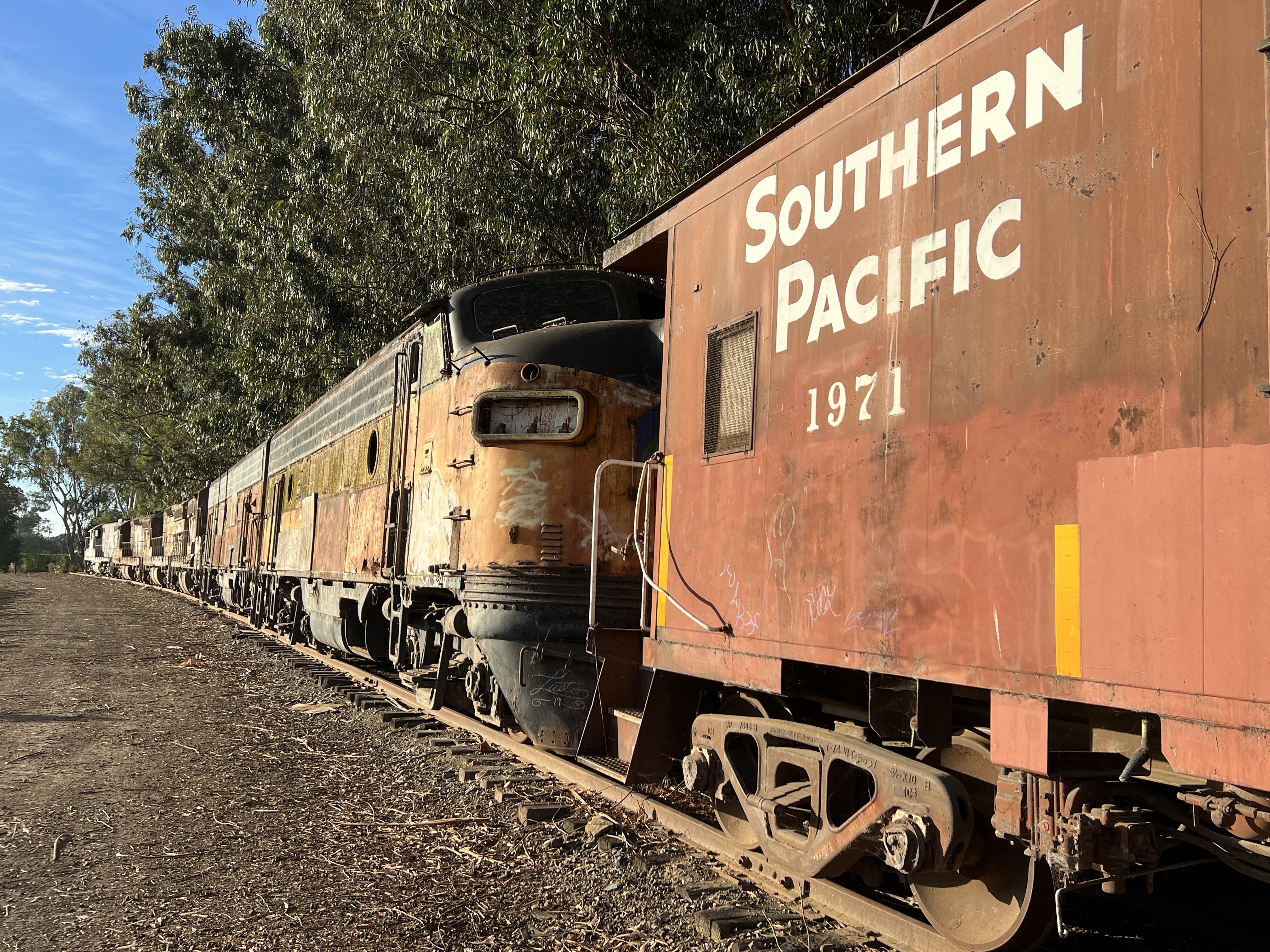
From the Y track at the station I headed north along the line, vineyards flanking either side of the rusted rails. I crossed a short trestle and before me stood a railroad graveyard, a mothballed fleet of NWP and SP diesels and rolling stock.
The mothball fleet is mainly Southern Pacific locomotives and a mix other other rolling stock. The locomotive on point is Northwestern Pacific EMD GP 9 No. 1922, faded and being returned to nature.At the end of the diesels is Southern Pacific caboose 1971. The locomotive coupled to the caboose is the former Bessemer and Lake Erie F7 numbers 718 A and 716 B.
While these locomotives had seen better days I was surprised to see a Southern Pacific Steam Locomotive on a siding across 8th Street.
At first I couldn’t believe my eyes. Could this be one of a handful of operable SP steam locomotives? I could barely make out the road number.
It was P-8 Class No. 2572 a 4-6-2 “Pacific” type built by the Baldwin Locomotive Works in 1921.
2472 was retired in 1957 and donated to the city of San Mateo and put on public display at the San Mateo County Fairgrounds.
In 1976 a group decided to restore the SP workhorse to working order. The group, the Golden Gate Railroad Museum, had 2472 ready for Railfair 91 in Sacramento which feature another Southern Pacific legend, 4449.
For many years 2472 operated steam excursions in Niles Canyon but was moved to Schellville on March 1, 2020.
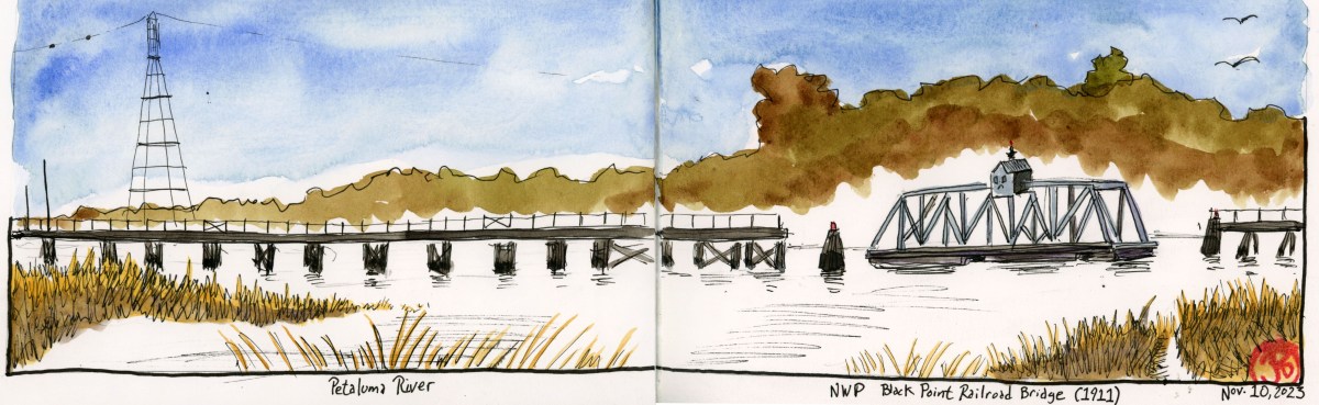
An important bridge that kept Northwestern Pacific Railroad connected with the mainline rail network is the Black Point Bridge.
The 50 foot rail bridge at Black Point is a steel swinging truss bridge that turns perpendicular to the rail line to allow boat traffic on the Petaluma River to pass downstream to San Pablo Bay.
In the days of heavier rail traffic, the bridge was aligned with the railroad but now with fewer freight traffic, the bridge is open to allow river traffic to pass.
The Black Point Bridge, which spans the Petaluma River which is the boundary between Marin and Sonoma Counties, was built in 1911 and then rebuilt in 2011.
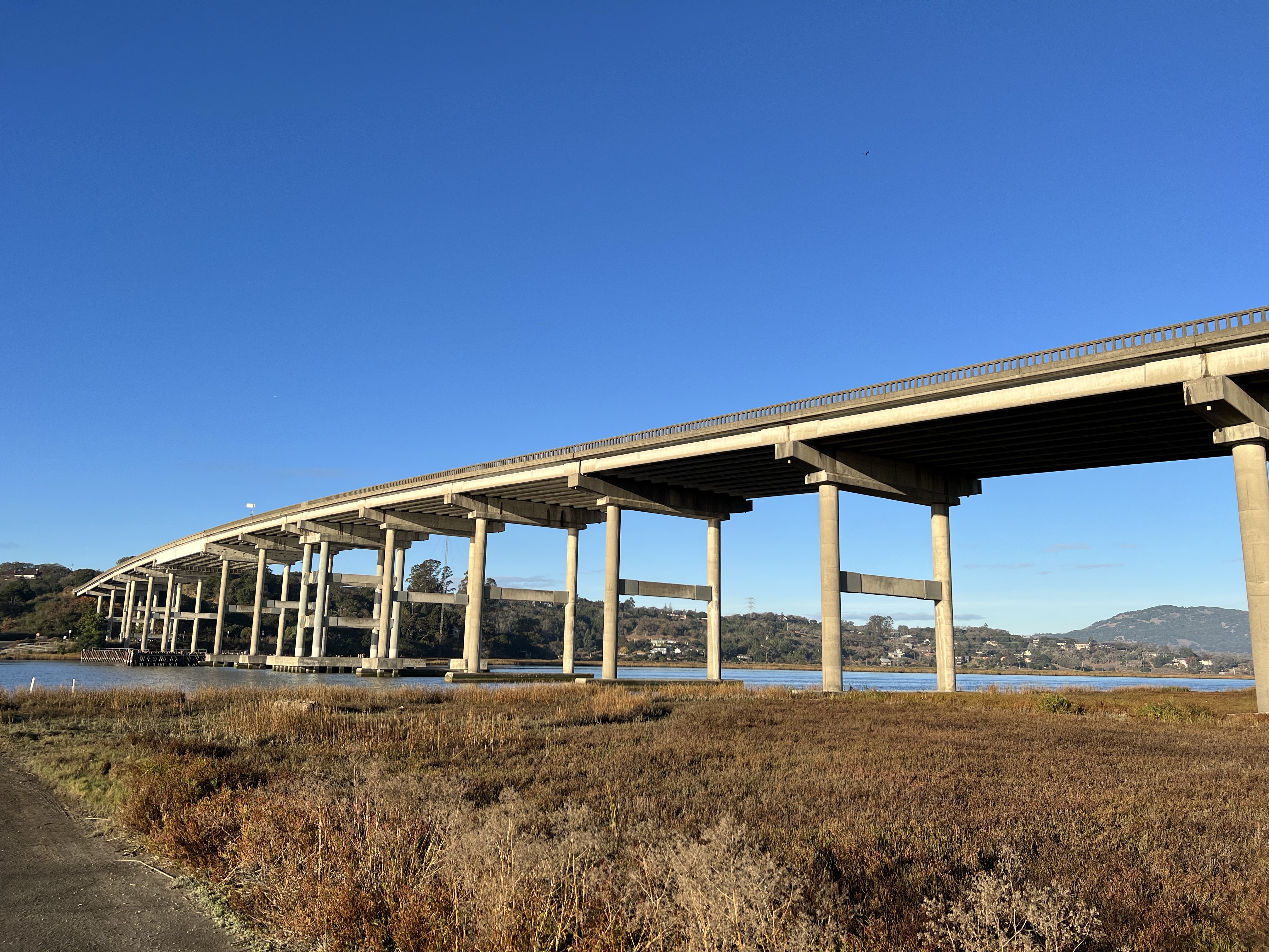
The Highway 37 bridge over the Petaluma River. The Black Point Bridge is just downstream from here.
Atop the bride is the Operator’s House where the bridge operator lived. He was in charge of opening and closing the bridge in the days when all the freight north to Eureka, had to cross this vital span to take freight to the rail junction at Schellville and beyond to the wider rail system. The bridge is now operated remotely.
On either side of the steel span, a wooden trestle reaches out into the river.
The marina at Port Sonoma has seen better days. The boat slips are now empty and the reeds are slowly taking over.
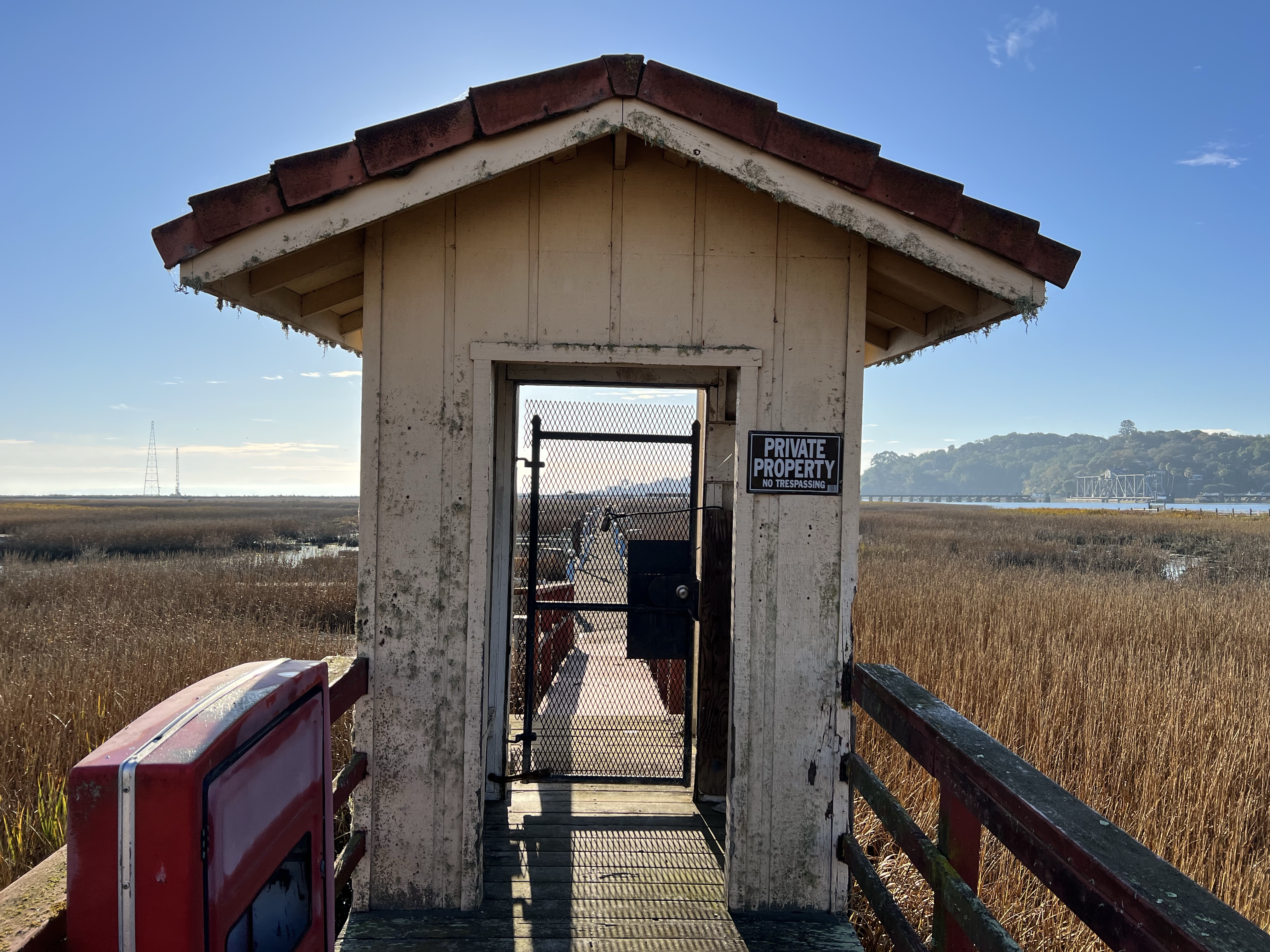
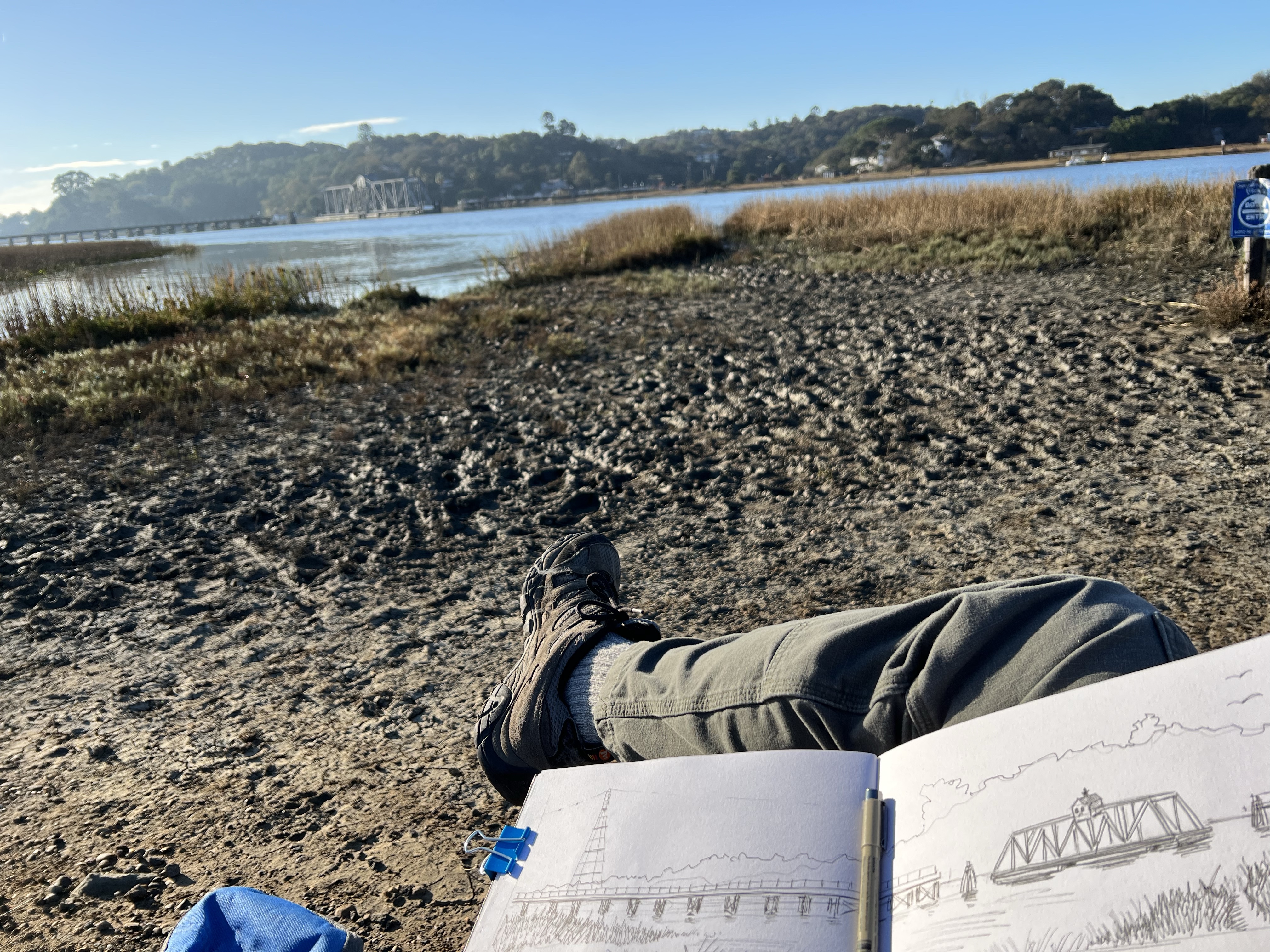
I parked in the overgrown parking lot, walked past the abandoned marina, and then headed down the river trail to find a good vantage point to sketch the bridge.
I parked my sketching chair near the outlet of the marina, took a sip of joe, and started to sketch (featured sketch).
A sketcher’s view and beautiful weather for a morning sketch.
I got to the California State Railroad Museum in Sacramento a little early so I walked over to sketch the replica of the Central Pacific passenger depot. (The former stations had burned down.)
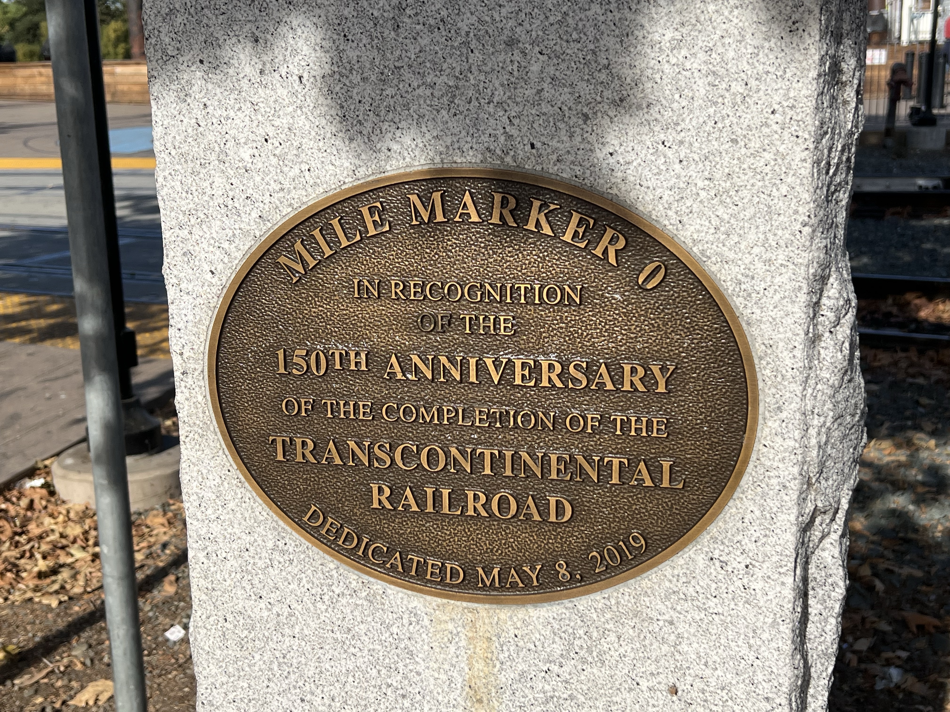
This station is at ground zero from where Central Pacific started the Transcontinental Railroad. Mile Marker 0 was a hundred feet behind me as I sketched.
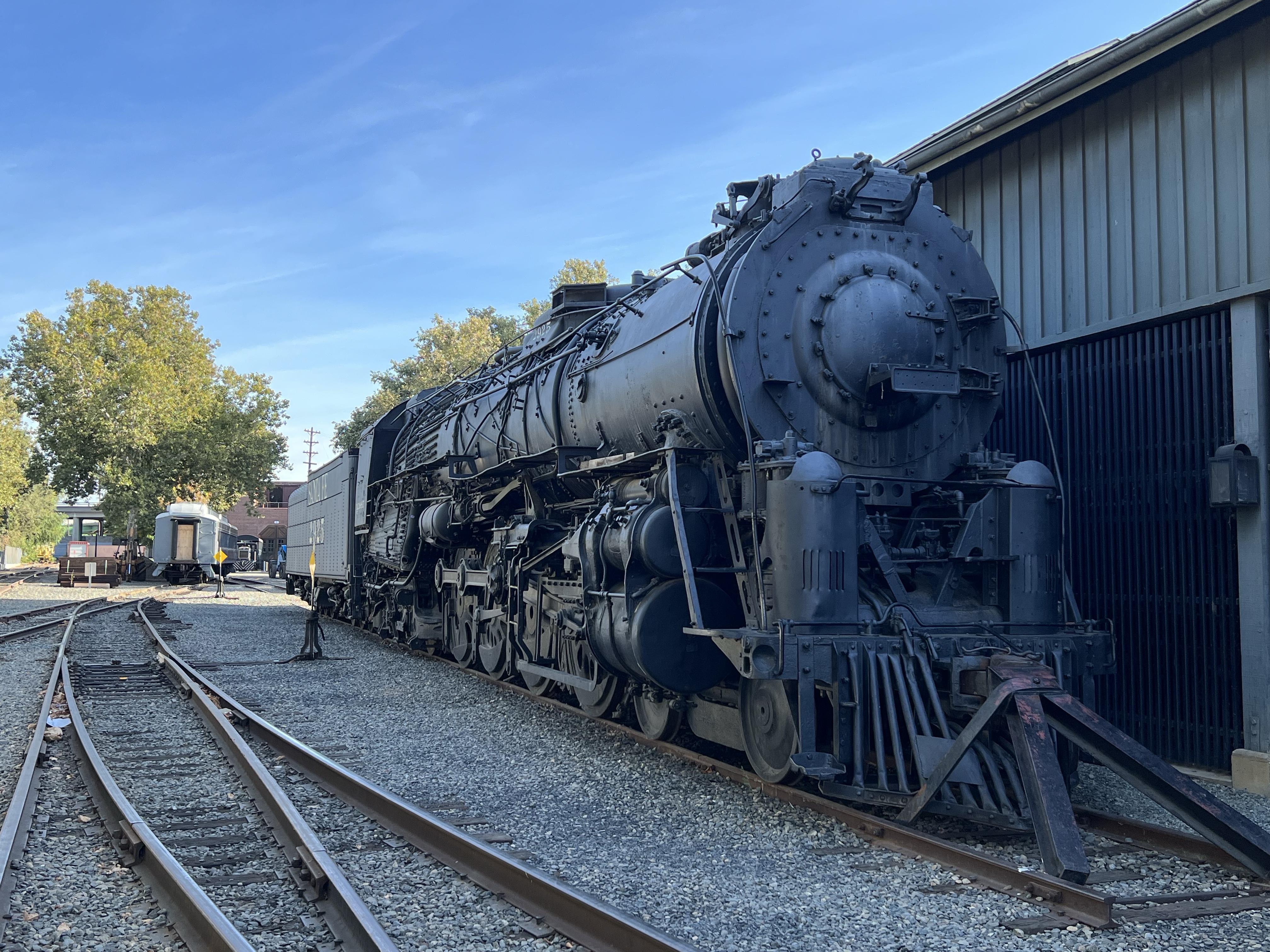
I walked around the depot and looked at two amazing Santa Fe steam locomotives that where sitting on sidings in static display. Both of them had come from New Mexico and both where not in great shape, needing some cosmetic restoration.
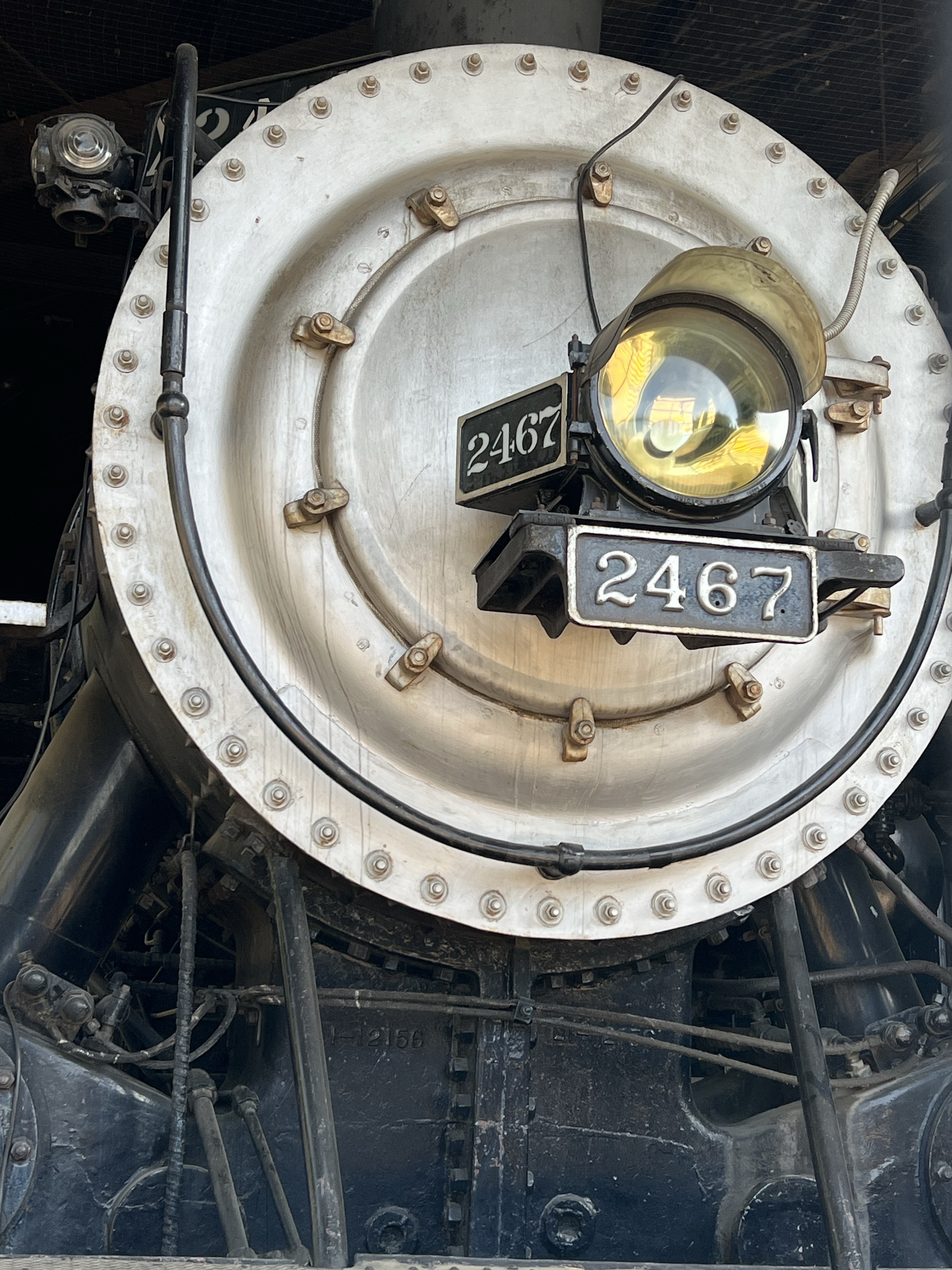
Santa Fe No. 2925 is a 4-8-4 passenger locomotive. This is one of the heaviest 4-8-4 Northerns ever built. Today only five of the 30 produced survive. SP No. 2467 is a 4-6-2 Pacific type build in 1921. She pulled passenger trains and was retired in 1956. The locomotive was restored to working order in the 1990s and is still operational.
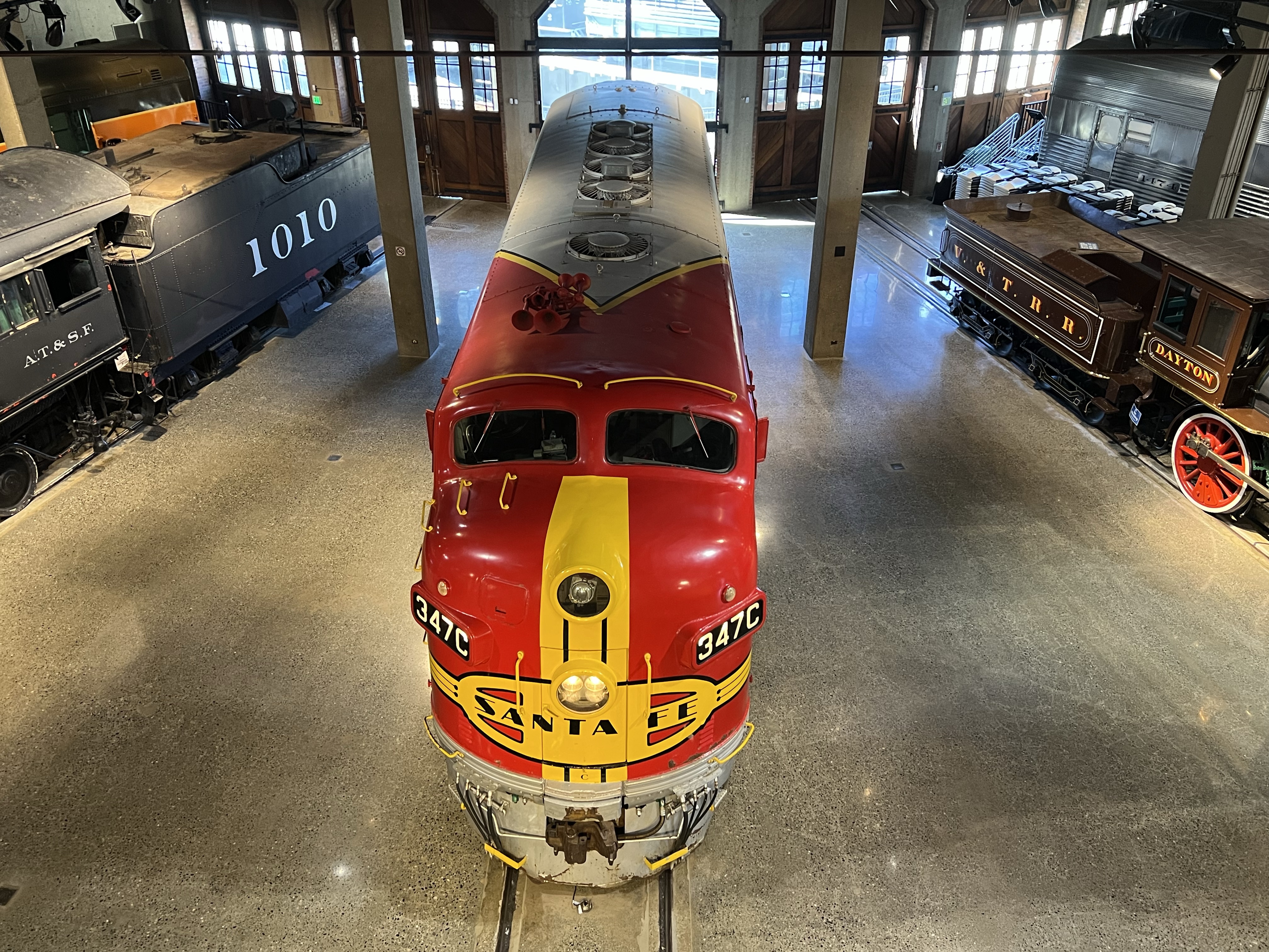
Once in the museum, one locomotive on my sketch list was an EMD diesel-electric F7 painted in the iconic Santa Fe Warbonnet livery.
When I was a child my dad used to take me to the tracks to see passing passenger trains. And one Christmas he got me my first HO train and it was a smaller version of the classic Santa Fe passenger locomotive.
This paint scheme is so famous that if you Google EMD F7, a picture of the Warbonnet F7 comes up.
The iconic Santa Fe units where on point of the 2,227 mile route from Chicago to Los Angeles called the Super Chief. This was one of the first all streamlined diesel cross country route.
Today the only way to get from Los Gatos to Santa Cruz is to drive over Highway 17. You can no longer take a passenger train. The last train ran in 1940.
On the other side of the Santa Cruz Mountains, you can board a train at the Santa Cruz Beach and Boardwalk and it will take you 6.8 miles north into the mountains to the town of Felton.
Detraining here you follow the line past the train shed and machine shop of the Roaring Camp and Big Trees Railroad and the old passenger and freight depot and then you cross Graham Hill Road and walk north on the rails toward Zayante, using the rusty rails as a guide.
The line begins to parallel Zayante Creek. The road builders used the watersheds of the Santa Cruz Mountains as a route to work up and down the summit. A good part of the Santa Cruz to Felton route parallels Santa Cruz County’s largest river, the San Lorenzo.
After a few miles you eventually come to a siding, this is the former stop of Eccles near Olympia Station Road. This was a flag stop as far back as 1901. There was once a passenger shelter (1913) and a freight platform.
The main line and siding at Eccles. The 310 foot siding was probably used to store lumber cars.
The station sign remained in place until 1942, when the station was decommissioned following the abandonment of the the railroad.
After World War II, passenger service was not resumed and the station shelter was torn down. The Eccles sign was saved and was on display at the Santa Cruz Museum of Art and History in downtown Santa Cruz.
Here’s where the Eccles station sign used to be at the Santa Cruz Museum of Art and History. It’s gone, like the rails that once reached over the Santa Cruz Mountains.
One a recent visit to the museum the sign was no longer on display.
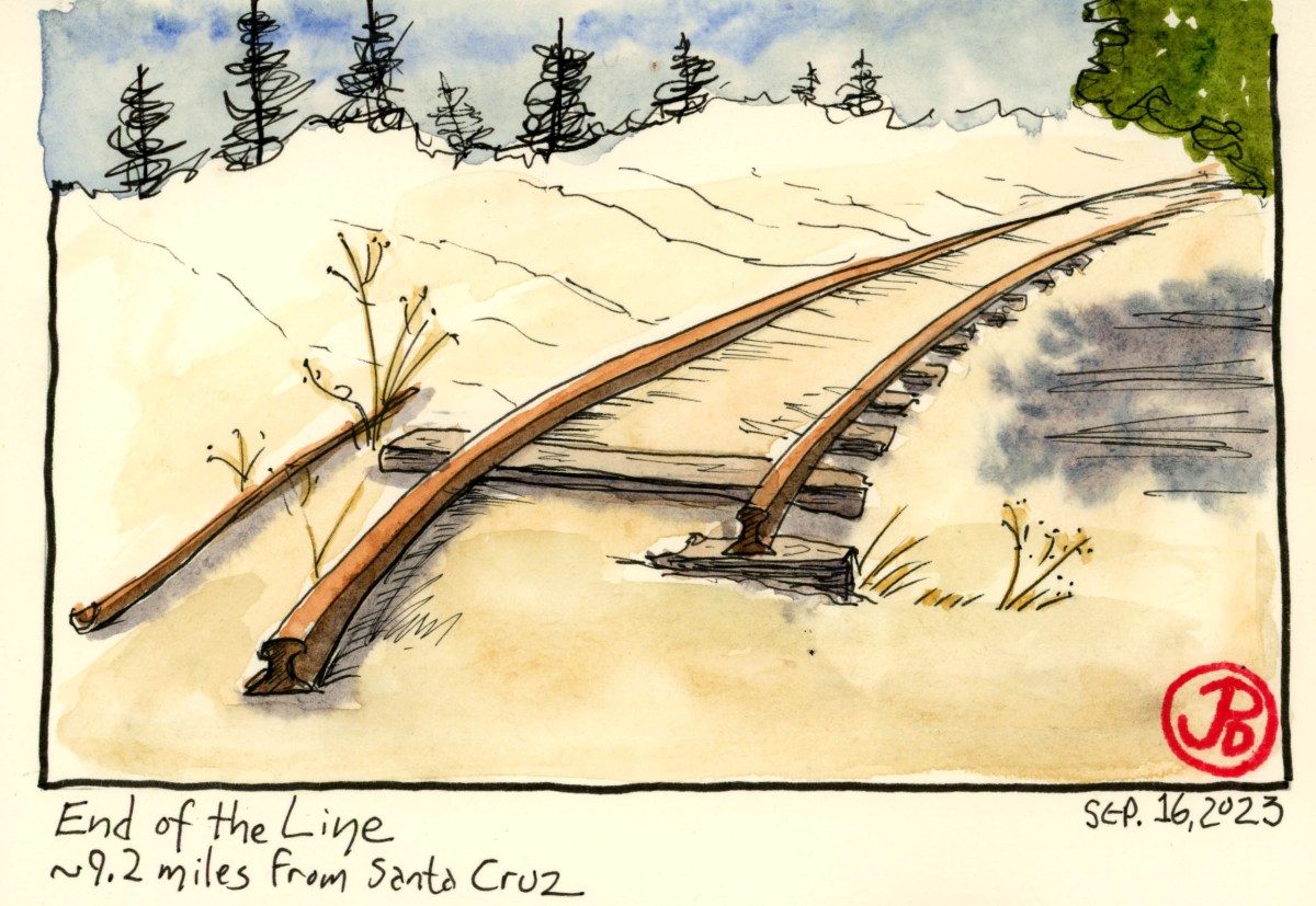
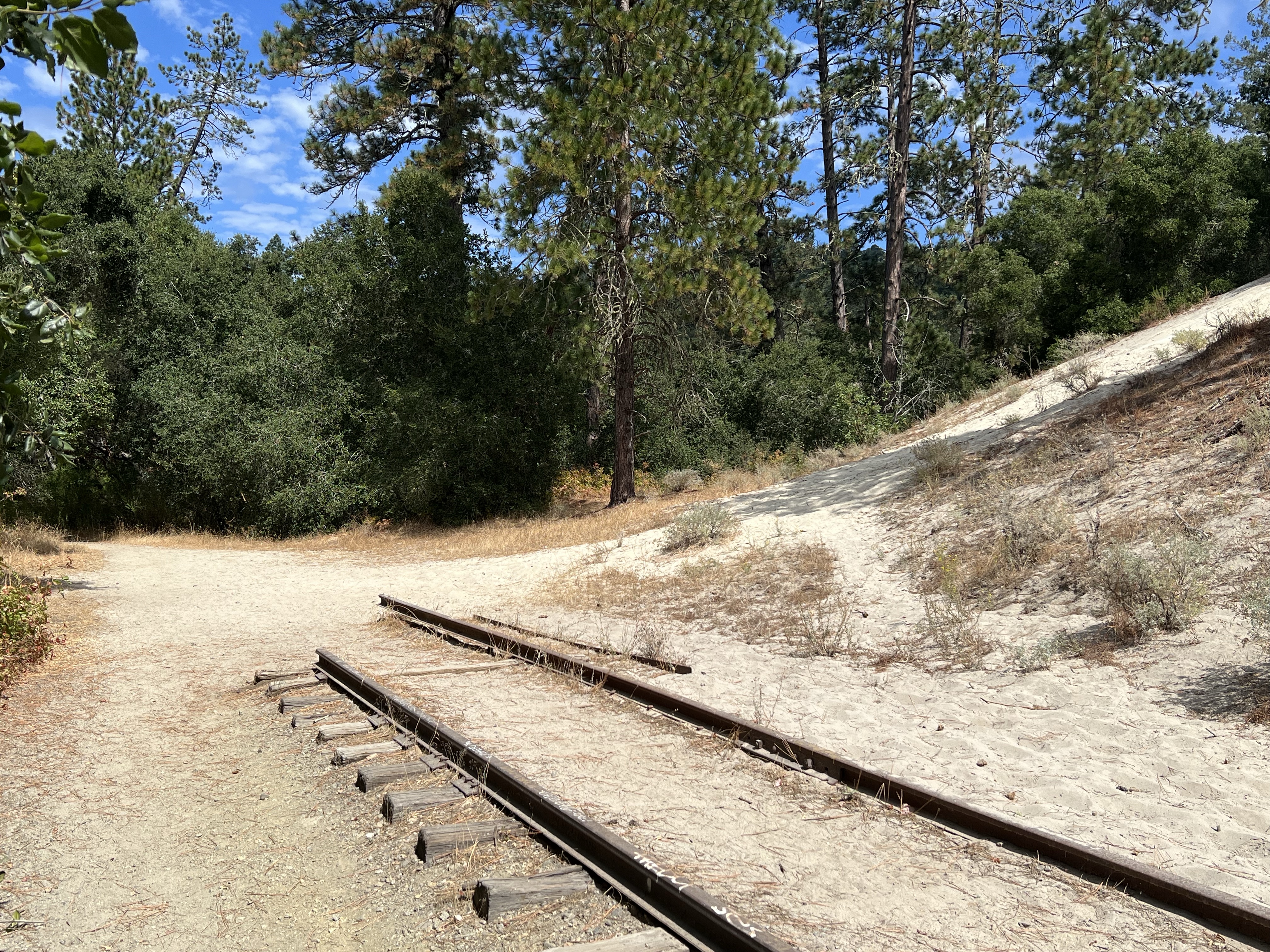
I continued north as the siding rejoined the mainline. And after about a five minute walk, the tracks end without much ceremony. There is no bumper stop to mark the end. And one tail is longer than it’s mate, 4 feet and 8 1/2 inches away.
This is the end of the line and as far north as the tracks go.
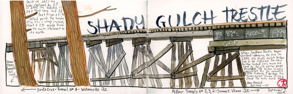
Just up the creek from my cabin is one of the remaining wooden trestles on the former South Pacific Coast Railroad (in 1887 the railroad became Southern Pacific). This is the Shady Gulch Trestle.
Not only does this trestle still exist but is still used for rail service on the Big Trees and Pacific Railway.
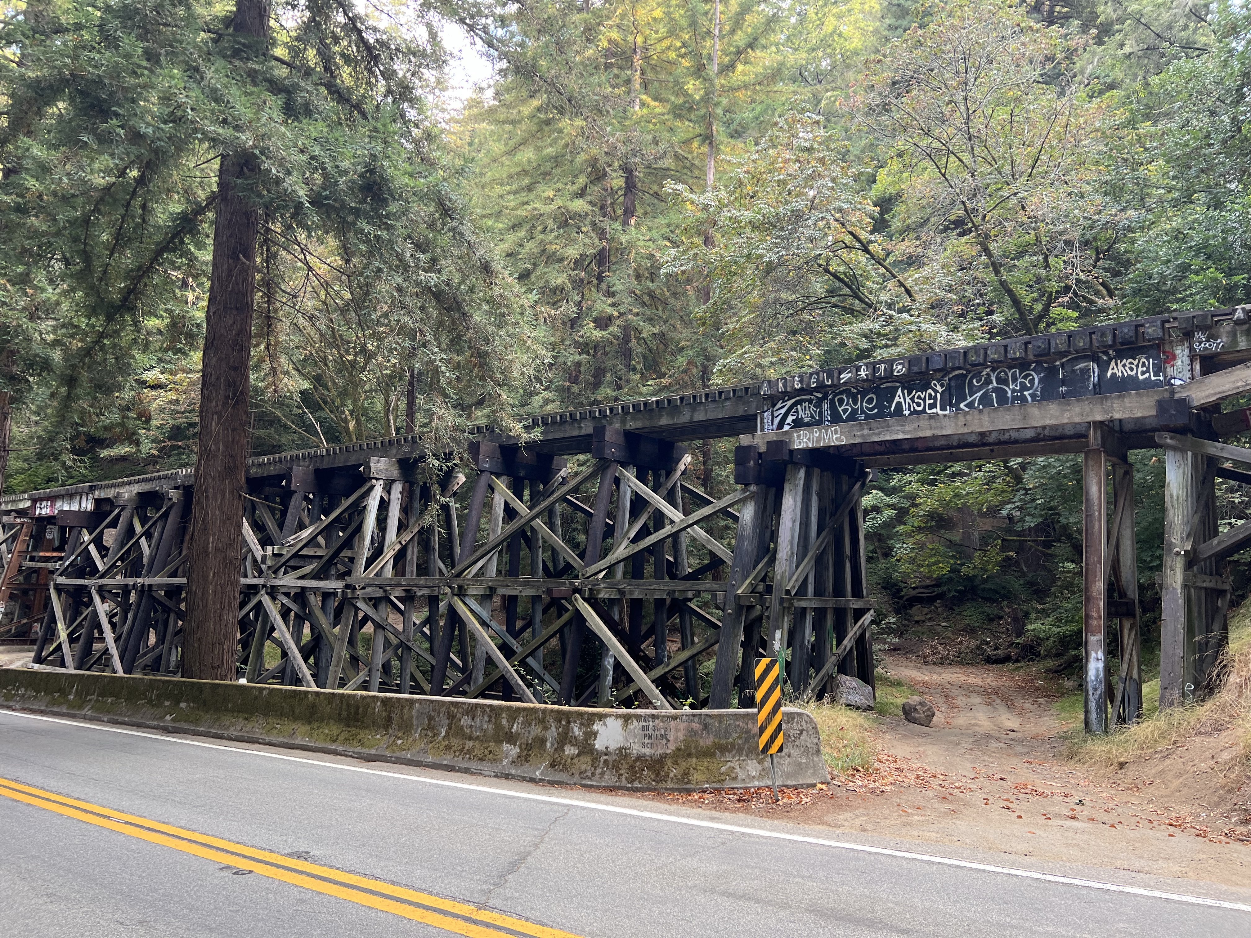
Shady Gulch Trestle with the Highway 9 concrete bridge (1930) in the foreground. The dirt road to the right is the former Eben Bennett toll road. The concrete highway bridge replaced the toll road.
The original trestle was built in 1875 to span Shady Gulch. At the time, the line was built for the narrow gauge South Pacific Coast Railroad. When Southern Pacific acquired the line they rebuilt the trestle in 1905 to accommodate standard gauge.
The trestle of today very much looks like the original narrow gauge trestle of the late 19th century, sans graffiti of course.
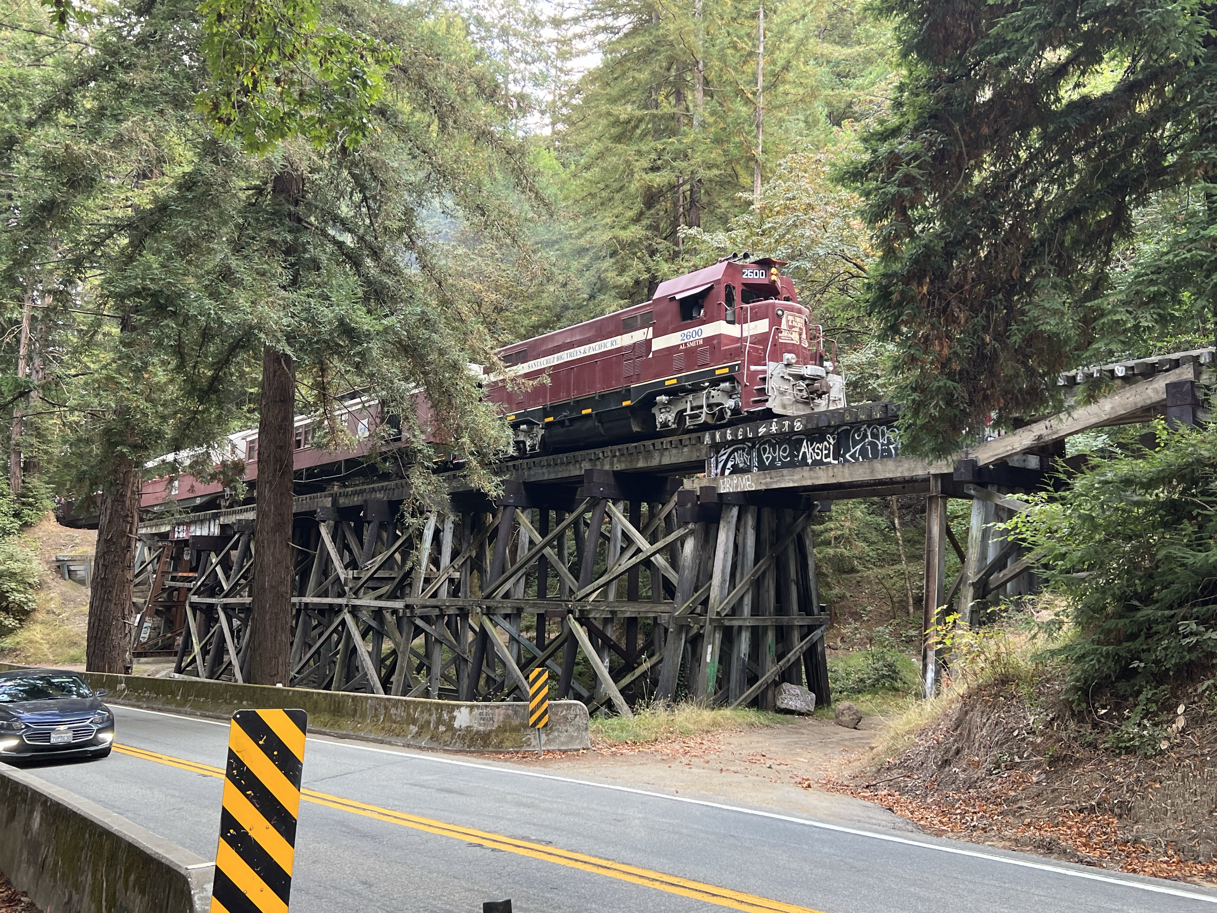
The afternoon Felton-bound Big Trees and Pacific crossing the Shady Gulch Trestle. This tourist train tends to stop traffic on Highway 9.
My father spend his childhood summers in the cabin in the 1930, 40s, and 50s. He would tell me of the time a freight would be climbing the grade on the trestle on their way to Felton on a foggy summer’s morning. The wet track would cause the locomotive’s driving wheels to slip. And after many slips and the hyperbolic “chuff-chuff-chuff” of the stream exhaust, the train would back down the grade, sanding the track as they reversed. The freight would make another attempt, this time slowly with the sanded rails helping the drivers grip the steel. And off they went to Felton.
There is a single one car pull off on the north side of the highway bridge. I made three attempts to sketch the trestle but was foiled by a camper van that was camped out in the spot.
Was this guy going to spend the night here? On my third attempt of the day, in late afternoon, the van was finally gone and I was able to park, set up my sketching chair, and start my sketch of the trestle.
I timed my sketching time with the Felton bound afternoon Big Trees and Pacific train.
One of the more interesting tunnels on the South Pacific Coast Railroad is Tunnel No. 5 in Zayante.
This is one only two tunnels on the former South Pacific Coast line that is still in use, although not by a railroad.
As the railroad climbed its way up Zayante Creek it came to a granite outcrop that the builders could not go around or over so they had to tunnel through it.
Granite is stable and solid and because of that they did not have to add any interior wooden supports. When completed Tunnel No. 5, at 250 feet, was the second shortest on the line.
The tunnel was active until the Southern Pacific’s abandonment in November of 1940.
The tunnel began it’s current use in 1952 when the Western States Atomic Vault Company bought the tunnel, sealed both ends and used Tunnel No. 5 as a fire-flood-nuclear-proof storage silo, housing records (mainly microfilm and microfiche) for many companies including Disney. The silo officially opened on May 2, 1954.
The eastern portal was made the entrance to the facility and a guard shack was built (featured sketch) where a guard was stationed 24/7. We did not see any signs of a guard so we could not ask for a tour. (The facility is currently owned by Iron Mountain).
In times past, the company would allow tours inside the facility and one visitor deemed it the “most interesting dull place in the world”.
One can only guess the nearly 70 year old “secret” files that now reside in the former railroad tunnel known as Tunnel No. 5.
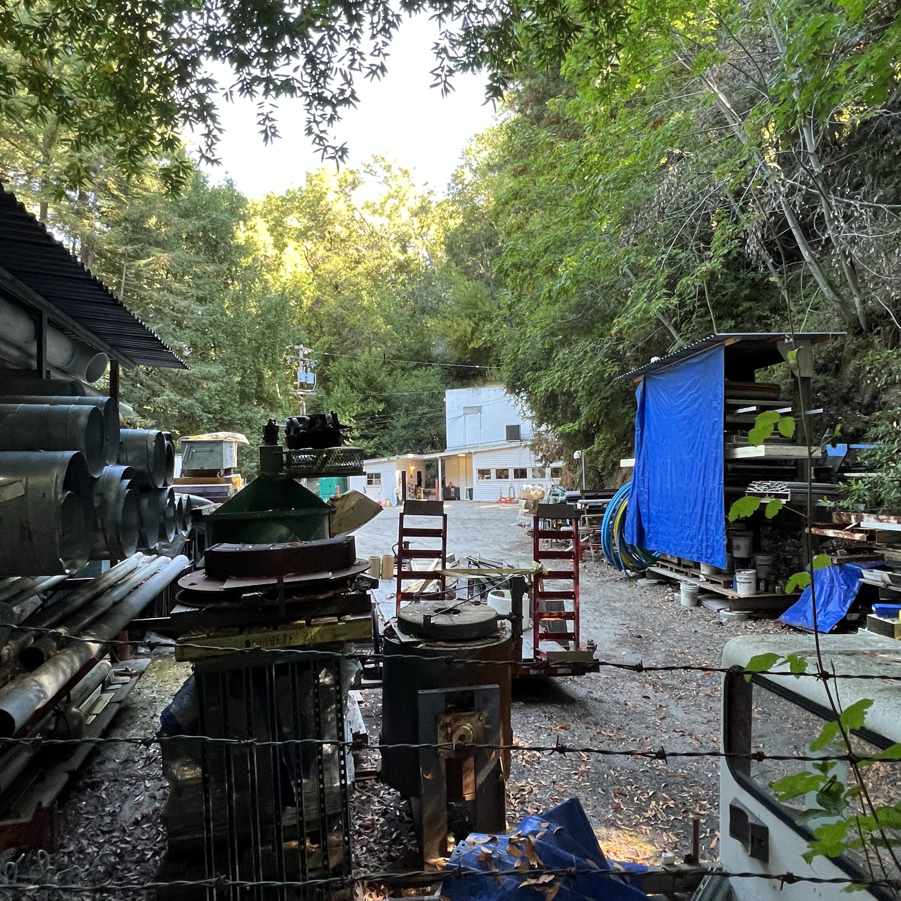
Peeping through the fencing toward the eastern portal of Tunnel No. 5. One of the two windowed buildings appears to be the guard shack. The parking lot now looks like an odd junk sale with junk that no one wants to buy!The former rail bed (sans rails) looking towards Eccles and Felton and Santa Cruz.
On a historic rail sketching adventure, Grasshopper and I headed up into the Santa Cruz Mountains to sketch a portal of one of the longest rail tunnels on the former South Pacific Coast Railroad (later Southern Pacific) route.
This 28 mile route started at Vasona Junction in Los Gatos and climbed over the Santa Cruz Mountains to the beach town of Santa Cruz.
Part of this route still exists as the Big Trees and Pacific Railroad which operates a tourist train from Felton to the Santa Cruz Beach Boardwalk.
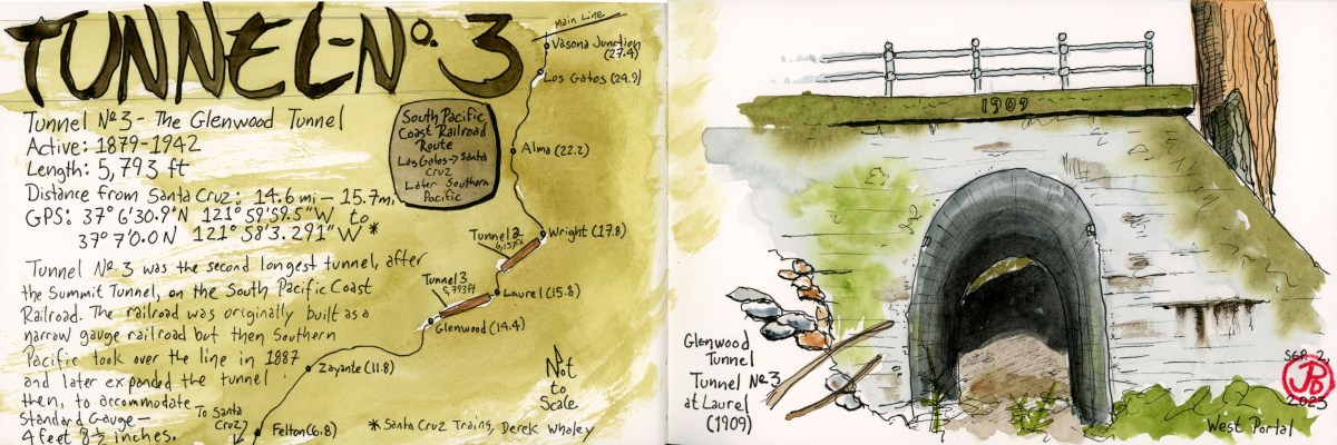
The tunnel we were looking for is the Glenwood Tunnel, also known as Tunnel No. 3. This 5,793 foot tunnel was active from 1879 to 1942. The original tunnel was built for narrow gauge but when Southern Pacific took over the line in 1887, they later converted the line to standard gauge (4 ft 8.5 in).
When the South Pacific Coast Railroad was first planned, then had to figure out how to get the road bed into the San Lorenzo Valley. To do this they had to built two one-mile long tunnels: Tunnel No. 2 (Summit Tunnel) and Tunnel No. 3 (Glenwood Tunnel).
From northbound Highway 17, we took the Laurel exit heading towards the former township of Laurel. We passed a few mountain homes and two bikers laboring up the hill as we headed down towards the former rail-bed.
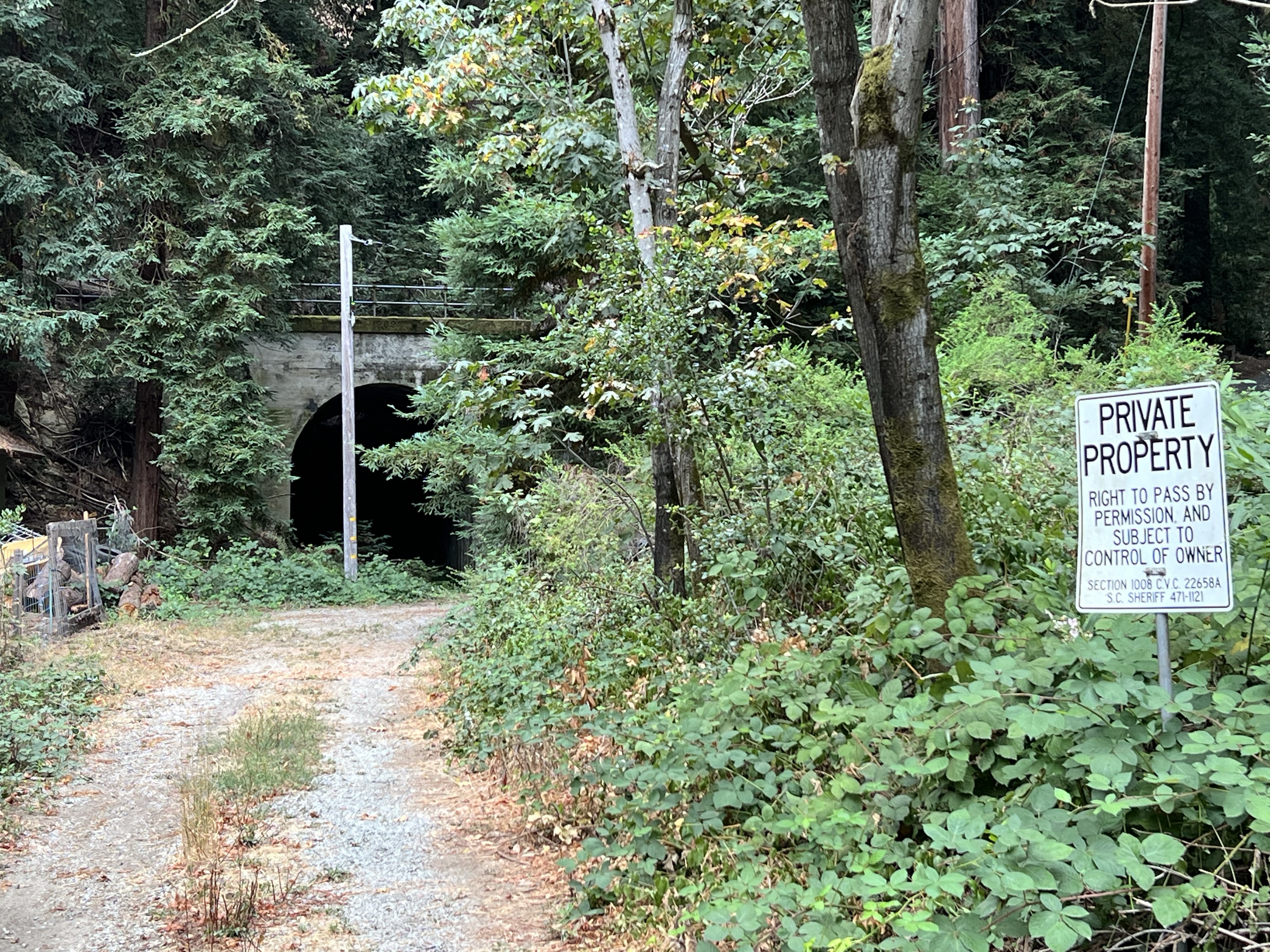
We parked and headed out to a get a better look. The west portal of the Glenwood Tunnel was visible, but parts were obscured by trees and a power pole. The “private property” sign kept us at bay. Was this the best view we would get?
The not-so-great view.
I climbed up a side road, probably also private property, that parallels the rail bed, to get a better sketching vantage point. Even here, the portal was obscured by redwoods but I started a sketch anyway (which, like Tunnel No. 3, I abandoned).
Not being satisfied with the sketch I returned to where Grasshopper was sketching. His only company was a barking dog on the other side of a fence. There was a house just to our left.
A man peeked over the fence with his cup of coffee and said, “You can walk up to the tunnel if you want.”
This was the owner of the house (let’s call him “Bill”) and we had a nice conversation with him about living in the redwoods, winter storms, history, his spring-fed water system, and trains and tunnels.
We thanked Bill and walked around the chain that crossed the rail bed and headed towards the western portal of the Glenwood Tunnel. Now this was the way to sketch the tunnel (featured sketch).
Grasshopper sketching the western portal of Tunnel No. 3. Bill’s spring-fed water system can be seen on the right.Corvidsketcher in the western portal of Tunnel No. 3.
We walked into the 1909 concrete portal. The tunnel ended in about 50 feet.
In 1940, winter storms and landslides closed portions of the route permanently. Southern Pacific made the decision to abandon the line. The major tunnels were dynamited at both ends, closing the tunnels for good. The concrete portals are all that still remain.
Now that we firmly had tunnel fever, we had to find the other side of the tunnel, the eastern portal.
Tunnel No. 3 now passes under Highway 17 so you have to cross over the highway to find the other end.
The eastern portal of the Glenwood Tunnel at Glenwood Drive.
The eastern portal of the Glenwood Tunnel is much harder to get to than the western portal. To get a comparable view you would have to scrabble down a steep hillside or trespass through a stable to reach the rail bed which now seems to be a creek bed.
So we had to make due and sketch the portal from the side of Glenwood Drive, which the concrete portal now supports.
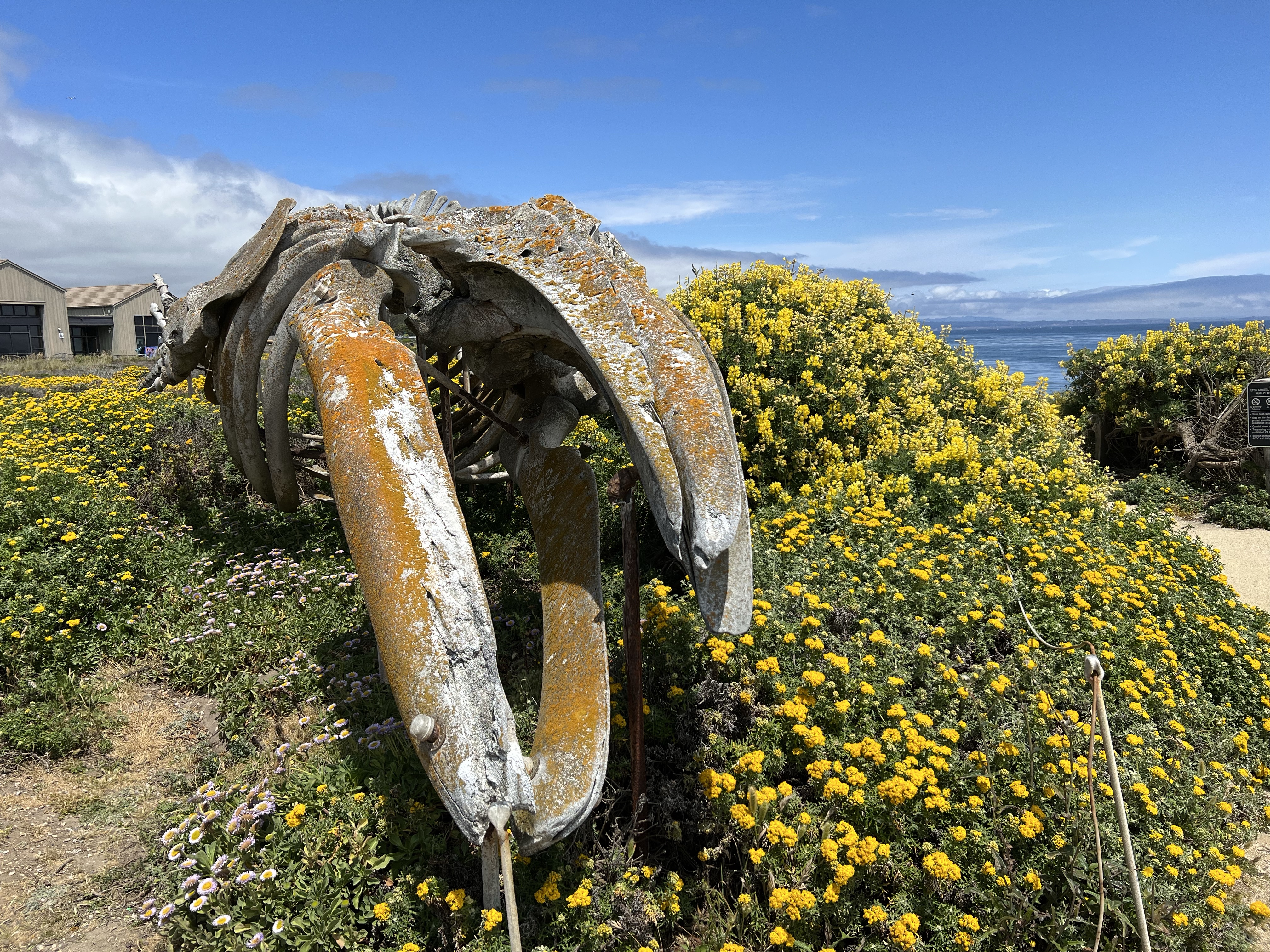
One joy of sketching is to return to a previous subject but sketch it from a different perspective. Such is the case with the whales of Long Marine Lab in Santa Cruz. (Former cetaceans, that is.)
Long Marine Lab is part of the University of California at Santa Cruz (UCSC) and is a research and educational facility for marine biology. The campus also features a small aquarium (the Seymour Marine Discovery Center) that is open to the public. The biggest draw for me is the biggest creature that ever lived on Planet Earth: the blue whale. The Discovery Center has an incredible blue whale skeleton on display flanking one side of the museum.
I had sketched the massive blue whale skeleton and the smaller gray whale skeleton before but I wanted to sketched them in a different way. For the blue, I stood directly in front and sketched it head on, as if the largest creature on Planet Earth was swimming towards me.
I have been lucky enough to see blue whales in the wild from pelagic boating trips. Most of these trips have been in Monterey Bay. I remember the first time I saw this massive cetacean on a trip out of Monterey Harbor with my father in the late 1980s. My high school biology teacher at the the time didn’t believe blue whales could be seen in Monterey Bay, until I showed him the photos.
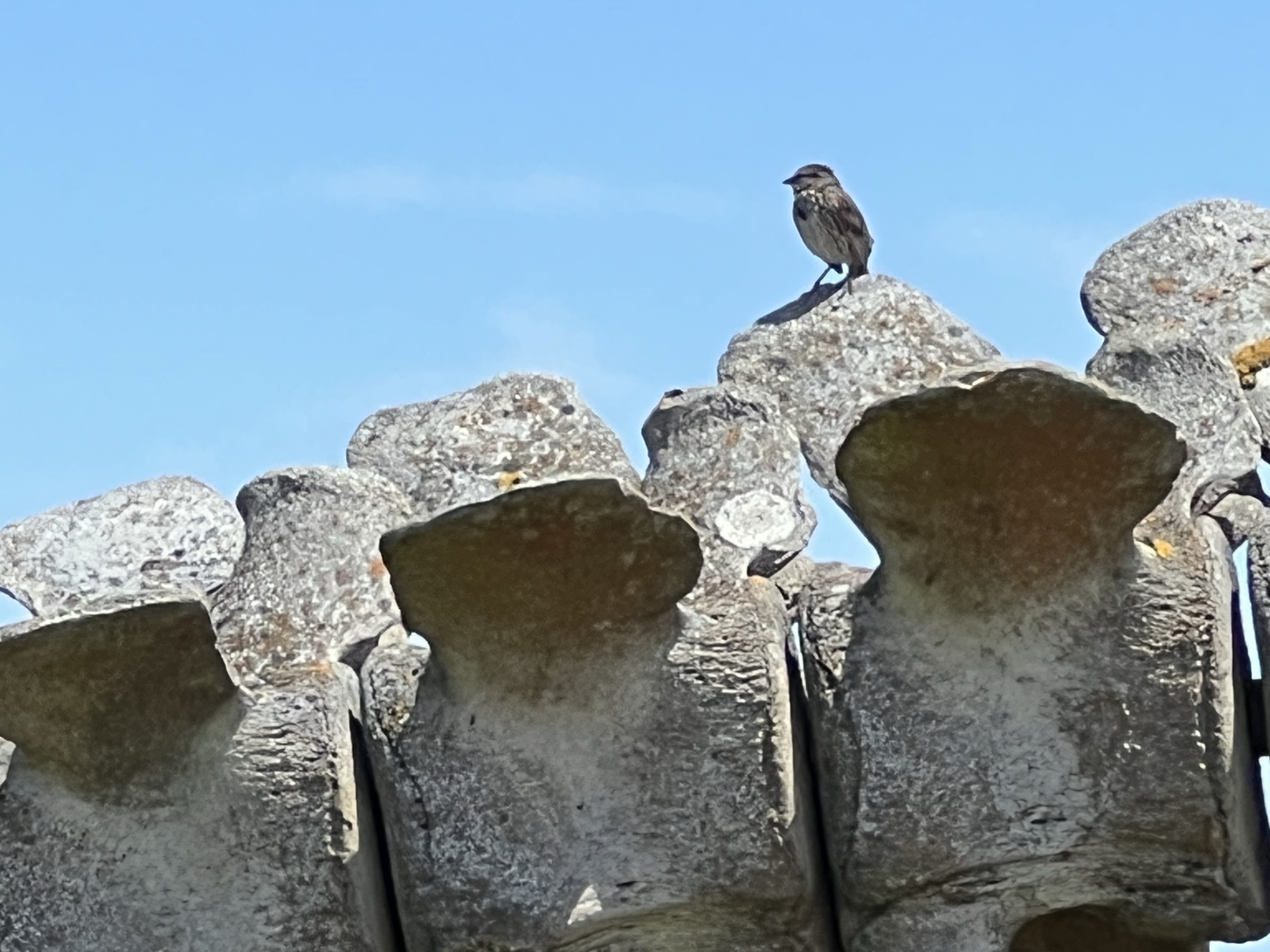
Song sparrow using the vertebrae of the gray whale for a singing perch. Gray whale skeleton with the Seymour Marine Discovery Center on the left and Big Blue on the right.